National Weather Service United States Department of Commerce

Hurricane Awareness Tour stop #3
Lake Charles, LA

Beaumont HAT stop image  


NWS logo image Airport logo image USAF Hurricane Hunters logo image
 
Event Info The Planes Directions
 

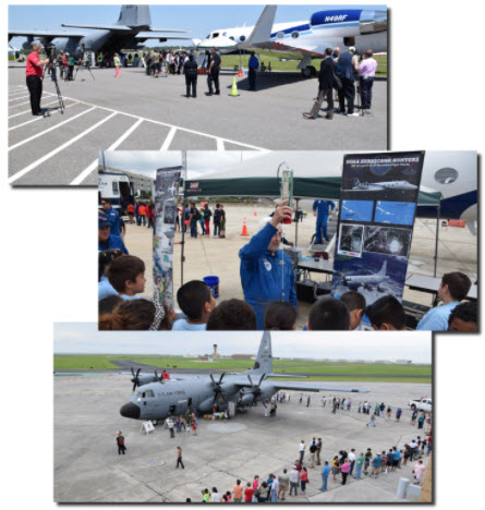
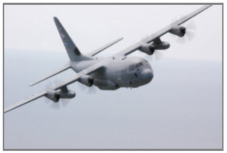
Ever been fascinated by hurricanes or wondered how in the world people fly safely into them? Have a passion for flying and love viewing various aircraft? Check out this 2-minute video about what it's like to be a Hurricane Hunter, then mark your calendar for the 2026 Hurricane Awareness Tour in Lake Charles, Louisiana on May 6th!

As part of a week-long tour along the Gulf Coast, the NOAA Hurricane Hunters will be making a stop at the Chennault International Airport. Come tour two of the Hurricane Hunter aircraft, speak with the pilots, and walk through vendor exhibits from various local agencies and organizations. The event is FREE and the public is invited to attend from 1:00 pm to 4:00 pm!

Be sure to arrive early as Gates will be closing at 3:00 PM to new traffic! 


Event Information


What: 2026 Hurricane Awareness Tour

Where: Chennault International Airport 

3650 Sen. J. Bennett Johnston Ave

Lake Charles, Louisiana 70615

When: Wednesday, May 6th, 1 PM to 4 PM

Admission: FREE!
 

Things To Do: 

  • Tour Hurricane Hunter aircraft
  • Meet the pilots & flight crew
  • Speak with hurricane forecasters
  • Meet with local National Weather Service meteorologists
  • Walk through exhibits from various agencies & organizations
  • Learn about weather safety & preparedness
HAT stop image
 

About the Planes

C-130 image

WC-130J - "Hercules"

The WC-130J is a high-wing, medium-range aircraft used in weather reconnaissance missions. This plane is configured to penetrate tropical disturbances and storms, hurricanes and winter storms and obtains data on the movement, size and intensity of these systems. The WC-130J is the weather data collection platform for the 53rd Weather Reconnaissance Squadron. It carries a minimal crew of five: pilot, co-pilot, navigator, aerial reconnaissance weather officer and weather reconnaissance loadmaster. The crew collects and reports weather data as often as every minute.


WP-3D "Orion"

The versatile turboprop aircraft is equipped with a variety of scientific instrumentation, radars, and recording systems for both in-situ and remote sensing measurements of the atmosphere, the earth, and its’ environment. Orion aircraft collects low-altitude data to fill gaps in data not available from ground-based radar or satellite imagery. This aircraft fly to an altitude of 27,000 ft and achieve a flight range of up to 3800 NM.

G-IV image

Gulfstream IV-SP

The G-IV jet is a high-tech, high-flying, and high-speed platform used for hurricane forecasting and research. The G-IV flies around and over developing tropical cyclones to create a detailed picture of the surrounding upper atmosphere. Its primary mission is to fly tropical cyclone surveillance missions to support National Hurricane Center forecasts and research by the  Hurricane Research Division of NOAA's Atlantic Oceanographic Meteorological Laboratory. With a range of nearly 4,000 nautical miles and a cruising altitude of 45,000 feet, this aircraft provides observational coverage at high altitudes critical for defining weather systems in the upper atmosphere.


 NOAA operates two Beechcraft King Air 350 CERs and one King Air 360CER. These versatile, twin-engine, extended-range turboprop aircraft primarily support coastal mapping, snow and soil moisture surveys, and emergency response missions.The aircraft feature two large downward-facing sensor ports that can support a wide variety of remote sensing systems, including digital cameras, multispectral and hyperspectral sensors, topographic and bathymetric LIDAR systems, and gamma radiation detectors. This aircraft has a range of 2300 NM and can fly up to an altitude of 35,000 ft.                                      


Directions & Parking

To be determined