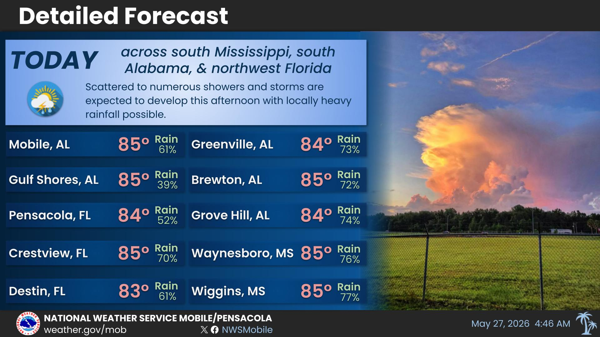
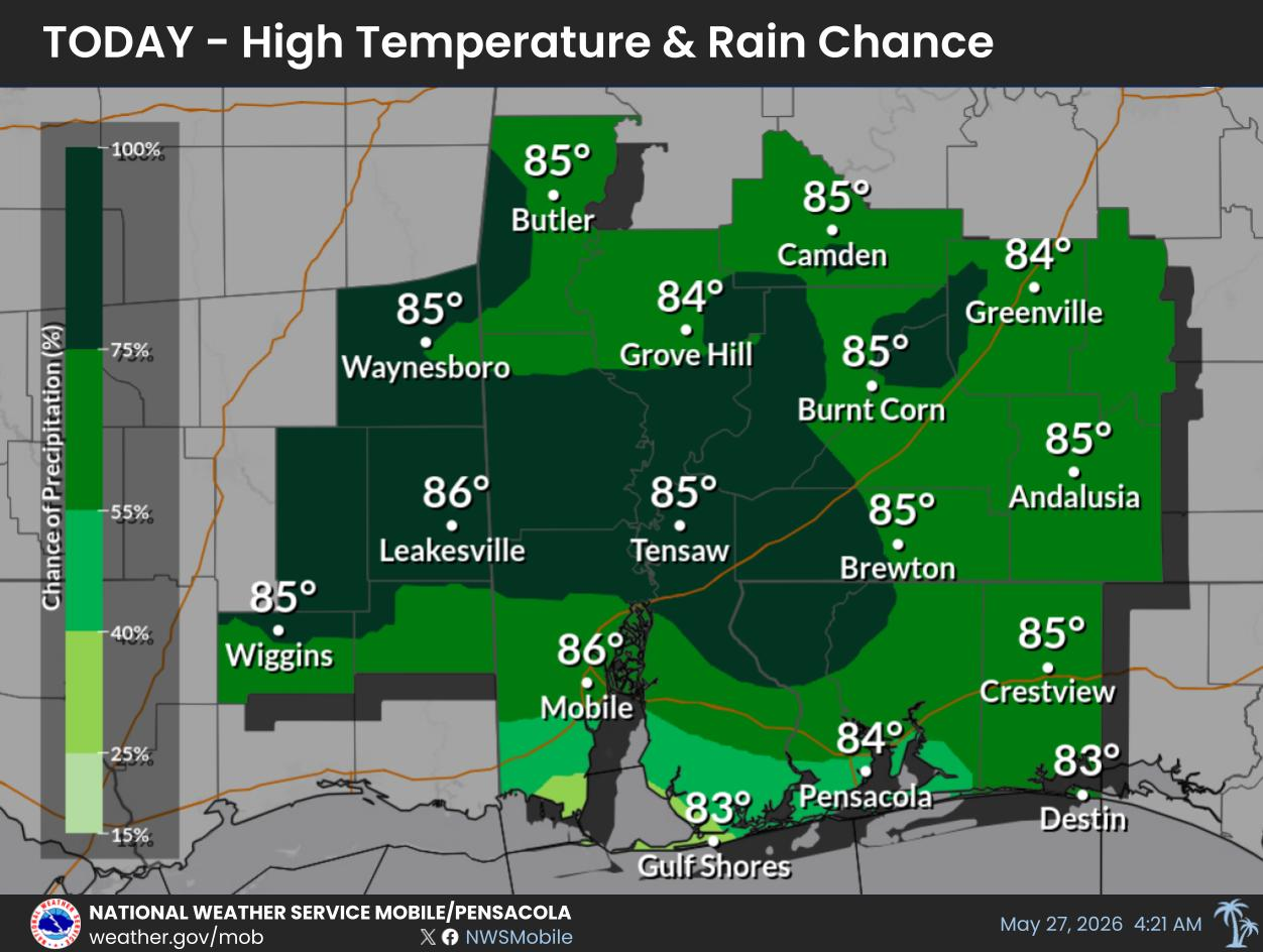
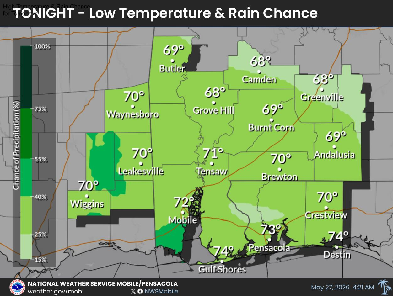
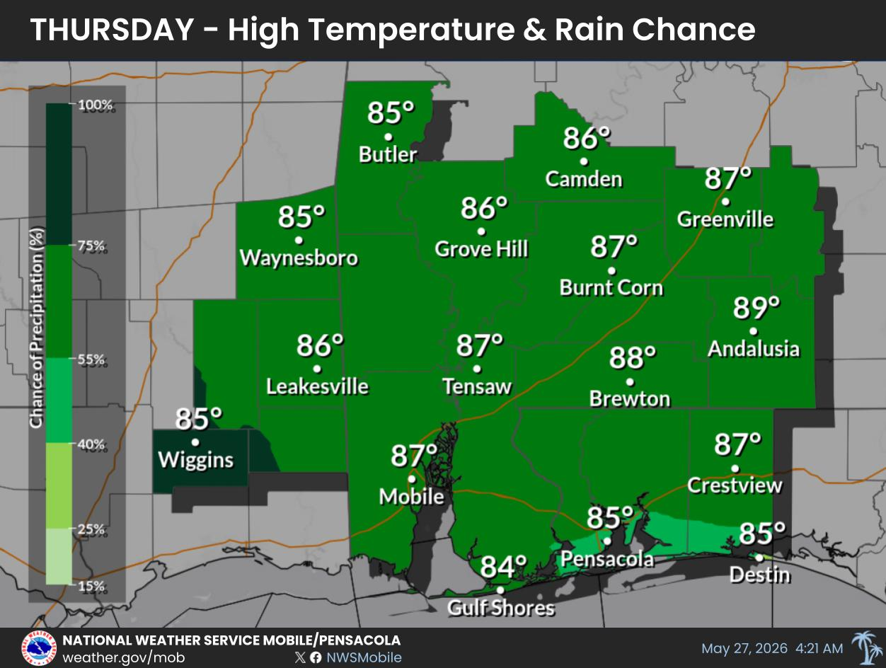
Afternoon shower and thunderstorm chances remain high into early next week. Temperatures stay warm with highs in the 80's and lows in the 70's each day.
For more information, visit our social media pages at Facebook and X pages or listen to a NOAA Weather Radio. Stay weather aware!


 Local Radar
 Weather Map
 Satellite Imagery
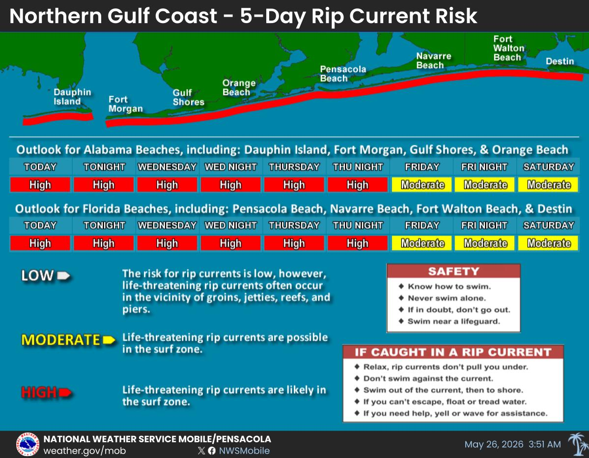
 Beach and Surf
 Local Forecast Maps