August 2023 Climate Summaries
Mobile Alabama and Pensacola Florida Area
National Weather Service Mobile Alabama
September 5th, 2023
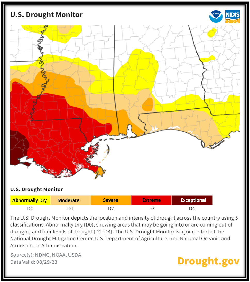
August 2023 in Review - The July long range outlook for above normal temperatures for August verified to the nth degree over the deep south. The first week of the month, a large scale ridge of high pressure over Texas nosed eastward over the central Gulf coast. After a brief break in the grip of the ridge the middle of the month, the larger scale high amplified over the heart of the nation. The strength of the ridge surged to 3 to 4 standard deviations above the climatological means on August 20th to the 22nd. When considering a normal distribution on a bell curve chart, the height fields in the ridge were way out on the extremes and thus signaled a strong anomaly. The ridge created large scale compressional sinking and warming. The result, August 2023 stands tall atop the Mobile and Pensacola area record books in several temperature metrics. First off, all three, being the average high, lows, and mean monthly temperatures for the month at both sites, are now the record warmest on record for each category. Considering this alone makes the long duration heat wave which impacted the local area truly astounding. Not to be outdone was the number of records either broken or matched. Mobile recorded 12 record daily highs and 11 record high low morning temperatures. That's 38.7% and 35.4% of the month respectively at Mobile. Pensacola saw 13 days of both record daily highs and morning high low temperatures or 41.9% occurrence for the month. These events are an impressive feat. Lastly, Mobile surged to 100° or higher for six consecutive days which is a new record. To close out the month, the eastern flank of the high level ridge moved west of the area and temperatures scaled back. In the other extreme, Mobile and Pensacola was well below normal in the monthly rain department. Considering the dryness and the heat, antecedent soil moisture decreased substantially leading to drought intensity worsening by the close of the month.
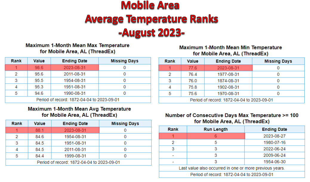
Mobile Alabama Area [Climate Normal Period 1991-2020, Climate Record Period 1872 to Present]- The average monthly high of 98.6° was an astounding 7.8° above normal. This is now the all time warmest average high on record surging past the previous occurrence of 95.6° in August 2011. The average monthly low of 77.6° was 4.7° above normal. This is now the all time warmest average low on record beating out the previous occurrence of 76.4° in August 1977. The average temperature was a toasty 88.1°, 6.2° above normal. This is now the all time warmest August average temperature on record, surging past the previous occurrence of 84.6° in August 1954. The highest temperature for the month climbed well above the century mark to an excessively hot 106° on the 26th. This was a remarkable 16° above the normal for the date and also became the hottest temperature ever recorded in the Mobile area since records have been kept. The lowest temperature for the month, 69° on the morning of the 17th, was just 4° below normal for this date.
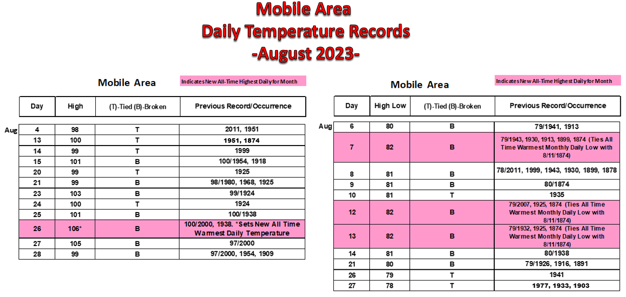
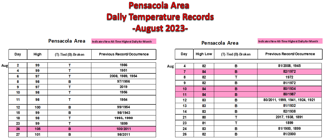
The following tables provide details on all the record daily and monthly average temperatures occurring in the Mobile Area for the month of August 2023:
|
|
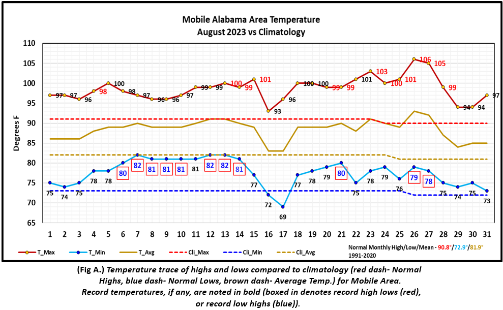
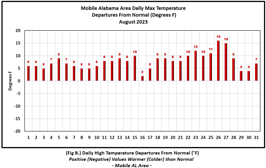
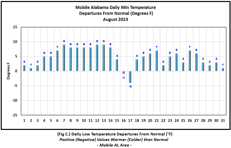
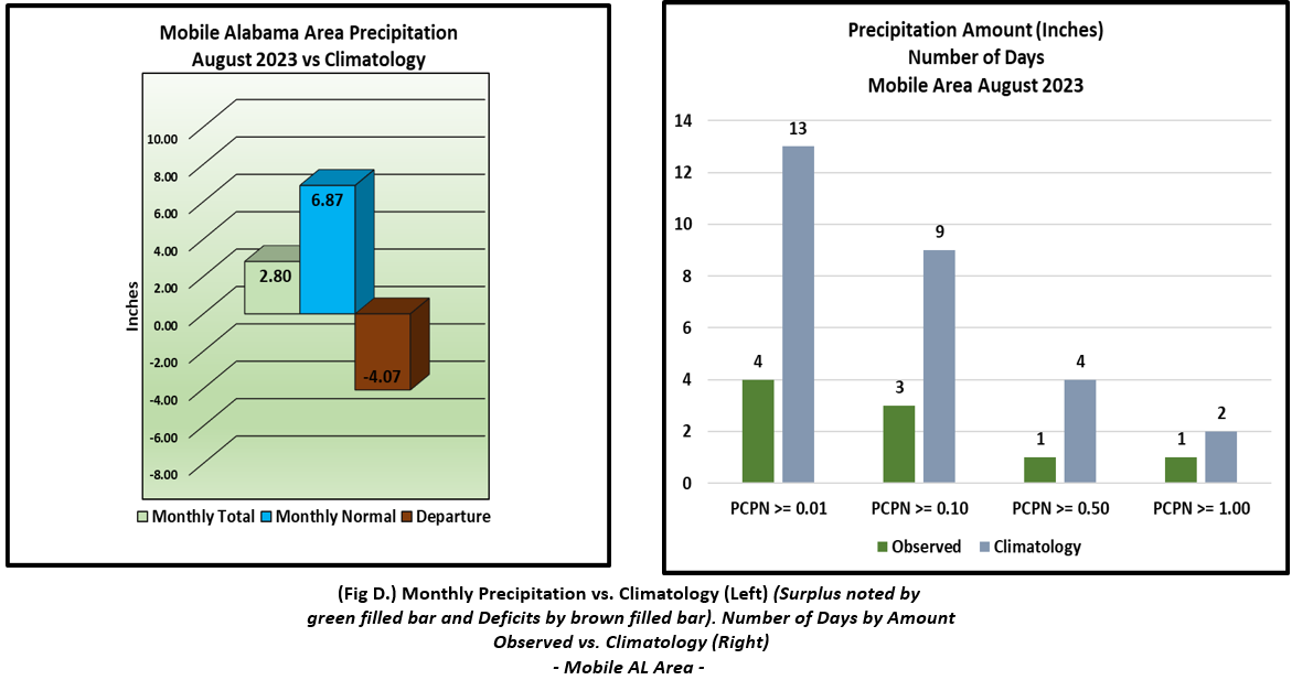
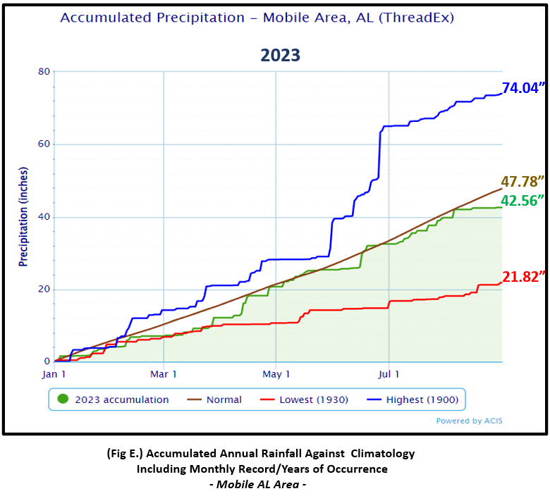
(Fig. A) shows a graphical representation of how the Mobile area temperatures compared to the seasonal normal daily highs and lows, which are shown by the colored dashed lines. Bar graphs reflecting the daily high/low temperature departures from normal are provided in the table below (Figs. B and C). The rain gauge caught a meager 2.80" (Fig. D), 4.07 " below the monthly normal. (Fig. E) shows the annual accumulated precipitation. The Mobile area is in deficit to date at 5.22" below normal.
August top records for the month during the Period of Record for the Mobile Area:
Click on the Mobile Alabama area climate graphics below to expand:
|
|
|
|
|
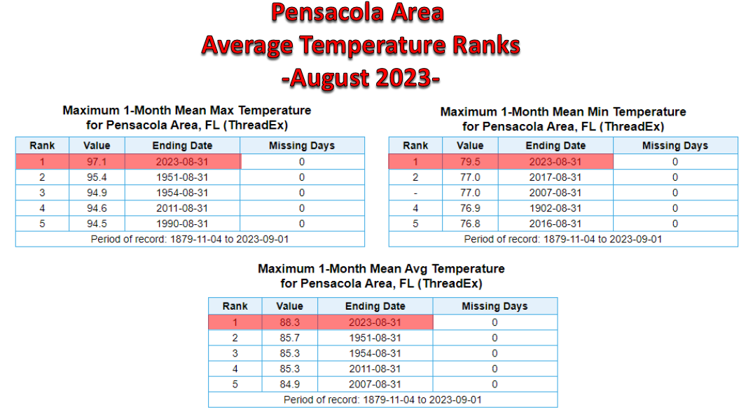
Pensacola Florida Area [Climate Normal Period 1991-2020, Climate Record Period 1879 to Present] - The average monthly high of 97.1° was a noteworthy 6.1° above normal. This is now the all time warmest average high on record surging past the previous occurrence of 95.4° in August 1951. The average monthly low of 79.5° was 4.5° above normal. This is now the all time warmest average low on record beating out the previous occurrence of 77.0° in August 2017 and 2007. The average temperature was a toasty 88.3°, 5.3° above normal. This is now the all time warmest August average temperature on record, surging past the previous occurrence of 85.7° in August 1951. The highest temperature for the month climbed well above the century mark to an excessively hot 105° on the 26th. This was a remarkable 14° above the normal for the date and also takes over the top spot in the warmest August day on record. The lowest temperature for the month, 72° on the morning of the 17th, was 3° below normal for this date.
The following tables provide details on all the record daily and monthly average temperatures occurring in the Pensacola Area for the month of August 2023:
|
|
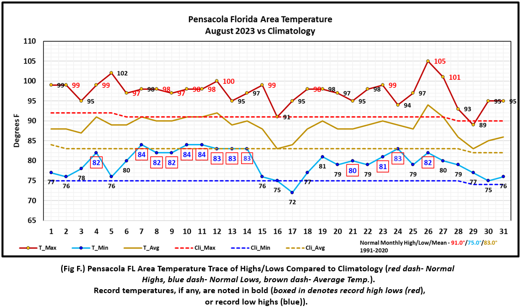
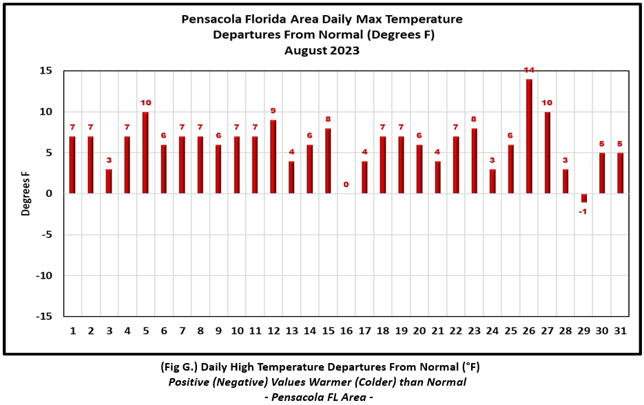
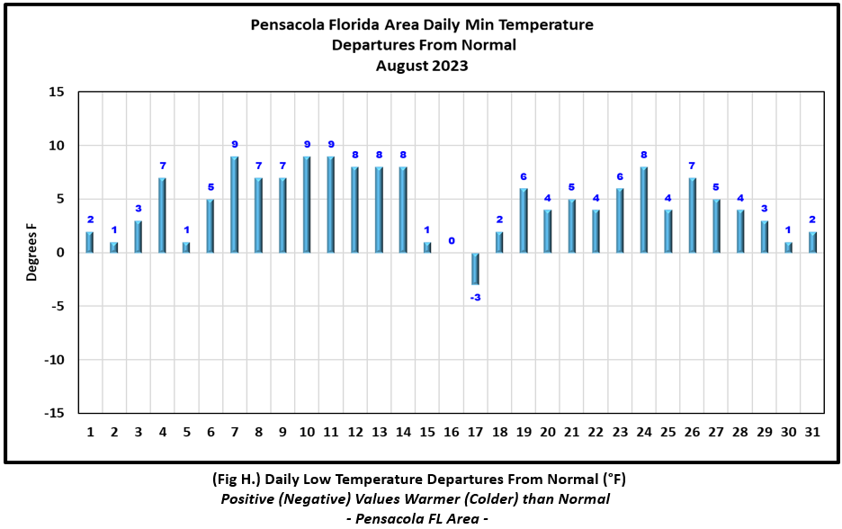
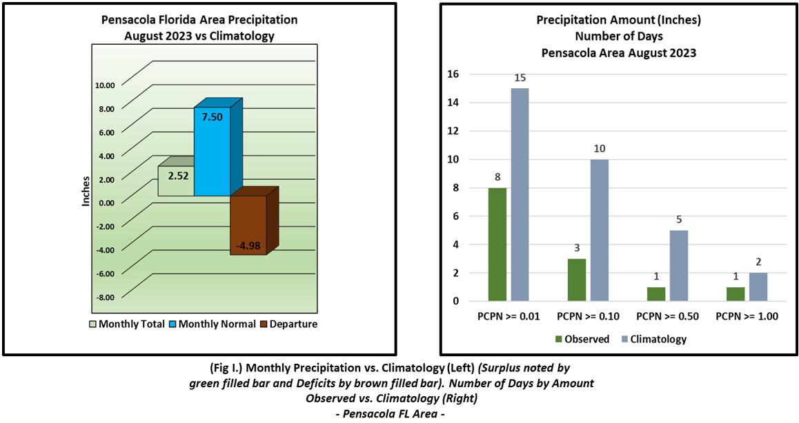
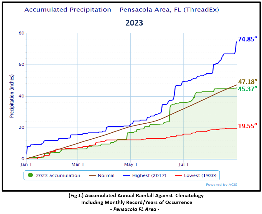
(Fig. F) shows a graphical representation of how the Pensacola area temperatures compared to the seasonal normal daily highs and lows, which are shown by the colored dashed lines. (Figs. G and H) shows the daily high/low temperature departures from normal. The rain gauge collected a meager 2.52" (Fig. I), 4.98 " below the monthly normal. (Fig. J) shows the annual accumulated precipitation. The Pensacola area is in deficit to date by just shy of two inches off the pace, 1.88" below normal.
August top records for the month during the Period of Record for the Pensacola Area:
Click on the Pensacola Florida area climate graphics below to expand:
|
|
|
|
|
Additional August 2023 Climatology and Topics
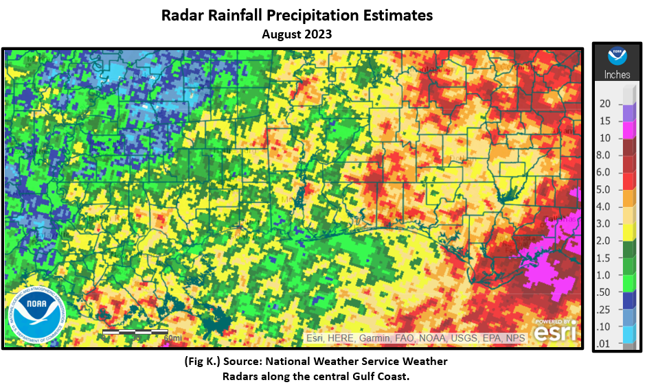
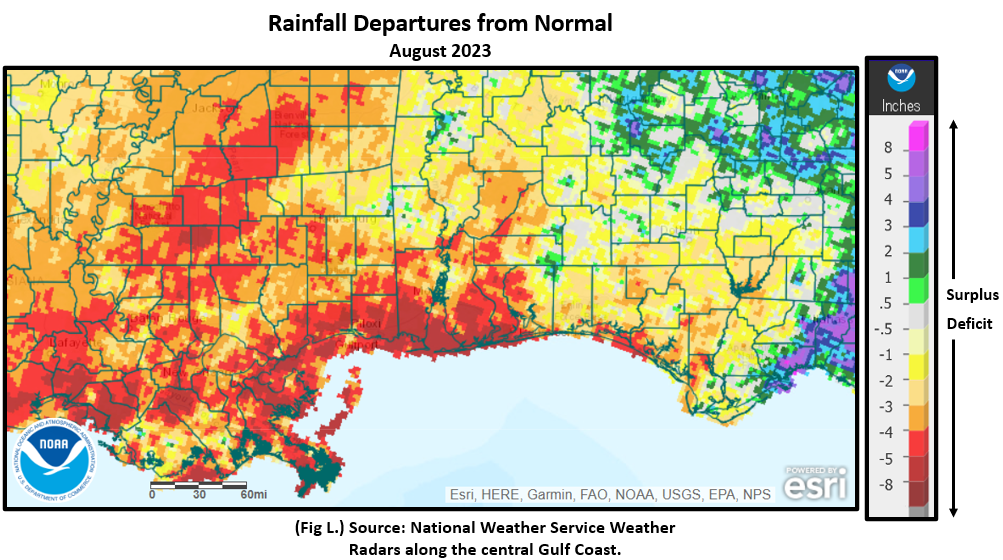
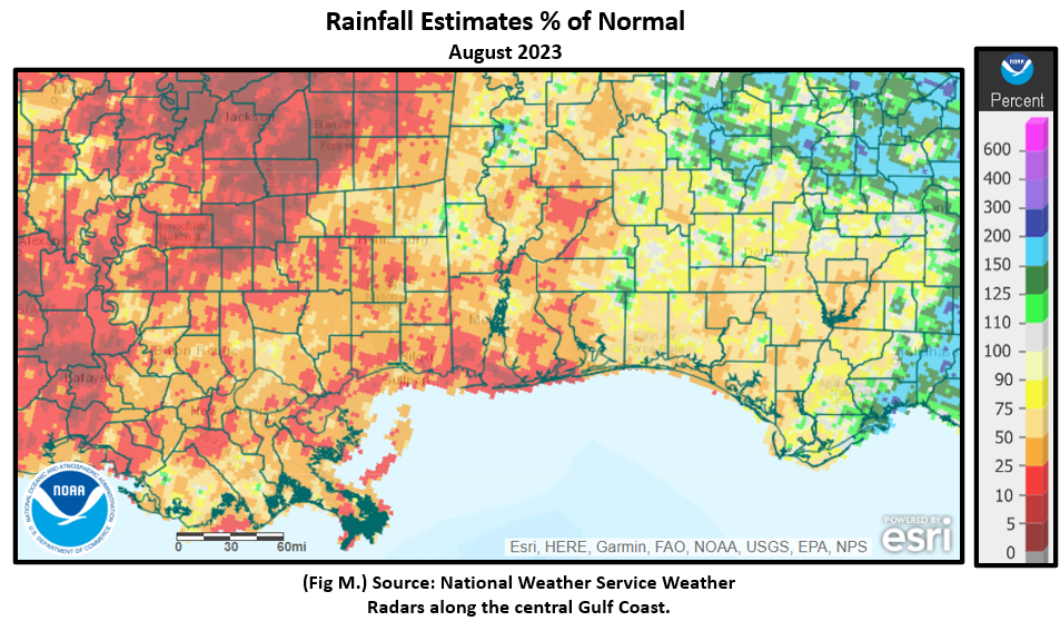
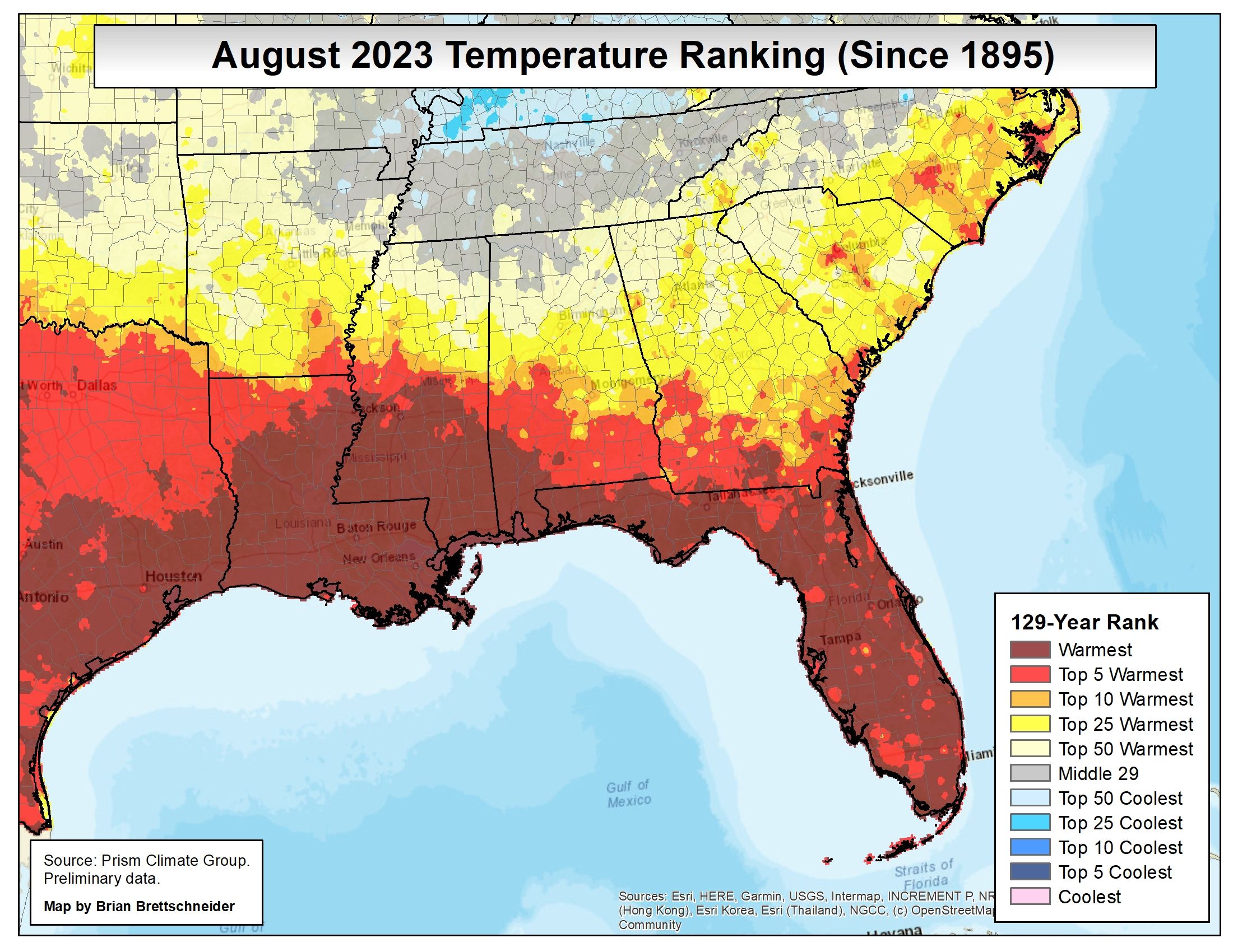
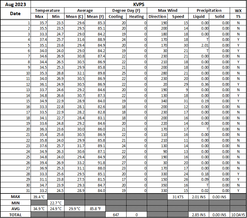
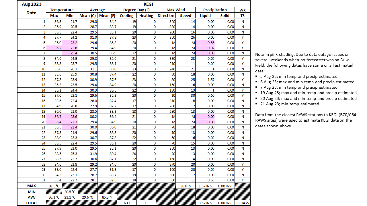
Precipitation deprived was the story for the month over the deep south. The zoomed in precipitation maps below indicates that Louisiana to southern Mississippi, eastward into southwest Alabama and northwest Florida came in several inches short of where August typically is in monthly rainfall. This is some 10 to 25% of normal in some areas over the Central Gulf Coast with a large area of 5 to 10% of normal rains back into Louisiana and southern Mississippi. (Fig. K) shows the areal distribution of monthly rainfall, (Fig. L) shows the areal rainfall departures from normal and (Fig. M), the areal percent of normal rainfall. (Fig. N) shows the August 2023 average temperature over a large chunk over the deep south was warmest on record or in the top 5 warmest based on climatology dating back to 1895. Map courtesy of Brian Brettschneider (NOAA). Data by PRISM Climate Group. The latest August 2023 monthly summary for Eglin Air Force Base (KVPS) and Duke Field (KEGI) has been received and provided in the table below. The temperatures in the daily tables consists of numbers both in °F/°C. Data courtesy of Mr. David Biggar, Staff Meteorologist, 96th Weather Squadron. Provided by permission.
|
|
|
|
|
|
|
September 2023 Climatology, Seasonal Climatology and Outlooks:
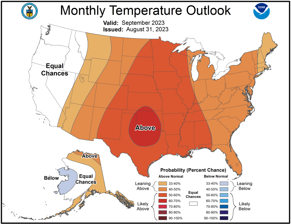
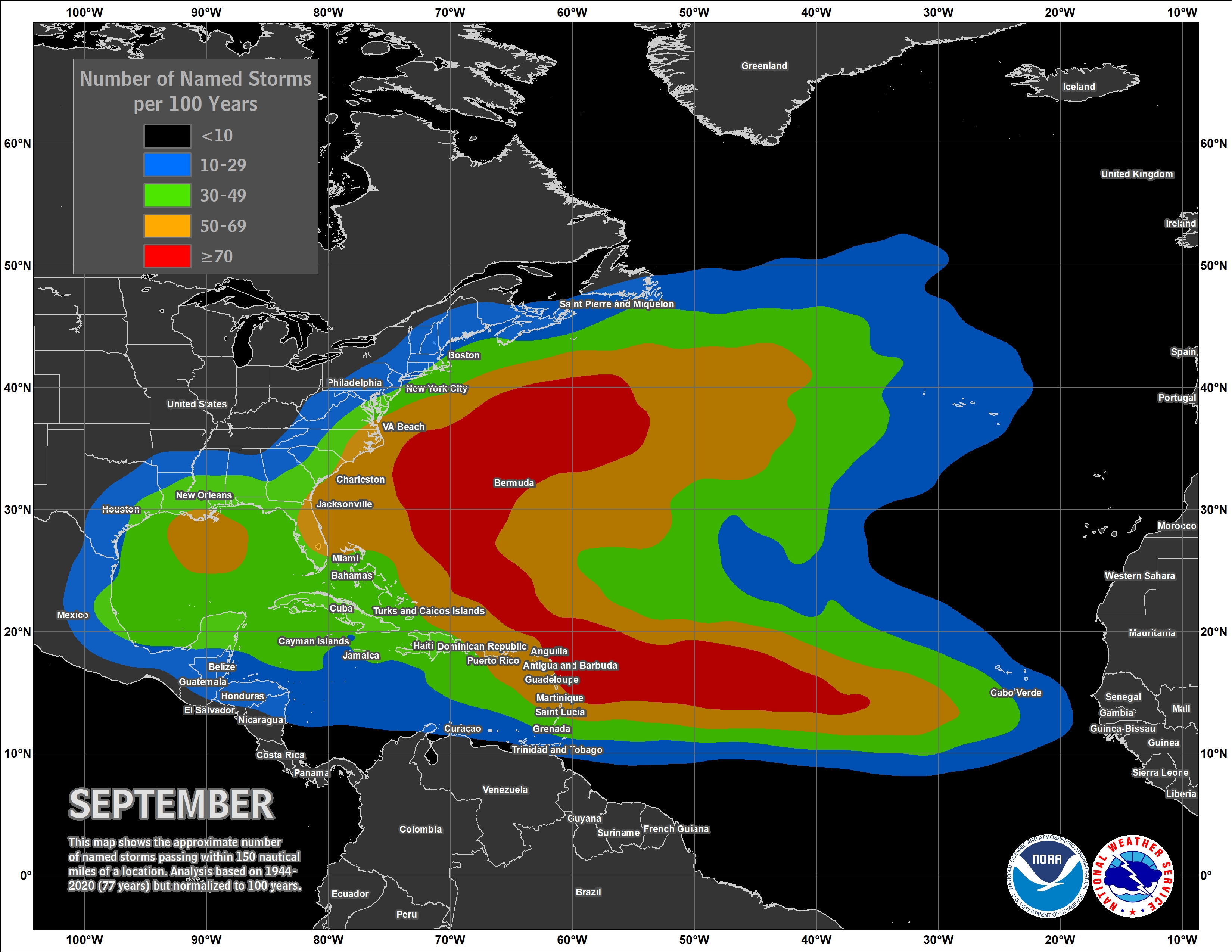
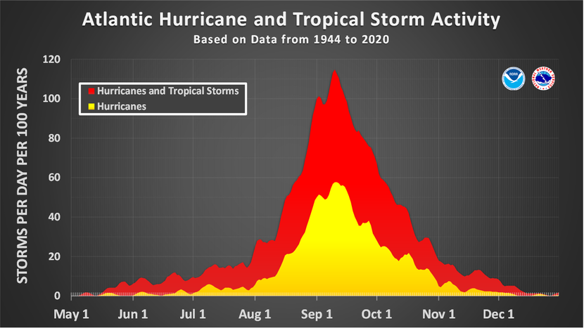
Looking ahead to September, temperatures are favored to be likely above normal over the central US including the central Gulf coast. Equal chances of above or below normal rainfall is favored over the southeast and the coastal plain. We are now into the peak month of hurricane season. NOAA updated its Atlantic Basin Hurricane outlook for tropical activity earlier in August which now indicates an above normal season. As we continue through the peak months of the Atlantic Basin Hurricane Season, it's highly encouraged to review your hurricane preparedness. Click on the Preparedness Tab on the NWS Mobile Tropical Webpage. Lastly, due to the persistently dry conditions, severe to extreme drought began to spread eastward over the central Gulf coast at the close of August. To view the latest trends and outlooks, visit the Drought Monitor.
Click on the snap shots below to expand:
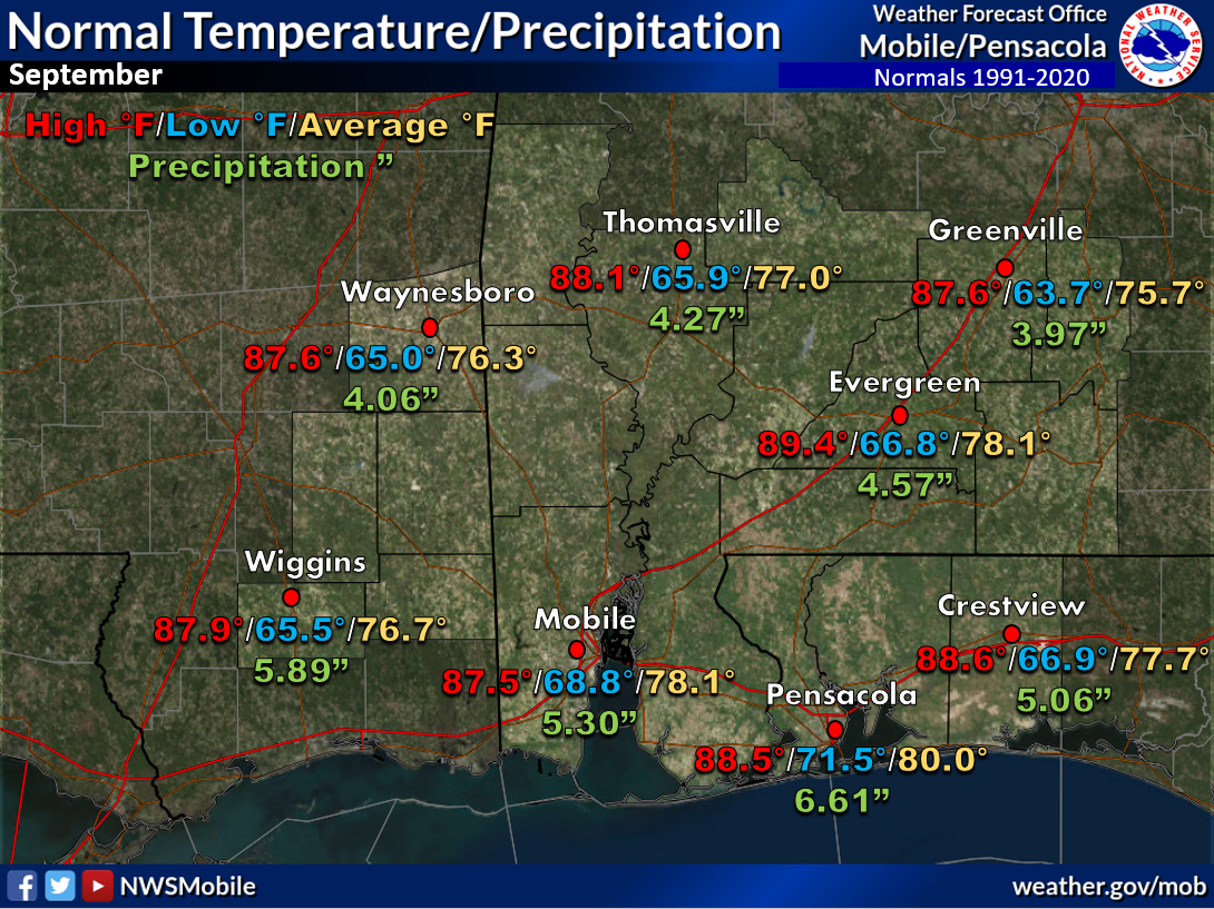 September Normals September Normals |
|
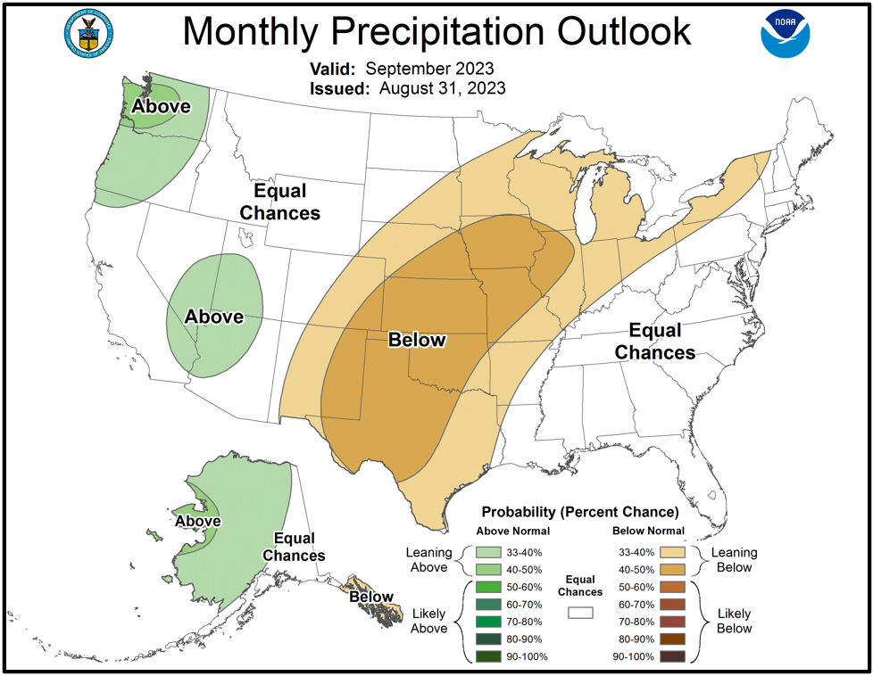
Outlook |

|
|
|

|
|
Additional Climate Links:
The National Weather Service Mobile Alabama's Climate and Past Weather page provides climate data at your fingertips for many observation points in the local forecast area by accessing the NOWData tab as well as many other climate resources. The Climate Prediction Center Link provides short and longer range climatic outlooks and education about the larger scale global circulations that impact temperatures and weather. With the large agriculture and farming presence along the central Gulf coast, the Drought Monitor link provides updates on drought trends and impacts. Another very helpful resource is the Community Collaborative Rain Hail and Snow (CoCoRaHS) network, which is a large group of volunteers working together to measure and map precipitation (rain, hail and snow). The aim of CoCoRaHS is to provide the highest quality data for natural resource, education and research applications. You can be a part of the CoCoRaHS team by becoming a volunteer rainfall observer.


