May 2025 Climate Summaries
Mobile Alabama and Pensacola Florida Area
National Weather Service Mobile Alabama
June 1, 2025
May 2025 in Review - Observing a best fit line (not shown in the graphics below) across the daily highs and lows at both Mobile and Pensacola resulted in a gradual upward slope, very close to the typical daily normals. Overall, the average monthly May temperatures were close to seasonal. No record temperatures were reached.
Monthly rainfall catch at Mobile surpassed 10" and Pensacola exceeded 6". Both sites seeing several inches above the monthly normal rainfall and were both above normal on the number of days receiving at or greater than 0.01", 0.10", 0.50", and 1.00" of rainfall. 37% of the monthly rainfall fell in a day's time at Pensacola on the 9th, setting a new record excessive rainfall for the date.
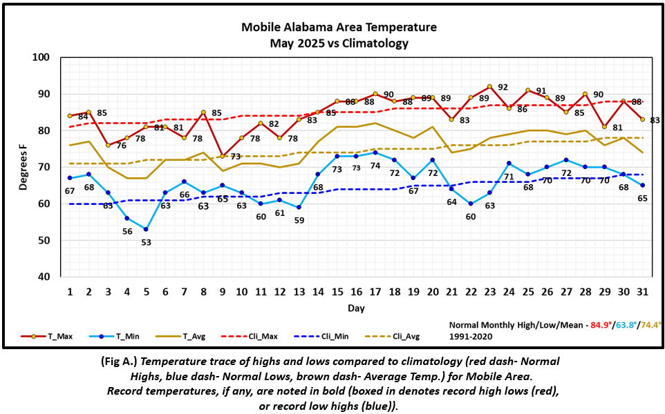
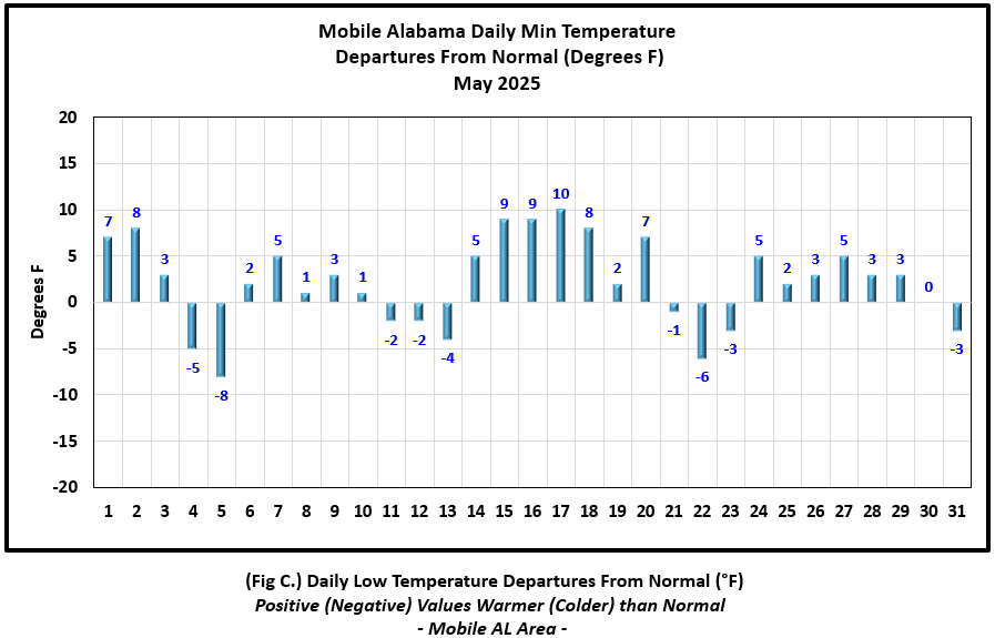
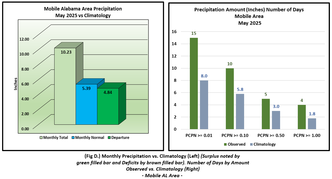
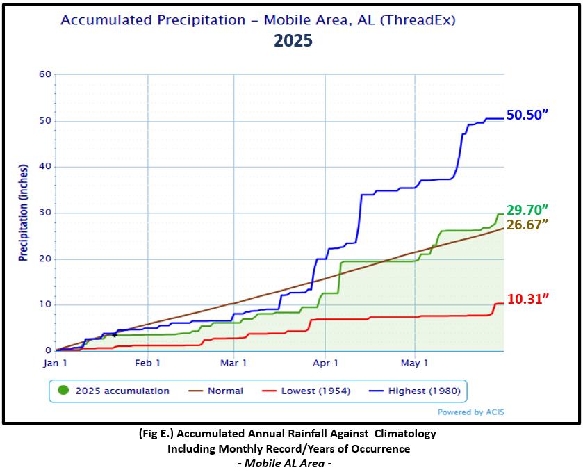
Mobile Alabama Area [Climate Normal Period 1991-2020, Climate Record Period 1872 to Present]- The average monthly high of 84.4° was 0.5° below normal. The average monthly low was 66.0° or 2.2° above normal. The average monthly temperature of 75.2° was 0.8° above normal. The highest temperature for the month of 92°, occurring on the 23rd, was 5° above normal for the date. The lowest temperature for the month, a chilly 53° by May's standards, was 8° below normal for the date. No record temperatures were reached. (Fig. A) shows a graphical representation of how the Mobile area temperatures compared to the seasonal normal daily highs and lows, which are shown by the colored dashed lines. Bar graphs reflecting the daily high/low temperature departures from normal are provided in the table below (Figs. B and C). Rainfall totaled 10.23" (Fig. D), or 4.84" above normal. This was a near carbon copy of the amount received last year at 10.28". Annual rainfall to date in Mobile is in surplus by 3.67" above normal. (Fig. E).
May Top Records for the Month During the Period of Record for the Mobile Area:
Click on the Mobile Alabama area climate graphics below to expand:
|

|
|
|
|
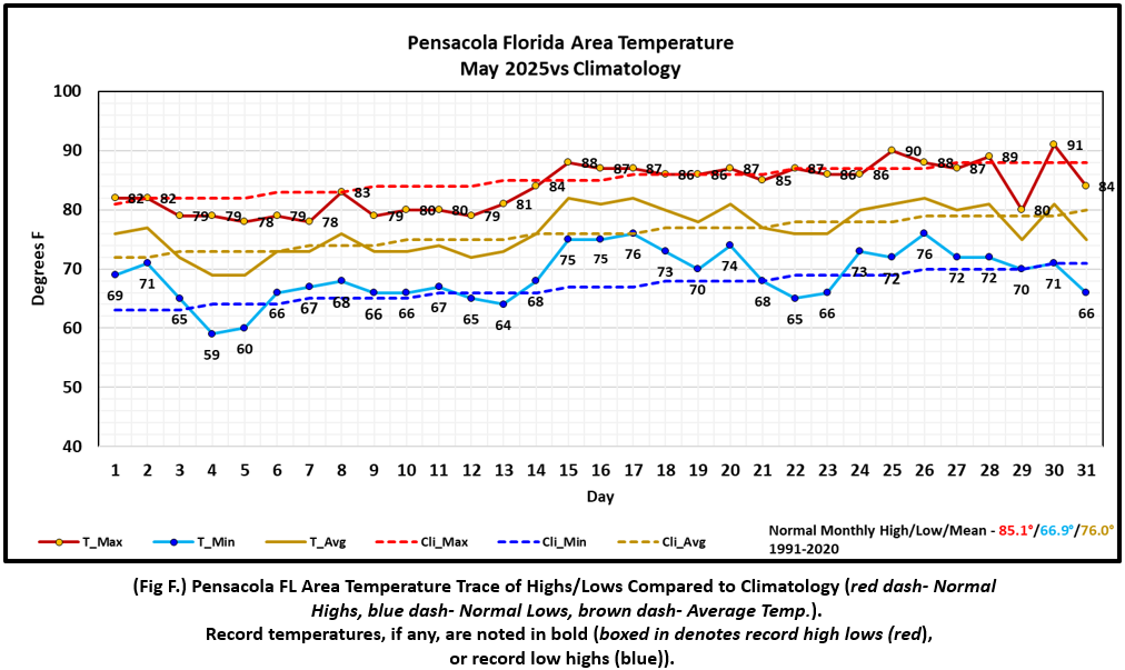
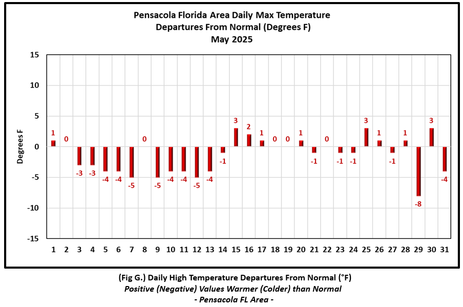
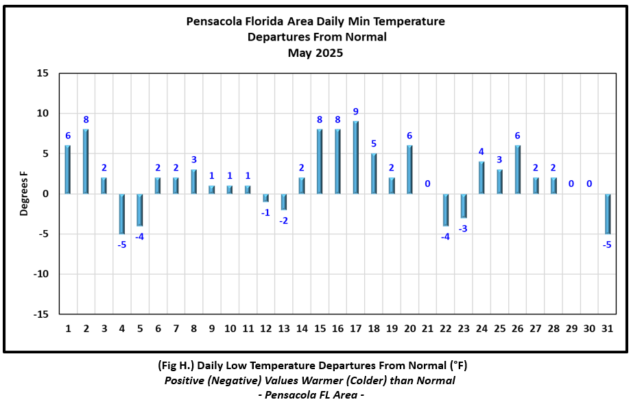
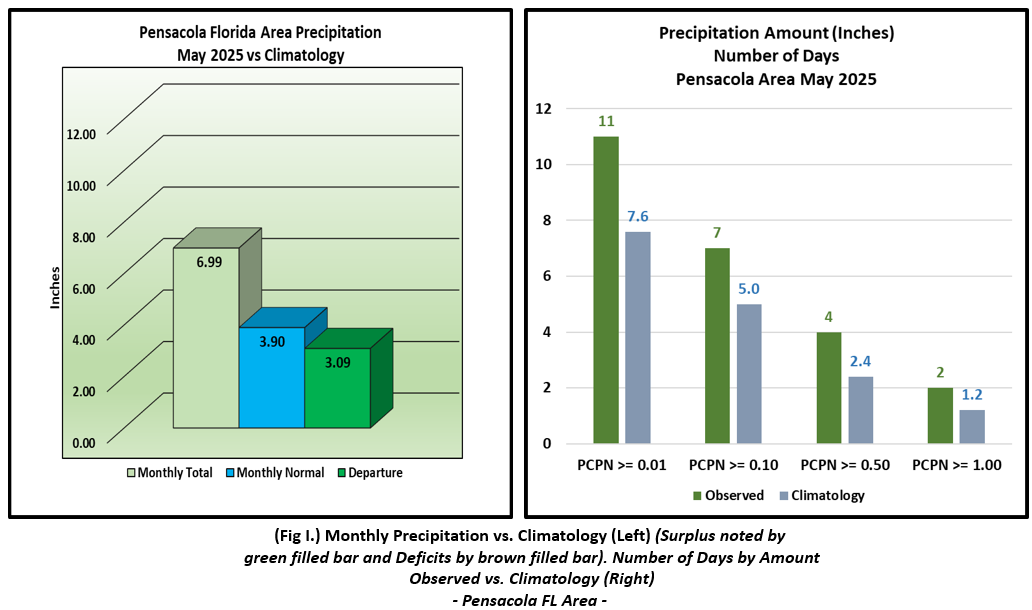
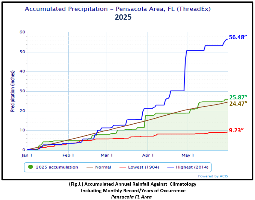
Pensacola Florida Area [Climate Normal Period 1991-2020, Climate Record Period 1879 to Present] - The average monthly high of 83.8° was 1.3° below normal. The average monthly low of 68.9° was 2.0° above normal. The average monthly temperature of 76.3° was 0.3° above normal. The highest temperature for the month, 91°, occurred on the 30th and was 3° above normal for the date. The lowest temperature was 59° on the morning of the 4th and 5° below normal for this date. No record temperatures were reached. (Fig. F) shows a graphical representation of how the Pensacola area temperatures compared to the seasonal normal daily highs and lows, which are shown by the colored dashed lines. (Figs. G and H) shows the daily high/low temperature departures from normal. Rainfall for May totaled 6.99" (Fig. I), or 3.09" above normal. 37% of the monthly rainfall fell in a day's time at Pensacola on the 9th, with a gauge catch of 2.60" setting a new record excessive rainfall for the date. The previous daily rainfall record for this date was 1.85" set in 1991. Annual rainfall is in surplus by 1.91" above normal for the Pensacola area to date (Fig. J).
May Top Records for the Month During the Period of Record for the Pensacola Area:
Click on the Pensacola Florida area climate graphics below to expand:
|
|
|
|
|
Additional May 2025 Climatology and Topics
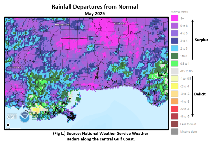
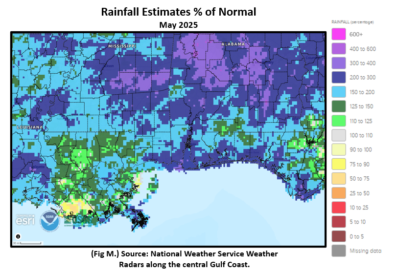
Wet month for the central Gulf coast. Much of the local area saw 4 to 8" inches of above monthly normal rainfall. There were a few pockets where rains exceeded 8" above normal over portions of the interior and coast, coming in at over 200% of normal monthly rainfall in these areas. (Fig. K) shows the areal monthly rainfall total, (Fig. L) shows the areal rainfall departures from normal and (Fig. M), the areal percent of normal rainfall.

|
|
|
June 2025 Climatology, Seasonal Climatology and Outlooks:
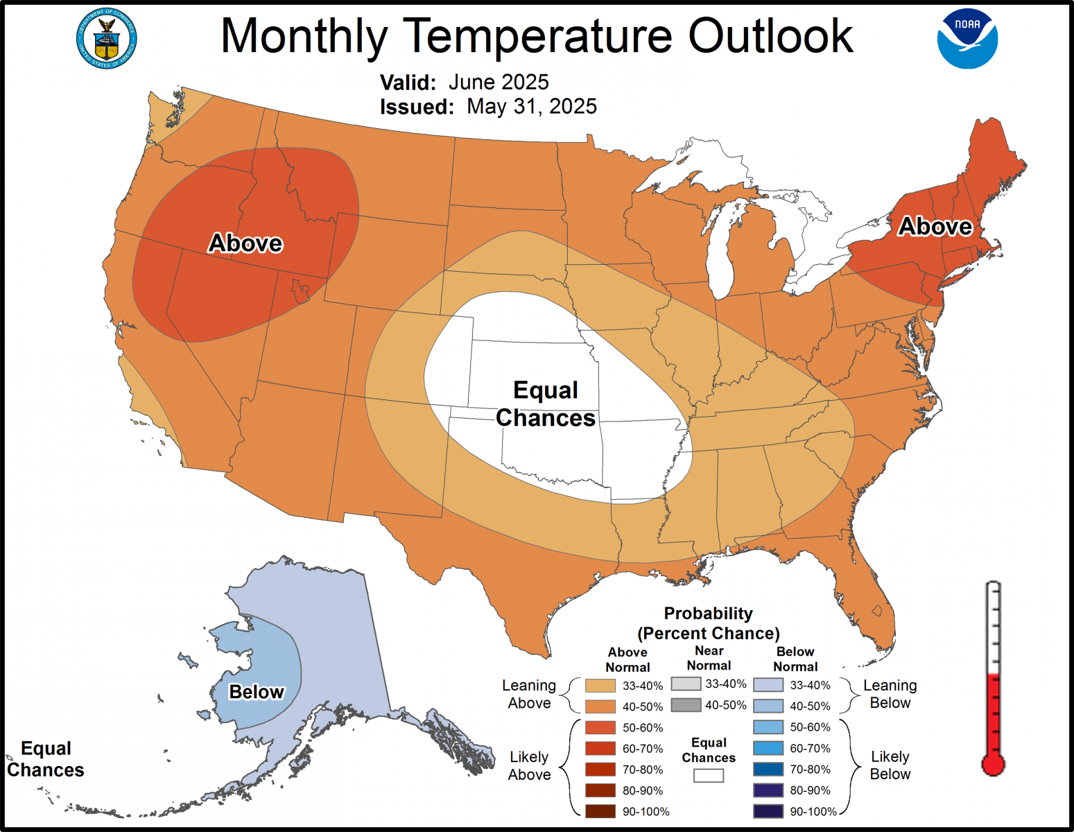
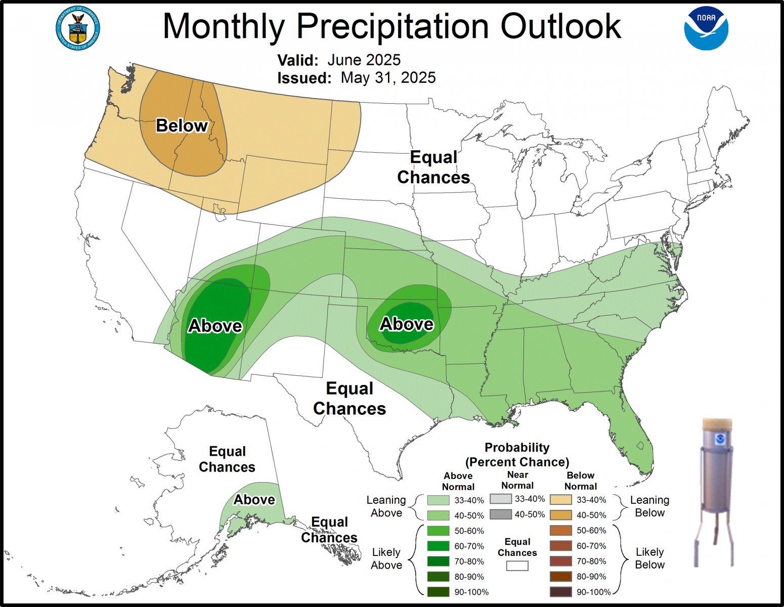
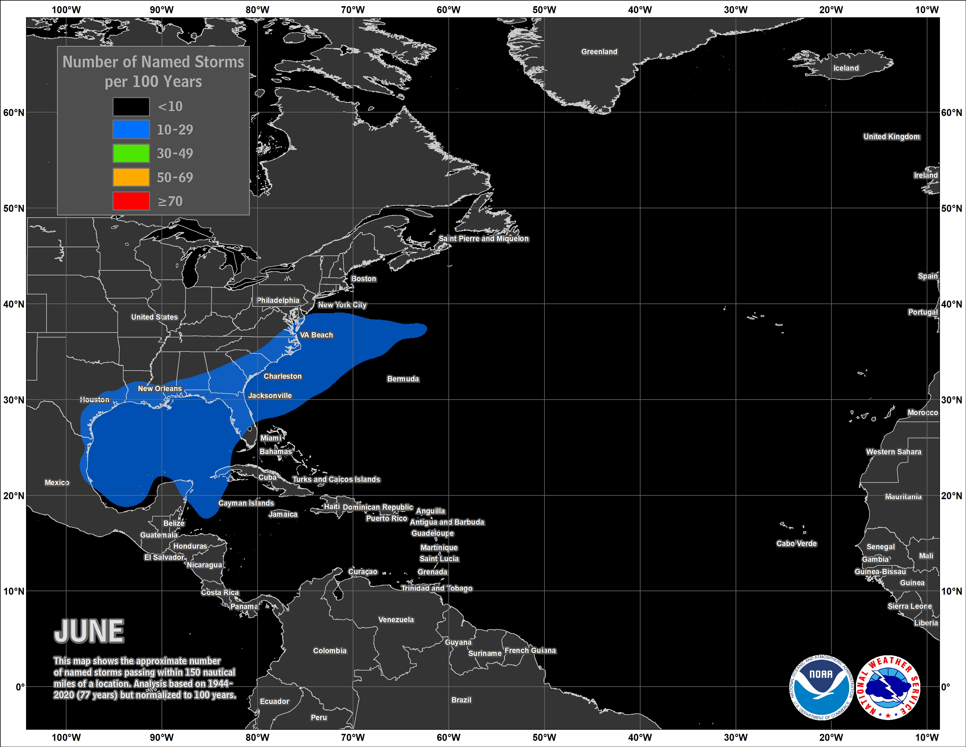
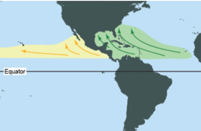
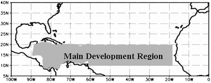
Temperatures in June are favored to lean above normal over the central Gulf Coast while precipitation leans above normal from the southern Plains to the southeast. June marks the official start of the Atlantic Basin Hurricane Season and NOAA has released its outlook for 2025 and predicts storm development at above normal. Lending to the outlook is a number of favorable factors, including warmer than average oceanic temperatures in the Atlantic Ocean, development of ENSO neutral conditions, forecast of weak wind shear and potential of higher activity from the west African Monsoon, the starting point for Atlantic hurricanes. The Monsoon can produce well defined easterly waves moving westward off the west African coast and across the Main Development Region (MDR). All of these factors tend to favor increased tropical cyclone formation. See the link to the outlook below. It's highly encouraged to review your hurricane preparedness. Click on the Preparedness Tab on the NWS Mobile Tropical Webpage.
Click on the snap shots below to expand:
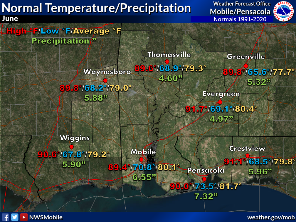 June Normals June Normals |
|
Outlook |

|
|
|
Additional Climate Links:
The National Weather Service Mobile Alabama's Climate and Past Weather page provides climate data at your fingertips for many observation points in the local forecast area by accessing the NOWData tab as well as many other climate resources. The Climate Prediction Center Link provides short and longer range climatic outlooks and education about the larger scale global circulations that impact temperatures and weather. With the large agriculture and farming presence along the central Gulf coast, the Drought Monitor link provides updates on drought trends and impacts. Another very helpful resource is the Community Collaborative Rain Hail and Snow (CoCoRaHS) network, which is a large group of volunteers working together to measure and map precipitation (rain, hail, and snow). The aim of CoCoRaHS is to provide the highest quality data for natural resource, education and research applications. You can be a part of the CoCoRaHS team by becoming a volunteer rainfall observer.


