The National Weather Service (NWS) office in Mobile-Pensacola in collaboration with the National Hurricane Center (NHC) has defined the Okaloosa and Walton county Florida line as a new forecast break point in reference to all tropical cyclone watches and warnings starting with the 2017 Hurricane Season.
The National Weather Service offices in Mobile-Pensacola and Tallahassee will be making changes to their marine zone configurations to better align the respective marine zones with the new NHC forecast break point. The new marine zone configuration will be implemented on December 5, 2017.
Figure 1 below shows the current configuration of the NWS Mobile-Pensacola marine area of responsibility:
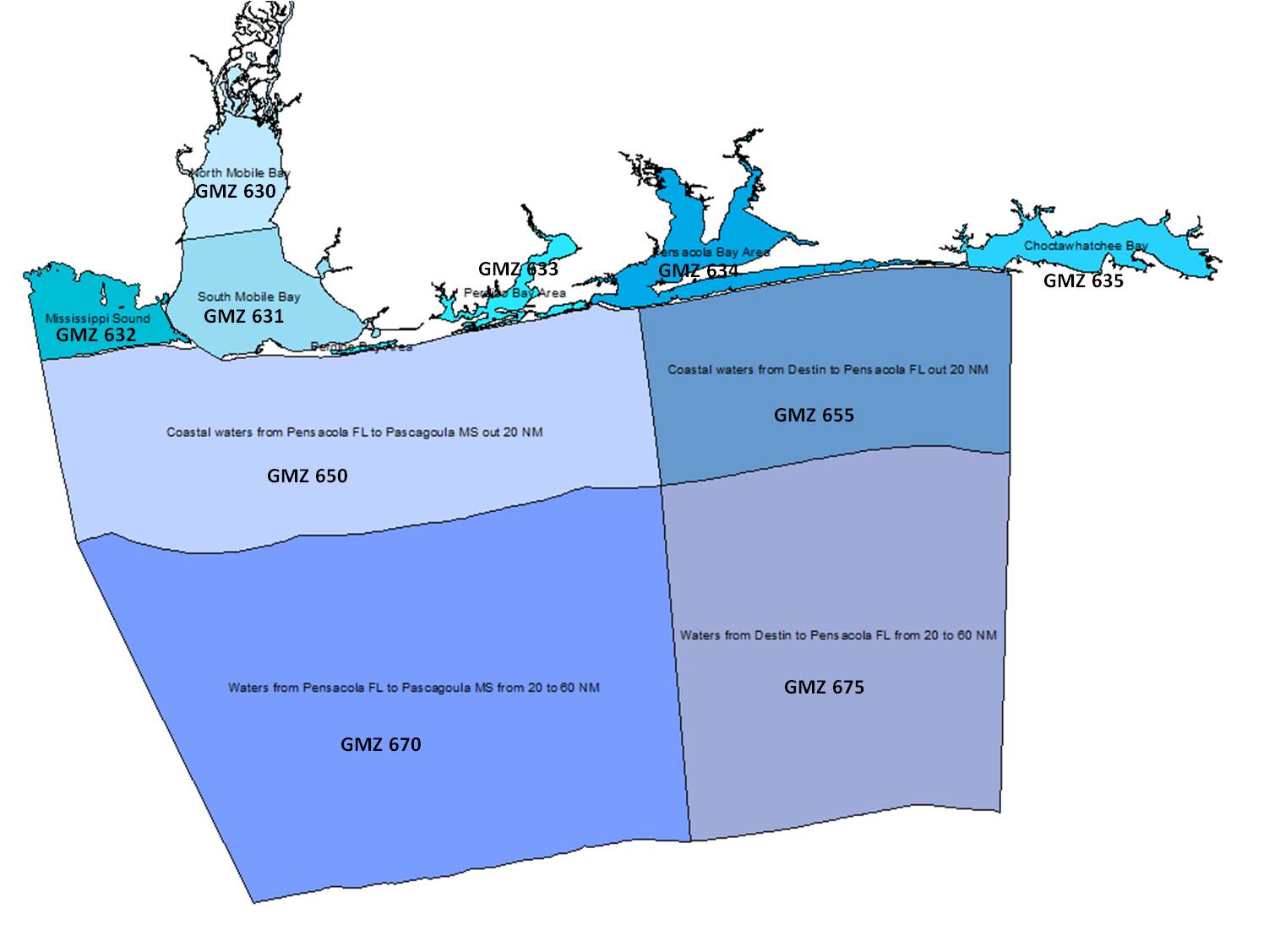
Figure 1: Current Configuration of the NWS Mobile-Pensacola Marine Area of Responsibility. Changes will be made to the Choctawhatchee Bay marine zone (GMZ635) and the Coastal Waters From Destin to Pensacola out 20 NM (GMZ655) and 20 to 60 NM (GMZ675) on December 5, 2017.
Marine zone changes to be implemented in the NWS Mobile-Pensacola area of responsibility on December 5, 2017 include:
1. Choctawhatchee Bay (GMZ635) will be split into two new marine zones - Western Choctawhatchee Bay (GMZ635) and Eastern Choctawhatchee Bay (GMZ636).
Choctawhatchee Bay will be split into two new marine zones along the Okaloosa and Walton county Florida line. Western Choctawhatchee Bay (GMZ635) will be defined as the Okaloosa county side of the bay and Eastern Choctawhatchee Bay (newly labeled GMZ636) will be defined as the Walton county portion of Choctawhatchee Bay. NWS Mobile-Pensacola will retain forecast and warning responsibility for both marine zones. See Figure 2 below for a graphical depiction of the new configuration.
2. The eastern border of the Coastal Waters From Destin to Pensacola FL out 20 NM (GMZ655) and the Coastal Waters From Destin to Pensacola FL From 20 to 60 NM (GMZ675) will be moved east to extend south of the Okaloosa and Walton county line.
The eastern border of GMZ655 and GMZ675 will be shifted east to extend south of the Okaloosa and Walton county line to better align with the new NHC forecast break point. Both marine zones will retain their current GMZ identifiers. Figure 2 below shows the new graphical depiction of this change.
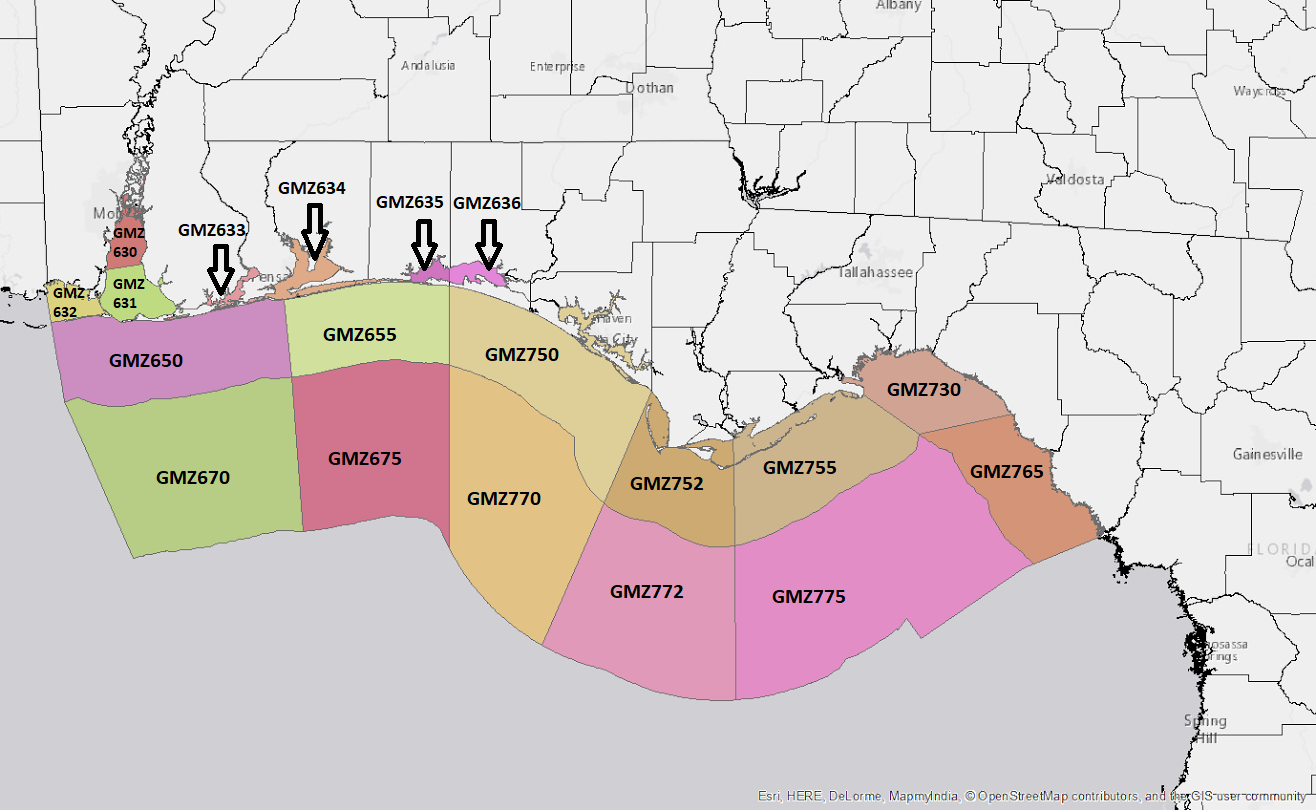
Figure 2: NWS Mobile-Pensacola and Tallahassee New Marine Zone Configuration Effective December 5, 2017. Note the new Choctawhatchee Bay Marine Zones split along the Okaloosa and Walton county FL line: Western Choctawhatchee Bay (GMZ635) and Eastern Choctawhatchee Bay (GMZ636). The eastern border of GMZ655 and GMZ675 will also be shifted east to extend south of the Okaloosa and Walton county FL line.
If you have any questions about the new marine zone configuration, please contact:
Jeffrey Medlin, Meteorologist in Charge - Jeff.Medlin@noaa.gov or
Cody Lindsey, Marine Program Leader - Cody.Lindsey@noaa.gov
(251) 633-6443

