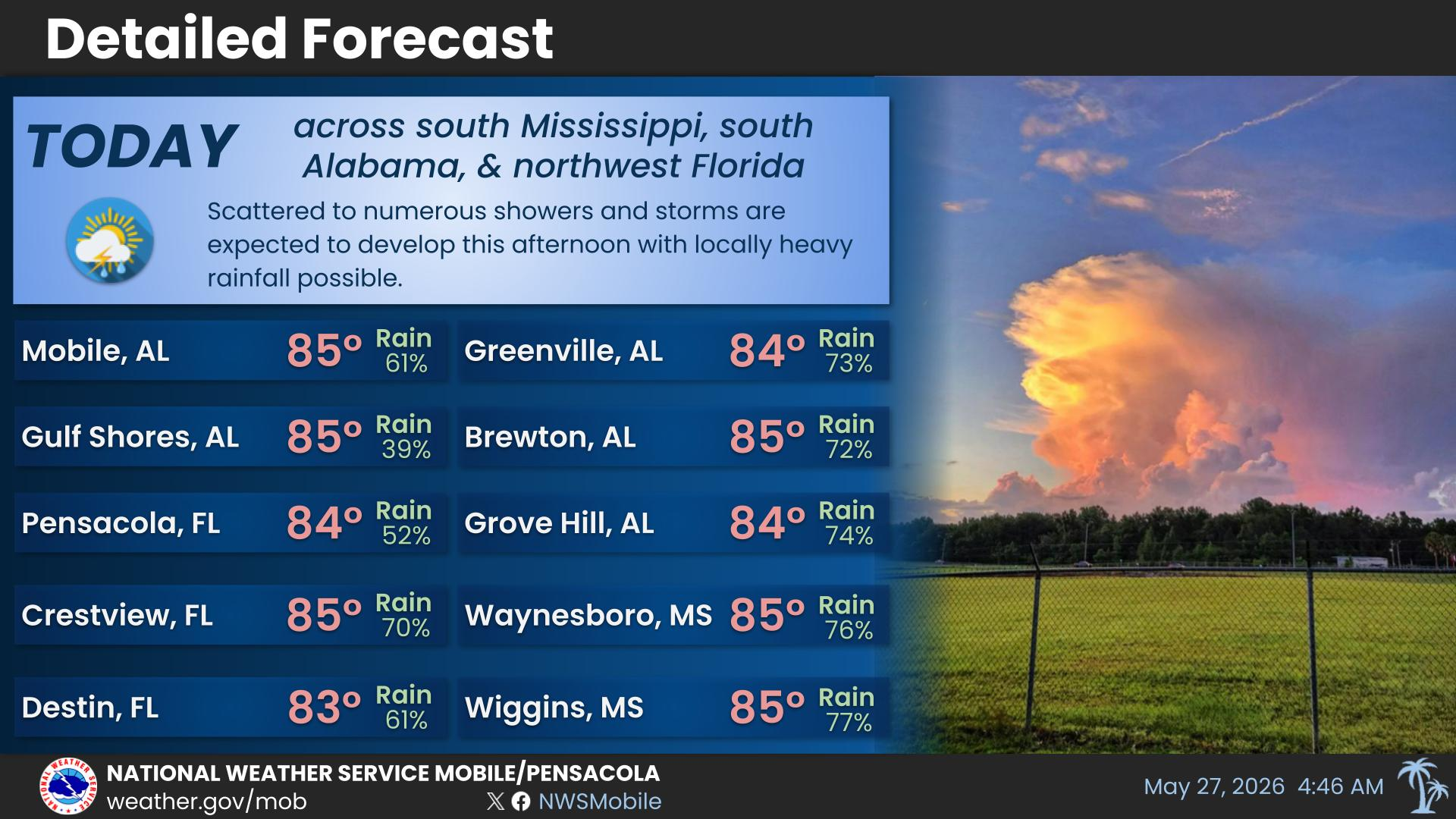
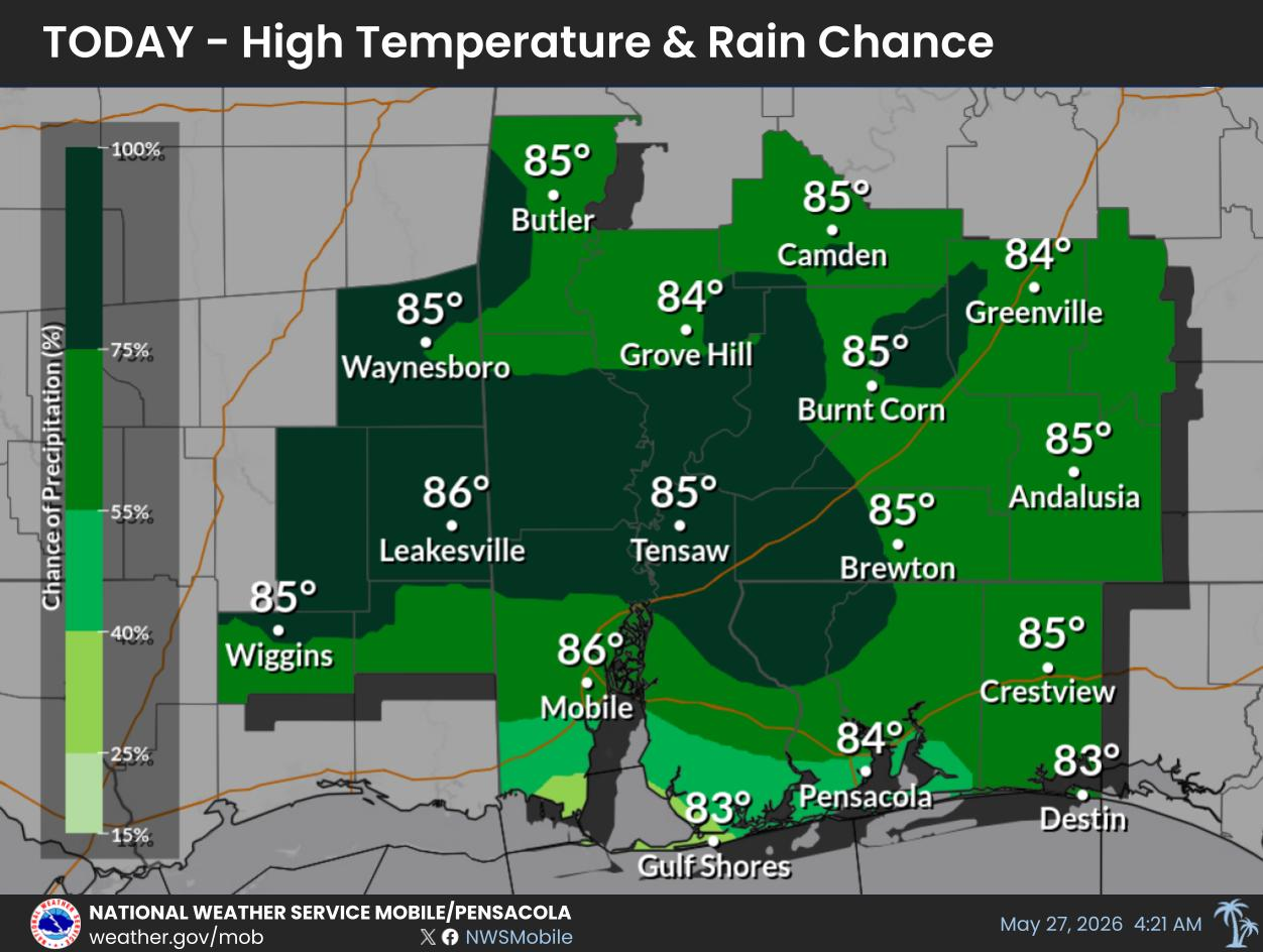
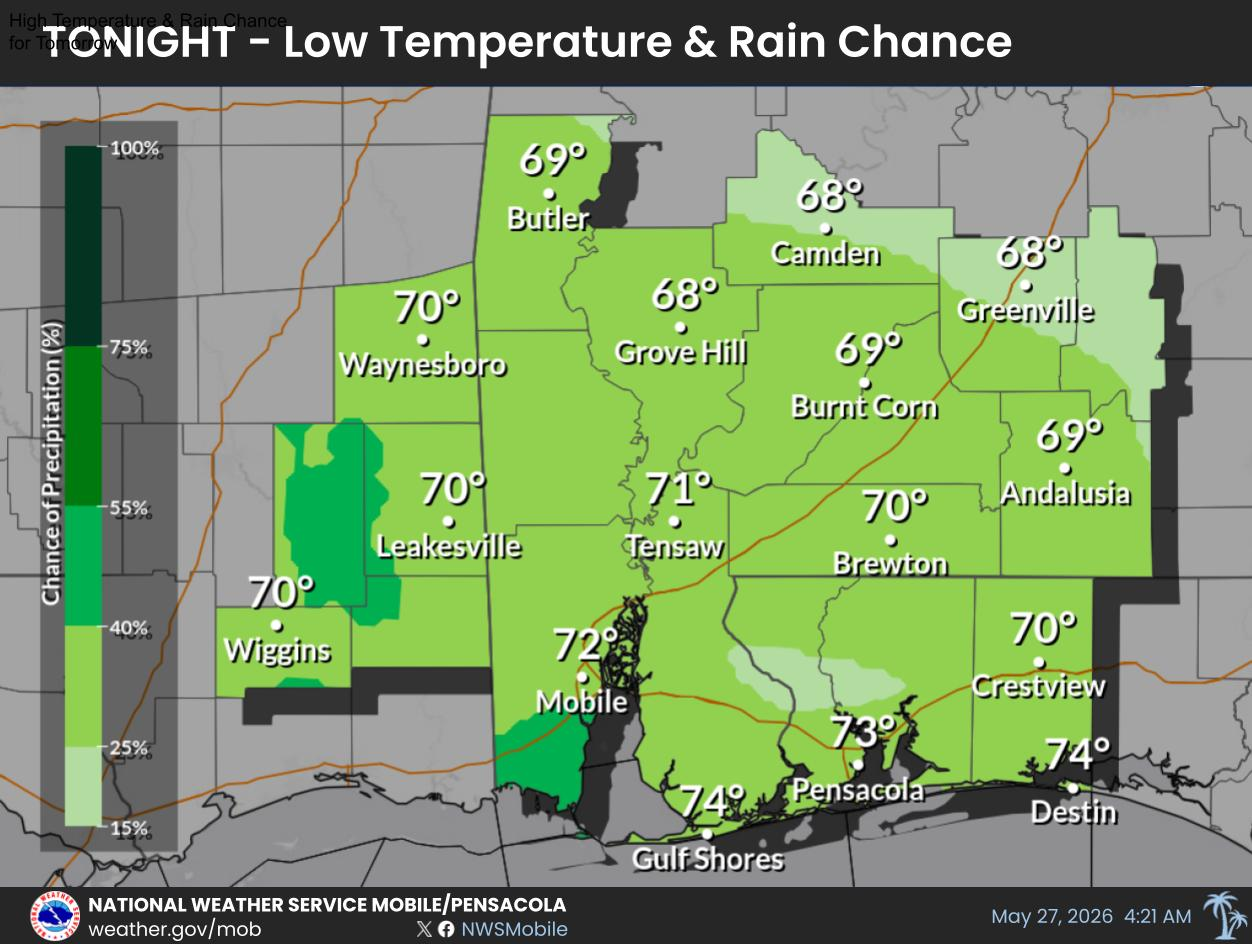
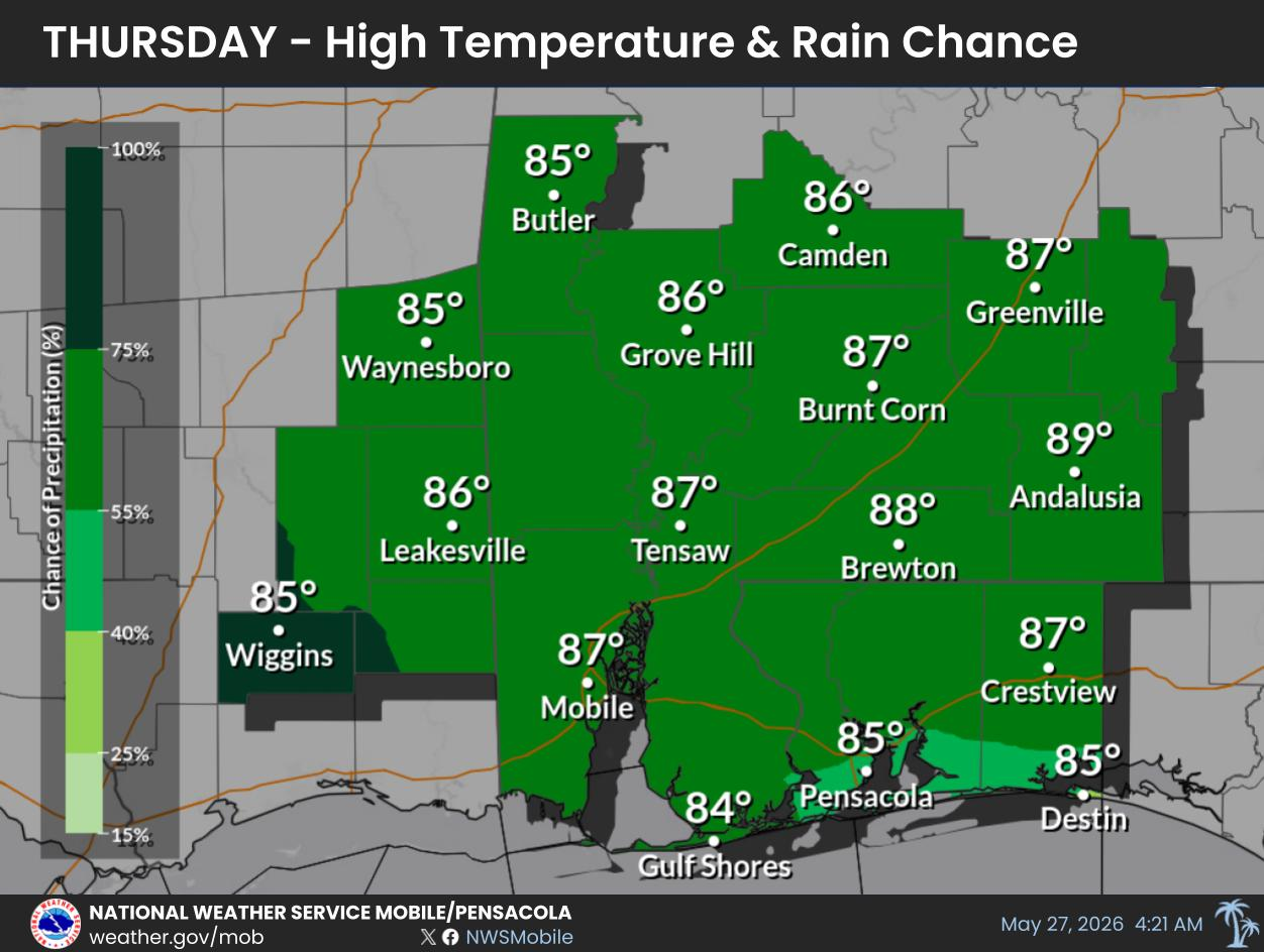
Our typical summertime pattern of scattered afternoon thunderstorms and hot conditions (heat indices ranging from 102-107 degrees), will continue through Friday. Rain chances will be on the increase on Saturday, and especially on Sunday and into early next week. Heavy rainfall, which could lead to flooding concerns, is possible as we head into next week.
For more information, visit our social media pages at
Facebook and
X pages or listen to a NOAA Weather Radio. Stay weather aware!


 Local Radar
 Weather Map
 Satellite Imagery
 Beach and Surf
 Tropical Weather
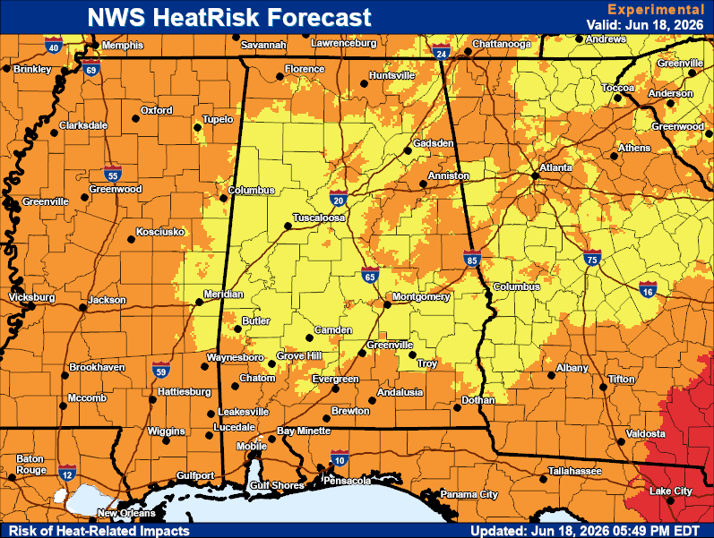 Heat Risk
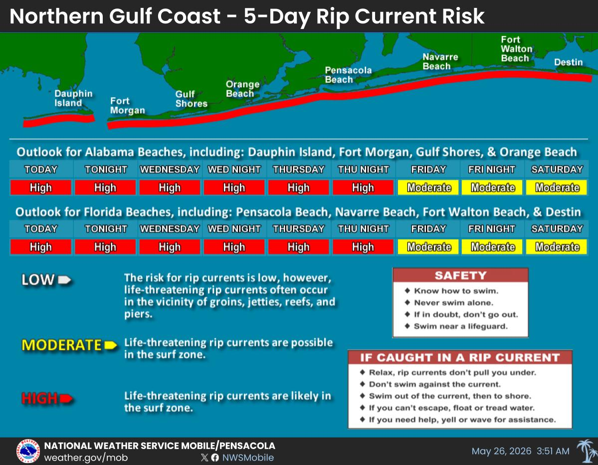
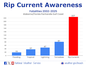 Rip Current Awareness
 Local Forecast Maps