National Weather Service United States Department of Commerce
Click a location below for detailed forecast.

Last Map Update: Thu, May 1, 2025 at 7:00:17 am EDT


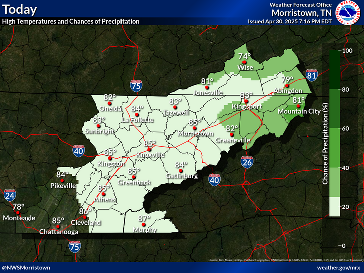
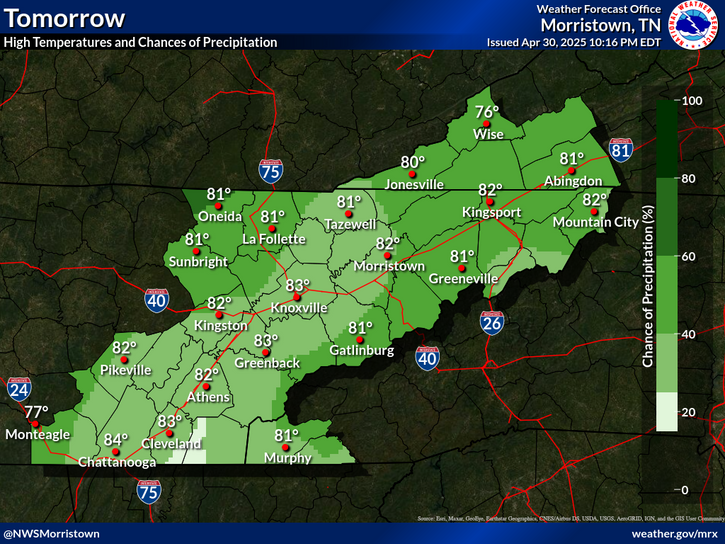
A few storms may become strong to severe late this afternoon to near midnight, especially over the northern Plateau. Damaging winds and hail will be the main threats, with a very low chance for a tornado for the northern Plateau.
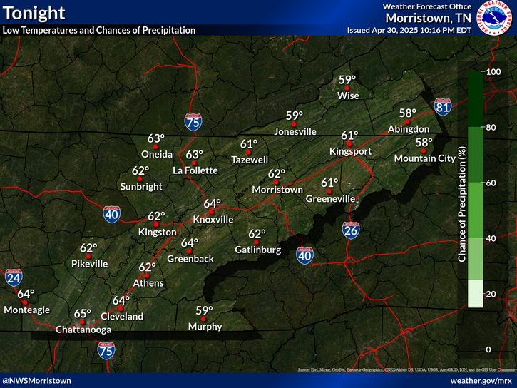
Expect scattered showers and thunderstorms to be around at times this afternoon and evening, then a better chance for showers and storms can be expected later Friday into Saturday. Temperatures will trend cooler for the weekend.

 Current Weather Observations...
Location Time
(EDT)
Weather Vsby.
(SM)
Temp.
(ºF)
Dewpt.
(ºF)
Hum.
(%)
Wind
(mph)
Wind Chill / Heat Index
(ºF)
Pres.
(in)
Abingdon VA18:55Clear10754838SSE 5-30.15
Andrews-Murphy NC06:29Mostly Cloudy10625990CALM-30.11
Chattanooga TN05:53Light Rain \ Lightning Observed7686693S 6-30.04
Crossville TN06:30Overcast10646396VRB 6-30.04
Dalton GA06:35Overcast96767100SSE 5-30.05
Knoxville TN (McGhee-Tyson)05:53Mostly Cloudy10676078SW 6-30.03
Middlesboro KY06:35Overcast10696174SSW 14G23-30.03
Monroe Cnty TN06:15Mostly Cloudy106666100SSW 6-30.04
Morristown TN11:4510696894NNE 6-30.19
Oak Ridge TN05:53Light Rain10666183SW 3-30.05
Tazewell Cnty VA06:35Clear10645779SSW 3-30.11
Tri-Cities TN06:00Partly Cloudy75858100CALM-30.06
Wise VA06:35Clear10625988S 5-30.10
Greeneville, TN06:10Clear10646088CALM-30.05


Local Weather History For May 1st...
In 2002, tornado hit near Big Sandy in Carter County. $100,000 damage. No injuries.


Briefing Hydrology Past Weather Events Graphical Hazardous Weather Outlook for East Tennessee East Tennessee Observations
Decision Support Hydrology Past Weather Events GHWO Observations Gridded Forecast
Daily Climate for Middle Tennessee Local East Tennessee Climate Tornado Database Tropical Weather Information NOAA Weather Radio
IDSS Point Forecasts Daily Climate Local Climate Tornado Database Tropical Weather Radio
Daily Climate for Middle Tennessee Probabilistic Data for East Tennessee Virtual Tour of the NWS Morristown Office Skywarn Spotter Training for East Tennessee  
Being Prepared Estar Perparado Probabilistic Virtual Tour Spotter Training