
A prolonged, dangerous heat wave will continue today in the Midwest and Mississippi Valley, and persist through the Independence Day weekend across the Ohio Valley, Mid-South, and East Coast. Widespread moderate to extreme HeatRisk is forecast. Scattered wind damage and large hail are expected from severe thunderstorms impacting parts of Nebraska into Iowa today. Read More >
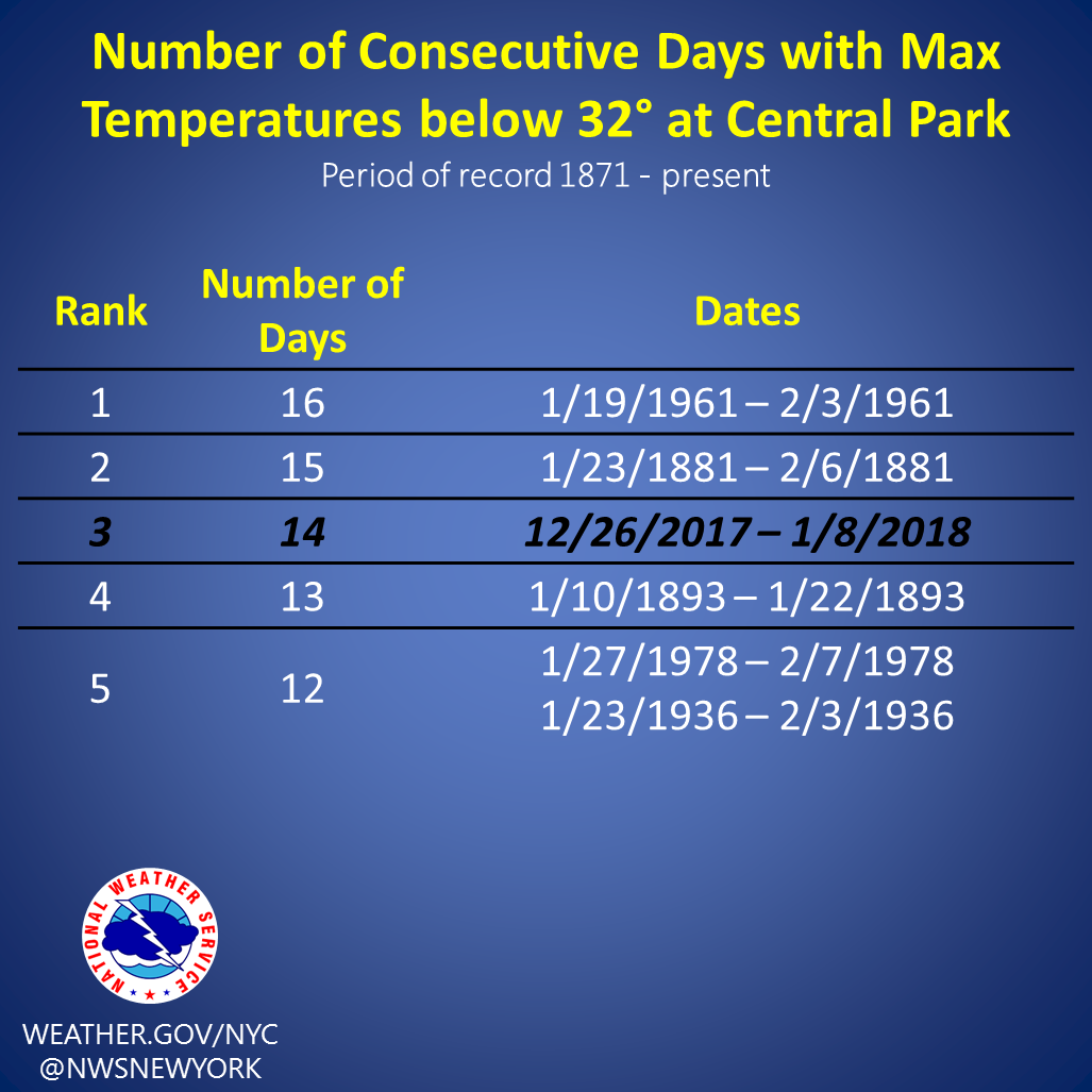
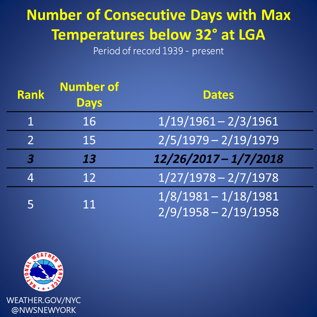
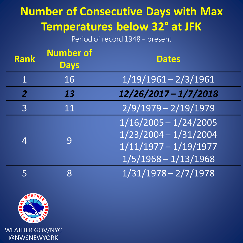
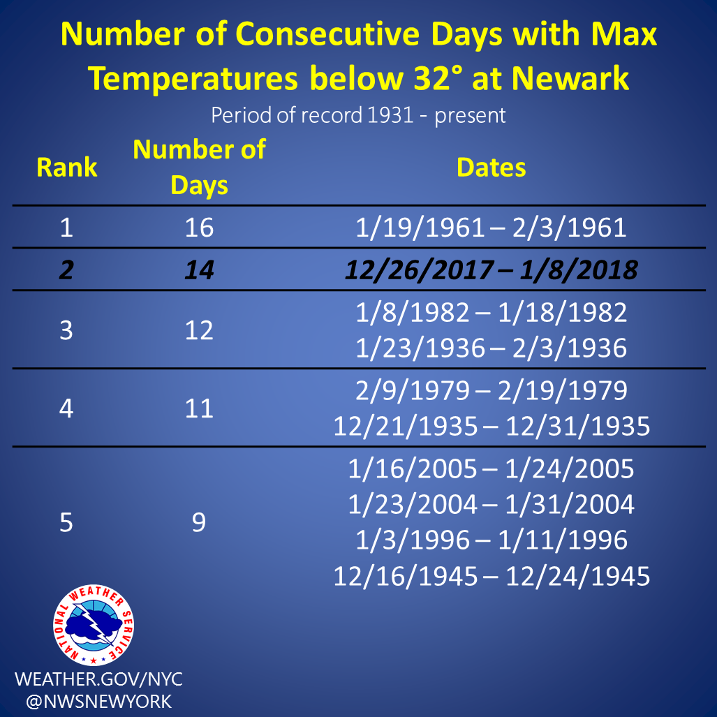
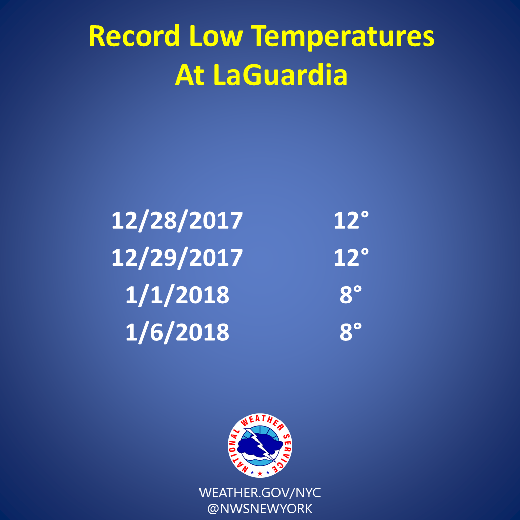
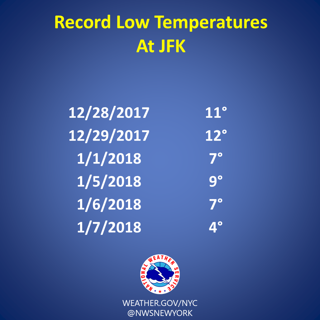
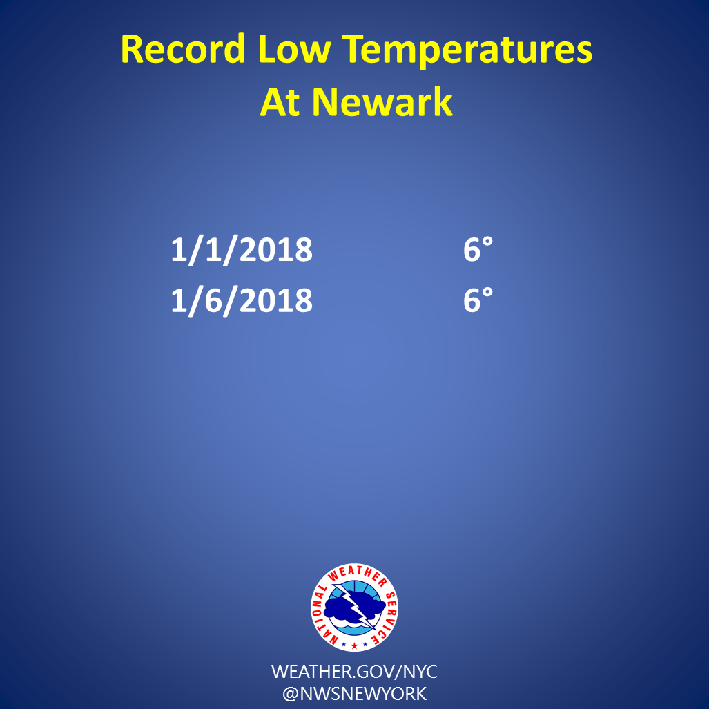
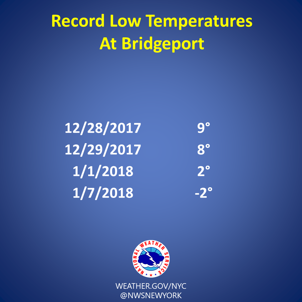
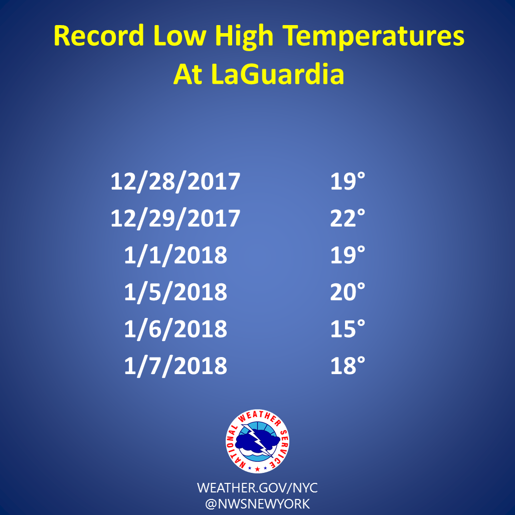
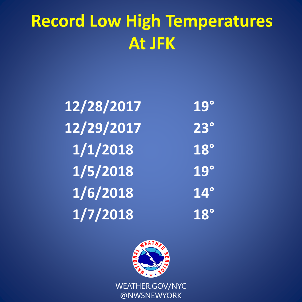
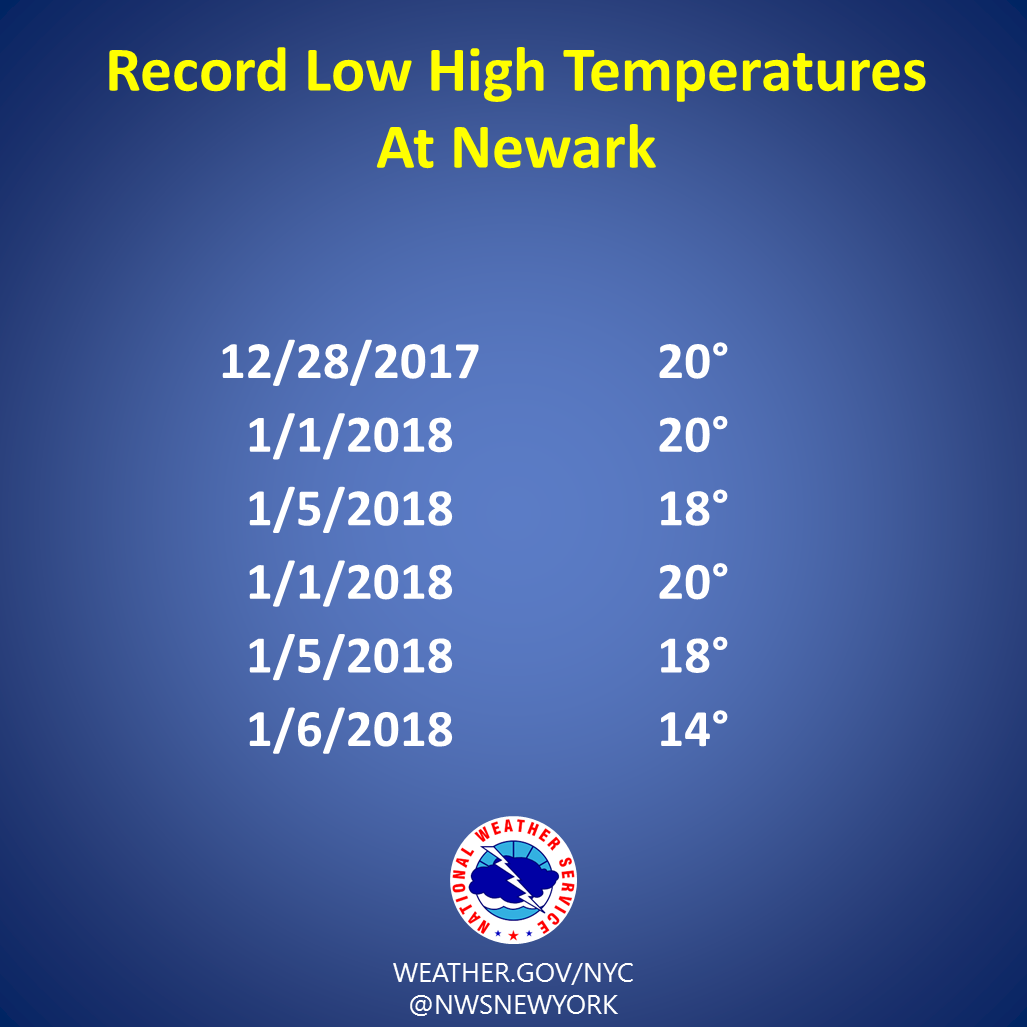
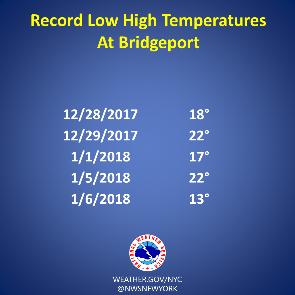
The majority of the central and eastern United States experienced one of the coldest late December through early January periods with record breaking cold temperatures.
Following the passage of a cold front on Christmas Day, arctic high pressure moved into the region. Strong winds combined with temperatures around 10 degrees below normal, made temperatures feel like the single digits and teens.
This cold and arctic airmass remained over the region through the last few days of the year, with high temperatures remaining below the freezing mark. A reinforcing shot of cold air was ushered in behind a cold front on New Years Eve. The temperature fell to 9°F at midnight, which is the second coldest midnight temperature since 1871 in Central Park.
Temperatures briefly returned to the upper 20s when a blizzard impacted the region on January 4th.
Average temperatures were 10 to around 25 degrees below normal at times during the arctic outbreak. On several occasions, wind chills were between -10 and -20°F.
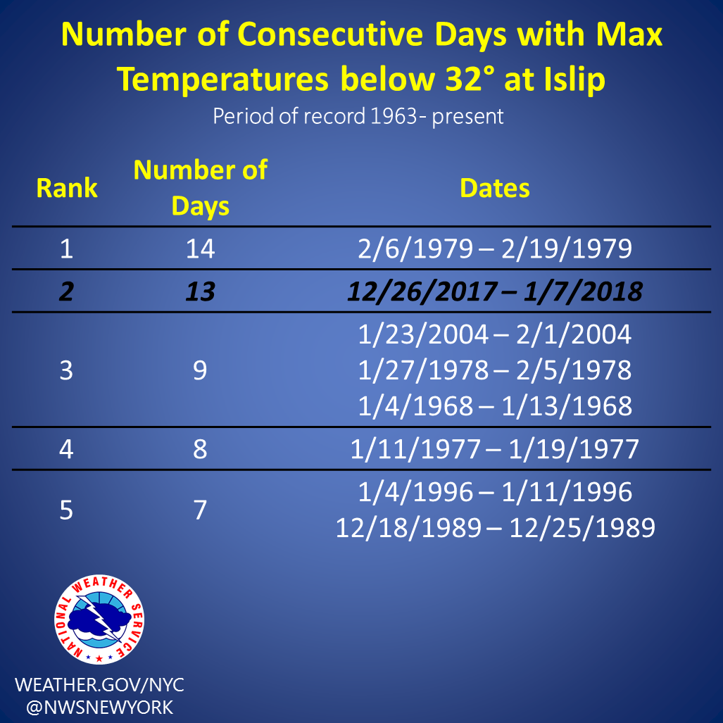
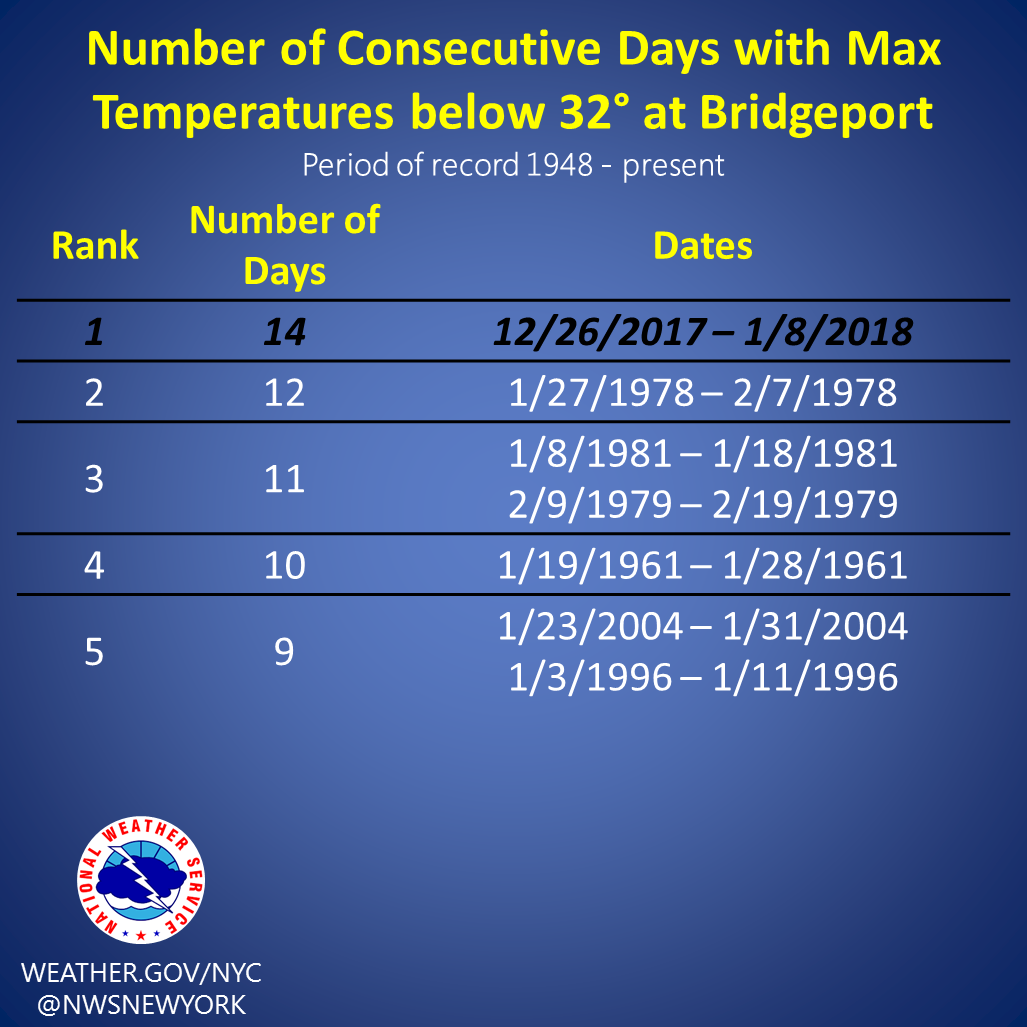
Climate sites set new records with the number of consecutive days with high temperatures below 32°.
 |
 |
 |
 |
 |
 |
 |
 |
 |
 |
 |
 |
 |
 |
 |
 |
 |


 Coastal Flooding