Latest Weather Briefing
Some older and mobile browsers may not display the latest briefing below. Please click the download latest briefing button below.
Current Watches, Warnings, and Advisories
Active Watches/Warnings/Advisories/Statements
Experimental Graphical Hazardous Weather Outlook
NWS NY Outlook, Watch, Warning, and Advisory Criteria
Routine Forecasts
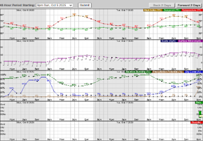
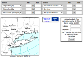
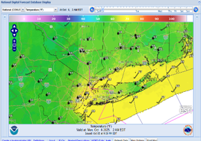
| Detailed Forecast | Hourly Weather Graph | Activity Planner | Digital Graphics |
|---|---|---|---|
 |
 |
 |
 |
| Current Radar | Current Satellite |
|---|---|
 |
 |
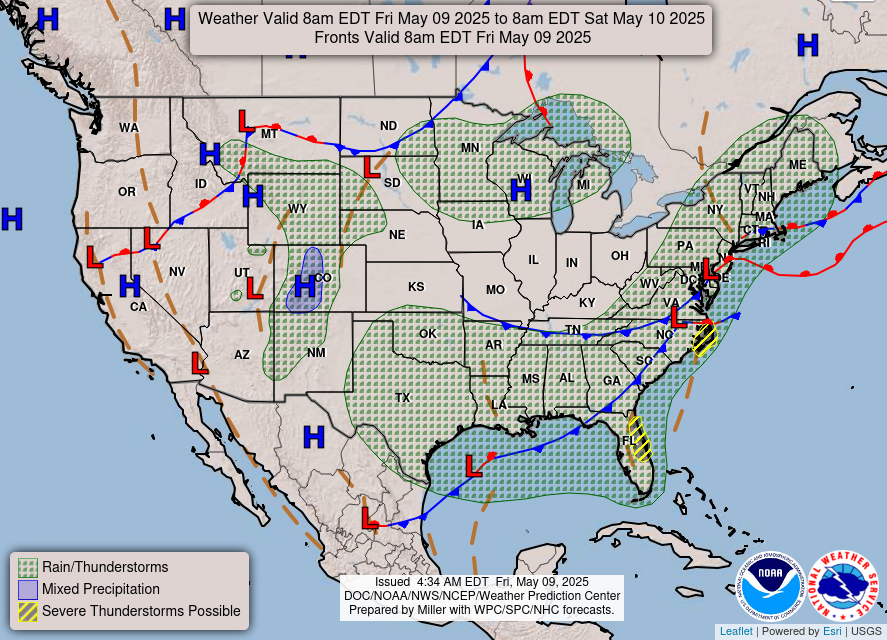
| Day 3-7 Hazard Assessment | Current Surface Map |
 |
 |
CPC Temperature Outlooks
| Seasonal Outlook | Monthly Outlook | Week 3-4 Outlook | 8-14 Day Outlook | 6-10 Day Outlook |
|---|---|---|---|---|
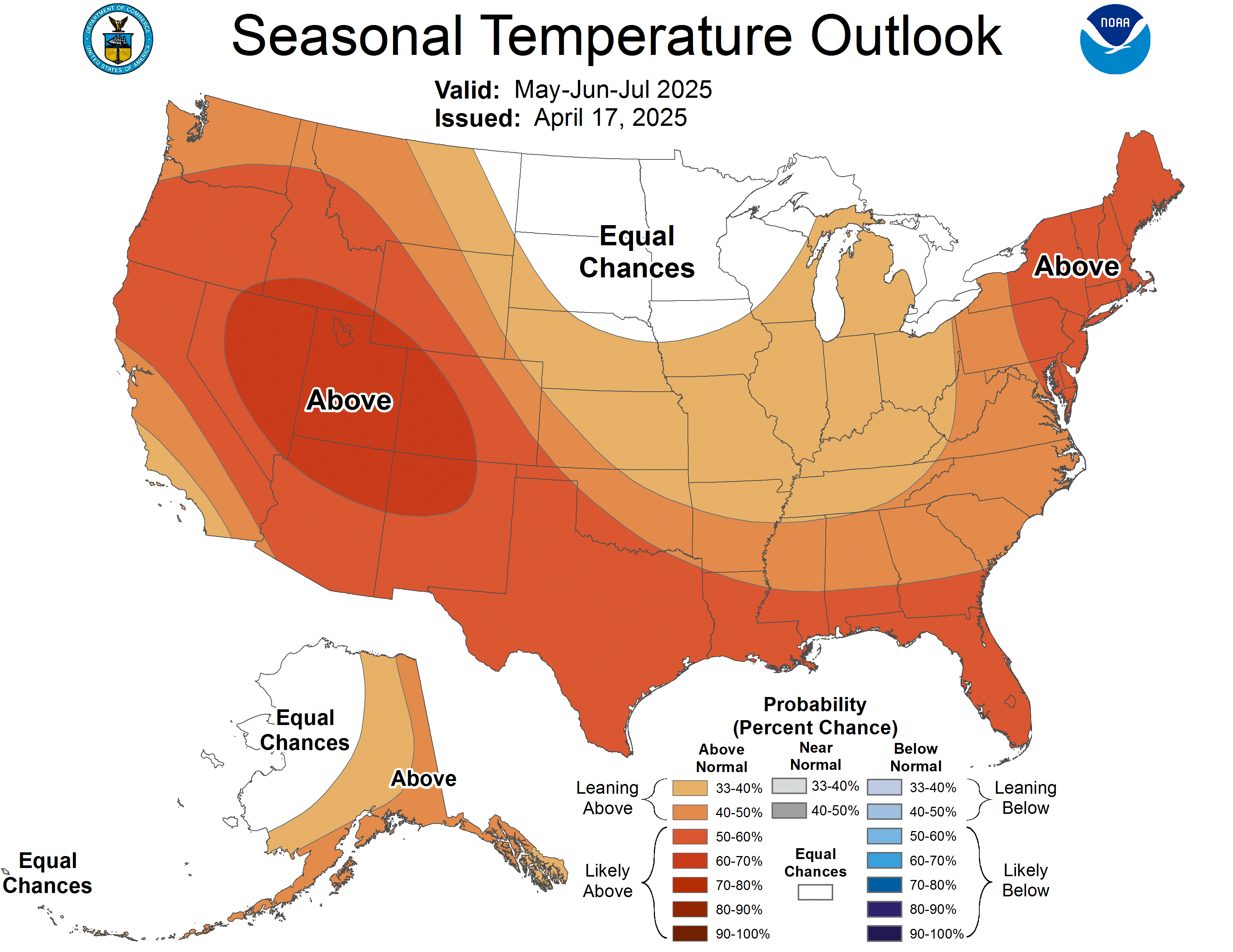 |
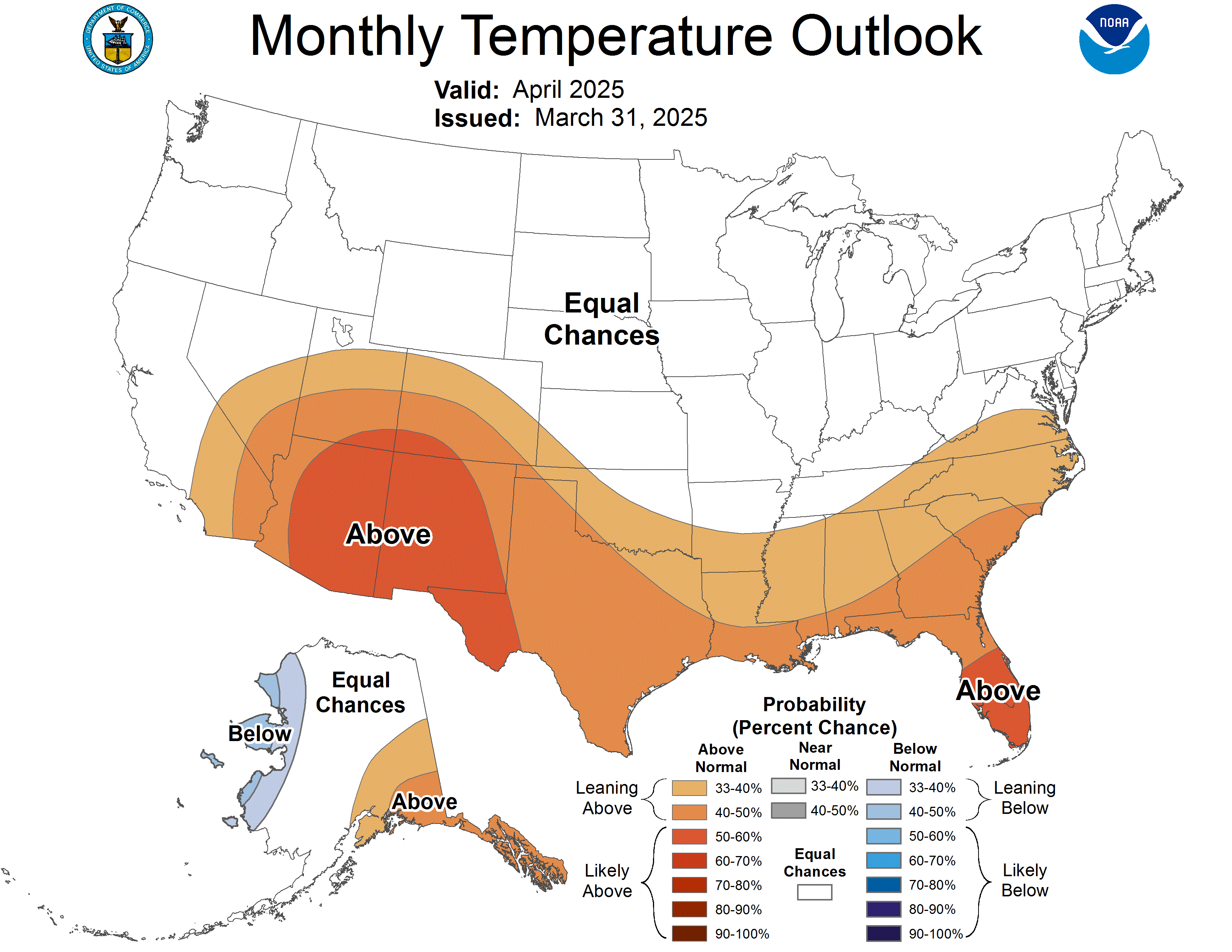 |
 |
 |
 |
CPC Precipitation Outlooks
| Seasonal Outlook | Monthly Outlook | Week 3-4 Outlook | 8-14 Day Outlook | 6-10 Day Outlook |
|---|---|---|---|---|
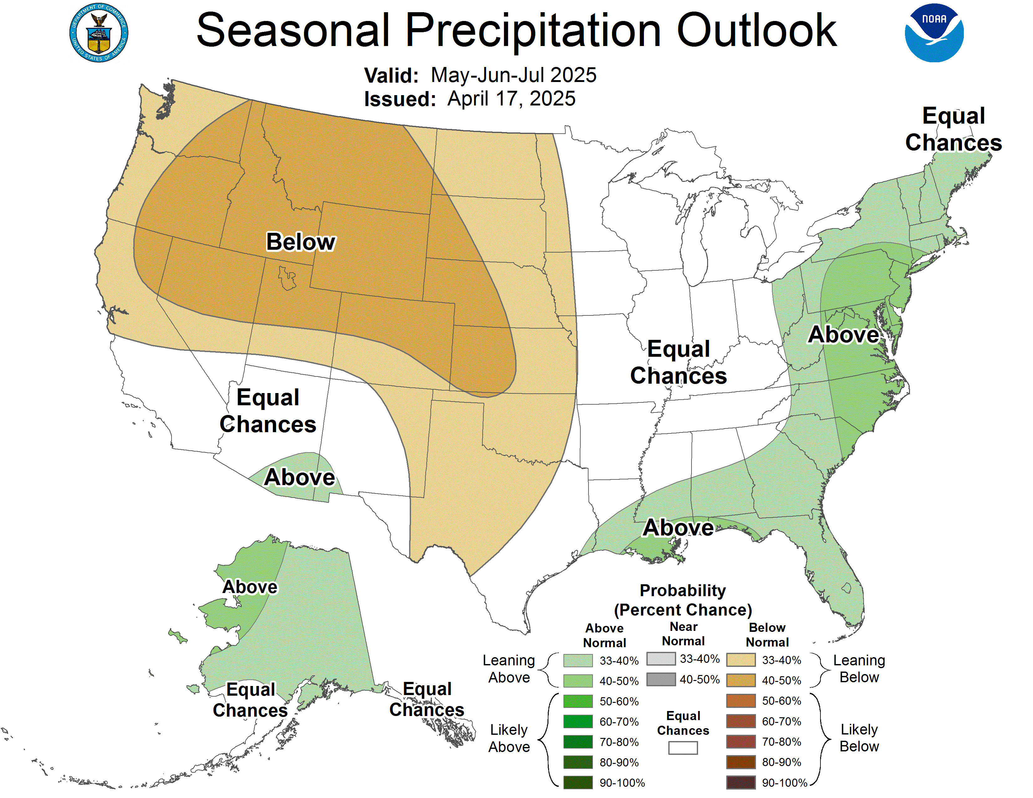 |
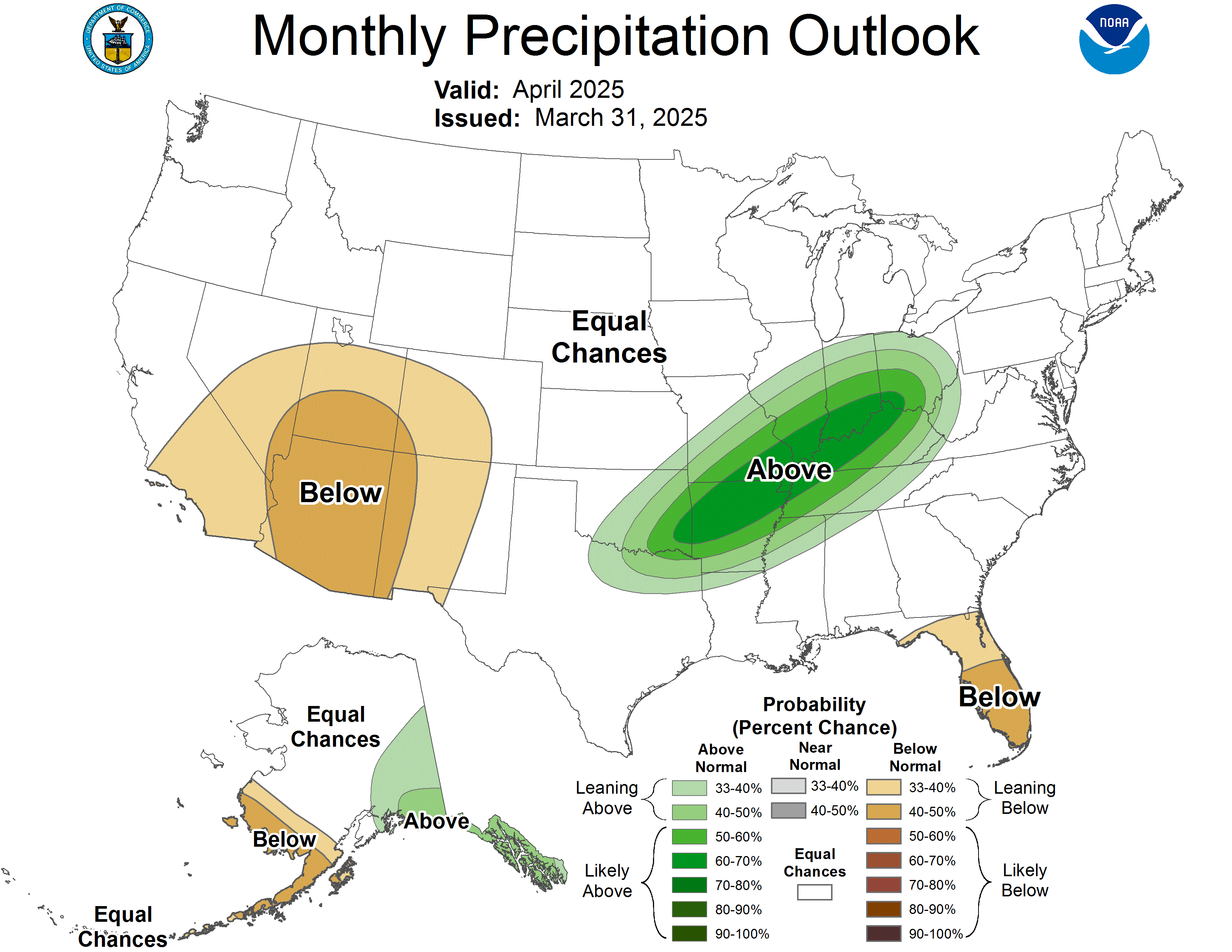 |
 |
 |
 |
Air Quality |
Beach Hazards |
Cold |
 |
 |
 |
Drought |
Flooding |
Fog |
 |
 |
 |
Heat |
Hurricanes |
Lightning |
 |
 |
 |
Marine |
Rip Currents |
Space Weather |
 |
 |
 |
Thunderstorms |
Tornado |
Tsunamis |
 |
 |
 |
Wildfires |
Wind |
Winter |
 |
 |
 |
| Expected Snow Accumulation Official NWS Forecast | Expected Ice Accumulation Official NWS Forecast |
|---|---|
| High End Snowfall Amount | Low End Snowfall Amount |
|---|---|
Latest Probabilistic Snow Forecasts
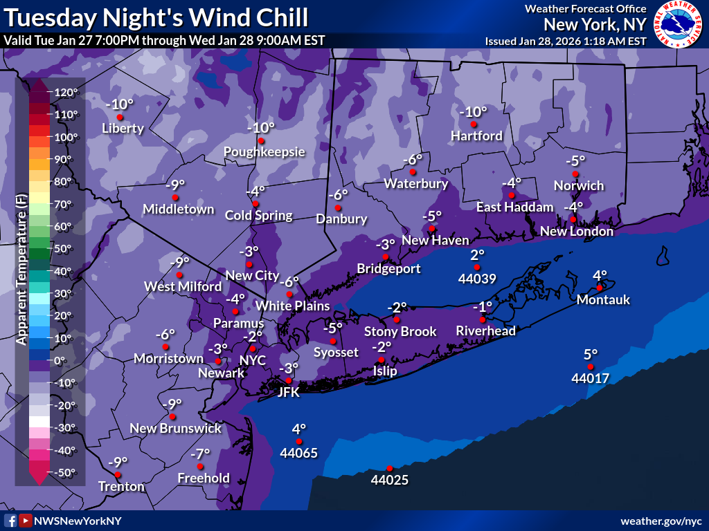
Extreme Cold Graphics
Day 1
| Minimum Wind Chill | Minimum Temperature | Maximum Temperature |
|---|---|---|
 |
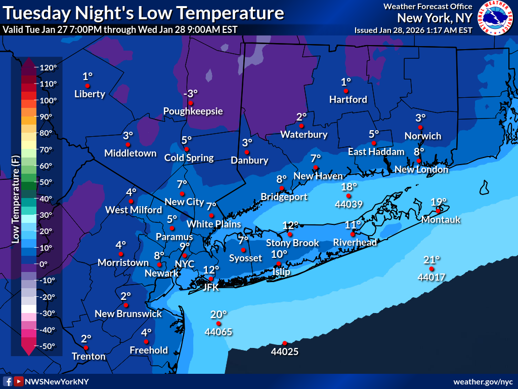 |
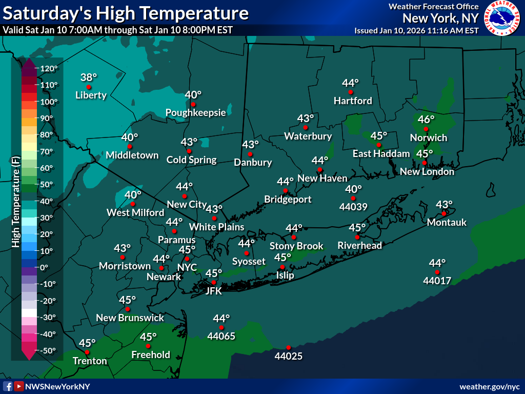 |
Day 2
| Minimum Wind Chill | Minimum Temperature | Maximum Temperature |
|---|---|---|
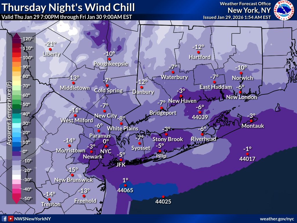 |
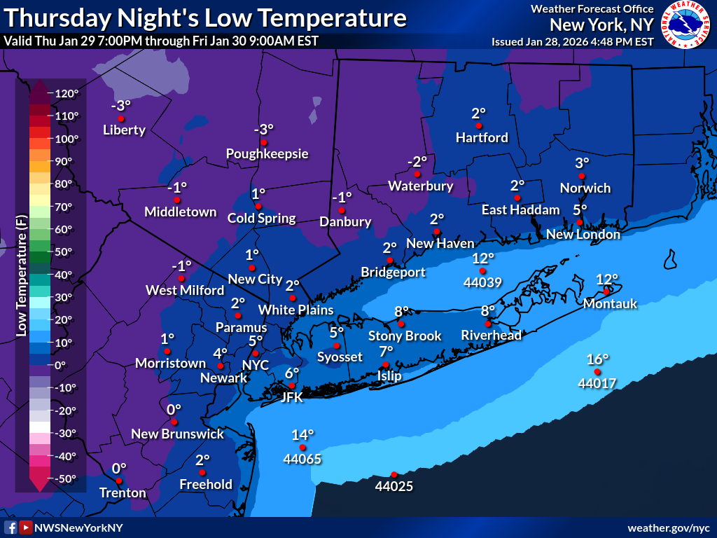 |
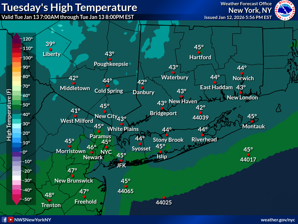 |
Day 3
| Minimum Wind Chill | Minimum Temperature | Maximum Temperature |
|---|---|---|
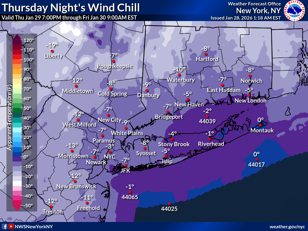 |
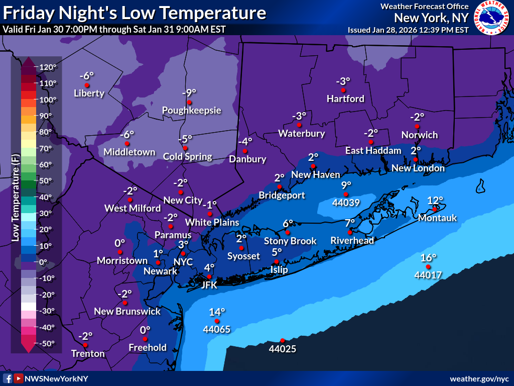 |
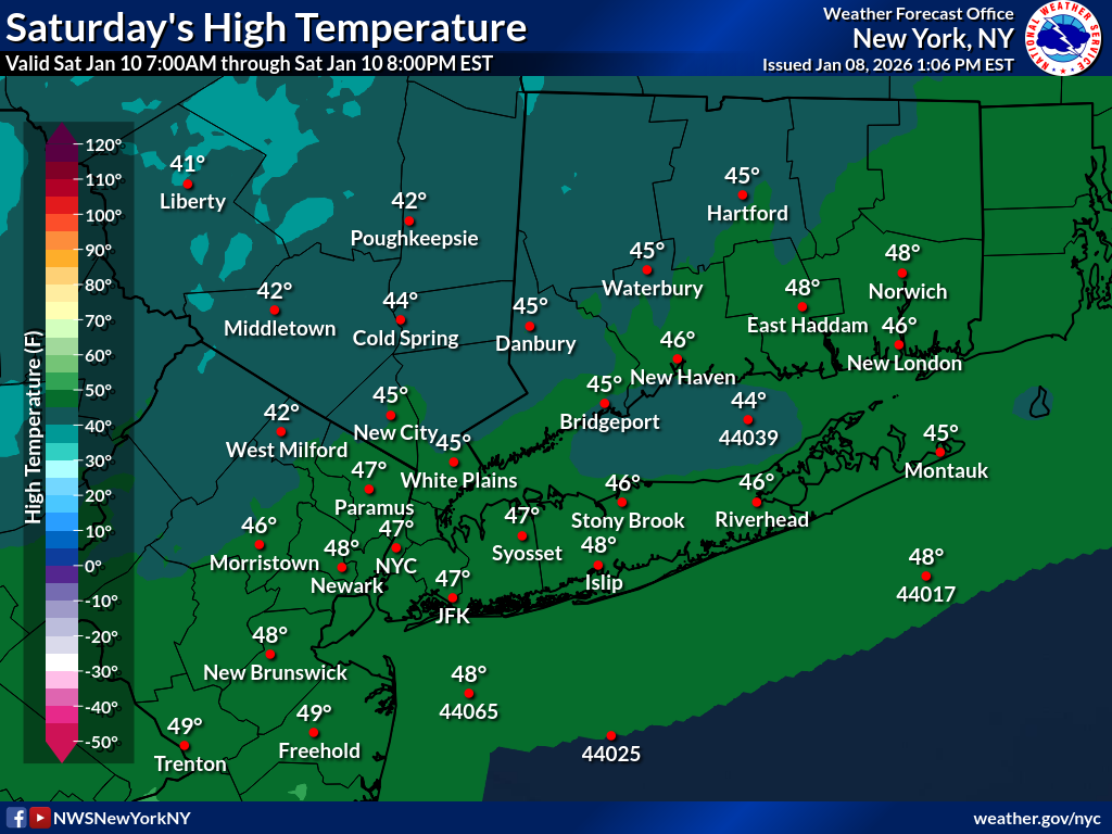 |
Day 4
| Minimum Wind Chill | Minimum Temperature | Maximum Temperature |
|---|---|---|
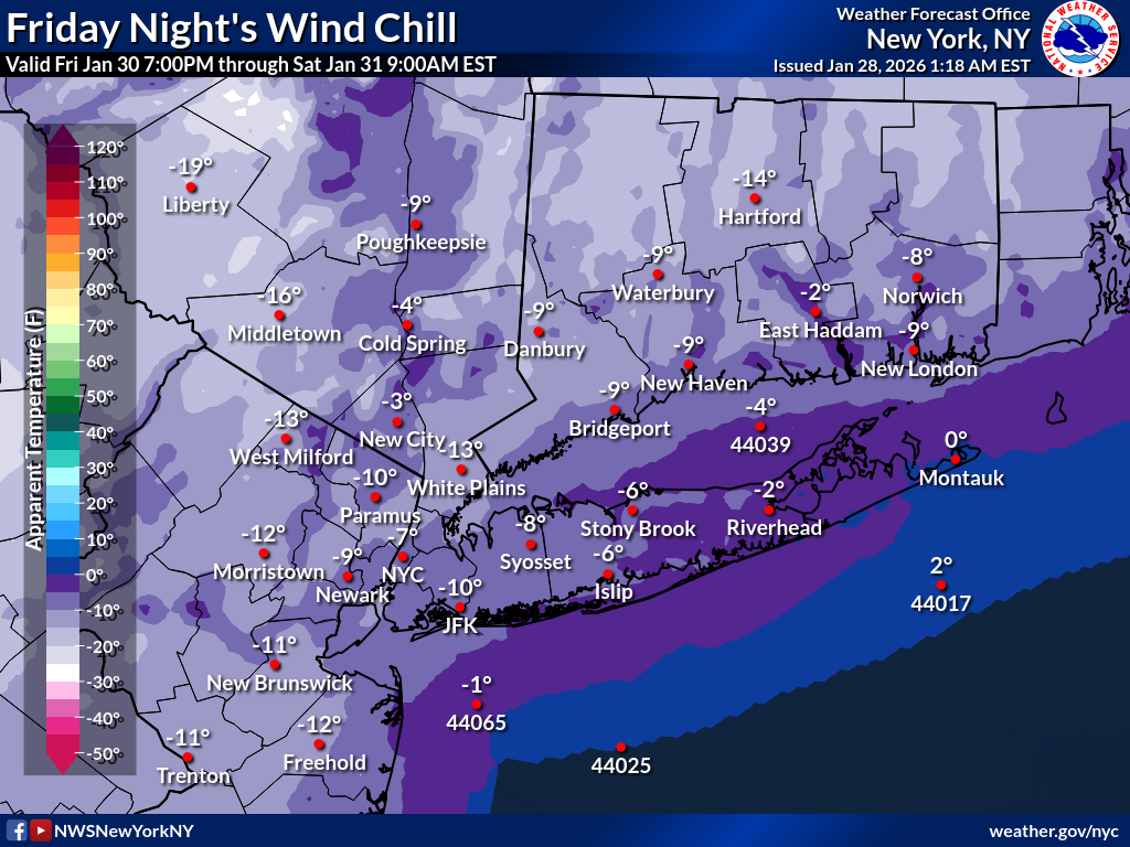 |
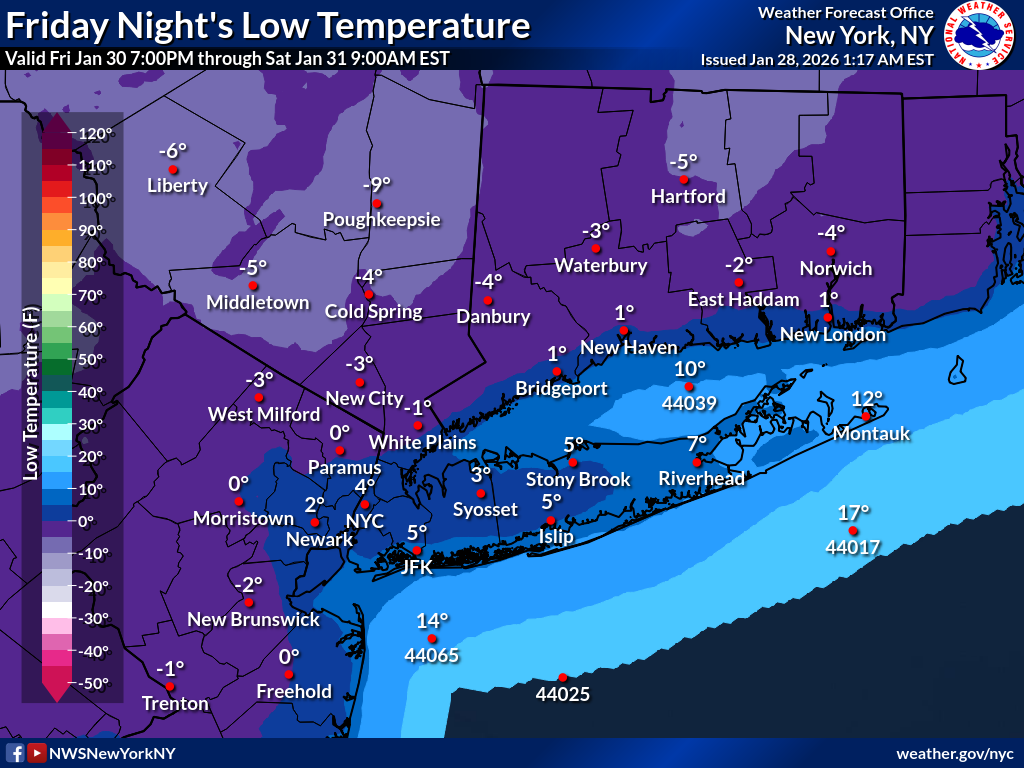 |
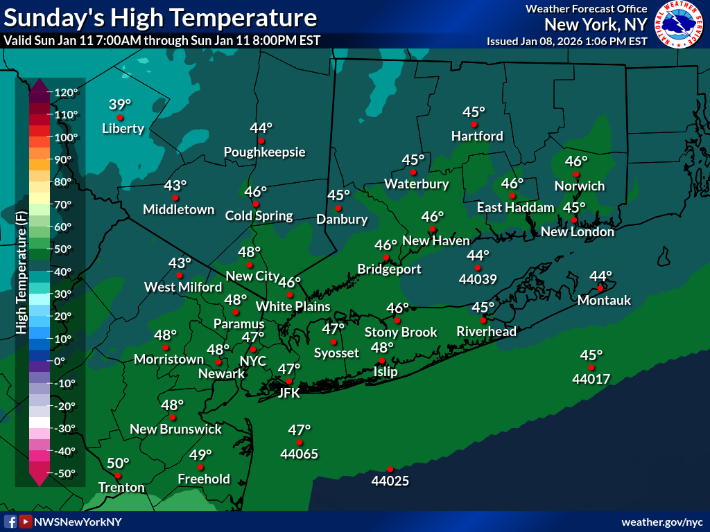 |
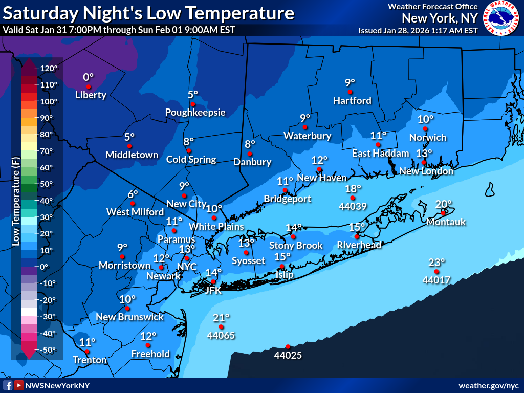
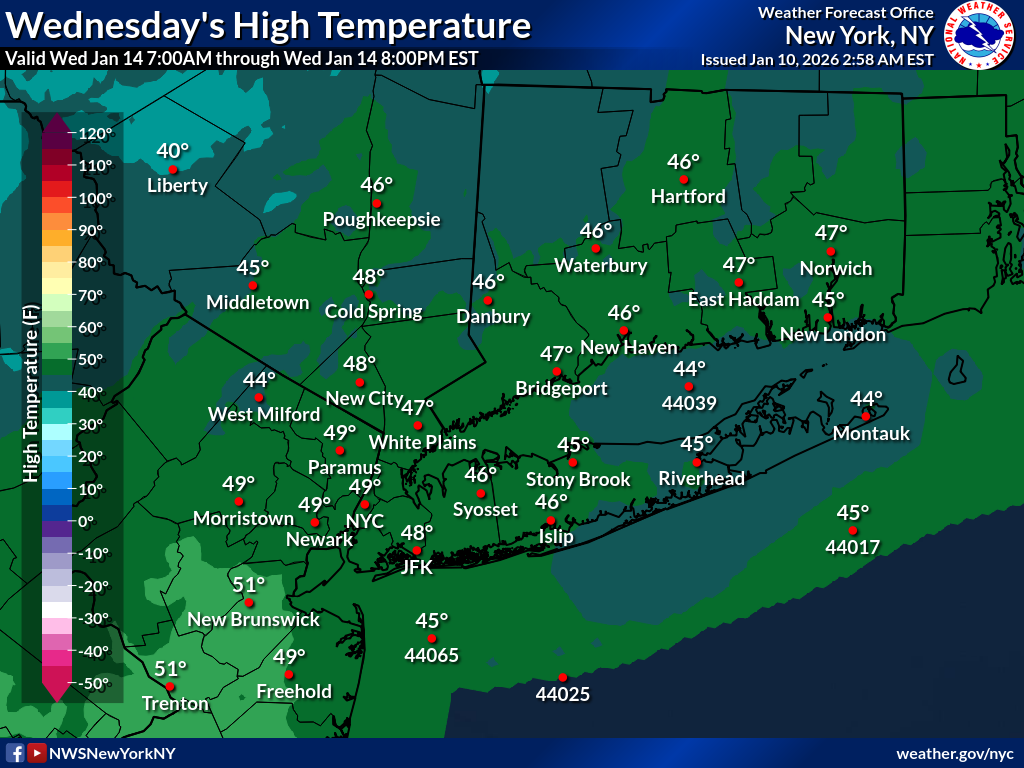
Day 5
| Minimum Wind Chill | Minimum Temperature | Maximum Temperature |
|---|---|---|
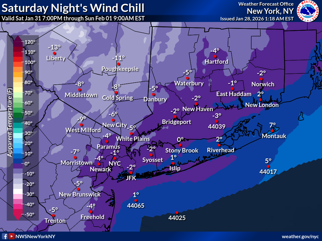 |
 |
 |
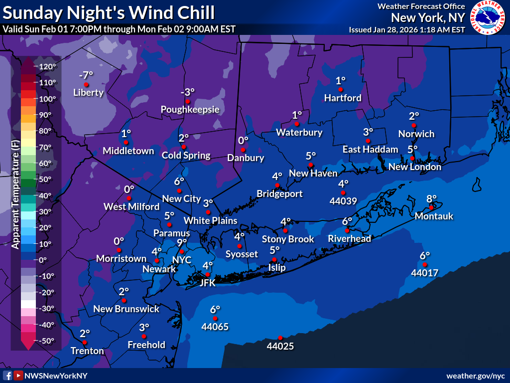
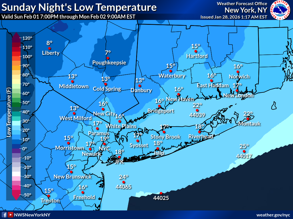
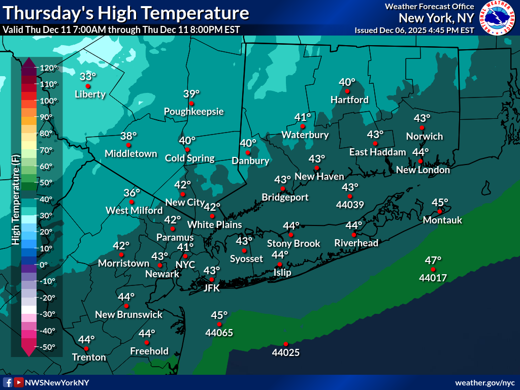
Day 6
| Minimum Wind Chill | Minimum Temperature | Maximum Temperature |
|---|---|---|
 |
 |
 |
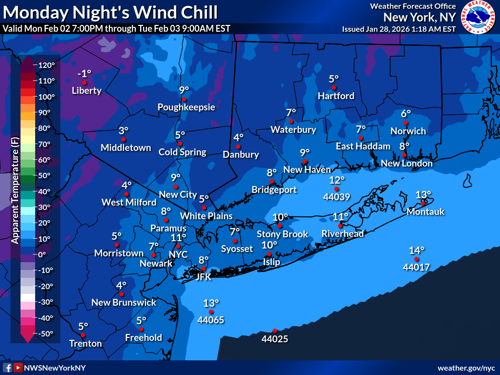
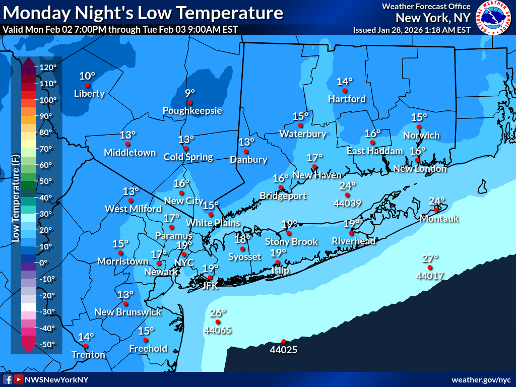
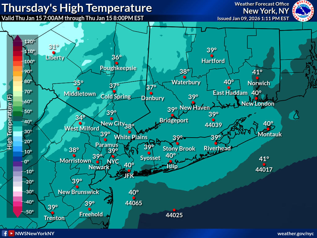
Day 7
| Minimum Wind Chill | Minimum Temperature | Maximum Temperature |
|---|---|---|
 |
 |
 |
| Current Watches | Understanding Severe Thunderstorm Outlooks |
|---|---|
 |
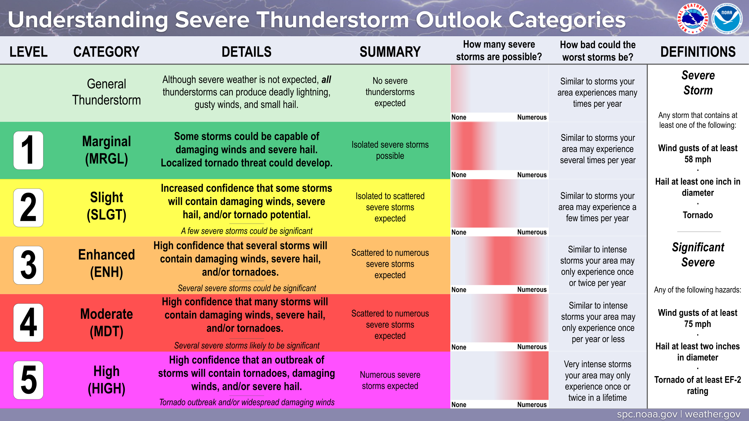 |
Day 1 Outlooks
| Severe Weather Outlook | Severe Wind Outlook | Severe Hail Outlook | Tornado Outlook |
|---|---|---|---|
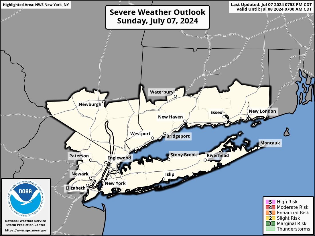 |
 |
 |
 |
Day 2 Outlooks
| Severe Weather Outlook | Severe Wind Outlook | Severe Hail Outlook | Tornado Outlook |
|---|---|---|---|
 |
 |
 |
 |
Day 3 Outlooks
| Severe Weather Outlook | Probability of Severe Weather |
|---|---|
 |
 |
Day 4-7 Outlooks
| Day 4 Severe Outlook | Day 5 Severe Outlook | Day 6 Severe Outlook | Day 7 Severe Outlook |
|---|---|---|---|
 |
 |
 |
 |
Day 1
| Max Temperature | Heat Index | Experimental Heat Risk | Min Temperature |
|---|---|---|---|
 |
 |
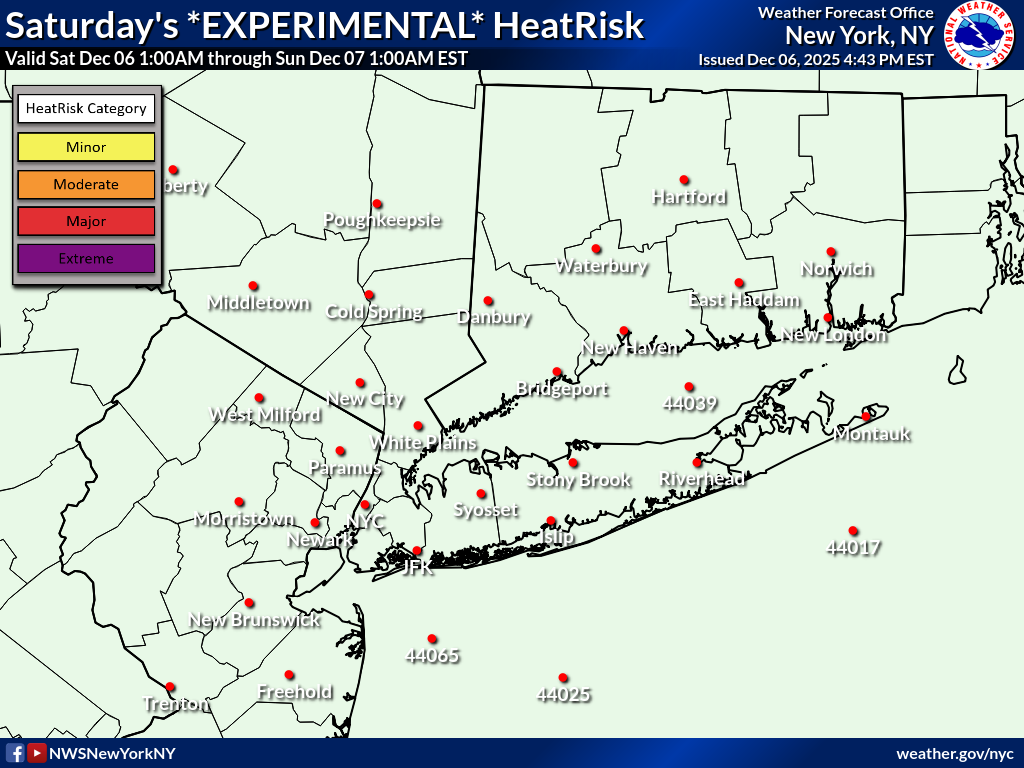 |
 |
Day 2
| Max Temperature | Heat Index | Experimental Heat Risk | Min Temperature |
|---|---|---|---|
 |
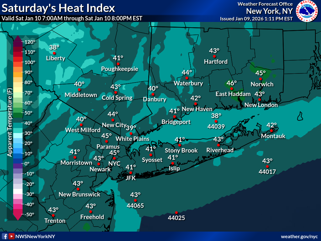 |
 |
 |
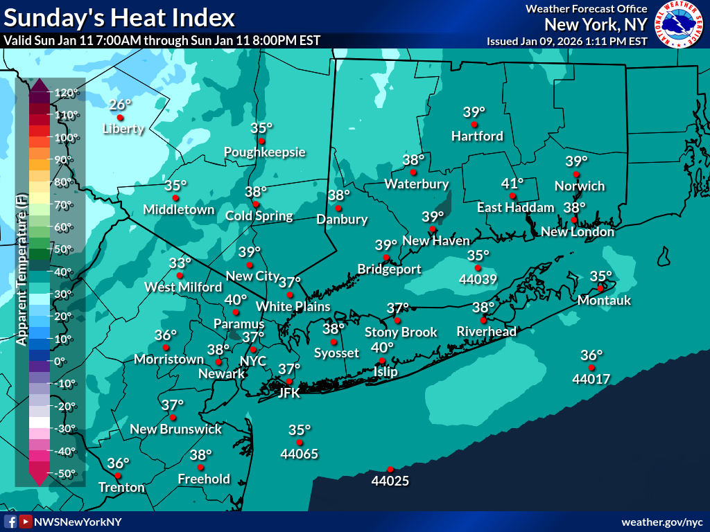
Day 3
| Max Temperature | Heat Index | Experimental Heat Risk | Min Temperature |
|---|---|---|---|
 |
 |
 |
 |
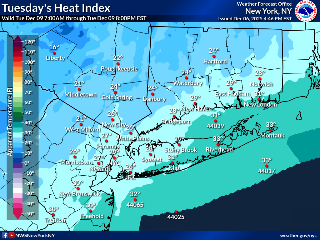
Day 4
| Max Temperature | Heat Index | Experimental Heat Risk | Min Temperature |
|---|---|---|---|
 |
 |
 |
 |
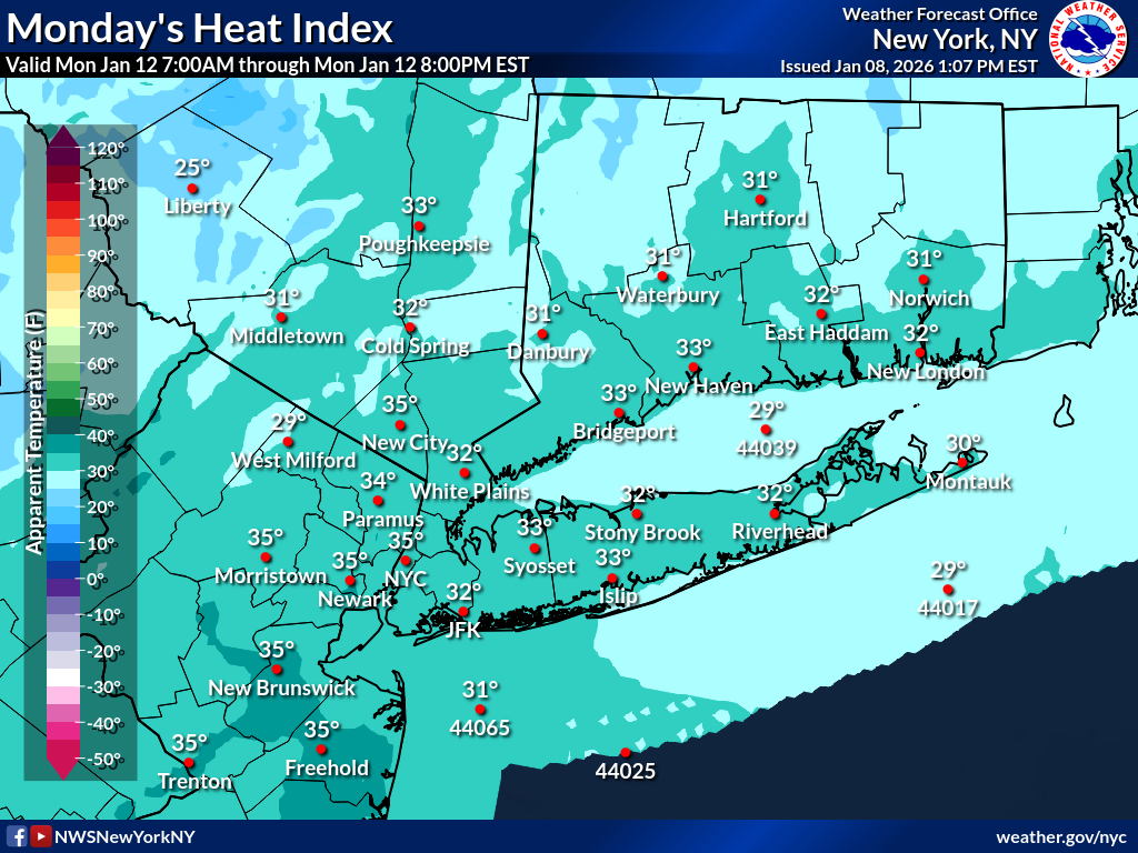
Day 5
| Max Temperature | Heat Index | Experimental Heat Risk | Min Temperature |
|---|---|---|---|
 |
 |
 |
 |
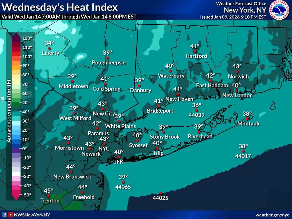
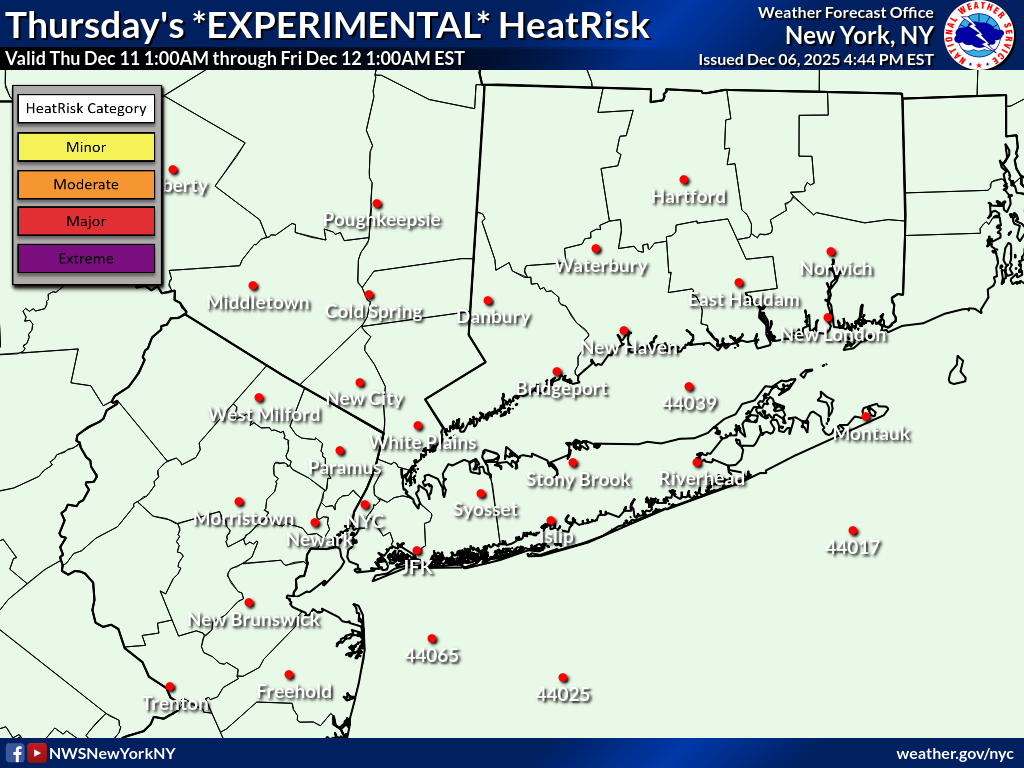
Day 6
| Max Temperature | Heat Index | Experimental Heat Risk | Min Temperature |
|---|---|---|---|
 |
 |
 |
 |
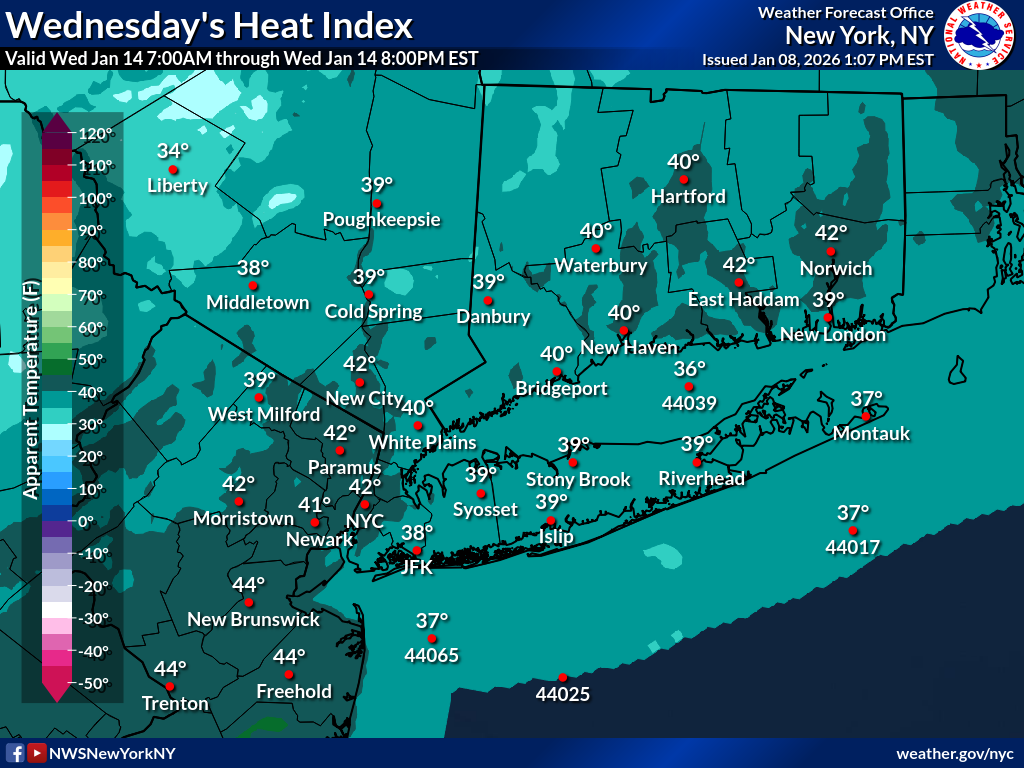
Day 7
| Max Temperature | Heat Index | Experimental Heat Risk | Min Temperature |
|---|---|---|---|
 |
 |
 |
 |
CPC Temperature Outlooks
| 6-10 Day Outlook | 8-14 Day Outlook | Week 3-4 Outlook | Monthly Outlook |
|---|---|---|---|
 |
 |
 |
 |
| Two-Day Graphical Tropical Weather Outlook | Seven-Day Graphical Tropical Weather Outlook |
|---|---|
 |
 |
NWS New York, NY Tropical Page
| GOES-19 Tropical Atlantic Infrared Satellite |
|---|
 |
| GOES-19 US Atlantic Coast Infrared Satellite |
|---|
 |
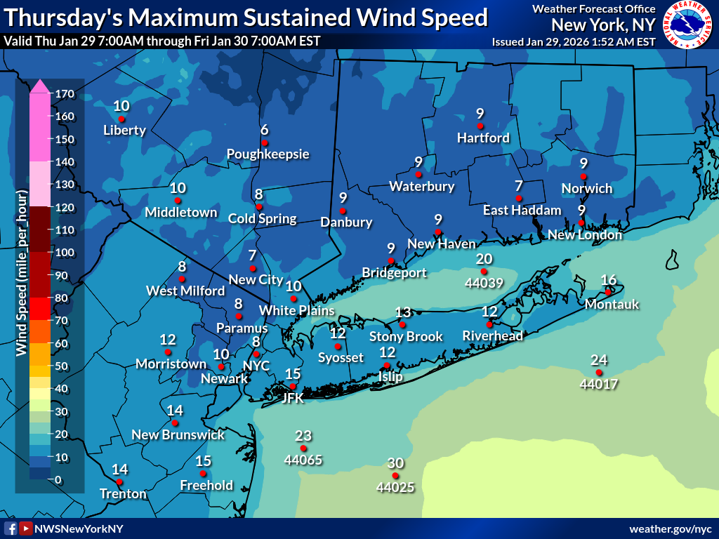
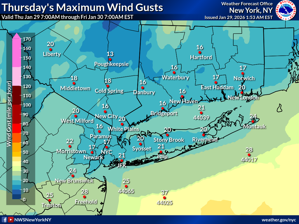
Day 1
| Maximum Sustained Wind | Maximum Wind Gust |
|---|---|
 |
 |
Day 2
| Maximum Sustained Wind | Maximum Wind Gust |
|---|---|
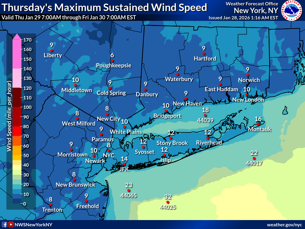 |
 |
Day 3
| Maximum Sustained Wind | Maximum Wind Gust |
|---|---|
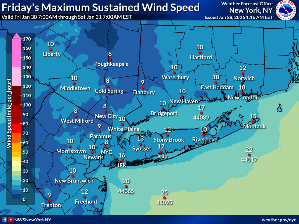 |
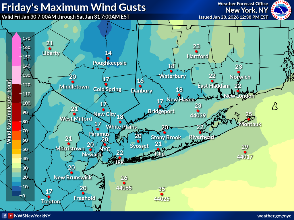 |
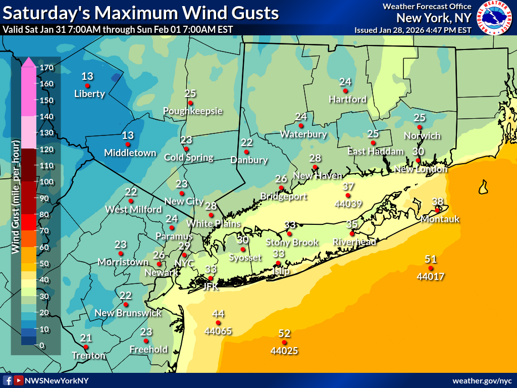
Day 4
| Maximum Sustained Wind | Maximum Wind Gust |
|---|---|
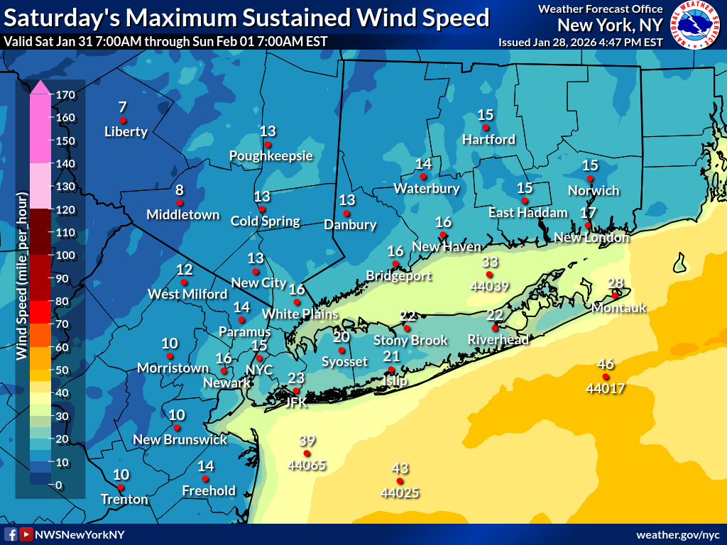 |
 |
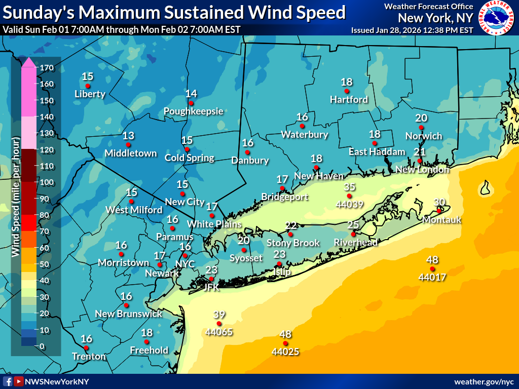
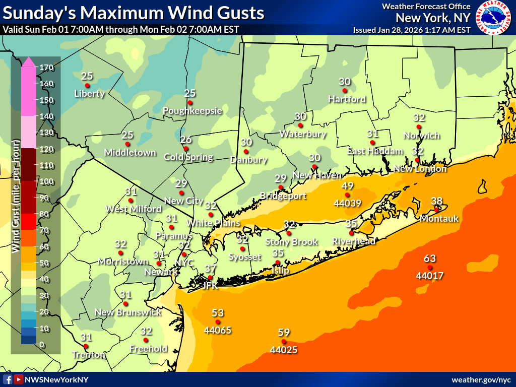
Day 5
| Maximum Sustained Wind | Maximum Wind Gust |
|---|---|
 |
 |
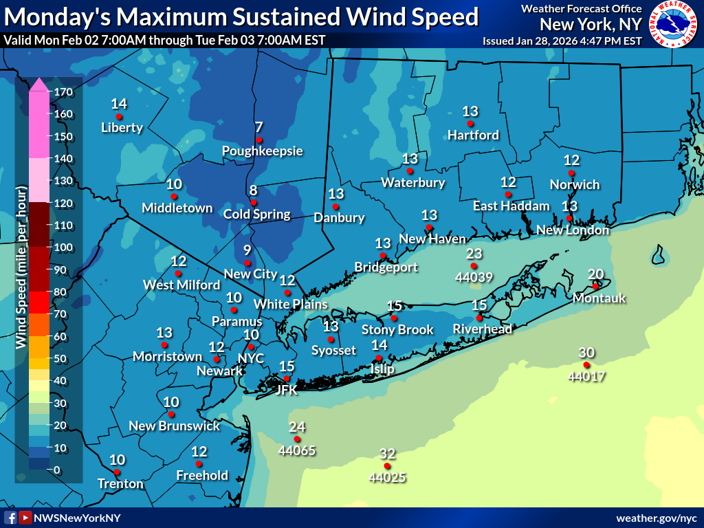
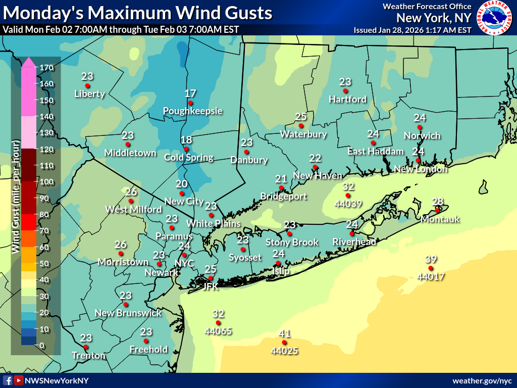
Day 6
| Maximum Sustained Wind | Maximum Wind Gust |
|---|---|
 |
 |
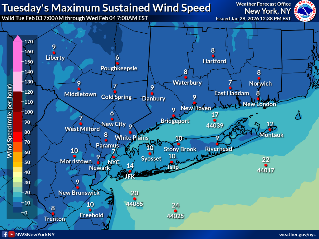
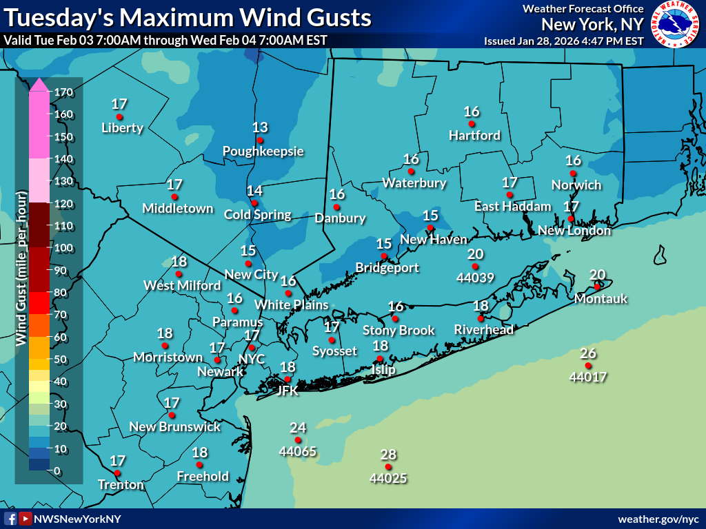
Day 7
| Maximum Sustained Wind | Maximum Wind Gust |
|---|---|
 |
 |
NWS New York Coastal Flooding Page
| Coastal Flooding Impacts Viewer | Coastal Flood Exposure | Coastal Change Hazard |
|---|---|---|
 |
 |
 |
Day 1 Maximum Wave Height
| 8AM-11AM | 11AM-2PM | 2PM-5PM | 5PM-8PM | 8PM-11PM | 11PM-2AM |
|---|---|---|---|---|---|
 |
 |
 |
 |
 |
 |
Day 1 Maximum Wave Period
| 8AM-11AM | 11AM-2PM | 2PM-5PM | 5PM-8PM | 8PM-11PM | 11PM-2AM |
|---|---|---|---|---|---|
 |
 |
 |
 |
 |
 |
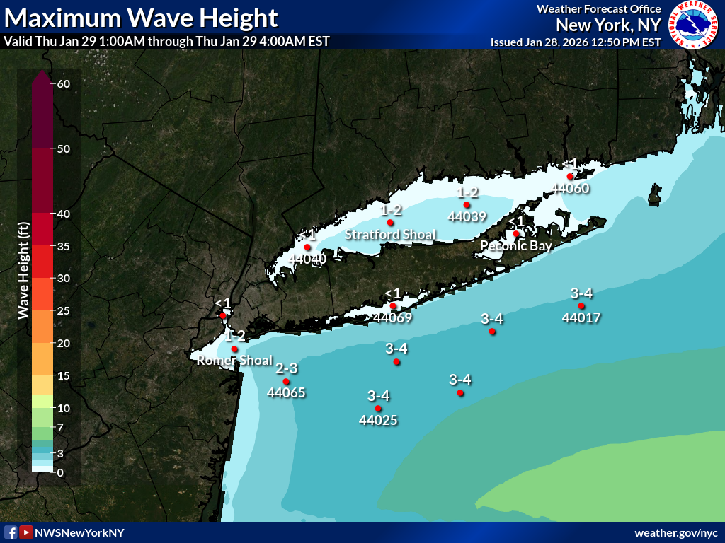
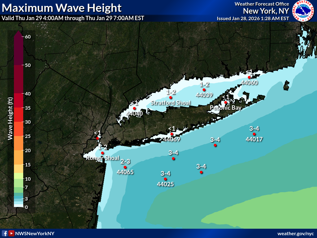
Day 2 Maximum Wave Height
| 2AM-5AM | 5AM-8AM | 8AM-11AM | 11AM-2PM | 2PM-5PM | 5PM-8PM | 8PM-11PM | 11PM-2AM |
|---|---|---|---|---|---|---|---|
 |
 |
 |
 |
 |
 |
 |
 |
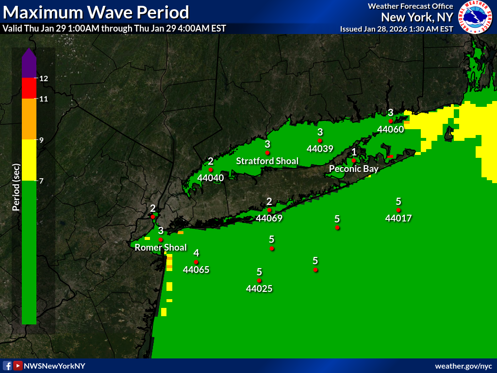
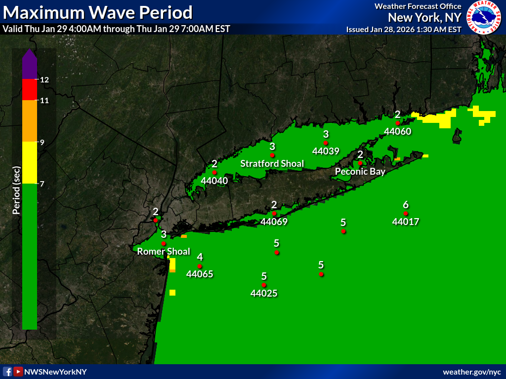
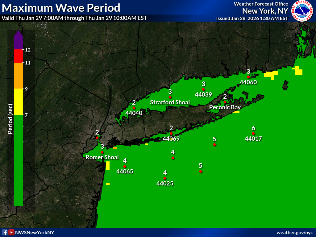
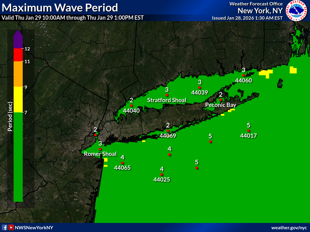
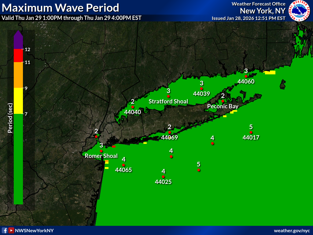
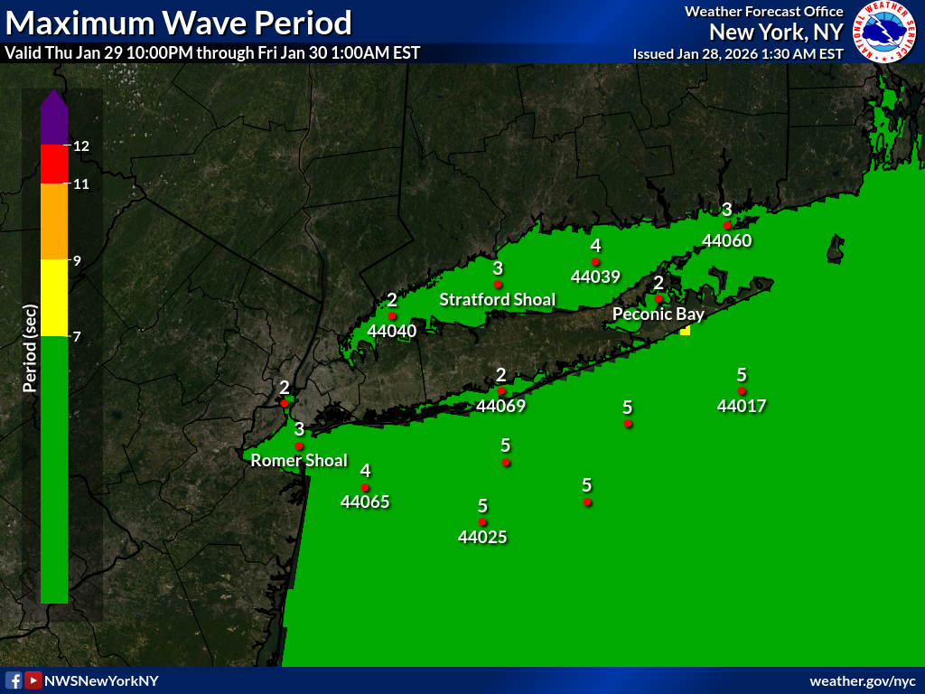
Day 2 Maximum Wave Period
| 2AM-5AM | 5AM-8AM | 8AM-11AM | 11AM-2PM | 2PM-5PM | 5PM-8PM | 8PM-11PM | 11PM-2AM |
|---|---|---|---|---|---|---|---|
 |
 |
 |
 |
 |
 |
 |
 |
Day 3 Maximum Wave Height
| 2AM-5AM | 5AM-8AM | 8AM-11AM | 11AM-2PM | 2PM-5PM | 5PM-8PM |
|---|---|---|---|---|---|
 |
 |
 |
 |
 |
 |
Day 3 Maximum Wave Period
| 2AM-5AM | 5AM-8AM | 8AM-11AM | 11AM-2PM | 2PM-5PM | 5PM-8PM |
|---|---|---|---|---|---|
 |
 |
 |
 |
 |
 |
Make an Official Spot Forecast
NWS New York NY Fire Weather Page
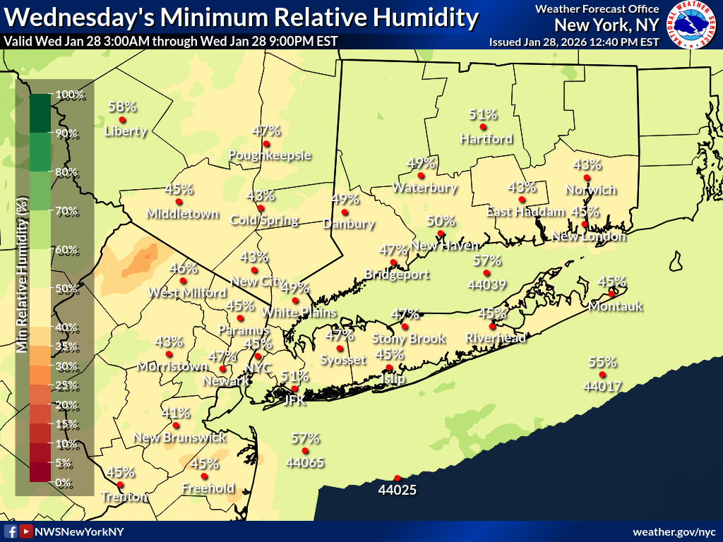
Day 1
| Minimum Relative Humidity | Maximum Wind Gust |
|---|---|
 |
 |
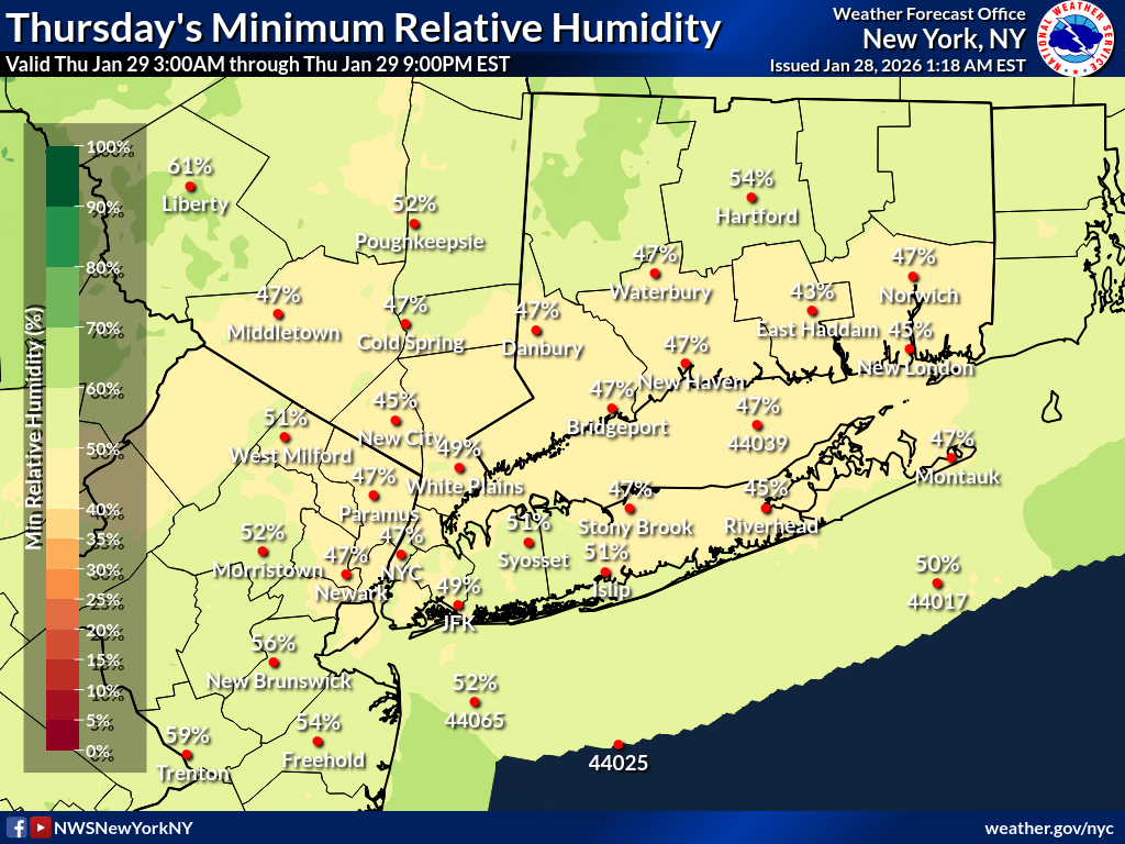
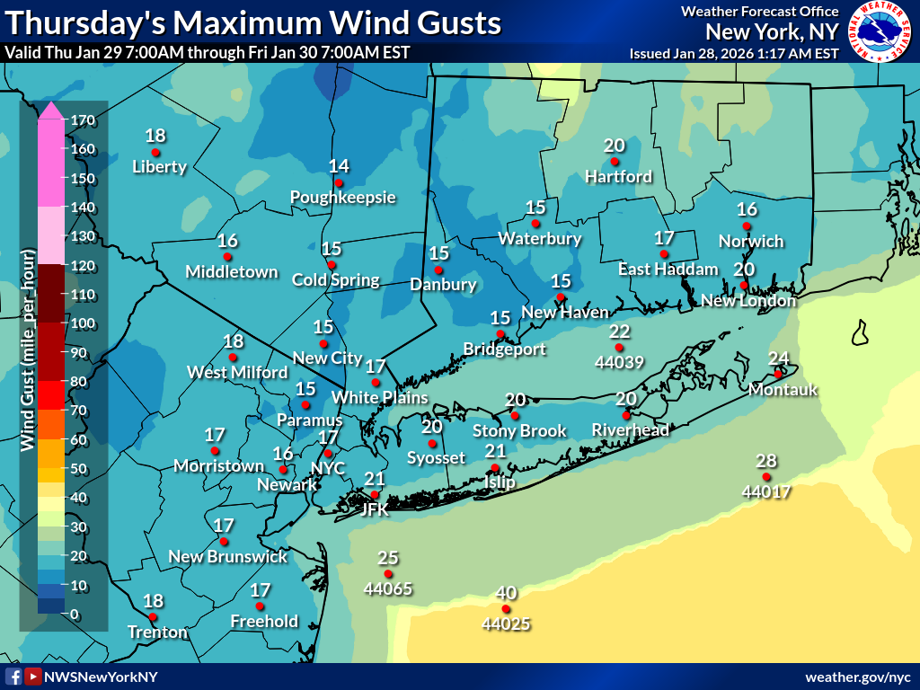
Day 2
| Minimum Relative Humidity | Maximum Wind Gust |
|---|---|
 |
 |
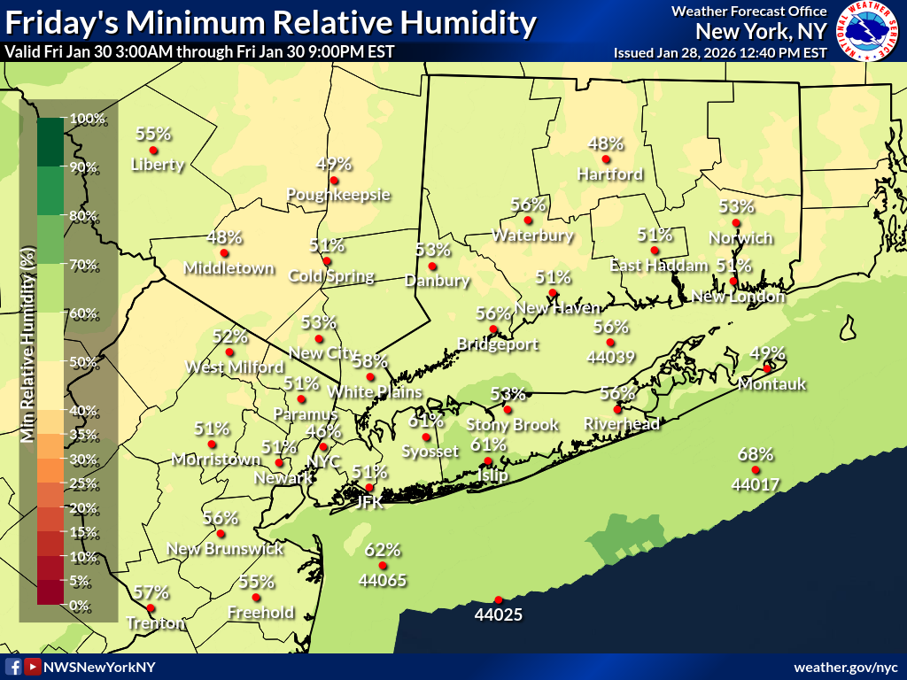
Day 3
| Minimum Relative Humidity | Maximum Wind Gust |
|---|---|
 |
 |
Day 4
| Minimum Relative Humidity | Maximum Wind Gust |
|---|---|
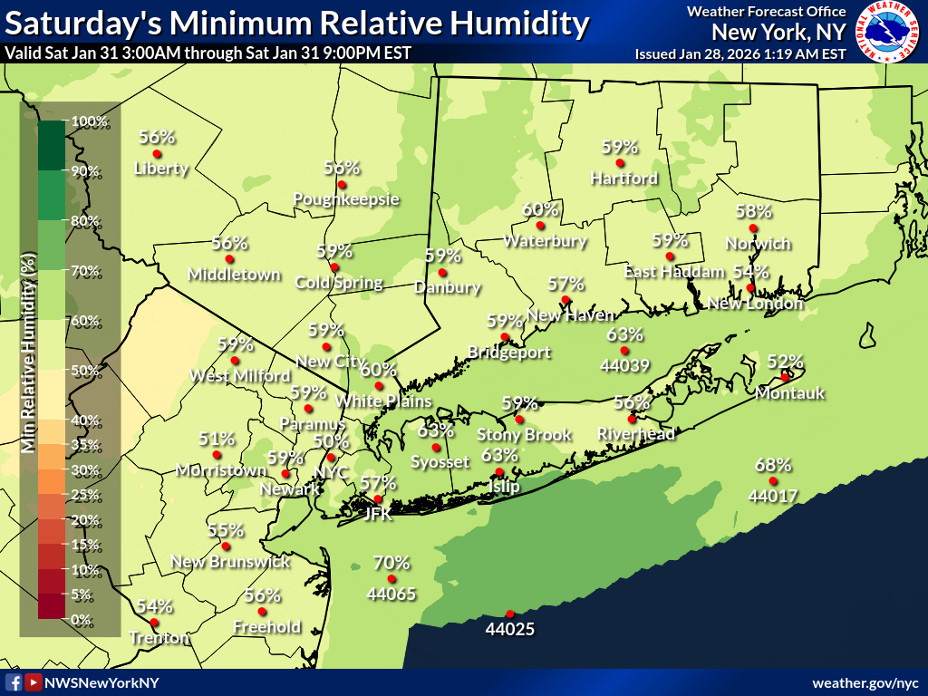 |
 |
Day 5
| Minimum Relative Humidity | Maximum Wind Gust |
|---|---|
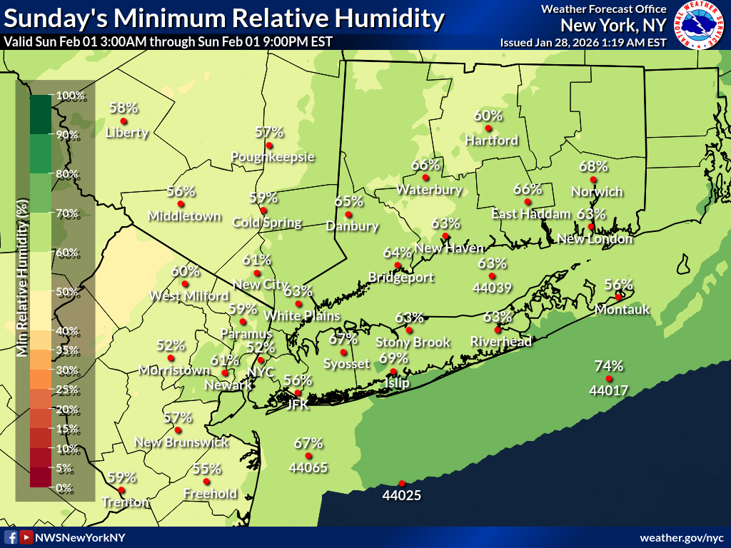 |
 |
Day 6
| Minimum Relative Humidity | Maximum Wind Gust |
|---|---|
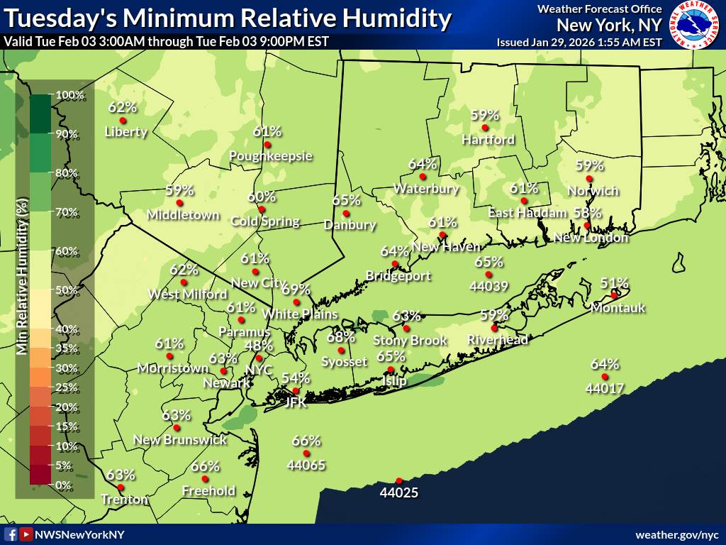 |
 |
Day 7
| Minimum Relative Humidity | Maximum Wind Gust |
|---|---|
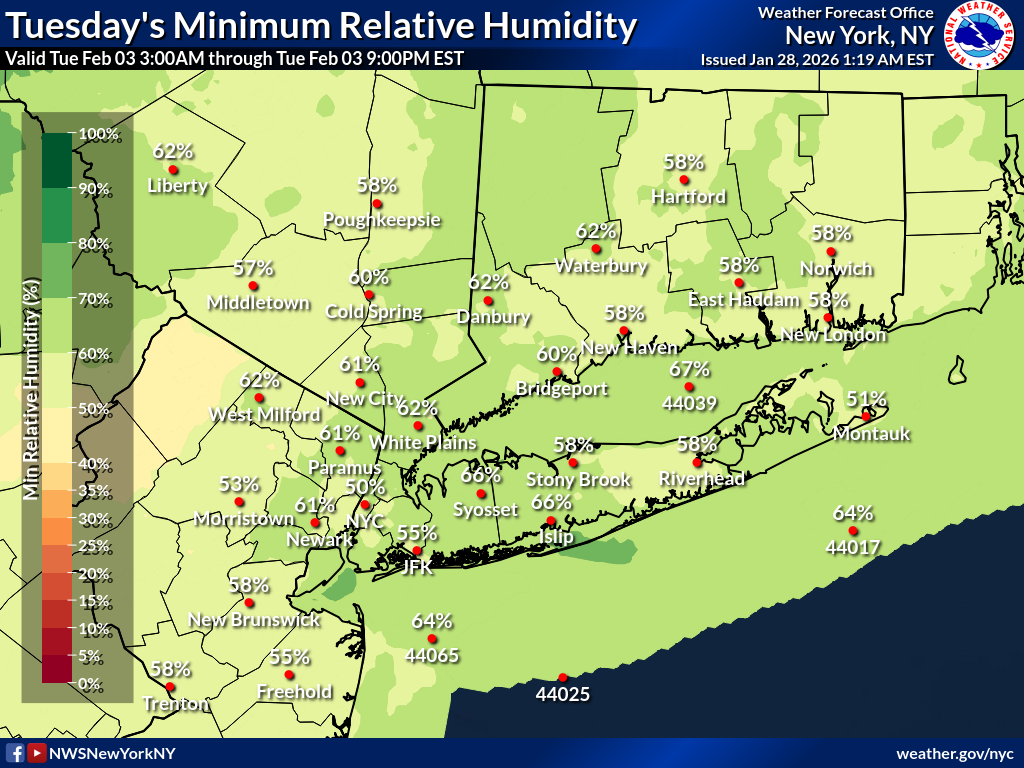 |
 |
| Day 1 Fire Weather Outlook | Day 2 Fire Weather Outlook | Day 3-8 Fire Weather Outlook |
|---|---|---|
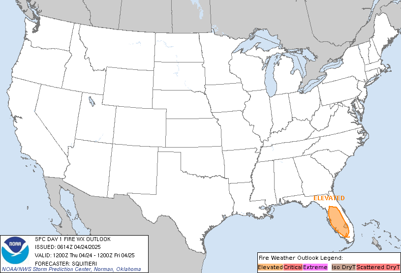 |
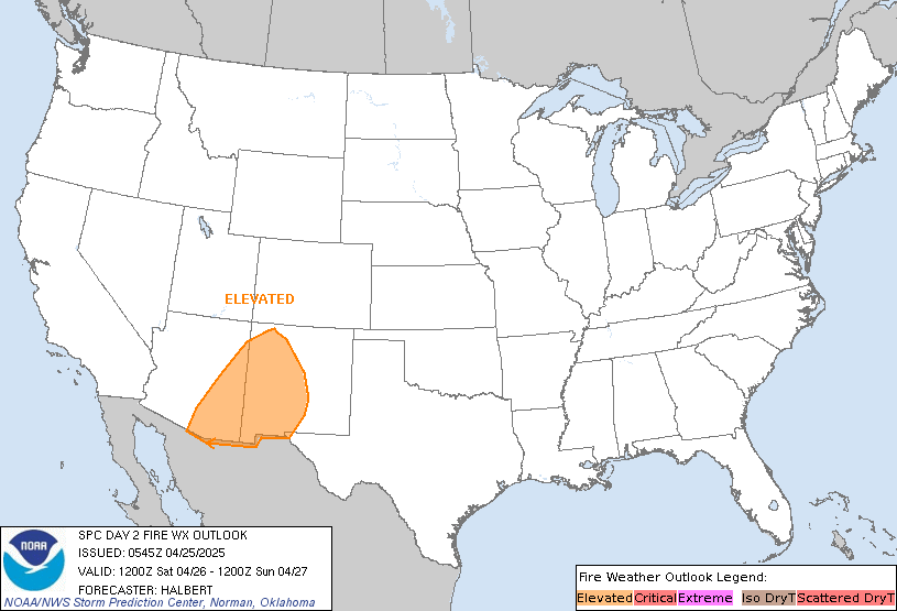 |
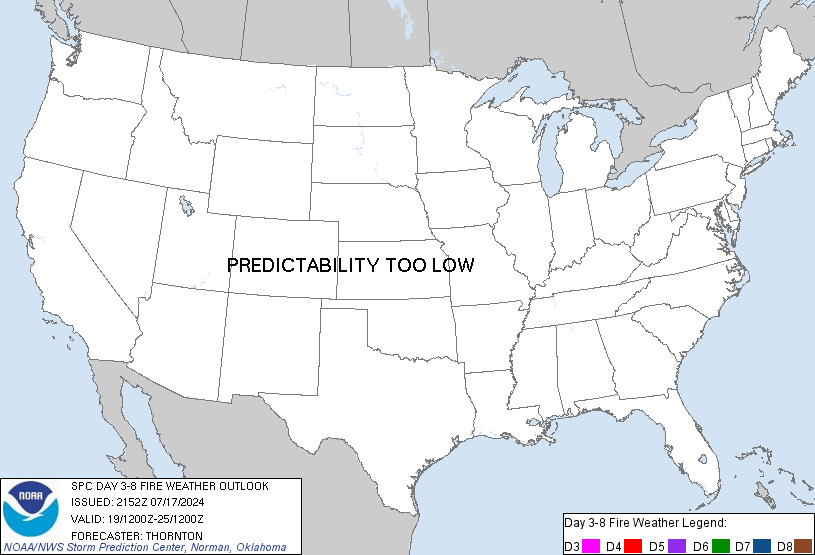 |
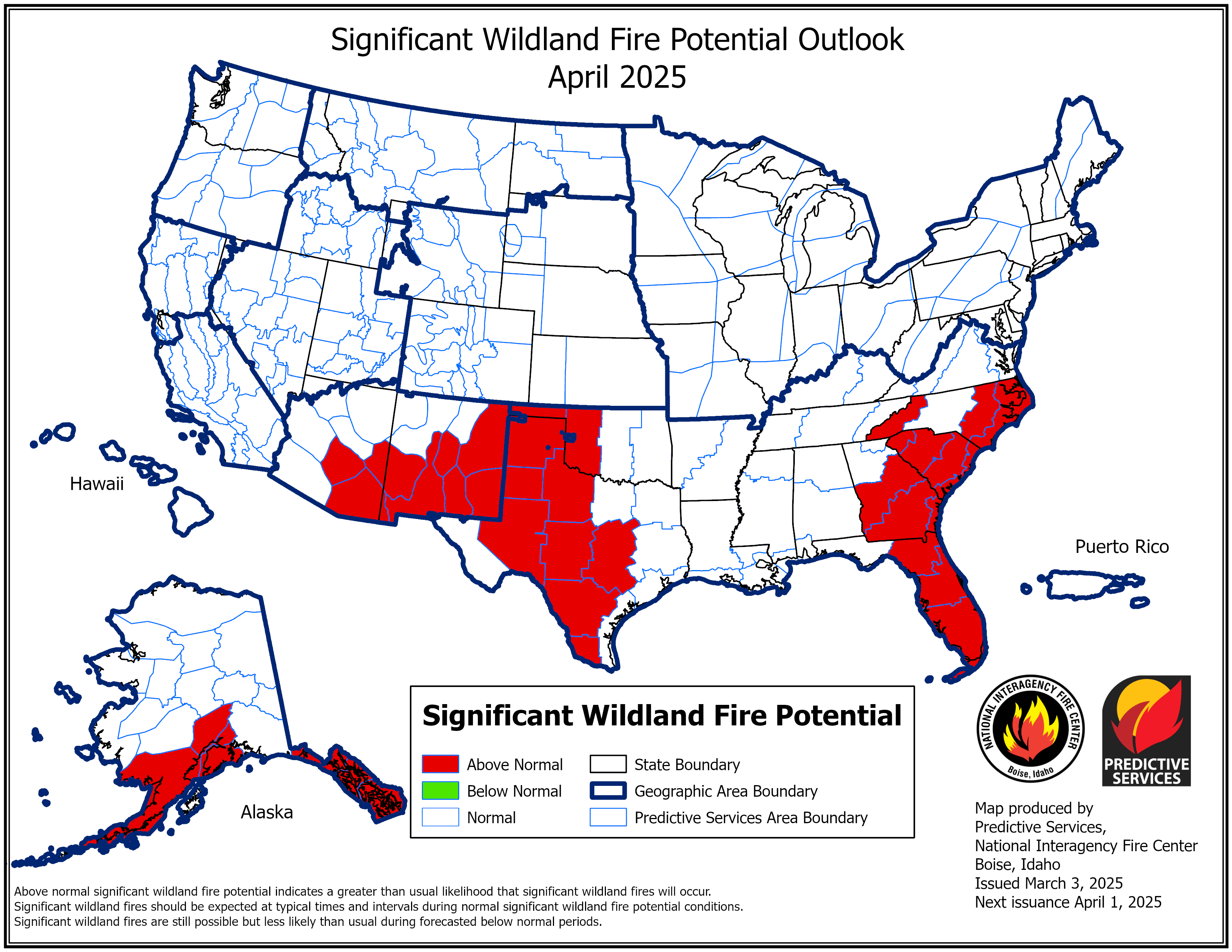
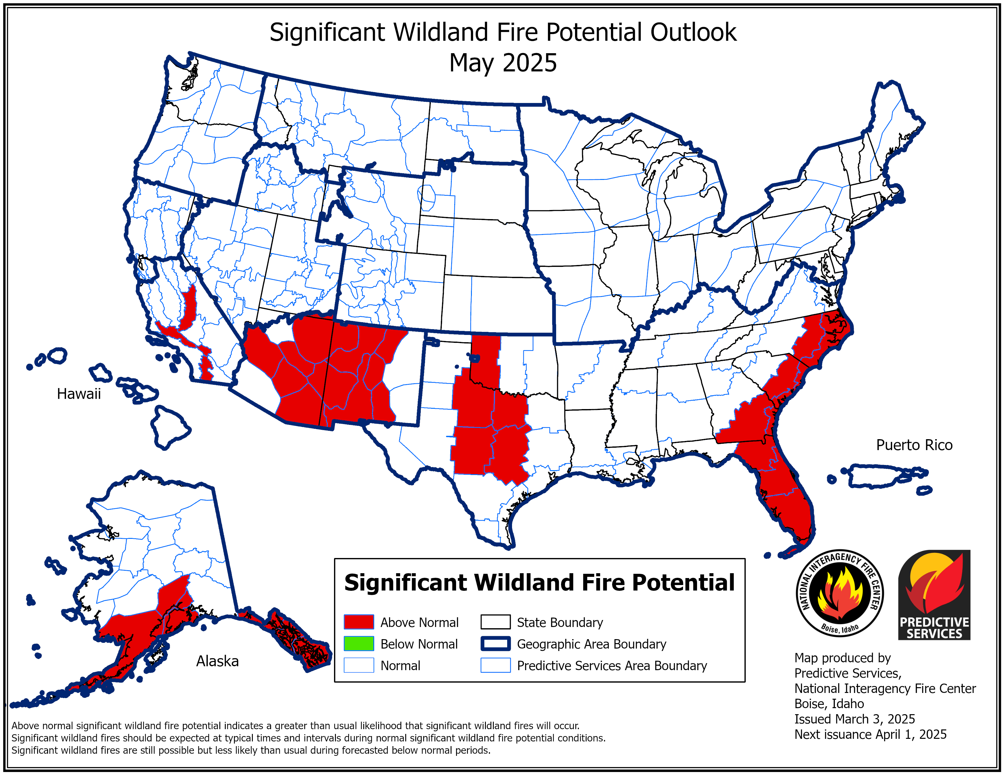
| Current Wildland Fire Potential Outlook | Next Month's Wildland Fire Potential Outlook | Extended Wildland Fire Potential Outlook |
|---|---|---|
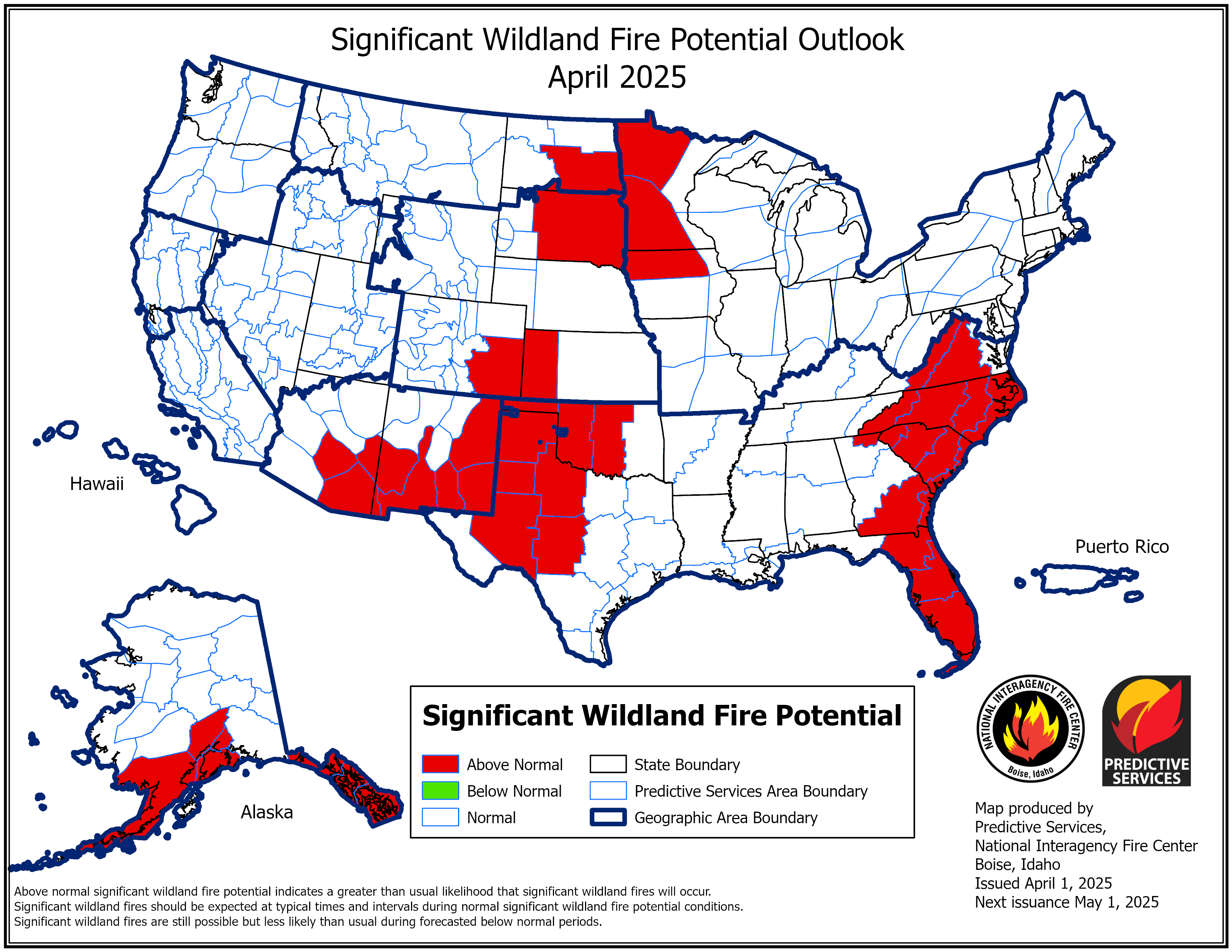 |
 |
 |
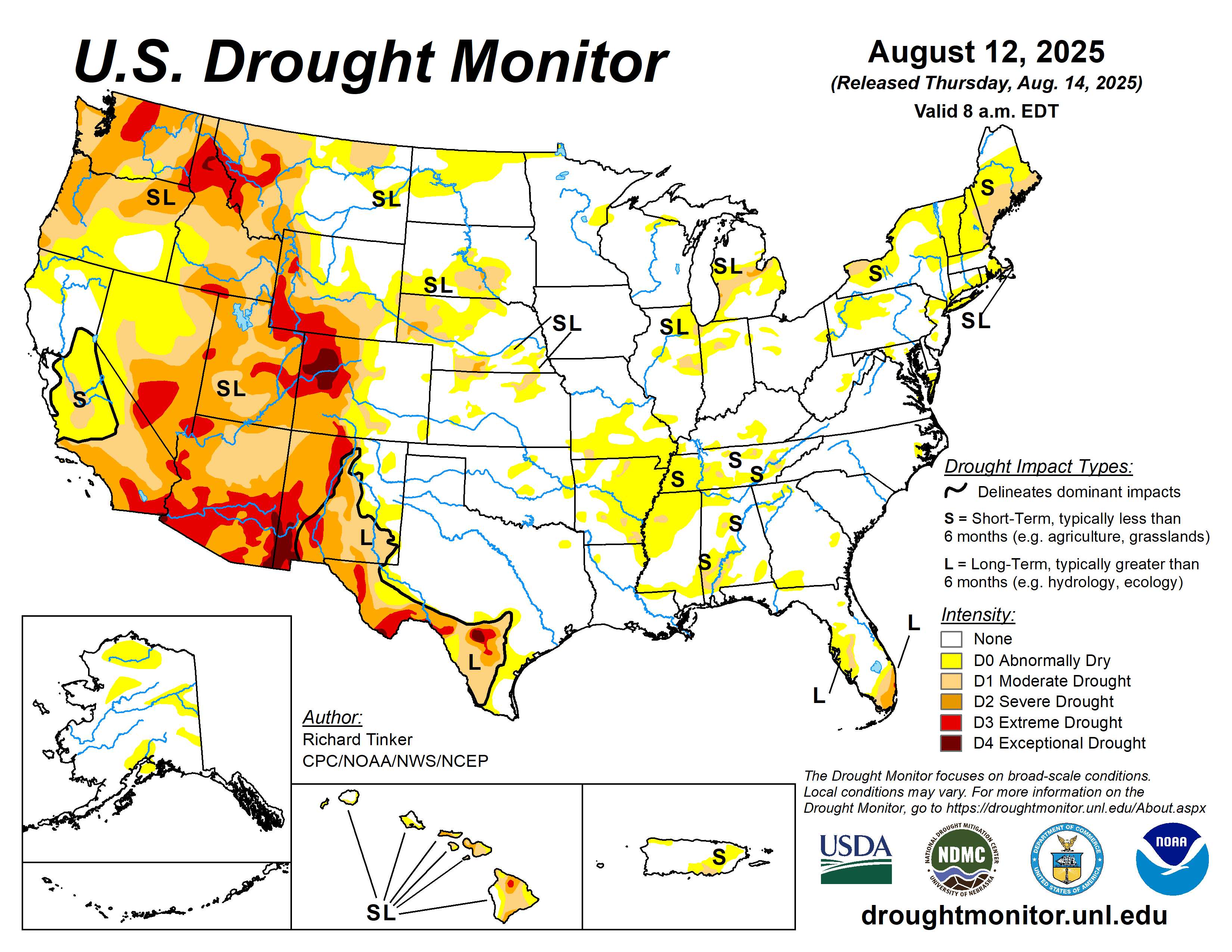
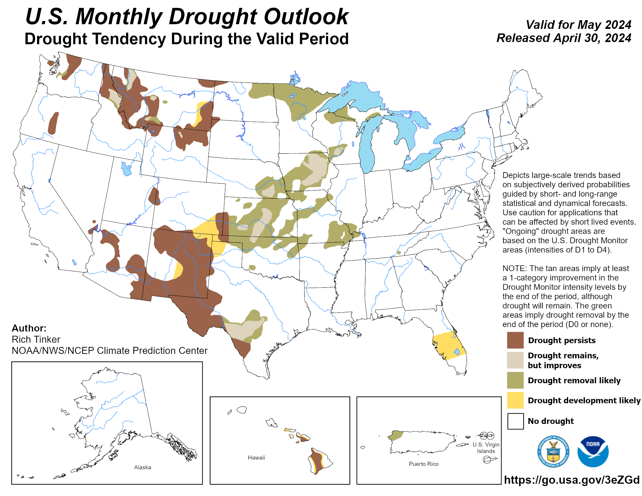
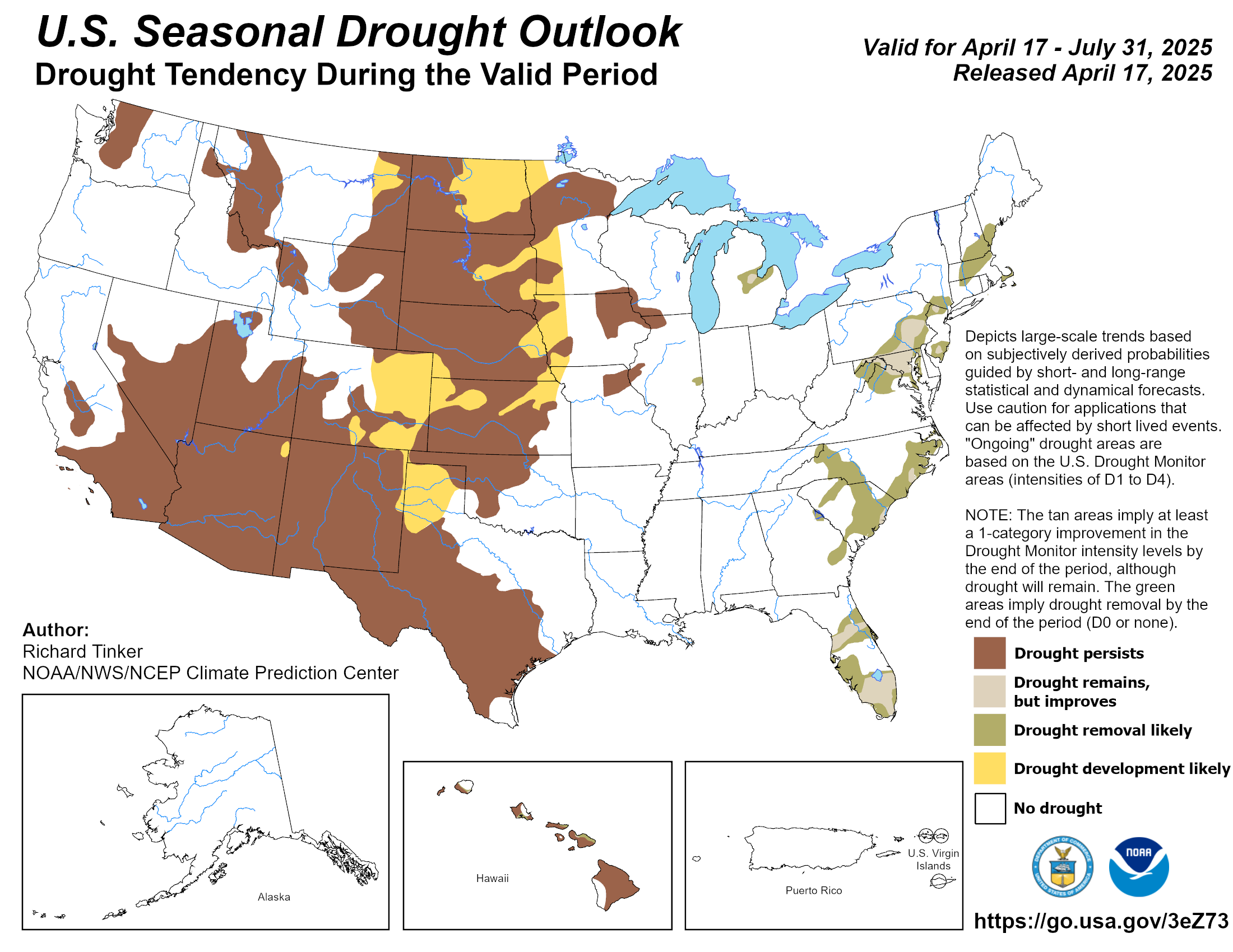
| U.S. Drought Monitor | U.S. Monthly Drought Monitor | U.S. Seasonal Drought Monitor |
|---|---|---|
 |
 |
 |