On the afternoon of January 29th, 2007, a light 2" of snow fell on Coeur d'Alene and the Spokane Valley. Often this wouldn't be noteworthy. But similar to the Palouse event earlier in the month, this one also caused a number of traffic accidents.
The Spokane radar at 2pm PST shows the narrow band of snow responsible for the 2" of snowfall in Coeur d'Alene.
The Coeur d'Alene Press newspaper reported the following:
"At last count, there were seven weather-related crashes" in the last two hours, not counting a half-dozen slideoffs, an Idaho State Police dispatcher said about 4:30 p.m. Coeur d'Alene Police spokeswoman Sgt. Christie Wood said dispatchers reported receiving 42 calls for crashes or slideoffs in less than four hours throughout the county.
Road sensors supplied by the Washington and Idaho Departments of Transportation allow us to measure and record the pavement temperatures.
The snow began during the early afternoon hours. The table below shows the readings from 4 pavement temperature sensors.
| Time | I-90 Medical Lake | I-90 Liberty Lake | I-90 Post Falls | I-90 Veterans Bridge |
|---|---|---|---|---|
| 10am | 28 | 31 | 29 | 27 |
| 11am | 30 | 33 | 30 | 30 |
| Noon | 31 | 33 | 31 | 32 |
| 1pm | 31 | 34 | 33 | 34 |
| 2pm | 30 | 32 | 31 | 31 |
| 3pm | 29 | 30 | 29 | 29 |
| 4pm | 28 | 30 | 29 | 29 |
| 5pm | 28 | 31 | 29 | |
| 6pm | 27 | 29 | 28 | 28 |
Note how the 3 sensors in the Spokane Valley (Liberty Lake) and Coeur d'Alene (Post Falls and Veterans Bridge) all warmed up above freezing around 1pm, just before the start of the snowfall. Thus, the snow landing on the Interstate 90 pavement initially melted. But by 2 pm, the temperatures had drop to or below freezing. The snow which initially melted now refroze to the pavement as ice. Air temperatures throughout this event were in the mid to upper 20s.
The Medical Lake sensor (west of Spokane) was provided for a couple of reasons. First, note that the temperatures at this sensor also started to cool by 2pm. So the maximum pavement temperature is naturally reached around solar noon and then begins to cool as the sun angle decreases in the afternoon.
The amount of cooling at this site between 1pm and 2pm was only 1 degree Farenheit. Notice that the other sensors (which started above freezing and where snowfall was heavier) dropped 2 to 3 degrees during this period. This more rapid cooling was likely due to the transfer of heat from the pavement to the snow which was required to melt the snow.
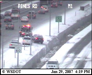
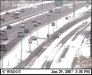
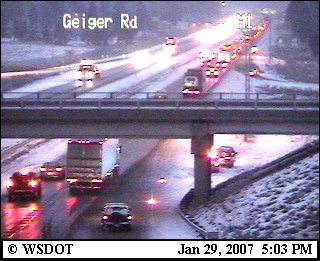
The pavement temperatures remained below freezing. While snowfall in this area was very light (less than a half inch), there were still problems on the roadway. Note the web cam images from Geiger Road exit on I-90 (near this temperature sensor). This just points out that even with a pavement sensor reporting 31F some melting can still occur.
By Ron Miller

