Widespread life-threatening flash and urban flooding will continue to pose a significant threat to life and property in south-central Texas. Catastrophic fiver flooding, with rapid rises on small streams, arroyos, and typically dry washes, is expected. Monsoonal showers persist across the Great Basin and Southwest with greatest flash flooding in southern Arizona. Read More >
.AVIATION...
06Z TAFS: There is a 30-40% chance for showers and
thunderstorms to impact KGEG-KSFF-KCOE through 14Z as elevated
showers and thunderstorms take advantage of elevated
instability. Other TAF sites have less than a 30% chance, so
have kept a PROB30/TEMPO out for now. Confidence is low for
gusty outflows tonight but may reach 30 mph. VFR conditons will
prevail with fairly light winds outside of the Cascade gaps
Friday evening in central WA.

FORECAST CONFIDENCE AND/OR ALTERNATE SCENARIOS: High confidence
in VFR conditions. Low confidence for gusty outflow winds.


-----------------------
Confidence descriptors:

Low - Less than a 30 percent chance
Moderate - 30 to 70 percent chance
High - Greater than a 70 percent chance

For additional probabilistic information for NWS Spokane airports,

please refer to the Aviation Dashboard on our webpage:
https:/www.weather.gov/otx/avndashboard

&&
FTUS80 KGEG 170609 AAA
KGEG 170607Z 1706/1806 VRB02KT P6SM -SHRA BKN080 BKN130
      TEMPO 1706/1709 5SM -TSRA OVC060CB
     FM170900 19008KT P6SM SCT100 PROB30 1709/1714 P6SM -SHRA
      BKN100
     FM180000 22008KT P6SM FEW150
FTUS44 KSFF 170615 AAA
KSFF 170611Z 1706/1806 02004KT P6SM SCT120
      TEMPO 1706/1709 5SM -TSRA OVC060CB
     FM170900 17005KT P6SM SCT110 PROB30 1709/1714 P6SM -SHRA
      BKN100
     FM180000 23004KT P6SM FEW150

FTUS46 KOTX 170613 AAA
TAFCOE
TAF AMD
KCOE 170613Z 1706/1806 04005KT P6SM BKN100
      TEMPO 1706/1709 5SM -TSRA OVC060CB
     FM170900 02005KT P6SM FEW050 SCT110
      PROB30 1709/1714 P6SM -SHRA OVC025
     FM180000 23005KT P6SM FEW150=

FTUS54 KPUW 170827 AAA
KPUW 170825Z 1708/1806 26005KT 3SM FU SCT015
     FM171700 28005KT P6SM FEW015 SCT100
     FM180000 30004KT P6SM FEW150

FTUS46 KOTX 170544
TAFLWS
TAF
KLWS 170544Z 1706/1806 34007KT P6SM BKN100
     FM170800 27005KT P6SM SCT110
     FM171200 VRB03KT P6SM FEW120
     FM172000 31007KT P6SM FEW190
     FM180000 35006KT P6SM FEW150=

FTUS44 KMWH 170545
KMWH 170544Z 1706/1806 26008KT P6SM FEW110
     FM171000 19006KT P6SM SCT130
     FM172100 19010G19KT P6SM SKC
     FM180000 18008KT P6SM SKC

FTUS80 KEAT 170545
KEAT 170544Z 1706/1806 31015KT P6SM FEW140
     FM171200 31010KT P6SM FEW090
     FM171800 VRB04KT P6SM SKC
     FM172300 25008KT P6SM SKC
     FM180300 30013KT P6SM SKC AMD NOT SKED

FTUS80 KSEA 170909 AAB
KSEA 170907Z 1709/1812 20005KT P6SM BKN022 OVC035
     FM171800 23007KT P6SM BKN035
     FM172100 24007KT P6SM FEW050
     FM180300 31006KT P6SM SCT050 BKN100
     FM180600 35006KT P6SM BKN100

FTUS80 KBOI 170521 RRD
KBOI 170520Z 1706/1806 13008KT P6SM SCT150
     FM171700 31007KT P6SM SCT150 PROB30 1722/1724 VRB20G30KT
      -TSRA
      BKN080CB
     FM180100 VRB06KT P6SM FEW150

FTUS54 KPDT 170521 RRC
KPDT 170520Z 1706/1806 30014G22KT 4SM HZ FEW120
     FM170900 24006KT 5SM HZ SKC
     FM171700 28008G17KT 5SM HZ SKC
     FM180000 30011KT 4SM HZ SKC
     FM180400 30006KT 6SM HZ SKC

FTUS80 KALW 170524 CCA
KALW 170521Z 1706/1806 18010KT 3SM HZ SCT250
     FM171900 23006KT P6SM SKC
     FM180000 25005KT P6SM BKN250

FTUS80 KPSC 170521 RRX
KPSC 170520Z 1706/1806 22010KT P6SM SKC
     FM180000 20006KT P6SM SKC

FTUS54 KYKM 170521 RRE
KYKM 170520Z 1706/1806 33012G21KT P6SM SKC
     FM170700 32006KT P6SM SKC
     FM171800 16005KT P6SM SKC
     FM180000 22008KT P6SM SKC

FTUS54 KDLS 170521
KDLS 170520Z 1706/1806 30018G30KT P6SM SKC
     FM171000 30013G22KT P6SM SKC
     FM171700 32017G25KT P6SM SKC
     FM180000 30018G26KT P6SM SKC

FTUS46 KPDT 170520
TAFBDN
TAF
KBDN 170520Z 1706/1806 35009KT P6SM SKC
     FM170800 VRB03KT P6SM SKC
     FM171800 34006G17KT P6SM SKC
     FM180000 33015G22KT P6SM SKC
     FM180400 33010KT P6SM SKC=

FTUS44 KMSO 170939 AAA
KMSO 170937Z 1710/1806 27008KT P6SM VCTS BKN120CB
     FM171100 VRB03KT P6SM FEW250
     FM172000 35008KT P6SM VCSH BKN100 PROB30 1722/1801 VRB20G35KT
      P6SM -TSRA OVC100CB

FTUS43 KBTM 170524
KBTM 170522Z 1706/1806 15004KT P6SM SCT250
     FM172000 35008KT P6SM VCSH BKN100 PROB30 1721/1724 VRB20G30KT
      P6SM -TSRA OVC100CB

FTUS80 KSMN 170524 RRC
KSMN 170522Z 1706/1806 13011KT P6SM SKC
     FM170900 10006KT P6SM FEW250
     FM171800 34006KT P6SM FEW100 SCT250
     FM172000 24006KT P6SM VCSH BKN100 PROB30 1720/1723 P6SM -TSRA
      OVC100CB

FTUS44 KGPI 170524
KGPI 170522Z 1706/1806 VRB03KT P6SM FEW250
     FM172200 15006KT P6SM VCSH BKN100 PROB30 1723/1803 VRB20G30KT
      P6SM -TSRA OVC100CB
| --TAFs-- | Time | T | Td | RH | HI | WC | Dir | Wind | G | PK | Vis | Wx | Pcp | Clouds |
|---|---|---|---|---|---|---|---|---|---|---|---|---|---|---|
| KGEG | 0953Z | 72 | 54 | 53 | 150 | 14 | 10 | FEW080 SCT130 | ||||||
| KSFF | 0953Z | 72 | 54 | 53 | 210 | 9 | 8 | CLR | ||||||
| KCOE | 0956Z | 69 | 63 | 81 | calm | 10 | CLR | |||||||
| KPUW | 0953Z | calm | 7 | FEW120 | ||||||||||
| KLWS | 0956Z | 77 | 47 | 35 | 330 | 6 | 7 | CLR | ||||||
| KMWH | 0952Z | 66 | 60 | 81 | 130 | 10 | 10 | T | --WA-- | Time | T | Td | RH | HI | WC | Dir | Wind | G | PK | Vis | Wx | Pcp | Clouds |
| KS52 | 0955Z | 63 | 61 | 93 | calm | 10 | 0.02 | |||||||
| KOMK | 0953Z | 70 | 56 | 61 | 310 | 7 | 10 | VCTS | 0.04 | FEW100 | ||||
| KS10 | ||||||||||||||
| KEPH | 0953Z | 67 | 59 | 76 | 170 | 5 | 10 | BKN120 | ||||||
| K63S | 0955Z | 63 | 57 | 83 | 30 | 5 | 10 | CLR | ||||||
| KDEW | 0953Z | 66 | 57 | 73 | 170 | 3 | 10 | CLR | ||||||
| KSKA | 0855Z | 70 | 53 | 54 | 210 | 13 | 10 | CLR | --ID-- | Time | T | Td | RH | HI | WC | Dir | Wind | G | PK | Vis | Wx | Pcp | Clouds |
| K65S | 0955Z | 66 | 59 | 78 | 10 | 7 | 10 | 0.01 | FEW041 FEW060 SCT120 | |||||
| KSZT | 0935Z | 64 | 55 | 73 | 60 | 9 | 10 | CLR | ||||||
| KMLP | 0953Z | 65 | 52 | 63 | 120 | 5 | 10 | T | CLR | -PDT TAFs- | Time | T | Td | RH | HI | WC | Dir | Wind | G | PK | Vis | Wx | Pcp | Clouds |
| KPDT | 0953Z | 67 | 39 | 36 | 240 | 7 | 10 | CLR | ||||||
| KALW | 0953Z | 67 | 43 | 42 | 210 | 12 | 10 | CLR | ||||||
| KPSC | 0953Z | 66 | 48 | 52 | 200 | 15 | 24 | 8 | CLR | |||||
| KYKM | 0953Z | 67 | 49 | 53 | 330 | 12 | 10 | CLR | ||||||
| KDLS | 0953Z | 63 | 48 | 58 | 270 | 10 | 10 | CLR | ||||||
| KRDM | 0956Z | 48 | 41 | 77 | calm | 10 | FU | CLR | ||||||
| KBDN | 0955Z | 54 | 41 | 63 | calm | 10 | CLR | -MSO TAFs- | Time | T | Td | RH | HI | WC | Dir | Wind | G | PK | Vis | Wx | Pcp | Clouds |
| KMSO | 0955Z | 75 | 55 | 50 | 70 | 3 | 10 | -RA | SCT095 BKN120 | |||||
| KBTM | 0955Z | 59 | 54 | 82 | 130 | 7 | 10 | CLR | ||||||
| KSMN | 0956Z | 71 | 55 | 57 | calm | 10 | CLR | |||||||
| KGPI | 0955Z | 66 | 55 | 68 | 340 | 6 | 10 | CLR | ||||||
| KHRF | 0955Z | 68 | 55 | 64 | calm | 10 | CLR | -Misc- | Time | T | Td | RH | HI | WC | Dir | Wind | G | PK | Vis | Wx | Pcp | Clouds |
| KSEA | 0953Z | 58 | 53 | 84 | 180 | 7 | 10 | OVC029 | ||||||
| KSMP | 0956Z | 48 | 48 | 100 | 45 | VRB | 6 | 1/4 | FG | VV001 | ||||
| KELN | 0953Z | 60 | 50 | 70 | 310 | 18 | 10 | CLR | ||||||
| KRLD | 0955Z | 66 | 51 | 58 | 180 | 13 | 10 | CLR | ||||||
| KGIC | 0955Z | 68 | 48 | 49 | 40 | 8 | 10 | CLR | ||||||
| K1S5 | 0955Z | 59 | 56 | 89 | calm | 10 | CLR | |||||||
| KHRI | 0953Z | 65 | 45 | 49 | 240 | 12 | 23 | 32 | 10 | CLR | ||||
| KP69 | 0952Z | 68 | 65 | 90 | calm |
•This site is for informational purposes. It should be used with other preflight information sources needed to satisfy all the requirements of 14 CFR 91.103. It is NOT designed to be used as a primary or sole source of information for preflight action. Refer to Flight Service for more information.
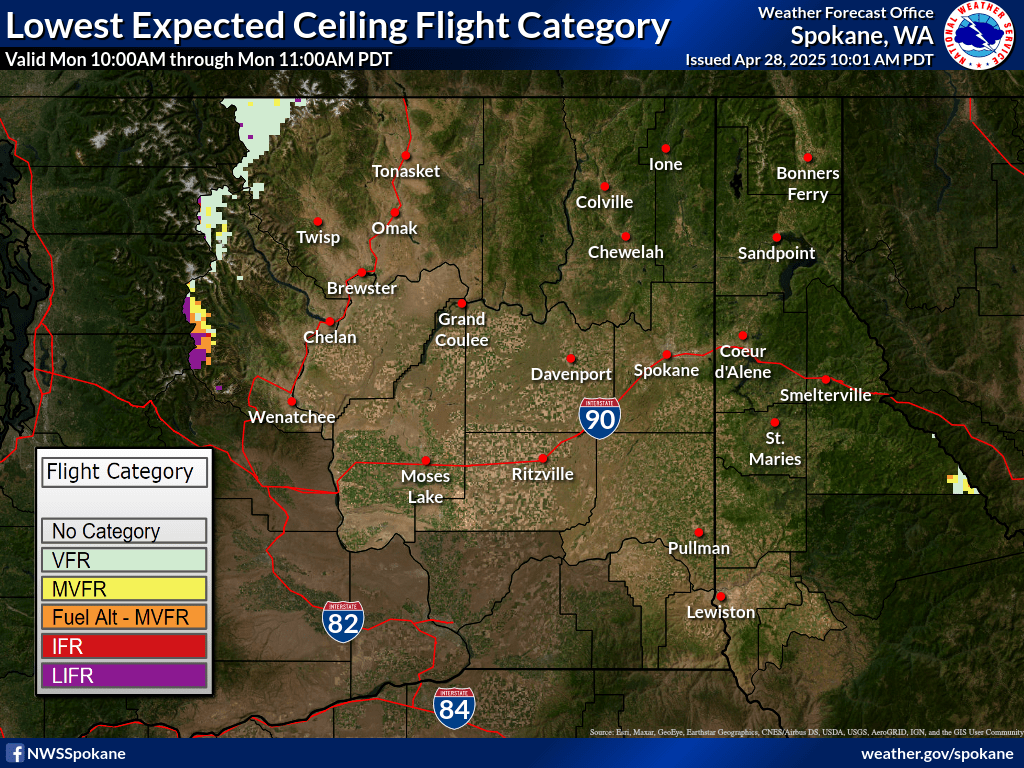
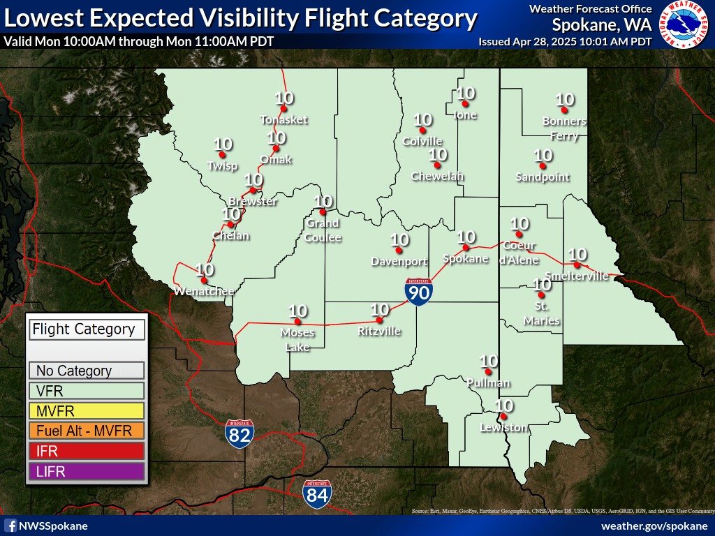
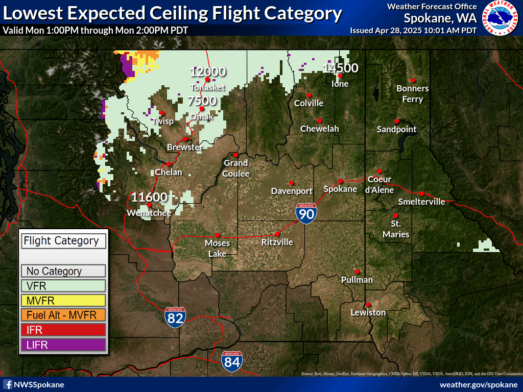
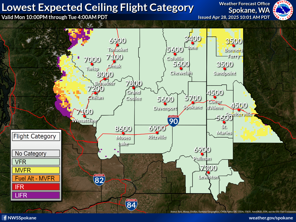
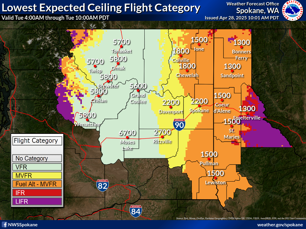
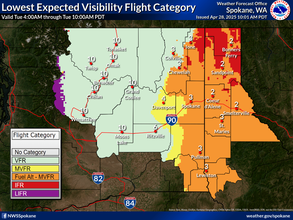
| 0-1 hr Ceiling Forecast | 0-1 hr Visibility Forecast |
|
|
|
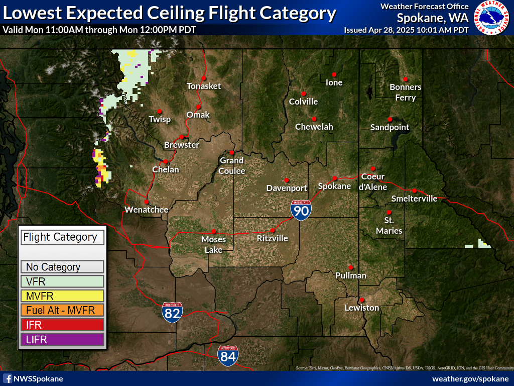
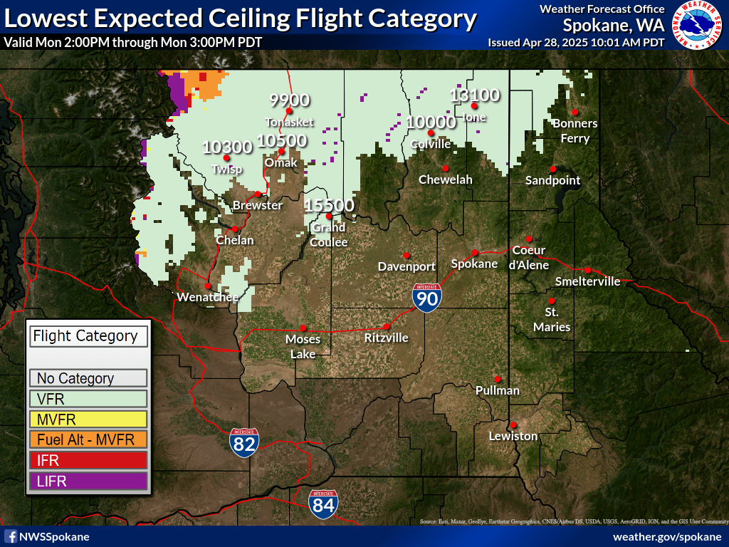
| 1-2 hr Ceiling Forecast | 1-2 hr Visibility Forecast |
|
|
|
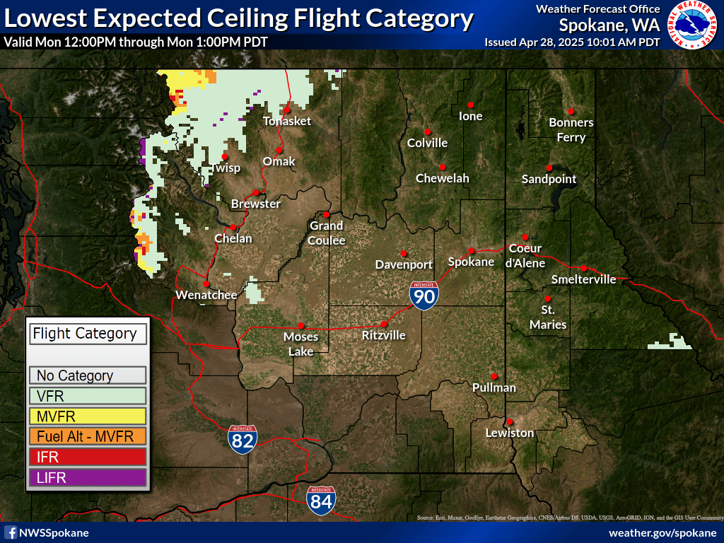
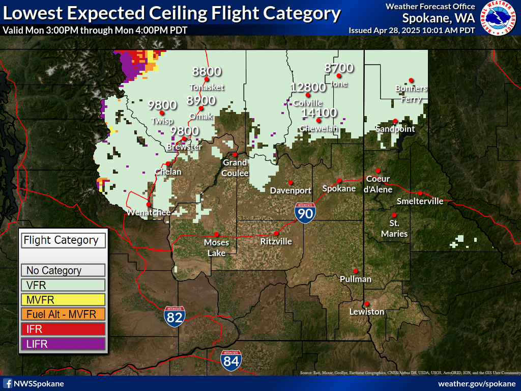
| 2-3 hr Ceiling Forecast | 2-3 hr Visibility Forecast |
|
|
|
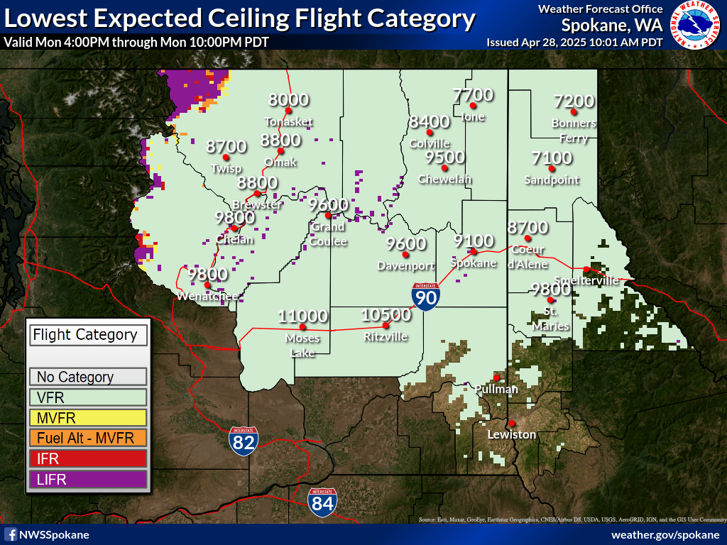
| 3-4 hr Ceiling Forecast | 3-4 hr Visibility Forecast |
|
|
|
| 4-5 hr Ceiling Forecast | 4-5 hr Visibility Forecast |
|
|
|
| 5-6 hr Ceiling Forecast | 5-6 hr Visibility Forecast |
|
|
|
| 6-12 hr Ceiling Forecast | 6-12 hr Visibility Forecast |
|
|
|
| 12-18 hr Ceiling Forecast | 12-18 hr Visibility Forecast |
|
|
|
| 18-24 hr Ceiling Forecast | 18-24 hr Visibility Forecast |
|
|
|
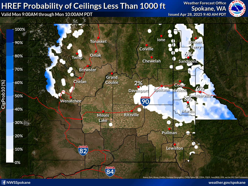
•These plots are produced by HREF ensemble guidance and are for informational purposes. It should be used with other preflight information sources needed to satisfy all the requirements of 14 CFR 91.103. It is NOT designed to be used as a primary or sole source of information for preflight action. Refer to Flight Service for more information.
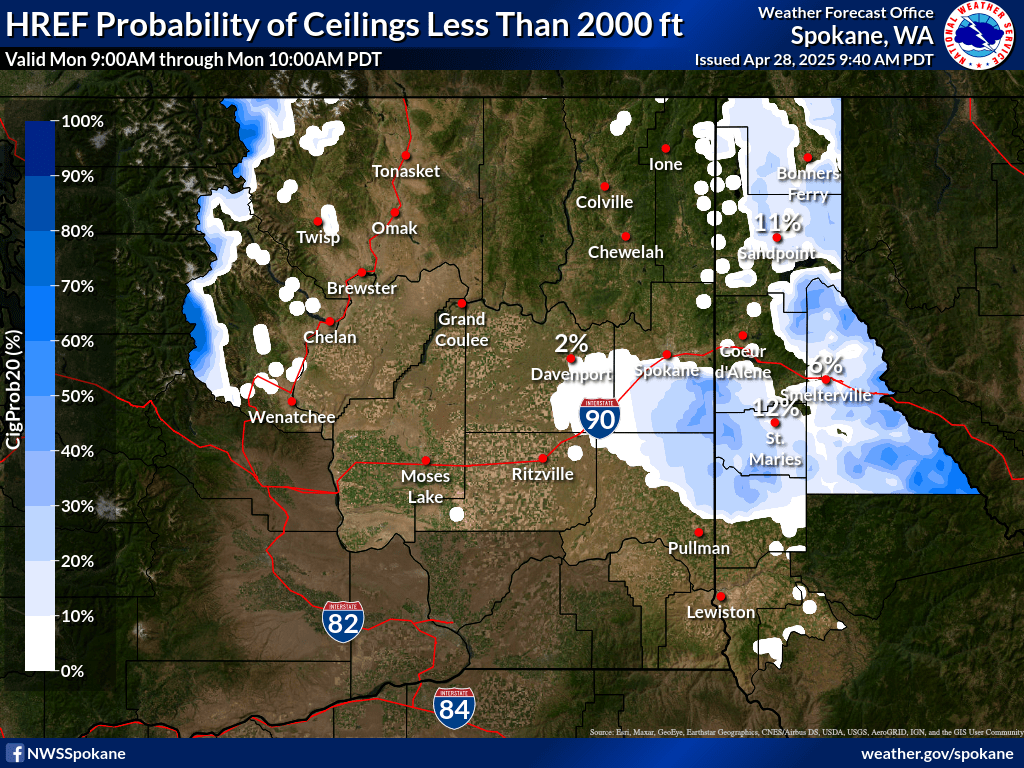
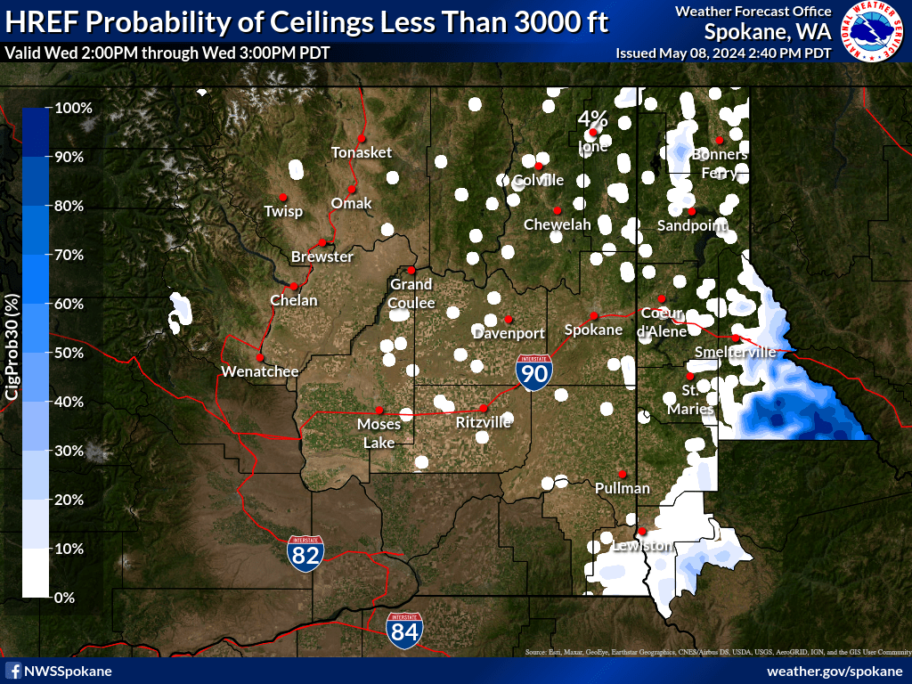
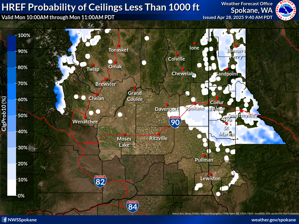
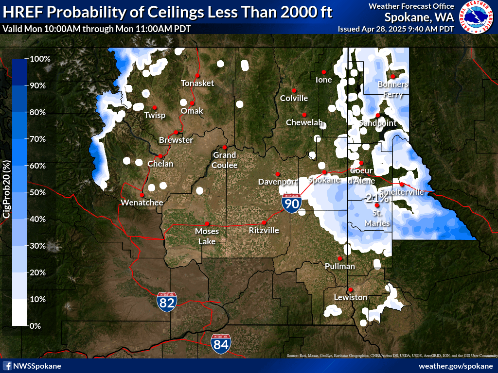
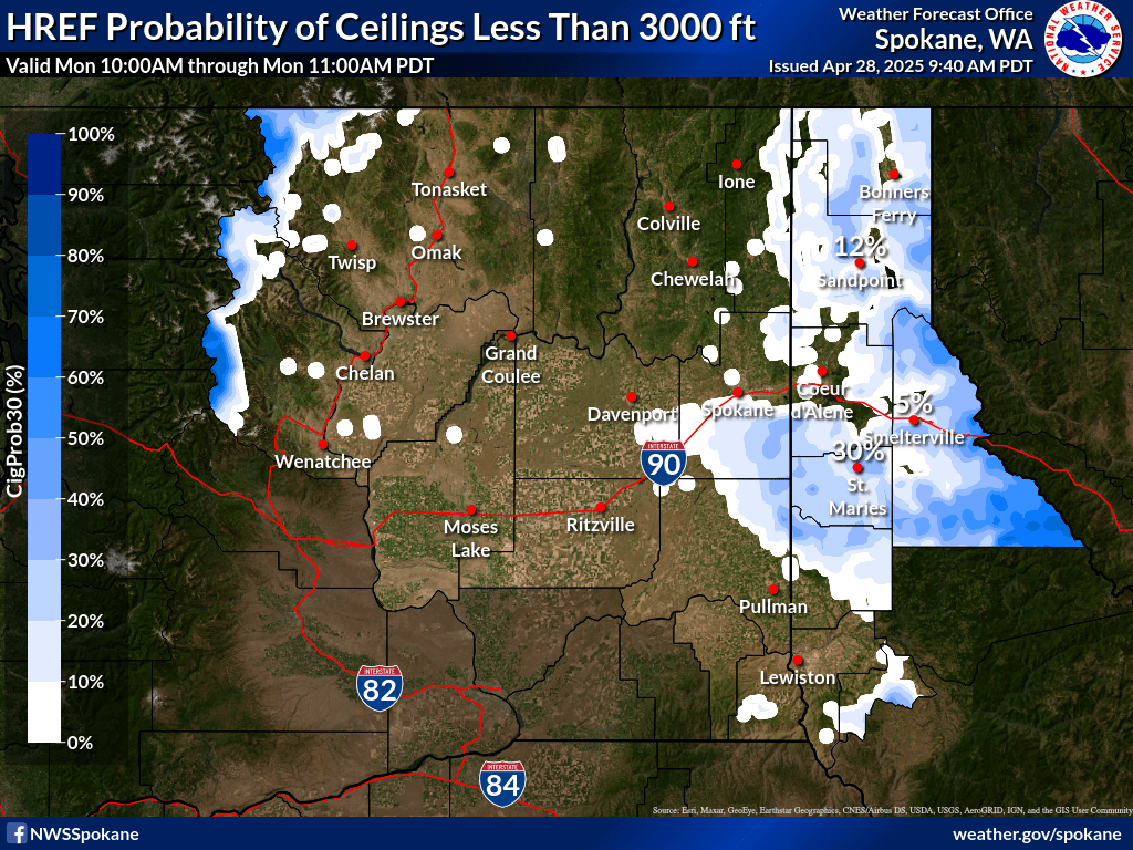
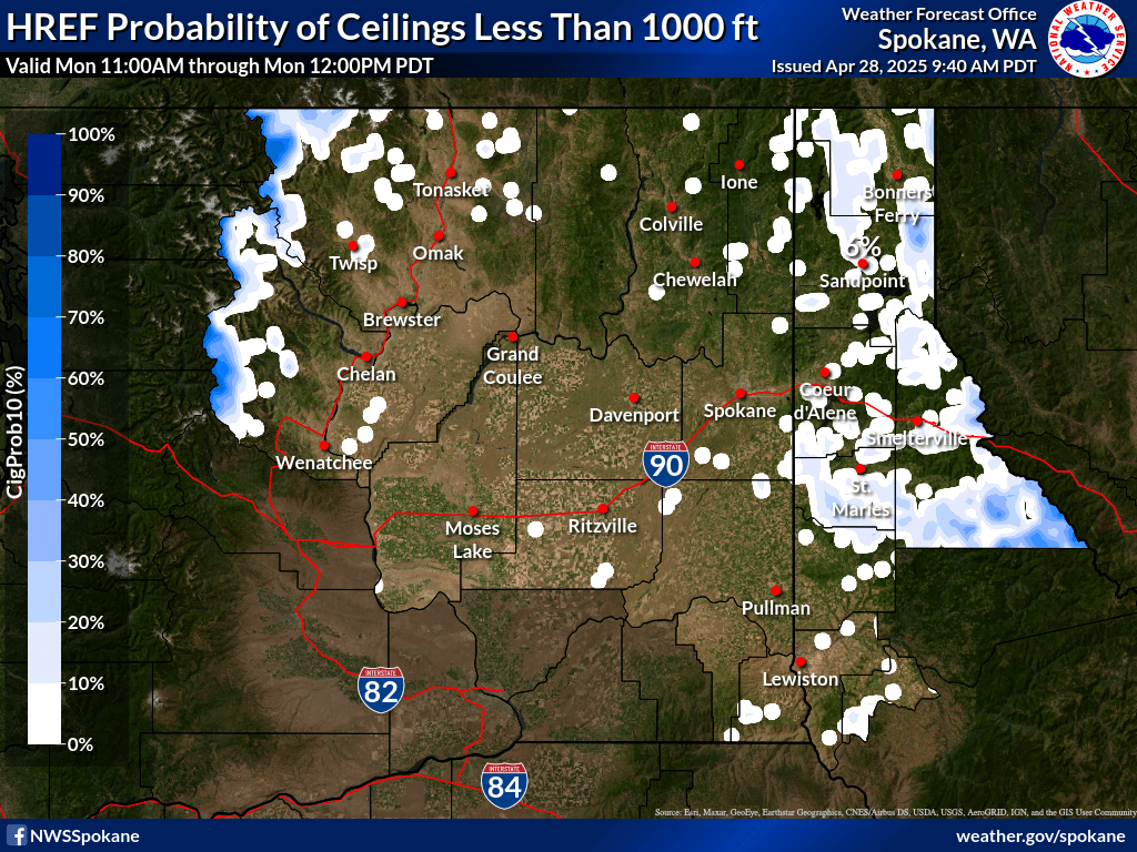
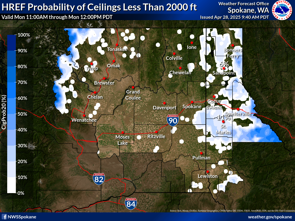
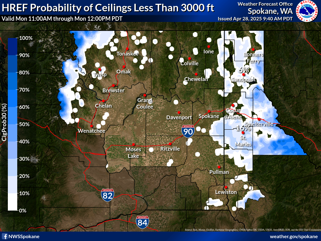
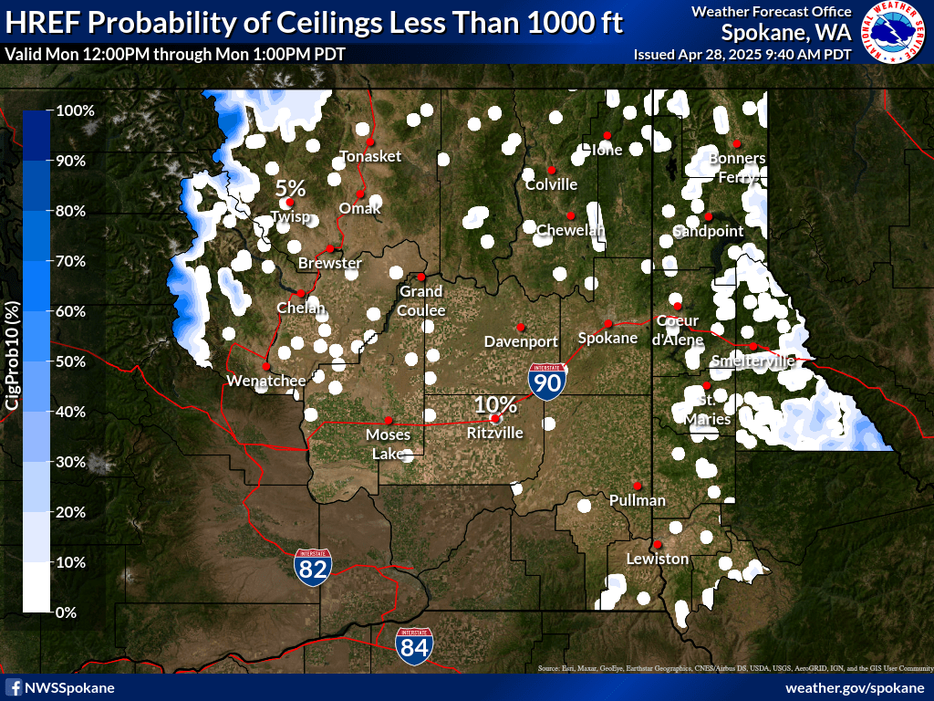
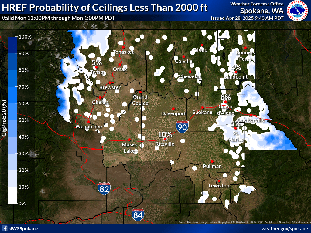
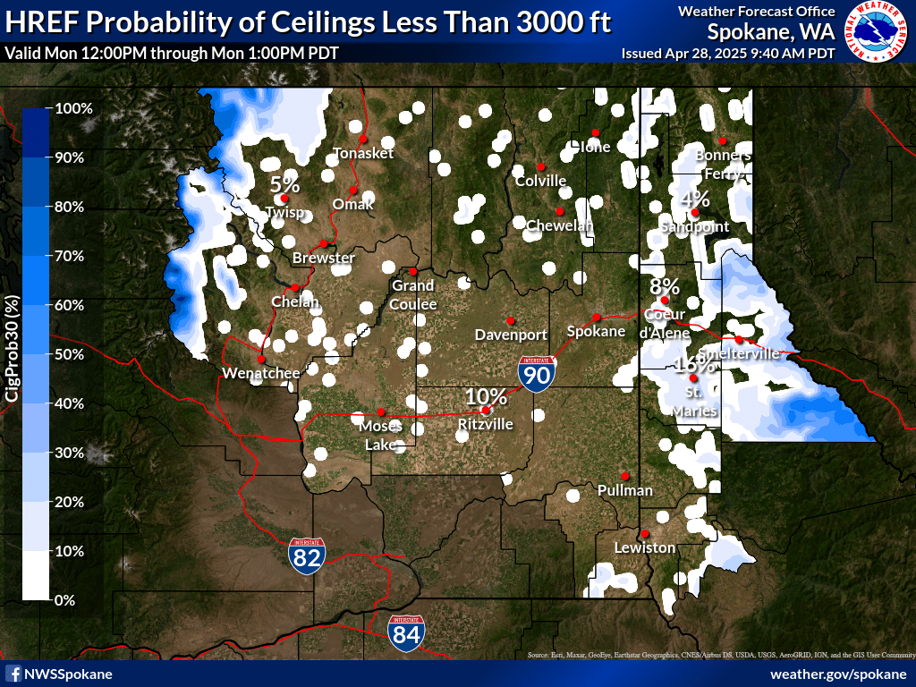
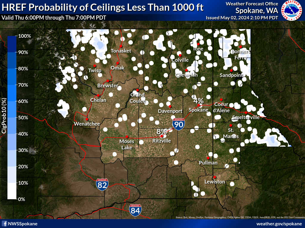
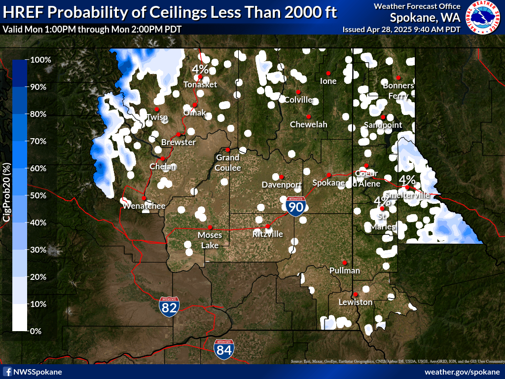
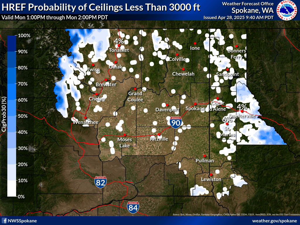
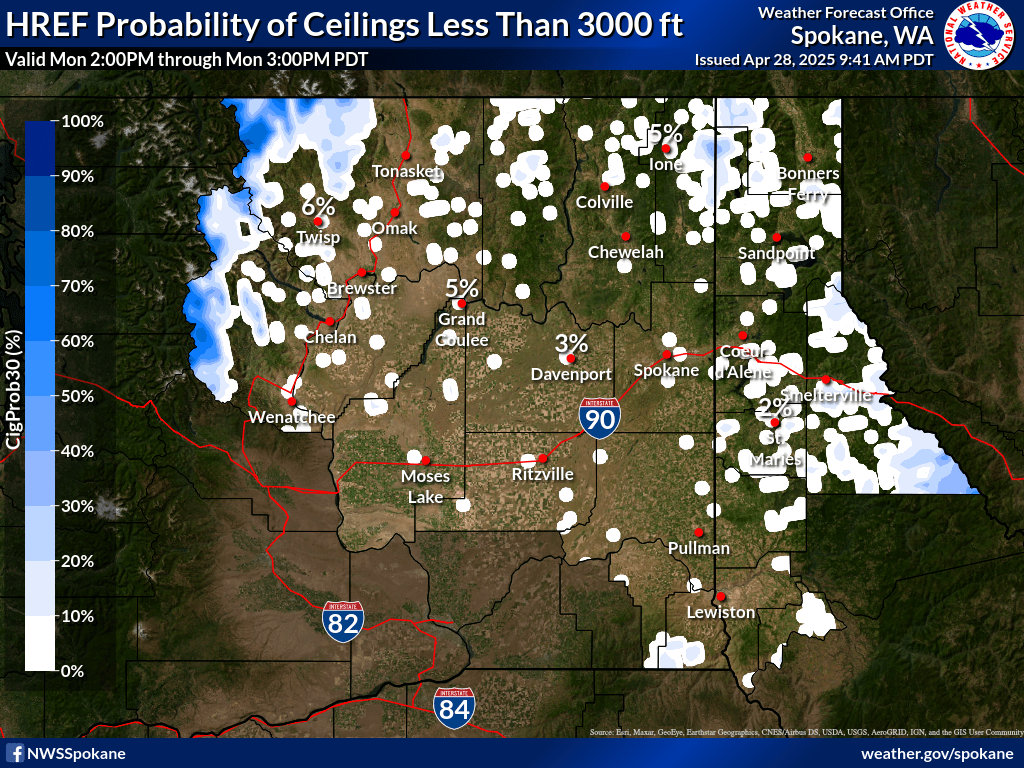
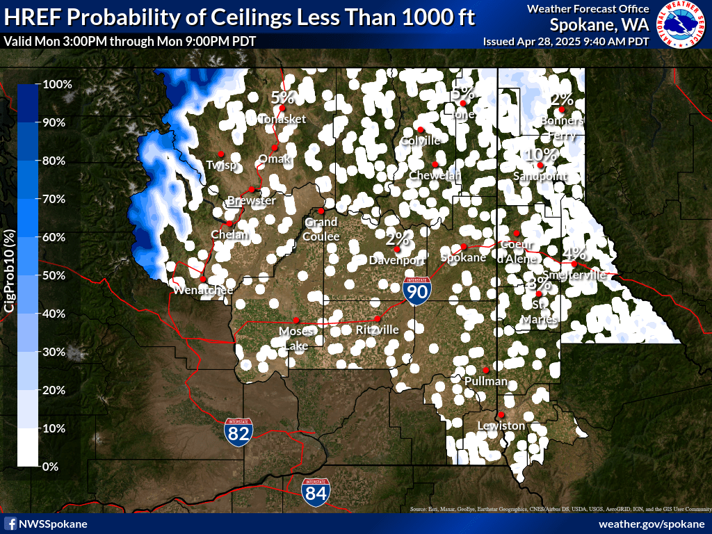
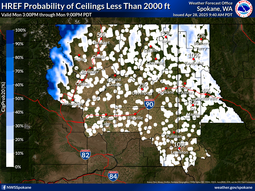
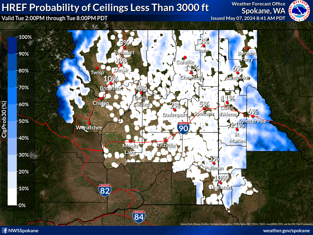
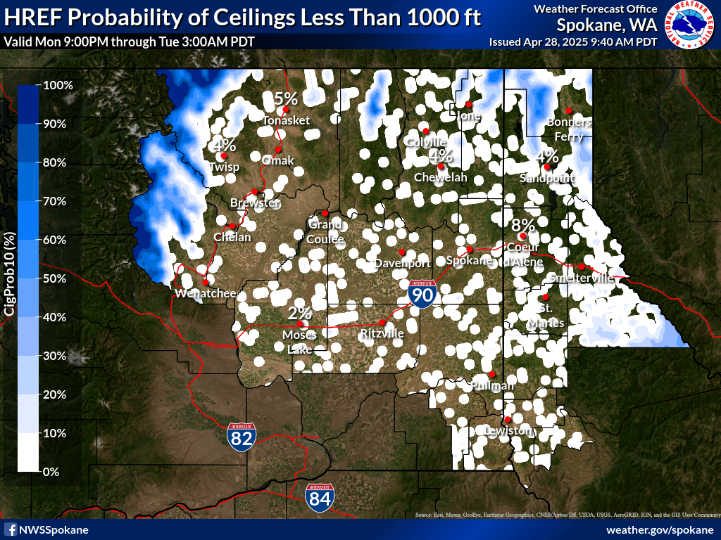
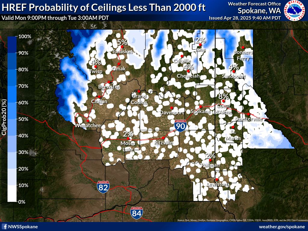
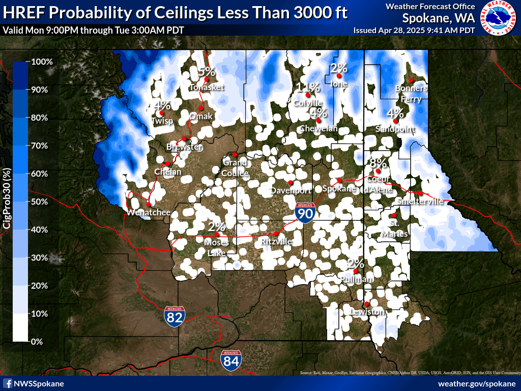
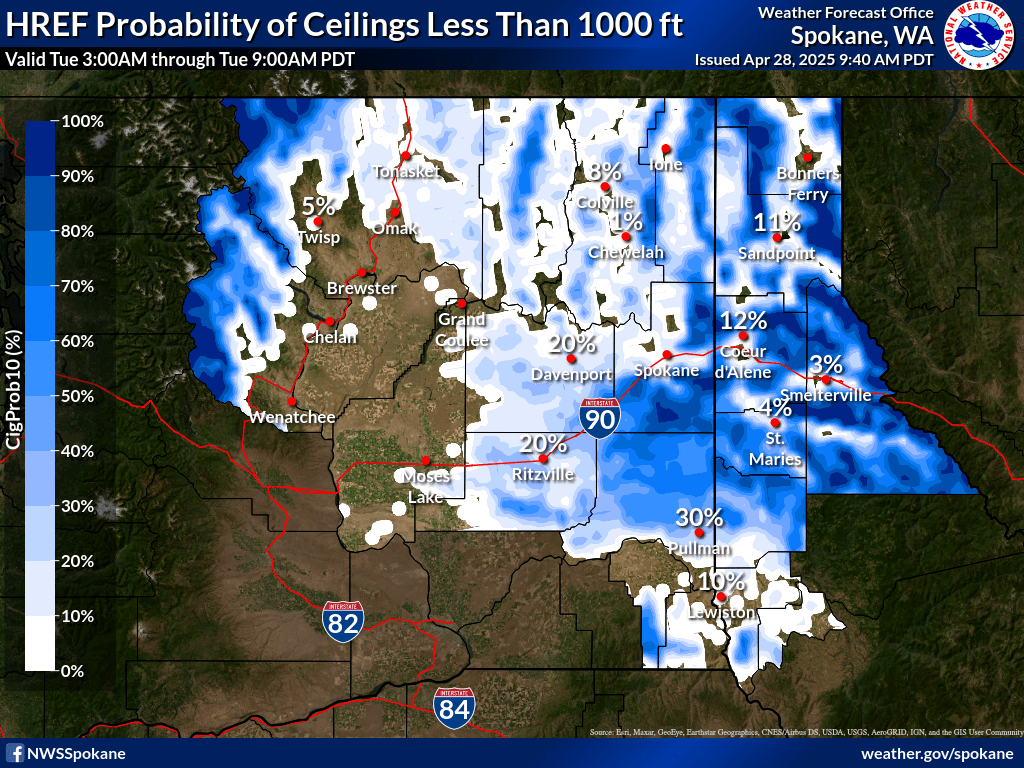
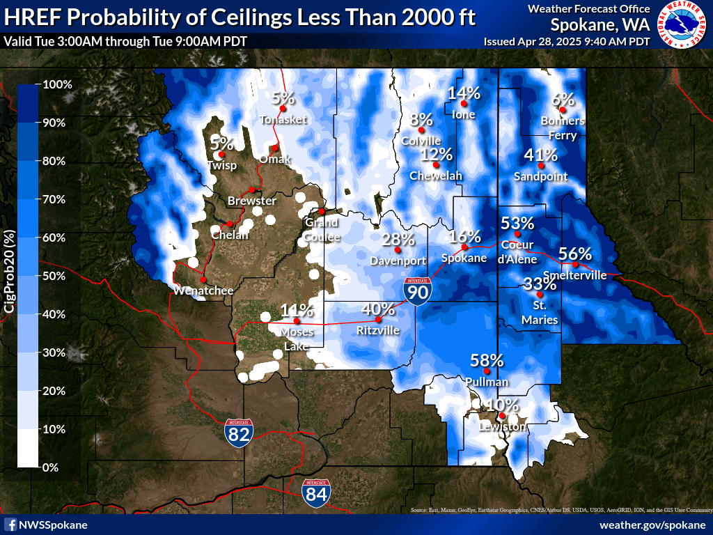
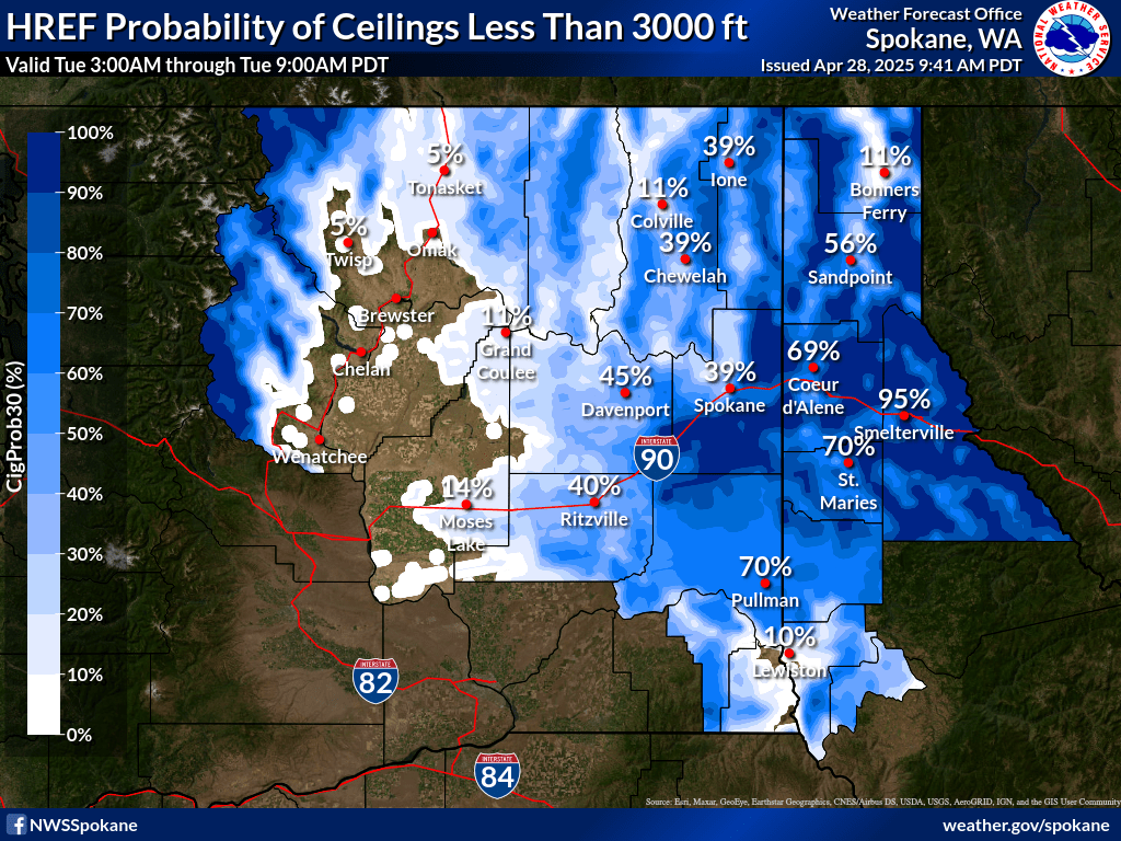
| 0-1 hr Probability of Ceiling < 1000 ft | 0-1 hr Probability of Ceiling < 2000 ft | 0-1 hr Probability of Ceiling < 3000 ft |
|
|
|
|
| 1-2 hr Probability of Ceiling < 1000 ft | 1-2 hr Probability of Ceiling < 2000 ft | 1-2 hr Probability of Ceiling < 3000 ft |
|
|
|
|
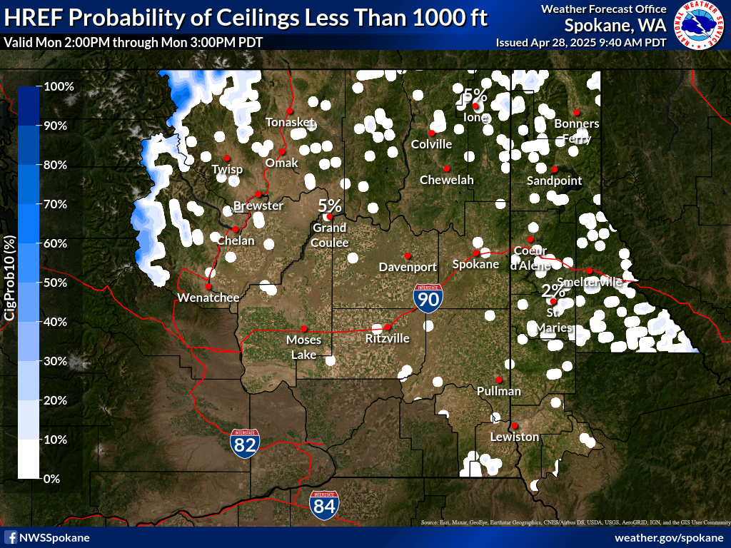
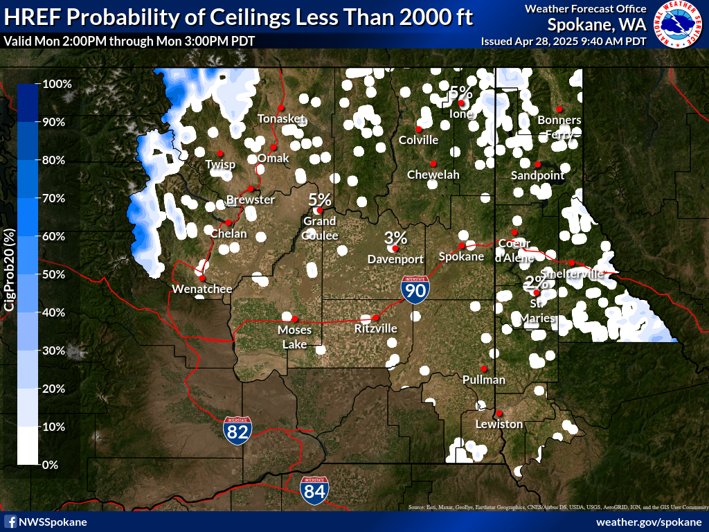
| 2-3 hr Probability of Ceiling < 1000 ft | 2-3 hr Probability of Ceiling < 2000 ft | 2-3 hr Probability of Ceiling < 3000 ft |
|
|
|
|
| 3-4 hr Probability of Ceiling < 1000 ft | 3-4 hr Probability of Ceiling < 2000 ft | 3-4 hr Probability of Ceiling < 3000 ft |
|
|
|
|
| 4-5 hr Probability of Ceiling < 1000 ft | 4-5 hr Probability of Ceiling < 2000 ft | 4-5 hr Probability of Ceiling < 3000 ft |
|
|
|
|
| 5-6 hr Probability of Ceiling < 1000 ft | 5-6 hr Probability of Ceiling < 2000 ft | 5-6 hr Probability of Ceiling < 3000 ft |
|
|
|
|
| 6-12 hr Probability of Ceiling < 1000 ft | 6-12 hr Probability of Ceiling < 2000 ft | 6-12 hr Probability of Ceiling < 3000 ft |
|
|
|
|
| 12-18 hr Probability of Ceiling < 1000 ft | 12-18 hr Probability of Ceiling < 2000 ft | 12-18 hr Probability of Ceiling < 3000 ft |
|
|
|
|
| 18-24 hr Probability of Ceiling < 1000 ft | 18-24 hr Probability of Ceiling < 2000 ft | 18-24 hr Probability of Ceiling < 3000 ft |
|
|
|
|
•These plots are produced by HREF ensemble guidance and are for informational purposes. It should be used with other preflight information sources needed to satisfy all the requirements of 14 CFR 91.103. It is NOT designed to be used as a primary or sole source of information for preflight action. Refer to Flight Service for more information.
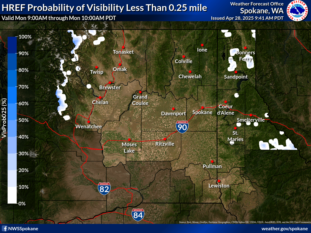
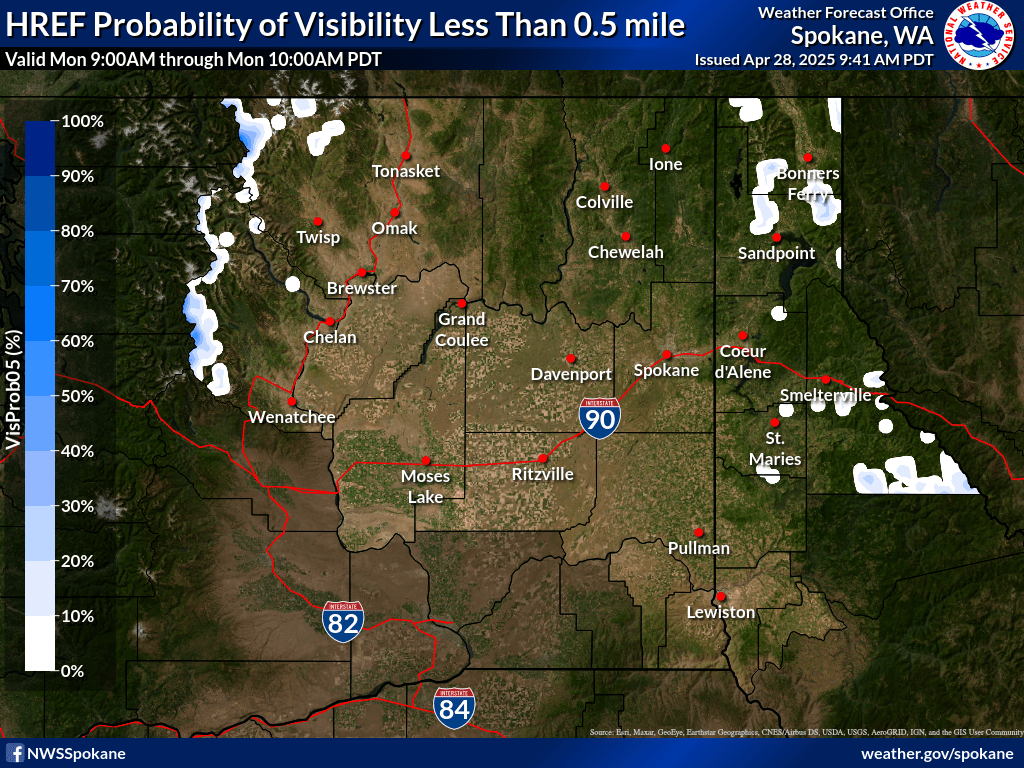
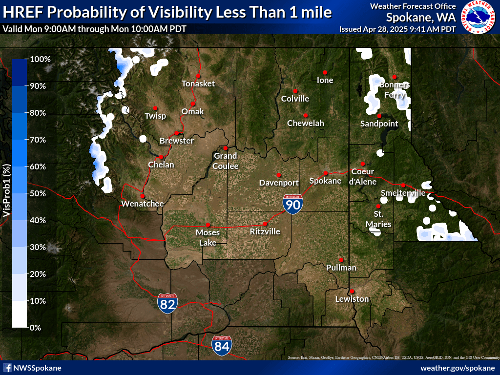
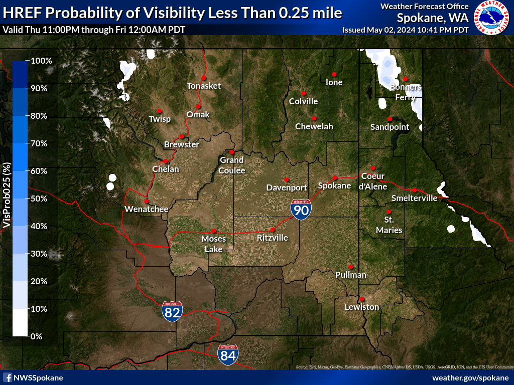
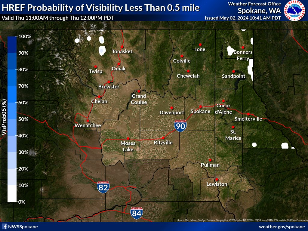
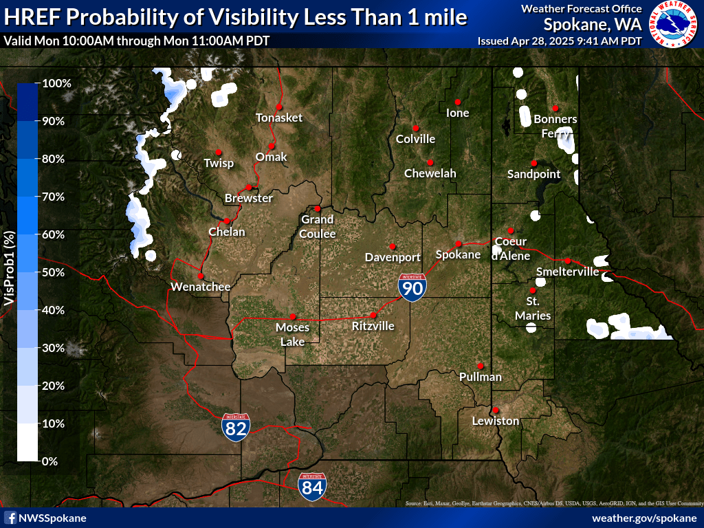
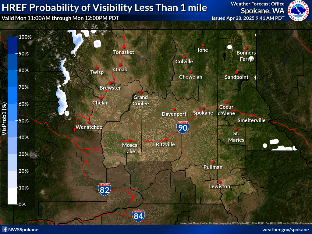
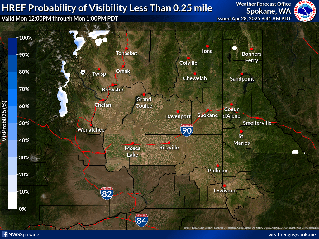
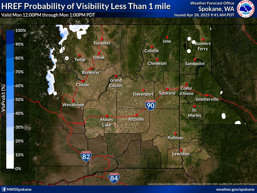
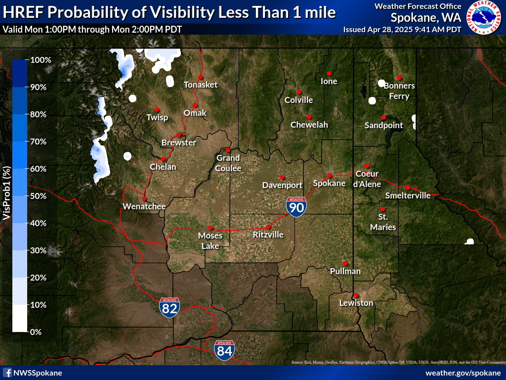
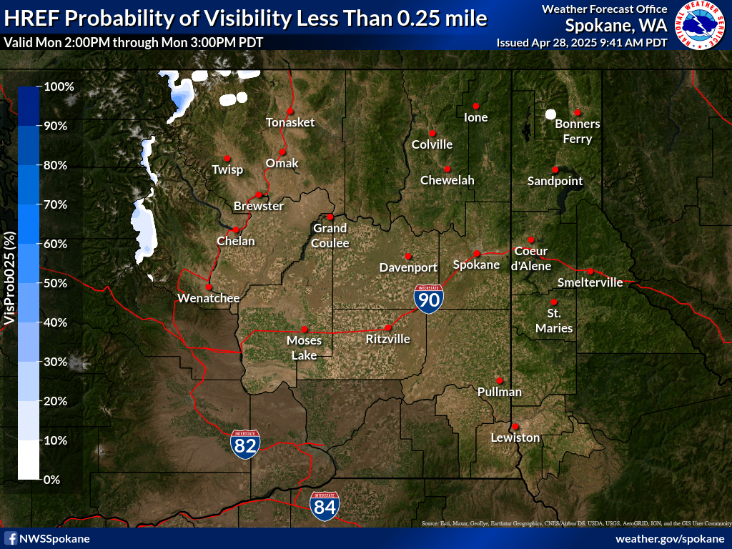
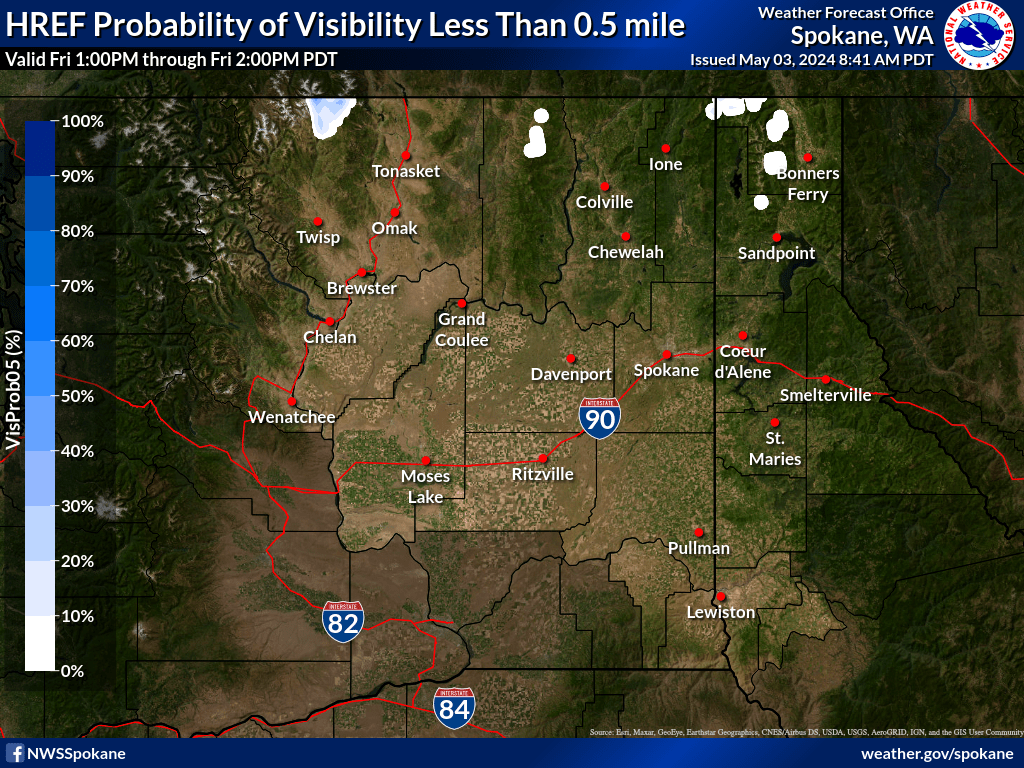
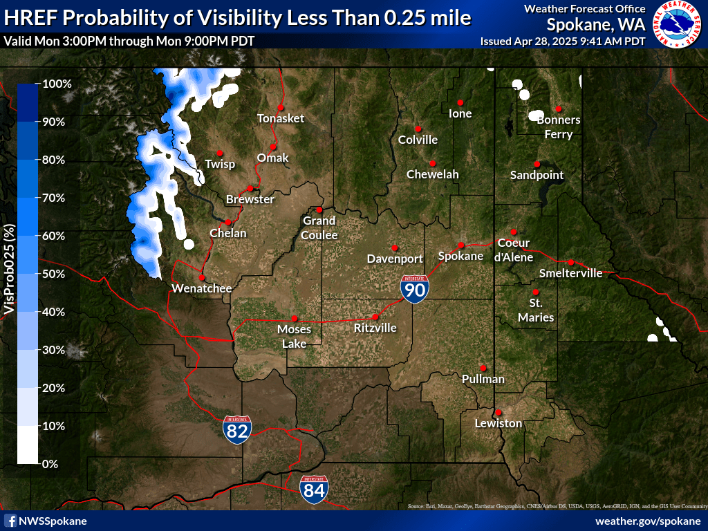
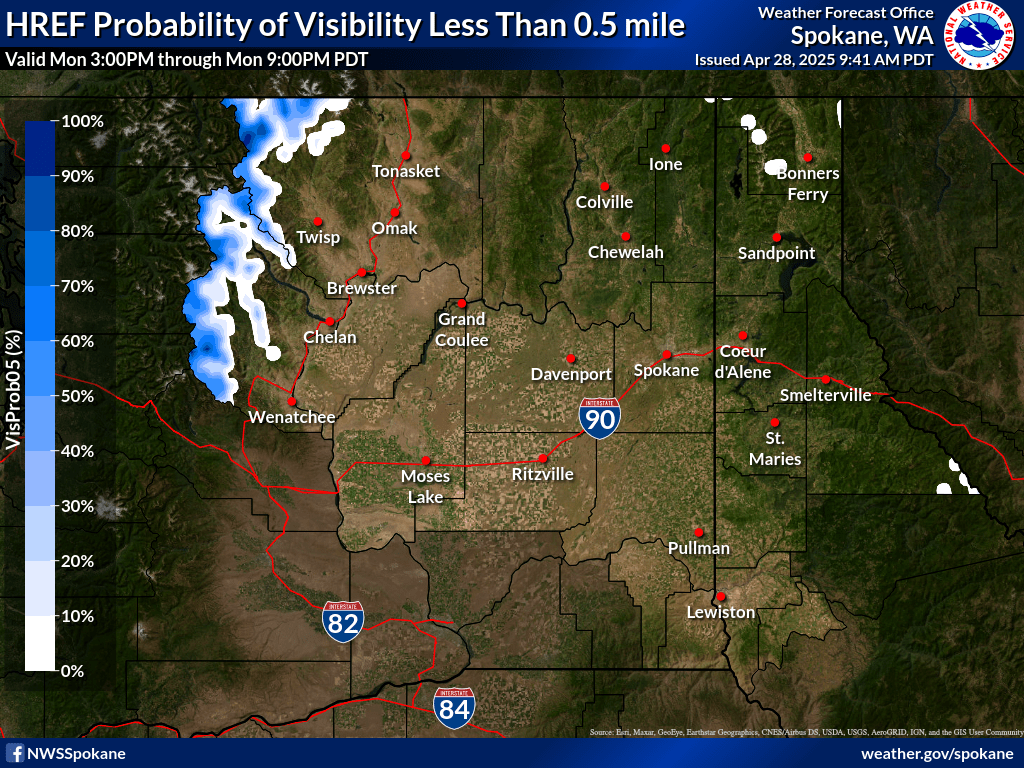
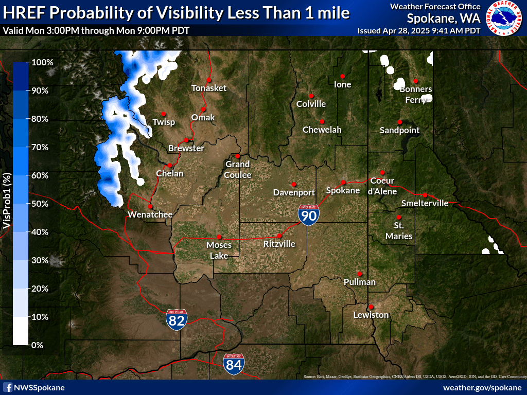
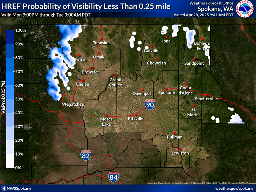
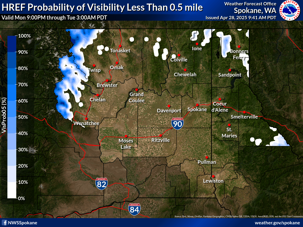
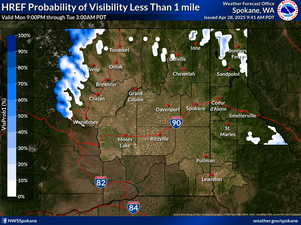
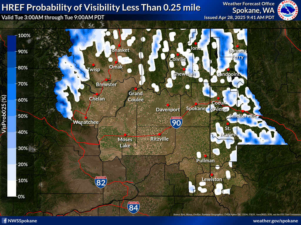
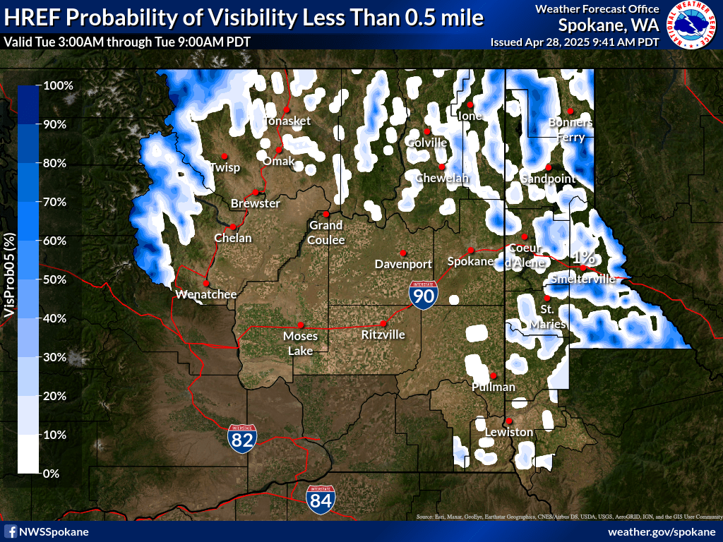
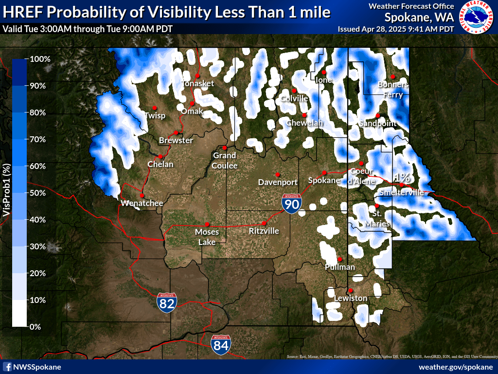
| 0-1 hr Probability of Visibility < 0.25 mi | 0-1 hr Probability of Visibility < 0.5 mi | 0-1 hr Probability of Visibility < 1 mi |
|
|
|
|
| 1-2 hr Probability of Visibility < 0.25 mi | 1-2 hr Probability of Visibility < 0.5 mi | 1-2 hr Probability of Visibility < 1 mi |
|
|
|
|
| 2-3 hr Probability of Visibility < 0.25 mi | 2-3 hr Probability of Visibility < 0.5 mi | 2-3 hr Probability of Visibility < 1 mi |
|
|
|
|
| 3-4 hr Probability of Visibility < 0.25 mi | 3-4 hr Probability of Visibility < 0.5 mi | 3-4 hr Probability of Visibility < 1 mi |
|
|
|
|
| 4-5 hr Probability of Visibility < 0.25 mi | 4-5 hr Probability of Visibility < 0.5 mi | 4-5 hr Probability of Visibility < 1 mi |
|
|
|
|
| 5-6 hr Probability of Visibility < 0.25 mi | 5-6 hr Probability of Visibility < 0.5 mi | 5-6 hr Probability of Visibility < 1 mi |
|
|
|
|
| 6-12 hr Probability of Visibility < 0.25 mi | 6-12 hr Probability of Visibility < 0.5 mi | 6-12 hr Probability of Visibility < 1 mi |
|
|
|
|
| 12-18 hr Probability of Visibility < 0.25 mi | 12-18 hr Probability of Visibility < 0.5 mi | 12-18 hr Probability of Visibility < 1 mi |
|
|
|
|
| 18-24 hr Probability of Visibility < 0.25 mi | 18-24 hr Probability of Visibility < 0.5 mi | 18-24 hr Probability of Visibility < 1 mi |
|
|
|
|
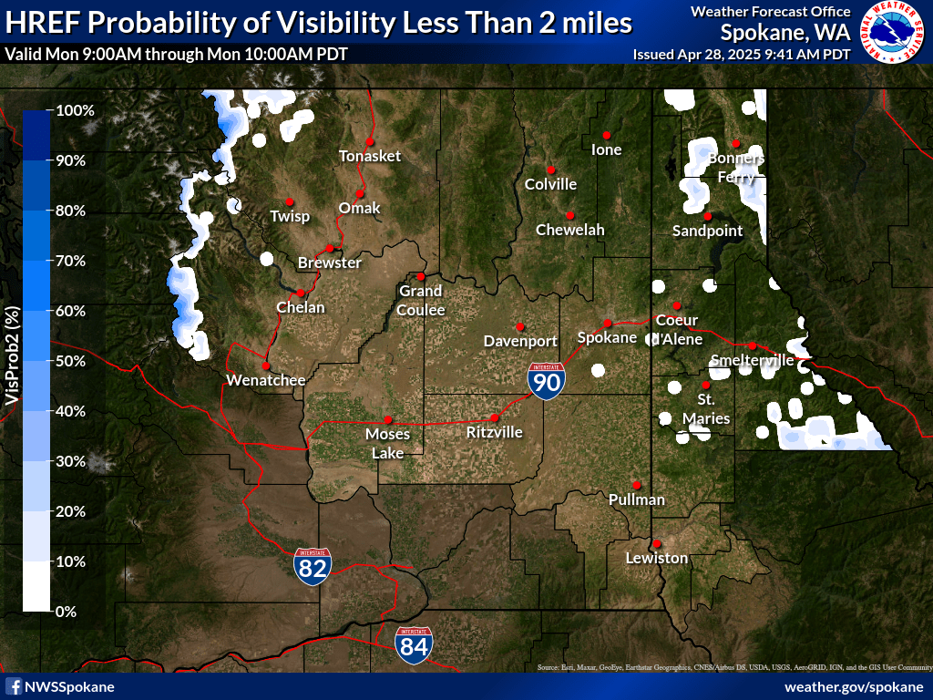
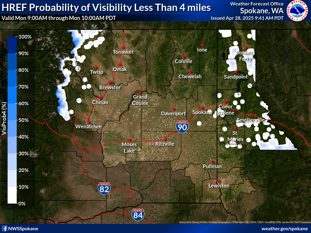
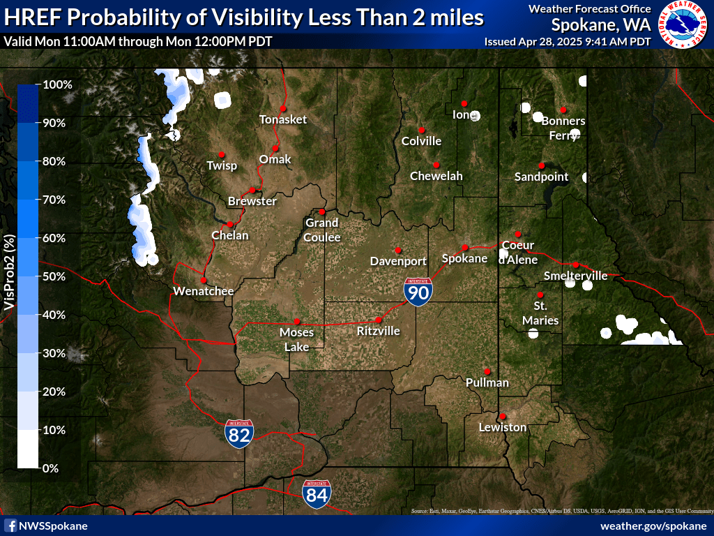
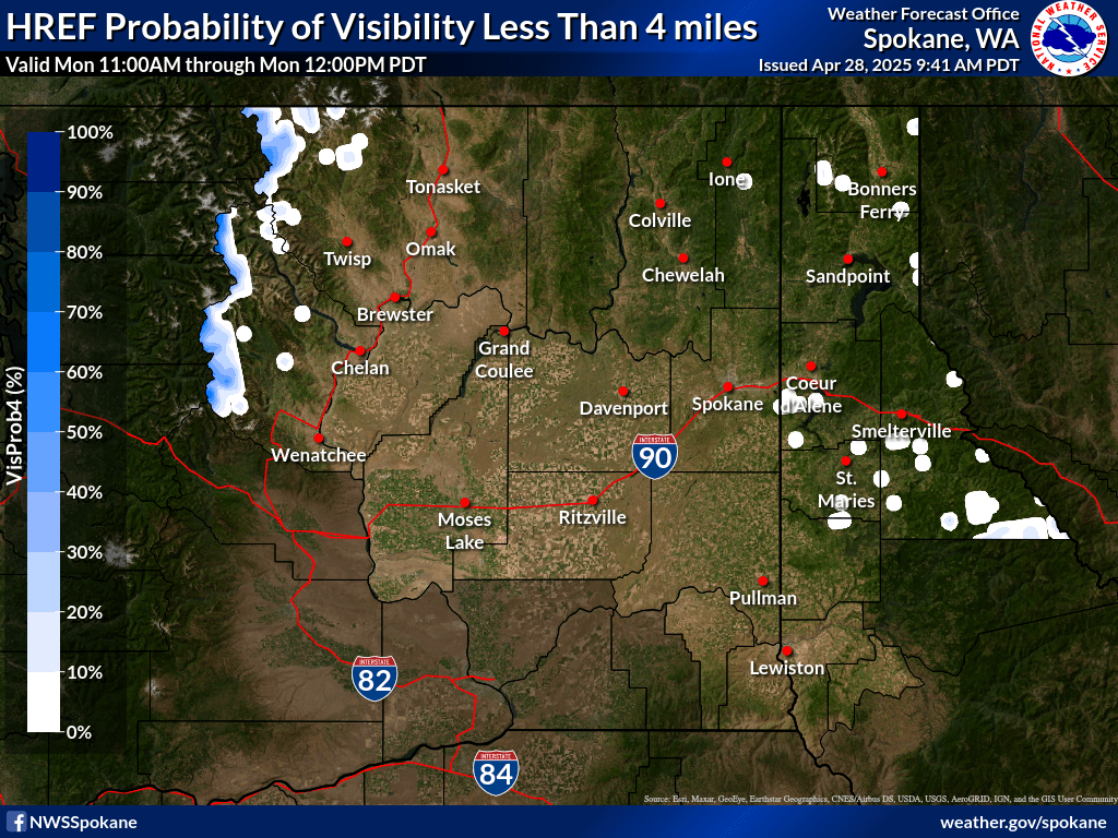
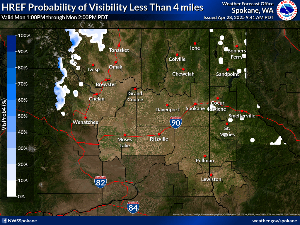
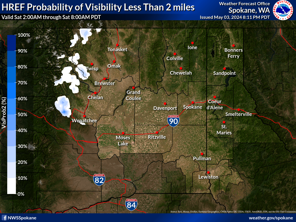
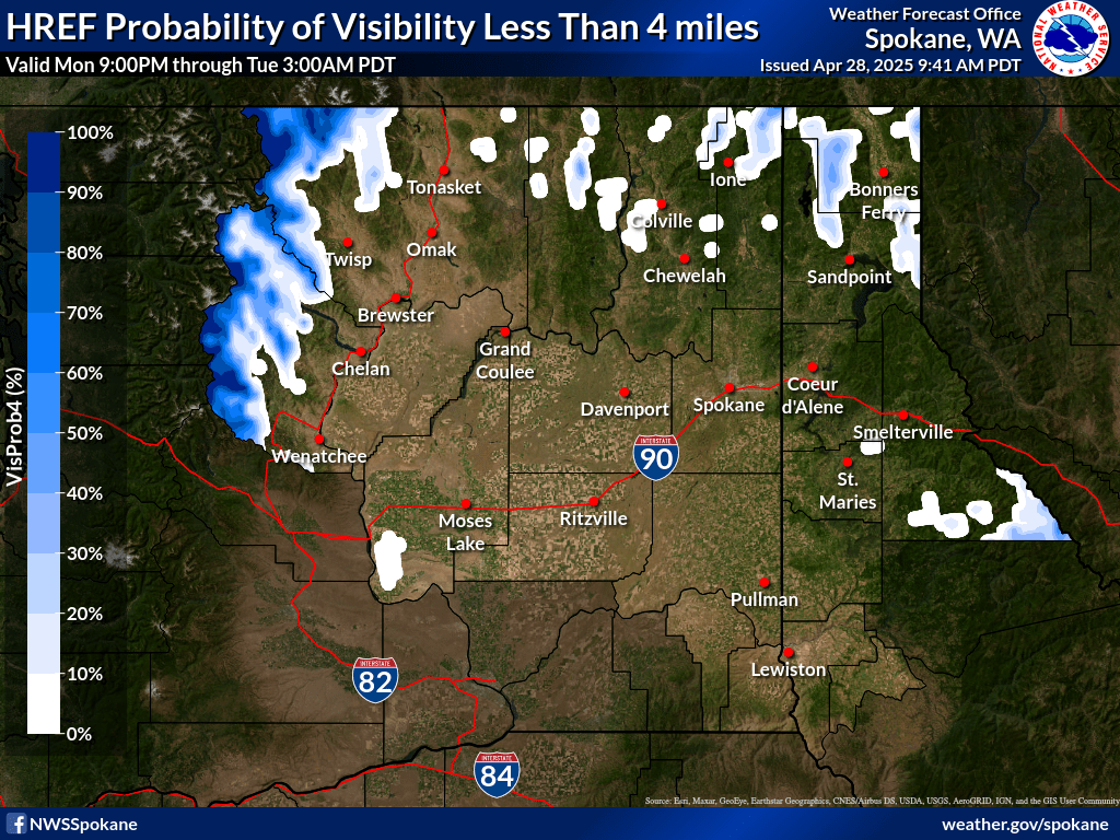
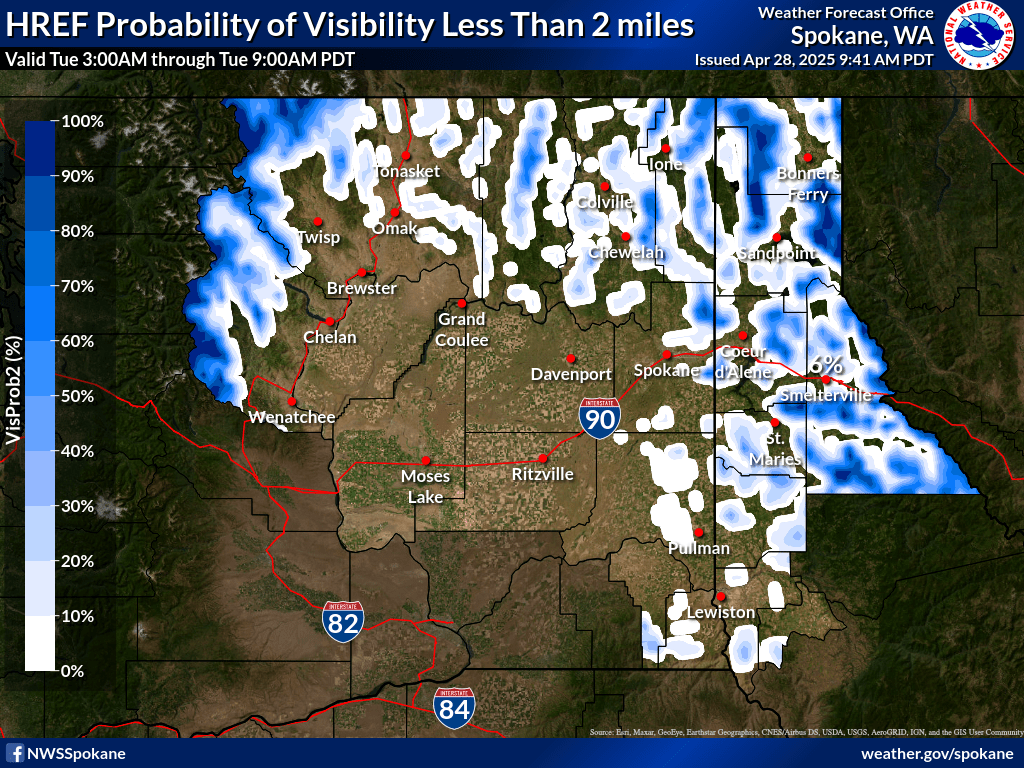
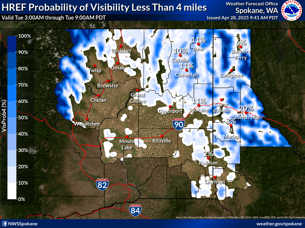
| 0-1 hr Probability of Visibility < 2 mi | 0-1 hr Probability of Visibility < 4 mi | |
|
|
|
|
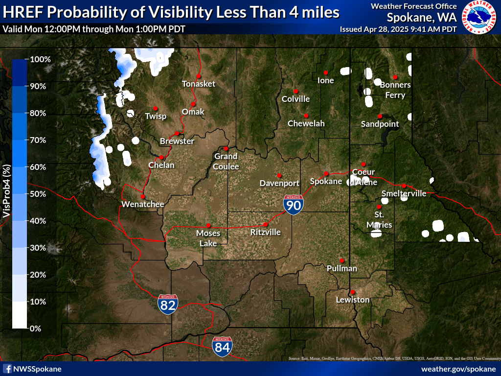
| 1-2 hr Probability of Visibility < 2 mi | 1-2 hr Probability of Visibility < 4 mi | |
|
|
|
|
| 2-3 hr Probability of Visibility < 2 mi | 2-3 hr Probability of Visibility < 4 mi | |
|
|
|
|
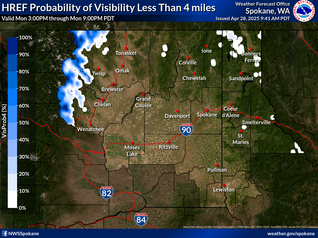
| 3-4 hr Probability of Visibility < 2 mi | 3-4 hr Probability of Visibility < 4 mi | |
|
|
|
|
| 4-5 hr Probability of Visibility < 2 mi | 4-5 hr Probability of Visibility < 4 mi | |
|
|
|
|
| 5-6 hr Probability of Visibility < 2 mi | 5-6 hr Probability of Visibility < 4 mi | |
|
|
|
|
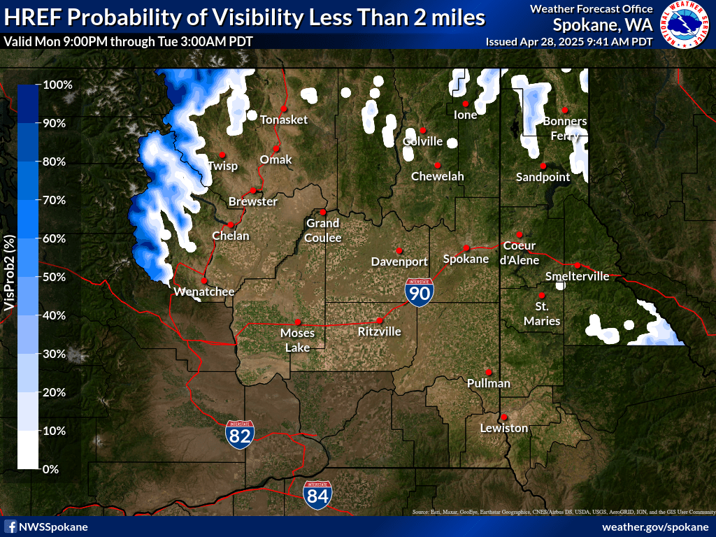
| 6-12 hr Probability of Visibility < 2 mi | 6-12 hr Probability of Visibility < 4 mi | |
|
|
|
|
| 12-18 hr Probability of Visibility < 2 mi | 12-18 hr Probability of Visibility < 4 mi | |
|
|
|
|
| 18-24 hr Probability of Visibility < 2 mi | 18-24 hr Probability of Visibility < 4 mi | |
|
|
|


| Current | 3-hr Forecast | 6-hr Forecast |
|
|
|
|
| 9-hr Forecast | 12-hr Forecast | |
|
|
|
| Current | 3-hr Forecast | 6-hr Forecast |
|
|
|
|
| 9-hr Forecast | 12-hr Forecast | |
|
|
|
| Current | 3-hr Forecast | 6-hr Forecast |
|
|
|
|
| 9-hr Forecast | 12-hr Forecast | |
|
|
|
| Current | 3-hr Forecast | 6-hr Forecast |
|
|
|
|
| 9-hr Forecast | 12-hr Forecast | |
|
|
|
| Legend |
|
|
Seattle Center Weather Service Unit (ZSE CWSU)
ZSE Current Weather Advisories and Meteorological Impact Statements
Salt Lake City Center Weather Service Unit (ZLC CWSU)
ZLC Current Weather Advisories and Meteorological Impact Statements