 |
 |
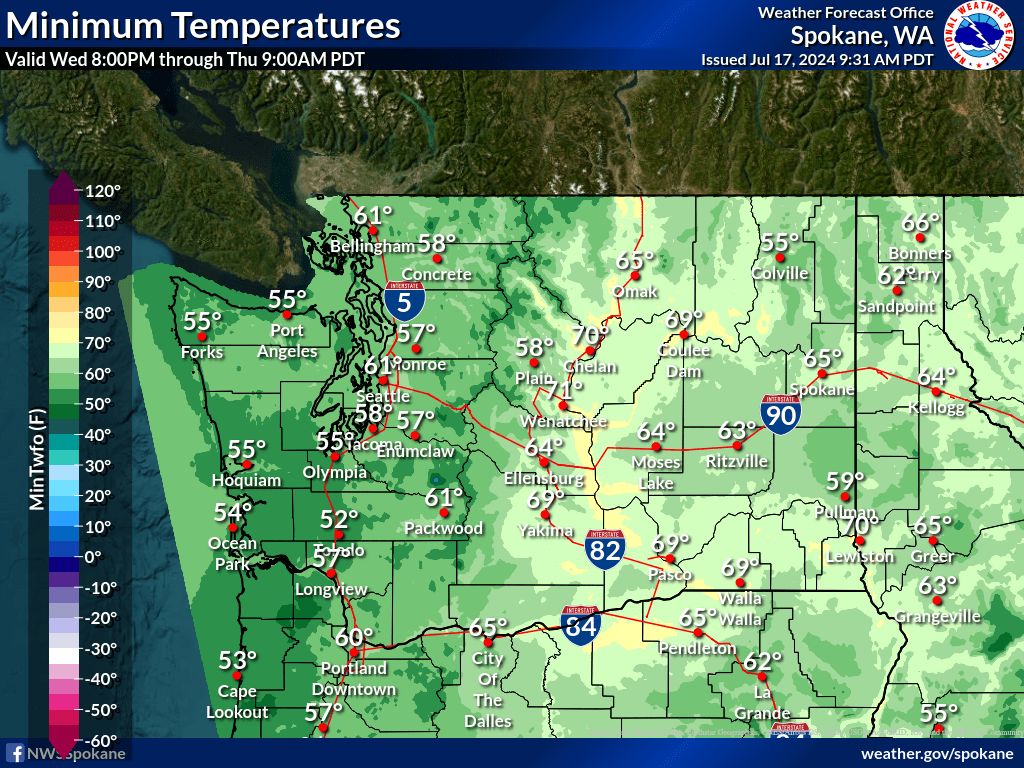
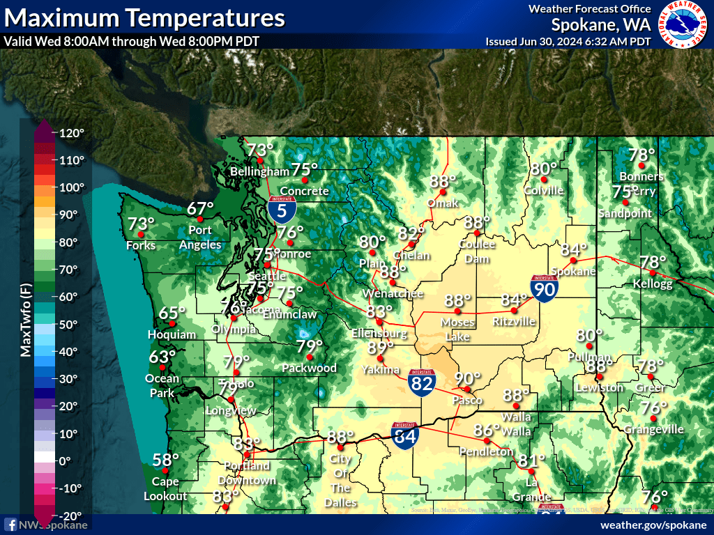
| Temperature | Precipitation |
 |
 |
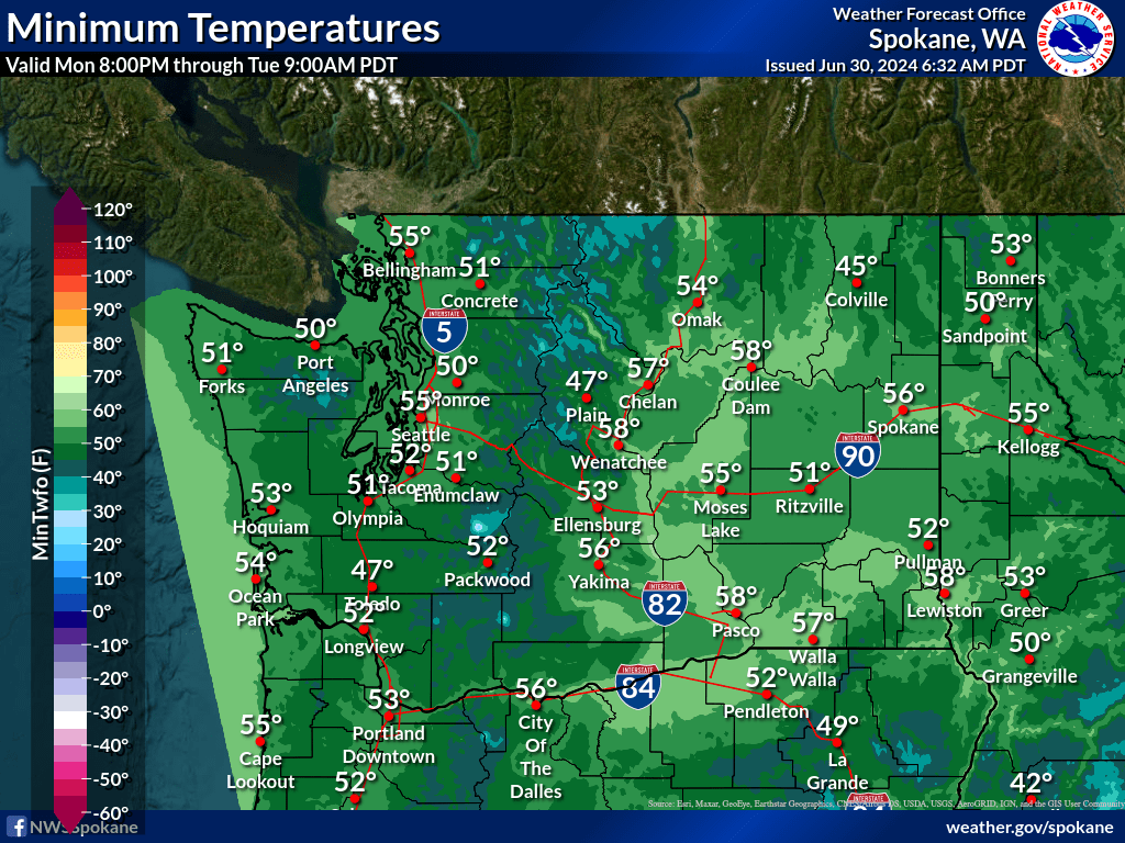
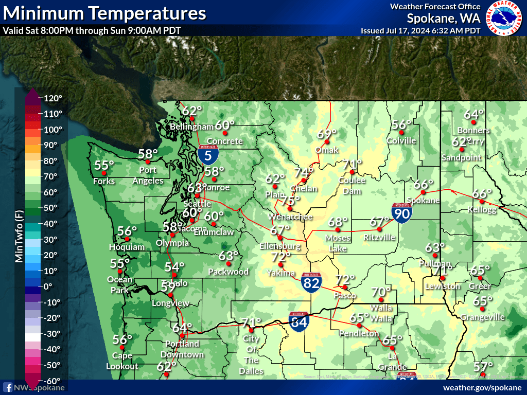
| Temperature | Precipitation |
 |
 |
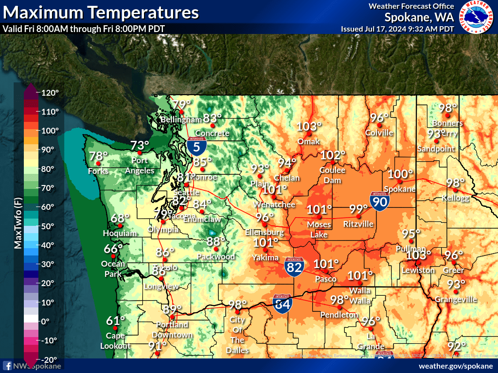
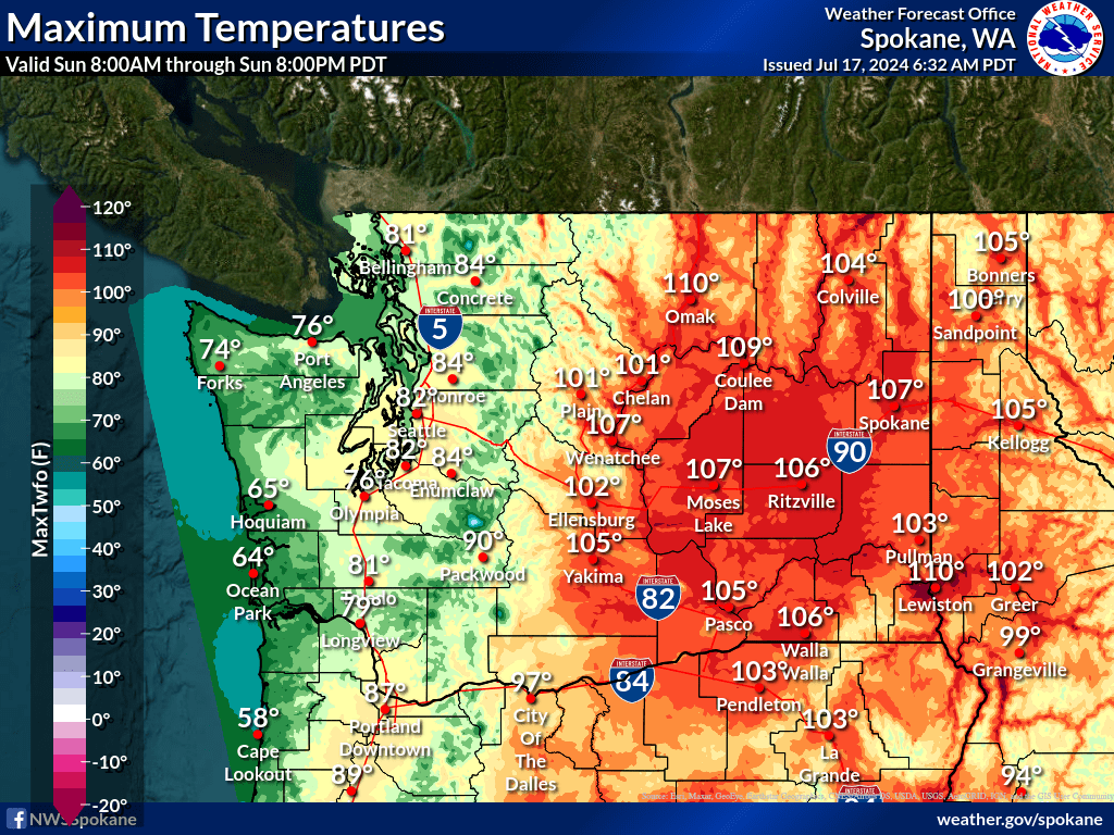
| Temperature | Precipitation |
 |
 |
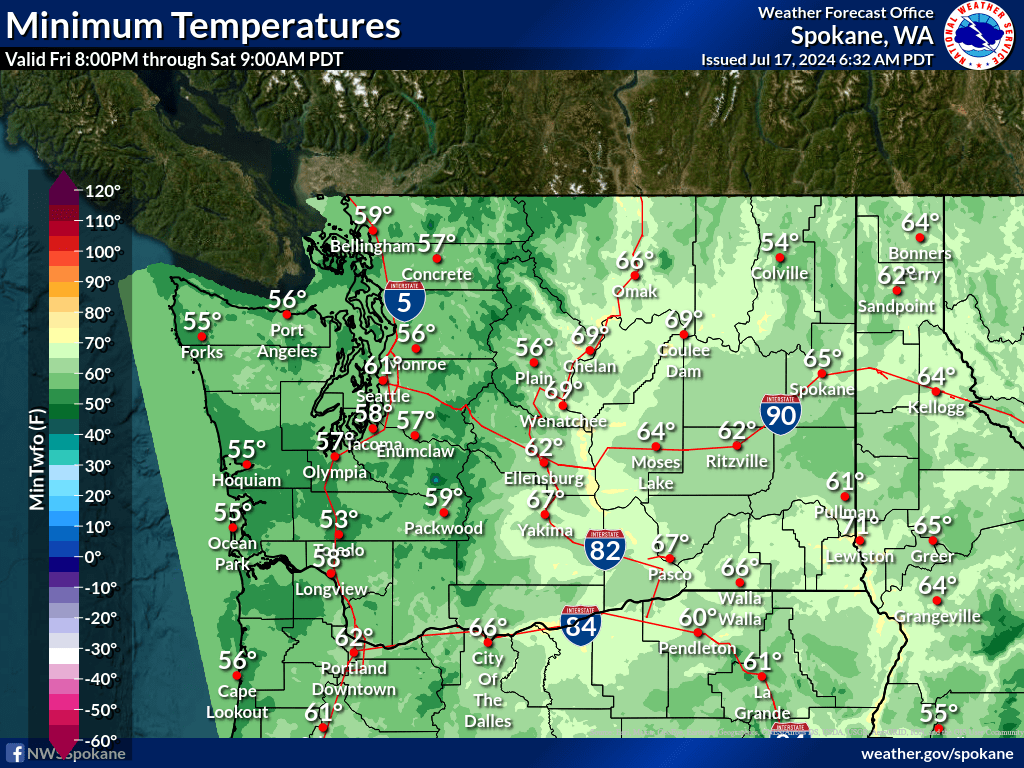
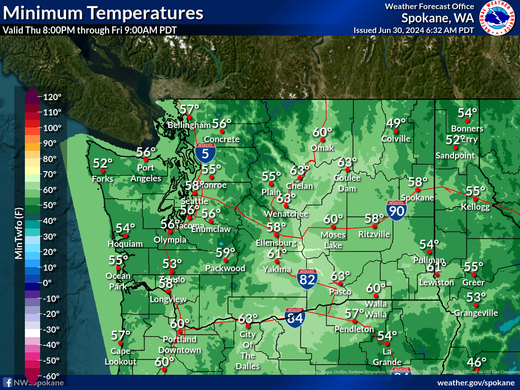
| Temperature | Precipitation |
|
|
 |
|
|
 |
| Past 7 Days | Past 14 Days | Past 30 Days |
 |
 |
 |
| Past 7 Days | Past 14 Days | Past 30 Days |
 |
 |
 |
| Past 7 Days | Past 14 Days | Past 30 Days |
 |
 |
 |
|
|
 |
|
|
 |
|
|
 |
|
|
|
|
 |
 |
 |
|
|
|
|
 |
 |
 |
|
|
|
|
 |
 |

|
|
|
|
|

|

|
|
|
|
|
|
|
|
|
|

|

|
| Day 1 | |
 |
 |
| Day 2 | |
 |
 |
| Day 3 | |
 |
 |
| Day 4 | |
 |
 |
| Day 5 | |
 |
 |
| Day 6 | |
 |
 |
| Day 7 | |
 |
 |
| Day 1 | |
 |
 |
| Day 2 | |
 |
 |
| Day 3 | |
 |
 |
| Day 4 | |
 |
 |
| Day 5 | |
 |
 |
| Day 6 | |
 |
 |
| Day 7 | |
 |
 |
| Day 1 | |
 |
 |
| Day 2 | |
 |
 |
| Day 3 | |
 |
 |
| Day 4 | |
 |
 |
| Day 5 | |
 |
 |
| Day 6 | |
 |
 |
| Day 7 | |
 |
 |
| Day 1 | |
| Day 2 | |
| Day 3 | |
| Day 1 | |
 |
 |
| Day 2 | |
 |
 |
| Day 3 | |
 |
 |
| Day 4 | |
 |
 |
| Day 5 | |
 |
 |
| Day 6 | |
 |
 |
| Day 7 | |
 |
 |
| Day 1 | |
 |
 |
| Day 2 | |
 |
 |
| Day 3 | |
 |
 |
| Day 4 | |
 |
 |
| Day 5 | |
 |
 |
| Day 6 | |
 |
 |
| Day 7 | |
 |
 |
| Day 1 | |
 |
 |
| Day 2 | |
 |
 |
| Day 3 | |
 |
 |
| Day 4 | |
 |
 |
| Day 5 | |
 |
 |
| Day 6 | |
 |
 |
| Day 7 | |
 |
 |


