
A wintry mix may impact travel across portions of the Mid-Atlantic through the morning and the Northeast U.S. through Tuesday. Heavy rain and thunderstorms may cause a flooding threat across the Southern Plains into the Ohio Valley beginning Tuesday. Fire weather concerns will continue across portions of the central and southern High Plains through Wednesday. Read More >
Spokane, WA
Weather Forecast Office
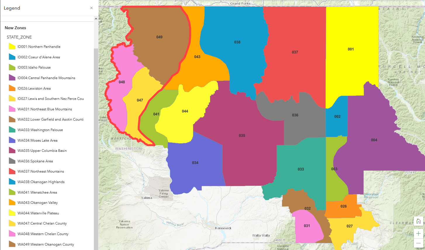
The National Weather Service Weather Forecast Office in Spokane, WA (WFO OTX) is proposing a boundary reconfiguration to the Washington East Slopes Cascades (WAZ042) Public Forecast Zone. This change would take the existing public zone boundary and create new zone section definitions within. Specifically, Chelan and western Okanogan counties will be highlighted in these new zones. New zone boundary areas WAZ047, WAZ048, WAZ049 will be created. The use of WAZ042 as a geographic zone code identifier would discontinue after this reconfiguration is implemented.
If you have any questions:
Please call Ron Miller (509-244-0110 x 222)
These changes are intended to enhance hazardous weather messaging for the complex terrain of the east slopes of the north Cascades in Chelan and western Okanogan counties of Washington. NWS Spokane, WA will be able to increase the specificity of the messaging provided for the areas to better communicate weather hazards with local partners.
WA Zone 047 (new) - Central Chelan County
WA Zone 048 (new) - Western Chelan County
WA Zone 049 (new) - Western Okanogan County
WA Zone 042 (DISCONTINUED)

US Dept of Commerce
National Oceanic and Atmospheric Administration
National Weather Service
Spokane, WA
2601 N Rambo Rd.
Spokane, WA 99224
509-244-0110
Comments? Questions? Please Contact Us.

