
Severe thunderstorms capable of damaging winds will be possible from the Ozark Plateau east into portions of the Southeast today. Rounds of heavy thunderstorms ahead of a slow moving front will continue locally heavy rainfall and scattered flash flooding potential from the Ozarks to the Ohio and Tennessee Valleys today. Read More >
Spokane, WA
Weather Forecast Office
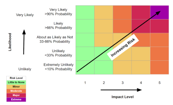
The Weather Risk Outlook colors are determined after NWS Spokane meteorologists examine both the impact level of potential weather scenarios AND the associated probability of those scenarios. The resulting outlook displays the highest risk for each day.
NWS Spokane meteorologists first use the impact table to determine the level of impact expected with a forecast weather event.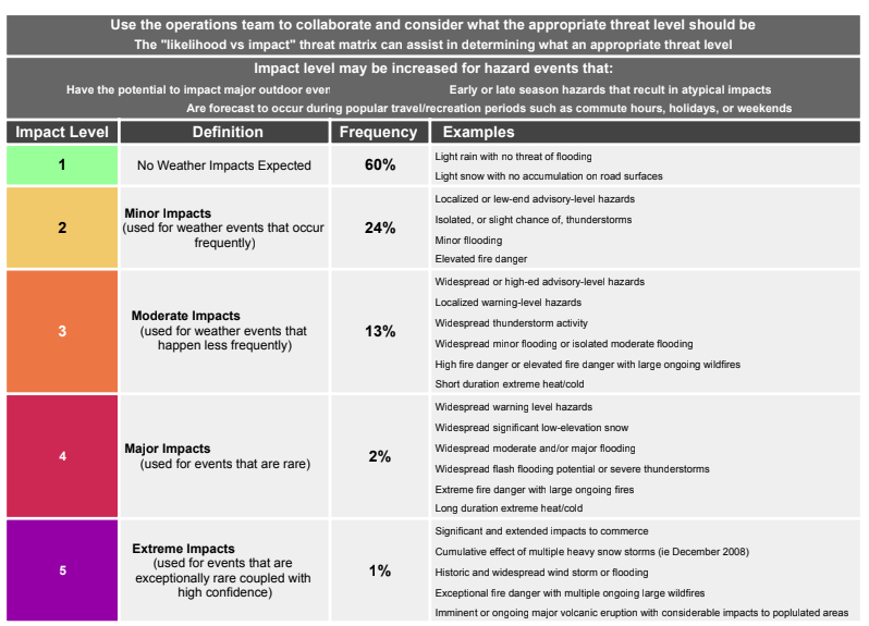
NWS Spokane meteorologists then determine the color by determining the probability of occurrence using all the available information and then reference the matrix to determine the risk level associated with the forecast weather event.
US Dept of Commerce
National Oceanic and Atmospheric Administration
National Weather Service
Spokane, WA
2601 N Rambo Rd.
Spokane, WA 99224
509-244-0110
Comments? Questions? Please Contact Us.

