
Numerous severe thunderstorms are expected across a broad region from the Ohio Valley to the Mid-Atlantic and Northeast States today into tonight. Swaths of damaging wind gusts are expected and some tornadoes are possible. Bertha is expected to bring tropical storm conditions to portions of the Gulf Coast from the Florida Panhandle westward to southeastern Louisiana later today and Wednesday. Read More >
Pacific ENSO Applications Climate Services
National Division
ENSO (+1) Years |
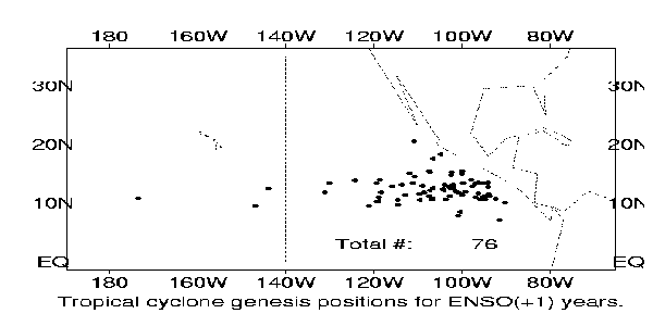
Tropical Cyclone Genesis Positions: ENSO (+1) Years |
 |
|
Tropical Cyclone Genesis Positions in the Eastern Pacific for ENSO (+1) years (1973, 77, 83, 87, 93). The number in the figure denotes total number of storms in the five years.
|
Tropical Cyclone Tracks: ENSO (+1) Years |
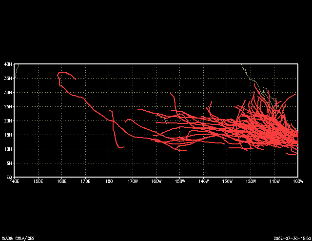 |
| Tropical Cyclone Tracks in the Eastern Pacific for ENSO (+1) years (1973, 77, 83, 87, 93, 98). In the six years there were a total of 89 storms. |
US Dept of Commerce
National Oceanic and Atmospheric Administration
National Weather Service
Pacific ENSO Applications Climate Services
Pacific ENSO Applications Climate Services
2525 Correa Rd. HIG room 340
Honolulu, HI 96822
8089562324
Comments? Questions? Please Contact Us.

