
Dangerous and extreme heat will remain across portions of the central U.S. this week, persisting across the mid to lower Mississippi Valley, Gulf Coast, southern Plains and portions of Texas. A heat wave over the Southwest U.S. will peak this weekend. Heavy to excessive rainfall may produce flash flooding from the Delmarva Peninsula north into the Hudson Valley today and tonight. Read More >
Pacific ENSO Applications Climate Services
National Division
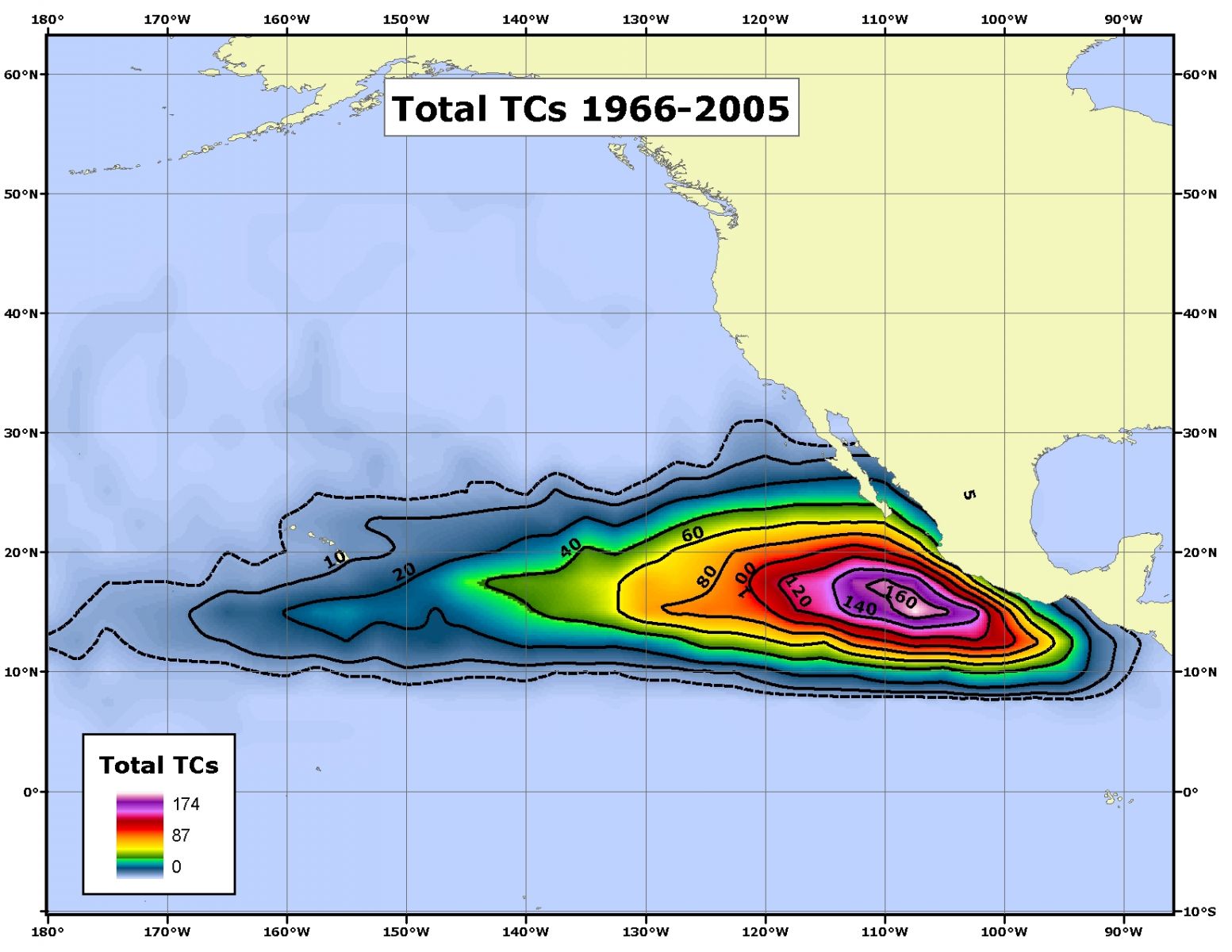
Contour plot of all TC's to occur within each 2.5� x 2.5� latitude-longitude gridbox throughout 1966-2005.
US Dept of Commerce
National Oceanic and Atmospheric Administration
National Weather Service
Pacific ENSO Applications Climate Services
Pacific ENSO Applications Climate Services
2525 Correa Rd. HIG room 340
Honolulu, HI 96822
8089562324
Comments? Questions? Please Contact Us.

