
A heat wave over the Southwest will intensify this week, peaking and expanding into the Intermountain West and northern High Plains this weekend. Critical to extremely critical fire weather conditions are forecast from the Northwest and the northern Great Basin this weekend. Particularly Dangerous Situation Red Flag Warnings have been issued. Read More >
Philadelphia/Mt Holly
Weather Forecast Office
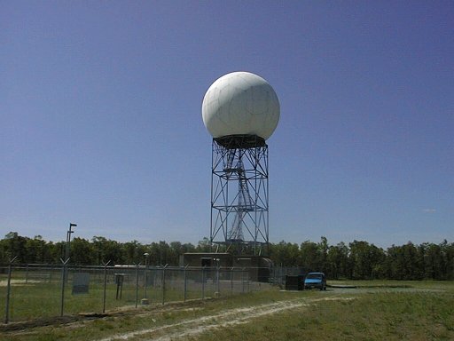
View the latest radar images from the WSR-88D at Fort Dix, NJ, which provides full coverage of the NWS Mount Holly forecast area.
US Dept of Commerce
National Oceanic and Atmospheric Administration
National Weather Service
Philadelphia/Mt Holly
732 Woodlane Rd.
Mount Holly, NJ 08060
609-261-6600
Comments? Questions? Please Contact Us.


 Coastal Flood
 Marine Forecasts
 Text Products
 Climate Information
 Skywarn
 Submit Storm Report
 Weather Event Archives
 Forecast Discussion
 Emergency Managers
 Briefing Page