
A strong atmospheric river moving into northern California later today will bring a threat for moderate to heavy rainfall and flooding, gusty to high winds, and mountain snows for parts of the Northwest U.S. through Wednesday. Gusty winds and isolated showers are expected today in the Northeast U.S. behind a cold front. Wind Advisories have been issued. Read More >
 |
NWS Mt Holly Weather Briefing PageClick HERE for the Latest Hazardous Weather Briefing Suggestions for improvement are welcome. |
 |
|
Fire Weather Outlooks and Parameters
|
|
 |
|||||||||||||||||||||||||
Updated 18 June 2020
No valid fire weather discussion is available at this time.
Fire Weather Message NWS PHI
WWUS81 KPHI 020043
RFWPHI

URGENT - FIRE WEATHER MESSAGE
National Weather Service Mount Holly NJ
743 PM EST Sat Mar 1 2025


DEZ001>004-MDZ012-015-019-020-020145-
/O.EXP.KPHI.FW.W.0001.000000T0000Z-250302T0100Z/
New Castle-Kent-Inland Sussex-Delaware Beaches-Kent MD-
Queen Annes-Talbot-Caroline-
743 PM EST Sat Mar 1 2025

...RED FLAG WARNING WILL EXPIRE AT 8 PM EST THIS EVENING FOR
GUSTY WINDS AND LOW RELATIVE HUMIDITY FOR DELAWARE AND THE UPPER
EASTERN SHORE OF MARYLAND...

Relative humidity levels are increasing as temperatures fall
across the area.

$$
Fire Weather Message NWS OKX
WWUS81 KOKX 121520
RFWOKX

URGENT - FIRE WEATHER MESSAGE
National Weather Service New York NY
1020 AM EST Tue Nov 12 2024

CTZ005>012-122300-
/O.CON.KOKX.FW.W.0007.000000T0000Z-241112T2300Z/
Northern Fairfield-Northern New Haven-Northern Middlesex-
Northern New London-Southern Fairfield-Southern New Haven-
Southern Middlesex-Southern New London-
1020 AM EST Tue Nov 12 2024

...RED FLAG WARNING REMAINS IN EFFECT UNTIL 6 PM EST THIS EVENING
FOR SOUTHERN CONNECTICUT...

* AFFECTED AREA...Northern Fairfield, Northern New Haven,
  Northern Middlesex, Northern New London, Southern Fairfield,
  Southern New Haven, Southern Middlesex and Southern New London.

* TIMING...Until 6 PM EST this evening.

* WINDS...Northwest 15 to 20 mph with gusts up to 35 mph.
  Occasional gusts to 40 mph possible.

* RELATIVE HUMIDITY...As low as mid 20 percent range.

* TEMPERATURES...Highs in the mid 50s.

* LIGHTNING...None.

* IMPACTS...Rapid fire spread if ignition occurs. Outdoor burning
  is not recommended.

PRECAUTIONARY/PREPAREDNESS ACTIONS...

A Red Flag Warning means that critical fire weather conditions
are expected or occurring. A combination of strong winds, low
relative humidity, and dry fuels will create a significantly
elevated fire growth potential.

&&

$$

NYZ211>213-122300-
/O.CON.KOKX.FW.W.0007.000000T0000Z-241112T2300Z/
Lower Hudson Valley-New York City-Long Island-
1020 AM EST Tue Nov 12 2024

...RED FLAG WARNING REMAINS IN EFFECT UNTIL 6 PM EST THIS EVENING
FOR THE LOWER HUDSON VALLEY, NEW YORK CITY,
AND LONG ISLAND...

* AFFECTED AREA...Lower Hudson Valley, New York City and Long
  Island.

* TIMING...Until 6 PM EST this evening.

* WINDS...Northwest 15 to 25 mph with gusts up to 35 mph.
  Occasional gusts to 40 mph possible.

* RELATIVE HUMIDITY...As low as mid 20 percent range.

* TEMPERATURES...Highs in the mid 50s.

* LIGHTNING...None.

* IMPACTS...Rapid fire spread if ignition occurs. Outdoor burning
  is not recommended.
PRECAUTIONARY/PREPAREDNESS ACTIONS...

A Red Flag Warning means that critical fire weather conditions
are expected or occurring. A combination of strong winds, low
relative humidity, and dry fuels will create a significantly
elevated fire growth potential.

&&

$$

NJZ002-004-006-103>108-122300-
/O.CON.KOKX.FW.W.0007.000000T0000Z-241112T2300Z/
Western Passaic-Eastern Passaic-Hudson-Western Bergen-
Eastern Bergen-Western Essex-Eastern Essex-Western Union-
Eastern Union-
1020 AM EST Tue Nov 12 2024

...RED FLAG WARNING REMAINS IN EFFECT UNTIL 6 PM EST THIS EVENING
FOR NORTHEASTERN NEW JERSEY...

* AFFECTED AREA...Western Passaic, Eastern Passaic, Hudson,
  Western Bergen, Eastern Bergen, Western Essex, Eastern Essex,
  Western Union and Eastern Union.

* TIMING...Until 6 PM EST this evening.

* WINDS...Northwest 15 to 25 mph with gusts up to 35 mph.
  Occasional gusts to 40 mph possible.

* RELATIVE HUMIDITY...As low as mid 20 percent range.

* TEMPERATURES...Highs in the mid 50s.

* LIGHTNING...None.

* IMPACTS...Rapid fire spread if ignition occurs. Outdoor burning
  is not recommended.

PRECAUTIONARY/PREPAREDNESS ACTIONS...

A Red Flag Warning means that critical fire weather conditions
are expected or occurring. A combination of strong winds, low
relative humidity, and dry fuels will create a significantly
elevated fire growth potential.

&&

$$

For more information from the National Weather Service visit
http://weather.gov/nyc
Fire Weather Message NWS LWX
WWUS81 KLWX 262121
RFWLWX

URGENT - FIRE WEATHER MESSAGE
National Weather Service Baltimore MD/Washington DC
521 PM EDT Wed Mar 26 2025

DCZ001-MDZ003>006-011-502>508-VAZ025>031-036>040-050-051-053-054-
501-502-504>508-526-527-WVZ050>053-055-502-504-506-262300-
/O.CON.KLWX.FW.W.0003.000000T0000Z-250326T2300Z/
District of Columbia-Washington-Frederick MD-Carroll-
Northern Baltimore-Southern Baltimore-
Central and Eastern Allegany-Northwest Montgomery-
Central and Southeast Montgomery-Northwest Howard-
Central and Southeast Howard-Northwest Harford-Southeast Harford-
Augusta-Rockingham-Shenandoah-Frederick VA-Page-Warren-Clarke-
Nelson-Albemarle-Greene-Madison-Rappahannock-Orange-Culpeper-
Fairfax-Arlington/Falls Church/Alexandria-Northern Fauquier-
Southern Fauquier-Eastern Highland-Western Loudoun-
Eastern Loudoun-Northern Virginia Blue Ridge-
Central Virginia Blue Ridge-Northwest Prince William-
Central and Southeast Prince William/Manassas/Manassas Park-
Hampshire-Morgan-Berkeley-Jefferson-Hardy-Eastern Grant-
Eastern Mineral-Eastern Pendleton-
521 PM EDT Wed Mar 26 2025

...RED FLAG WARNING REMAINS IN EFFECT UNTIL 7 PM EDT THIS EVENING
FOR NORTHERN VIRGINIA, CENTRAL MARYLAND, AND WASHINGTON DC...

* TIMING...Until 7 PM EDT this evening.

* WINDS...Northwest 15 to 20 mph with gusts up to 35 mph.

* RELATIVE HUMIDITY...Around 15 to 30 percent, with the lowest
  values most likely in Virginia.

* IMPACTS...Any fire that develops will catch and spread
  quickly. Outdoor burning is not recommended.

* FUEL MOISTURE...Falling to less than 10 percent.

PRECAUTIONARY/PREPAREDNESS ACTIONS...

A Red Flag Warning means that critical fire weather conditions
are either occurring now, or will shortly. A combination of
strong winds, low relative humidity, and warm temperatures can
contribute to extreme fire behavior.

&&

$$

http://www.weather.gov/lwx/fire
Fire Weather Message NWS AKQ
WWUS81 KAKQ 011658
RFWAKQ

URGENT - FIRE WEATHER MESSAGE
National Weather Service Wakefield VA
1158 AM EST Sat Mar 1 2025

...DANGEROUS FIRE WEATHER CONDITIONS POSSIBLE TODAY...

.Gusty winds combined with low relative humidity, dry fuels, and
shifting winds will result in the potential for dangerous adverse
fire behavior today.

VAZ048-060>062-064>069-075>090-092-093-509>524-020100-
/O.EXT.KAKQ.FW.W.0001.000000T0000Z-250302T0100Z/
Fluvanna-Prince Edward-Cumberland-Goochland-Caroline-Mecklenburg-
Lunenburg-Nottoway-Amelia-Powhatan-Westmoreland-Richmond-
Northumberland-Lancaster-Brunswick-Dinwiddie-Prince George-
Charles City-New Kent-Gloucester-Middlesex-Mathews-Greensville-
Sussex-Surry-James City-Southampton-Isle of Wight-Western Louisa-
Eastern Louisa-Western Hanover-Eastern Hanover-
Western Chesterfield-
Eastern Chesterfield (Including Col. Heights)-
Western Henrico (Including the City of Richmond)-Eastern Henrico-
Western King William-Eastern King William-Western King and Queen-
Eastern King and Queen-Western Essex-Eastern Essex-York-
Newport News-
1158 AM EST Sat Mar 1 2025

...RED FLAG WARNING NOW IN EFFECT UNTIL 8 PM EST THIS EVENING FOR
PORTIONS OF CENTRAL AND EASTERN VIRGINIA...

* AFFECTED AREA...Central and eastern Virginia.

* TIMING...Through 8 PM EST this evening.

* WINDS...West-southwest winds 15 to 20 mph with gusts up to 35
  mph, shifting to northwest this evening.

* RELATIVE HUMIDITY...As low as 15 to 20 percent.

* TEMPERATURES...Upper 60s to lower 70s.

* LIGHTNING...None.

* IMPACTS...The combination of gusty winds and low humidity will
  create critical fire weather conditions. All outdoor burning
  is discouraged. Virginia residents are reminded that open
  burning is prohibited before 4 pm each day through April 30th.

PRECAUTIONARY/PREPAREDNESS ACTIONS...

A Red Flag Warning means that critical fire weather conditions
are either occurring now....or will shortly. A combination of
strong winds...low relative humidity...and warm temperatures can
contribute to extreme fire behavior.

&&

$$

MDZ021>024-020100-
/O.EXT.KAKQ.FW.W.0001.000000T0000Z-250302T0100Z/
Dorchester-Wicomico-Somerset-Inland Worcester-
1158 AM EST Sat Mar 1 2025

...RED FLAG WARNING NOW IN EFFECT UNTIL 8 PM EST THIS EVENING FOR
PORTIONS OF THE LOWER MARYLAND EASTERN SHORE...

* AFFECTED AREA...Lower Maryland Eastern Shore.

* TIMING...Through 8 PM EST this evening.

* WINDS...West to southwest winds 15 to 20 mph with gusts up to
  35 mph, shifting to northwest this evening.

* RELATIVE HUMIDITY...As low as 25 percent.

* TEMPERATURES...Mid to upper 60s.

* LIGHTNING...None.

* IMPACTS...The combination of gusty winds and low humidity will
  create critical fire weather conditions. All outdoor burning
  is discouraged.

PRECAUTIONARY/PREPAREDNESS ACTIONS...

A Red Flag Warning means that critical fire weather conditions
are either occurring now....or will shortly. A combination of
strong winds...low relative humidity...and warm temperatures can
contribute to extreme fire behavior.

&&

$$

NCZ012-013-030-020100-
/O.EXT.KAKQ.FW.W.0001.000000T0000Z-250302T0100Z/
Northampton-Hertford-Bertie-
1158 AM EST Sat Mar 1 2025

...RED FLAG WARNING NOW IN EFFECT UNTIL 8 PM EST THIS EVENING FOR
PORTIONS OF INTERIOR NORTHEAST NORTH CAROLINA...

* AFFECTED AREA...Northampton, Hertford, and Bertie Counties.

* TIMING...From 10 AM this morning to 7 PM EST this evening.

* WINDS...West-southwest to west 15 to 20 mph with gusts up to
  30 mph, shifting to northwest this evening.

* RELATIVE HUMIDITY...As low as 20 percent.

* TEMPERATURES...Low to mid 70s.

* LIGHTNING...None.

* IMPACTS...The combination of gusty winds and low humidity will
  create critical fire weather conditions. All outdoor burning
  is discouraged.

PRECAUTIONARY/PREPAREDNESS ACTIONS...

A Red Flag Warning means that critical fire weather conditions
are either occurring now....or will shortly. A combination of
strong winds...low relative humidity...and warm temperatures can
contribute to extreme fire behavior.

&&

$$
Fire Weather Message NWS CTP
WWUS81 KCTP 161512 CCA
RFWCTP

URGENT - FIRE WEATHER MESSAGE...CORRECTED
National Weather Service State College PA
1012 AM EST Sat Nov 16 2024

PAZ051>053-057>059-066-161600-
/O.COR.KCTP.FW.A.0003.000000T0000Z-241116T2300Z/
Montour-Northumberland-Columbia-Dauphin-Schuylkill-Lebanon-
Lancaster-
1012 AM EST Sat Nov 16 2024

...FIRE WEATHER WATCH IS CANCELLED FOR EAST CENTRAL PENNSYLVANIA...

The National Weather Service in State College has cancelled the
Fire Weather Watch.

Although critical fire weather conditions are no longer expected,
there is still an increased risk of wildfire spread and a Special
Weather Statement has been issued to discuss this risk.

$$
Fire Weather Message NWS BGM
WWUS81 KBGM 192334
RFWBGM

URGENT - FIRE WEATHER MESSAGE
National Weather Service Binghamton NY
734 PM EDT Wed Mar 19 2025


NYZ210-200045-
/O.CAN.KBGM.FW.W.0001.000000T0000Z-250320T0000Z/
Leatherstocking-
734 PM EDT Wed Mar 19 2025

...RED FLAG WARNING IS CANCELLED FOR FIRE WEATHER ZONE 210...

The National Weather Service in Binghamton has cancelled the Red
Flag Warning.

As temperatures gradually cool tonight, humidity levels will
continue to rise to around 50 to 60%. Winds will remain breezy
tonight with peak gusts exceeding 25 mph at times. As a reminder,
a burn ban remains in effect in New York through May 14th.

$$
Fire Weather Planning Forecast NWS PHI
FNUS51 KPHI 040906
FWFPHI
Fire Weather Planning Forecast
National Weather Service Mount Holly NJ
405 AM EST Tue Nov 4 2025
.DISCUSSION...
High pressure returns for today and tomorrow before another
cold front moves through Wednesday night. High pressure builds
back in for Thursday and Friday ahead of a sequence of quick-
moving low pressure systems that impact the region over the
weekend and into early next week.
PAZ054-042100-
Carbon-
Including the city of Jim Thorpe
405 AM EST Tue Nov 4 2025
Today Tonight Wed
Cloud Cover Clear Mclear Pcldy
Precip Type None None None
Chance Precip (%) 0 0 0
Chance of Thunder (%) 0 0 0
Max/Min Temp 57 34 62
Min/Max RH % 33 74 42
Wind 20ft/early(mph) NW 10 G29 W 4 SW 4 G20
Wind 20ft/late(mph) NW 9 G29 Lgt/Var SW 8 G23
Precip Amount 0.00 0.00 0.00
Precip Duration
Mixing Hgt(ft-agl/msl)5850 170 3170
Transport Wnd (mph) NW 31 W 9 SW 25
Vent Rate (mph-ft) 204520 10 93380
Dispersion 5 1 5
Max ADI Early 91 Good 6 Very Poor 63 Good
Max ADI Late 137 Very Good5 Very Poor 78 Good
Max LVORI Early 3 3 3
Max LVORI Late 2 3 2
Remarks...None.
.FORECAST FOR DAYS 3 THROUGH 7...
.WEDNESDAY NIGHT...Mostly cloudy with a chance of rain. Lows in
the upper 30s. Southwest winds around 15 mph.
.THURSDAY...Mostly sunny. Highs around 50. Northwest winds around
10 mph.
.THURSDAY NIGHT...Partly cloudy. Lows around 30. Light winds.
.FRIDAY...Mostly cloudy. Highs in the mid 50s. South winds around
10 mph.
.FRIDAY NIGHT...Rain. Not as cool. Lows in the mid 40s. South
winds around 10 mph.
.SATURDAY...Partly sunny. Highs in the upper 50s. Southwest winds
around 10 mph.
.SATURDAY NIGHT...Mostly cloudy. Lows in the upper 30s. West
winds around 5 mph.
.SUNDAY...Partly sunny with a chance of rain. Highs in the lower
50s. South winds around 5 mph.
.SUNDAY NIGHT...Mostly cloudy with a chance of rain. Lows in the
lower 30s. West winds around 5 mph.
.MONDAY...Partly sunny. Colder. Highs in the lower 40s. Northwest
winds around 10 mph.
$$
PAZ055-042100-
Monroe-
Including the city of Stroudsburg
405 AM EST Tue Nov 4 2025
Today Tonight Wed
Cloud Cover Clear Mclear Pcldy
Precip Type None None None
Chance Precip (%) 0 0 0
Chance of Thunder (%) 0 0 0
Max/Min Temp 58 32 61
Min/Max RH % 33 77 42
Wind 20ft/early(mph) W 11 G30 W 4 SW 4 G20
Wind 20ft/late(mph) W 10 G30 W 3 SW 9 G24
Precip Amount 0.00 0.00 0.00
Precip Duration
Mixing Hgt(ft-agl/msl)6250 200 3290
Transport Wnd (mph) NW 32 W 9 SW 28
Vent Rate (mph-ft) 219900 0 96300
Dispersion 5 1 5
Max ADI Early 92 Good 5 Very Poor 67 Good
Max ADI Late 134 Very Good5 Very Poor 87 Good
Max LVORI Early 3 3 3
Max LVORI Late 2 3 2
Remarks...None.
.FORECAST FOR DAYS 3 THROUGH 7...
.WEDNESDAY NIGHT...Mostly cloudy with a chance of rain. Lows in
the upper 30s. Southwest winds around 15 mph.
.THURSDAY...Mostly sunny. Highs in the upper 40s. Northwest winds
around 10 mph.
.THURSDAY NIGHT...Partly cloudy. Lows in the upper 20s. Light
winds.
.FRIDAY...Mostly cloudy. Highs in the mid 50s. South winds around
10 mph.
.FRIDAY NIGHT...Rain. Not as cool. Lows in the mid 40s. South
winds around 10 mph.
.SATURDAY...Partly sunny. Highs in the upper 50s. Southwest winds
around 10 mph.
.SATURDAY NIGHT...Partly cloudy. Lows in the upper 30s. Northwest
winds around 5 mph.
.SUNDAY...Mostly cloudy with a chance of rain. Highs in the lower
50s. South winds around 5 mph.
.SUNDAY NIGHT...Mostly cloudy with a chance of rain. Lows in the
lower 30s. West winds around 5 mph.
.MONDAY...Partly sunny. Colder. Highs in the lower 40s. Northwest
winds around 10 mph.
$$
PAZ062-042100-
Northampton-
Including the cities of Bethlehem and Easton
405 AM EST Tue Nov 4 2025
Today Tonight Wed
Cloud Cover Clear Mclear Pcldy
Precip Type None None None
Chance Precip (%) 0 0 0
Chance of Thunder (%) 0 0 0
Max/Min Temp 58 34 64
Min/Max RH % 33 80 41
Wind 20ft/early(mph) W 10 G25 W 4 SW 4
Wind 20ft/late(mph) W 10 G25 Lgt/Var SW 10 G22
Precip Amount 0.00 0.00 0.00
Precip Duration
Mixing Hgt(ft-agl/msl)6170 290 3540
Transport Wnd (mph) NW 30 W 8 SW 26
Vent Rate (mph-ft) 187020 60 99880
Dispersion 5 1 5
Max ADI Early 80 Good 5 Very Poor 60 Gen Good
Max ADI Late 109 Very Good4 Very Poor 91 Good
Max LVORI Early 3 3 4
Max LVORI Late 2 4 2
Remarks...None.
.FORECAST FOR DAYS 3 THROUGH 7...
.WEDNESDAY NIGHT...Partly cloudy. Lows in the lower 40s.
Southwest winds around 15 mph.
.THURSDAY...Mostly sunny. Highs in the mid 50s. Northwest winds
around 10 mph.
.THURSDAY NIGHT...Partly cloudy. Colder. Lows in the lower 30s.
Light winds.
.FRIDAY...Partly sunny. Highs in the upper 50s. South winds
around 10 mph.
.FRIDAY NIGHT...Rain. Not as cool. Lows in the upper 40s. South
winds around 10 mph.
.SATURDAY...Partly sunny. Highs in the lower 60s. Southwest winds
around 10 mph.
.SATURDAY NIGHT...Partly cloudy. Lows in the upper 30s. Northwest
winds around 5 mph.
.SUNDAY...Partly sunny with a chance of rain. Highs in the upper
50s. South winds around 5 mph.
.SUNDAY NIGHT...Mostly cloudy with a chance of rain. Lows in the
lower 30s. West winds around 5 mph.
.MONDAY...Partly sunny. Cooler. Highs in the mid 40s. Northwest
winds around 10 mph.
$$
PAZ061-042100-
Lehigh-
Including the city of Allentown
405 AM EST Tue Nov 4 2025
Today Tonight Wed
Cloud Cover Clear Mclear Pcldy
Precip Type None None None
Chance Precip (%) 0 0 0
Chance of Thunder (%) 0 0 0
Max/Min Temp 58 35 63
Min/Max RH % 33 77 41
Wind 20ft/early(mph) W 11 G25 W 5 SW 4 G17
Wind 20ft/late(mph) W 11 G25 Lgt/Var SW 10 G23
Precip Amount 0.00 0.00 0.00
Precip Duration
Mixing Hgt(ft-agl/msl)5820 290 3410
Transport Wnd (mph) NW 30 W 9 SW 26
Vent Rate (mph-ft) 181070 270 95520
Dispersion 5 1 5
Max ADI Early 78 Good 8 Poor 62 Good
Max ADI Late 115 Very Good4 Very Poor 80 Good
Max LVORI Early 3 3 3
Max LVORI Late 2 3 2
Remarks...None.
.FORECAST FOR DAYS 3 THROUGH 7...
.WEDNESDAY NIGHT...Partly cloudy. Lows in the lower 40s.
Southwest winds around 15 mph.
.THURSDAY...Sunny. Highs in the mid 50s. West winds around
10 mph.
.THURSDAY NIGHT...Mostly clear. Lows in the lower 30s. Light
winds.
.FRIDAY...Partly sunny. Highs in the upper 50s. South winds
around 10 mph.
.FRIDAY NIGHT...Rain. Not as cool. Lows in the upper 40s. South
winds around 10 mph.
.SATURDAY...Partly sunny. Highs in the lower 60s. Southwest winds
around 10 mph.
.SATURDAY NIGHT...Partly cloudy. Lows around 40. Northwest winds
around 5 mph.
.SUNDAY...Partly sunny with a chance of rain. Highs in the upper
50s. South winds around 10 mph.
.SUNDAY NIGHT...Mostly cloudy with a chance of rain. Lows in the
mid 30s. West winds around 10 mph.
.MONDAY...Mostly sunny. Cooler. Highs in the mid 40s. West winds
around 10 mph.
$$
PAZ060-042100-
Berks-
Including the city of Reading
405 AM EST Tue Nov 4 2025
Today Tonight Wed
Cloud Cover Clear Mclear Pcldy
Precip Type None None None
Chance Precip (%) 0 0 0
Chance of Thunder (%) 0 0 0
Max/Min Temp 60 36 66
Min/Max RH % 32 74 41
Wind 20ft/early(mph) W 11 G24 W 5 S 4 G18
Wind 20ft/late(mph) W 11 G25 Lgt/Var SW 11 G23
Precip Amount 0.00 0.00 0.00
Precip Duration
Mixing Hgt(ft-agl/msl)5800 220 3290
Transport Wnd (mph) NW 29 W 8 SW 25
Vent Rate (mph-ft) 174970 0 90220
Dispersion 5 1 5
Max ADI Early 73 Good 8 Poor 66 Good
Max ADI Late 107 Very Good4 Very Poor 80 Good
Max LVORI Early 3 3 3
Max LVORI Late 2 3 2
Remarks...None.
.FORECAST FOR DAYS 3 THROUGH 7...
.WEDNESDAY NIGHT...Partly cloudy. Lows in the lower 40s.
Southwest winds around 15 mph.
.THURSDAY...Sunny. Highs in the mid 50s. West winds around
10 mph.
.THURSDAY NIGHT...Mostly clear. Lows in the lower 30s. Light
winds.
.FRIDAY...Partly sunny. Highs in the upper 50s. South winds
around 15 mph.
.FRIDAY NIGHT...Rain, warmer. Lows around 50. South winds around
10 mph.
.SATURDAY...Mostly sunny. Highs in the lower 60s. Southwest winds
around 10 mph.
.SATURDAY NIGHT...Partly cloudy. Lows in the lower 40s. Northwest
winds around 5 mph.
.SUNDAY...Partly sunny with a chance of rain. Highs in the upper
50s. South winds around 10 mph.
.SUNDAY NIGHT...Mostly cloudy with a chance of rain. Lows in the
mid 30s. West winds around 10 mph.
.MONDAY...Mostly sunny. Cooler. Highs in the mid 40s. West winds
around 15 mph.
$$
PAZ101-042100-
Western Chester-
Including the cities of Honey Brook and Oxford
405 AM EST Tue Nov 4 2025
Today Tonight Wed
Cloud Cover Mclear Mclear Mclear
Precip Type None None None
Chance Precip (%) 0 0 0
Chance of Thunder (%) 0 0 0
Max/Min Temp 59 36 64
Min/Max RH % 33 72 43
Wind 20ft/early(mph) W 9 G24 W 4 S 5 G19
Wind 20ft/late(mph) W 9 G24 Lgt/Var SW 10 G23
Precip Amount 0.00 0.00 0.00
Precip Duration
Mixing Hgt(ft-agl/msl)5470 240 2650
Transport Wnd (mph) NW 28 W 9 SW 25
Vent Rate (mph-ft) 171810 30 79770
Dispersion 5 1 5
Max ADI Early 91 Good 6 Very Poor 65 Good
Max ADI Late 118 Very Good5 Very Poor 73 Good
Max LVORI Early 3 3 3
Max LVORI Late 2 3 2
Remarks...None.
.FORECAST FOR DAYS 3 THROUGH 7...
.WEDNESDAY NIGHT...Partly cloudy. Lows in the lower 40s.
Southwest winds around 10 mph.
.THURSDAY...Sunny. Highs in the mid 50s. West winds around
10 mph.
.THURSDAY NIGHT...Mostly clear. Lows in the mid 30s. Light winds.
.FRIDAY...Partly sunny. Highs in the upper 50s. South winds
around 10 mph.
.FRIDAY NIGHT...Rain, warmer. Lows in the lower 50s. South winds
around 10 mph.
.SATURDAY...Mostly sunny. Highs in the lower 60s. Southwest winds
around 10 mph.
.SATURDAY NIGHT...Partly cloudy. Lows in the lower 40s. Northwest
winds around 5 mph.
.SUNDAY...Partly sunny with a chance of rain. Highs in the upper
50s. South winds around 10 mph.
.SUNDAY NIGHT...Mostly cloudy with a chance of rain. Lows in the
mid 30s. West winds around 5 mph.
.MONDAY...Mostly sunny. Cooler. Highs in the mid 40s. West winds
around 10 mph.
$$
PAZ102-042100-
Eastern Chester-
Including the cities of West Chester and Kennett Square
405 AM EST Tue Nov 4 2025
Today Tonight Wed
Cloud Cover Clear Mclear Mclear
Precip Type None None None
Chance Precip (%) 0 0 0
Chance of Thunder (%) 0 0 0
Max/Min Temp 59 36 64
Min/Max RH % 33 73 45
Wind 20ft/early(mph) W 9 G22 W 4 S 5 G18
Wind 20ft/late(mph) W 9 G23 Lgt/Var SW 9 G22
Precip Amount 0.00 0.00 0.00
Precip Duration
Mixing Hgt(ft-agl/msl)5230 280 2490
Transport Wnd (mph) NW 28 W 9 SW 25
Vent Rate (mph-ft) 160020 1000 73230
Dispersion 5 1 5
Max ADI Early 89 Good 6 Very Poor 62 Good
Max ADI Late 114 Very Good5 Very Poor 69 Good
Max LVORI Early 3 3 3
Max LVORI Late 2 3 2
Remarks...None.
.FORECAST FOR DAYS 3 THROUGH 7...
.WEDNESDAY NIGHT...Partly cloudy. Lows in the lower 40s.
Southwest winds around 10 mph.
.THURSDAY...Sunny. Highs in the mid 50s. Northwest winds around
10 mph.
.THURSDAY NIGHT...Mostly clear. Lows in the mid 30s. Light winds.
.FRIDAY...Partly sunny. Highs in the upper 50s. South winds
around 10 mph.
.FRIDAY NIGHT...Rain, warmer. Lows in the lower 50s. South winds
around 10 mph.
.SATURDAY...Mostly sunny. Highs in the lower 60s. Southwest winds
around 10 mph.
.SATURDAY NIGHT...Partly cloudy. Lows in the lower 40s. Northwest
winds around 5 mph.
.SUNDAY...Partly sunny with a chance of rain. Highs in the upper
50s. South winds around 5 mph.
.SUNDAY NIGHT...Mostly cloudy with a chance of rain. Lows in the
mid 30s. West winds around 5 mph.
.MONDAY...Mostly sunny. Cooler. Highs in the upper 40s. West
winds around 10 mph.
$$
PAZ103-042100-
Western Montgomery-
Including the cities of Collegeville and Pottstown
405 AM EST Tue Nov 4 2025
Today Tonight Wed
Cloud Cover Clear Mclear Pcldy
Precip Type None None None
Chance Precip (%) 0 0 0
Chance of Thunder (%) 0 0 0
Max/Min Temp 60 35 65
Min/Max RH % 32 75 40
Wind 20ft/early(mph) W 10 G23 W 4 S 4 G17
Wind 20ft/late(mph) W 10 G23 Lgt/Var SW 10 G22
Precip Amount 0.00 0.00 0.00
Precip Duration
Mixing Hgt(ft-agl/msl)5640 350 3130
Transport Wnd (mph) NW 29 W 9 SW 25
Vent Rate (mph-ft) 174170 1930 86020
Dispersion 5 1 5
Max ADI Early 83 Good 5 Very Poor 64 Good
Max ADI Late 120 Very Good4 Very Poor 83 Good
Max LVORI Early 3 3 3
Max LVORI Late 2 3 2
Remarks...None.
.FORECAST FOR DAYS 3 THROUGH 7...
.WEDNESDAY NIGHT...Partly cloudy. Lows in the lower 40s. West
winds around 10 mph.
.THURSDAY...Sunny. Highs in the mid 50s. West winds around
10 mph.
.THURSDAY NIGHT...Mostly clear. Lows in the lower 30s. Light
winds.
.FRIDAY...Partly sunny. Highs around 60. South winds around
10 mph.
.FRIDAY NIGHT...Rain, warmer. Lows around 50. South winds around
10 mph.
.SATURDAY...Partly sunny. Highs in the lower 60s. Southwest winds
around 10 mph.
.SATURDAY NIGHT...Partly cloudy. Colder. Lows around 40. Light
winds.
.SUNDAY...Partly sunny with a chance of rain. Highs in the upper
50s. Southwest winds around 5 mph.
.SUNDAY NIGHT...Mostly cloudy with a chance of rain. Lows in the
mid 30s. West winds around 5 mph.
.MONDAY...Mostly sunny. Cooler. Highs in the upper 40s. West
winds around 10 mph.
$$
PAZ104-042100-
Eastern Montgomery-
Including the cities of Norristown and Lansdale
405 AM EST Tue Nov 4 2025
Today Tonight Wed
Cloud Cover Clear Mclear Mclear
Precip Type None None None
Chance Precip (%) 0 0 0
Chance of Thunder (%) 0 0 0
Max/Min Temp 59 36 65
Min/Max RH % 31 73 42
Wind 20ft/early(mph) W 9 G23 W 4 SW 5 G17
Wind 20ft/late(mph) W 9 G23 Lgt/Var SW 10 G23
Precip Amount 0.00 0.00 0.00
Precip Duration
Mixing Hgt(ft-agl/msl)5380 280 3030
Transport Wnd (mph) NW 28 W 9 SW 26
Vent Rate (mph-ft) 168010 1280 84700
Dispersion 5 1 5
Max ADI Early 98 Good 6 Very Poor 60 Gen Good
Max ADI Late 115 Very Good4 Very Poor 86 Good
Max LVORI Early 3 3 3
Max LVORI Late 2 3 2
Remarks...None.
.FORECAST FOR DAYS 3 THROUGH 7...
.WEDNESDAY NIGHT...Mostly clear. Lows in the lower 40s. Southwest
winds around 10 mph.
.THURSDAY...Sunny. Highs in the mid 50s. West winds around
10 mph.
.THURSDAY NIGHT...Mostly clear. Lows in the mid 30s. Light winds.
.FRIDAY...Partly sunny. Highs around 60. South winds around
10 mph.
.FRIDAY NIGHT...Rain, warmer. Lows in the lower 50s. South winds
around 10 mph.
.SATURDAY...Partly sunny. Highs in the lower 60s. Southwest winds
around 10 mph.
.SATURDAY NIGHT...Partly cloudy. Lows in the lower 40s. Northwest
winds around 5 mph.
.SUNDAY...Partly sunny with a chance of rain. Highs around 60.
South winds around 5 mph.
.SUNDAY NIGHT...Mostly cloudy with a chance of rain. Lows in the
upper 30s. West winds around 5 mph.
.MONDAY...Mostly sunny. Cooler. Highs in the upper 40s. West
winds around 10 mph.
$$
PAZ105-042100-
Upper Bucks-
Including the cities of Chalfont and Perkasie
405 AM EST Tue Nov 4 2025
Today Tonight Wed
Cloud Cover Clear Mclear Pcldy
Precip Type None None None
Chance Precip (%) 0 0 0
Chance of Thunder (%) 0 0 0
Max/Min Temp 58 36 63
Min/Max RH % 34 74 41
Wind 20ft/early(mph) W 10 G23 W 4 SW 4
Wind 20ft/late(mph) W 10 G24 Lgt/Var SW 9 G22
Precip Amount 0.00 0.00 0.00
Precip Duration
Mixing Hgt(ft-agl/msl)5710 250 3200
Transport Wnd (mph) NW 30 W 9 SW 26
Vent Rate (mph-ft) 181130 300 90860
Dispersion 5 1 5
Max ADI Early 77 Good 5 Very Poor 61 Good
Max ADI Late 128 Very Good5 Very Poor 85 Good
Max LVORI Early 3 3 3
Max LVORI Late 2 3 2
Remarks...None.
.FORECAST FOR DAYS 3 THROUGH 7...
.WEDNESDAY NIGHT...Partly cloudy. Lows in the lower 40s.
Southwest winds around 10 mph.
.THURSDAY...Sunny. Highs in the mid 50s. West winds around
10 mph.
.THURSDAY NIGHT...Mostly clear. Lows in the lower 30s. Light
winds.
.FRIDAY...Partly sunny. Highs in the upper 50s. South winds
around 10 mph.
.FRIDAY NIGHT...Rain, warmer. Lows around 50. South winds around
10 mph.
.SATURDAY...Partly sunny. Highs in the lower 60s. Southwest winds
around 10 mph.
.SATURDAY NIGHT...Partly cloudy. Colder. Lows around 40.
Northwest winds around 5 mph.
.SUNDAY...Partly sunny with a chance of rain. Highs in the upper
50s. South winds around 5 mph.
.SUNDAY NIGHT...Mostly cloudy with a chance of rain. Lows in the
mid 30s. West winds around 5 mph.
.MONDAY...Mostly sunny. Cooler. Highs in the mid 40s. West winds
around 10 mph.
$$
PAZ106-042100-
Lower Bucks-
Including the cities of Morrisville and Doylestown
405 AM EST Tue Nov 4 2025
Today Tonight Wed
Cloud Cover Clear Mclear Pcldy
Precip Type None None None
Chance Precip (%) 0 0 0
Chance of Thunder (%) 0 0 0
Max/Min Temp 60 36 66
Min/Max RH % 31 77 41
Wind 20ft/early(mph) W 9 G23 W 4 SW 4
Wind 20ft/late(mph) W 9 G23 Lgt/Var SW 10 G23
Precip Amount 0.00 0.00 0.00
Precip Duration
Mixing Hgt(ft-agl/msl)5430 350 3240
Transport Wnd (mph) NW 28 W 9 SW 28
Vent Rate (mph-ft) 172490 2440 96600
Dispersion 5 2 5
Max ADI Early 93 Good 6 Very Poor 61 Good
Max ADI Late 115 Very Good5 Very Poor 88 Good
Max LVORI Early 3 3 4
Max LVORI Late 2 3 2
Remarks...None.
.FORECAST FOR DAYS 3 THROUGH 7...
.WEDNESDAY NIGHT...Partly cloudy. Lows in the mid 40s. Southwest
winds around 10 mph.
.THURSDAY...Sunny. Highs in the mid 50s. West winds around
10 mph.
.THURSDAY NIGHT...Mostly clear. Colder. Lows in the lower 30s.
Light winds.
.FRIDAY...Partly sunny. Highs around 60. South winds around
10 mph.
.FRIDAY NIGHT...Rain, warmer. Lows in the lower 50s. South winds
around 10 mph.
.SATURDAY...Partly sunny. Highs in the mid 60s. Southwest winds
around 10 mph.
.SATURDAY NIGHT...Partly cloudy. Lows in the lower 40s. Northwest
winds around 5 mph.
.SUNDAY...Partly sunny with a chance of rain. Highs around 60.
Southwest winds around 5 mph.
.SUNDAY NIGHT...Mostly cloudy with a chance of rain. Lows in the
upper 30s. West winds around 5 mph.
.MONDAY...Mostly sunny. Cooler. Highs in the upper 40s. West
winds around 10 mph.
$$
PAZ071-042100-
Philadelphia-
Including the city of Philadelphia
405 AM EST Tue Nov 4 2025
Today Tonight Wed
Cloud Cover Clear Mclear Mclear
Precip Type None None None
Chance Precip (%) 0 0 0
Chance of Thunder (%) 0 0 0
Max/Min Temp 61 40 66
Min/Max RH % 31 74 42
Wind 20ft/early(mph) W 9 G22 W 5 SW 4
Wind 20ft/late(mph) W 9 G22 Lgt/Var SW 10 G23
Precip Amount 0.00 0.00 0.00
Precip Duration
Mixing Hgt(ft-agl/msl)5530 340 3070
Transport Wnd (mph) NW 26 W 9 SW 28
Vent Rate (mph-ft) 153480 2170 86880
Dispersion 5 1 5
Max ADI Early 97 Good 6 Very Poor 59 Gen Good
Max ADI Late 113 Very Good5 Very Poor 88 Good
Max LVORI Early 3 3 3
Max LVORI Late 2 3 1
Remarks...None.
.FORECAST FOR DAYS 3 THROUGH 7...
.WEDNESDAY NIGHT...Mostly clear. Lows in the mid 40s. West winds
around 10 mph.
.THURSDAY...Sunny. Highs in the upper 50s. Northwest winds around
10 mph.
.THURSDAY NIGHT...Mostly clear. Patchy frost. Lows in the mid
30s. Light winds.
.FRIDAY...Partly sunny. Highs in the lower 60s. South winds
around 10 mph.
.FRIDAY NIGHT...Rain, warmer. Lows in the lower 50s. South winds
around 10 mph.
.SATURDAY...Mostly sunny. Highs in the mid 60s. Southwest winds
around 10 mph.
.SATURDAY NIGHT...Partly cloudy. Lows in the mid 40s. West winds
around 5 mph.
.SUNDAY...Partly sunny with a chance of rain. Highs in the lower
60s. South winds around 5 mph.
.SUNDAY NIGHT...Mostly cloudy with a chance of rain. Lows in the
upper 30s. West winds around 5 mph.
.MONDAY...Mostly sunny. Cooler. Highs in the upper 40s. West
winds around 10 mph.
$$
PAZ070-042100-
Delaware-
Including the city of Media
405 AM EST Tue Nov 4 2025
Today Tonight Wed
Cloud Cover Clear Mclear Mclear
Precip Type None None None
Chance Precip (%) 0 0 0
Chance of Thunder (%) 0 0 0
Max/Min Temp 60 38 66
Min/Max RH % 31 73 43
Wind 20ft/early(mph) W 9 G22 W 5 SW 5 G17
Wind 20ft/late(mph) W 8 G22 W 3 SW 10 G23
Precip Amount 0.00 0.00 0.00
Precip Duration
Mixing Hgt(ft-agl/msl)5270 270 2910
Transport Wnd (mph) NW 25 SW 8 SW 28
Vent Rate (mph-ft) 139470 1690 82580
Dispersion 5 1 5
Max ADI Early 93 Good 6 Very Poor 62 Good
Max ADI Late 109 Very Good5 Very Poor 84 Good
Max LVORI Early 3 3 3
Max LVORI Late 2 3 2
Remarks...None.
.FORECAST FOR DAYS 3 THROUGH 7...
.WEDNESDAY NIGHT...Mostly clear. Lows in the mid 40s. Southwest
winds around 10 mph.
.THURSDAY...Sunny. Highs in the mid 50s. Northwest winds around
10 mph.
.THURSDAY NIGHT...Mostly clear. Patchy frost. Lows in the mid
30s. Light winds.
.FRIDAY...Partly sunny. Highs around 60. South winds around
10 mph.
.FRIDAY NIGHT...Rain, warmer. Lows in the lower 50s. South winds
around 10 mph.
.SATURDAY...Mostly sunny. Highs in the mid 60s. Southwest winds
around 10 mph.
.SATURDAY NIGHT...Mostly clear. Lows in the mid 40s. West winds
around 5 mph.
.SUNDAY...Partly sunny with a chance of rain. Highs in the lower
60s. South winds around 5 mph.
.SUNDAY NIGHT...Mostly cloudy with a chance of rain. Lows in the
upper 30s. West winds around 5 mph.
.MONDAY...Mostly sunny. Cooler. Highs in the upper 40s. West
winds around 10 mph.
$$
NJZ001-042100-
Sussex-
Including the city of Newton
405 AM EST Tue Nov 4 2025
Today Tonight Wed
Cloud Cover Clear Mclear Pcldy
Precip Type None None None
Chance Precip (%) 0 0 0
Chance of Thunder (%) 0 0 0
Max/Min Temp 58 33 61
Min/Max RH % 31 78 36
Wind 20ft/early(mph) NW 8 G27 Lgt/Var SW 4
Wind 20ft/late(mph) NW 8 G26 Lgt/Var SW 7 G22
Precip Amount 0.00 0.00 0.00
Precip Duration
Mixing Hgt(ft-agl/msl)6640 160 3440
Transport Wnd (mph) NW 32 W 8 SW 28
Vent Rate (mph-ft) 231050 0 109310
Dispersion 5 1 5
Max ADI Early 125 Very Good5 Very Poor 68 Good
Max ADI Late 152 Very Good4 Very Poor 94 Good
Max LVORI Early 3 3 4
Max LVORI Late 2 4 2
Remarks...None.
.FORECAST FOR DAYS 3 THROUGH 7...
.WEDNESDAY NIGHT...Mostly cloudy with a chance of rain. Lows in
the upper 30s. Southwest winds around 10 mph.
.THURSDAY...Mostly sunny. Highs in the lower 50s. Northwest winds
around 10 mph.
.THURSDAY NIGHT...Partly cloudy. Lows around 30. Light winds.
.FRIDAY...Mostly cloudy. Highs in the mid 50s. South winds around
5 mph.
.FRIDAY NIGHT...Rain. Not as cool. Lows in the upper 40s. South
winds around 5 mph.
.SATURDAY...Partly sunny. Highs around 60. Southwest winds around
5 mph.
.SATURDAY NIGHT...Partly cloudy. Lows in the upper 30s. Light
winds.
.SUNDAY...Mostly cloudy with a chance of rain. Highs in the mid
50s. Southwest winds around 5 mph.
.SUNDAY NIGHT...Mostly cloudy with a chance of rain. Lows in the
lower 30s. West winds around 5 mph.
.MONDAY...Mostly sunny. Highs in the mid 40s. West winds around
10 mph.
$$
NJZ007-042100-
Warren-
Including the city of Washington
405 AM EST Tue Nov 4 2025
Today Tonight Wed
Cloud Cover Clear Mclear Pcldy
Precip Type None None None
Chance Precip (%) 0 0 0
Chance of Thunder (%) 0 0 0
Max/Min Temp 59 34 63
Min/Max RH % 32 80 39
Wind 20ft/early(mph) W 7 G24 W 3 SW 3
Wind 20ft/late(mph) W 7 G24 Lgt/Var SW 7 G21
Precip Amount 0.00 0.00 0.00
Precip Duration
Mixing Hgt(ft-agl/msl)6340 230 3390
Transport Wnd (mph) NW 30 W 8 SW 26
Vent Rate (mph-ft) 198780 0 103240
Dispersion 5 1 5
Max ADI Early 113 Very Good5 Very Poor 63 Good
Max ADI Late 132 Very Good4 Very Poor 90 Good
Max LVORI Early 3 3 4
Max LVORI Late 2 4 2
Remarks...None.
.FORECAST FOR DAYS 3 THROUGH 7...
.WEDNESDAY NIGHT...Partly cloudy with a chance of rain. Lows
around 40. Southwest winds around 10 mph.
.THURSDAY...Mostly sunny. Highs in the lower 50s. Northwest winds
around 10 mph.
.THURSDAY NIGHT...Partly cloudy. Lows in the lower 30s. Light
winds.
.FRIDAY...Partly sunny. Highs in the upper 50s. South winds
around 5 mph.
.FRIDAY NIGHT...Rain. Not as cool. Lows in the upper 40s. South
winds around 5 mph.
.SATURDAY...Partly sunny. Highs in the lower 60s. Southwest winds
around 5 mph.
.SATURDAY NIGHT...Partly cloudy. Lows in the upper 30s. Light
winds.
.SUNDAY...Partly sunny with a chance of rain. Highs in the mid
50s. South winds around 5 mph.
.SUNDAY NIGHT...Mostly cloudy with a chance of rain. Lows in the
lower 30s. West winds around 5 mph.
.MONDAY...Partly sunny. Cooler. Highs in the mid 40s. Northwest
winds around 10 mph.
$$
NJZ008-042100-
Morris-
Including the city of Morristown
405 AM EST Tue Nov 4 2025
Today Tonight Wed
Cloud Cover Clear Mclear Pcldy
Precip Type None None None
Chance Precip (%) 0 0 0
Chance of Thunder (%) 0 0 0
Max/Min Temp 58 36 62
Min/Max RH % 32 77 41
Wind 20ft/early(mph) NW 9 G26 Lgt/Var SW 4
Wind 20ft/late(mph) NW 8 G26 Lgt/Var SW 7 G24
Precip Amount 0.00 0.00 0.00
Precip Duration
Mixing Hgt(ft-agl/msl)6450 200 3440
Transport Wnd (mph) NW 31 W 10 SW 28
Vent Rate (mph-ft) 222180 20 113620
Dispersion 5 1 5
Max ADI Early 119 Very Good5 Very Poor 63 Good
Max ADI Late 140 Very Good5 Very Poor 91 Good
Max LVORI Early 3 3 4
Max LVORI Late 2 3 2
Remarks...None.
.FORECAST FOR DAYS 3 THROUGH 7...
.WEDNESDAY NIGHT...Partly cloudy. Lows in the lower 40s.
Southwest winds around 10 mph.
.THURSDAY...Mostly sunny. Highs in the lower 50s. West winds
around 10 mph.
.THURSDAY NIGHT...Partly cloudy. Colder. Lows in the lower 30s.
Light winds.
.FRIDAY...Partly sunny. Highs in the mid 50s. South winds around
5 mph.
.FRIDAY NIGHT...Rain. Not as cool. Lows in the upper 40s. South
winds around 5 mph.
.SATURDAY...Partly sunny with a chance of rain. Highs in the
lower 60s. Southwest winds around 5 mph.
.SATURDAY NIGHT...Partly cloudy. Lows in the lower 40s. Light
winds.
.SUNDAY...Mostly cloudy with a chance of rain. Highs in the mid
50s. South winds around 5 mph.
.SUNDAY NIGHT...Mostly cloudy with a chance of rain. Lows in the
mid 30s. West winds around 5 mph.
.MONDAY...Mostly sunny. Cooler. Highs in the mid 40s. Northwest
winds around 10 mph.
$$
NJZ009-042100-
Hunterdon-
Including the city of Flemington
405 AM EST Tue Nov 4 2025
Today Tonight Wed
Cloud Cover Clear Mclear Pcldy
Precip Type None None None
Chance Precip (%) 0 0 0
Chance of Thunder (%) 0 0 0
Max/Min Temp 58 35 64
Min/Max RH % 34 78 41
Wind 20ft/early(mph) W 8 G24 W 3 SW 4
Wind 20ft/late(mph) W 8 G24 Lgt/Var SW 8 G21
Precip Amount 0.00 0.00 0.00
Precip Duration
Mixing Hgt(ft-agl/msl)5650 220 3240
Transport Wnd (mph) NW 28 W 9 SW 26
Vent Rate (mph-ft) 184330 40 98040
Dispersion 5 1 5
Max ADI Early 104 Very Good6 Very Poor 61 Good
Max ADI Late 118 Very Good5 Very Poor 85 Good
Max LVORI Early 3 3 4
Max LVORI Late 2 3 2
Remarks...None.
.FORECAST FOR DAYS 3 THROUGH 7...
.WEDNESDAY NIGHT...Partly cloudy. Lows in the lower 40s.
Southwest winds around 10 mph.
.THURSDAY...Sunny. Highs in the mid 50s. West winds around
10 mph.
.THURSDAY NIGHT...Mostly clear. Lows in the lower 30s. Light
winds.
.FRIDAY...Partly sunny. Highs in the upper 50s. South winds
around 5 mph.
.FRIDAY NIGHT...Rain. Not as cool. Lows in the upper 40s. South
winds around 5 mph.
.SATURDAY...Partly sunny. Highs in the lower 60s. Southwest winds
around 5 mph.
.SATURDAY NIGHT...Partly cloudy. Lows around 40. Light winds.
.SUNDAY...Partly sunny with a chance of rain. Highs in the upper
50s. South winds around 5 mph.
.SUNDAY NIGHT...Mostly cloudy with a chance of rain. Lows in the
mid 30s. West winds around 5 mph.
.MONDAY...Mostly sunny. Cooler. Highs in the upper 40s. Northwest
winds around 10 mph.
$$
NJZ010-042100-
Somerset-
Including the city of Somerville
405 AM EST Tue Nov 4 2025
Today Tonight Wed
Cloud Cover Clear Mclear Pcldy
Precip Type None None None
Chance Precip (%) 0 0 0
Chance of Thunder (%) 0 0 0
Max/Min Temp 60 34 64
Min/Max RH % 33 83 39
Wind 20ft/early(mph) W 8 G25 W 3 SW 4
Wind 20ft/late(mph) W 8 G25 Lgt/Var SW 8 G23
Precip Amount 0.00 0.00 0.00
Precip Duration
Mixing Hgt(ft-agl/msl)5680 300 3420
Transport Wnd (mph) NW 26 W 9 SW 28
Vent Rate (mph-ft) 175000 770 96600
Dispersion 5 1 5
Max ADI Early 105 Very Good6 Very Poor 65 Good
Max ADI Late 117 Very Good4 Very Poor 91 Good
Max LVORI Early 3 3 4
Max LVORI Late 2 4 2
Remarks...None.
.FORECAST FOR DAYS 3 THROUGH 7...
.WEDNESDAY NIGHT...Partly cloudy. Lows in the lower 40s.
Southwest winds around 10 mph.
.THURSDAY...Sunny. Highs in the mid 50s. West winds around
10 mph.
.THURSDAY NIGHT...Mostly clear. Colder. Lows in the lower 30s.
Light winds.
.FRIDAY...Partly sunny. Highs in the upper 50s. South winds
around 5 mph.
.FRIDAY NIGHT...Rain. Not as cool. Lows in the upper 40s. South
winds around 5 mph.
.SATURDAY...Partly sunny. Highs in the lower 60s. Southwest winds
around 5 mph.
.SATURDAY NIGHT...Partly cloudy. Lows in the lower 40s. Light
winds.
.SUNDAY...Partly sunny with a chance of rain. Highs in the upper
50s. South winds around 5 mph.
.SUNDAY NIGHT...Mostly cloudy with a chance of rain. Lows in the
mid 30s. West winds around 5 mph.
.MONDAY...Mostly sunny. Cooler. Highs in the upper 40s. Northwest
winds around 10 mph.
$$
NJZ012-042100-
Middlesex-
Including the city of New Brunswick
405 AM EST Tue Nov 4 2025
Today Tonight Wed
Cloud Cover Clear Mclear Pcldy
Precip Type None None None
Chance Precip (%) 0 0 0
Chance of Thunder (%) 0 0 0
Max/Min Temp 60 35 65
Min/Max RH % 32 82 39
Wind 20ft/early(mph) W 8 G24 W 3 SW 4
Wind 20ft/late(mph) W 8 G24 Lgt/Var SW 8 G23
Precip Amount 0.00 0.00 0.00
Precip Duration
Mixing Hgt(ft-agl/msl)5830 380 3630
Transport Wnd (mph) NW 28 W 10 SW 28
Vent Rate (mph-ft) 184360 2420 110600
Dispersion 5 2 5
Max ADI Early 106 Very Good6 Very Poor 62 Good
Max ADI Late 120 Very Good5 Very Poor 95 Good
Max LVORI Early 3 3 4
Max LVORI Late 2 4 2
Remarks...None.
.FORECAST FOR DAYS 3 THROUGH 7...
.WEDNESDAY NIGHT...Partly cloudy. Lows in the mid 40s. Southwest
winds around 10 mph.
.THURSDAY...Sunny. Highs in the mid 50s. West winds around
10 mph.
.THURSDAY NIGHT...Mostly clear. Colder. Lows in the lower 30s.
Light winds.
.FRIDAY...Partly sunny. Highs around 60. South winds around
5 mph.
.FRIDAY NIGHT...Mostly cloudy with rain likely. Warmer. Lows in
the lower 50s. South winds around 5 mph.
.SATURDAY...Partly sunny with a chance of rain. Highs in the mid
60s. Southwest winds around 5 mph.
.SATURDAY NIGHT...Partly cloudy. Lows in the lower 40s. West
winds around 5 mph.
.SUNDAY...Partly sunny with a chance of rain. Highs around 60.
South winds around 5 mph.
.SUNDAY NIGHT...Mostly cloudy with a chance of rain. Lows in the
upper 30s. West winds around 5 mph.
.MONDAY...Mostly sunny. Cooler. Highs in the upper 40s. West
winds around 10 mph.
$$
NJZ015-042100-
Mercer-
Including the city of Trenton
405 AM EST Tue Nov 4 2025
Today Tonight Wed
Cloud Cover Clear Mclear Pcldy
Precip Type None None None
Chance Precip (%) 0 0 0
Chance of Thunder (%) 0 0 0
Max/Min Temp 60 35 66
Min/Max RH % 32 82 39
Wind 20ft/early(mph) W 8 G23 W 4 SW 4
Wind 20ft/late(mph) W 8 G23 Lgt/Var SW 9 G21
Precip Amount 0.00 0.00 0.00
Precip Duration
Mixing Hgt(ft-agl/msl)5340 340 3400
Transport Wnd (mph) NW 26 W 9 SW 29
Vent Rate (mph-ft) 151280 1950 105160
Dispersion 5 1 5
Max ADI Early 104 Very Good6 Very Poor 71 Good
Max ADI Late 115 Very Good5 Very Poor 95 Good
Max LVORI Early 3 3 4
Max LVORI Late 2 4 2
Remarks...None.
.FORECAST FOR DAYS 3 THROUGH 7...
.WEDNESDAY NIGHT...Partly cloudy. Lows in the lower 40s.
Southwest winds around 10 mph.
.THURSDAY...Sunny. Highs in the mid 50s. West winds around
10 mph.
.THURSDAY NIGHT...Mostly clear. Colder. Lows in the lower 30s.
Light winds.
.FRIDAY...Partly sunny. Highs around 60. South winds around
10 mph.
.FRIDAY NIGHT...Rain, warmer. Lows in the lower 50s. South winds
around 5 mph.
.SATURDAY...Partly sunny. Highs in the mid 60s. Southwest winds
around 5 mph.
.SATURDAY NIGHT...Partly cloudy. Lows in the lower 40s. West
winds around 5 mph.
.SUNDAY...Partly sunny with a chance of rain. Highs in the lower
60s. South winds around 5 mph.
.SUNDAY NIGHT...Mostly cloudy with a chance of rain. Lows in the
mid 30s. West winds around 5 mph.
.MONDAY...Mostly sunny. Cooler. Highs in the upper 40s. West
winds around 10 mph.
$$
NJZ013-042100-
Western Monmouth-
Including the city of Freehold
405 AM EST Tue Nov 4 2025
Today Tonight Wed
Cloud Cover Clear Mclear Mclear
Precip Type None None None
Chance Precip (%) 0 0 0
Chance of Thunder (%) 0 0 0
Max/Min Temp 60 35 65
Min/Max RH % 33 80 40
Wind 20ft/early(mph) W 9 G24 W 4 G17 SW 4
Wind 20ft/late(mph) W 9 G24 W 3 SW 9 G22
Precip Amount 0.00 0.00 0.00
Precip Duration
Mixing Hgt(ft-agl/msl)5310 340 3680
Transport Wnd (mph) NW 28 W 15 SW 28
Vent Rate (mph-ft) 152820 3210 109850
Dispersion 5 2 5
Max ADI Early 103 Very Good7 Poor 61 Good
Max ADI Late 114 Very Good6 Very Poor 97 Good
Max LVORI Early 3 3 4
Max LVORI Late 2 3 2
Remarks...None.
.FORECAST FOR DAYS 3 THROUGH 7...
.WEDNESDAY NIGHT...Mostly clear. Lows in the mid 40s. Southwest
winds around 10 mph.
.THURSDAY...Sunny. Highs in the mid 50s. West winds around
10 mph.
.THURSDAY NIGHT...Mostly clear. Lows in the mid 30s. Light winds.
.FRIDAY...Partly sunny. Highs around 60. South winds around
10 mph.
.FRIDAY NIGHT...Mostly cloudy with rain likely. Warmer. Lows in
the lower 50s. South winds around 5 mph.
.SATURDAY...Partly sunny with a chance of rain. Highs in the mid
60s. Southwest winds around 5 mph.
.SATURDAY NIGHT...Partly cloudy. Lows in the mid 40s. West winds
around 5 mph.
.SUNDAY...Partly sunny with a chance of rain. Highs in the lower
60s. South winds around 5 mph.
.SUNDAY NIGHT...Mostly cloudy with a chance of rain. Lows in the
upper 30s. West winds around 5 mph.
.MONDAY...Mostly sunny. Cooler. Highs around 50. West winds
around 10 mph.
$$
NJZ014-042100-
Eastern Monmouth-
Including the city of Sandy Hook
405 AM EST Tue Nov 4 2025
Today Tonight Wed
Cloud Cover Clear Mclear Mclear
Precip Type None None None
Chance Precip (%) 0 0 0
Chance of Thunder (%) 0 0 0
Max/Min Temp 59 39 65
Min/Max RH % 35 75 47
Wind 20ft/early(mph) W 11 G29 W 5 G20 SW 6 G18
Wind 20ft/late(mph) W 10 G27 W 4 SW 12 G25
Precip Amount 0.00 0.00 0.00
Precip Duration
Mixing Hgt(ft-agl/msl)5080 380 3460
Transport Wnd (mph) NW 28 W 14 SW 29
Vent Rate (mph-ft) 149360 4030 104300
Dispersion 5 2 5
Max ADI Early 100 Good 9 Poor 53 Gen Good
Max ADI Late 117 Very Good7 Poor 92 Good
Max LVORI Early 2 3 3
Max LVORI Late 2 3 1
Remarks...None.
.FORECAST FOR DAYS 3 THROUGH 7...
.WEDNESDAY NIGHT...Mostly clear. Lows in the mid 40s. Southwest
winds around 10 mph.
.THURSDAY...Sunny. Highs in the mid 50s. Northwest winds around
10 mph.
.THURSDAY NIGHT...Mostly clear. Lows around 40. Northwest winds
around 5 mph.
.FRIDAY...Partly sunny. Highs in the lower 60s. South winds
around 10 mph.
.FRIDAY NIGHT...Mostly cloudy with rain likely. Warmer. Lows in
the mid 50s. South winds around 10 mph.
.SATURDAY...Partly sunny with a chance of rain. Highs in the
lower 60s. Southwest winds around 10 mph.
.SATURDAY NIGHT...Partly cloudy. Lows in the upper 40s. West
winds around 5 mph.
.SUNDAY...Partly sunny with a chance of rain. Highs around 60.
South winds around 10 mph.
.SUNDAY NIGHT...Mostly cloudy with a chance of rain. Lows in the
lower 40s. West winds around 5 mph.
.MONDAY...Mostly sunny. Cooler. Highs around 50. Northwest winds
around 10 mph.
$$
NJZ026-042100-
Coastal Ocean-
Including the city of Long Beach Island
405 AM EST Tue Nov 4 2025
Today Tonight Wed
Cloud Cover Clear Mclear Mclear
Precip Type None None None
Chance Precip (%) 0 0 0
Chance of Thunder (%) 0 0 0
Max/Min Temp 59 43 64
Min/Max RH % 38 72 54
Wind 20ft/early(mph) W 16 G27 W 10 G20 SW 10 G23
Wind 20ft/late(mph) W 15 G25 W 8 SW 19 G32
Precip Amount 0.00 0.00 0.00
Precip Duration
Mixing Hgt(ft-agl/msl)4870 380 3080
Transport Wnd (mph) NW 26 W 12 SW 32
Vent Rate (mph-ft) 134720 3530 105950
Dispersion 5 2 5
Max ADI Early 71 Good 16 Gen Poor 52 Gen Good
Max ADI Late 80 Good 12 Poor 73 Good
Max LVORI Early 2 2 3
Max LVORI Late 1 3 1
Remarks...None.
.FORECAST FOR DAYS 3 THROUGH 7...
.WEDNESDAY NIGHT...Breezy. Mostly clear. Lows in the upper 40s.
Southwest winds around 25 mph.
.THURSDAY...Sunny. Highs in the mid 50s. Northwest winds around
15 mph.
.THURSDAY NIGHT...Mostly clear. Lows in the lower 40s. Northwest
winds around 5 mph.
.FRIDAY...Partly sunny. Highs in the lower 60s. South winds
around 15 mph.
.FRIDAY NIGHT...Mostly cloudy with rain likely. Warmer. Lows in
the mid 50s. South winds around 20 mph.
.SATURDAY...Partly sunny with a chance of rain. Highs in the
lower 60s. Southwest winds around 15 mph.
.SATURDAY NIGHT...Partly cloudy. Lows around 50. West winds
around 10 mph.
.SUNDAY...Partly sunny with a chance of rain. Highs in the lower
60s. South winds around 15 mph.
.SUNDAY NIGHT...Mostly cloudy with a chance of rain. Lows in the
lower 40s. Southwest winds around 15 mph.
.MONDAY...Mostly sunny. Cooler. Highs around 50. Northwest winds
around 20 mph.
$$
NJZ020-042100-
Ocean-
Including the city of Jackson
405 AM EST Tue Nov 4 2025
Today Tonight Wed
Cloud Cover Clear Mclear Mclear
Precip Type None None None
Chance Precip (%) 0 0 0
Chance of Thunder (%) 0 0 0
Max/Min Temp 60 34 65
Min/Max RH % 32 78 41
Wind 20ft/early(mph) W 9 G24 W 4 G17 SW 5 G20
Wind 20ft/late(mph) W 9 G24 W 3 SW 11 G26
Precip Amount 0.00 0.00 0.00
Precip Duration
Mixing Hgt(ft-agl/msl)5070 370 3630
Transport Wnd (mph) NW 26 W 9 SW 29
Vent Rate (mph-ft) 141950 2540 110740
Dispersion 5 2 5
Max ADI Early 98 Good 6 Very Poor 66 Good
Max ADI Late 109 Very Good5 Very Poor 97 Good
Max LVORI Early 3 3 4
Max LVORI Late 2 3 1
Remarks...None.
.FORECAST FOR DAYS 3 THROUGH 7...
.WEDNESDAY NIGHT...Mostly clear. Lows in the lower 40s. Southwest
winds around 10 mph.
.THURSDAY...Sunny. Highs in the upper 50s. West winds around
10 mph.
.THURSDAY NIGHT...Mostly clear. Lows in the mid 30s. Light winds.
.FRIDAY...Partly sunny. Highs in the lower 60s. South winds
around 10 mph.
.FRIDAY NIGHT...Mostly cloudy with rain likely. Warmer. Lows in
the lower 50s. South winds around 10 mph.
.SATURDAY...Partly sunny with a chance of rain. Highs in the mid
60s. Southwest winds around 10 mph.
.SATURDAY NIGHT...Partly cloudy. Lows in the mid 40s. West winds
around 5 mph.
.SUNDAY...Partly sunny with a chance of rain. Highs in the lower
60s. South winds around 5 mph.
.SUNDAY NIGHT...Mostly cloudy with a chance of rain. Lows in the
upper 30s. West winds around 5 mph.
.MONDAY...Mostly sunny. Cooler. Highs around 50. Northwest winds
around 10 mph.
$$
NJZ027-042100-
Southeastern Burlington-
Including the city of Wharton State Forest
405 AM EST Tue Nov 4 2025
Today Tonight Wed
Cloud Cover Clear Mclear Mclear
Precip Type None None None
Chance Precip (%) 0 0 0
Chance of Thunder (%) 0 0 0
Max/Min Temp 60 36 66
Min/Max RH % 31 80 41
Wind 20ft/early(mph) W 8 G23 W 4 SW 4 G18
Wind 20ft/late(mph) W 8 G23 Lgt/Var SW 9 G24
Precip Amount 0.00 0.00 0.00
Precip Duration
Mixing Hgt(ft-agl/msl)5030 380 3550
Transport Wnd (mph) NW 26 W 9 SW 28
Vent Rate (mph-ft) 134000 2960 106740
Dispersion 5 2 5
Max ADI Early 94 Good 6 Very Poor 74 Good
Max ADI Late 109 Very Good5 Very Poor 96 Good
Max LVORI Early 3 3 4
Max LVORI Late 2 4 1
Remarks...None.
.FORECAST FOR DAYS 3 THROUGH 7...
.WEDNESDAY NIGHT...Mostly clear. Lows in the lower 40s. Southwest
winds around 10 mph.
.THURSDAY...Sunny. Highs in the upper 50s. Northwest winds around
10 mph.
.THURSDAY NIGHT...Mostly clear. Colder. Lows in the lower 30s.
Light winds.
.FRIDAY...Partly sunny. Highs in the lower 60s. South winds
around 10 mph.
.FRIDAY NIGHT...Mostly cloudy with rain likely. Warmer. Lows in
the lower 50s. South winds around 10 mph.
.SATURDAY...Mostly sunny with a chance of rain. Highs in the mid
60s. Southwest winds around 5 mph.
.SATURDAY NIGHT...Partly cloudy. Lows in the lower 40s. West
winds around 5 mph.
.SUNDAY...Partly sunny with a chance of rain. Highs in the lower
60s. South winds around 5 mph.
.SUNDAY NIGHT...Mostly cloudy with a chance of rain. Lows in the
upper 30s. West winds around 5 mph.
.MONDAY...Mostly sunny. Cooler. Highs around 50. West winds
around 10 mph.
$$
NJZ018-019-042100-
Camden-Northwestern Burlington-
Including the cities of Camden, Cherry Hill, Moorestown,
and Mount Holly
405 AM EST Tue Nov 4 2025
Today Tonight Wed
Cloud Cover Clear Clear Mclear
Precip Type None None None
Chance Precip (%) 0 0 0
Chance of Thunder (%) 0 0 0
Max/Min Temp 60 36 66
Min/Max RH % 31 80 40
Wind 20ft/early(mph) W 8 G22 W 4 SW 4 G17
Wind 20ft/late(mph) W 9 G22 Lgt/Var SW 10 G23
Precip Amount 0.00 0.00 0.00
Precip Duration
Mixing Hgt(ft-agl/msl)5410 370 3360
Transport Wnd (mph) NW 25 W 9 SW 28
Vent Rate (mph-ft) 148540 2910 98530
Dispersion 5 2 5
Max ADI Early 96 Good 6 Very Poor 69 Good
Max ADI Late 111 Very Good5 Very Poor 95 Good
Max LVORI Early 3 3 4
Max LVORI Late 2 3 1
Remarks...None.
.FORECAST FOR DAYS 3 THROUGH 7...
.WEDNESDAY NIGHT...Mostly clear. Lows in the mid 40s. Southwest
winds around 10 mph.
.THURSDAY...Sunny. Highs in the upper 50s. West winds around
10 mph.
.THURSDAY NIGHT...Mostly clear. Colder. Lows in the lower 30s.
Light winds.
.FRIDAY...Partly sunny. Highs in the lower 60s. South winds
around 10 mph.
.FRIDAY NIGHT...Mostly cloudy with rain likely. Warmer. Lows in
the lower 50s. South winds around 10 mph.
.SATURDAY...Mostly sunny. Highs in the mid 60s. Southwest winds
around 10 mph.
.SATURDAY NIGHT...Partly cloudy. Lows in the lower 40s. West
winds around 5 mph.
.SUNDAY...Partly sunny with a chance of rain. Highs in the lower
60s. South winds around 5 mph.
.SUNDAY NIGHT...Mostly cloudy with a chance of rain. Lows in the
upper 30s. West winds around 5 mph.
.MONDAY...Mostly sunny. Cooler. Highs in the upper 40s. West
winds around 10 mph.
$$
NJZ017-042100-
Gloucester-
Including the city of Glassboro
405 AM EST Tue Nov 4 2025
Today Tonight Wed
Cloud Cover Clear Clear Mclear
Precip Type None None None
Chance Precip (%) 0 0 0
Chance of Thunder (%) 0 0 0
Max/Min Temp 60 36 66
Min/Max RH % 32 82 43
Wind 20ft/early(mph) W 8 G22 W 4 S 4 G17
Wind 20ft/late(mph) W 8 G22 Lgt/Var SW 9 G22
Precip Amount 0.00 0.00 0.00
Precip Duration
Mixing Hgt(ft-agl/msl)5180 360 3030
Transport Wnd (mph) NW 25 SW 9 SW 29
Vent Rate (mph-ft) 134800 2910 93380
Dispersion 5 2 5
Max ADI Early 91 Good 6 Very Poor 71 Good
Max ADI Late 109 Very Good5 Very Poor 89 Good
Max LVORI Early 3 3 4
Max LVORI Late 2 4 2
Remarks...None.
.FORECAST FOR DAYS 3 THROUGH 7...
.WEDNESDAY NIGHT...Mostly clear. Lows in the mid 40s. Southwest
winds around 10 mph.
.THURSDAY...Sunny. Highs in the upper 50s. Northwest winds around
10 mph.
.THURSDAY NIGHT...Mostly clear. Patchy frost. Colder. Lows in the
mid 30s. Light winds.
.FRIDAY...Partly sunny. Highs in the lower 60s. South winds
around 10 mph.
.FRIDAY NIGHT...Mostly cloudy with rain likely. Warmer. Lows in
the lower 50s. South winds around 10 mph.
.SATURDAY...Mostly sunny. Highs in the mid 60s. Southwest winds
around 5 mph.
.SATURDAY NIGHT...Mostly clear. Lows in the mid 40s. West winds
around 5 mph.
.SUNDAY...Partly sunny with a chance of rain. Highs in the lower
60s. South winds around 5 mph.
.SUNDAY NIGHT...Mostly cloudy with a chance of rain. Lows in the
upper 30s. West winds around 5 mph.
.MONDAY...Mostly sunny. Cooler. Highs in the upper 40s. West
winds around 10 mph.
$$
NJZ016-042100-
Salem-
Including the city of Pennsville
405 AM EST Tue Nov 4 2025
Today Tonight Wed
Cloud Cover Clear Clear Mclear
Precip Type None None None
Chance Precip (%) 0 0 0
Chance of Thunder (%) 0 0 0
Max/Min Temp 61 36 67
Min/Max RH % 31 86 42
Wind 20ft/early(mph) W 8 G22 W 5 S 5 G17
Wind 20ft/late(mph) W 9 G22 Lgt/Var SW 10 G23
Precip Amount 0.00 0.00 0.00
Precip Duration
Mixing Hgt(ft-agl/msl)5030 370 2970
Transport Wnd (mph) NW 25 W 8 SW 28
Vent Rate (mph-ft) 129510 2540 89460
Dispersion 5 2 5
Max ADI Early 89 Good 6 Very Poor 73 Good
Max ADI Late 105 Very Good4 Very Poor 86 Good
Max LVORI Early 3 3 4
Max LVORI Late 2 4 2
Remarks...None.
.FORECAST FOR DAYS 3 THROUGH 7...
.WEDNESDAY NIGHT...Mostly clear. Lows in the mid 40s. Southwest
winds around 10 mph.
.THURSDAY...Sunny. Highs in the upper 50s. Northwest winds around
10 mph.
.THURSDAY NIGHT...Mostly clear. Patchy frost. Lows in the upper
30s. Light winds.
.FRIDAY...Partly sunny. Highs in the lower 60s. South winds
around 10 mph.
.FRIDAY NIGHT...Mostly cloudy with rain likely. Warmer. Lows in
the mid 50s. South winds around 10 mph.
.SATURDAY...Mostly sunny. Highs in the mid 60s. Southwest winds
around 10 mph.
.SATURDAY NIGHT...Mostly clear. Lows in the mid 40s. West winds
around 5 mph.
.SUNDAY...Partly sunny with a chance of rain. Highs in the lower
60s. South winds around 5 mph.
.SUNDAY NIGHT...Mostly cloudy with a chance of rain. Lows in the
upper 30s. West winds around 5 mph.
.MONDAY...Mostly sunny. Cooler. Highs around 50. West winds
around 10 mph.
$$
NJZ021-042100-
Cumberland-
Including the city of Millville
405 AM EST Tue Nov 4 2025
Today Tonight Wed
Cloud Cover Clear Clear Mclear
Precip Type None None None
Chance Precip (%) 0 0 0
Chance of Thunder (%) 0 0 0
Max/Min Temp 60 36 67
Min/Max RH % 32 89 43
Wind 20ft/early(mph) W 9 G23 W 4 SW 5 G19
Wind 20ft/late(mph) W 9 G23 Lgt/Var SW 11 G26
Precip Amount 0.00 0.00 0.00
Precip Duration
Mixing Hgt(ft-agl/msl)4880 370 3070
Transport Wnd (mph) NW 25 W 8 SW 28
Vent Rate (mph-ft) 129130 2720 91790
Dispersion 5 2 5
Max ADI Early 84 Good 6 Very Poor 75 Good
Max ADI Late 103 Very Good5 Very Poor 90 Good
Max LVORI Early 3 3 5
Max LVORI Late 2 5 2
Remarks...None.
.FORECAST FOR DAYS 3 THROUGH 7...
.WEDNESDAY NIGHT...Mostly clear. Lows in the mid 40s. Southwest
winds around 10 mph.
.THURSDAY...Sunny. Highs in the upper 50s. Northwest winds around
10 mph.
.THURSDAY NIGHT...Mostly clear. Patchy frost. Lows in the mid
30s. Light winds.
.FRIDAY...Mostly sunny. Highs in the lower 60s. South winds
around 10 mph.
.FRIDAY NIGHT...Mostly cloudy with rain likely. Warmer. Lows in
the lower 50s. South winds around 10 mph.
.SATURDAY...Mostly sunny. Highs in the mid 60s. Southwest winds
around 10 mph.
.SATURDAY NIGHT...Mostly clear. Lows in the mid 40s. West winds
around 5 mph.
.SUNDAY...Partly sunny with a chance of rain. Highs in the lower
60s. South winds around 5 mph.
.SUNDAY NIGHT...Mostly cloudy with a chance of rain. Lows in the
upper 30s. West winds around 5 mph.
.MONDAY...Mostly sunny. Cooler. Highs in the lower 50s. West
winds around 10 mph.
$$
NJZ022-042100-
Atlantic-
Including the city of Hammonton
405 AM EST Tue Nov 4 2025
Today Tonight Wed
Cloud Cover Clear Clear Mclear
Precip Type None None None
Chance Precip (%) 0 0 0
Chance of Thunder (%) 0 0 0
Max/Min Temp 60 35 66
Min/Max RH % 32 83 42
Wind 20ft/early(mph) W 8 G23 W 3 SW 4 G20
Wind 20ft/late(mph) W 8 G22 Lgt/Var SW 10 G25
Precip Amount 0.00 0.00 0.00
Precip Duration
Mixing Hgt(ft-agl/msl)4880 380 3230
Transport Wnd (mph) NW 26 W 9 SW 29
Vent Rate (mph-ft) 132590 2950 104350
Dispersion 5 2 5
Max ADI Early 89 Good 6 Very Poor 76 Good
Max ADI Late 107 Very Good5 Very Poor 93 Good
Max LVORI Early 3 3 4
Max LVORI Late 2 4 2
Remarks...None.
.FORECAST FOR DAYS 3 THROUGH 7...
.WEDNESDAY NIGHT...Mostly clear. Lows in the mid 40s. Southwest
winds around 10 mph.
.THURSDAY...Sunny. Highs in the upper 50s. Northwest winds around
10 mph.
.THURSDAY NIGHT...Mostly clear. Patchy frost. Lows in the mid
30s. Light winds.
.FRIDAY...Partly sunny. Highs in the lower 60s. South winds
around 10 mph.
.FRIDAY NIGHT...Mostly cloudy with rain likely. Warmer. Lows in
the lower 50s. South winds around 10 mph.
.SATURDAY...Mostly sunny with a chance of rain. Highs in the mid
60s. Southwest winds around 5 mph.
.SATURDAY NIGHT...Mostly clear. Lows in the mid 40s. Light winds.
.SUNDAY...Partly sunny with a chance of rain. Highs in the lower
60s. South winds around 5 mph.
.SUNDAY NIGHT...Mostly cloudy with a chance of rain. Lows in the
upper 30s. West winds around 5 mph.
.MONDAY...Mostly sunny. Cooler. Highs in the lower 50s. West
winds around 10 mph.
$$
NJZ025-042100-
Coastal Atlantic-
Including the city of Atlantic City
405 AM EST Tue Nov 4 2025
Today Tonight Wed
Cloud Cover Clear Clear Mclear
Precip Type None None None
Chance Precip (%) 0 0 0
Chance of Thunder (%) 0 0 0
Max/Min Temp 60 43 64
Min/Max RH % 36 73 52
Wind 20ft/early(mph) W 13 G26 W 8 G19 SW 8 G23
Wind 20ft/late(mph) W 13 G25 W 6 SW 17 G31
Precip Amount 0.00 0.00 0.00
Precip Duration
Mixing Hgt(ft-agl/msl)4700 390 2990
Transport Wnd (mph) NW 26 W 10 SW 32
Vent Rate (mph-ft) 127010 3380 103320
Dispersion 5 2 5
Max ADI Early 69 Good 12 Poor 55 Gen Good
Max ADI Late 78 Good 9 Poor 72 Good
Max LVORI Early 3 2 3
Max LVORI Late 2 3 1
Remarks...None.
.FORECAST FOR DAYS 3 THROUGH 7...
.WEDNESDAY NIGHT...Mostly clear. Lows in the upper 40s. Southwest
winds around 15 mph.
.THURSDAY...Sunny. Highs in the upper 50s. Northwest winds around
15 mph.
.THURSDAY NIGHT...Mostly clear. Lows in the lower 40s. Northwest
winds around 5 mph.
.FRIDAY...Partly sunny. Highs in the lower 60s. South winds
around 15 mph.
.FRIDAY NIGHT...Mostly cloudy with rain likely. Warmer. Lows in
the upper 50s. South winds around 15 mph.
.SATURDAY...Partly sunny with a chance of rain. Highs in the mid
60s. Southwest winds around 15 mph.
.SATURDAY NIGHT...Mostly clear. Lows around 50. West winds around
5 mph.
.SUNDAY...Partly sunny with a chance of rain. Highs in the lower
60s. South winds around 10 mph.
.SUNDAY NIGHT...Mostly cloudy with a chance of rain. Lows in the
lower 40s. West winds around 15 mph.
.MONDAY...Mostly sunny. Cooler. Highs around 50. Northwest winds
around 15 mph.
$$
NJZ024-042100-
Atlantic Coastal Cape May-
Including the city of Ocean City
405 AM EST Tue Nov 4 2025
Today Tonight Wed
Cloud Cover Mclear Clear Mclear
Precip Type None None None
Chance Precip (%) 0 0 0
Chance of Thunder (%) 0 0 0
Max/Min Temp 60 44 65
Min/Max RH % 37 78 52
Wind 20ft/early(mph) NW 13 G29 W 7 G19 SW 8 G23
Wind 20ft/late(mph) W 13 G25 W 4 SW 15 G30
Precip Amount 0.00 0.00 0.00
Precip Duration
Mixing Hgt(ft-agl/msl)4410 360 2960
Transport Wnd (mph) NW 26 W 9 SW 30
Vent Rate (mph-ft) 125640 2950 93410
Dispersion 5 2 5
Max ADI Early 66 Good 11 Poor 57 Gen Good
Max ADI Late 73 Good 6 Very Poor 69 Good
Max LVORI Early 3 3 3
Max LVORI Late 2 3 1
Remarks...None.
.FORECAST FOR DAYS 3 THROUGH 7...
.WEDNESDAY NIGHT...Mostly clear. Lows in the upper 40s. Southwest
winds around 15 mph.
.THURSDAY...Sunny. Highs in the upper 50s. Northwest winds around
15 mph.
.THURSDAY NIGHT...Mostly clear. Lows in the mid 40s. Northwest
winds around 5 mph.
.FRIDAY...Mostly sunny. Highs in the lower 60s. South winds
around 10 mph.
.FRIDAY NIGHT...Mostly cloudy with rain likely. Warmer. Lows in
the mid 50s. South winds around 15 mph.
.SATURDAY...Mostly sunny. Highs in the mid 60s. Southwest winds
around 10 mph.
.SATURDAY NIGHT...Mostly clear. Lows around 50. West winds around
5 mph.
.SUNDAY...Partly sunny with a chance of rain. Highs in the lower
60s. South winds around 10 mph.
.SUNDAY NIGHT...Mostly cloudy with a chance of rain. Lows in the
lower 40s. West winds around 15 mph.
.MONDAY...Mostly sunny. Cooler. Highs in the lower 50s. Northwest
winds around 15 mph.
$$
NJZ023-042100-
Cape May-
Including the city of Cape May Court House
405 AM EST Tue Nov 4 2025
Today Tonight Wed
Cloud Cover Mclear Clear Mclear
Precip Type None None None
Chance Precip (%) 0 0 0
Chance of Thunder (%) 0 0 0
Max/Min Temp 60 38 66
Min/Max RH % 33 84 46
Wind 20ft/early(mph) NW 10 G26 W 4 G17 SW 6 G21
Wind 20ft/late(mph) W 9 G24 Lgt/Var SW 11 G26
Precip Amount 0.00 0.00 0.00
Precip Duration
Mixing Hgt(ft-agl/msl)4670 370 3150
Transport Wnd (mph) NW 26 SW 8 SW 30
Vent Rate (mph-ft) 125660 2750 94160
Dispersion 5 2 5
Max ADI Early 86 Good 6 Very Poor 77 Good
Max ADI Late 101 Very Good5 Very Poor 90 Good
Max LVORI Early 3 3 4
Max LVORI Late 2 4 2
Remarks...None.
.FORECAST FOR DAYS 3 THROUGH 7...
.WEDNESDAY NIGHT...Mostly clear. Lows in the mid 40s. Southwest
winds around 10 mph.
.THURSDAY...Sunny. Highs in the upper 50s. Northwest winds around
10 mph.
.THURSDAY NIGHT...Mostly clear. Lows around 40. Light winds.
.FRIDAY...Mostly sunny. Highs in the lower 60s. South winds
around 10 mph.
.FRIDAY NIGHT...Mostly cloudy with rain likely. Warmer. Lows in
the lower 50s. South winds around 10 mph.
.SATURDAY...Mostly sunny. Highs in the mid 60s. Southwest winds
around 10 mph.
.SATURDAY NIGHT...Mostly clear. Lows in the upper 40s. West winds
around 5 mph.
.SUNDAY...Partly sunny with a chance of rain. Highs in the mid
60s. South winds around 5 mph.
.SUNDAY NIGHT...Mostly cloudy with a chance of rain. Lows in the
upper 30s. West winds around 5 mph.
.MONDAY...Mostly sunny. Cooler. Highs in the lower 50s. Northwest
winds around 10 mph.
$$
DEZ001-042100-
New Castle-
Including the city of Wilmington
405 AM EST Tue Nov 4 2025
Today Tonight Wed
Cloud Cover Clear Mclear Mclear
Precip Type None None None
Chance Precip (%) 0 0 0
Chance of Thunder (%) 0 0 0
Max/Min Temp 60 38 66
Min/Max RH % 30 84 41
Wind 20ft/early(mph) W 8 G22 W 4 S 5 G17
Wind 20ft/late(mph) W 8 G22 Lgt/Var SW 10 G22
Precip Amount 0.00 0.00 0.00
Precip Duration
Mixing Hgt(ft-agl/msl)5070 340 2810
Transport Wnd (mph) NW 25 SW 8 SW 26
Vent Rate (mph-ft) 130780 1700 79980
Dispersion 5 1 5
Max ADI Early 87 Good 6 Very Poor 64 Good
Max ADI Late 105 Very Good4 Very Poor 78 Good
Max LVORI Early 3 3 4
Max LVORI Late 2 4 2
Remarks...None.
.FORECAST FOR DAYS 3 THROUGH 7...
.WEDNESDAY NIGHT...Mostly clear. Lows in the mid 40s. Southwest
winds around 10 mph.
.THURSDAY...Sunny. Highs in the upper 50s. Northwest winds around
10 mph.
.THURSDAY NIGHT...Mostly clear. Patchy frost. Lows in the upper
30s. Light winds.
.FRIDAY...Partly sunny. Highs in the lower 60s. South winds
around 10 mph.
.FRIDAY NIGHT...Mostly cloudy with rain likely. Warmer. Lows in
the lower 50s. South winds around 10 mph.
.SATURDAY...Mostly sunny. Highs in the mid 60s. Southwest winds
around 10 mph.
.SATURDAY NIGHT...Mostly clear. Lows in the mid 40s. West winds
around 5 mph.
.SUNDAY...Partly sunny with a chance of rain. Highs in the lower
60s. South winds around 5 mph.
.SUNDAY NIGHT...Mostly cloudy with a chance of rain. Lows in the
upper 30s. West winds around 5 mph.
.MONDAY...Mostly sunny. Cooler. Highs in the upper 40s. West
winds around 10 mph.
$$
DEZ002-042100-
Kent-
Including the city of Dover
405 AM EST Tue Nov 4 2025
Today Tonight Wed
Cloud Cover Mclear Clear Mclear
Precip Type None None None
Chance Precip (%) 0 0 0
Chance of Thunder (%) 0 0 0
Max/Min Temp 61 38 67
Min/Max RH % 31 85 39
Wind 20ft/early(mph) W 8 G22 W 4 S 6 G19
Wind 20ft/late(mph) W 9 G22 SW 3 SW 11 G26
Precip Amount 0.00 0.00 0.00
Precip Duration
Mixing Hgt(ft-agl/msl)4630 380 2940
Transport Wnd (mph) NW 24 SW 9 SW 29
Vent Rate (mph-ft) 135190 2950 90450
Dispersion 5 2 5
Max ADI Early 83 Good 6 Very Poor 70 Good
Max ADI Late 96 Good 4 Very Poor 87 Good
Max LVORI Early 3 3 4
Max LVORI Late 2 4 2
Remarks...None.
.FORECAST FOR DAYS 3 THROUGH 7...
.WEDNESDAY NIGHT...Mostly clear. Lows in the mid 40s. Southwest
winds around 10 mph.
.THURSDAY...Sunny. Highs in the upper 50s. Northwest winds around
10 mph.
.THURSDAY NIGHT...Mostly clear. Lows in the upper 30s. Light
winds.
.FRIDAY...Mostly sunny. Highs in the lower 60s. South winds
around 10 mph.
.FRIDAY NIGHT...Mostly cloudy with rain likely. Warmer. Lows in
the mid 50s. South winds around 10 mph.
.SATURDAY...Mostly sunny. Highs in the upper 60s. Southwest winds
around 10 mph.
.SATURDAY NIGHT...Mostly clear. Lows in the mid 40s. West winds
around 5 mph.
.SUNDAY...Partly sunny with a chance of rain. Highs in the mid
60s. South winds around 10 mph.
.SUNDAY NIGHT...Mostly cloudy with a chance of rain. Lows in the
upper 30s. West winds around 5 mph.
.MONDAY...Mostly sunny. Cooler. Highs in the lower 50s. West
winds around 10 mph.
$$
DEZ003-042100-
Inland Sussex-
Including the city of Georgetown
405 AM EST Tue Nov 4 2025
Today Tonight Wed
Cloud Cover Mclear Clear Mclear
Precip Type None None None
Chance Precip (%) 0 0 0
Chance of Thunder (%) 0 0 0
Max/Min Temp 61 37 67
Min/Max RH % 31 89 39
Wind 20ft/early(mph) NW 9 G22 W 4 S 6 G21
Wind 20ft/late(mph) W 9 G22 Lgt/Var SW 13 G27
Precip Amount 0.00 0.00 0.00
Precip Duration
Mixing Hgt(ft-agl/msl)3940 380 3070
Transport Wnd (mph) NW 23 SW 8 SW 31
Vent Rate (mph-ft) 100260 2950 102420
Dispersion 5 2 5
Max ADI Early 79 Good 6 Very Poor 72 Good
Max ADI Late 83 Good 4 Very Poor 74 Good
Max LVORI Early 3 3 5
Max LVORI Late 2 5 2
Remarks...None.
.FORECAST FOR DAYS 3 THROUGH 7...
.WEDNESDAY NIGHT...Mostly clear. Lows in the mid 40s. Southwest
winds around 10 mph.
.THURSDAY...Sunny. Highs in the upper 50s. Northwest winds around
10 mph.
.THURSDAY NIGHT...Mostly clear. Lows in the upper 30s. Light
winds.
.FRIDAY...Mostly sunny. Highs in the mid 60s. South winds around
10 mph.
.FRIDAY NIGHT...Mostly cloudy with rain likely. Warmer. Lows in
the mid 50s. South winds around 10 mph.
.SATURDAY...Mostly sunny. Highs in the upper 60s. Southwest winds
around 10 mph.
.SATURDAY NIGHT...Mostly clear. Lows in the mid 40s. Northwest
winds around 5 mph.
.SUNDAY...Mostly sunny with a chance of rain. Highs in the mid
60s. South winds around 10 mph.
.SUNDAY NIGHT...Mostly cloudy with a chance of rain. Lows in the
upper 30s. West winds around 5 mph.
.MONDAY...Mostly sunny. Cooler. Highs in the lower 50s. Northwest
winds around 10 mph.
$$
DEZ004-042100-
Delaware Beaches-
Including the city of Rehoboth Beach
405 AM EST Tue Nov 4 2025
Today Tonight Wed
Cloud Cover Mclear Clear Mclear
Precip Type None None None
Chance Precip (%) 0 0 0
Chance of Thunder (%) 0 0 0
Max/Min Temp 60 42 67
Min/Max RH % 36 79 46
Wind 20ft/early(mph) NW 14 G25 W 6 G17 SW 9 G23
Wind 20ft/late(mph) W 13 G24 W 5 SW 18 G30
Precip Amount 0.00 0.00 0.00
Precip Duration
Mixing Hgt(ft-agl/msl)3930 340 2910
Transport Wnd (mph) NW 24 SW 9 SW 31
Vent Rate (mph-ft) 99610 2750 101550
Dispersion 5 2 5
Max ADI Early 65 Good 10 Poor 56 Gen Good
Max ADI Late 66 Good 5 Very Poor 70 Good
Max LVORI Early 3 3 4
Max LVORI Late 2 3 1
Remarks...None.
.FORECAST FOR DAYS 3 THROUGH 7...
.WEDNESDAY NIGHT...Mostly clear. Lows in the upper 40s. Southwest
winds around 20 mph.
.THURSDAY...Sunny. Highs in the upper 50s. Northwest winds around
15 mph.
.THURSDAY NIGHT...Mostly clear. Lows in the mid 40s. Northwest
winds around 5 mph.
.FRIDAY...Mostly sunny. Highs in the mid 60s. South winds around
15 mph.
.FRIDAY NIGHT...Mostly cloudy with rain likely. Warmer. Lows in
the mid 50s. South winds around 15 mph.
.SATURDAY...Mostly sunny. Highs in the mid 60s. Southwest winds
around 10 mph.
.SATURDAY NIGHT...Mostly clear. Lows around 50. Northwest winds
around 5 mph.
.SUNDAY...Mostly sunny with a chance of rain. Highs in the mid
60s. South winds around 10 mph.
.SUNDAY NIGHT...Mostly cloudy with a chance of rain. Lows in the
lower 40s. West winds around 15 mph.
.MONDAY...Mostly sunny. Cooler. Highs in the lower 50s. Northwest
winds around 15 mph.
$$
MDZ012-042100-
Kent MD-
Including the city of Chestertown
405 AM EST Tue Nov 4 2025
Today Tonight Wed
Cloud Cover Mclear Mclear Mclear
Precip Type None None None
Chance Precip (%) 0 0 0
Chance of Thunder (%) 0 0 0
Max/Min Temp 61 38 67
Min/Max RH % 32 88 45
Wind 20ft/early(mph) W 8 G21 W 4 S 6 G18
Wind 20ft/late(mph) W 8 G20 Lgt/Var SW 11 G22
Precip Amount 0.00 0.00 0.00
Precip Duration
Mixing Hgt(ft-agl/msl)4990 360 2320
Transport Wnd (mph) W 23 SW 8 SW 25
Vent Rate (mph-ft) 119180 2750 65900
Dispersion 5 2 5
Max ADI Early 81 Good 6 Very Poor 60 Gen Good
Max ADI Late 93 Good 4 Very Poor 65 Good
Max LVORI Early 3 3 5
Max LVORI Late 2 4 2
Remarks...None.
.FORECAST FOR DAYS 3 THROUGH 7...
.WEDNESDAY NIGHT...Mostly clear. Lows in the mid 40s. Southwest
winds around 10 mph.
.THURSDAY...Sunny. Highs in the upper 50s. Northwest winds around
10 mph.
.THURSDAY NIGHT...Mostly clear. Lows in the upper 30s. Light
winds.
.FRIDAY...Partly sunny. Highs in the lower 60s. South winds
around 10 mph.
.FRIDAY NIGHT...Mostly cloudy with rain likely. Warmer. Lows in
the mid 50s. South winds around 10 mph.
.SATURDAY...Mostly sunny. Highs in the mid 60s. Southwest winds
around 10 mph.
.SATURDAY NIGHT...Mostly clear. Lows in the mid 40s. Northwest
winds around 5 mph.
.SUNDAY...Partly sunny with a chance of rain. Highs in the lower
60s. South winds around 10 mph.
.SUNDAY NIGHT...Mostly cloudy with a chance of rain. Lows in the
upper 30s. West winds around 5 mph.
.MONDAY...Mostly sunny. Cooler. Highs around 50. West winds
around 10 mph.
$$
MDZ015-042100-
Queen Annes-
Including the city of Centreville
405 AM EST Tue Nov 4 2025
Today Tonight Wed
Cloud Cover Mclear Mclear Mclear
Precip Type None None None
Chance Precip (%) 0 0 0
Chance of Thunder (%) 0 0 0
Max/Min Temp 61 38 67
Min/Max RH % 31 90 43
Wind 20ft/early(mph) W 8 G21 W 3 S 6 G18
Wind 20ft/late(mph) W 8 G20 Lgt/Var SW 11 G22
Precip Amount 0.00 0.00 0.00
Precip Duration
Mixing Hgt(ft-agl/msl)4800 360 2430
Transport Wnd (mph) W 23 SW 9 SW 25
Vent Rate (mph-ft) 118880 2900 68110
Dispersion 5 2 5
Max ADI Early 76 Good 6 Very Poor 63 Good
Max ADI Late 90 Good 4 Very Poor 70 Good
Max LVORI Early 3 3 5
Max LVORI Late 2 5 2
Remarks...None.
.FORECAST FOR DAYS 3 THROUGH 7...
.WEDNESDAY NIGHT...Mostly clear. Lows in the upper 40s. Southwest
winds around 10 mph.
.THURSDAY...Sunny. Highs in the upper 50s. Northwest winds around
10 mph.
.THURSDAY NIGHT...Mostly clear. Patchy frost. Lows in the upper
30s. Light winds.
.FRIDAY...Partly sunny. Highs in the lower 60s. South winds
around 10 mph.
.FRIDAY NIGHT...Mostly cloudy with rain likely. Warmer. Lows in
the mid 50s. South winds around 10 mph.
.SATURDAY...Mostly sunny. Highs in the mid 60s. Southwest winds
around 5 mph.
.SATURDAY NIGHT...Mostly clear. Lows in the mid 40s. Northwest
winds around 5 mph.
.SUNDAY...Partly sunny with a chance of rain. Highs in the mid
60s. South winds around 5 mph.
.SUNDAY NIGHT...Mostly cloudy with a chance of rain. Lows around
40. West winds around 5 mph.
.MONDAY...Mostly sunny. Cooler. Highs around 50. Northwest winds
around 10 mph.
$$
MDZ020-042100-
Caroline-
Including the city of Denton
405 AM EST Tue Nov 4 2025
Today Tonight Wed
Cloud Cover Mclear Mclear Mclear
Precip Type None None None
Chance Precip (%) 0 0 0
Chance of Thunder (%) 0 0 0
Max/Min Temp 61 38 68
Min/Max RH % 30 89 42
Wind 20ft/early(mph) W 7 G21 W 3 S 5 G19
Wind 20ft/late(mph) W 8 G20 Lgt/Var SW 11 G24
Precip Amount 0.00 0.00 0.00
Precip Duration
Mixing Hgt(ft-agl/msl)4230 380 2720
Transport Wnd (mph) NW 22 SW 8 SW 28
Vent Rate (mph-ft) 110920 2540 86320
Dispersion 5 2 5
Max ADI Early 79 Good 5 Very Poor 68 Good
Max ADI Late 82 Good 4 Very Poor 80 Good
Max LVORI Early 3 3 5
Max LVORI Late 2 5 1
Remarks...None.
.FORECAST FOR DAYS 3 THROUGH 7...
.WEDNESDAY NIGHT...Mostly clear. Lows in the mid 40s. Southwest
winds around 10 mph.
.THURSDAY...Sunny. Highs in the upper 50s. Northwest winds around
10 mph.
.THURSDAY NIGHT...Mostly clear. Patchy frost. Colder. Lows in the
mid 30s. Light winds.
.FRIDAY...Mostly sunny. Highs in the lower 60s. South winds
around 10 mph.
.FRIDAY NIGHT...Mostly cloudy with rain likely. Warmer. Lows in
the mid 50s. South winds around 10 mph.
.SATURDAY...Mostly sunny. Highs in the upper 60s. Southwest winds
around 5 mph.
.SATURDAY NIGHT...Mostly clear. Lows in the mid 40s. Northwest
winds around 5 mph.
.SUNDAY...Mostly sunny with a chance of rain. Highs in the mid
60s. Southwest winds around 5 mph.
.SUNDAY NIGHT...Mostly cloudy with a chance of rain. Lows in the
upper 30s. West winds around 5 mph.
.MONDAY...Mostly sunny. Cooler. Highs in the lower 50s. Northwest
winds around 10 mph.
$$
MDZ019-042100-
Talbot-
Including the city of Easton
405 AM EST Tue Nov 4 2025
Today Tonight Wed
Cloud Cover Mclear Mclear Mclear
Precip Type None None None
Chance Precip (%) 0 0 0
Chance of Thunder (%) 0 0 0
Max/Min Temp 62 39 67
Min/Max RH % 31 90 44
Wind 20ft/early(mph) NW 8 G21 W 4 S 7 G19
Wind 20ft/late(mph) W 8 G20 Lgt/Var SW 12 G23
Precip Amount 0.00 0.00 0.00
Precip Duration
Mixing Hgt(ft-agl/msl)4060 380 2440
Transport Wnd (mph) NW 22 SW 7 SW 26
Vent Rate (mph-ft) 91180 2260 69520
Dispersion 5 1 5
Max ADI Early 72 Good 5 Very Poor 64 Good
Max ADI Late 80 Good 4 Very Poor 67 Good
Max LVORI Early 3 3 5
Max LVORI Late 2 5 2
Remarks...None.
.FORECAST FOR DAYS 3 THROUGH 7...
.WEDNESDAY NIGHT...Mostly clear. Lows in the upper 40s. Southwest
winds around 10 mph.
.THURSDAY...Sunny. Highs in the upper 50s. Northwest winds around
10 mph.
.THURSDAY NIGHT...Mostly clear. Lows around 40. Light winds.
.FRIDAY...Mostly sunny. Highs in the lower 60s. South winds
around 10 mph.
.FRIDAY NIGHT...Mostly cloudy with rain likely. Warmer. Lows in
the mid 50s. South winds around 10 mph.
.SATURDAY...Mostly sunny. Highs in the upper 60s. Southwest winds
around 10 mph.
.SATURDAY NIGHT...Mostly clear. Lows in the upper 40s. Northwest
winds around 5 mph.
.SUNDAY...Mostly sunny with a chance of rain. Highs in the mid
60s. South winds around 10 mph.
.SUNDAY NIGHT...Mostly cloudy with a chance of rain. Lows in the
lower 40s. West winds around 5 mph.
.MONDAY...Mostly sunny. Cooler. Highs in the lower 50s. Northwest
winds around 10 mph.
$$
.OUTLOOK 8 TO 14 DAYS...
Temperatures below normal. Precipitation near normal.
$$
Fire Weather Planning Forecast NWS OKX
FNUS51 KOKX 040638
FWFOKX
Fire Weather Planning Forecast for Southeastern New York
Northern New Jersey and Southern CT
National Weather Service New York NY
138 AM EST Tue Nov 4 2025
.DISCUSSION...
High pressure builds in today with a return to dry conditions
through Wednesday.
WNW today at 10 to around 20 mph. Gusts 25 to around 30 mph are
expected. Winds begin to diminish mid to late this afternoon.
Winds will be light Wednesday morning, then increase out of the
south to 10 to around 15 mph by the afternoon, with gusts 20 to 30
mph.
Minimum RH values will from 30% to 50% today and Wednesday.
NYZ212-050645-
New York City-
138 AM EST Tue Nov 4 2025
Today Tonight Wed
Cloud Cover Clear Mclear Pcldy
Precip Type None None None
Chance Precip (%) 0 0 0
Chance of Thunder (%) 0 0 0
Temp (24h trend) 59 (-1) 41 (-7) 63
RH % (24h trend) 33 (-26) 72 (-1) 41
Wind 20ft/early(mph) W 13-17 G30 W 6-10 G23 SW 5-9 G17
Wind 20ft/late(mph) NW 12-16 G30 W 4-8 G17 SW 11-15 G30
Precip Amount 0.00 0.00 0.00
Precip Duration
Precip Begin
Precip End
Mixing Hgt(ft-agl/msl)6510 350 3430
Transport Wnd (mph) NW 29 W 14 SW 26
Vent Rate (kt-ft) 162750 4200 78890
Max ADI Early 84 Good 10 Poor 12 Poor
Max ADI Late 94 Good 8 Poor 18 Gen Poor
Remarks...None.
$$
NYZ213-050645-
Long Island-
138 AM EST Tue Nov 4 2025
Today Tonight Wed
Cloud Cover Clear Mclear Pcldy
Precip Type None None None
Chance Precip (%) 0 0 0
Chance of Thunder (%) 0 0 0
Temp (24h trend) 58 (-2) 40 (-7) 63
RH % (24h trend) 38 (-24) 76 (-6) 47
Wind 20ft/early(mph) NW 16-20 G33 W 8-12 G25 SW 5-9 G19
Wind 20ft/late(mph) NW 14-18 G31 W 5-9 G18 SW 12-16 G32
Precip Amount 0.00 0.00 0.00
Precip Duration
Precip Begin
Precip End
Mixing Hgt(ft-agl/msl)5670 240 3380
Transport Wnd (mph) NW 32 NW 17 SW 29
Vent Rate (kt-ft) 158760 3600 84500
Max ADI Early 94 Good 19 Gen Poor 14 Gen Poor
Max ADI Late 98 Good 11 Poor 23 Fair
Remarks...None.
$$
NYZ211-050645-
Lower Hudson Valley-
138 AM EST Tue Nov 4 2025
Today Tonight Wed
Cloud Cover Mclear Mclear Pcldy
Precip Type None None None
Chance Precip (%) 0 0 0
Chance of Thunder (%) 0 0 0
Temp (24h trend) 57 (-1) 35 (-7) 61
RH % (24h trend) 35 (-21) 80 (+6) 40
Wind 20ft/early(mph) NW 11-15 G29 W 3-7 G21 Lgt/Var
Wind 20ft/late(mph) NW 10-14 G30 Lgt/Var SW 7-11 G25
Precip Amount 0.00 0.00 0.00
Precip Duration
Precip Begin
Precip End
Mixing Hgt(ft-agl/msl)6810 220 3370
Transport Wnd (mph) NW 32 W 8 SW 25
Vent Rate (kt-ft) 190680 1540 74140
Max ADI Early 96 Good 8 Poor 9 Poor
Max ADI Late 105 Very Good5 Very Poor 14 Gen Poor
Remarks...None.
$$
NJZ002-050645-
Western Passaic-
138 AM EST Tue Nov 4 2025
Today Tonight Wed
Cloud Cover Clear Mclear Pcldy
Precip Type None None None
Chance Precip (%) 0 0 0
Chance of Thunder (%) 0 0 0
Temp (24h trend) 57 (-1) 37 (-5) 61
RH % (24h trend) 35 (-23) 76 (+5) 42
Wind 20ft/early(mph) NW 8-12 G27 Lgt/Var Lgt/Var
Wind 20ft/late(mph) NW 7-11 G26 Lgt/Var SW 5-9 G24
Precip Amount 0.00 0.00 0.00
Precip Duration
Precip Begin
Precip End
Mixing Hgt(ft-agl/msl)6670 140 3440
Transport Wnd (mph) NW 33 W 10 SW 28
Vent Rate (kt-ft) 193430 1260 82560
Max ADI Early 115 Very Good6 Very Poor 9 Poor
Max ADI Late 135 Very Good6 Very Poor 14 Gen Poor
Remarks...None.
$$
NJZ004-050645-
Eastern Passaic-
138 AM EST Tue Nov 4 2025
Today Tonight Wed
Cloud Cover Clear Mclear Pcldy
Precip Type None None None
Chance Precip (%) 0 0 0
Chance of Thunder (%) 0 0 0
Temp (24h trend) 58 (-2) 37 (-7) 63
RH % (24h trend) 34 (-23) 76 (+8) 41
Wind 20ft/early(mph) W 10-14 G29 W 3-7 G21 Lgt/Var
Wind 20ft/late(mph) NW 9-13 G29 Lgt/Var SW 7-11 G27
Precip Amount 0.00 0.00 0.00
Precip Duration
Precip Begin
Precip End
Mixing Hgt(ft-agl/msl)6770 290 3550
Transport Wnd (mph) NW 31 W 10 SW 26
Vent Rate (kt-ft) 182790 2610 81650
Max ADI Early 107 Very Good8 Poor 8 Poor
Max ADI Late 100 Good 5 Very Poor 14 Gen Poor
Remarks...None.
$$
NJZ103-050645-
Western Bergen-
138 AM EST Tue Nov 4 2025
Today Tonight Wed
Cloud Cover Clear Mclear Pcldy
Precip Type None None None
Chance Precip (%) 0 0 0
Chance of Thunder (%) 0 0 0
Temp (24h trend) 59 (0) 37 (-7) 63
RH % (24h trend) 33 (-23) 76 (+7) 41
Wind 20ft/early(mph) W 9-13 G27 Lgt/Var Lgt/Var
Wind 20ft/late(mph) NW 8-12 G27 Lgt/Var SW 6-10 G26
Precip Amount 0.00 0.00 0.00
Precip Duration
Precip Begin
Precip End
Mixing Hgt(ft-agl/msl)6880 270 3530
Transport Wnd (mph) NW 32 W 10 SW 26
Vent Rate (kt-ft) 192640 2430 81190
Max ADI Early 109 Very Good8 Poor 8 Poor
Max ADI Late 133 Very Good5 Very Poor 14 Gen Poor
Remarks...None.
$$
NJZ104-050645-
Eastern Bergen-
138 AM EST Tue Nov 4 2025
Today Tonight Wed
Cloud Cover Clear Mclear Pcldy
Precip Type None None None
Chance Precip (%) 0 0 0
Chance of Thunder (%) 0 0 0
Temp (24h trend) 59 (-1) 39 (-7) 63
RH % (24h trend) 32 (-24) 75 (+6) 40
Wind 20ft/early(mph) W 10-14 G29 W 3-7 G21 Lgt/Var
Wind 20ft/late(mph) NW 10-14 G30 Lgt/Var SW 7-11 G27
Precip Amount 0.00 0.00 0.00
Precip Duration
Precip Begin
Precip End
Mixing Hgt(ft-agl/msl)6980 340 3610
Transport Wnd (mph) NW 30 W 9 SW 25
Vent Rate (kt-ft) 181480 2720 79420
Max ADI Early 88 Good 8 Poor 9 Poor
Max ADI Late 97 Good 5 Very Poor 16 Gen Poor
Remarks...None.
$$
NJZ105-050645-
Western Essex-
138 AM EST Tue Nov 4 2025
Today Tonight Wed
Cloud Cover Clear Mclear Pcldy
Precip Type None None None
Chance Precip (%) 0 0 0
Chance of Thunder (%) 0 0 0
Temp (24h trend) 58 (-1) 37 (-7) 63
RH % (24h trend) 32 (-26) 76 (+7) 39
Wind 20ft/early(mph) W 10-14 G29 W 3-7 G21 Lgt/Var
Wind 20ft/late(mph) NW 9-13 G30 Lgt/Var SW 8-12 G29
Precip Amount 0.00 0.00 0.00
Precip Duration
Precip Begin
Precip End
Mixing Hgt(ft-agl/msl)6640 180 3670
Transport Wnd (mph) NW 30 W 10 SW 26
Vent Rate (kt-ft) 172640 1620 84410
Max ADI Early 82 Good 8 Poor 11 Poor
Max ADI Late 97 Good 6 Very Poor 15 Gen Poor
Remarks...None.
$$
NJZ106-050645-
Eastern Essex-
138 AM EST Tue Nov 4 2025
Today Tonight Wed
Cloud Cover Clear Mclear Pcldy
Precip Type None None None
Chance Precip (%) 0 0 0
Chance of Thunder (%) 0 0 0
Temp (24h trend) 59 (-2) 41 (-5) 64
RH % (24h trend) 32 (-23) 71 (+3) 40
Wind 20ft/early(mph) W 11-15 G29 W 4-8 G21 Lgt/Var
Wind 20ft/late(mph) W 10-14 G29 Lgt/Var SW 8-12 G27
Precip Amount 0.00 0.00 0.00
Precip Duration
Precip Begin
Precip End
Mixing Hgt(ft-agl/msl)6770 400 3790
Transport Wnd (mph) NW 30 W 10 SW 26
Vent Rate (kt-ft) 176020 3600 87170
Max ADI Early 83 Good 8 Poor 12 Poor
Max ADI Late 97 Good 7 Poor 18 Gen Poor
Remarks...None.
$$
NJZ107-050645-
Western Union-
138 AM EST Tue Nov 4 2025
Today Tonight Wed
Cloud Cover Clear Mclear Pcldy
Precip Type None None None
Chance Precip (%) 0 0 0
Chance of Thunder (%) 0 0 0
Temp (24h trend) 59 (-1) 37 (-7) 64
RH % (24h trend) 33 (-26) 78 (+9) 40
Wind 20ft/early(mph) W 9-13 G27 Lgt/Var Lgt/Var
Wind 20ft/late(mph) NW 8-12 G27 Lgt/Var SW 7-11 G26
Precip Amount 0.00 0.00 0.00
Precip Duration
Precip Begin
Precip End
Mixing Hgt(ft-agl/msl)6310 310 3700
Transport Wnd (mph) NW 29 W 10 SW 26
Vent Rate (kt-ft) 157750 2790 85100
Max ADI Early 82 Good 8 Poor 10 Poor
Max ADI Late 117 Very Good6 Very Poor 15 Gen Poor
Remarks...None.
$$
NJZ108-050645-
Eastern Union-
138 AM EST Tue Nov 4 2025
Today Tonight Wed
Cloud Cover Clear Mclear Pcldy
Precip Type None None None
Chance Precip (%) 0 0 0
Chance of Thunder (%) 0 0 0
Temp (24h trend) 60 (-1) 40 (-6) 64
RH % (24h trend) 30 (-26) 76 (+10) 36
Wind 20ft/early(mph) W 10-14 G32 W 3-7 G23 Lgt/Var
Wind 20ft/late(mph) NW 9-13 G34 Lgt/Var SW 8-12 G31
Precip Amount 0.00 0.00 0.00
Precip Duration
Precip Begin
Precip End
Mixing Hgt(ft-agl/msl)6550 450 3820
Transport Wnd (mph) NW 30 W 10 SW 26
Vent Rate (kt-ft) 170300 4050 87860
Max ADI Early 83 Good 8 Poor 12 Poor
Max ADI Late 120 Very Good7 Poor 18 Gen Poor
Remarks...None.
$$
NJZ006-050645-
Hudson-
138 AM EST Tue Nov 4 2025
Today Tonight Wed
Cloud Cover Clear Mclear Pcldy
Precip Type None None None
Chance Precip (%) 0 0 0
Chance of Thunder (%) 0 0 0
Temp (24h trend) 59 (-1) 42 (-5) 63
RH % (24h trend) 31 (-25) 71 (+3) 38
Wind 20ft/early(mph) W 13-17 G30 W 5-9 G21 SW 4-8 G17
Wind 20ft/late(mph) NW 12-16 G30 W 3-7 SW 10-14 G30
Precip Amount 0.00 0.00 0.00
Precip Duration
Precip Begin
Precip End
Mixing Hgt(ft-agl/msl)6900 390 3830
Transport Wnd (mph) NW 30 W 9 SW 28
Vent Rate (kt-ft) 179400 3120 91920
Max ADI Early 84 Good 8 Poor 12 Poor
Max ADI Late 97 Good 7 Poor 17 Gen Poor
Remarks...None.
$$
CTZ005-050645-
Northern Fairfield-
138 AM EST Tue Nov 4 2025
Today Tonight Wed
Cloud Cover Mclear Mclear Pcldy
Precip Type None None None
Chance Precip (%) 0 0 0
Chance of Thunder (%) 0 0 0
Temp (24h trend) 57 (-2) 37 (-5) 59
RH % (24h trend) 42 (-14) 80 (+1) 46
Wind 20ft/early(mph) NW 13-17 G29 W 4-8 G19 Lgt/Var
Wind 20ft/late(mph) NW 11-15 G30 Lgt/Var S 7-11 G22
Precip Amount 0.00 0.00 0.00
Precip Duration
Precip Begin
Precip End
Mixing Hgt(ft-agl/msl)6020 260 3020
Transport Wnd (mph) NW 31 W 9 SW 23
Vent Rate (kt-ft) 162540 2080 60400
Max ADI Early 96 Good 8 Poor 9 Poor
Max ADI Late 102 Very Good5 Very Poor 14 Gen Poor
Remarks...None.
$$
CTZ009-050645-
Southern Fairfield-
138 AM EST Tue Nov 4 2025
Today Tonight Wed
Cloud Cover Clear Mclear Pcldy
Precip Type None None None
Chance Precip (%) 0 0 0
Chance of Thunder (%) 0 0 0
Temp (24h trend) 58 (-2) 38 (-7) 61
RH % (24h trend) 40 (-20) 76 (-2) 45
Wind 20ft/early(mph) W 13-17 G29 W 5-9 G21 SW 3-7
Wind 20ft/late(mph) NW 11-15 G27 W 3-7 SW 9-13 G26
Precip Amount 0.00 0.00 0.00
Precip Duration
Precip Begin
Precip End
Mixing Hgt(ft-agl/msl)5950 350 3120
Transport Wnd (mph) NW 31 W 13 SW 24
Vent Rate (kt-ft) 160650 3850 65520
Max ADI Early 95 Good 9 Poor 12 Poor
Max ADI Late 98 Good 8 Poor 15 Gen Poor
Remarks...None.
$$
CTZ006-050645-
Northern New Haven-
138 AM EST Tue Nov 4 2025
Today Tonight Wed
Cloud Cover Mclear Mclear Pcldy
Precip Type None None None
Chance Precip (%) 0 0 0
Chance of Thunder (%) 0 0 0
Temp (24h trend) 57 (-2) 36 (-6) 60
RH % (24h trend) 42 (-13) 79 (0) 46
Wind 20ft/early(mph) NW 13-17 G31 W 5-9 G21 SW 3-7
Wind 20ft/late(mph) NW 12-16 G31 Lgt/Var S 8-12 G25
Precip Amount 0.00 0.00 0.00
Precip Duration
Precip Begin
Precip End
Mixing Hgt(ft-agl/msl)6030 240 2980
Transport Wnd (mph) NW 30 W 9 SW 23
Vent Rate (kt-ft) 156780 1920 59600
Max ADI Early 93 Good 8 Poor 11 Poor
Max ADI Late 101 Very Good7 Poor 14 Gen Poor
Remarks...None.
$$
CTZ010-050645-
Southern New Haven-
138 AM EST Tue Nov 4 2025
Today Tonight Wed
Cloud Cover Mclear Mclear Pcldy
Precip Type None None None
Chance Precip (%) 0 0 0
Chance of Thunder (%) 0 0 0
Temp (24h trend) 58 (-2) 38 (-6) 61
RH % (24h trend) 41 (-20) 77 (-5) 48
Wind 20ft/early(mph) NW 13-17 G31 W 6-10 G23 SW 4-8 G17
Wind 20ft/late(mph) NW 12-16 G30 W 3-7 SW 10-14 G27
Precip Amount 0.00 0.00 0.00
Precip Duration
Precip Begin
Precip End
Mixing Hgt(ft-agl/msl)5710 350 3240
Transport Wnd (mph) NW 31 W 14 SW 24
Vent Rate (kt-ft) 154170 4200 68040
Max ADI Early 96 Good 10 Poor 12 Poor
Max ADI Late 97 Good 8 Poor 17 Gen Poor
Remarks...None.
$$
CTZ007-050645-
Northern Middlesex-
138 AM EST Tue Nov 4 2025
Today Tonight Wed
Cloud Cover Mclear Mclear Pcldy
Precip Type None None None
Chance Precip (%) 0 0 0
Chance of Thunder (%) 0 0 0
Temp (24h trend) 57 (-2) 37 (-5) 59
RH % (24h trend) 41 (-17) 79 (-2) 48
Wind 20ft/early(mph) NW 14-18 G33 W 5-9 G24 Lgt/Var
Wind 20ft/late(mph) NW 13-17 G34 Lgt/Var S 9-13 G25
Precip Amount 0.00 0.00 0.00
Precip Duration
Precip Begin
Precip End
Mixing Hgt(ft-agl/msl)5780 230 3160
Transport Wnd (mph) NW 32 W 9 SW 23
Vent Rate (kt-ft) 161840 1840 63200
Max ADI Early 94 Good 10 Poor 10 Poor
Max ADI Late 106 Very Good6 Very Poor 15 Gen Poor
Remarks...None.
$$
CTZ011-050645-
Southern Middlesex-
138 AM EST Tue Nov 4 2025
Today Tonight Wed
Cloud Cover Clear Mclear Pcldy
Precip Type None None None
Chance Precip (%) 0 0 0
Chance of Thunder (%) 0 0 0
Temp (24h trend) 58 (-2) 39 (-5) 62
RH % (24h trend) 41 (-19) 76 (-6) 48
Wind 20ft/early(mph) NW 14-18 G33 W 6-10 G24 W 4-8 G17
Wind 20ft/late(mph) NW 13-17 G31 W 3-7 G18 SW 10-14 G29
Precip Amount 0.00 0.00 0.00
Precip Duration
Precip Begin
Precip End
Mixing Hgt(ft-agl/msl)5760 290 3470
Transport Wnd (mph) NW 33 W 16 SW 25
Vent Rate (kt-ft) 167040 4060 76340
Max ADI Early 98 Good 13 Gen Poor 13 Gen Poor
Max ADI Late 106 Very Good7 Poor 19 Gen Poor
Remarks...None.
$$
CTZ008-050645-
Northern New London-
138 AM EST Tue Nov 4 2025
Today Tonight Wed
Cloud Cover Clear Mclear Pcldy
Precip Type None None None
Chance Precip (%) 0 0 0
Chance of Thunder (%) 0 0 0
Temp (24h trend) 56 (-3) 36 (-5) 60
RH % (24h trend) 40 (-20) 81 (-1) 49
Wind 20ft/early(mph) NW 15-19 G34 W 6-10 G23 SW 3-7
Wind 20ft/late(mph) NW 14-18 G34 Lgt/Var SW 9-13 G26
Precip Amount 0.00 0.00 0.00
Precip Duration
Precip Begin
Precip End
Mixing Hgt(ft-agl/msl)5410 300 3310
Transport Wnd (mph) NW 36 W 9 SW 23
Vent Rate (kt-ft) 167710 2400 66200
Max ADI Early 97 Good 12 Poor 11 Poor
Max ADI Late 108 Very Good6 Very Poor 16 Gen Poor
Remarks...None.
$$
CTZ012-050645-
Southern New London-
138 AM EST Tue Nov 4 2025
Today Tonight Wed
Cloud Cover Clear Mclear Pcldy
Precip Type None None None
Chance Precip (%) 0 0 0
Chance of Thunder (%) 0 0 0
Temp (24h trend) 57 (-2) 38 (-5) 61
RH % (24h trend) 40 (-17) 78 (0) 49
Wind 20ft/early(mph) NW 14-18 G33 W 6-10 G24 W 4-8 G17
Wind 20ft/late(mph) NW 13-17 G32 W 3-7 G18 SW 10-14 G30
Precip Amount 0.00 0.00 0.00
Precip Duration
Precip Begin
Precip End
Mixing Hgt(ft-agl/msl)5510 360 3510
Transport Wnd (mph) NW 32 W 15 SW 24
Vent Rate (kt-ft) 154280 4680 73710
Max ADI Early 99 Good 15 Gen Poor 12 Poor
Max ADI Late 109 Very Good7 Poor 20 Gen Poor
Remarks...None.
$$
.FORECAST FOR DAYS 3 THROUGH 7...
.WEDNESDAY NIGHT AND THURSDAY...Windy. Partly cloudy. A chance of
rain. Lows in the lower 40s. Highs in the lower 50s. Northwest
winds 25 to 35 mph.
.THURSDAY NIGHT AND FRIDAY...Breezy. Partly cloudy. Lows in the
mid 30s. Highs in the upper 50s. South winds 15 to 25 mph.
.FRIDAY NIGHT AND SATURDAY...Breezy. Mostly cloudy. Rain likely.
Lows around 50. Highs in the lower 60s. West winds 15 to 25 mph.
.SATURDAY NIGHT AND SUNDAY...Mostly cloudy. A chance of rain.
Lows in the lower 40s. Highs in the upper 50s. South winds 10 to
15 mph.
.SUNDAY NIGHT AND MONDAY...Mostly cloudy. A chance of rain.
Cooler. Lows in the upper 30s. Highs in the upper 40s. Northwest
winds 15 to 20 mph.
.OUTLOOK 8 TO 14 DAYS...
Temperatures below normal. Precipitation near normal.
$$
Fire Weather Planning Forecast NWS LWX
FNUS51 KLWX 041753
FWFLWX
Fire Weather Planning Forecast FOR W and CTL MD...E WV...N VA...DC
National Weather Service Baltimore MD/Washington DC
1252 PM EST Tue Nov 4 2025
.DISCUSSION...
Dry high pressure will drop relative humidity values into the 20 to
35 percent range Tuesday afternoon with intermittent wind gusts
between 15 to 25 mph. Elevated fire weather conditions are possible
today given long term dryness.
A very dry air mass will move into the region as high pressure moves
directly overhead. A strong thermal belt is likely to develop over
the higher elevations, leading to very poor overnight recoveries on
Wednesday morning in the midslopes and on the ridgetops. Some sites
may not recover above 40 percent, and some guidance even shows
substantially lower recoveries. This dry air mixes down area-wide
during the afternoon, and will come with increased winds out of the
southwest. Wind gusts are expected to be around 20-30 mph, with
isolated gusts close to 40 on the ridges. This, paired with
afternoon RH values into the upper 20s to low 30s and increasingly
dry fuels could lead to a more notable threat for the spread of
wildfires on Wednesday.
Another day of low RH expected on Thursday, but winds will be on the
decrease throughout the day. So, the wind and RH may not line up at
the right time to yield a substantial threat for the spread of
wildfires.
A cold front will approach the region Friday before moving through
Friday night into Saturday. RH values increase ahead of this, and
wetting rains are becoming increasingly likely.
VAZ054-042100-
Arlington/Falls Church/Alexandria-
Including the cities of Arlington, Alexandria, and Falls Church
1252 PM EST Tue Nov 4 2025
Today Tonight Wed
Cloud Cover Mclear Mclear Mclear
Precip Type None None None
Chance Precip (%) 0 0 0
Chance of Thunder (%) 0 0 0
Temp (24h trend) 62 (-1) 41 (-4) 70
RH % (24h trend) 28 (-28) 66 (+7) 34
Wind 20ft/early(mph) W 9 G20 Lgt/Var S 9 G23
Wind 20ft/late(mph) W 10 G21 Lgt/Var SW 15 G32
Precip Amount 0.00 0.00 0.00
Precip Duration
Precip Begin
Precip End
Mixing Hgt(ft-agl/msl)5120 3140
Transport Wnd (mph) W 22 SW 29
Vent Rate (kt-ft) 97280 78500
Max ADI Early 71 Good 5 Very Poor 47 Gen Good
Max ADI Late 91 Good 4 Very Poor 71 Good
Max LVORI Early 2 2 3
Max LVORI Late 2 3 2
Remarks...None.
.FORECAST FOR DAYS 3 THROUGH 7...
.THURSDAY...Mostly clear. Lows in the mid 40s. Highs in the upper
50s. Northwest winds 10 to 15 mph.
.FRIDAY...Partly cloudy. Lows in the upper 30s. Highs in the
lower 60s. South winds 10 to 15 mph.
.SATURDAY...Mostly cloudy. Rain likely. Lows in the mid 50s.
Highs in the upper 60s. West winds 10 to 15 mph.
.SUNDAY...Partly cloudy. A chance of rain. Lows in the upper 40s.
Highs in the mid 60s. South winds 5 to 10 mph.
.MONDAY...Partly cloudy. A chance of rain. Cooler. Lows in the
lower 40s. Highs in the upper 40s. Northwest winds 10 to 15 mph.
$$
VAZ055-042100-
Stafford-
Including the city of Falmouth
1252 PM EST Tue Nov 4 2025
Today Tonight Wed
Cloud Cover Pcldy Mclear Mclear
Precip Type None None None
Chance Precip (%) 0 0 0
Chance of Thunder (%) 0 0 0
Temp (24h trend) 63 (-1) 37 (-4) 72
RH % (24h trend) 25 (-36) 73 (0) 33
Wind 20ft/early(mph) W 7 G17 Lgt/Var SW 9 G24
Wind 20ft/late(mph) W 8 G17 Lgt/Var SW 14 G32
Precip Amount 0.00 0.00 0.00
Precip Duration
Precip Begin
Precip End
Mixing Hgt(ft-agl/msl)4450 3260
Transport Wnd (mph) W 17 SW 30
Vent Rate (kt-ft) 66750 84760
Max ADI Early 62 Good 4 Very Poor 51 Gen Good
Max ADI Late 76 Good 4 Very Poor 74 Good
Max LVORI Early 3 3 3
Max LVORI Late 2 3 2
Remarks...None.
.FORECAST FOR DAYS 3 THROUGH 7...
.THURSDAY...Mostly clear. Lows in the mid 40s. Highs around 60.
Northwest winds 15 to 20 mph.
.FRIDAY...Partly cloudy. Lows in the mid 30s. Highs in the mid
60s. South winds 10 to 15 mph.
.SATURDAY...Mostly cloudy. Rain likely. Lows in the lower 50s.
Highs around 70. West winds 15 to 20 mph.
.SUNDAY...Partly cloudy. A chance of rain. Lows in the upper 40s.
Highs in the upper 60s. South winds 5 to 10 mph.
.MONDAY...Partly cloudy. A chance of rain. Cooler. Lows around
40. Highs around 50. Northwest winds 15 to 20 mph.
$$
VAZ056-042100-
Spotsylvania-
Including the city of Fredericksburg
1252 PM EST Tue Nov 4 2025
Today Tonight Wed
Cloud Cover Pcldy Mclear Mclear
Precip Type None None None
Chance Precip (%) 0 0 0
Chance of Thunder (%) 0 0 0
Temp (24h trend) 63 (0) 37 (-2) 71
RH % (24h trend) 26 (-34) 74 (-4) 34
Wind 20ft/early(mph) W 5 Lgt/Var SW 8 G24
Wind 20ft/late(mph) W 6 Lgt/Var SW 13 G28
Precip Amount 0.00 0.00 0.00
Precip Duration
Precip Begin
Precip End
Mixing Hgt(ft-agl/msl)4200 3330
Transport Wnd (mph) W 15 SW 30
Vent Rate (kt-ft) 54600 86580
Max ADI Early 57 Gen Good 3 Very Poor 56 Gen Good
Max ADI Late 73 Good 5 Very Poor 74 Good
Max LVORI Early 4 3 3
Max LVORI Late 2 3 2
Remarks...None.
.FORECAST FOR DAYS 3 THROUGH 7...
.THURSDAY...Mostly clear. Lows in the mid 40s. Highs around 60.
Northwest winds 10 to 15 mph.
.FRIDAY...Partly cloudy. Lows in the mid 30s. Highs in the mid
60s. South winds 10 to 15 mph.
.SATURDAY...Mostly cloudy. Rain likely. Lows in the lower 50s.
Highs around 70. West winds 5 to 10 mph.
.SUNDAY...Partly cloudy. A chance of rain. Lows in the mid 40s.
Highs in the upper 60s. Southwest winds 5 to 10 mph.
.MONDAY...Partly cloudy. A chance of rain. Cooler. Lows in the
upper 30s. Highs around 50. Northwest winds 10 to 15 mph.
$$
VAZ057-042100-
King George-
Including the city of Dahlgren
1252 PM EST Tue Nov 4 2025
Today Tonight Wed
Cloud Cover Pcldy Mclear Mclear
Precip Type None None None
Chance Precip (%) 0 0 0
Chance of Thunder (%) 0 0 0
Temp (24h trend) 62 (0) 38 (-5) 70
RH % (24h trend) 30 (-38) 77 (-9) 35
Wind 20ft/early(mph) W 7 Lgt/Var SW 9 G23
Wind 20ft/late(mph) W 8 Lgt/Var SW 15 G27
Precip Amount 0.00 0.00 0.00
Precip Duration
Precip Begin
Precip End
Mixing Hgt(ft-agl/msl)4020 3040
Transport Wnd (mph) W 16 SW 29
Vent Rate (kt-ft) 56280 76000
Max ADI Early 55 Gen Good 3 Very Poor 54 Gen Good
Max ADI Late 62 Good 4 Very Poor 67 Good
Max LVORI Early 4 3 3
Max LVORI Late 2 4 2
Remarks...None.
.FORECAST FOR DAYS 3 THROUGH 7...
.THURSDAY...Mostly clear. Lows in the mid 40s. Highs in the upper
50s. Northwest winds 15 to 20 mph.
.FRIDAY...Partly cloudy. Lows in the upper 30s. Highs in the
lower 60s. South winds 10 to 15 mph.
.SATURDAY...Mostly cloudy. Rain likely. Lows in the mid 50s.
Highs in the upper 60s. West winds 10 to 15 mph.
.SUNDAY...Partly cloudy. A chance of rain. Lows in the upper 40s.
Highs in the upper 60s. South winds 5 to 10 mph.
.MONDAY...Partly cloudy. A chance of rain. Cooler. Lows in the
lower 40s. Highs around 50. Northwest winds 10 to 15 mph.
$$
WVZ502-042100-
Eastern Grant-
Including the city of Petersburg
1252 PM EST Tue Nov 4 2025
Today Tonight Wed
Cloud Cover Pcldy Mclear Mclear
Precip Type None None None
Chance Precip (%) 0 0 0
Chance of Thunder (%) 0 0 0
Temp (24h trend) 60 (-1) 36 (-1) 72
RH % (24h trend) 24 (-21) 56 (-14) 28
Wind 20ft/early(mph) SW 6 G23 SW 5 S 10 G32
Wind 20ft/late(mph) W 9 G23 S 5 SW 18 G47
Precip Amount 0.00 0.00 0.00
Precip Duration
Precip Begin
Precip End
Mixing Hgt(ft-agl/msl)4330 4700
Transport Wnd (mph) W 20 W 36
Vent Rate (kt-ft) 73610 145700
Max ADI Early 67 Good 5 Very Poor 89 Good
Max ADI Late 75 Good 4 Very Poor 105 Very Good
Max LVORI Early 3 3 2
Max LVORI Late 2 2 1
Remarks...None.
.FORECAST FOR DAYS 3 THROUGH 7...
.THURSDAY...Windy. Mostly clear. Lows in the upper 30s. Highs in
the mid 50s. Northwest winds 20 to 30 mph.
.FRIDAY...Partly cloudy. Warmer. Lows in the lower 30s. Highs in
the mid 60s. South winds 10 to 15 mph.
.SATURDAY...Rain. Lows in the upper 40s. Highs in the lower 60s.
West winds 15 to 20 mph.
.SUNDAY...Mostly cloudy. A chance of rain. Lows in the lower 40s.
Highs in the lower 60s. Southwest winds 10 to 15 mph.
.MONDAY...Mostly cloudy. A chance of rain and snow. Colder. Lows
in the lower 30s. Highs in the lower 40s. Northwest winds 15 to
20 mph.
$$
WVZ503-042100-
Western Mineral-
Including the city of Elk Garden
1252 PM EST Tue Nov 4 2025
Today Tonight Wed
Cloud Cover Mclear Mclear Mclear
Precip Type None None None
Chance Precip (%) 0 0 0
Chance of Thunder (%) 0 0 0
Temp (24h trend) 56 (-1) 38 (+1) 67
RH % (24h trend) 29 (-24) 58 (-15) 33
Wind 20ft/early(mph) W 11 G27 W 8 G18 SW 14 G39
Wind 20ft/late(mph) W 12 G27 SW 7 G19 W 23 G49
Precip Amount 0.00 0.00 0.00
Precip Duration
Precip Begin
Precip End
Mixing Hgt(ft-agl/msl)3880 3700
Transport Wnd (mph) W 23 W 40
Vent Rate (kt-ft) 77600 129500
Max ADI Early 64 Good 7 Poor 91 Good
Max ADI Late 76 Good 6 Very Poor 103 Very Good
Max LVORI Early 3 3 2
Max LVORI Late 2 2 1
Remarks...None.
.FORECAST FOR DAYS 3 THROUGH 7...
.THURSDAY...Windy. Mostly clear. Lows in the mid 30s. Highs
around 50. Northwest winds 25 to 35 mph.
.FRIDAY...Mostly cloudy. A chance of rain. Warmer. Lows in the
lower 30s. Highs in the lower 60s. South winds 10 to 15 mph.
.SATURDAY...Rain. Lows in the mid 40s. Highs in the upper 50s.
West winds 15 to 20 mph.
.SUNDAY...Mostly cloudy. A chance of rain. Lows around 40. Highs
in the mid 50s. Southwest winds 10 to 15 mph.
.MONDAY...Breezy. Mostly cloudy. A chance of rain and snow.
Colder. Lows around 30. Highs in the upper 30s. Northwest winds
15 to 25 mph.
$$
WVZ504-042100-
Eastern Mineral-
Including the cities of Antioch, Keyser, New Creek, Ridgeville,
Russelldale, Headsville, and Fort Ashby
1252 PM EST Tue Nov 4 2025
Today Tonight Wed
Cloud Cover Mclear Mclear Mclear
Precip Type None None None
Chance Precip (%) 0 0 0
Chance of Thunder (%) 0 0 0
Temp (24h trend) 60 (-2) 35 (-4) 71
RH % (24h trend) 26 (-20) 68 (0) 33
Wind 20ft/early(mph) W 7 G23 SW 6 SW 9 G31
Wind 20ft/late(mph) W 10 G23 Lgt/Var SW 19 G44
Precip Amount 0.00 0.00 0.00
Precip Duration
Precip Begin
Precip End
Mixing Hgt(ft-agl/msl)4930 4540
Transport Wnd (mph) W 21 W 33
Vent Rate (kt-ft) 88740 131660
Max ADI Early 64 Good 4 Very Poor 73 Good
Max ADI Late 83 Good 4 Very Poor 94 Good
Max LVORI Early 3 3 3
Max LVORI Late 2 3 2
Remarks...None.
.FORECAST FOR DAYS 3 THROUGH 7...
.THURSDAY...Windy. Mostly clear. Lows in the upper 30s. Highs in
the mid 50s. Northwest winds 25 to 35 mph.
.FRIDAY...Mostly cloudy. Lows in the lower 30s. Highs in the mid
60s. South winds 10 to 15 mph.
.SATURDAY...Rain. Lows in the upper 40s. Highs in the lower 60s.
West winds 15 to 20 mph.
.SUNDAY...Mostly cloudy. A chance of rain. Lows in the lower 40s.
Highs in the upper 50s. Southwest winds 10 to 15 mph.
.MONDAY...Mostly cloudy. A chance of rain. Colder. Lows in the
mid 30s. Highs in the lower 40s. Northwest winds 15 to 20 mph.
$$
WVZ505-042100-
Western Pendleton-
Including the city of Riverton
1252 PM EST Tue Nov 4 2025
Today Tonight Wed
Cloud Cover Pcldy Mclear Mclear
Precip Type None None None
Chance Precip (%) 0 0 0
Chance of Thunder (%) 0 0 0
Temp (24h trend) 53 (+1) 35 (+1) 66
RH % (24h trend) 28 (-29) 57 (-23) 30
Wind 20ft/early(mph) W 10 G29 W 6 G17 SW 15 G46
Wind 20ft/late(mph) W 10 G29 SW 8 G25 W 21 G52
Precip Amount 0.00 0.00 0.00
Precip Duration
Precip Begin
Precip End
Mixing Hgt(ft-agl/msl)3550 3760
Transport Wnd (mph) NW 24 W 44
Vent Rate (kt-ft) 74550 142880
Max ADI Early 72 Good 7 Poor 93 Good
Max ADI Late 78 Good 10 Poor 111 Very Good
Max LVORI Early 3 2 2
Max LVORI Late 2 2 1
Remarks...None.
.FORECAST FOR DAYS 3 THROUGH 7...
.THURSDAY...Very windy. Mostly clear. Lows in the lower 30s.
Highs in the upper 40s. Northwest winds 30 to 40 mph.
.FRIDAY...Breezy. Partly cloudy. Lows in the lower 30s. Highs in
the upper 50s. Southwest winds 20 to 25 mph.
.SATURDAY...Breezy, rain. Lows in the mid 40s. Highs in the mid
50s. West winds 20 to 25 mph.
.SUNDAY...Mostly cloudy. A chance of rain. Lows around 40. Highs
in the lower 50s. Southwest winds 15 to 20 mph.
.MONDAY...Windy. Mostly cloudy with a chance of snow and rain.
Much colder. Lows in the upper 20s. Highs in the lower 30s.
Northwest winds 20 to 30 mph.
$$
WVZ501-042100-
Western Grant-
Including the cities of Bayard and Mount Storm
1252 PM EST Tue Nov 4 2025
Today Tonight Wed
Cloud Cover Mclear Mclear Mclear
Precip Type None None None
Chance Precip (%) 0 0 0
Chance of Thunder (%) 0 0 0
Temp (24h trend) 54 (0) 36 (+1) 65
RH % (24h trend) 30 (-29) 59 (-21) 30
Wind 20ft/early(mph) W 10 G32 W 8 G19 SW 14 G48
Wind 20ft/late(mph) W 11 G31 SW 8 G25 W 22 G55
Precip Amount 0.00 0.00 0.00
Precip Duration
Precip Begin
Precip End
Mixing Hgt(ft-agl/msl)3430 3480
Transport Wnd (mph) W 24 W 43
Vent Rate (kt-ft) 72030 128760
Max ADI Early 59 Gen Good 8 Poor 92 Good
Max ADI Late 72 Good 9 Poor 105 Very Good
Max LVORI Early 3 3 2
Max LVORI Late 2 2 1
Remarks...None.
.FORECAST FOR DAYS 3 THROUGH 7...
.THURSDAY...Windy. Mostly clear. Lows in the mid 30s. Highs in
the upper 40s. Northwest winds 25 to 35 mph.
.FRIDAY...Mostly cloudy. A chance of rain. Warmer. Lows in the
lower 30s. Highs around 60. Southwest winds 15 to 20 mph.
.SATURDAY...Breezy, rain. Lows in the mid 40s. Highs in the mid
50s. West winds 15 to 25 mph.
.SUNDAY...Mostly cloudy. A chance of rain. Lows in the lower 40s.
Highs in the mid 50s. Southwest winds 10 to 15 mph.
.MONDAY...Breezy. Mostly cloudy. A chance of snow and rain.
Colder. Lows in the upper 20s. Highs in the mid 30s. Northwest
winds 20 to 25 mph.
$$
MDZ507-042100-
Northwest Harford-
Including the city of Jarrettsville
1252 PM EST Tue Nov 4 2025
Today Tonight Wed
Cloud Cover Mclear Mclear Mclear
Precip Type None None None
Chance Precip (%) 0 0 0
Chance of Thunder (%) 0 0 0
Temp (24h trend) 59 (-2) 38 (-5) 66
RH % (24h trend) 34 (-29) 66 (-1) 41
Wind 20ft/early(mph) W 10 G24 W 6 S 8 G23
Wind 20ft/late(mph) W 12 G25 Lgt/Var SW 14 G28
Precip Amount 0.00 0.00 0.00
Precip Duration
Precip Begin
Precip End
Mixing Hgt(ft-agl/msl)5550 2610
Transport Wnd (mph) NW 25 SW 26
Vent Rate (kt-ft) 122100 60030
Max ADI Early 77 Good 7 Poor 37 Fair
Max ADI Late 100 Good 4 Very Poor 59 Gen Good
Max LVORI Early 3 2 3
Max LVORI Late 2 3 2
Remarks...None.
.FORECAST FOR DAYS 3 THROUGH 7...
.THURSDAY...Mostly clear. Lows in the lower 40s. Highs in the mid
50s. Northwest winds 15 to 20 mph.
.FRIDAY...Partly cloudy. Lows in the mid 30s. Highs in the upper
50s. South winds 10 to 15 mph.
.SATURDAY...Mostly cloudy. Rain likely. Lows in the lower 50s.
Highs in the mid 60s. West winds 10 to 15 mph.
.SUNDAY...Mostly cloudy. A chance of rain. Lows in the lower 40s.
Highs in the lower 60s. South winds 5 to 10 mph.
.MONDAY...Partly cloudy. A chance of rain. Cooler. Lows in the
upper 30s. Highs in the upper 40s. Northwest winds 10 to 15 mph.
$$
MDZ506-042100-
Central and Southeast Howard-
Including the cities of Columbia and Ellicott City
1252 PM EST Tue Nov 4 2025
Today Tonight Wed
Cloud Cover Mclear Mclear Mclear
Precip Type None None None
Chance Precip (%) 0 0 0
Chance of Thunder (%) 0 0 0
Temp (24h trend) 60 (-2) 38 (-5) 69
RH % (24h trend) 32 (-27) 66 (0) 36
Wind 20ft/early(mph) W 9 G23 Lgt/Var S 7 G21
Wind 20ft/late(mph) W 11 G23 Lgt/Var SW 14 G31
Precip Amount 0.00 0.00 0.00
Precip Duration
Precip Begin
Precip End
Mixing Hgt(ft-agl/msl)5030 2930
Transport Wnd (mph) W 23 SW 28
Vent Rate (kt-ft) 100600 70320
Max ADI Early 79 Good 5 Very Poor 38 Fair
Max ADI Late 93 Good 4 Very Poor 67 Good
Max LVORI Early 3 2 3
Max LVORI Late 2 3 2
Remarks...None.
.FORECAST FOR DAYS 3 THROUGH 7...
.THURSDAY...Mostly clear. Lows in the lower 40s. Highs in the mid
50s. Northwest winds 10 to 15 mph.
.FRIDAY...Partly cloudy. Lows in the mid 30s. Highs in the lower
60s. South winds 10 to 15 mph.
.SATURDAY...Mostly cloudy. Rain likely. Lows in the lower 50s.
Highs in the upper 60s. West winds 5 to 10 mph.
.SUNDAY...Mostly cloudy. A chance of rain. Lows in the mid 40s.
Highs in the lower 60s. South winds 5 to 10 mph.
.MONDAY...Partly cloudy. A chance of rain. Cooler. Lows in the
upper 30s. Highs in the upper 40s. Northwest winds 10 to 15 mph.
$$
MDZ508-042100-
Southeast Harford-
Including the city of Aberdeen
1252 PM EST Tue Nov 4 2025
Today Tonight Wed
Cloud Cover Mclear Mclear Mclear
Precip Type None None None
Chance Precip (%) 0 0 0
Chance of Thunder (%) 0 0 0
Temp (24h trend) 62 (+1) 39 (-5) 67
RH % (24h trend) 33 (-33) 75 (+3) 40
Wind 20ft/early(mph) W 10 G23 W 5 S 8 G23
Wind 20ft/late(mph) W 11 G23 Lgt/Var SW 14 G27
Precip Amount 0.00 0.00 0.00
Precip Duration
Precip Begin
Precip End
Mixing Hgt(ft-agl/msl)5340 2440
Transport Wnd (mph) NW 23 SW 25
Vent Rate (kt-ft) 106800 53680
Max ADI Early 72 Good 6 Very Poor 48 Gen Good
Max ADI Late 97 Good 4 Very Poor 51 Gen Good
Max LVORI Early 3 3 3
Max LVORI Late 2 3 2
Remarks...None.
.FORECAST FOR DAYS 3 THROUGH 7...
.THURSDAY...Breezy. Mostly clear. Lows in the lower 40s. Highs in
the upper 50s. Northwest winds 20 to 25 mph.
.FRIDAY...Partly cloudy. Lows in the mid 30s. Highs in the lower
60s. South winds 15 to 20 mph.
.SATURDAY...Breezy. Mostly cloudy. Rain likely. Lows in the lower
50s. Highs in the mid 60s. West winds 20 to 25 mph.
.SUNDAY...Mostly cloudy. A chance of rain. Lows in the mid 40s.
Highs in the lower 60s. South winds 10 to 15 mph.
.MONDAY...Breezy. Partly cloudy. A chance of rain. Cooler. Lows
around 40. Highs in the upper 40s. Northwest winds 15 to 25 mph.
$$
MDZ501-042100-
Extreme Western Allegany-
Including the city of Frostburg
1252 PM EST Tue Nov 4 2025
Today Tonight Wed
Cloud Cover Mclear Mclear Mclear
Precip Type None None None
Chance Precip (%) 0 0 0
Chance of Thunder (%) 0 0 0
Temp (24h trend) 57 (-2) 38 (-1) 68
RH % (24h trend) 28 (-23) 60 (-11) 36
Wind 20ft/early(mph) W 12 G27 W 8 G19 SW 13 G35
Wind 20ft/late(mph) W 13 G27 SW 6 G17 W 23 G49
Precip Amount 0.00 0.00 0.00
Precip Duration
Precip Begin
Precip End
Mixing Hgt(ft-agl/msl)4170 4030
Transport Wnd (mph) W 23 W 36
Vent Rate (kt-ft) 83400 124930
Max ADI Early 50 Gen Good 7 Poor 83 Good
Max ADI Late 63 Good 5 Very Poor 97 Good
Max LVORI Early 3 3 2
Max LVORI Late 2 3 1
Remarks...None.
.FORECAST FOR DAYS 3 THROUGH 7...
.THURSDAY...Windy. Mostly clear. Lows in the upper 30s. Highs in
the lower 50s. Northwest winds 25 to 35 mph.
.FRIDAY...Mostly cloudy. A chance of rain. Warmer. Lows in the
lower 30s. Highs in the lower 60s. South winds 10 to 15 mph.
.SATURDAY...Rain. Lows in the upper 40s. Highs in the upper 50s.
West winds 15 to 20 mph.
.SUNDAY...Mostly cloudy. A chance of rain. Lows in the lower 40s.
Highs in the mid 50s. Southwest winds 10 to 15 mph.
.MONDAY...Breezy. Mostly cloudy. A chance of rain and snow.
Colder. Lows in the lower 30s. Highs in the upper 30s. Northwest
winds 15 to 25 mph.
$$
MDZ503-042100-
Northwest Montgomery-
Including the cities of Germantown and Damascus
1252 PM EST Tue Nov 4 2025
Today Tonight Wed
Cloud Cover Mclear Mclear Mclear
Precip Type None None None
Chance Precip (%) 0 0 0
Chance of Thunder (%) 0 0 0
Temp (24h trend) 61 (-2) 37 (-4) 70
RH % (24h trend) 30 (-25) 67 (-1) 32
Wind 20ft/early(mph) W 9 G23 Lgt/Var S 8 G21
Wind 20ft/late(mph) W 11 G23 Lgt/Var SW 14 G31
Precip Amount 0.00 0.00 0.00
Precip Duration
Precip Begin
Precip End
Mixing Hgt(ft-agl/msl)5060 2930
Transport Wnd (mph) W 22 SW 26
Vent Rate (kt-ft) 96140 67390
Max ADI Early 71 Good 5 Very Poor 34 Fair
Max ADI Late 90 Good 4 Very Poor 63 Good
Max LVORI Early 3 2 3
Max LVORI Late 2 3 2
Remarks...None.
.FORECAST FOR DAYS 3 THROUGH 7...
.THURSDAY...Mostly clear. Lows in the lower 40s. Highs in the mid
50s. Northwest winds 15 to 20 mph.
.FRIDAY...Partly cloudy. Lows in the mid 30s. Highs around 60.
South winds 15 to 20 mph.
.SATURDAY...Mostly cloudy. Rain likely. Lows around 50. Highs in
the upper 60s. West winds 10 to 15 mph.
.SUNDAY...Mostly cloudy. A chance of rain. Lows in the mid 40s.
Highs in the lower 60s. South winds 5 to 10 mph.
.MONDAY...Partly cloudy. A chance of rain. Cooler. Lows in the
upper 30s. Highs in the upper 40s. Northwest winds 10 to 15 mph.
$$
MDZ502-042100-
Central and Eastern Allegany-
Including the city of Cumberland
1252 PM EST Tue Nov 4 2025
Today Tonight Wed
Cloud Cover Pcldy Mclear Mclear
Precip Type None None None
Chance Precip (%) 0 0 0
Chance of Thunder (%) 0 0 0
Temp (24h trend) 60 (-2) 35 (-5) 70
RH % (24h trend) 27 (-17) 70 (+4) 33
Wind 20ft/early(mph) W 8 G21 Lgt/Var SW 7 G27
Wind 20ft/late(mph) W 10 G23 Lgt/Var SW 16 G41
Precip Amount 0.00 0.00 0.00
Precip Duration
Precip Begin
Precip End
Mixing Hgt(ft-agl/msl)5050 4880
Transport Wnd (mph) W 22 W 33
Vent Rate (kt-ft) 95950 141520
Max ADI Early 63 Good 4 Very Poor 84 Good
Max ADI Late 88 Good 3 Very Poor 101 Very Good
Max LVORI Early 3 3 3
Max LVORI Late 2 3 1
Remarks...None.
.FORECAST FOR DAYS 3 THROUGH 7...
.THURSDAY...Breezy. Mostly clear. Lows around 40. Highs in the
mid 50s. Northwest winds 20 to 25 mph.
.FRIDAY...Mostly cloudy. Lows in the lower 30s. Highs in the
lower 60s. South winds 5 to 10 mph.
.SATURDAY...Rain. Lows in the upper 40s. Highs in the lower 60s.
West winds 10 to 15 mph.
.SUNDAY...Mostly cloudy. A chance of rain. Lows in the lower 40s.
Highs in the upper 50s. Southwest winds 5 to 10 mph.
.MONDAY...Mostly cloudy. A chance of rain. Colder. Lows in the
mid 30s. Highs in the lower 40s. Northwest winds 10 to 15 mph.
$$
MDZ505-042100-
Northwest Howard-
Including the city of Lisbon
1252 PM EST Tue Nov 4 2025
Today Tonight Wed
Cloud Cover Mclear Mclear Mclear
Precip Type None None None
Chance Precip (%) 0 0 0
Chance of Thunder (%) 0 0 0
Temp (24h trend) 59 (-2) 38 (-3) 68
RH % (24h trend) 33 (-26) 64 (-5) 35
Wind 20ft/early(mph) W 9 G23 Lgt/Var S 7 G21
Wind 20ft/late(mph) W 11 G23 Lgt/Var SW 14 G28
Precip Amount 0.00 0.00 0.00
Precip Duration
Precip Begin
Precip End
Mixing Hgt(ft-agl/msl)5030 2790
Transport Wnd (mph) W 23 SW 28
Vent Rate (kt-ft) 100600 66960
Max ADI Early 73 Good 5 Very Poor 36 Fair
Max ADI Late 96 Good 4 Very Poor 63 Good
Max LVORI Early 3 2 2
Max LVORI Late 2 3 2
Remarks...None.
.FORECAST FOR DAYS 3 THROUGH 7...
.THURSDAY...Mostly clear. Lows in the lower 40s. Highs in the mid
50s. Northwest winds 15 to 20 mph.
.FRIDAY...Partly cloudy. Lows in the mid 30s. Highs in the upper
50s. South winds 10 to 15 mph.
.SATURDAY...Mostly cloudy. Rain likely. Lows around 50. Highs in
the mid 60s. West winds 10 to 15 mph.
.SUNDAY...Mostly cloudy. A chance of rain. Lows in the mid 40s.
Highs in the lower 60s. South winds 5 to 10 mph.
.MONDAY...Partly cloudy. A chance of rain. Cooler. Lows in the
upper 30s. Highs in the mid 40s. Northwest winds 10 to 15 mph.
$$
MDZ504-042100-
Central and Southeast Montgomery-
Including the cities of Bethesda, Rockville, Gaithersburg,
and Silver Spring
1252 PM EST Tue Nov 4 2025
Today Tonight Wed
Cloud Cover Mclear Mclear Mclear
Precip Type None None None
Chance Precip (%) 0 0 0
Chance of Thunder (%) 0 0 0
Temp (24h trend) 60 (-3) 38 (-5) 69
RH % (24h trend) 29 (-27) 65 (+1) 33
Wind 20ft/early(mph) W 8 G21 Lgt/Var S 8 G21
Wind 20ft/late(mph) W 11 G23 Lgt/Var SW 14 G31
Precip Amount 0.00 0.00 0.00
Precip Duration
Precip Begin
Precip End
Mixing Hgt(ft-agl/msl)5040 3010
Transport Wnd (mph) W 22 SW 29
Vent Rate (kt-ft) 95760 75250
Max ADI Early 72 Good 5 Very Poor 39 Fair
Max ADI Late 90 Good 4 Very Poor 68 Good
Max LVORI Early 2 2 3
Max LVORI Late 2 3 2
Remarks...None.
.FORECAST FOR DAYS 3 THROUGH 7...
.THURSDAY...Mostly clear. Lows in the lower 40s. Highs in the mid
50s. Northwest winds 10 to 15 mph.
.FRIDAY...Partly cloudy. Lows in the mid 30s. Highs in the lower
60s. South winds 10 to 15 mph.
.SATURDAY...Mostly cloudy. Rain likely. Lows in the lower 50s.
Highs in the upper 60s. West winds 10 to 15 mph.
.SUNDAY...Partly cloudy. A chance of rain. Lows in the mid 40s.
Highs in the lower 60s. South winds 5 to 10 mph.
.MONDAY...Partly cloudy. A chance of rain. Cooler. Lows in the
upper 30s. Highs in the upper 40s. Northwest winds 10 to 15 mph.
$$
MDZ006-042100-
Northern Baltimore-
Including the cities of Reisterstown and Cockeysville
1252 PM EST Tue Nov 4 2025
Today Tonight Wed
Cloud Cover Mclear Mclear Mclear
Precip Type None None None
Chance Precip (%) 0 0 0
Chance of Thunder (%) 0 0 0
Temp (24h trend) 60 (-2) 38 (-5) 67
RH % (24h trend) 33 (-25) 63 (-3) 38
Wind 20ft/early(mph) W 10 G23 W 5 S 7 G23
Wind 20ft/late(mph) W 12 G24 Lgt/Var SW 14 G28
Precip Amount 0.00 0.00 0.00
Precip Duration
Precip Begin
Precip End
Mixing Hgt(ft-agl/msl)5440 2760
Transport Wnd (mph) NW 25 SW 28
Vent Rate (kt-ft) 119680 66240
Max ADI Early 73 Good 5 Very Poor 37 Fair
Max ADI Late 101 Very Good4 Very Poor 61 Good
Max LVORI Early 3 2 2
Max LVORI Late 2 3 2
Remarks...None.
.FORECAST FOR DAYS 3 THROUGH 7...
.THURSDAY...Mostly clear. Lows in the lower 40s. Highs in the mid
50s. Northwest winds 15 to 20 mph.
.FRIDAY...Partly cloudy. Lows in the mid 30s. Highs around 60.
South winds 10 to 15 mph.
.SATURDAY...Mostly cloudy. Rain likely. Lows in the lower 50s.
Highs in the mid 60s. West winds 10 to 15 mph.
.SUNDAY...Mostly cloudy. A chance of rain. Lows in the mid 40s.
Highs in the lower 60s. South winds 5 to 10 mph.
.MONDAY...Partly cloudy. A chance of rain. Cooler. Lows in the
upper 30s. Highs in the upper 40s. Northwest winds 10 to 15 mph.
$$
MDZ005-042100-
Carroll-
Including the cities of Eldersburg and Westminster
1252 PM EST Tue Nov 4 2025
Today Tonight Wed
Cloud Cover Mclear Mclear Mclear
Precip Type None None None
Chance Precip (%) 0 0 0
Chance of Thunder (%) 0 0 0
Temp (24h trend) 60 (-2) 36 (-5) 68
RH % (24h trend) 31 (-24) 65 (-4) 34
Wind 20ft/early(mph) W 9 G23 Lgt/Var S 6 G21
Wind 20ft/late(mph) W 11 G24 Lgt/Var SW 13 G28
Precip Amount 0.00 0.00 0.00
Precip Duration
Precip Begin
Precip End
Mixing Hgt(ft-agl/msl)5280 2880
Transport Wnd (mph) W 24 SW 26
Vent Rate (kt-ft) 110880 66240
Max ADI Early 74 Good 5 Very Poor 36 Fair
Max ADI Late 100 Good 4 Very Poor 62 Good
Max LVORI Early 3 2 2
Max LVORI Late 2 3 2
Remarks...None.
.FORECAST FOR DAYS 3 THROUGH 7...
.THURSDAY...Mostly clear. Lows in the lower 40s. Highs in the mid
50s. Northwest winds 15 to 20 mph.
.FRIDAY...Partly cloudy. Lows in the mid 30s. Highs in the upper
50s. South winds 10 to 15 mph.
.SATURDAY...Mostly cloudy. Rain likely. Lows around 50. Highs in
the mid 60s. West winds 10 to 15 mph.
.SUNDAY...Mostly cloudy. A chance of rain. Lows in the lower 40s.
Highs in the lower 60s. South winds 5 to 10 mph.
.MONDAY...Partly cloudy. A chance of rain. Cooler. Lows in the
upper 30s. Highs in the mid 40s. Northwest winds 10 to 15 mph.
$$
MDZ004-042100-
Frederick MD-
Including the cities of Frederick and Ballenger Creek
1252 PM EST Tue Nov 4 2025
Today Tonight Wed
Cloud Cover Mclear Mclear Mclear
Precip Type None None None
Chance Precip (%) 0 0 0
Chance of Thunder (%) 0 0 0
Temp (24h trend) 62 (-1) 36 (-5) 70
RH % (24h trend) 30 (-23) 67 (-1) 32
Wind 20ft/early(mph) W 8 G23 Lgt/Var S 6 G23
Wind 20ft/late(mph) W 11 G24 Lgt/Var SW 14 G31
Precip Amount 0.00 0.00 0.00
Precip Duration
Precip Begin
Precip End
Mixing Hgt(ft-agl/msl)5390 3730
Transport Wnd (mph) W 22 SW 29
Vent Rate (kt-ft) 102410 93250
Max ADI Early 70 Good 5 Very Poor 35 Fair
Max ADI Late 93 Good 4 Very Poor 70 Good
Max LVORI Early 3 2 2
Max LVORI Late 2 3 2
Remarks...None.
.FORECAST FOR DAYS 3 THROUGH 7...
.THURSDAY...Breezy. Mostly clear. Lows in the lower 40s. Highs in
the mid 50s. Northwest winds 20 to 25 mph.
.FRIDAY...Partly cloudy. Lows in the mid 30s. Highs around 60.
South winds 15 to 20 mph.
.SATURDAY...Mostly cloudy. Rain likely. Lows around 50. Highs in
the mid 60s. West winds 15 to 20 mph.
.SUNDAY...Mostly cloudy. A chance of rain. Lows in the mid 40s.
Highs in the lower 60s. South winds 5 to 10 mph.
.MONDAY...Partly cloudy. A chance of rain. Cooler. Lows in the
upper 30s. Highs in the mid 40s. Northwest winds 10 to 15 mph.
$$
MDZ003-042100-
Washington-
Including the city of Hagerstown
1252 PM EST Tue Nov 4 2025
Today Tonight Wed
Cloud Cover Mclear Mclear Mclear
Precip Type None None None
Chance Precip (%) 0 0 0
Chance of Thunder (%) 0 0 0
Temp (24h trend) 62 (-2) 35 (-6) 72
RH % (24h trend) 26 (-21) 70 (+4) 30
Wind 20ft/early(mph) W 8 G23 Lgt/Var S 7 G23
Wind 20ft/late(mph) W 11 G24 Lgt/Var SW 14 G34
Precip Amount 0.00 0.00 0.00
Precip Duration
Precip Begin
Precip End
Mixing Hgt(ft-agl/msl)5570 4970
Transport Wnd (mph) W 22 SW 32
Vent Rate (kt-ft) 105830 139160
Max ADI Early 67 Good 5 Very Poor 44 Gen Good
Max ADI Late 93 Good 4 Very Poor 93 Good
Max LVORI Early 3 2 3
Max LVORI Late 2 3 1
Remarks...None.
.FORECAST FOR DAYS 3 THROUGH 7...
.THURSDAY...Windy. Mostly clear. Lows in the lower 40s. Highs in
the mid 50s. Northwest winds 20 to 30 mph.
.FRIDAY...Partly cloudy. Lows in the mid 30s. Highs in the lower
60s. South winds 15 to 20 mph.
.SATURDAY...Mostly cloudy. Rain likely. Lows in the upper 40s.
Highs in the mid 60s. West winds 15 to 20 mph.
.SUNDAY...Mostly cloudy. A chance of rain. Lows in the lower 40s.
Highs around 60. South winds 10 to 15 mph.
.MONDAY...Mostly cloudy. A chance of rain. Cooler. Lows in the
upper 30s. Highs in the mid 40s. Northwest winds 10 to 15 mph.
$$
VAZ053-042100-
Fairfax-
Including the cities of Reston, Herndon, Annandale, Centreville,
Chantilly, McLean, and Franconia
1252 PM EST Tue Nov 4 2025
Today Tonight Wed
Cloud Cover Mclear Mclear Mclear
Precip Type None None None
Chance Precip (%) 0 0 0
Chance of Thunder (%) 0 0 0
Temp (24h trend) 62 (-1) 38 (-5) 71
RH % (24h trend) 27 (-29) 66 (+4) 32
Wind 20ft/early(mph) W 8 G21 Lgt/Var S 9 G24
Wind 20ft/late(mph) W 10 G21 Lgt/Var SW 15 G32
Precip Amount 0.00 0.00 0.00
Precip Duration
Precip Begin
Precip End
Mixing Hgt(ft-agl/msl)4980 3150
Transport Wnd (mph) W 22 SW 29
Vent Rate (kt-ft) 94620 78750
Max ADI Early 70 Good 5 Very Poor 38 Fair
Max ADI Late 89 Good 4 Very Poor 69 Good
Max LVORI Early 2 2 3
Max LVORI Late 2 3 2
Remarks...None.
.FORECAST FOR DAYS 3 THROUGH 7...
.THURSDAY...Mostly clear. Lows in the mid 40s. Highs in the upper
50s. Northwest winds 10 to 15 mph.
.FRIDAY...Partly cloudy. Lows in the mid 30s. Highs in the lower
60s. South winds 10 to 15 mph.
.SATURDAY...Mostly cloudy. Rain likely. Lows in the lower 50s.
Highs in the upper 60s. West winds 10 to 15 mph.
.SUNDAY...Partly cloudy. A chance of rain. Lows in the upper 40s.
Highs in the mid 60s. South winds 5 to 10 mph.
.MONDAY...Partly cloudy. A chance of rain. Cooler. Lows around
40. Highs in the upper 40s. Northwest winds 15 to 20 mph.
$$
VAZ527-042100-
Central and Southeast Prince William/Manassas/Manassas Park-
Including the cities of Dale City, Manassas, Woodbridge,
Lake Ridge, and Montclair
1252 PM EST Tue Nov 4 2025
Today Tonight Wed
Cloud Cover Mclear Mclear Mclear
Precip Type None None None
Chance Precip (%) 0 0 0
Chance of Thunder (%) 0 0 0
Temp (24h trend) 63 (-1) 36 (-6) 72
RH % (24h trend) 25 (-31) 68 (+3) 31
Wind 20ft/early(mph) W 8 G19 Lgt/Var S 9 G24
Wind 20ft/late(mph) W 9 G20 Lgt/Var SW 15 G32
Precip Amount 0.00 0.00 0.00
Precip Duration
Precip Begin
Precip End
Mixing Hgt(ft-agl/msl)4860 3360
Transport Wnd (mph) W 20 SW 30
Vent Rate (kt-ft) 82620 87360
Max ADI Early 67 Good 4 Very Poor 40 Fair
Max ADI Late 79 Good 4 Very Poor 74 Good
Max LVORI Early 3 2 3
Max LVORI Late 2 3 2
Remarks...None.
.FORECAST FOR DAYS 3 THROUGH 7...
.THURSDAY...Mostly clear. Lows in the mid 40s. Highs in the upper
50s. Northwest winds 15 to 20 mph.
.FRIDAY...Partly cloudy. Lows in the mid 30s. Highs in the lower
60s. South winds 15 to 20 mph.
.SATURDAY...Mostly cloudy. Rain likely. Lows in the lower 50s.
Highs around 70. West winds 10 to 15 mph.
.SUNDAY...Partly cloudy. A chance of rain. Lows in the mid 40s.
Highs in the mid 60s. South winds 10 to 15 mph.
.MONDAY...Partly cloudy. A chance of rain. Cooler. Lows in the
upper 30s. Highs in the upper 40s. Northwest winds 15 to 20 mph.
$$
VAZ051-042100-
Culpeper-
Including the city of Culpeper
1252 PM EST Tue Nov 4 2025
Today Tonight Wed
Cloud Cover Pcldy Mclear Mclear
Precip Type None None None
Chance Precip (%) 0 0 0
Chance of Thunder (%) 0 0 0
Temp (24h trend) 64 (-2) 34 (-5) 73
RH % (24h trend) 23 (-27) 70 (+1) 29
Wind 20ft/early(mph) W 5 G17 Lgt/Var S 8 G24
Wind 20ft/late(mph) W 6 G17 Lgt/Var SW 15 G32
Precip Amount 0.00 0.00 0.00
Precip Duration
Precip Begin
Precip End
Mixing Hgt(ft-agl/msl)4680 3600
Transport Wnd (mph) W 16 SW 31
Vent Rate (kt-ft) 65520 97200
Max ADI Early 71 Good 3 Very Poor 45 Gen Good
Max ADI Late 67 Good 4 Very Poor 81 Good
Max LVORI Early 3 3 3
Max LVORI Late 2 3 2
Remarks...None.
.FORECAST FOR DAYS 3 THROUGH 7...
.THURSDAY...Mostly clear. Lows in the lower 40s. Highs around 60.
Northwest winds 10 to 15 mph.
.FRIDAY...Partly cloudy. Lows in the lower 30s. Highs in the mid
60s. South winds 10 to 15 mph.
.SATURDAY...Mostly cloudy. Rain likely. Lows in the upper 40s.
Highs around 70. West winds 5 to 10 mph.
.SUNDAY...Partly cloudy. A chance of rain. Lows in the lower 40s.
Highs in the mid 60s. Southwest winds 5 to 10 mph.
.MONDAY...Partly cloudy. A chance of rain. Cooler. Lows in the
upper 30s. Highs in the upper 40s. Northwest winds 10 to 15 mph.
$$
VAZ050-042100-
Orange-
Including the cities of Orange and Gordonsville
1252 PM EST Tue Nov 4 2025
Today Tonight Wed
Cloud Cover Pcldy Mclear Mclear
Precip Type None None None
Chance Precip (%) 0 0 0
Chance of Thunder (%) 0 0 0
Temp (24h trend) 64 (-1) 35 (-3) 72
RH % (24h trend) 25 (-27) 69 (-4) 32
Wind 20ft/early(mph) W 5 Lgt/Var SW 9 G25
Wind 20ft/late(mph) W 6 Lgt/Var SW 14 G29
Precip Amount 0.00 0.00 0.00
Precip Duration
Precip Begin
Precip End
Mixing Hgt(ft-agl/msl)4260 3530
Transport Wnd (mph) W 14 SW 30
Vent Rate (kt-ft) 51120 91780
Max ADI Early 64 Good 3 Very Poor 47 Gen Good
Max ADI Late 72 Good 4 Very Poor 78 Good
Max LVORI Early 3 3 2
Max LVORI Late 2 3 2
Remarks...None.
.FORECAST FOR DAYS 3 THROUGH 7...
.THURSDAY...Mostly clear. Lows in the lower 40s. Highs around 60.
Northwest winds 10 to 15 mph.
.FRIDAY...Partly cloudy. Lows in the lower 30s. Highs in the mid
60s. South winds 10 to 15 mph.
.SATURDAY...Mostly cloudy. Rain likely. Lows around 50. Highs
around 70. West winds 10 to 15 mph.
.SUNDAY...Partly cloudy. A chance of rain. Lows in the mid 40s.
Highs in the mid 60s. Southwest winds 5 to 10 mph.
.MONDAY...Partly cloudy. A chance of rain. Cooler. Lows in the
upper 30s. Highs around 50. Northwest winds 10 to 15 mph.
$$
VAZ036-042100-
Nelson-
Including the city of Lovingston
1252 PM EST Tue Nov 4 2025
Today Tonight Wed
Cloud Cover Pcldy Mclear Mclear
Precip Type None None None
Chance Precip (%) 0 0 0
Chance of Thunder (%) 0 0 0
Temp (24h trend) 64 (-1) 37 (-2) 72
RH % (24h trend) 26 (-20) 68 (-3) 31
Wind 20ft/early(mph) W 5 G17 Lgt/Var SW 9 G25
Wind 20ft/late(mph) W 6 Lgt/Var SW 15 G34
Precip Amount 0.00 0.00 0.00
Precip Duration
Precip Begin
Precip End
Mixing Hgt(ft-agl/msl)4310 4340
Transport Wnd (mph) W 14 SW 30
Vent Rate (kt-ft) 51720 112840
Max ADI Early 47 Gen Good 4 Very Poor 49 Gen Good
Max ADI Late 56 Gen Good 4 Very Poor 83 Good
Max LVORI Early 3 2 2
Max LVORI Late 2 3 2
Remarks...None.
.FORECAST FOR DAYS 3 THROUGH 7...
.THURSDAY...Windy. Mostly clear. Lows in the lower 40s. Highs
around 60. Northwest winds 20 to 30 mph.
.FRIDAY...Partly cloudy. Lows in the mid 30s. Highs in the lower
60s. Southwest winds 10 to 15 mph.
.SATURDAY...Breezy. Partly cloudy. Rain likely. Lows around 50.
Highs in the upper 60s. West winds 20 to 25 mph.
.SUNDAY...Partly cloudy. A chance of rain. Lows in the mid 40s.
Highs in the mid 60s. Southwest winds 10 to 15 mph.
.MONDAY...Partly cloudy. Cooler. Lows in the upper 30s. Highs in
the upper 40s. Northwest winds 15 to 20 mph.
$$
VAZ037-042100-
Albemarle-
Including the city of Charlottesville
1252 PM EST Tue Nov 4 2025
Today Tonight Wed
Cloud Cover Pcldy Mclear Mclear
Precip Type None None None
Chance Precip (%) 0 0 0
Chance of Thunder (%) 0 0 0
Temp (24h trend) 64 (-2) 38 (-1) 73
RH % (24h trend) 25 (-24) 64 (-4) 31
Wind 20ft/early(mph) W 5 Lgt/Var SW 9 G25
Wind 20ft/late(mph) W 6 Lgt/Var SW 15 G33
Precip Amount 0.00 0.00 0.00
Precip Duration
Precip Begin
Precip End
Mixing Hgt(ft-agl/msl)4580 4180
Transport Wnd (mph) W 14 SW 30
Vent Rate (kt-ft) 54960 108680
Max ADI Early 60 Gen Good 4 Very Poor 42 Gen Good
Max ADI Late 66 Good 3 Very Poor 81 Good
Max LVORI Early 3 2 3
Max LVORI Late 2 3 2
Remarks...None.
.FORECAST FOR DAYS 3 THROUGH 7...
.THURSDAY...Mostly clear. Lows in the lower 40s. Highs in the
lower 60s. Northwest winds 15 to 20 mph.
.FRIDAY...Partly cloudy. Lows in the mid 30s. Highs in the lower
60s. South winds 10 to 15 mph.
.SATURDAY...Mostly cloudy. Rain likely. Lows in the lower 50s.
Highs around 70. West winds 15 to 20 mph.
.SUNDAY...Partly cloudy. A chance of rain. Lows in the mid 40s.
Highs in the mid 60s. Southwest winds 10 to 15 mph.
.MONDAY...Partly cloudy. A chance of rain. Cooler. Lows in the
upper 30s. Highs in the upper 40s. Northwest winds 10 to 15 mph.
$$
VAZ038-042100-
Greene-
Including the city of Stanardsville
1252 PM EST Tue Nov 4 2025
Today Tonight Wed
Cloud Cover Pcldy Mclear Mclear
Precip Type None None None
Chance Precip (%) 0 0 0
Chance of Thunder (%) 0 0 0
Temp (24h trend) 64 (-1) 38 (-1) 73
RH % (24h trend) 24 (-23) 56 (-10) 29
Wind 20ft/early(mph) W 5 G17 Lgt/Var SW 9 G26
Wind 20ft/late(mph) W 6 G18 Lgt/Var SW 16 G35
Precip Amount 0.00 0.00 0.00
Precip Duration
Precip Begin
Precip End
Mixing Hgt(ft-agl/msl)4630 4240
Transport Wnd (mph) W 15 SW 31
Vent Rate (kt-ft) 60190 114480
Max ADI Early 62 Good 3 Very Poor 48 Gen Good
Max ADI Late 70 Good 4 Very Poor 87 Good
Max LVORI Early 3 2 2
Max LVORI Late 2 2 2
Remarks...None.
.FORECAST FOR DAYS 3 THROUGH 7...
.THURSDAY...Mostly clear. Lows in the lower 40s. Highs in the
upper 50s. Northwest winds 15 to 20 mph.
.FRIDAY...Partly cloudy. Lows in the mid 30s. Highs in the lower
60s. South winds 10 to 15 mph.
.SATURDAY...Mostly cloudy. Rain likely. Lows in the upper 40s.
Highs in the upper 60s. West winds 10 to 15 mph.
.SUNDAY...Partly cloudy. A chance of rain. Lows in the mid 40s.
Highs in the mid 60s. Southwest winds 5 to 10 mph.
.MONDAY...Partly cloudy. A chance of rain. Cooler. Lows in the
upper 30s. Highs in the upper 40s. Northwest winds 10 to 15 mph.
$$
VAZ039-042100-
Madison-
Including the city of Madison
1252 PM EST Tue Nov 4 2025
Today Tonight Wed
Cloud Cover Pcldy Mclear Mclear
Precip Type None None None
Chance Precip (%) 0 0 0
Chance of Thunder (%) 0 0 0
Temp (24h trend) 64 (-1) 35 (-4) 73
RH % (24h trend) 24 (-23) 61 (-6) 30
Wind 20ft/early(mph) W 5 Lgt/Var SW 9 G25
Wind 20ft/late(mph) W 6 Lgt/Var SW 15 G33
Precip Amount 0.00 0.00 0.00
Precip Duration
Precip Begin
Precip End
Mixing Hgt(ft-agl/msl)4560 4160
Transport Wnd (mph) W 15 SW 32
Vent Rate (kt-ft) 59280 116480
Max ADI Early 64 Good 3 Very Poor 47 Gen Good
Max ADI Late 66 Good 4 Very Poor 89 Good
Max LVORI Early 3 2 2
Max LVORI Late 2 3 2
Remarks...None.
.FORECAST FOR DAYS 3 THROUGH 7...
.THURSDAY...Mostly clear. Lows in the lower 40s. Highs around 60.
Northwest winds 15 to 20 mph.
.FRIDAY...Partly cloudy. Lows in the mid 30s. Highs in the lower
60s. South winds 10 to 15 mph.
.SATURDAY...Mostly cloudy. Rain likely. Lows in the upper 40s.
Highs in the upper 60s. West winds 15 to 20 mph.
.SUNDAY...Partly cloudy. A chance of rain. Lows in the mid 40s.
Highs in the mid 60s. Southwest winds 5 to 10 mph.
.MONDAY...Partly cloudy. A chance of rain. Cooler. Lows in the
upper 30s. Highs in the upper 40s. Northwest winds 10 to 15 mph.
$$
MDZ014-042100-
Anne Arundel-
Including the cities of Glen Burnie, Annapolis, Severn,
South Gate, Severna Park, Arnold, and Odenton
1252 PM EST Tue Nov 4 2025
Today Tonight Wed
Cloud Cover Mclear Mclear Mclear
Precip Type None None None
Chance Precip (%) 0 0 0
Chance of Thunder (%) 0 0 0
Temp (24h trend) 62 (0) 38 (-6) 69
RH % (24h trend) 31 (-31) 70 (0) 38
Wind 20ft/early(mph) W 9 G20 W 5 S 8 G24
Wind 20ft/late(mph) W 11 G21 Lgt/Var SW 14 G28
Precip Amount 0.00 0.00 0.00
Precip Duration
Precip Begin
Precip End
Mixing Hgt(ft-agl/msl)4950 2870
Transport Wnd (mph) W 22 SW 26
Vent Rate (kt-ft) 94050 66010
Max ADI Early 72 Good 5 Very Poor 48 Gen Good
Max ADI Late 88 Good 4 Very Poor 61 Good
Max LVORI Early 3 2 3
Max LVORI Late 2 3 2
Remarks...None.
.FORECAST FOR DAYS 3 THROUGH 7...
.THURSDAY...Breezy. Mostly clear. Lows in the mid 40s. Highs in
the upper 50s. Northwest winds 20 to 25 mph.
.FRIDAY...Partly cloudy. Lows in the upper 30s. Highs in the
lower 60s. South winds 15 to 20 mph.
.SATURDAY...Mostly cloudy. Rain likely. Lows in the lower 50s.
Highs in the upper 60s. West winds 15 to 20 mph.
.SUNDAY...Partly cloudy. A chance of rain. Lows in the upper 40s.
Highs in the mid 60s. South winds 10 to 15 mph.
.MONDAY...Partly cloudy. A chance of rain. Cooler. Lows around
40. Highs around 50. Northwest winds 15 to 20 mph.
$$
MDZ017-042100-
St. Marys-
Including the cities of Lexington Park and California
1252 PM EST Tue Nov 4 2025
Today Tonight Wed
Cloud Cover Pcldy Mclear Mclear
Precip Type None None None
Chance Precip (%) 0 0 0
Chance of Thunder (%) 0 0 0
Temp (24h trend) 62 (+1) 40 (-5) 69
RH % (24h trend) 32 (-44) 79 (-8) 36
Wind 20ft/early(mph) NW 9 G23 W 5 SW 10 G25
Wind 20ft/late(mph) W 9 G18 Lgt/Var SW 16 G33
Precip Amount 0.00 0.00 0.00
Precip Duration
Precip Begin
Precip End
Mixing Hgt(ft-agl/msl)3700 2240
Transport Wnd (mph) W 18 SW 28
Vent Rate (kt-ft) 59200 53760
Max ADI Early 58 Gen Good 4 Very Poor 48 Gen Good
Max ADI Late 66 Good 4 Very Poor 53 Gen Good
Max LVORI Early 3 3 4
Max LVORI Late 2 4 2
Remarks...None.
.FORECAST FOR DAYS 3 THROUGH 7...
.THURSDAY...Breezy. Mostly clear. Lows in the upper 40s. Highs in
the upper 50s. Northwest winds 15 to 25 mph.
.FRIDAY...Partly cloudy. Lows in the lower 40s. Highs in the
lower 60s. South winds 10 to 15 mph.
.SATURDAY...Mostly cloudy. Rain likely. Lows in the mid 50s.
Highs in the upper 60s. West winds 15 to 20 mph.
.SUNDAY...Partly cloudy. A chance of rain and thunderstorms. Lows
in the lower 50s. Highs in the upper 60s. South winds 10 to
15 mph.
.MONDAY...Partly cloudy. A chance of rain. Cooler. Lows in the
lower 40s. Highs in the lower 50s. Northwest winds 15 to 20 mph.
$$
MDZ016-042100-
Charles-
Including the cities of St. Charles and Waldorf
1252 PM EST Tue Nov 4 2025
Today Tonight Wed
Cloud Cover Mclear Mclear Mclear
Precip Type None None None
Chance Precip (%) 0 0 0
Chance of Thunder (%) 0 0 0
Temp (24h trend) 62 (0) 38 (-5) 70
RH % (24h trend) 28 (-38) 80 (+3) 36
Wind 20ft/early(mph) W 8 G18 Lgt/Var S 9 G24
Wind 20ft/late(mph) W 9 G19 Lgt/Var SW 16 G32
Precip Amount 0.00 0.00 0.00
Precip Duration
Precip Begin
Precip End
Mixing Hgt(ft-agl/msl)4520 3070
Transport Wnd (mph) W 18 SW 29
Vent Rate (kt-ft) 72320 76750
Max ADI Early 62 Good 4 Very Poor 44 Gen Good
Max ADI Late 72 Good 4 Very Poor 67 Good
Max LVORI Early 3 3 4
Max LVORI Late 2 4 2
Remarks...None.
.FORECAST FOR DAYS 3 THROUGH 7...
.THURSDAY...Mostly clear. Lows in the mid 40s. Highs in the upper
50s. Northwest winds 15 to 20 mph.
.FRIDAY...Partly cloudy. Lows in the upper 30s. Highs in the
lower 60s. South winds 10 to 15 mph.
.SATURDAY...Mostly cloudy. Rain likely. Lows in the mid 50s.
Highs in the upper 60s. West winds 15 to 20 mph.
.SUNDAY...Partly cloudy. A chance of rain. Lows in the upper 40s.
Highs in the upper 60s. South winds 10 to 15 mph.
.MONDAY...Partly cloudy. A chance of rain. Cooler. Lows in the
lower 40s. Highs around 50. Northwest winds 15 to 20 mph.
$$
MDZ018-042100-
Calvert-
Including the cities of Chesapeake Beach, Huntingtown, Dunkirk,
North Beach, Lusby, and Prince Frederick
1252 PM EST Tue Nov 4 2025
Today Tonight Wed
Cloud Cover Mclear Mclear Mclear
Precip Type None None None
Chance Precip (%) 0 0 0
Chance of Thunder (%) 0 0 0
Temp (24h trend) 62 (-1) 41 (-3) 69
RH % (24h trend) 32 (-40) 77 (-4) 38
Wind 20ft/early(mph) W 10 G20 W 5 SW 10 G25
Wind 20ft/late(mph) W 10 G19 Lgt/Var SW 16 G32
Precip Amount 0.00 0.00 0.00
Precip Duration
Precip Begin
Precip End
Mixing Hgt(ft-agl/msl)4080 2370
Transport Wnd (mph) W 20 SW 26
Vent Rate (kt-ft) 69360 54510
Max ADI Early 64 Good 5 Very Poor 48 Gen Good
Max ADI Late 71 Good 4 Very Poor 55 Gen Good
Max LVORI Early 3 3 3
Max LVORI Late 2 3 2
Remarks...None.
.FORECAST FOR DAYS 3 THROUGH 7...
.THURSDAY...Breezy. Mostly clear. Lows in the mid 40s. Highs in
the upper 50s. Northwest winds 15 to 25 mph.
.FRIDAY...Partly cloudy. Lows in the lower 40s. Highs in the
lower 60s. South winds 15 to 20 mph.
.SATURDAY...Mostly cloudy. Rain likely. Lows in the mid 50s.
Highs in the upper 60s. West winds 15 to 20 mph.
.SUNDAY...Partly cloudy. A chance of rain. Lows around 50. Highs
in the upper 60s. South winds 10 to 15 mph.
.MONDAY...Breezy. Partly cloudy. A chance of rain. Cooler. Lows
in the lower 40s. Highs in the lower 50s. Northwest winds 15 to
25 mph.
$$
MDZ011-042100-
Southern Baltimore-
Including the city of Baltimore
1252 PM EST Tue Nov 4 2025
Today Tonight Wed
Cloud Cover Mclear Mclear Mclear
Precip Type None None None
Chance Precip (%) 0 0 0
Chance of Thunder (%) 0 0 0
Temp (24h trend) 61 (-1) 40 (-5) 68
RH % (24h trend) 30 (-29) 67 (+1) 37
Wind 20ft/early(mph) W 9 G23 W 5 S 7 G20
Wind 20ft/late(mph) W 12 G21 Lgt/Var SW 13 G28
Precip Amount 0.00 0.00 0.00
Precip Duration
Precip Begin
Precip End
Mixing Hgt(ft-agl/msl)5180 2940
Transport Wnd (mph) W 23 SW 25
Vent Rate (kt-ft) 103600 64680
Max ADI Early 75 Good 5 Very Poor 42 Gen Good
Max ADI Late 94 Good 4 Very Poor 59 Gen Good
Max LVORI Early 3 2 3
Max LVORI Late 2 3 2
Remarks...None.
.FORECAST FOR DAYS 3 THROUGH 7...
.THURSDAY...Breezy. Mostly clear. Lows in the mid 40s. Highs in
the upper 50s. Northwest winds 20 to 25 mph.
.FRIDAY...Partly cloudy. Lows in the upper 30s. Highs in the
lower 60s. South winds 15 to 20 mph.
.SATURDAY...Mostly cloudy. Rain likely. Lows in the lower 50s.
Highs in the upper 60s. West winds 15 to 20 mph.
.SUNDAY...Mostly cloudy. A chance of rain. Lows in the upper 40s.
Highs in the lower 60s. South winds 10 to 15 mph.
.MONDAY...Partly cloudy. A chance of rain. Cooler. Lows around
40. Highs in the upper 40s. Northwest winds 15 to 20 mph.
$$
MDZ013-042100-
Prince Georges-
Including the cities of Bowie, Suitland-Silver Hill, Clinton,
College Park, Greenbelt, Laurel, and Camp Springs
1252 PM EST Tue Nov 4 2025
Today Tonight Wed
Cloud Cover Mclear Mclear Mclear
Precip Type None None None
Chance Precip (%) 0 0 0
Chance of Thunder (%) 0 0 0
Temp (24h trend) 62 (-1) 39 (-5) 69
RH % (24h trend) 29 (-32) 72 (+4) 37
Wind 20ft/early(mph) W 8 G20 Lgt/Var S 9 G24
Wind 20ft/late(mph) W 10 G21 Lgt/Var SW 15 G32
Precip Amount 0.00 0.00 0.00
Precip Duration
Precip Begin
Precip End
Mixing Hgt(ft-agl/msl)4910 2990
Transport Wnd (mph) W 21 SW 29
Vent Rate (kt-ft) 88380 74750
Max ADI Early 71 Good 5 Very Poor 44 Gen Good
Max ADI Late 87 Good 4 Very Poor 68 Good
Max LVORI Early 3 2 3
Max LVORI Late 2 3 2
Remarks...None.
.FORECAST FOR DAYS 3 THROUGH 7...
.THURSDAY...Mostly clear. Lows in the mid 40s. Highs in the upper
50s. Northwest winds 10 to 15 mph.
.FRIDAY...Partly cloudy. Lows in the upper 30s. Highs in the
lower 60s. South winds 10 to 15 mph.
.SATURDAY...Mostly cloudy. Rain likely. Lows in the lower 50s.
Highs in the upper 60s. West winds 10 to 15 mph.
.SUNDAY...Partly cloudy. A chance of rain. Lows in the upper 40s.
Highs in the mid 60s. South winds 5 to 10 mph.
.MONDAY...Partly cloudy. A chance of rain. Cooler. Lows around
40. Highs in the upper 40s. Northwest winds 15 to 20 mph.
$$
VAZ040-042100-
Rappahannock-
Including the city of Washington
1252 PM EST Tue Nov 4 2025
Today Tonight Wed
Cloud Cover Pcldy Mclear Mclear
Precip Type None None None
Chance Precip (%) 0 0 0
Chance of Thunder (%) 0 0 0
Temp (24h trend) 63 (-2) 37 (-4) 74
RH % (24h trend) 24 (-23) 57 (-4) 29
Wind 20ft/early(mph) W 5 G18 Lgt/Var S 7 G24
Wind 20ft/late(mph) W 6 G19 Lgt/Var SW 14 G34
Precip Amount 0.00 0.00 0.00
Precip Duration
Precip Begin
Precip End
Mixing Hgt(ft-agl/msl)4880 4060
Transport Wnd (mph) W 18 SW 30
Vent Rate (kt-ft) 78080 105560
Max ADI Early 73 Good 3 Very Poor 45 Gen Good
Max ADI Late 86 Good 4 Very Poor 80 Good
Max LVORI Early 2 2 2
Max LVORI Late 2 2 2
Remarks...None.
.FORECAST FOR DAYS 3 THROUGH 7...
.THURSDAY...Mostly clear. Lows in the lower 40s. Highs in the
upper 50s. Northwest winds 15 to 20 mph.
.FRIDAY...Partly cloudy. Lows in the mid 30s. Highs in the lower
60s. South winds 10 to 15 mph.
.SATURDAY...Mostly cloudy. Rain likely. Lows in the upper 40s.
Highs in the upper 60s. West winds 10 to 15 mph.
.SUNDAY...Partly cloudy. A chance of rain. Lows in the mid 40s.
Highs in the mid 60s. Southwest winds 5 to 10 mph.
.MONDAY...Partly cloudy. A chance of rain. Cooler. Lows in the
upper 30s. Highs in the upper 40s. Northwest winds 10 to 15 mph.
$$
DCZ001-042100-
District of Columbia-
Including the city of Washington
1252 PM EST Tue Nov 4 2025
Today Tonight Wed
Cloud Cover Mclear Mclear Mclear
Precip Type None None None
Chance Precip (%) 0 0 0
Chance of Thunder (%) 0 0 0
Temp (24h trend) 62 (-1) 40 (-5) 70
RH % (24h trend) 28 (-29) 65 (+3) 34
Wind 20ft/early(mph) W 8 G20 Lgt/Var S 8 G23
Wind 20ft/late(mph) W 10 G21 Lgt/Var SW 14 G31
Precip Amount 0.00 0.00 0.00
Precip Duration
Precip Begin
Precip End
Mixing Hgt(ft-agl/msl)5040 3080
Transport Wnd (mph) W 22 SW 29
Vent Rate (kt-ft) 95760 77000
Max ADI Early 72 Good 5 Very Poor 51 Gen Good
Max ADI Late 90 Good 4 Very Poor 71 Good
Max LVORI Early 2 2 3
Max LVORI Late 2 3 2
Remarks...None.
.FORECAST FOR DAYS 3 THROUGH 7...
.THURSDAY...Mostly clear. Lows in the mid 40s. Highs in the upper
50s. Northwest winds 10 to 15 mph.
.FRIDAY...Partly cloudy. Lows in the upper 30s. Highs in the
lower 60s. South winds 10 to 15 mph.
.SATURDAY...Mostly cloudy. Rain likely. Lows in the lower 50s.
Highs in the upper 60s. West winds 5 to 10 mph.
.SUNDAY...Partly cloudy. A chance of rain. Lows in the upper 40s.
Highs in the mid 60s. South winds 5 to 10 mph.
.MONDAY...Partly cloudy. A chance of rain. Cooler. Lows in the
lower 40s. Highs in the upper 40s. Northwest winds 10 to 15 mph.
$$
VAZ504-042100-
Eastern Highland-
Including the city of Monterey
1252 PM EST Tue Nov 4 2025
Today Tonight Wed
Cloud Cover Pcldy Mclear Mclear
Precip Type None None None
Chance Precip (%) 0 0 0
Chance of Thunder (%) 0 0 0
Temp (24h trend) 57 (0) 36 (+1) 68
RH % (24h trend) 25 (-26) 59 (-17) 31
Wind 20ft/early(mph) W 6 G21 Lgt/Var SW 10 G35
Wind 20ft/late(mph) W 8 G21 SW 5 G17 W 17 G42
Precip Amount 0.00 0.00 0.00
Precip Duration
Precip Begin
Precip End
Mixing Hgt(ft-agl/msl)3650 4180
Transport Wnd (mph) W 20 W 38
Vent Rate (kt-ft) 62050 137940
Max ADI Early 69 Good 4 Very Poor 76 Good
Max ADI Late 67 Good 5 Very Poor 103 Very Good
Max LVORI Early 3 2 2
Max LVORI Late 2 2 1
Remarks...None.
.FORECAST FOR DAYS 3 THROUGH 7...
.THURSDAY...Windy. Mostly clear. Lows in the mid 30s. Highs in
the lower 50s. Northwest winds 20 to 30 mph.
.FRIDAY...Partly cloudy. Lows in the lower 30s. Highs in the
upper 50s. Southwest winds 15 to 20 mph.
.SATURDAY...Mostly cloudy. Rain likely. Lows in the mid 40s.
Highs around 60. West winds 15 to 20 mph.
.SUNDAY...Mostly cloudy. A chance of rain. Lows in the lower 40s.
Highs in the upper 50s. Southwest winds 10 to 15 mph.
.MONDAY...Mostly cloudy. A chance of rain and snow. Colder. Lows
around 30. Highs in the upper 30s. Northwest winds 15 to 20 mph.
$$
VAZ027-042100-
Shenandoah-
Including the cities of Strasburg, Woodstock, Mount Jackson,
and New Market
1252 PM EST Tue Nov 4 2025
Today Tonight Wed
Cloud Cover Pcldy Mclear Mclear
Precip Type None None None
Chance Precip (%) 0 0 0
Chance of Thunder (%) 0 0 0
Temp (24h trend) 61 (-3) 36 (-3) 75
RH % (24h trend) 22 (-19) 56 (-8) 25
Wind 20ft/early(mph) W 6 G20 Lgt/Var SW 9 G27
Wind 20ft/late(mph) W 8 G20 SW 5 G17 SW 15 G41
Precip Amount 0.00 0.00 0.00
Precip Duration
Precip Begin
Precip End
Mixing Hgt(ft-agl/msl)4910 5170
Transport Wnd (mph) W 20 SW 35
Vent Rate (kt-ft) 83470 155100
Max ADI Early 69 Good 4 Very Poor 50 Gen Good
Max ADI Late 84 Good 4 Very Poor 103 Very Good
Max LVORI Early 3 2 2
Max LVORI Late 2 2 1
Remarks...None.
.FORECAST FOR DAYS 3 THROUGH 7...
.THURSDAY...Windy. Mostly clear. Lows in the upper 30s. Highs in
the mid 50s. Northwest winds 20 to 30 mph.
.FRIDAY...Partly cloudy. Lows in the lower 30s. Highs in the
lower 60s. South winds 15 to 20 mph.
.SATURDAY...Breezy. Mostly cloudy. Rain likely. Lows in the upper
40s. Highs in the mid 60s. West winds 20 to 25 mph.
.SUNDAY...Partly cloudy. A chance of rain. Lows in the lower 40s.
Highs in the lower 60s. Southwest winds 10 to 15 mph.
.MONDAY...Mostly cloudy. A chance of rain. Colder. Lows in the
mid 30s. Highs in the mid 40s. Northwest winds 15 to 20 mph.
$$
VAZ505-042100-
Western Loudoun-
Including the city of Purcellville
1252 PM EST Tue Nov 4 2025
Today Tonight Wed
Cloud Cover Mclear Mclear Mclear
Precip Type None None None
Chance Precip (%) 0 0 0
Chance of Thunder (%) 0 0 0
Temp (24h trend) 62 (-2) 36 (-5) 71
RH % (24h trend) 27 (-22) 65 (-1) 30
Wind 20ft/early(mph) W 9 G23 Lgt/Var S 8 G23
Wind 20ft/late(mph) W 11 G24 Lgt/Var SW 15 G32
Precip Amount 0.00 0.00 0.00
Precip Duration
Precip Begin
Precip End
Mixing Hgt(ft-agl/msl)5080 3730
Transport Wnd (mph) W 22 SW 29
Vent Rate (kt-ft) 96520 93250
Max ADI Early 64 Good 5 Very Poor 33 Fair
Max ADI Late 90 Good 4 Very Poor 74 Good
Max LVORI Early 3 2 2
Max LVORI Late 2 3 2
Remarks...None.
.FORECAST FOR DAYS 3 THROUGH 7...
.THURSDAY...Windy. Mostly clear. Lows in the lower 40s. Highs in
the mid 50s. Northwest winds 20 to 30 mph.
.FRIDAY...Partly cloudy. Lows in the mid 30s. Highs in the lower
60s. South winds 15 to 20 mph.
.SATURDAY...Breezy. Mostly cloudy. Rain likely. Lows around 50.
Highs in the upper 60s. West winds 20 to 25 mph.
.SUNDAY...Partly cloudy. A chance of rain. Lows in the mid 40s.
Highs in the lower 60s. Southwest winds 10 to 15 mph.
.MONDAY...Partly cloudy. A chance of rain. Cooler. Lows in the
upper 30s. Highs in the mid 40s. Northwest winds 15 to 20 mph.
$$
VAZ028-042100-
Frederick VA-
Including the city of Winchester
1252 PM EST Tue Nov 4 2025
Today Tonight Wed
Cloud Cover Mclear Mclear Mclear
Precip Type None None None
Chance Precip (%) 0 0 0
Chance of Thunder (%) 0 0 0
Temp (24h trend) 60 (-3) 36 (-4) 73
RH % (24h trend) 26 (-19) 61 (-2) 28
Wind 20ft/early(mph) W 9 G21 Lgt/Var SW 8 G26
Wind 20ft/late(mph) W 11 G23 Lgt/Var SW 15 G35
Precip Amount 0.00 0.00 0.00
Precip Duration
Precip Begin
Precip End
Mixing Hgt(ft-agl/msl)5110 4980
Transport Wnd (mph) W 22 SW 33
Vent Rate (kt-ft) 97090 144420
Max ADI Early 68 Good 5 Very Poor 54 Gen Good
Max ADI Late 89 Good 5 Very Poor 101 Very Good
Max LVORI Early 2 2 2
Max LVORI Late 2 3 1
Remarks...None.
.FORECAST FOR DAYS 3 THROUGH 7...
.THURSDAY...Windy. Mostly clear. Lows in the lower 40s. Highs in
the mid 50s. Northwest winds 20 to 30 mph.
.FRIDAY...Partly cloudy. Lows in the lower 30s. Highs in the
lower 60s. South winds 15 to 20 mph.
.SATURDAY...Breezy. Mostly cloudy. Rain likely. Lows in the upper
40s. Highs in the mid 60s. West winds 20 to 25 mph.
.SUNDAY...Mostly cloudy. A chance of rain. Lows in the lower 40s.
Highs in the lower 60s. Southwest winds 10 to 15 mph.
.MONDAY...Partly cloudy. A chance of rain. Colder. Lows in the
mid 30s. Highs in the mid 40s. Northwest winds 15 to 20 mph.
$$
VAZ025-042100-
Augusta-
Including the cities of Staunton, Waynesboro, and Stuarts Draft
1252 PM EST Tue Nov 4 2025
Today Tonight Wed
Cloud Cover Pcldy Mclear Mclear
Precip Type None None None
Chance Precip (%) 0 0 0
Chance of Thunder (%) 0 0 0
Temp (24h trend) 61 (-1) 36 (-1) 72
RH % (24h trend) 23 (-21) 59 (-10) 29
Wind 20ft/early(mph) W 6 G19 Lgt/Var SW 10 G34
Wind 20ft/late(mph) W 7 G19 Lgt/Var SW 17 G41
Precip Amount 0.00 0.00 0.00
Precip Duration
Precip Begin
Precip End
Mixing Hgt(ft-agl/msl)4310 4280
Transport Wnd (mph) W 17 SW 36
Vent Rate (kt-ft) 64650 132680
Max ADI Early 62 Good 4 Very Poor 61 Good
Max ADI Late 66 Good 5 Very Poor 99 Good
Max LVORI Early 3 2 2
Max LVORI Late 2 2 1
Remarks...None.
.FORECAST FOR DAYS 3 THROUGH 7...
.THURSDAY...Windy. Mostly clear. Lows in the upper 30s. Highs in
the mid 50s. Northwest winds 20 to 30 mph.
.FRIDAY...Partly cloudy. Lows in the lower 30s. Highs in the
upper 50s. Southwest winds 15 to 20 mph.
.SATURDAY...Breezy. Mostly cloudy. Rain likely. Lows in the upper
40s. Highs in the mid 60s. West winds 15 to 25 mph.
.SUNDAY...Partly cloudy. A chance of rain. Lows in the lower 40s.
Highs in the lower 60s. Southwest winds 10 to 15 mph.
.MONDAY...Breezy. Partly cloudy. Colder. Lows in the lower 30s.
Highs in the lower 40s. Northwest winds 20 to 25 mph.
$$
VAZ502-042100-
Southern Fauquier-
Including the city of Turnbull
1252 PM EST Tue Nov 4 2025
Today Tonight Wed
Cloud Cover Pcldy Mclear Mclear
Precip Type None None None
Chance Precip (%) 0 0 0
Chance of Thunder (%) 0 0 0
Temp (24h trend) 64 (-1) 34 (-6) 72
RH % (24h trend) 24 (-29) 70 (+2) 30
Wind 20ft/early(mph) W 6 G18 Lgt/Var SW 9 G25
Wind 20ft/late(mph) W 8 G19 Lgt/Var SW 15 G32
Precip Amount 0.00 0.00 0.00
Precip Duration
Precip Begin
Precip End
Mixing Hgt(ft-agl/msl)4760 3460
Transport Wnd (mph) W 18 SW 31
Vent Rate (kt-ft) 76160 93420
Max ADI Early 63 Good 4 Very Poor 41 Gen Good
Max ADI Late 81 Good 4 Very Poor 78 Good
Max LVORI Early 3 3 3
Max LVORI Late 2 3 2
Remarks...None.
.FORECAST FOR DAYS 3 THROUGH 7...
.THURSDAY...Mostly clear. Lows in the lower 40s. Highs in the
upper 50s. Northwest winds 10 to 15 mph.
.FRIDAY...Partly cloudy. Lows in the lower 30s. Highs in the
lower 60s. South winds 10 to 15 mph.
.SATURDAY...Mostly cloudy. Rain likely. Lows around 50. Highs
around 70. West winds 10 to 15 mph.
.SUNDAY...Partly cloudy. A chance of rain. Lows in the mid 40s.
Highs in the mid 60s. Southwest winds 5 to 10 mph.
.MONDAY...Partly cloudy. A chance of rain. Cooler. Lows in the
upper 30s. Highs around 50. Northwest winds 10 to 15 mph.
$$
VAZ026-042100-
Rockingham-
Including the city of Harrisonburg
1252 PM EST Tue Nov 4 2025
Today Tonight Wed
Cloud Cover Pcldy Mclear Mclear
Precip Type None None None
Chance Precip (%) 0 0 0
Chance of Thunder (%) 0 0 0
Temp (24h trend) 62 (0) 36 (-1) 73
RH % (24h trend) 22 (-22) 58 (-11) 27
Wind 20ft/early(mph) W 5 G20 Lgt/Var SW 9 G33
Wind 20ft/late(mph) NW 7 G20 Lgt/Var SW 17 G43
Precip Amount 0.00 0.00 0.00
Precip Duration
Precip Begin
Precip End
Mixing Hgt(ft-agl/msl)4730 4820
Transport Wnd (mph) NW 18 SW 35
Vent Rate (kt-ft) 75680 144600
Max ADI Early 66 Good 3 Very Poor 59 Gen Good
Max ADI Late 74 Good 4 Very Poor 99 Good
Max LVORI Early 3 2 2
Max LVORI Late 2 2 1
Remarks...None.
.FORECAST FOR DAYS 3 THROUGH 7...
.THURSDAY...Windy. Mostly clear. Lows in the upper 30s. Highs in
the mid 50s. Northwest winds 20 to 30 mph.
.FRIDAY...Partly cloudy. Lows in the lower 30s. Highs around 60.
South winds 15 to 20 mph.
.SATURDAY...Mostly cloudy. Rain likely. Lows in the upper 40s.
Highs in the mid 60s. West winds 15 to 20 mph.
.SUNDAY...Partly cloudy. A chance of rain. Lows in the lower 40s.
Highs in the lower 60s. Southwest winds 10 to 15 mph.
.MONDAY...Mostly cloudy. A chance of rain and snow. Colder. Lows
in the mid 30s. Highs in the lower 40s. Northwest winds 15 to
20 mph.
$$
VAZ503-042100-
Western Highland-
Including the city of Hightown
1252 PM EST Tue Nov 4 2025
Today Tonight Wed
Cloud Cover Pcldy Mclear Mclear
Precip Type None None None
Chance Precip (%) 0 0 0
Chance of Thunder (%) 0 0 0
Temp (24h trend) 53 (0) 34 (0) 64
RH % (24h trend) 29 (-30) 57 (-25) 34
Wind 20ft/early(mph) W 9 G27 Lgt/Var SW 13 G41
Wind 20ft/late(mph) W 9 G26 SW 7 G20 W 18 G46
Precip Amount 0.00 0.00 0.00
Precip Duration
Precip Begin
Precip End
Mixing Hgt(ft-agl/msl)3100 3620
Transport Wnd (mph) NW 22 W 39
Vent Rate (kt-ft) 58900 123080
Max ADI Early 62 Good 5 Very Poor 77 Good
Max ADI Late 65 Good 9 Poor 99 Good
Max LVORI Early 3 2 2
Max LVORI Late 2 2 1
Remarks...None.
.FORECAST FOR DAYS 3 THROUGH 7...
.THURSDAY...Windy. Mostly clear. Lows in the lower 30s. Highs in
the upper 40s. Northwest winds 25 to 35 mph.
.FRIDAY...Partly cloudy. Lows in the lower 30s. Highs in the mid
50s. Southwest winds 15 to 20 mph.
.SATURDAY...Breezy, rain. Lows in the mid 40s. Highs in the mid
50s. West winds 15 to 25 mph.
.SUNDAY...Mostly cloudy. A chance of rain. Lows around 40. Highs
in the lower 50s. Southwest winds 10 to 15 mph.
.MONDAY...Breezy. Mostly cloudy. A chance of rain and snow.
Colder. Lows in the upper 20s. Highs in the lower 30s. Northwest
winds 20 to 25 mph.
$$
VAZ508-042100-
Central Virginia Blue Ridge-
Including the city of Wintergreen
1252 PM EST Tue Nov 4 2025
Today Tonight Wed
Cloud Cover Pcldy Mclear Mclear
Precip Type None None None
Chance Precip (%) 0 0 0
Chance of Thunder (%) 0 0 0
Temp (24h trend) 58 (-1) 40 (+2) 69
RH % (24h trend) 24 (-21) 46 (-21) 29
Wind 20ft/early(mph) W 9 G19 W 6 SW 12 G31
Wind 20ft/late(mph) W 8 G19 SW 7 G17 SW 17 G47
Precip Amount 0.00 0.00 0.00
Precip Duration
Precip Begin
Precip End
Mixing Hgt(ft-agl/msl)3400 3650
Transport Wnd (mph) W 16 SW 33
Vent Rate (kt-ft) 47600 105850
Max ADI Early 42 Gen Good 5 Very Poor 44 Gen Good
Max ADI Late 50 Gen Good 6 Very Poor 83 Good
Max LVORI Early 3 2 2
Max LVORI Late 2 2 2
Remarks...None.
.FORECAST FOR DAYS 3 THROUGH 7...
.THURSDAY...Windy. Mostly clear. Lows in the upper 30s. Highs in
the lower 50s. Northwest winds 20 to 30 mph.
.FRIDAY...Partly cloudy. Lows in the mid 30s. Highs in the mid
50s. South winds 15 to 20 mph.
.SATURDAY...Breezy. Mostly cloudy. Rain likely. Lows in the upper
40s. Highs in the lower 60s. West winds 20 to 25 mph.
.SUNDAY...Partly cloudy. A chance of rain. Lows in the mid 40s.
Highs in the upper 50s. Southwest winds 10 to 15 mph.
.MONDAY...Partly cloudy. Colder. Lows in the mid 30s. Highs
around 40. Northwest winds 15 to 20 mph.
$$
VAZ506-042100-
Eastern Loudoun-
Including the cities of Leesburg, Ashburn, and Sterling
1252 PM EST Tue Nov 4 2025
Today Tonight Wed
Cloud Cover Mclear Mclear Mclear
Precip Type None None None
Chance Precip (%) 0 0 0
Chance of Thunder (%) 0 0 0
Temp (24h trend) 62 (-2) 36 (-6) 72
RH % (24h trend) 27 (-25) 67 (+2) 30
Wind 20ft/early(mph) W 9 G21 Lgt/Var S 8 G23
Wind 20ft/late(mph) W 11 G23 Lgt/Var SW 15 G31
Precip Amount 0.00 0.00 0.00
Precip Duration
Precip Begin
Precip End
Mixing Hgt(ft-agl/msl)5080 3100
Transport Wnd (mph) W 22 SW 28
Vent Rate (kt-ft) 96520 74400
Max ADI Early 70 Good 5 Very Poor 35 Fair
Max ADI Late 91 Good 4 Very Poor 67 Good
Max LVORI Early 3 2 3
Max LVORI Late 2 3 2
Remarks...None.
.FORECAST FOR DAYS 3 THROUGH 7...
.THURSDAY...Mostly clear. Lows in the lower 40s. Highs in the
upper 50s. Northwest winds 10 to 15 mph.
.FRIDAY...Partly cloudy. Lows in the mid 30s. Highs in the lower
60s. South winds 15 to 20 mph.
.SATURDAY...Mostly cloudy. Rain likely. Lows around 50. Highs in
the upper 60s. West winds 10 to 15 mph.
.SUNDAY...Partly cloudy. A chance of rain. Lows in the mid 40s.
Highs in the mid 60s. South winds 5 to 10 mph.
.MONDAY...Partly cloudy. A chance of rain. Cooler. Lows in the
upper 30s. Highs in the upper 40s. Northwest winds 10 to 15 mph.
$$
VAZ507-042100-
Northern Virginia Blue Ridge-
Including the city of Big Meadows
1252 PM EST Tue Nov 4 2025
Today Tonight Wed
Cloud Cover Pcldy Mclear Mclear
Precip Type None None None
Chance Precip (%) 0 0 0
Chance of Thunder (%) 0 0 0
Temp (24h trend) 58 (-1) 39 (+1) 69
RH % (24h trend) 26 (-23) 49 (-17) 28
Wind 20ft/early(mph) W 9 G21 W 5 SW 13 G32
Wind 20ft/late(mph) NW 8 G21 SW 7 G18 SW 17 G47
Precip Amount 0.00 0.00 0.00
Precip Duration
Precip Begin
Precip End
Mixing Hgt(ft-agl/msl)3670 3590
Transport Wnd (mph) W 18 SW 33
Vent Rate (kt-ft) 58720 104110
Max ADI Early 46 Gen Good 4 Very Poor 40 Fair
Max ADI Late 59 Gen Good 7 Poor 81 Good
Max LVORI Early 3 2 2
Max LVORI Late 2 2 2
Remarks...None.
.FORECAST FOR DAYS 3 THROUGH 7...
.THURSDAY...Windy. Mostly clear. Lows in the upper 30s. Highs in
the lower 50s. Northwest winds 20 to 30 mph.
.FRIDAY...Partly cloudy. Lows in the mid 30s. Highs in the mid
50s. South winds 15 to 20 mph.
.SATURDAY...Breezy. Mostly cloudy. Rain likely. Lows in the upper
40s. Highs in the lower 60s. West winds 20 to 25 mph.
.SUNDAY...Partly cloudy. A chance of rain. Lows in the mid 40s.
Highs in the upper 50s. Southwest winds 10 to 15 mph.
.MONDAY...Partly cloudy. A chance of rain. Colder. Lows in the
mid 30s. Highs around 40. Northwest winds 15 to 20 mph.
$$
VAZ501-042100-
Northern Fauquier-
Including the city of Warrenton
1252 PM EST Tue Nov 4 2025
Today Tonight Wed
Cloud Cover Mclear Mclear Mclear
Precip Type None None None
Chance Precip (%) 0 0 0
Chance of Thunder (%) 0 0 0
Temp (24h trend) 63 (-1) 36 (-5) 72
RH % (24h trend) 25 (-22) 60 (-2) 29
Wind 20ft/early(mph) W 8 G21 Lgt/Var S 8 G24
Wind 20ft/late(mph) W 9 G21 Lgt/Var SW 14 G33
Precip Amount 0.00 0.00 0.00
Precip Duration
Precip Begin
Precip End
Mixing Hgt(ft-agl/msl)4890 3660
Transport Wnd (mph) W 21 SW 30
Vent Rate (kt-ft) 88020 95160
Max ADI Early 68 Good 4 Very Poor 36 Fair
Max ADI Late 82 Good 4 Very Poor 75 Good
Max LVORI Early 2 2 2
Max LVORI Late 2 3 2
Remarks...None.
.FORECAST FOR DAYS 3 THROUGH 7...
.THURSDAY...Breezy. Mostly clear. Lows in the lower 40s. Highs in
the upper 50s. Northwest winds 20 to 25 mph.
.FRIDAY...Partly cloudy. Lows in the mid 30s. Highs in the lower
60s. South winds 15 to 20 mph.
.SATURDAY...Mostly cloudy. Rain likely. Lows in the upper 40s.
Highs in the upper 60s. West winds 15 to 20 mph.
.SUNDAY...Partly cloudy. A chance of rain. Lows in the mid 40s.
Highs in the lower 60s. Southwest winds 5 to 10 mph.
.MONDAY...Partly cloudy. A chance of rain. Cooler. Lows in the
upper 30s. Highs in the mid 40s. Northwest winds 10 to 15 mph.
$$
VAZ029-042100-
Page-
Including the cities of Luray, Shenandoah, and Stanley
1252 PM EST Tue Nov 4 2025
Today Tonight Wed
Cloud Cover Pcldy Mclear Mclear
Precip Type None None None
Chance Precip (%) 0 0 0
Chance of Thunder (%) 0 0 0
Temp (24h trend) 62 (-3) 38 (0) 74
RH % (24h trend) 24 (-20) 52 (-13) 27
Wind 20ft/early(mph) W 5 G18 Lgt/Var SW 9 G27
Wind 20ft/late(mph) W 6 G18 Lgt/Var SW 15 G36
Precip Amount 0.00 0.00 0.00
Precip Duration
Precip Begin
Precip End
Mixing Hgt(ft-agl/msl)4800 4580
Transport Wnd (mph) W 18 SW 32
Vent Rate (kt-ft) 76800 128240
Max ADI Early 61 Good 3 Very Poor 51 Gen Good
Max ADI Late 72 Good 5 Very Poor 90 Good
Max LVORI Early 3 2 2
Max LVORI Late 2 2 2
Remarks...None.
.FORECAST FOR DAYS 3 THROUGH 7...
.THURSDAY...Breezy. Mostly clear. Lows in the upper 30s. Highs in
the upper 50s. Northwest winds 20 to 25 mph.
.FRIDAY...Partly cloudy. Lows in the mid 30s. Highs in the lower
60s. South winds 10 to 15 mph.
.SATURDAY...Mostly cloudy. Rain likely. Lows in the upper 40s.
Highs in the upper 60s. West winds 15 to 20 mph.
.SUNDAY...Partly cloudy. A chance of rain. Lows in the lower 40s.
Highs in the mid 60s. Southwest winds 5 to 10 mph.
.MONDAY...Partly cloudy. A chance of rain. Cooler. Lows in the
mid 30s. Highs in the mid 40s. Northwest winds 10 to 15 mph.
$$
WVZ506-042100-
Eastern Pendleton-
Including the cities of Brandywine, Franklin, Oak Flat, Ruddle,
and Sugar Grove
1252 PM EST Tue Nov 4 2025
Today Tonight Wed
Cloud Cover Pcldy Mclear Mclear
Precip Type None None None
Chance Precip (%) 0 0 0
Chance of Thunder (%) 0 0 0
Temp (24h trend) 57 (-1) 37 (+1) 70
RH % (24h trend) 25 (-25) 56 (-17) 29
Wind 20ft/early(mph) W 6 G23 SW 5 SW 11 G36
Wind 20ft/late(mph) W 8 G21 SW 7 G18 SW 18 G44
Precip Amount 0.00 0.00 0.00
Precip Duration
Precip Begin
Precip End
Mixing Hgt(ft-agl/msl)4030 4370
Transport Wnd (mph) W 21 W 38
Vent Rate (kt-ft) 72540 144210
Max ADI Early 71 Good 5 Very Poor 87 Good
Max ADI Late 74 Good 6 Very Poor 108 Very Good
Max LVORI Early 3 2 2
Max LVORI Late 2 2 1
Remarks...None.
.FORECAST FOR DAYS 3 THROUGH 7...
.THURSDAY...Windy. Mostly clear. Lows in the mid 30s. Highs in
the lower 50s. Northwest winds 20 to 30 mph.
.FRIDAY...Partly cloudy. Lows in the lower 30s. Highs in the
upper 50s. Southwest winds 15 to 20 mph.
.SATURDAY...Mostly cloudy. Rain likely. Lows in the mid 40s.
Highs in the lower 60s. West winds 15 to 20 mph.
.SUNDAY...Mostly cloudy. A chance of rain. Lows in the lower 40s.
Highs in the upper 50s. Southwest winds 10 to 15 mph.
.MONDAY...Mostly cloudy. A chance of rain and snow. Colder. Lows
around 30. Highs in the upper 30s. Northwest winds 15 to 20 mph.
$$
VAZ031-042100-
Clarke-
Including the city of Berryville
1252 PM EST Tue Nov 4 2025
Today Tonight Wed
Cloud Cover Mclear Mclear Mclear
Precip Type None None None
Chance Precip (%) 0 0 0
Chance of Thunder (%) 0 0 0
Temp (24h trend) 62 (-3) 36 (-4) 74
RH % (24h trend) 26 (-20) 63 (-2) 28
Wind 20ft/early(mph) W 9 G23 Lgt/Var SW 7 G23
Wind 20ft/late(mph) W 10 G23 Lgt/Var SW 15 G34
Precip Amount 0.00 0.00 0.00
Precip Duration
Precip Begin
Precip End
Mixing Hgt(ft-agl/msl)5160 4530
Transport Wnd (mph) W 22 SW 31
Vent Rate (kt-ft) 98040 122310
Max ADI Early 67 Good 5 Very Poor 48 Gen Good
Max ADI Late 90 Good 4 Very Poor 88 Good
Max LVORI Early 2 2 2
Max LVORI Late 2 3 2
Remarks...None.
.FORECAST FOR DAYS 3 THROUGH 7...
.THURSDAY...Breezy. Mostly clear. Lows in the lower 40s. Highs in
the mid 50s. Northwest winds 20 to 25 mph.
.FRIDAY...Partly cloudy. Lows in the lower 30s. Highs in the
lower 60s. South winds 15 to 20 mph.
.SATURDAY...Mostly cloudy. Rain likely. Lows in the upper 40s.
Highs in the upper 60s. West winds 15 to 20 mph.
.SUNDAY...Partly cloudy. A chance of rain. Lows in the lower 40s.
Highs in the lower 60s. Southwest winds 5 to 10 mph.
.MONDAY...Partly cloudy. A chance of rain. Cooler. Lows in the
mid 30s. Highs in the mid 40s. Northwest winds 10 to 15 mph.
$$
WVZ053-042100-
Jefferson-
Including the cities of Charles Town and Shepherdstown
1252 PM EST Tue Nov 4 2025
Today Tonight Wed
Cloud Cover Mclear Mclear Mclear
Precip Type None None None
Chance Precip (%) 0 0 0
Chance of Thunder (%) 0 0 0
Temp (24h trend) 62 (-3) 36 (-4) 72
RH % (24h trend) 26 (-20) 68 (+1) 30
Wind 20ft/early(mph) W 9 G21 Lgt/Var S 7 G23
Wind 20ft/late(mph) W 12 G23 Lgt/Var SW 15 G33
Precip Amount 0.00 0.00 0.00
Precip Duration
Precip Begin
Precip End
Mixing Hgt(ft-agl/msl)5310 4400
Transport Wnd (mph) W 22 SW 31
Vent Rate (kt-ft) 100890 118800
Max ADI Early 65 Good 5 Very Poor 43 Gen Good
Max ADI Late 91 Good 4 Very Poor 87 Good
Max LVORI Early 3 2 2
Max LVORI Late 2 3 1
Remarks...None.
.FORECAST FOR DAYS 3 THROUGH 7...
.THURSDAY...Windy. Mostly clear. Lows in the lower 40s. Highs in
the mid 50s. Northwest winds 20 to 30 mph.
.FRIDAY...Partly cloudy. Lows in the lower 30s. Highs in the
lower 60s. South winds 15 to 20 mph.
.SATURDAY...Breezy. Mostly cloudy. Rain likely. Lows in the upper
40s. Highs in the upper 60s. West winds 20 to 25 mph.
.SUNDAY...Mostly cloudy. A chance of rain. Lows in the lower 40s.
Highs in the lower 60s. Southwest winds 10 to 15 mph.
.MONDAY...Partly cloudy. A chance of rain. Cooler. Lows in the
mid 30s. Highs in the mid 40s. Northwest winds 15 to 20 mph.
$$
VAZ030-042100-
Warren-
Including the city of Front Royal
1252 PM EST Tue Nov 4 2025
Today Tonight Wed
Cloud Cover Mclear Mclear Mclear
Precip Type None None None
Chance Precip (%) 0 0 0
Chance of Thunder (%) 0 0 0
Temp (24h trend) 62 (-3) 38 (-3) 74
RH % (24h trend) 24 (-19) 55 (-6) 26
Wind 20ft/early(mph) W 7 G21 Lgt/Var SW 7 G25
Wind 20ft/late(mph) W 9 G21 Lgt/Var SW 14 G35
Precip Amount 0.00 0.00 0.00
Precip Duration
Precip Begin
Precip End
Mixing Hgt(ft-agl/msl)5130 4780
Transport Wnd (mph) W 21 SW 31
Vent Rate (kt-ft) 92340 129060
Max ADI Early 68 Good 4 Very Poor 56 Gen Good
Max ADI Late 83 Good 5 Very Poor 90 Good
Max LVORI Early 2 2 2
Max LVORI Late 2 2 1
Remarks...None.
.FORECAST FOR DAYS 3 THROUGH 7...
.THURSDAY...Breezy. Mostly clear. Lows in the lower 40s. Highs in
the upper 50s. Northwest winds 20 to 25 mph.
.FRIDAY...Partly cloudy. Lows in the mid 30s. Highs in the lower
60s. South winds 15 to 20 mph.
.SATURDAY...Mostly cloudy. Rain likely. Lows in the upper 40s.
Highs in the upper 60s. West winds 15 to 20 mph.
.SUNDAY...Partly cloudy. A chance of rain. Lows in the lower 40s.
Highs in the lower 60s. Southwest winds 5 to 10 mph.
.MONDAY...Partly cloudy. A chance of rain. Cooler. Lows in the
mid 30s. Highs in the mid 40s. Northwest winds 15 to 20 mph.
$$
WVZ052-042100-
Berkeley-
Including the city of Martinsburg
1252 PM EST Tue Nov 4 2025
Today Tonight Wed
Cloud Cover Mclear Mclear Mclear
Precip Type None None None
Chance Precip (%) 0 0 0
Chance of Thunder (%) 0 0 0
Temp (24h trend) 61 (-3) 35 (-6) 73
RH % (24h trend) 26 (-19) 68 (+6) 30
Wind 20ft/early(mph) W 9 G23 Lgt/Var S 7 G24
Wind 20ft/late(mph) W 11 G23 Lgt/Var SW 14 G34
Precip Amount 0.00 0.00 0.00
Precip Duration
Precip Begin
Precip End
Mixing Hgt(ft-agl/msl)5450 5010
Transport Wnd (mph) W 22 SW 33
Vent Rate (kt-ft) 103550 145290
Max ADI Early 65 Good 5 Very Poor 54 Gen Good
Max ADI Late 92 Good 4 Very Poor 99 Good
Max LVORI Early 2 2 3
Max LVORI Late 2 3 1
Remarks...None.
.FORECAST FOR DAYS 3 THROUGH 7...
.THURSDAY...Windy. Mostly clear. Lows in the lower 40s. Highs in
the mid 50s. Northwest winds 20 to 30 mph.
.FRIDAY...Partly cloudy. Lows in the lower 30s. Highs in the
lower 60s. South winds 10 to 15 mph.
.SATURDAY...Mostly cloudy. Rain likely. Lows around 50. Highs in
the mid 60s. West winds 15 to 20 mph.
.SUNDAY...Mostly cloudy. A chance of rain. Lows in the lower 40s.
Highs around 60. Southwest winds 5 to 10 mph.
.MONDAY...Partly cloudy. A chance of rain. Cooler. Lows in the
upper 30s. Highs in the mid 40s. Northwest winds 10 to 15 mph.
$$
WVZ051-042100-
Morgan-
Including the city of Paw Paw
1252 PM EST Tue Nov 4 2025
Today Tonight Wed
Cloud Cover Mclear Mclear Mclear
Precip Type None None None
Chance Precip (%) 0 0 0
Chance of Thunder (%) 0 0 0
Temp (24h trend) 59 (-3) 35 (-5) 70
RH % (24h trend) 28 (-19) 69 (+5) 34
Wind 20ft/early(mph) W 8 G23 Lgt/Var S 6 G24
Wind 20ft/late(mph) W 10 G23 Lgt/Var SW 13 G40
Precip Amount 0.00 0.00 0.00
Precip Duration
Precip Begin
Precip End
Mixing Hgt(ft-agl/msl)5200 5240
Transport Wnd (mph) W 22 W 35
Vent Rate (kt-ft) 98800 157200
Max ADI Early 65 Good 5 Very Poor 89 Good
Max ADI Late 92 Good 4 Very Poor 127 Very Good
Max LVORI Early 2 3 3
Max LVORI Late 2 3 1
Remarks...None.
.FORECAST FOR DAYS 3 THROUGH 7...
.THURSDAY...Windy. Mostly clear. Lows around 40. Highs in the mid
50s. Northwest winds 20 to 30 mph.
.FRIDAY...Mostly cloudy. Lows in the mid 30s. Highs around 60.
South winds 10 to 15 mph.
.SATURDAY...Rain. Lows in the upper 40s. Highs in the lower 60s.
West winds 15 to 20 mph.
.SUNDAY...Mostly cloudy. A chance of rain. Lows in the lower 40s.
Highs in the upper 50s. South winds 5 to 10 mph.
.MONDAY...Mostly cloudy. A chance of rain. Colder. Lows in the
mid 30s. Highs in the lower 40s. Northwest winds 10 to 15 mph.
$$
WVZ050-042100-
Hampshire-
Including the city of Romney
1252 PM EST Tue Nov 4 2025
Today Tonight Wed
Cloud Cover Mclear Mclear Mclear
Precip Type None None None
Chance Precip (%) 0 0 0
Chance of Thunder (%) 0 0 0
Temp (24h trend) 59 (-3) 35 (-3) 71
RH % (24h trend) 27 (-19) 63 (-3) 31
Wind 20ft/early(mph) W 8 G23 SW 6 SW 9 G29
Wind 20ft/late(mph) W 10 G23 Lgt/Var SW 17 G46
Precip Amount 0.00 0.00 0.00
Precip Duration
Precip Begin
Precip End
Mixing Hgt(ft-agl/msl)4850 4940
Transport Wnd (mph) W 22 W 35
Vent Rate (kt-ft) 92150 148200
Max ADI Early 62 Good 5 Very Poor 76 Good
Max ADI Late 87 Good 4 Very Poor 103 Very Good
Max LVORI Early 3 3 2
Max LVORI Late 2 3 1
Remarks...None.
.FORECAST FOR DAYS 3 THROUGH 7...
.THURSDAY...Windy. Mostly clear. Lows in the upper 30s. Highs in
the mid 50s. Northwest winds 20 to 30 mph.
.FRIDAY...Partly cloudy. Lows in the lower 30s. Highs in the
lower 60s. South winds 15 to 20 mph.
.SATURDAY...Breezy. Mostly cloudy. Rain likely. Lows in the upper
40s. Highs in the lower 60s. West winds 20 to 25 mph.
.SUNDAY...Mostly cloudy. A chance of rain. Lows in the lower 40s.
Highs in the upper 50s. Southwest winds 10 to 15 mph.
.MONDAY...Mostly cloudy. A chance of rain. Colder. Lows in the
mid 30s. Highs in the lower 40s. Northwest winds 15 to 20 mph.
$$
WVZ055-042100-
Hardy-
Including the city of Moorefield
1252 PM EST Tue Nov 4 2025
Today Tonight Wed
Cloud Cover Mclear Mclear Mclear
Precip Type None None None
Chance Precip (%) 0 0 0
Chance of Thunder (%) 0 0 0
Temp (24h trend) 59 (-1) 38 (0) 72
RH % (24h trend) 24 (-22) 55 (-12) 29
Wind 20ft/early(mph) W 7 G21 SW 5 SW 10 G31
Wind 20ft/late(mph) W 9 G23 S 6 G18 SW 17 G46
Precip Amount 0.00 0.00 0.00
Precip Duration
Precip Begin
Precip End
Mixing Hgt(ft-agl/msl)4510 4740
Transport Wnd (mph) W 21 W 36
Vent Rate (kt-ft) 81180 146940
Max ADI Early 63 Good 5 Very Poor 78 Good
Max ADI Late 76 Good 6 Very Poor 102 Very Good
Max LVORI Early 3 2 2
Max LVORI Late 2 2 1
Remarks...None.
.FORECAST FOR DAYS 3 THROUGH 7...
.THURSDAY...Windy. Mostly clear. Lows in the upper 30s. Highs in
the lower 50s. Northwest winds 20 to 30 mph.
.FRIDAY...Partly cloudy. Lows in the mid 30s. Highs in the lower
60s. South winds 15 to 20 mph.
.SATURDAY...Breezy. Mostly cloudy. Rain likely. Lows in the upper
40s. Highs in the lower 60s. West winds 20 to 25 mph.
.SUNDAY...Mostly cloudy. A chance of rain. Lows in the lower 40s.
Highs in the upper 50s. Southwest winds 10 to 15 mph.
.MONDAY...Mostly cloudy. A chance of rain and snow. Colder. Lows
in the mid 30s. Highs around 40. Northwest winds 15 to 20 mph.
$$
MDZ509-042100-
Western Garrett-
Including the cities of Mountain Lake Park and Oakland
1252 PM EST Tue Nov 4 2025
Today Tonight Wed
Cloud Cover Mclear Mclear Mclear
Precip Type None None None
Chance Precip (%) 0 0 0
Chance of Thunder (%) 0 0 0
Temp (24h trend) 52 (-1) 36 (+1) 62
RH % (24h trend) 35 (-26) 66 (-15) 36
Wind 20ft/early(mph) W 11 G27 SW 7 G17 SW 15 G41
Wind 20ft/late(mph) W 12 G27 SW 7 G20 W 23 G49
Precip Amount 0.00 0.00 0.00
Precip Duration
Precip Begin
Precip End
Mixing Hgt(ft-agl/msl)3460 3480
Transport Wnd (mph) W 23 W 39
Vent Rate (kt-ft) 69200 118320
Max ADI Early 49 Gen Good 8 Poor 89 Good
Max ADI Late 67 Good 9 Poor 102 Very Good
Max LVORI Early 3 3 2
Max LVORI Late 2 3 1
Remarks...None.
.FORECAST FOR DAYS 3 THROUGH 7...
.THURSDAY...Windy. Partly cloudy. A chance of rain. Lows in the
mid 30s. Highs in the upper 40s. Northwest winds 20 to 30 mph.
.FRIDAY...Mostly cloudy. A chance of rain. Warmer. Lows in the
lower 30s. Highs around 60. Southwest winds 10 to 15 mph.
.SATURDAY...Rain. Lows in the mid 40s. Highs in the mid 50s. West
winds 15 to 20 mph.
.SUNDAY...Mostly cloudy with rain likely. Lows in the lower 40s.
Highs in the lower 50s. Southwest winds 10 to 15 mph.
.MONDAY...Mostly cloudy with a chance of rain and snow. Colder.
Lows in the upper 20s. Highs in the mid 30s. Northwest winds
15 to 20 mph.
$$
MDZ510-042100-
Eastern Garrett-
Including the city of Grantsville
1252 PM EST Tue Nov 4 2025
Today Tonight Wed
Cloud Cover Mclear Mclear Mclear
Precip Type None None None
Chance Precip (%) 0 0 0
Chance of Thunder (%) 0 0 0
Temp (24h trend) 53 (-2) 38 (+2) 64
RH % (24h trend) 31 (-25) 60 (-16) 37
Wind 20ft/early(mph) W 13 G28 W 8 G19 SW 15 G39
Wind 20ft/late(mph) W 14 G27 SW 7 G19 W 24 G50
Precip Amount 0.00 0.00 0.00
Precip Duration
Precip Begin
Precip End
Mixing Hgt(ft-agl/msl)3690 3440
Transport Wnd (mph) W 24 W 40
Vent Rate (kt-ft) 77490 120400
Max ADI Early 50 Gen Good 8 Poor 89 Good
Max ADI Late 62 Good 8 Poor 103 Very Good
Max LVORI Early 3 3 2
Max LVORI Late 2 3 1
Remarks...None.
.FORECAST FOR DAYS 3 THROUGH 7...
.THURSDAY...Windy. Partly cloudy. Lows in the mid 30s. Highs in
the upper 40s. Northwest winds 25 to 35 mph.
.FRIDAY...Mostly cloudy. A chance of rain. Warmer. Lows in the
lower 30s. Highs in the lower 60s. South winds 10 to 15 mph.
.SATURDAY...Rain. Lows in the mid 40s. Highs in the mid 50s. West
winds 15 to 20 mph.
.SUNDAY...Mostly cloudy with a chance of rain. Lows around 40.
Highs in the lower 50s. Southwest winds 10 to 15 mph.
.MONDAY...Mostly cloudy. A chance of rain and snow. Colder. Lows
around 30. Highs in the mid 30s. Northwest winds 15 to 20 mph.
$$
MDZ008-VAZ526-042100-
Cecil-Northwest Prince William-
Including the cities of Elkton and Haymarket
1252 PM EST Tue Nov 4 2025
Today Tonight Wed
Cloud Cover Mclear Mclear Mclear
Precip Type None None None
Chance Precip (%) 0 0 0
Chance of Thunder (%) 0 0 0
Temp (24h trend) 61 (0) 37 (-7) 69
RH % (24h trend) 31 (-33) 77 (+3) 36
Wind 20ft/early(mph) W 10 G23 W 5 S 8 G24
Wind 20ft/late(mph) W 11 G24 Lgt/Var SW 14 G31
Precip Amount 0.00 0.00 0.00
Precip Duration
Precip Begin
Precip End
Mixing Hgt(ft-agl/msl)5550 2740
Transport Wnd (mph) NW 25 SW 28
Vent Rate (kt-ft) 122100 65760
Max ADI Early 80 Good 6 Very Poor 54 Gen Good
Max ADI Late 107 Very Good4 Very Poor 57 Gen Good
Max LVORI Early 3 3 3
Max LVORI Late 2 3 2
Remarks...None.
.FORECAST FOR DAYS 3 THROUGH 7...
.THURSDAY...Breezy. Mostly clear. Lows in the mid 40s. Highs in
the mid 50s. Northwest winds 15 to 25 mph.
.FRIDAY...Partly cloudy. Lows in the mid 30s. Highs around 60.
South winds 15 to 20 mph.
.SATURDAY...Breezy. Mostly cloudy. Rain likely. Lows in the lower
50s. Highs in the mid 60s. West winds 20 to 25 mph.
.SUNDAY...Mostly cloudy. A chance of rain. Lows in the mid 40s.
Highs in the lower 60s. South winds 10 to 15 mph.
.MONDAY...Breezy. Partly cloudy. A chance of rain. Cooler. Lows
around 40. Highs in the upper 40s. Northwest winds 15 to 25 mph.
$$
.OUTLOOK 8 TO 14 DAYS...
Temperatures below normal. Precipitation near normal.
$$
Fire Weather Planning Forecast NWS AKQ
FNUS51 KAKQ 040910
FWFAKQ
Fire Weather Planning Forecast For CEN/ERN VA...NE NC...MD ERN SHORE
National Weather Service WAKEFIELD VA
410 AM EST Tue Nov 4 2025
.DISCUSSION...
Dry conditions return today and persist through the remainder of
the work week, with multiple dry cold fronts moving across the
area. Becoming breezy to windy tomorrow with 15-20 mph winds
gusting to 25-35 mph and RH values in the 30-35% range.
MDZ021>023-042115-
Dorchester-Wicomico-Somerset-
Including the cities of Cambridge, Salisbury, Crisfield,
and Princess Anne
410 AM EST Tue Nov 4 2025
Today Tonight Wed
Cloud Cover MClear MClear MClear
Chance Precip (%) 0 0 0
Precip Type None None None
Chance of Thunder (%) 0 0 0
Max/Min Temp 62 38 68
Min/Max RH (%) 34 93 37
Wnd20ft/Early(MPH) NW 8-12 G23 S 7-11 G24
Wnd20ft/Late(MPH) W 8-12 G20 W 2-6 SW 13-17 G29
Precip Duration 0 0 0
Precip Amount 0.00 0.00 0.00
Precip Begin
Precip End
Inversion(Temp/Time) 50/0800 1900 54/0900
Dispersion (Evening) Very Poor
Max Mixing Hgt(FT-AGL)3910 2490
Transport Wind (MPH) NW 18 SW 20
Vent Rate (FT-MPH) 70380 49800
ADI Early 77 Good 5 Very Poor 49 Gen Good
ADI Late 80 Good 2 Very Poor 65 Good
Max LVORI Early 3 3 6
Max LVORI Late 2 5 2
Turner Stability C F C
Remarks...None.
.FORECAST FOR DAYS 3 THROUGH 7...
.WEDNESDAY NIGHT...Mostly clear. Lows in the upper 40s. Southwest
winds around 15 mph.
.THURSDAY...Sunny. Highs in the upper 50s. Minimum RH 40 percent
during the day. Northwest winds around 10 mph.
.THURSDAY NIGHT...Mostly clear. Lows in the lower 40s. Light
winds.
.FRIDAY...Mostly sunny. Highs in the lower 60s. Minimum RH
51 percent during the day. South winds around 10 mph.
.SATURDAY...Partly cloudy. A chance of rain. Lows in the mid 50s.
Highs in the upper 60s. Minimum RH 59 percent. Southwest winds
around 10 mph.
.SUNDAY...Partly cloudy. A chance of rain. Lows in the upper 40s.
Highs in the mid 60s. Minimum RH 59 percent. South winds 5 to
10 mph.
.MONDAY...Partly cloudy. A chance of rain. Cooler. Lows in the
lower 40s. Highs in the lower 50s. Minimum RH 44 percent.
Northwest winds 5 to 10 mph.
$$
MDZ024-042115-
Inland Worcester-
Including the city of Snow Hill
410 AM EST Tue Nov 4 2025
Today Tonight Wed
Cloud Cover MClear Clear MClear
Chance Precip (%) 0 0 0
Precip Type None None None
Chance of Thunder (%) 0 0 0
Max/Min Temp 61 39 67
Min/Max RH (%) 35 92 37
Wnd20ft/Early(MPH) NW 7-11 G19 SW 6-10 G22
Wnd20ft/Late(MPH) W 7-11 G19 W 2-6 SW 13-17 G29
Precip Duration 0 0 0
Precip Amount 0.00 0.00 0.00
Precip Begin
Precip End
Inversion(Temp/Time) 53/0900 1800 52/0900
Dispersion (Evening) Poor
Max Mixing Hgt(FT-AGL)3990 2610
Transport Wind (MPH) NW 20 SW 22
Vent Rate (FT-MPH) 79800 57420
ADI Early 86 Good 5 Very Poor 53 Gen Good
ADI Late 86 Good 3 Very Poor 72 Good
Max LVORI Early 4 3 6
Max LVORI Late 2 5 1
Turner Stability C F C
Remarks...None.
.FORECAST FOR DAYS 3 THROUGH 7...
.WEDNESDAY NIGHT...Mostly clear. Lows in the upper 40s. Southwest
winds around 15 mph.
.THURSDAY...Sunny. Highs in the upper 50s. Minimum RH 40 percent
during the day. Northwest winds around 10 mph.
.THURSDAY NIGHT...Mostly clear. Lows around 40. Light winds.
.FRIDAY...Mostly sunny. Highs in the lower 60s. Minimum RH
51 percent during the day. South winds around 10 mph.
.SATURDAY...Partly cloudy. A chance of rain. Lows in the mid 50s.
Highs in the upper 60s. Minimum RH 61 percent. Southwest winds
around 10 mph.
.SUNDAY...Partly cloudy. Lows in the upper 40s. Highs in the mid
60s. Minimum RH 63 percent. South winds 5 to 10 mph.
.MONDAY...Partly cloudy. A chance of rain. Cooler. Lows around
40. Highs in the lower 50s. Minimum RH 46 percent. Northwest
winds 5 to 10 mph.
$$
MDZ025-042115-
Maryland Beaches-
Including the city of Ocean City
410 AM EST Tue Nov 4 2025
Today Tonight Wed
Cloud Cover MClear Clear MClear
Chance Precip (%) 0 0 0
Precip Type None None None
Chance of Thunder (%) 0 0 0
Max/Min Temp 60 44 65
Min/Max RH (%) 38 79 44
Wnd20ft/Early(MPH) NW 11-15 G25 SW 9-13 G25
Wnd20ft/Late(MPH) NW 10-14 G22 W 5-9 G16 SW 16-20 G34
Precip Duration 0 0 0
Precip Amount 0.00 0.00 0.00
Precip Begin
Precip End
Inversion(Temp/Time) 52/0800 1900 55/0900
Dispersion (Evening) Poor
Max Mixing Hgt(FT-AGL)3970 2460
Transport Wind (MPH) NW 21 SW 25
Vent Rate (FT-MPH) 83370 61500
ADI Early 62 Good 10 Poor 52 Gen Good
ADI Late 63 Good 7 Poor 73 Good
Max LVORI Early 3 3 4
Max LVORI Late 2 3 1
Turner Stability D E D
Remarks...None.
.FORECAST FOR DAYS 3 THROUGH 7...
.WEDNESDAY NIGHT...Mostly clear. Lows in the upper 40s. Southwest
winds around 15 mph.
.THURSDAY...Sunny. Highs in the upper 50s. Minimum RH 43 percent
during the day. Northwest winds around 10 mph.
.THURSDAY NIGHT...Mostly clear. Lows in the mid 40s. Northwest
winds around 5 mph.
.FRIDAY...Mostly sunny. Highs in the lower 60s. Minimum RH
57 percent during the day. South winds around 10 mph.
.SATURDAY...Partly cloudy. A chance of rain. Lows in the upper
50s. Highs in the mid 60s. Minimum RH 66 percent. Southwest winds
10 to 15 mph.
.SUNDAY...Partly cloudy. Lows in the lower 50s. Highs in the
lower 60s. Minimum RH 68 percent. South winds 5 to 10 mph.
.MONDAY...Partly cloudy. A chance of rain. Cooler. Lows in the
lower 40s. Highs in the lower 50s. Minimum RH 51 percent.
Northwest winds 10 to 15 mph.
$$
NCZ012>014-030-042115-
Northampton-Hertford-Gates-Bertie-
Including the cities of Margarettsville, Ahoskie, Corapeake,
Quitsna, Edenhouse, Merry Hill, Midway, and Windsor
410 AM EST Tue Nov 4 2025
Today Tonight Wed
Cloud Cover Clear MClear MClear
Chance Precip (%) 0 0 0
Precip Type None None None
Chance of Thunder (%) 0 0 0
Max/Min Temp 65 36 70
Min/Max RH (%) 34 94 32
Wnd20ft/Early(MPH) NW 2-6 SW 4-8 G18
Wnd20ft/Late(MPH) NW 1-5 LGT/VAR SW 8-12 G24
Precip Duration 0 0 0
Precip Amount 0.00 0.00 0.00
Precip Begin
Precip End
Inversion(Temp/Time) 52/0900 1900 57/1000
Dispersion (Evening) Stagnant
Max Mixing Hgt(FT-AGL)3790 2730
Transport Wind (MPH) NW 11 SW 17
Vent Rate (FT-MPH) 41690 46410
ADI Early 55 Gen Good 2 Very Poor 49 Gen Good
ADI Late 56 Gen Good 2 Very Poor 64 Good
Max LVORI Early 5 5 6
Max LVORI Late 2 6 2
Turner Stability B F B
Remarks...None.
.FORECAST FOR DAYS 3 THROUGH 7...
.WEDNESDAY NIGHT...Clear. Lows in the upper 40s. Southwest winds
around 10 mph.
.THURSDAY...Sunny. Highs in the mid 60s. Minimum RH 36 percent
during the day. Northwest winds around 5 mph.
.THURSDAY NIGHT...Clear, colder. Lows in the upper 30s. Light
winds.
.FRIDAY...Mostly sunny. Highs in the upper 60s. Minimum RH
52 percent during the day. Southeast winds around 5 mph.
.SATURDAY...Partly cloudy. A chance of rain. Lows in the mid 50s.
Highs in the lower 70s. Minimum RH 53 percent. Southwest winds
around 5 mph.
.SUNDAY...Mostly clear. Lows in the upper 40s. Highs in the lower
70s. Minimum RH 51 percent. Southwest winds around 5 mph.
.MONDAY...Mostly clear. Cooler. Lows in the lower 40s. Highs in
the mid 50s. Minimum RH 37 percent. West winds around 5 mph.
$$
NCZ015-016-031-032-042115-
Pasquotank-Camden-Chowan-Perquimans-
Including the cities of Elizabeth City, Horseshoe, Lilly, Sharon,
Cape Colony, Edenton, Hancock, Macedonia, Mavaton, Saint Johns,
Valhalla, Jacocks, and Woodville
410 AM EST Tue Nov 4 2025
Today Tonight Wed
Cloud Cover Clear MClear MClear
Chance Precip (%) 0 0 0
Precip Type None None None
Chance of Thunder (%) 0 0 0
Max/Min Temp 65 38 69
Min/Max RH (%) 36 91 33
Wnd20ft/Early(MPH) NW 4-8 SW 4-8 G18
Wnd20ft/Late(MPH) NW 3-7 LGT/VAR SW 9-13 G23
Precip Duration 0 0 0
Precip Amount 0.00 0.00 0.00
Precip Begin
Precip End
Inversion(Temp/Time) 52/0900 1900 58/1000
Dispersion (Evening) Very Poor
Max Mixing Hgt(FT-AGL)3800 2600
Transport Wind (MPH) NW 13 SW 17
Vent Rate (FT-MPH) 49400 44200
ADI Early 61 Good 3 Very Poor 52 Gen Good
ADI Late 60 Gen Good 2 Very Poor 53 Gen Good
Max LVORI Early 5 4 6
Max LVORI Late 2 5 2
Turner Stability B F C
Remarks...None.
.FORECAST FOR DAYS 3 THROUGH 7...
.WEDNESDAY NIGHT...Mostly clear. Lows around 50. Southwest winds
around 10 mph.
.THURSDAY...Sunny. Highs in the lower 60s. Minimum RH 42 percent
during the day. Northwest winds around 5 mph.
.THURSDAY NIGHT...Clear. Lows in the lower 40s. Light winds.
.FRIDAY...Mostly sunny. Highs in the upper 60s. Minimum RH
57 percent during the day. Southeast winds around 5 mph.
.SATURDAY...Partly cloudy. A chance of rain. Lows in the upper
50s. Highs in the lower 70s. Minimum RH 59 percent. Southwest
winds 5 to 10 mph.
.SUNDAY...Mostly clear. Lows in the lower 50s. Highs in the lower
70s. Minimum RH 56 percent. South winds 5 to 10 mph.
.MONDAY...Mostly clear. Cooler. Lows in the mid 40s. Highs in the
mid 50s. Minimum RH 43 percent. Northwest winds 5 to 10 mph.
$$
NCZ017-042115-
Western Currituck-
Including the city of Knotts Island
410 AM EST Tue Nov 4 2025
Today Tonight Wed
Cloud Cover Clear MClear MClear
Chance Precip (%) 0 0 0
Precip Type None None None
Chance of Thunder (%) 0 0 0
Max/Min Temp 64 39 69
Min/Max RH (%) 37 87 34
Wnd20ft/Early(MPH) NW 6-10 G18 SW 5-9 G18
Wnd20ft/Late(MPH) NW 4-8 LGT/VAR SW 10-14 G22
Precip Duration 0 0 0
Precip Amount 0.00 0.00 0.00
Precip Begin
Precip End
Inversion(Temp/Time) 54/0900 2200 59/1000
Dispersion (Evening) Very Poor
Max Mixing Hgt(FT-AGL)3810 2610
Transport Wind (MPH) NW 15 SW 19
Vent Rate (FT-MPH) 57150 49590
ADI Early 61 Good 4 Very Poor 54 Gen Good
ADI Late 59 Gen Good 4 Very Poor 57 Gen Good
Max LVORI Early 4 4 4
Max LVORI Late 2 4 2
Turner Stability C F C
Remarks...None.
.FORECAST FOR DAYS 3 THROUGH 7...
.WEDNESDAY NIGHT...Mostly clear. Lows in the lower 50s. Southwest
winds around 10 mph.
.THURSDAY...Sunny. Highs in the lower 60s. Minimum RH 45 percent
during the day. Northwest winds around 10 mph.
.THURSDAY NIGHT...Mostly clear. Lows in the upper 40s. Light
winds.
.FRIDAY...Sunny. Highs in the upper 60s. Minimum RH 58 percent
during the day. Southeast winds around 5 mph.
.SATURDAY...Partly cloudy. A chance of rain. Lows in the upper
50s. Highs in the lower 70s. Minimum RH 61 percent. Southwest
winds around 10 mph.
.SUNDAY...Partly cloudy. Lows in the lower 50s. Highs in the
lower 70s. Minimum RH 58 percent. Southwest winds 5 to 10 mph.
.MONDAY...Partly cloudy. Cooler. Lows in the mid 40s. Highs in
the mid 50s. Minimum RH 46 percent. Northwest winds 5 to 10 mph.
$$
NCZ102-042115-
Eastern Currituck-
Including the city of Corolla
410 AM EST Tue Nov 4 2025
Today Tonight Wed
Cloud Cover Clear MClear MClear
Chance Precip (%) 0 0 0
Precip Type None None None
Chance of Thunder (%) 0 0 0
Max/Min Temp 63 49 67
Min/Max RH (%) 40 78 42
Wnd20ft/Early(MPH) NW 11-15 G23 SW 8-12 G19
Wnd20ft/Late(MPH) NW 7-11 G16 W 2-6 SW 13-17 G25
Precip Duration 0 0 0
Precip Amount 0.00 0.00 0.00
Precip Begin
Precip End
Inversion(Temp/Time) 50/0600 2100 61/1000
Dispersion (Evening) Poor
Max Mixing Hgt(FT-AGL)3180 1840
Transport Wind (MPH) NW 18 SW 21
Vent Rate (FT-MPH) 57240 38640
ADI Early 41 Gen Good 7 Poor 36 Fair
ADI Late 50 Gen Good 5 Very Poor 50 Gen Good
Max LVORI Early 3 3 4
Max LVORI Late 2 3 1
Turner Stability D F C
Remarks...None.
.FORECAST FOR DAYS 3 THROUGH 7...
.WEDNESDAY NIGHT...Mostly clear. Lows in the mid 50s. Southwest
winds around 15 mph.
.THURSDAY...Sunny. Highs around 60. Minimum RH 54 percent during
the day. Northwest winds around 10 mph.
.THURSDAY NIGHT...Mostly clear. Lows in the lower 50s. North
winds around 5 mph.
.FRIDAY...Sunny. Highs in the mid 60s. Minimum RH 67 percent
during the day. South winds around 10 mph.
.SATURDAY...Partly cloudy. A chance of rain. Lows in the lower
60s. Highs in the upper 60s. Minimum RH 73 percent. Southwest
winds 10 to 15 mph.
.SUNDAY...Partly cloudy. Lows in the upper 50s. Highs in the
upper 60s. Minimum RH 68 percent. Southwest winds 5 to 10 mph.
.MONDAY...Partly cloudy. Cooler. Lows in the upper 40s. Highs in
the mid 50s. Minimum RH 54 percent. Northwest winds 10 to 15 mph.
$$
VAZ048-061-062-068-069-509-510-042115-
Fluvanna-Cumberland-Goochland-Amelia-Powhatan-Western Louisa-
Eastern Louisa-
Including the cities of Bybee, Central Plains, Cunningham,
Lake Monticello, Nahor, Palmyra, Troy, Angola, Guinea Mills,
Hawk, Raines Tavern, Reeds, Stoddert, Goochland, Earls, Mannboro,
Scotts Fork, Amelia Courthouse, Chula, Denaro, Jetersville,
Fine Creek Mills, Flat Rock, Goodwins Store, Subletts, Worshams,
Clayville, Genito, Louisa, and Mineral
410 AM EST Tue Nov 4 2025
Today Tonight Wed
Cloud Cover MClear MClear MClear
Chance Precip (%) 0 0 0
Precip Type None None None
Chance of Thunder (%) 0 0 0
Max/Min Temp 64 34 72
Min/Max RH (%) 27 86 32
Wnd20ft/Early(MPH) W 3-7 SW 5-9 G19
Wnd20ft/Late(MPH) W 2-6 LGT/VAR SW 10-14 G23
Precip Duration 0 0 0
Precip Amount 0.00 0.00 0.00
Precip Begin
Precip End
Inversion(Temp/Time) 51/0900 1900 51/0900
Dispersion (Evening) Stagnant
Max Mixing Hgt(FT-AGL)4440 2940
Transport Wind (MPH) NW 12 SW 18
Vent Rate (FT-MPH) 53280 52920
ADI Early 58 Gen Good 3 Very Poor 46 Gen Good
ADI Late 67 Good 2 Very Poor 56 Gen Good
Max LVORI Early 4 3 5
Max LVORI Late 2 4 1
Turner Stability B F C
Remarks...None.
.FORECAST FOR DAYS 3 THROUGH 7...
.WEDNESDAY NIGHT...Clear. Lows in the mid 40s. Southwest winds
around 5 mph.
.THURSDAY...Sunny. Highs in the lower 60s. Minimum RH 35 percent
during the day. Northwest winds around 5 mph.
.THURSDAY NIGHT...Mostly clear. Lows in the mid 30s. Light winds.
.FRIDAY...Sunny in the morning, then becoming partly sunny. Highs
in the mid 60s. Minimum RH 49 percent during the day. South winds
around 10 mph.
.SATURDAY...Partly cloudy. A chance of rain. Lows in the lower
50s. Highs in the upper 60s. Minimum RH 50 percent. Southwest
winds 5 to 10 mph.
.SUNDAY...Partly cloudy. Lows in the mid 40s. Highs in the upper
60s. Minimum RH 49 percent. Southwest winds around 5 mph.
.MONDAY...Partly cloudy. Cooler. Lows in the upper 30s. Highs in
the lower 50s. Minimum RH 39 percent. West winds 5 to 10 mph.
$$
VAZ060-065>067-042115-
Prince Edward-Mecklenburg-Lunenburg-Nottoway-
Including the cities of Farmville, South Hill, Fort Mitchell,
Kells Corner, Arvins Store, Loves Mill, Lunenburg, Nutbush,
Rehoboth, and Crewe
410 AM EST Tue Nov 4 2025
Today Tonight Wed
Cloud Cover MClear MClear MClear
Chance Precip (%) 0 0 0
Precip Type None None None
Chance of Thunder (%) 0 0 0
Max/Min Temp 65 36 71
Min/Max RH (%) 27 86 33
Wnd20ft/Early(MPH) NW 2-6 SW 5-9 G19
Wnd20ft/Late(MPH) W 2-6 LGT/VAR SW 10-14 G24
Precip Duration 0 0 0
Precip Amount 0.00 0.00 0.00
Precip Begin
Precip End
Inversion(Temp/Time) 51/0900 1900 53/0900
Dispersion (Evening) Stagnant
Max Mixing Hgt(FT-AGL)4190 2630
Transport Wind (MPH) NW 9 SW 19
Vent Rate (FT-MPH) 37710 49970
ADI Early 41 Gen Good 2 Very Poor 49 Gen Good
ADI Late 48 Gen Good 2 Very Poor 58 Gen Good
Max LVORI Early 4 3 5
Max LVORI Late 2 5 1
Turner Stability B F C
Remarks...None.
.FORECAST FOR DAYS 3 THROUGH 7...
.WEDNESDAY NIGHT...Clear. Lows in the upper 40s. Southwest winds
around 5 mph.
.THURSDAY...Sunny. Highs in the mid 60s. Minimum RH 34 percent
during the day. Northwest winds around 5 mph.
.THURSDAY NIGHT...Mostly clear. Lows in the upper 30s. Light
winds.
.FRIDAY...Mostly sunny. Highs in the mid 60s. Minimum RH
50 percent during the day. South winds around 5 mph.
.SATURDAY...Partly cloudy. A chance of rain. Lows in the mid 50s.
Highs around 70. Minimum RH 49 percent. Southwest winds around
5 mph.
.SUNDAY...Partly cloudy. Lows in the upper 40s. Highs in the
upper 60s. Minimum RH 48 percent. Southwest winds around 5 mph.
.MONDAY...Mostly clear. Cooler. Lows in the upper 30s. Highs in
the lower 50s. Minimum RH 37 percent. West winds 5 to 10 mph.
$$
VAZ064-075-076-082-083-090-511>522-042115-
Caroline-Westmoreland-Richmond-Charles City-New Kent-James City-
Western Hanover-Eastern Hanover-Western Chesterfield-
Eastern Chesterfield (Including Col. Heights)-
Western Henrico (Including the City of Richmond)-Eastern Henrico-
Western King William-Eastern King William-Western King and Queen-
Eastern King and Queen-Western Essex-Eastern Essex-
Including the cities of Corbin, Burruss Corner, Cedar Fork, Dawn,
Sandy Point, Westmoreland, Colonial Beach, Leedstown, Oak Grove,
Potomac Beach, Potomac Mills, Naylors Beach, Downing, Emmerton,
Ethel, Farnham, Haynesville, Kennard, Barnetts, Wayside, Roxbury,
Bottoms Bridge, Browns Corner, Mountcastle, New Kent Airport,
Orapax Farms, Quinton, Talleysville, Williamsburg, Ashland,
Mechanicsville, Bon Air, Midlothian, Chesterfield, Chester,
Colonial Heights, Richmond, Sandston, Aylett, King William,
West Point, Beazley, Biscoe, Henley Fork, Indian Neck, Newtown,
Owenton, Saint Stephens Church, King And Queen Court House,
Tappahannock, and Dunnsville
410 AM EST Tue Nov 4 2025
Today Tonight Wed
Cloud Cover MClear MClear MClear
Chance Precip (%) 0 0 0
Precip Type None None None
Chance of Thunder (%) 0 0 0
Max/Min Temp 64 35 71
Min/Max RH (%) 29 90 34
Wnd20ft/Early(MPH) NW 3-7 SW 5-9 G19
Wnd20ft/Late(MPH) W 3-7 LGT/VAR SW 10-14 G24
Precip Duration 0 0 0
Precip Amount 0.00 0.00 0.00
Precip Begin
Precip End
Inversion(Temp/Time) 52/0900 1900 57/1000
Dispersion (Evening) Stagnant
Max Mixing Hgt(FT-AGL)4270 2660
Transport Wind (MPH) NW 13 SW 18
Vent Rate (FT-MPH) 55510 47880
ADI Early 60 Gen Good 3 Very Poor 47 Gen Good
ADI Late 77 Good 2 Very Poor 58 Gen Good
Max LVORI Early 4 4 5
Max LVORI Late 2 5 2
Turner Stability B F C
Remarks...None.
.FORECAST FOR DAYS 3 THROUGH 7...
.WEDNESDAY NIGHT...Clear. Lows in the upper 40s. Southwest winds
around 10 mph.
.THURSDAY...Sunny. Highs in the lower 60s. Minimum RH 36 percent
during the day. Northwest winds around 5 mph.
.THURSDAY NIGHT...Mostly clear. Colder. Lows in the upper 30s.
Light winds.
.FRIDAY...Sunny in the morning, then becoming partly sunny. Highs
in the mid 60s. Minimum RH 46 percent during the day. South winds
around 5 mph.
.SATURDAY...Partly cloudy. A chance of rain. Lows in the mid 50s.
Highs around 70. Minimum RH 52 percent. Southwest winds around
5 mph.
.SUNDAY...Partly cloudy. A chance of rain. Lows in the mid 40s.
Highs in the upper 60s. Minimum RH 52 percent. South winds around
5 mph.
.MONDAY...Partly cloudy. A chance of rain. Cooler. Lows around
40. Highs in the lower 50s. Minimum RH 39 percent. West winds
5 to 10 mph.
$$
VAZ077-078-084>086-042115-
Northumberland-Lancaster-Gloucester-Middlesex-Mathews-
Including the cities of Lewisetta, Alfonso, Beanes Corner,
Brook Vale, Kilmarnock, Lancaster, Lively, Regina, Achilles,
Glass, Gloucester Point, Maryus, Naxera, Ordinary, Severn,
Grafton, Harmony Village, Church View, Cooper, Healys, Jamaica,
Nesting, Bavon, New Point, New Point Comfort, and Peary
410 AM EST Tue Nov 4 2025
Today Tonight Wed
Cloud Cover MClear MClear MClear
Chance Precip (%) 0 0 0
Precip Type None None None
Chance of Thunder (%) 0 0 0
Max/Min Temp 64 39 69
Min/Max RH (%) 31 89 36
Wnd20ft/Early(MPH) NW 6-10 G17 SW 6-10 G21
Wnd20ft/Late(MPH) W 4-8 G15 SW 1-5 SW 12-16 G24
Precip Duration 0 0 0
Precip Amount 0.00 0.00 0.00
Precip Begin
Precip End
Inversion(Temp/Time) 53/0900 1900 58/1000
Dispersion (Evening) Very Poor
Max Mixing Hgt(FT-AGL)3990 2710
Transport Wind (MPH) NW 16 SW 20
Vent Rate (FT-MPH) 63840 54200
ADI Early 61 Good 4 Very Poor 42 Gen Good
ADI Late 73 Good 3 Very Poor 65 Good
Max LVORI Early 4 3 5
Max LVORI Late 2 4 2
Turner Stability C F C
Remarks...None.
.FORECAST FOR DAYS 3 THROUGH 7...
.WEDNESDAY NIGHT...Mostly clear. Lows in the upper 40s. Southwest
winds around 10 mph.
.THURSDAY...Sunny. Highs around 60. Minimum RH 42 percent during
the day. Northwest winds around 5 mph.
.THURSDAY NIGHT...Mostly clear. Lows in the lower 40s. Light
winds.
.FRIDAY...Sunny in the morning, then becoming partly sunny. Highs
in the mid 60s. Minimum RH 53 percent during the day. South winds
around 5 mph.
.SATURDAY...Partly cloudy. A chance of rain. Lows in the mid 50s.
Highs in the upper 60s. Minimum RH 59 percent. Southwest winds
around 5 mph.
.SUNDAY...Partly cloudy. Lows in the upper 40s. Highs in the
upper 60s. Minimum RH 61 percent. South winds around 5 mph.
.MONDAY...Partly cloudy. Cooler. Lows in the lower 40s. Highs in
the lower 50s. Minimum RH 44 percent. Northwest winds 5 to
10 mph.
$$
VAZ079>081-087>089-092-042115-
Brunswick-Dinwiddie-
Prince George (including Hopewell and Petersburg)-Greensville-
Sussex-Surry-Southampton-
Including the cities of Lawrenceville, Reams, Petersburg,
Hopewell, Emporia, Wakefield, Barham, Gwaltney Corner,
Bacons Castle, Chippokes State Park, Hog Island Game Reserve,
Poolesville, Booth Fork, and Franklin
410 AM EST Tue Nov 4 2025
Today Tonight Wed
Cloud Cover MClear Clear MClear
Chance Precip (%) 0 0 0
Precip Type None None None
Chance of Thunder (%) 0 0 0
Max/Min Temp 65 36 70
Min/Max RH (%) 30 90 33
Wnd20ft/Early(MPH) NW 2-6 SW 4-8 G19
Wnd20ft/Late(MPH) W 2-6 LGT/VAR SW 10-14 G24
Precip Duration 0 0 0
Precip Amount 0.00 0.00 0.00
Precip Begin
Precip End
Inversion(Temp/Time) 52/0900 1900 57/1000
Dispersion (Evening) Stagnant
Max Mixing Hgt(FT-AGL)3940 2700
Transport Wind (MPH) NW 11 SW 18
Vent Rate (FT-MPH) 43340 48600
ADI Early 50 Gen Good 3 Very Poor 50 Gen Good
ADI Late 57 Gen Good 2 Very Poor 60 Gen Good
Max LVORI Early 4 4 5
Max LVORI Late 2 5 2
Turner Stability B F C
Remarks...None.
.FORECAST FOR DAYS 3 THROUGH 7...
.WEDNESDAY NIGHT...Clear. Lows in the upper 40s. Southwest winds
around 5 mph.
.THURSDAY...Sunny. Highs in the lower 60s. Minimum RH 34 percent
during the day. Northwest winds around 5 mph.
.THURSDAY NIGHT...Clear, colder. Lows in the upper 30s. Light
winds.
.FRIDAY...Mostly sunny. Highs in the upper 60s. Minimum RH
46 percent during the day. South winds around 5 mph.
.SATURDAY...Partly cloudy. A chance of rain. Lows in the mid 50s.
Highs in the lower 70s. Minimum RH 50 percent. Southwest winds
around 5 mph.
.SUNDAY...Partly cloudy. Lows in the upper 40s. Highs around 70.
Minimum RH 50 percent. South winds around 5 mph.
.MONDAY...Partly cloudy. Cooler. Lows in the lower 40s. Highs in
the lower 50s. Minimum RH 36 percent. Northwest winds around
5 mph.
$$
VAZ523>525-042115-
York-Newport News-Hampton/Poquoson-
Including the cities of Grafton, Tabb, Beaconsdale, Denbigh,
Fort Eustis, Hilton Village, Lee Hall, Menchville, Newport News,
Buckroe Beach, Fort Monroe, Fox Hill, Grand View, Hallwood,
Hampton, and Langley AFB
410 AM EST Tue Nov 4 2025
Today Tonight Wed
Cloud Cover MClear Clear MClear
Chance Precip (%) 0 0 0
Precip Type None None None
Chance of Thunder (%) 0 0 0
Max/Min Temp 64 42 69
Min/Max RH (%) 35 83 35
Wnd20ft/Early(MPH) NW 6-10 G18 SW 7-11 G21
Wnd20ft/Late(MPH) W 4-8 SW 1-5 SW 12-16 G25
Precip Duration 0 0 0
Precip Amount 0.00 0.00 0.00
Precip Begin
Precip End
Inversion(Temp/Time) 53/0900 1800 59/1000
Dispersion (Evening) Very Poor
Max Mixing Hgt(FT-AGL)3910 2670
Transport Wind (MPH) NW 14 SW 20
Vent Rate (FT-MPH) 54740 53400
ADI Early 51 Gen Good 4 Very Poor 42 Gen Good
ADI Late 57 Gen Good 3 Very Poor 65 Good
Max LVORI Early 3 3 4
Max LVORI Late 2 4 2
Turner Stability C F C
Remarks...None.
.FORECAST FOR DAYS 3 THROUGH 7...
.WEDNESDAY NIGHT...Clear. Lows around 50. Southwest winds around
10 mph.
.THURSDAY...Sunny. Highs in the lower 60s. Minimum RH 40 percent
during the day. Northwest winds around 5 mph.
.THURSDAY NIGHT...Clear. Lows in the mid 40s. Light winds.
.FRIDAY...Mostly sunny. Highs in the mid 60s. Minimum RH
51 percent during the day. South winds around 5 mph.
.SATURDAY...Partly cloudy. A chance of rain. Lows in the upper
50s. Highs around 70. Minimum RH 57 percent. Southwest winds
around 10 mph.
.SUNDAY...Partly cloudy. Lows in the lower 50s. Highs in the
upper 60s. Minimum RH 59 percent. South winds 5 to 10 mph.
.MONDAY...Partly cloudy. Cooler. Lows in the mid 40s. Highs in
the lower 50s. Minimum RH 42 percent. Northwest winds around
10 mph.
$$
VAZ093-096-097-042115-
Isle of Wight-Suffolk-Chesapeake-
Including the cities of Carrsville, Lees Mill, Benns Church,
Bethel Church, Carrollton, Lawson, Longview, Chuckatuck, Cleopus,
Crittenden, Deanes, Downtown Suffolk, Driver, Elwood,
Mount Pleasant, Bowers Hill, Chesapeake Airport, Deep Creek,
Fentress, Great Bridge, and Greenbrier
410 AM EST Tue Nov 4 2025
Today Tonight Wed
Cloud Cover Clear Clear MClear
Chance Precip (%) 0 0 0
Precip Type None None None
Chance of Thunder (%) 0 0 0
Max/Min Temp 64 37 69
Min/Max RH (%) 34 90 33
Wnd20ft/Early(MPH) NW 4-8 SW 5-9 G19
Wnd20ft/Late(MPH) W 3-7 LGT/VAR SW 10-14 G24
Precip Duration 0 0 0
Precip Amount 0.00 0.00 0.00
Precip Begin
Precip End
Inversion(Temp/Time) 52/0900 1800 57/1000
Dispersion (Evening) Stagnant
Max Mixing Hgt(FT-AGL)3810 2730
Transport Wind (MPH) NW 12 SW 17
Vent Rate (FT-MPH) 45720 46410
ADI Early 54 Gen Good 3 Very Poor 50 Gen Good
ADI Late 60 Gen Good 2 Very Poor 61 Good
Max LVORI Early 4 4 5
Max LVORI Late 2 5 2
Turner Stability B F C
Remarks...None.
.FORECAST FOR DAYS 3 THROUGH 7...
.WEDNESDAY NIGHT...Clear. Lows in the upper 40s. Southwest winds
around 10 mph.
.THURSDAY...Sunny. Highs in the lower 60s. Minimum RH 39 percent
during the day. Northwest winds around 5 mph.
.THURSDAY NIGHT...Clear. Lows around 40. Light winds.
.FRIDAY...Mostly sunny. Highs in the upper 60s. Minimum RH
51 percent during the day. South winds around 5 mph.
.SATURDAY...Partly cloudy. A chance of rain. Lows in the mid 50s.
Highs in the lower 70s. Minimum RH 57 percent. Southwest winds
around 5 mph.
.SUNDAY...Partly cloudy. Lows in the upper 40s. Highs around 70.
Minimum RH 56 percent. South winds around 5 mph.
.MONDAY...Partly cloudy. Cooler. Lows in the lower 40s. Highs in
the mid 50s. Minimum RH 41 percent. Northwest winds 5 to 10 mph.
$$
VAZ095-098-042115-
Norfolk/Portsmouth-Virginia Beach-
Including the cities of Downtown Norfolk, Ghent,
Norfolk International Arpt, Norfolk NAS, Norview, Ocean View,
Wards Corner, Back Bay, Bayside, Cape Henry, Dam Neck,
Gallups Corner, Kempsville, and London Bridge
410 AM EST Tue Nov 4 2025
Today Tonight Wed
Cloud Cover Clear MClear MClear
Chance Precip (%) 0 0 0
Precip Type None None None
Chance of Thunder (%) 0 0 0
Max/Min Temp 64 40 69
Min/Max RH (%) 38 84 35
Wnd20ft/Early(MPH) NW 8-12 G21 SW 6-10 G20
Wnd20ft/Late(MPH) NW 5-9 G16 SW 1-5 SW 11-15 G25
Precip Duration 0 0 0
Precip Amount 0.00 0.00 0.00
Precip Begin
Precip End
Inversion(Temp/Time) 54/0900 1800 58/1000
Dispersion (Evening) Very Poor
Max Mixing Hgt(FT-AGL)3510 2610
Transport Wind (MPH) NW 16 SW 18
Vent Rate (FT-MPH) 56160 46980
ADI Early 51 Gen Good 4 Very Poor 40 Fair
ADI Late 53 Gen Good 4 Very Poor 59 Gen Good
Max LVORI Early 4 3 4
Max LVORI Late 2 4 2
Turner Stability C F C
Remarks...None.
.FORECAST FOR DAYS 3 THROUGH 7...
.WEDNESDAY NIGHT...Clear. Lows in the lower 50s. Southwest winds
around 10 mph.
.THURSDAY...Sunny. Highs around 60. Minimum RH 45 percent during
the day. Northwest winds around 10 mph.
.THURSDAY NIGHT...Clear. Lows in the upper 40s. Light winds.
.FRIDAY...Sunny. Highs in the upper 60s. Minimum RH 57 percent
during the day. South winds around 10 mph.
.SATURDAY...Partly cloudy. A chance of rain. Lows in the upper
50s. Highs around 70. Minimum RH 63 percent. Southwest winds
around 10 mph.
.SUNDAY...Partly cloudy. Lows in the lower 50s. Highs around 70.
Minimum RH 59 percent. South winds 5 to 10 mph.
.MONDAY...Partly cloudy. Cooler. Lows in the mid 40s. Highs in
the mid 50s. Minimum RH 46 percent. Northwest winds around
10 mph.
$$
VAZ099-100-042115-
Accomack-Northampton-
Including the cities of Chincoteague, Wallops Island, Melfa,
Exmore, Cape Charles, Cheapside, Fishermans Island, Kiptopeke,
Kiptopeke State Park, and Plantation
410 AM EST Tue Nov 4 2025
Today Tonight Wed
Cloud Cover MClear MClear MClear
Chance Precip (%) 0 0 0
Precip Type None None None
Chance of Thunder (%) 0 0 0
Max/Min Temp 61 44 67
Min/Max RH (%) 40 85 40
Wnd20ft/Early(MPH) NW 9-13 G22 SW 8-12 G23
Wnd20ft/Late(MPH) NW 8-12 G20 W 3-7 SW 15-19 G29
Precip Duration 0 0 0
Precip Amount 0.00 0.00 0.00
Precip Begin
Precip End
Inversion(Temp/Time) 52/0800 1900 59/1000
Dispersion (Evening) Poor
Max Mixing Hgt(FT-AGL)3480 2160
Transport Wind (MPH) NW 19 SW 22
Vent Rate (FT-MPH) 66120 47520
ADI Early 56 Gen Good 8 Poor 41 Gen Good
ADI Late 56 Gen Good 4 Very Poor 60 Gen Good
Max LVORI Early 3 3 4
Max LVORI Late 2 4 2
Turner Stability C F C
Remarks...None.
.FORECAST FOR DAYS 3 THROUGH 7...
.WEDNESDAY NIGHT...Mostly clear. Lows in the upper 40s. Southwest
winds around 15 mph.
.THURSDAY...Sunny. Highs in the upper 50s. Minimum RH 44 percent
during the day. Northwest winds around 10 mph.
.THURSDAY NIGHT...Mostly clear. Lows in the mid 40s. North winds
around 5 mph.
.FRIDAY...Mostly sunny. Highs in the mid 60s. Minimum RH
54 percent during the day. South winds around 10 mph.
.SATURDAY...Partly cloudy. A chance of rain. Lows in the mid 50s.
Highs in the upper 60s. Minimum RH 64 percent. Southwest winds
around 10 mph.
.SUNDAY...Partly cloudy. Lows in the lower 50s. Highs in the mid
60s. Minimum RH 64 percent. South winds 5 to 10 mph.
.MONDAY...Partly cloudy. A chance of rain. Cooler. Lows in the
lower 40s. Highs in the lower 50s. Minimum RH 46 percent.
Northwest winds 10 to 15 mph.
$$
.OUTLOOK 8 TO 14 DAYS...
Temperatures below normal. Precipitation near normal.
$$
Fire Weather Planning Forecast NWS CTP
FNUS51 KCTP 041748
FWFCTP
Fire Weather Planning Forecast for Central Pennsylvania
National Weather Service State College, PA
1248 PM EST Tue Nov 4 2025
.DISCUSSION...
An area of surface high pressure drifting from the Tennessee
Valley to the Carolinas today will help to maintain dry
weather with minRH bottoming in the mid 20s to mid 30s% range
this afternoon.
Moderately gusty west-northwest winds in the upper teens to
mid 20s (MPH) will combine with the low RH and drying fine
fuels and leaf litter to elevate the threat for wildfire
spread. A Special Weather Statement remains in effect for the
Lower Susquehanna Valley through 6PM for an elevated risk of
wildfire spread.
A potent cold front will push east across the state
late Wednesday and Wednesday evening, accompanied by some
fast-moving gusty showers that will likely accentuate wind
gusts to 40 to 50 mph in some locations. Relative humidity could
drop into the middle 30s across south central PA ahead of the
front Wednesday afternoon.
The progressive weather pattern continues through late this
week with another quick moving system expected to bring
another round of showers Friday along with more breezy
conditions/gusty winds.
PAZ064-050915-
Adams-
Including the city of Gettysburg
1248 PM EST Tue Nov 4 2025
Tonight Wed Wed Night Thu
Cloud Cover Mclear Mclear Mclear Mclear
Precip Type None None None None
Chance Precip (%) 0 0 0 0
Chance of Thunder (%) 0 0 0 0
Temp (24h trend) 35 (-5) 68 (+8) 38 56
RH % (24h trend) 70 (-1) 37 (+9) 72 39
20ftWnd-Val/AM(mph) S 5 G22 NW 7 G20
20ftWnd-Rdg/PM(mph) Lgt/Var SW 10 G30 W 10 G34 NW 7 G16
Precip Amount 0.00 0.00 0.00 0.00
Precip Duration
Precip Begin
Precip End
Mixing Hgt(ft-agl) 210 4160 290 6060
Transport Wnd (mph) W 9 SW 31 NW 16 NW 24
Vent Rate (kt-ft) 1680 112320 4060 127260
Dispersion 1 5 1 5
DSI 2 3
Sunshine Hours 8 9
Max ADI Early 5 Very Poor 38 Fair 31 Fair 78 Good
Max ADI Late 4 Very Poor 84 Good 23 Fair 77 Good
Max LVORI Early 3 3 2 3
Max LVORI Late 3 2 3 2
Remarks: ADI is Atmospheric Dispersion Index by Lavdas.
LVORI is Low Visibility Occurrence Risk Index.
.FORECAST FOR DAYS 3 THROUGH 7...
.FRIDAY...Partly cloudy. Lows in the mid 30s. Highs in the upper
50s. Minimum RH 46 percent. South winds up to 10 mph.
.SATURDAY...Showers. Lows in the upper 40s. Highs in the mid 60s.
Minimum RH 52 percent. Southwest winds around 5 mph.
.SUNDAY...Mostly cloudy. A chance of showers. Lows in the lower
40s. Highs in the upper 50s. Minimum RH 70 percent. Southeast
winds around 5 mph.
.MONDAY...Partly cloudy. A chance of rain showers. Cooler. Lows
in the mid 30s. Highs in the mid 40s. Minimum RH 49 percent.
Northwest winds 5 to 10 mph.
.TUESDAY...Partly cloudy. Lows in the upper 20s. Highs in the
lower 40s. Minimum RH 46 percent. West winds 5 to 10 mph.
$$
PAZ034-050915-
Bedford-
Including the city of Bedford
1248 PM EST Tue Nov 4 2025
Tonight Wed Wed Night Thu
Cloud Cover Mclear Mclear Mclear Mclear
Precip Type None None Showers None
Chance Precip (%) 0 0 20 0
Chance of Thunder (%) 0 0 0 0
Temp (24h trend) 35 (-4) 67 (+10) 36 53
RH % (24h trend) 66 (-1) 35 (+7) 73 36
20ftWnd-Val/AM(mph) SW 7 G29 NW 10 G24
20ftWnd-Rdg/PM(mph) Lgt/Var SW 15 G39 W 17 G40 NW 8 G17
Precip Amount 0.00 0.00 0.00 0.00
Precip Duration 1
Precip Begin 7 PM
Precip End 1 AM
Mixing Hgt(ft-agl) 210 5000 240 5610
Transport Wnd (mph) W 9 W 37 NW 18 NW 22
Vent Rate (kt-ft) 1680 160000 3840 106590
Dispersion 1 5 1 5
DSI 2 2
Sunshine Hours 8 8
Max ADI Early 5 Very Poor 69 Good 40 Fair 75 Good
Max ADI Late 4 Very Poor 108 Very Good30 Fair 69 Good
Max LVORI Early 3 2 3 3
Max LVORI Late 3 1 3 2
Remarks: ADI is Atmospheric Dispersion Index by Lavdas.
LVORI is Low Visibility Occurrence Risk Index.
.FORECAST FOR DAYS 3 THROUGH 7...
.FRIDAY...Mostly cloudy. A chance of rain showers. Lows in the
lower 30s. Highs around 60. Minimum RH 44 percent. South winds up
to 10 mph.
.SATURDAY...Showers. Lows in the mid 40s. Highs in the upper 50s.
Minimum RH 53 percent. West winds around 10 mph.
.SUNDAY...Mostly cloudy with a chance of showers. Lows around 40.
Highs in the mid 50s. Minimum RH 62 percent. Southeast winds 5 to
10 mph.
.MONDAY...Mostly cloudy. A chance of rain and snow showers.
Colder. Lows in the lower 30s. Highs around 40. Minimum RH
52 percent. Northwest winds around 10 mph.
.TUESDAY...Partly cloudy. Lows in the mid 20s. Highs in the upper
30s. Minimum RH 48 percent. West winds around 10 mph.
$$
PAZ025-050915-
Blair-
Including the city of Altoona
1248 PM EST Tue Nov 4 2025
Tonight Wed Wed Night Thu
Cloud Cover Mclear Pcldy Pcldy Pcldy
Precip Type None None Showers None
Chance Precip (%) 0 0 30 0
Chance of Thunder (%) 0 0 0 0
Temp (24h trend) 34 (-4) 65 (+9) 36 52
RH % (24h trend) 67 (-6) 40 (+9) 80 41
20ftWnd-Val/AM(mph) SW 8 G33 NW 12 G28
20ftWnd-Rdg/PM(mph) W 5 G16 SW 15 G42 W 18 G42 NW 8 G21
Precip Amount 0.00 0.00 0.02 0.00
Precip Duration 1
Precip Begin 6 PM
Precip End 1 AM
Mixing Hgt(ft-agl) 150 4770 410 5770
Transport Wnd (mph) SW 10 W 37 NW 21 NW 18
Vent Rate (kt-ft) 1350 152640 7380 92320
Dispersion 1 5 1 5
DSI 2 2
Sunshine Hours 7 7
Max ADI Early 7 Poor 71 Good 48 Gen Good 77 Good
Max ADI Late 5 Very Poor 106 Very Good30 Fair 72 Good
Max LVORI Early 3 2 3 3
Max LVORI Late 3 1 3 1
Remarks: ADI is Atmospheric Dispersion Index by Lavdas.
LVORI is Low Visibility Occurrence Risk Index.
.FORECAST FOR DAYS 3 THROUGH 7...
.FRIDAY...Mostly cloudy. A chance of rain showers. Lows in the
lower 30s. Highs in the upper 50s. Minimum RH 48 percent. South
winds 5 to 10 mph.
.SATURDAY...Showers. Lows in the mid 40s. Highs in the upper 50s.
Minimum RH 60 percent. West winds around 10 mph.
.SUNDAY...Mostly cloudy with showers likely. Lows in the upper
30s. Highs in the mid 50s. Minimum RH 68 percent. Southeast winds
5 to 10 mph.
.MONDAY...Mostly cloudy. A chance of rain and snow showers.
Colder. Lows around 30. Highs in the upper 30s. Minimum RH
55 percent. Northwest winds around 10 mph.
.TUESDAY...Mostly cloudy. Lows in the mid 20s. Highs in the upper
30s. Minimum RH 54 percent. West winds around 10 mph.
$$
PAZ024-050915-
Cambria-
Including the city of Johnstown
1248 PM EST Tue Nov 4 2025
Tonight Wed Wed Night Thu
Cloud Cover Mclear Pcldy Pcldy Pcldy
Precip Type None None Showers None
Chance Precip (%) 0 0 50 0
Chance of Thunder (%) 0 0 0 0
Temp (24h trend) 36 (0) 61 (+8) 35 48
RH % (24h trend) 66 (-15) 49 (+15) 85 47
20ftWnd-Val/AM(mph) SW 11 G34 NW 12 G28
20ftWnd-Rdg/PM(mph) SW 6 G16 W 17 G42 W 18 G42 NW 9 G21
Precip Amount 0.00 0.00 0.03 0.00
Precip Duration 1
Precip Begin 6 PM
Precip End 1 AM
Mixing Hgt(ft-agl) 160 3940 340 5270
Transport Wnd (mph) SW 12 W 39 NW 22 NW 18
Vent Rate (kt-ft) 1600 133960 6460 84320
Dispersion 1 5 1 5
DSI 1 2
Sunshine Hours 6 6
Max ADI Early 8 Poor 80 Good 47 Gen Good 74 Good
Max ADI Late 7 Poor 103 Very Good28 Fair 68 Good
Max LVORI Early 3 2 3 3
Max LVORI Late 3 1 3 2
Remarks: ADI is Atmospheric Dispersion Index by Lavdas.
LVORI is Low Visibility Occurrence Risk Index.
.FORECAST FOR DAYS 3 THROUGH 7...
.FRIDAY...Mostly cloudy. A chance of rain showers. Lows in the
lower 30s. Highs in the upper 50s. Minimum RH 52 percent. South
winds 5 to 10 mph.
.SATURDAY...Showers. Lows in the mid 40s. Highs in the lower 50s.
Minimum RH 67 percent. West winds around 10 mph.
.SUNDAY...Mostly cloudy with showers likely. Lows in the upper
30s. Highs in the lower 50s. Minimum RH 71 percent. Southeast
winds 5 to 10 mph.
.MONDAY...Mostly cloudy. Snow showers likely and a chance of rain
showers. Colder. Lows in the upper 20s. Highs in the mid 30s.
Minimum RH 61 percent. West winds 10 to 15 mph.
.TUESDAY...Mostly cloudy with a chance of snow showers. Lows in
the mid 20s. Highs in the mid 30s. Minimum RH 59 percent. West
winds 10 to 15 mph.
$$
PAZ011-050915-
Cameron-
Including the city of Emporium
1248 PM EST Tue Nov 4 2025
Tonight Wed Wed Night Thu
Cloud Cover Mclear Mcldy Mcldy Pcldy
Precip Type None Showers Showers None
Chance Precip (%) 0 40 70 0
Chance of Thunder (%) 0 0 0 0
Temp (24h trend) 34 (-3) 61 (+5) 34 49
RH % (24h trend) 73 (-5) 46 (+15) 89 42
20ftWnd-Val/AM(mph) S 7 G27 NW 9 G24
20ftWnd-Rdg/PM(mph) Lgt/Var SW 12 G36 W 14 G37 NW 6 G17
Precip Amount 0.00 0.04 0.04 0.00
Precip Duration 1 6
Precip Begin 3 PM Continuing
Precip End Continuing 6 AM
Mixing Hgt(ft-agl) 170 3900 710 5550
Transport Wnd (mph) SW 9 SW 32 NW 21 NW 21
Vent Rate (kt-ft) 1360 109200 12780 99900
Dispersion 1 5 3 5
DSI 2 2
Sunshine Hours 3 5
Max ADI Early 6 Very Poor 69 Good 45 Gen Good 74 Good
Max ADI Late 5 Very Poor 86 Good 37 Fair 71 Good
Max LVORI Early 3 3 4 4
Max LVORI Late 3 1 4 2
Remarks: ADI is Atmospheric Dispersion Index by Lavdas.
LVORI is Low Visibility Occurrence Risk Index.
.FORECAST FOR DAYS 3 THROUGH 7...
.FRIDAY...Mostly cloudy. Rain showers likely. Lows in the lower
30s. Highs in the upper 50s. Minimum RH 51 percent. South winds
up to 10 mph.
.SATURDAY...Showers. Lows in the mid 40s. Highs in the mid 50s.
Minimum RH 62 percent. West winds around 5 mph.
.SUNDAY...Mostly cloudy with showers likely. Lows in the upper
30s. Highs in the lower 50s. Minimum RH 65 percent. Southeast
winds around 5 mph.
.MONDAY...Mostly cloudy with rain and snow showers likely.
Colder. Lows in the upper 20s. Highs in the upper 30s. Minimum RH
49 percent. Northwest winds 5 to 10 mph.
.TUESDAY...Mostly cloudy with a chance of snow showers. Lows in
the mid 20s. Highs in the upper 30s. Minimum RH 52 percent. West
winds 5 to 10 mph.
$$
PAZ017-050915-
Clearfield-
Including the cities of DuBois and Clearfield
1248 PM EST Tue Nov 4 2025
Tonight Wed Wed Night Thu
Cloud Cover Mclear Pcldy Pcldy Pcldy
Precip Type None None Showers None
Chance Precip (%) 0 0 60 0
Chance of Thunder (%) 0 0 0 0
Temp (24h trend) 33 (-3) 62 (+7) 34 49
RH % (24h trend) 71 (-11) 46 (+14) 87 43
20ftWnd-Val/AM(mph) SW 9 G30 NW 11 G24
20ftWnd-Rdg/PM(mph) W 5 G15 SW 16 G38 W 17 G37 NW 8 G18
Precip Amount 0.00 0.00 0.04 0.00
Precip Duration 5
Precip Begin 6 PM
Precip End 6 AM
Mixing Hgt(ft-agl) 220 3950 870 5490
Transport Wnd (mph) SW 9 SW 36 NW 21 NW 18
Vent Rate (kt-ft) 1760 122450 15660 87840
Dispersion 1 5 4 5
DSI 1 2
Sunshine Hours 5 5
Max ADI Early 8 Poor 73 Good 44 Gen Good 69 Good
Max ADI Late 5 Very Poor 97 Good 27 Fair 66 Good
Max LVORI Early 3 3 3 4
Max LVORI Late 3 1 4 2
Remarks: ADI is Atmospheric Dispersion Index by Lavdas.
LVORI is Low Visibility Occurrence Risk Index.
.FORECAST FOR DAYS 3 THROUGH 7...
.FRIDAY...Mostly cloudy. A chance of rain showers. Lows in the
lower 30s. Highs in the upper 50s. Minimum RH 50 percent.
Southeast winds 5 to 10 mph.
.SATURDAY...Showers. Lows in the mid 40s. Highs in the mid 50s.
Minimum RH 62 percent. West winds around 10 mph.
.SUNDAY...Mostly cloudy with showers likely. Lows in the upper
30s. Highs in the lower 50s. Minimum RH 66 percent. Southeast
winds 5 to 10 mph.
.MONDAY...Mostly cloudy. Rain and snow showers likely. Colder.
Lows in the upper 20s. Highs in the upper 30s. Minimum RH
53 percent. West winds around 10 mph.
.TUESDAY...Mostly cloudy with a chance of snow showers. Lows in
the mid 20s. Highs in the upper 30s. Minimum RH 54 percent. West
winds around 10 mph.
$$
PAZ053-050915-
Columbia-
Including the cities of Bloomsburg and Berwick
1248 PM EST Tue Nov 4 2025
Tonight Wed Wed Night Thu
Cloud Cover Mclear Pcldy Pcldy Pcldy
Precip Type None None Showers None
Chance Precip (%) 0 0 20 0
Chance of Thunder (%) 0 0 0 0
Temp (24h trend) 35 (-4) 63 (+6) 38 52
RH % (24h trend) 74 (0) 40 (+5) 78 41
20ftWnd-Val/AM(mph) Lgt/Var NW 9 G24
20ftWnd-Rdg/PM(mph) Lgt/Var SW 9 G30 W 13 G40 NW 6 G19
Precip Amount 0.00 0.00 0.01 0.00
Precip Duration 1
Precip Begin 7 PM
Precip End 1 AM
Mixing Hgt(ft-agl) 180 3190 230 6290
Transport Wnd (mph) SW 6 SW 25 NW 16 NW 24
Vent Rate (kt-ft) 900 70180 3220 132090
Dispersion 1 5 1 5
DSI 2 2
Sunshine Hours 5 7
Max ADI Early 5 Very Poor 48 Gen Good 29 Fair 85 Good
Max ADI Late 3 Very Poor 63 Good 26 Fair 81 Good
Max LVORI Early 3 3 3 3
Max LVORI Late 3 1 3 2
Remarks: ADI is Atmospheric Dispersion Index by Lavdas.
LVORI is Low Visibility Occurrence Risk Index.
.FORECAST FOR DAYS 3 THROUGH 7...
.FRIDAY...Mostly cloudy. Lows in the lower 30s. Highs in the mid
50s. Minimum RH 52 percent. South winds up to 10 mph.
.SATURDAY...Showers. Lows in the upper 40s. Highs in the upper
50s. Minimum RH 60 percent. Southwest winds around 5 mph.
.SUNDAY...Mostly cloudy with a chance of showers. Lows in the
upper 30s. Highs in the mid 50s. Minimum RH 72 percent. Southeast
winds around 5 mph.
.MONDAY...Mostly cloudy. A chance of rain showers. Colder. Lows
in the mid 30s. Highs in the mid 40s. Minimum RH 50 percent.
Northwest winds around 5 mph.
.TUESDAY...Mostly cloudy. Lows in the mid 20s. Highs in the lower
40s. Minimum RH 50 percent. West winds 5 to 10 mph.
$$
PAZ063-050915-
Cumberland-
Including the city of Carlisle
1248 PM EST Tue Nov 4 2025
Tonight Wed Wed Night Thu
Cloud Cover Mclear Mclear Mclear Mclear
Precip Type None None None None
Chance Precip (%) 0 0 0 0
Chance of Thunder (%) 0 0 0 0
Temp (24h trend) 36 (-5) 68 (+8) 39 55
RH % (24h trend) 69 (+1) 34 (+6) 70 38
20ftWnd-Val/AM(mph) S 5 G23 NW 8 G21
20ftWnd-Rdg/PM(mph) Lgt/Var SW 10 G30 W 12 G34 NW 7 G17
Precip Amount 0.00 0.00 0.00 0.00
Precip Duration
Precip Begin
Precip End
Mixing Hgt(ft-agl) 240 4540 280 6340
Transport Wnd (mph) SW 8 SW 32 NW 16 NW 24
Vent Rate (kt-ft) 1680 127120 3920 133140
Dispersion 1 5 1 5
DSI 2 3
Sunshine Hours 8 8
Max ADI Early 5 Very Poor 43 Gen Good 32 Fair 85 Good
Max ADI Late 4 Very Poor 90 Good 29 Fair 80 Good
Max LVORI Early 3 3 2 3
Max LVORI Late 3 1 3 2
Remarks: ADI is Atmospheric Dispersion Index by Lavdas.
LVORI is Low Visibility Occurrence Risk Index.
.FORECAST FOR DAYS 3 THROUGH 7...
.FRIDAY...Mostly cloudy. Lows in the mid 30s. Highs in the upper
50s. Minimum RH 44 percent. South winds up to 10 mph.
.SATURDAY...Showers. Lows in the upper 40s. Highs in the lower
60s. Minimum RH 51 percent. Southwest winds 5 to 10 mph.
.SUNDAY...Mostly cloudy. A chance of showers. Lows in the lower
40s. Highs in the upper 50s. Minimum RH 67 percent. Southeast
winds around 5 mph.
.MONDAY...Mostly cloudy. A chance of rain showers. Cooler. Lows
in the mid 30s. Highs in the mid 40s. Minimum RH 47 percent.
Northwest winds 5 to 10 mph.
.TUESDAY...Partly cloudy. Lows in the upper 20s. Highs in the
lower 40s. Minimum RH 45 percent. West winds 5 to 10 mph.
$$
PAZ057-050915-
Dauphin-
Including the cities of Harrisburg and Hershey
1248 PM EST Tue Nov 4 2025
Tonight Wed Wed Night Thu
Cloud Cover Mclear Pcldy Pcldy Mclear
Precip Type None None None None
Chance Precip (%) 0 0 0 0
Chance of Thunder (%) 0 0 0 0
Temp (24h trend) 36 (-5) 67 (+7) 39 55
RH % (24h trend) 72 (+2) 36 (+6) 72 38
20ftWnd-Val/AM(mph) S 5 G22 NW 10 G23
20ftWnd-Rdg/PM(mph) W 5 G14 SW 11 G30 W 14 G36 NW 9 G19
Precip Amount 0.00 0.00 0.00 0.00
Precip Duration
Precip Begin
Precip End
Mixing Hgt(ft-agl) 200 3910 280 6540
Transport Wnd (mph) SW 7 SW 29 NW 16 NW 22
Vent Rate (kt-ft) 1200 97750 3920 124260
Dispersion 1 5 1 5
DSI 2 3
Sunshine Hours 7 8
Max ADI Early 8 Poor 42 Gen Good 41 Gen Good 85 Good
Max ADI Late 4 Very Poor 74 Good 31 Fair 81 Good
Max LVORI Early 3 3 2 3
Max LVORI Late 3 2 3 1
Remarks: ADI is Atmospheric Dispersion Index by Lavdas.
LVORI is Low Visibility Occurrence Risk Index.
.FORECAST FOR DAYS 3 THROUGH 7...
.FRIDAY...Mostly cloudy. Lows in the lower 30s. Highs in the
upper 50s. Minimum RH 46 percent. South winds up to 10 mph.
.SATURDAY...Showers. Lows in the upper 40s. Highs in the lower
60s. Minimum RH 52 percent. Southwest winds around 10 mph.
.SUNDAY...Mostly cloudy. A chance of showers. Lows in the lower
40s. Highs in the upper 50s. Minimum RH 69 percent. East winds
around 5 mph.
.MONDAY...Mostly cloudy. A chance of rain showers. Cooler. Lows
in the mid 30s. Highs in the mid 40s. Minimum RH 47 percent.
Northwest winds 5 to 10 mph.
.TUESDAY...Partly cloudy. Lows in the upper 20s. Highs in the mid
40s. Minimum RH 46 percent. West winds around 10 mph.
$$
PAZ010-050915-
Elk-
Including the cities of St. Marys and Ridgway
1248 PM EST Tue Nov 4 2025
Tonight Wed Wed Night Thu
Cloud Cover Mclear Mcldy Mcldy Pcldy
Precip Type None Showers Showers None
Chance Precip (%) 0 60 80 0
Chance of Thunder (%) 0 0 0 0
Temp (24h trend) 33 (-2) 59 (+4) 32 47
RH % (24h trend) 73 (-8) 51 (+17) 94 48
20ftWnd-Val/AM(mph) SW 9 G29 NW 9 G22
20ftWnd-Rdg/PM(mph) Lgt/Var SW 15 G36 W 15 G36 NW 7 G17
Precip Amount 0.00 0.06 0.05 0.00
Precip Duration 1 8
Precip Begin 1 PM Continuing
Precip End Continuing 6 AM
Mixing Hgt(ft-agl) 210 3450 710 5160
Transport Wnd (mph) SW 10 SW 33 NW 20 NW 17
Vent Rate (kt-ft) 1890 100050 12070 77400
Dispersion 1 5 4 5
DSI 1 2
Sunshine Hours 3 4
Max ADI Early 6 Very Poor 68 Good 45 Gen Good 67 Good
Max ADI Late 7 Poor 80 Good 28 Fair 62 Good
Max LVORI Early 3 3 4 4
Max LVORI Late 3 2 4 2
Remarks: ADI is Atmospheric Dispersion Index by Lavdas.
LVORI is Low Visibility Occurrence Risk Index.
.FORECAST FOR DAYS 3 THROUGH 7...
.FRIDAY...Mostly cloudy with rain showers likely. Lows around 30.
Highs in the mid 50s. Minimum RH 55 percent. South winds up to
10 mph.
.SATURDAY...Showers. Lows in the lower 40s. Highs in the lower
50s. Minimum RH 68 percent. West winds around 5 mph.
.SUNDAY...Rain showers. Lows in the mid 30s. Highs around 50.
Minimum RH 70 percent. Southeast winds 5 to 10 mph.
.MONDAY...Mostly cloudy with rain and snow showers likely.
Colder. Lows in the upper 20s. Highs in the upper 30s. Minimum RH
55 percent. Northwest winds 5 to 10 mph.
.TUESDAY...Mostly cloudy with a chance of snow showers. Lows in
the lower 20s. Highs in the upper 30s. Minimum RH 56 percent.
West winds 5 to 10 mph.
$$
PAZ036-050915-
Franklin-
Including the city of Chambersburg
1248 PM EST Tue Nov 4 2025
Tonight Wed Wed Night Thu
Cloud Cover Mclear Mclear Mclear Mclear
Precip Type None None None None
Chance Precip (%) 0 0 0 0
Chance of Thunder (%) 0 0 0 0
Temp (24h trend) 35 (-5) 69 (+9) 38 55
RH % (24h trend) 71 (+1) 34 (+7) 72 36
20ftWnd-Val/AM(mph) S 5 G23 NW 8 G21
20ftWnd-Rdg/PM(mph) Lgt/Var SW 10 G31 W 12 G35 NW 6 G16
Precip Amount 0.00 0.00 0.00 0.00
Precip Duration
Precip Begin
Precip End
Mixing Hgt(ft-agl) 200 4800 190 6040
Transport Wnd (mph) SW 8 SW 30 NW 15 NW 23
Vent Rate (kt-ft) 1400 124800 2470 120800
Dispersion 1 5 1 5
DSI 2 2
Sunshine Hours 8 9
Max ADI Early 5 Very Poor 38 Fair 31 Fair 77 Good
Max ADI Late 4 Very Poor 89 Good 26 Fair 73 Good
Max LVORI Early 3 3 2 3
Max LVORI Late 3 1 3 2
Remarks: ADI is Atmospheric Dispersion Index by Lavdas.
LVORI is Low Visibility Occurrence Risk Index.
.FORECAST FOR DAYS 3 THROUGH 7...
.FRIDAY...Mostly cloudy. Lows in the mid 30s. Highs around 60.
Minimum RH 45 percent. South winds up to 10 mph.
.SATURDAY...Showers. Lows in the upper 40s. Highs in the mid 60s.
Minimum RH 51 percent. Southwest winds 5 to 10 mph.
.SUNDAY...Mostly cloudy. A chance of showers. Lows in the lower
40s. Highs in the upper 50s. Minimum RH 67 percent. Southeast
winds around 5 mph.
.MONDAY...Mostly cloudy. A chance of rain showers. Colder. Lows
in the mid 30s. Highs in the mid 40s. Minimum RH 48 percent.
Northwest winds 5 to 10 mph.
.TUESDAY...Partly cloudy. Lows in the upper 20s. Highs in the
lower 40s. Minimum RH 46 percent. West winds 5 to 10 mph.
$$
PAZ035-050915-
Fulton-
Including the city of McConnellsburg
1248 PM EST Tue Nov 4 2025
Tonight Wed Wed Night Thu
Cloud Cover Mclear Mclear Mclear Mclear
Precip Type None None None None
Chance Precip (%) 0 0 0 0
Chance of Thunder (%) 0 0 0 0
Temp (24h trend) 35 (-5) 68 (+9) 37 54
RH % (24h trend) 71 (+3) 35 (+8) 72 36
20ftWnd-Val/AM(mph) Lgt/Var NW 7 G22
20ftWnd-Rdg/PM(mph) Lgt/Var SW 9 G34 W 12 G36 NW 6 G16
Precip Amount 0.00 0.00 0.00 0.00
Precip Duration
Precip Begin
Precip End
Mixing Hgt(ft-agl) 160 5230 140 5890
Transport Wnd (mph) W 8 SW 33 NW 15 NW 17
Vent Rate (kt-ft) 1120 151670 1820 88350
Dispersion 1 5 1 5
DSI 2 2
Sunshine Hours 8 8
Max ADI Early 5 Very Poor 49 Gen Good 40 Fair 74 Good
Max ADI Late 4 Very Poor 103 Very Good29 Fair 69 Good
Max LVORI Early 3 3 2 3
Max LVORI Late 3 1 3 2
Remarks: ADI is Atmospheric Dispersion Index by Lavdas.
LVORI is Low Visibility Occurrence Risk Index.
.FORECAST FOR DAYS 3 THROUGH 7...
.FRIDAY...Mostly cloudy. Lows in the mid 30s. Highs around 60.
Minimum RH 45 percent. South winds up to 10 mph.
.SATURDAY...Showers. Lows in the upper 40s. Highs in the lower
60s. Minimum RH 51 percent. West winds around 5 mph.
.SUNDAY...Mostly cloudy. A chance of showers. Lows in the lower
40s. Highs in the upper 50s. Minimum RH 66 percent. Southeast
winds around 5 mph.
.MONDAY...Mostly cloudy. A chance of rain showers. Colder. Lows
in the mid 30s. Highs in the lower 40s. Minimum RH 49 percent.
Northwest winds 5 to 10 mph.
.TUESDAY...Partly cloudy. Lows in the upper 20s. Highs in the
lower 40s. Minimum RH 46 percent. West winds 5 to 10 mph.
$$
PAZ026-050915-
Huntingdon-
Including the cities of Huntingdon and Mount Union
1248 PM EST Tue Nov 4 2025
Tonight Wed Wed Night Thu
Cloud Cover Mclear Pcldy Pcldy Mclear
Precip Type None None Showers None
Chance Precip (%) 0 0 20 0
Chance of Thunder (%) 0 0 0 0
Temp (24h trend) 35 (-4) 68 (+10) 37 54
RH % (24h trend) 72 (0) 35 (+6) 76 37
20ftWnd-Val/AM(mph) S 5 G25 NW 8 G24
20ftWnd-Rdg/PM(mph) Lgt/Var SW 11 G34 W 14 G38 NW 6 G16
Precip Amount 0.00 0.00 0.00 0.00
Precip Duration 1
Precip Begin 7 PM
Precip End 1 AM
Mixing Hgt(ft-agl) 170 5130 260 5860
Transport Wnd (mph) SW 8 SW 35 NW 17 NW 23
Vent Rate (kt-ft) 1190 153900 3900 117200
Dispersion 1 5 1 5
DSI 2 2
Sunshine Hours 7 7
Max ADI Early 5 Very Poor 61 Good 47 Gen Good 79 Good
Max ADI Late 4 Very Poor 103 Very Good31 Fair 73 Good
Max LVORI Early 3 3 3 3
Max LVORI Late 3 1 3 2
Remarks: ADI is Atmospheric Dispersion Index by Lavdas.
LVORI is Low Visibility Occurrence Risk Index.
.FORECAST FOR DAYS 3 THROUGH 7...
.FRIDAY...Mostly cloudy. A chance of rain showers. Lows in the
lower 30s. Highs in the upper 50s. Minimum RH 46 percent. South
winds around 5 mph.
.SATURDAY...Showers. Lows in the upper 40s. Highs around 60.
Minimum RH 54 percent. West winds around 5 mph.
.SUNDAY...Mostly cloudy with showers likely. Lows in the upper
30s. Highs in the mid 50s. Minimum RH 65 percent. Southeast winds
around 5 mph.
.MONDAY...Mostly cloudy. A chance of rain and snow showers.
Colder. Lows in the lower 30s. Highs in the lower 40s. Minimum RH
49 percent. Northwest winds 5 to 10 mph.
.TUESDAY...Mostly cloudy. Lows in the upper 20s. Highs in the
lower 40s. Minimum RH 49 percent. West winds 5 to 10 mph.
$$
PAZ028-050915-
Juniata-
Including the city of Mifflintown
1248 PM EST Tue Nov 4 2025
Tonight Wed Wed Night Thu
Cloud Cover Mclear Pcldy Pcldy Mclear
Precip Type None None Showers None
Chance Precip (%) 0 0 20 0
Chance of Thunder (%) 0 0 0 0
Temp (24h trend) 36 (-3) 67 (+8) 38 53
RH % (24h trend) 73 (0) 36 (+5) 76 40
20ftWnd-Val/AM(mph) Lgt/Var NW 8 G23
20ftWnd-Rdg/PM(mph) Lgt/Var SW 9 G30 W 12 G36 NW 6 G16
Precip Amount 0.00 0.00 0.00 0.00
Precip Duration 1
Precip Begin 7 PM
Precip End 1 AM
Mixing Hgt(ft-agl) 210 4960 340 6400
Transport Wnd (mph) W 9 SW 32 NW 16 NW 23
Vent Rate (kt-ft) 1680 138880 4760 128000
Dispersion 1 5 1 5
DSI 2 2
Sunshine Hours 7 7
Max ADI Early 6 Very Poor 49 Gen Good 44 Gen Good 83 Good
Max ADI Late 4 Very Poor 93 Good 31 Fair 77 Good
Max LVORI Early 3 3 3 3
Max LVORI Late 3 1 3 2
Remarks: ADI is Atmospheric Dispersion Index by Lavdas.
LVORI is Low Visibility Occurrence Risk Index.
.FORECAST FOR DAYS 3 THROUGH 7...
.FRIDAY...Mostly cloudy. Lows in the lower 30s. Highs in the
upper 50s. Minimum RH 49 percent. South winds around 5 mph.
.SATURDAY...Showers. Lows in the upper 40s. Highs in the lower
60s. Minimum RH 57 percent. West winds around 5 mph.
.SUNDAY...Mostly cloudy with a chance of showers. Lows in the
upper 30s. Highs in the mid 50s. Minimum RH 71 percent. Southeast
winds around 5 mph.
.MONDAY...Mostly cloudy. A chance of rain showers. Colder. Lows
in the mid 30s. Highs in the lower 40s. Minimum RH 51 percent.
Northwest winds 5 to 10 mph.
.TUESDAY...Partly cloudy. Lows in the upper 20s. Highs in the
lower 40s. Minimum RH 51 percent. West winds 5 to 10 mph.
$$
PAZ066-050915-
Lancaster-
Including the city of Lancaster
1248 PM EST Tue Nov 4 2025
Tonight Wed Wed Night Thu
Cloud Cover Mclear Mclear Mclear Mclear
Precip Type None None None None
Chance Precip (%) 0 0 0 0
Chance of Thunder (%) 0 0 0 0
Temp (24h trend) 36 (-6) 67 (+7) 41 56
RH % (24h trend) 69 (-2) 38 (+6) 69 40
20ftWnd-Val/AM(mph) S 6 G23 NW 12 G22
20ftWnd-Rdg/PM(mph) W 6 SW 13 G30 W 15 G34 NW 10 G19
Precip Amount 0.00 0.00 0.00 0.00
Precip Duration
Precip Begin
Precip End
Mixing Hgt(ft-agl) 280 3100 270 6290
Transport Wnd (mph) SW 7 SW 28 NW 17 NW 23
Vent Rate (kt-ft) 1680 74400 4050 125800
Dispersion 1 5 1 5
DSI 2 3
Sunshine Hours 8 9
Max ADI Early 8 Poor 46 Gen Good 41 Gen Good 85 Good
Max ADI Late 4 Very Poor 67 Good 29 Fair 84 Good
Max LVORI Early 3 3 2 3
Max LVORI Late 3 2 3 2
Remarks: ADI is Atmospheric Dispersion Index by Lavdas.
LVORI is Low Visibility Occurrence Risk Index.
.FORECAST FOR DAYS 3 THROUGH 7...
.FRIDAY...Partly cloudy. Lows in the mid 30s. Highs in the upper
50s. Minimum RH 48 percent. South winds up to 15 mph.
.SATURDAY...Mostly cloudy. Showers likely. Lows in the lower 50s.
Highs in the mid 60s. Minimum RH 54 percent. Southwest winds
around 10 mph.
.SUNDAY...Mostly cloudy. A chance of showers. Lows in the lower
40s. Highs around 60. Minimum RH 73 percent. Southeast winds 5 to
10 mph.
.MONDAY...Partly cloudy. A chance of showers. Cooler. Lows in the
upper 30s. Highs in the upper 40s. Minimum RH 50 percent.
Northwest winds 10 to 15 mph.
.TUESDAY...Partly cloudy. Lows in the upper 20s. Highs in the mid
40s. Minimum RH 48 percent. West winds 10 to 15 mph.
$$
PAZ059-050915-
Lebanon-
Including the city of Lebanon
1248 PM EST Tue Nov 4 2025
Tonight Wed Wed Night Thu
Cloud Cover Mclear Pcldy Mclear Mclear
Precip Type None None None None
Chance Precip (%) 0 0 0 0
Chance of Thunder (%) 0 0 0 0
Temp (24h trend) 36 (-6) 68 (+8) 41 56
RH % (24h trend) 76 (+6) 37 (+6) 71 39
20ftWnd-Val/AM(mph) S 5 G23 NW 12 G22
20ftWnd-Rdg/PM(mph) W 6 G13 SW 12 G30 W 15 G36 NW 10 G20
Precip Amount 0.00 0.00 0.00 0.00
Precip Duration
Precip Begin
Precip End
Mixing Hgt(ft-agl) 220 3230 230 6530
Transport Wnd (mph) SW 7 SW 28 NW 17 NW 23
Vent Rate (kt-ft) 1320 77520 3450 130600
Dispersion 1 5 1 5
DSI 2 3
Sunshine Hours 7 8
Max ADI Early 8 Poor 45 Gen Good 28 Fair 84 Good
Max ADI Late 4 Very Poor 67 Good 25 Fair 85 Good
Max LVORI Early 3 3 2 3
Max LVORI Late 3 2 3 1
Remarks: ADI is Atmospheric Dispersion Index by Lavdas.
LVORI is Low Visibility Occurrence Risk Index.
.FORECAST FOR DAYS 3 THROUGH 7...
.FRIDAY...Partly cloudy. Lows in the lower 30s. Highs in the
upper 50s. Minimum RH 46 percent. South winds up to 15 mph.
.SATURDAY...Showers. Lows in the upper 40s. Highs in the mid 60s.
Minimum RH 53 percent. Southwest winds around 10 mph.
.SUNDAY...Mostly cloudy. A chance of showers. Lows in the lower
40s. Highs in the upper 50s. Minimum RH 70 percent. East winds
5 to 10 mph.
.MONDAY...Mostly cloudy. A chance of rain showers. Cooler. Lows
in the mid 30s. Highs in the upper 40s. Minimum RH 47 percent.
Northwest winds 10 to 15 mph.
.TUESDAY...Partly cloudy. Lows in the upper 20s. Highs in the mid
40s. Minimum RH 46 percent. West winds 10 to 15 mph.
$$
PAZ005-050915-
McKean-
Including the city of Bradford
1248 PM EST Tue Nov 4 2025
Tonight Wed Wed Night Thu
Cloud Cover Mclear Mcldy Mcldy Pcldy
Precip Type None Showers Showers None
Chance Precip (%) 0 80 90 0
Chance of Thunder (%) 0 0 0 0
Temp (24h trend) 32 (-1) 57 (+3) 31 45
RH % (24h trend) 75 (-9) 54 (+20) 98 49
20ftWnd-Val/AM(mph) S 10 G28 NW 9 G20
20ftWnd-Rdg/PM(mph) W 5 G13 SW 15 G34 W 16 G34 NW 7 G17
Precip Amount 0.00 0.08 0.06 0.00
Precip Duration 2 8
Precip Begin 1 PM Continuing
Precip End Continuing 6 AM
Mixing Hgt(ft-agl) 220 3030 680 4790
Transport Wnd (mph) SW 10 SW 32 NW 21 NW 21
Vent Rate (kt-ft) 1980 84840 12240 86220
Dispersion 1 5 3 5
DSI 1 2
Sunshine Hours 3 4
Max ADI Early 8 Poor 64 Good 47 Gen Good 63 Good
Max ADI Late 8 Poor 73 Good 30 Fair 61 Good
Max LVORI Early 3 3 4 5
Max LVORI Late 3 3 5 2
Remarks: ADI is Atmospheric Dispersion Index by Lavdas.
LVORI is Low Visibility Occurrence Risk Index.
.FORECAST FOR DAYS 3 THROUGH 7...
.FRIDAY...Mostly cloudy with rain showers likely. Lows in the
upper 20s. Highs in the mid 50s. Minimum RH 55 percent. South
winds up to 15 mph.
.SATURDAY...Showers. Lows in the upper 30s. Highs in the upper
40s. Minimum RH 68 percent. West winds around 10 mph.
.SUNDAY...Rain showers. Lows in the lower 30s. Highs in the upper
40s. Minimum RH 69 percent. Southeast winds 5 to 10 mph.
.MONDAY...Mostly cloudy with snow and rain showers likely.
Colder. Lows in the mid 20s. Highs in the mid 30s. Minimum RH
56 percent. Northwest winds 5 to 10 mph.
.TUESDAY...Mostly cloudy with a chance of snow showers. Lows
around 20. Highs in the mid 30s. Minimum RH 58 percent. West
winds 5 to 10 mph.
$$
PAZ027-050915-
Mifflin-
Including the city of Lewistown
1248 PM EST Tue Nov 4 2025
Tonight Wed Wed Night Thu
Cloud Cover Mclear Pcldy Pcldy Pcldy
Precip Type None None Showers None
Chance Precip (%) 0 0 20 0
Chance of Thunder (%) 0 0 0 0
Temp (24h trend) 35 (-4) 68 (+9) 38 54
RH % (24h trend) 71 (-2) 37 (+6) 76 41
20ftWnd-Val/AM(mph) Lgt/Var NW 9 G24
20ftWnd-Rdg/PM(mph) Lgt/Var SW 11 G33 W 13 G37 NW 6 G16
Precip Amount 0.00 0.00 0.00 0.00
Precip Duration 1
Precip Begin 7 PM
Precip End 1 AM
Mixing Hgt(ft-agl) 160 5090 340 6190
Transport Wnd (mph) W 9 SW 32 NW 17 NW 24
Vent Rate (kt-ft) 1280 142520 5100 129990
Dispersion 1 5 1 5
DSI 2 2
Sunshine Hours 6 7
Max ADI Early 5 Very Poor 53 Gen Good 47 Gen Good 82 Good
Max ADI Late 4 Very Poor 95 Good 31 Fair 77 Good
Max LVORI Early 3 3 3 3
Max LVORI Late 3 1 3 2
Remarks: ADI is Atmospheric Dispersion Index by Lavdas.
LVORI is Low Visibility Occurrence Risk Index.
.FORECAST FOR DAYS 3 THROUGH 7...
.FRIDAY...Mostly cloudy. A chance of rain showers. Lows in the
lower 30s. Highs in the upper 50s. Minimum RH 49 percent. South
winds around 5 mph.
.SATURDAY...Showers. Lows in the mid 40s. Highs around 60.
Minimum RH 56 percent. West winds around 5 mph.
.SUNDAY...Mostly cloudy with showers likely. Lows in the upper
30s. Highs in the mid 50s. Minimum RH 69 percent. Southeast winds
around 5 mph.
.MONDAY...Mostly cloudy. A chance of rain and snow showers.
Colder. Lows in the lower 30s. Highs in the lower 40s. Minimum RH
51 percent. Northwest winds 5 to 10 mph.
.TUESDAY...Mostly cloudy. Lows in the mid 20s. Highs in the lower
40s. Minimum RH 50 percent. West winds 5 to 10 mph.
$$
PAZ051-050915-
Montour-
Including the city of Danville
1248 PM EST Tue Nov 4 2025
Tonight Wed Wed Night Thu
Cloud Cover Mclear Pcldy Pcldy Mclear
Precip Type None None Showers None
Chance Precip (%) 0 0 20 0
Chance of Thunder (%) 0 0 0 0
Temp (24h trend) 36 (-4) 64 (+5) 39 52
RH % (24h trend) 75 (+2) 39 (+6) 74 40
20ftWnd-Val/AM(mph) Lgt/Var NW 9 G22
20ftWnd-Rdg/PM(mph) Lgt/Var SW 10 G29 W 14 G36 NW 8 G19
Precip Amount 0.00 0.00 0.01 0.00
Precip Duration 1
Precip Begin 7 PM
Precip End 1 AM
Mixing Hgt(ft-agl) 230 3170 280 6510
Transport Wnd (mph) S 6 SW 25 NW 15 NW 24
Vent Rate (kt-ft) 1150 69740 3640 136710
Dispersion 1 5 1 5
DSI 2 2
Sunshine Hours 5 7
Max ADI Early 5 Very Poor 44 Gen Good 24 Fair 87 Good
Max ADI Late 3 Very Poor 59 Gen Good 21 Fair 81 Good
Max LVORI Early 3 3 3 3
Max LVORI Late 3 2 3 2
Remarks: ADI is Atmospheric Dispersion Index by Lavdas.
LVORI is Low Visibility Occurrence Risk Index.
.FORECAST FOR DAYS 3 THROUGH 7...
.FRIDAY...Mostly cloudy. Lows in the lower 30s. Highs in the
upper 50s. Minimum RH 50 percent. South winds up to 10 mph.
.SATURDAY...Showers. Lows in the upper 40s. Highs around 60.
Minimum RH 58 percent. Southwest winds around 5 mph.
.SUNDAY...Mostly cloudy with a chance of showers. Lows around 40.
Highs in the mid 50s. Minimum RH 69 percent. Southeast winds
around 5 mph.
.MONDAY...Mostly cloudy. A chance of rain showers. Cooler. Lows
in the mid 30s. Highs in the mid 40s. Minimum RH 47 percent.
Northwest winds 5 to 10 mph.
.TUESDAY...Mostly cloudy. Lows in the upper 20s. Highs in the
lower 40s. Minimum RH 48 percent. West winds 5 to 10 mph.
$$
PAZ018-050915-
Northern Centre-
Including the city of Philipsburg
1248 PM EST Tue Nov 4 2025
Tonight Wed Wed Night Thu
Cloud Cover Mclear Pcldy Pcldy Pcldy
Precip Type None None Showers None
Chance Precip (%) 0 0 50 0
Chance of Thunder (%) 0 0 0 0
Temp (24h trend) 34 (-3) 62 (+7) 34 48
RH % (24h trend) 69 (-8) 42 (+10) 84 41
20ftWnd-Val/AM(mph) S 7 G29 NW 11 G28
20ftWnd-Rdg/PM(mph) W 5 G15 SW 13 G39 W 16 G40 NW 7 G20
Precip Amount 0.00 0.00 0.02 0.00
Precip Duration 1
Precip Begin 6 PM
Precip End 1 AM
Mixing Hgt(ft-agl) 50 4230 730 5760
Transport Wnd (mph) W 10 SW 35 NW 23 NW 20
Vent Rate (kt-ft) 450 126900 14600 97920
Dispersion 1 5 3 5
DSI 2 2
Sunshine Hours 5 6
Max ADI Early 8 Poor 59 Gen Good 48 Gen Good 77 Good
Max ADI Late 6 Very Poor 97 Good 32 Fair 74 Good
Max LVORI Early 3 3 3 3
Max LVORI Late 3 1 3 1
Remarks: ADI is Atmospheric Dispersion Index by Lavdas.
LVORI is Low Visibility Occurrence Risk Index.
.FORECAST FOR DAYS 3 THROUGH 7...
.FRIDAY...Mostly cloudy. A chance of rain showers. Lows in the
lower 30s. Highs in the mid 50s. Minimum RH 49 percent. South
winds 5 to 10 mph.
.SATURDAY...Showers. Lows in the mid 40s. Highs in the mid 50s.
Minimum RH 59 percent. West winds around 10 mph.
.SUNDAY...Mostly cloudy with showers likely. Lows in the upper
30s. Highs in the lower 50s. Minimum RH 66 percent. Southeast
winds around 5 mph.
.MONDAY...Mostly cloudy. A chance of rain and snow showers.
Colder. Lows around 30. Highs in the upper 30s. Minimum RH
51 percent. Northwest winds around 10 mph.
.TUESDAY...Mostly cloudy with a chance of snow showers. Lows in
the mid 20s. Highs in the upper 30s. Minimum RH 52 percent. West
winds around 10 mph.
$$
PAZ012-050915-
Northern Clinton-
Including the city of Renovo
1248 PM EST Tue Nov 4 2025
Tonight Wed Wed Night Thu
Cloud Cover Mclear Mcldy Pcldy Pcldy
Precip Type None None Showers None
Chance Precip (%) 0 0 50 0
Chance of Thunder (%) 0 0 0 0
Temp (24h trend) 35 (-2) 62 (+6) 36 49
RH % (24h trend) 72 (-5) 44 (+14) 83 38
20ftWnd-Val/AM(mph) S 6 G26 NW 9 G26
20ftWnd-Rdg/PM(mph) Lgt/Var SW 10 G36 W 14 G39 NW 6 G19
Precip Amount 0.00 0.00 0.03 0.00
Precip Duration 1
Precip Begin 6 PM
Precip End 1 AM
Mixing Hgt(ft-agl) 110 4270 630 5950
Transport Wnd (mph) W 9 SW 32 NW 22 NW 22
Vent Rate (kt-ft) 880 119560 11970 113050
Dispersion 1 5 2 5
DSI 2 2
Sunshine Hours 4 6
Max ADI Early 5 Very Poor 55 Gen Good 47 Gen Good 78 Good
Max ADI Late 4 Very Poor 87 Good 30 Fair 76 Good
Max LVORI Early 3 3 3 3
Max LVORI Late 3 1 3 2
Remarks: ADI is Atmospheric Dispersion Index by Lavdas.
LVORI is Low Visibility Occurrence Risk Index.
.FORECAST FOR DAYS 3 THROUGH 7...
.FRIDAY...Mostly cloudy. A chance of rain showers. Lows in the
lower 30s. Highs in the mid 50s. Minimum RH 48 percent. Southeast
winds up to 10 mph.
.SATURDAY...Showers. Lows in the mid 40s. Highs in the mid 50s.
Minimum RH 57 percent. West winds around 5 mph.
.SUNDAY...Mostly cloudy with showers likely. Lows in the upper
30s. Highs in the lower 50s. Minimum RH 63 percent. Southeast
winds around 5 mph.
.MONDAY...Mostly cloudy. A chance of rain and snow showers.
Colder. Lows in the lower 30s. Highs around 40. Minimum RH
46 percent. Northwest winds around 5 mph.
.TUESDAY...Mostly cloudy. A chance of snow showers. Lows in the
mid 20s. Highs in the upper 30s. Minimum RH 48 percent. West
winds 5 to 10 mph.
$$
PAZ041-050915-
Northern Lycoming-
Including the city of Trout Run
1248 PM EST Tue Nov 4 2025
Tonight Wed Wed Night Thu
Cloud Cover Mclear Mcldy Pcldy Pcldy
Precip Type None None Showers None
Chance Precip (%) 0 0 40 0
Chance of Thunder (%) 0 0 0 0
Temp (24h trend) 35 (-3) 60 (+5) 36 48
RH % (24h trend) 72 (-4) 44 (+10) 81 43
20ftWnd-Val/AM(mph) S 7 G25 NW 11 G26
20ftWnd-Rdg/PM(mph) W 5 G15 SW 12 G35 W 17 G40 NW 8 G20
Precip Amount 0.00 0.00 0.01 0.00
Precip Duration 1
Precip Begin 6 PM
Precip End 1 AM
Mixing Hgt(ft-agl) 100 4090 540 5800
Transport Wnd (mph) SW 8 SW 30 NW 26 NW 24
Vent Rate (kt-ft) 700 106340 12420 121800
Dispersion 1 5 1 5
DSI 1 2
Sunshine Hours 4 6
Max ADI Early 8 Poor 46 Gen Good 48 Gen Good 80 Good
Max ADI Late 4 Very Poor 80 Good 24 Fair 75 Good
Max LVORI Early 3 3 3 3
Max LVORI Late 3 2 3 2
Remarks: ADI is Atmospheric Dispersion Index by Lavdas.
LVORI is Low Visibility Occurrence Risk Index.
.FORECAST FOR DAYS 3 THROUGH 7...
.FRIDAY...Mostly cloudy. A chance of rain showers. Lows around
30. Highs in the lower 50s. Minimum RH 57 percent. South winds up
to 10 mph.
.SATURDAY...Showers. Lows in the mid 40s. Highs in the mid 50s.
Minimum RH 65 percent. Southwest winds around 10 mph.
.SUNDAY...Mostly cloudy with rain showers likely. Lows in the
upper 30s. Highs around 50. Minimum RH 74 percent. Southeast
winds around 5 mph.
.MONDAY...Mostly cloudy. A chance of rain and snow showers.
Colder. Lows around 30. Highs in the upper 30s. Minimum RH
54 percent. Northwest winds 5 to 10 mph.
.TUESDAY...Mostly cloudy. A chance of snow showers. Lows in the
mid 20s. Highs in the upper 30s. Minimum RH 55 percent. West
winds around 10 mph.
$$
PAZ052-050915-
Northumberland-
Including the cities of Sunbury and Shamokin
1248 PM EST Tue Nov 4 2025
Tonight Wed Wed Night Thu
Cloud Cover Mclear Pcldy Pcldy Mclear
Precip Type None None Showers None
Chance Precip (%) 0 0 20 0
Chance of Thunder (%) 0 0 0 0
Temp (24h trend) 36 (-4) 65 (+7) 39 53
RH % (24h trend) 73 (+1) 38 (+6) 73 39
20ftWnd-Val/AM(mph) Lgt/Var NW 9 G23
20ftWnd-Rdg/PM(mph) Lgt/Var SW 10 G29 W 13 G38 NW 7 G19
Precip Amount 0.00 0.00 0.00 0.00
Precip Duration 1
Precip Begin 7 PM
Precip End 1 AM
Mixing Hgt(ft-agl) 230 3740 270 6520
Transport Wnd (mph) SW 7 SW 26 NW 16 NW 24
Vent Rate (kt-ft) 1380 86020 3780 136920
Dispersion 1 5 1 5
DSI 2 2
Sunshine Hours 6 8
Max ADI Early 5 Very Poor 42 Gen Good 26 Fair 86 Good
Max ADI Late 4 Very Poor 70 Good 24 Fair 81 Good
Max LVORI Early 3 3 3 3
Max LVORI Late 3 1 3 2
Remarks: ADI is Atmospheric Dispersion Index by Lavdas.
LVORI is Low Visibility Occurrence Risk Index.
.FORECAST FOR DAYS 3 THROUGH 7...
.FRIDAY...Mostly cloudy. Lows in the lower 30s. Highs in the
upper 50s. Minimum RH 48 percent. South winds up to 10 mph.
.SATURDAY...Showers. Lows in the upper 40s. Highs around 60.
Minimum RH 55 percent. Southwest winds around 5 mph.
.SUNDAY...Mostly cloudy. A chance of showers. Lows around 40.
Highs in the mid 50s. Minimum RH 68 percent. Southeast winds
around 5 mph.
.MONDAY...Mostly cloudy. A chance of rain showers. Colder. Lows
in the mid 30s. Highs in the mid 40s. Minimum RH 46 percent.
Northwest winds 5 to 10 mph.
.TUESDAY...Partly cloudy. Lows in the upper 20s. Highs in the
lower 40s. Minimum RH 47 percent. West winds 5 to 10 mph.
$$
PAZ056-050915-
Perry-
Including the city of Newport
1248 PM EST Tue Nov 4 2025
Tonight Wed Wed Night Thu
Cloud Cover Mclear Pcldy Mclear Mclear
Precip Type None None None None
Chance Precip (%) 0 0 0 0
Chance of Thunder (%) 0 0 0 0
Temp (24h trend) 36 (-4) 67 (+8) 38 54
RH % (24h trend) 73 (+2) 36 (+6) 73 40
20ftWnd-Val/AM(mph) S 5 G22 NW 8 G23
20ftWnd-Rdg/PM(mph) Lgt/Var SW 10 G30 W 13 G36 NW 7 G16
Precip Amount 0.00 0.00 0.00 0.00
Precip Duration
Precip Begin
Precip End
Mixing Hgt(ft-agl) 140 4690 240 6320
Transport Wnd (mph) W 9 SW 32 NW 16 NW 24
Vent Rate (kt-ft) 1120 131320 3360 132720
Dispersion 1 5 1 5
DSI 2 2
Sunshine Hours 7 8
Max ADI Early 6 Very Poor 39 Fair 44 Gen Good 83 Good
Max ADI Late 4 Very Poor 91 Good 32 Fair 78 Good
Max LVORI Early 3 3 3 3
Max LVORI Late 3 1 3 2
Remarks: ADI is Atmospheric Dispersion Index by Lavdas.
LVORI is Low Visibility Occurrence Risk Index.
.FORECAST FOR DAYS 3 THROUGH 7...
.FRIDAY...Mostly cloudy. Lows in the lower 30s. Highs in the
upper 50s. Minimum RH 47 percent. South winds up to 10 mph.
.SATURDAY...Showers. Lows in the upper 40s. Highs in the lower
60s. Minimum RH 54 percent. West winds around 5 mph.
.SUNDAY...Mostly cloudy. A chance of showers. Lows in the upper
30s. Highs in the upper 50s. Minimum RH 70 percent. Southeast
winds around 5 mph.
.MONDAY...Mostly cloudy. A chance of rain showers. Colder. Lows
in the mid 30s. Highs in the mid 40s. Minimum RH 50 percent.
Northwest winds 5 to 10 mph.
.TUESDAY...Partly cloudy. Lows in the upper 20s. Highs in the
lower 40s. Minimum RH 48 percent. West winds 5 to 10 mph.
$$
PAZ006-050915-
Potter-
Including the city of Coudersport
1248 PM EST Tue Nov 4 2025
Tonight Wed Wed Night Thu
Cloud Cover Mclear Mcldy Mcldy Pcldy
Precip Type None Showers Showers None
Chance Precip (%) 0 50 70 0
Chance of Thunder (%) 0 0 0 0
Temp (24h trend) 34 (-1) 57 (+4) 32 45
RH % (24h trend) 72 (-11) 48 (+14) 94 45
20ftWnd-Val/AM(mph) S 9 G28 NW 10 G23
20ftWnd-Rdg/PM(mph) W 5 G15 SW 13 G35 W 16 G37 NW 7 G19
Precip Amount 0.00 0.05 0.05 0.00
Precip Duration 1 5
Precip Begin 3 PM Continuing
Precip End Continuing 6 AM
Mixing Hgt(ft-agl) 180 3470 610 5100
Transport Wnd (mph) SW 10 SW 33 NW 22 NW 21
Vent Rate (kt-ft) 1620 100630 11590 91800
Dispersion 1 5 3 5
DSI 1 2
Sunshine Hours 3 4
Max ADI Early 9 Poor 66 Good 47 Gen Good 70 Good
Max ADI Late 7 Poor 81 Good 32 Fair 68 Good
Max LVORI Early 3 3 4 4
Max LVORI Late 3 3 4 2
Remarks: ADI is Atmospheric Dispersion Index by Lavdas.
LVORI is Low Visibility Occurrence Risk Index.
.FORECAST FOR DAYS 3 THROUGH 7...
.FRIDAY...Mostly cloudy with rain showers likely. Lows in the
upper 20s. Highs in the lower 50s. Minimum RH 54 percent. South
winds 5 to 10 mph.
.SATURDAY...Showers. Lows in the lower 40s. Highs around 50.
Minimum RH 69 percent. West winds 5 to 10 mph.
.SUNDAY...Rain showers. Lows in the mid 30s. Highs in the upper
40s. Minimum RH 71 percent. Southeast winds around 5 mph.
.MONDAY...Mostly cloudy with snow and rain showers likely.
Colder. Lows in the upper 20s. Highs in the mid 30s. Minimum RH
56 percent. Northwest winds 5 to 10 mph.
.TUESDAY...Mostly cloudy with a chance of snow showers. Lows in
the lower 20s. Highs in the mid 30s. Minimum RH 59 percent. West
winds around 10 mph.
$$
PAZ058-050915-
Schuylkill-
Including the city of Pottsville
1248 PM EST Tue Nov 4 2025
Tonight Wed Wed Night Thu
Cloud Cover Mclear Pcldy Pcldy Mclear
Precip Type None None None None
Chance Precip (%) 0 0 0 0
Chance of Thunder (%) 0 0 0 0
Temp (24h trend) 35 (-4) 63 (+6) 38 52
RH % (24h trend) 73 (0) 40 (+6) 75 41
20ftWnd-Val/AM(mph) Lgt/Var NW 9 G25
20ftWnd-Rdg/PM(mph) Lgt/Var SW 8 G29 W 12 G40 NW 7 G20
Precip Amount 0.00 0.00 0.00 0.00
Precip Duration
Precip Begin
Precip End
Mixing Hgt(ft-agl) 170 3590 260 6180
Transport Wnd (mph) SW 8 SW 29 NW 18 NW 24
Vent Rate (kt-ft) 1190 89750 4160 129780
Dispersion 1 5 1 5
DSI 2 2
Sunshine Hours 6 8
Max ADI Early 6 Very Poor 45 Gen Good 51 Gen Good 89 Good
Max ADI Late 4 Very Poor 74 Good 46 Gen Good 85 Good
Max LVORI Early 3 3 3 3
Max LVORI Late 3 2 3 1
Remarks: ADI is Atmospheric Dispersion Index by Lavdas.
LVORI is Low Visibility Occurrence Risk Index.
.FORECAST FOR DAYS 3 THROUGH 7...
.FRIDAY...Partly cloudy. Lows in the lower 30s. Highs in the mid
50s. Minimum RH 50 percent. South winds up to 10 mph.
.SATURDAY...Showers. Lows in the upper 40s. Highs around 60.
Minimum RH 57 percent. Southwest winds around 5 mph.
.SUNDAY...Mostly cloudy. A chance of showers. Lows in the upper
30s. Highs in the mid 50s. Minimum RH 72 percent. East winds
around 5 mph.
.MONDAY...Mostly cloudy. A chance of rain showers. Colder. Lows
in the mid 30s. Highs in the mid 40s. Minimum RH 49 percent.
Northwest winds 5 to 10 mph.
.TUESDAY...Partly cloudy. Lows in the mid 20s. Highs in the lower
40s. Minimum RH 49 percent. West winds 5 to 10 mph.
$$
PAZ050-050915-
Snyder-
Including the city of Selinsgrove
1248 PM EST Tue Nov 4 2025
Tonight Wed Wed Night Thu
Cloud Cover Mclear Pcldy Pcldy Mclear
Precip Type None None Showers None
Chance Precip (%) 0 0 20 0
Chance of Thunder (%) 0 0 0 0
Temp (24h trend) 35 (-5) 65 (+7) 38 53
RH % (24h trend) 73 (+1) 37 (+4) 73 41
20ftWnd-Val/AM(mph) S 5 G23 NW 9 G23
20ftWnd-Rdg/PM(mph) Lgt/Var SW 11 G32 W 14 G38 NW 7 G17
Precip Amount 0.00 0.00 0.00 0.00
Precip Duration 1
Precip Begin 7 PM
Precip End 1 AM
Mixing Hgt(ft-agl) 190 4660 210 6550
Transport Wnd (mph) SW 8 SW 31 NW 17 NW 24
Vent Rate (kt-ft) 1330 125820 3150 137550
Dispersion 1 5 1 5
DSI 2 2
Sunshine Hours 6 8
Max ADI Early 5 Very Poor 43 Gen Good 33 Fair 83 Good
Max ADI Late 4 Very Poor 89 Good 28 Fair 79 Good
Max LVORI Early 3 3 3 3
Max LVORI Late 3 1 3 2
Remarks: ADI is Atmospheric Dispersion Index by Lavdas.
LVORI is Low Visibility Occurrence Risk Index.
.FORECAST FOR DAYS 3 THROUGH 7...
.FRIDAY...Mostly cloudy. Lows in the lower 30s. Highs in the mid
50s. Minimum RH 51 percent. South winds up to 10 mph.
.SATURDAY...Showers. Lows in the upper 40s. Highs around 60.
Minimum RH 59 percent. Southwest winds around 5 mph.
.SUNDAY...Mostly cloudy with a chance of showers. Lows in the
upper 30s. Highs in the mid 50s. Minimum RH 73 percent. Southeast
winds around 5 mph.
.MONDAY...Mostly cloudy. A chance of rain showers. Colder. Lows
in the mid 30s. Highs in the lower 40s. Minimum RH 51 percent.
Northwest winds 5 to 10 mph.
.TUESDAY...Mostly cloudy. Lows in the upper 20s. Highs in the
lower 40s. Minimum RH 51 percent. West winds 5 to 10 mph.
$$
PAZ033-050915-
Somerset-
Including the city of Somerset
1248 PM EST Tue Nov 4 2025
Tonight Wed Wed Night Thu
Cloud Cover Mclear Mclear Pcldy Mclear
Precip Type None None Showers None
Chance Precip (%) 0 0 30 0
Chance of Thunder (%) 0 0 0 0
Temp (24h trend) 35 (0) 61 (+9) 33 48
RH % (24h trend) 68 (-9) 46 (+13) 85 44
20ftWnd-Val/AM(mph) SW 12 G33 NW 12 G27
20ftWnd-Rdg/PM(mph) W 5 G15 W 18 G41 W 18 G41 NW 8 G19
Precip Amount 0.00 0.00 0.03 0.00
Precip Duration 1
Precip Begin 6 PM
Precip End 1 AM
Mixing Hgt(ft-agl) 150 3820 250 4890
Transport Wnd (mph) SW 12 W 40 NW 22 NW 18
Vent Rate (kt-ft) 1500 133700 4750 78240
Dispersion 1 5 1 5
DSI 1 2
Sunshine Hours 8 7
Max ADI Early 8 Poor 87 Good 39 Fair 71 Good
Max ADI Late 6 Very Poor 103 Very Good32 Fair 66 Good
Max LVORI Early 3 2 3 3
Max LVORI Late 3 1 3 2
Remarks: ADI is Atmospheric Dispersion Index by Lavdas.
LVORI is Low Visibility Occurrence Risk Index.
.FORECAST FOR DAYS 3 THROUGH 7...
.FRIDAY...Mostly cloudy. A chance of rain showers. Lows in the
lower 30s. Highs around 60. Minimum RH 53 percent. South winds
5 to 10 mph.
.SATURDAY...Showers. Lows in the mid 40s. Highs in the mid 50s.
Minimum RH 65 percent. West winds around 10 mph.
.SUNDAY...Mostly cloudy with showers likely. Lows in the upper
30s. Highs in the lower 50s. Minimum RH 70 percent. South winds
5 to 10 mph.
.MONDAY...Mostly cloudy with a chance of rain and snow showers.
Colder. Lows in the upper 20s. Highs in the mid 30s. Minimum RH
65 percent. West winds 10 to 15 mph.
.TUESDAY...Mostly cloudy. A chance of snow showers. Lows in the
lower 20s. Highs in the mid 30s. Minimum RH 60 percent. West
winds 10 to 15 mph.
$$
PAZ019-050915-
Southern Centre-
Including the city of State College
1248 PM EST Tue Nov 4 2025
Tonight Wed Wed Night Thu
Cloud Cover Mclear Pcldy Pcldy Pcldy
Precip Type None None Showers None
Chance Precip (%) 0 0 30 0
Chance of Thunder (%) 0 0 0 0
Temp (24h trend) 35 (-3) 65 (+8) 36 51
RH % (24h trend) 70 (-4) 40 (+8) 78 43
20ftWnd-Val/AM(mph) S 6 G23 NW 10 G26
20ftWnd-Rdg/PM(mph) W 5 G14 SW 12 G34 W 15 G39 NW 7 G17
Precip Amount 0.00 0.00 0.01 0.00
Precip Duration 1
Precip Begin 6 PM
Precip End 1 AM
Mixing Hgt(ft-agl) 150 4700 700 6040
Transport Wnd (mph) W 9 SW 32 NW 24 NW 20
Vent Rate (kt-ft) 1200 131600 14700 102680
Dispersion 1 5 1 5
DSI 2 2
Sunshine Hours 5 6
Max ADI Early 5 Very Poor 54 Gen Good 48 Gen Good 79 Good
Max ADI Late 5 Very Poor 93 Good 31 Fair 76 Good
Max LVORI Early 3 3 3 3
Max LVORI Late 3 1 3 1
Remarks: ADI is Atmospheric Dispersion Index by Lavdas.
LVORI is Low Visibility Occurrence Risk Index.
.FORECAST FOR DAYS 3 THROUGH 7...
.FRIDAY...Mostly cloudy. A chance of rain showers. Lows in the
lower 30s. Highs in the mid 50s. Minimum RH 51 percent. South
winds up to 10 mph.
.SATURDAY...Showers. Lows in the mid 40s. Highs in the upper 50s.
Minimum RH 59 percent. West winds around 5 mph.
.SUNDAY...Mostly cloudy with showers likely. Lows in the upper
30s. Highs in the mid 50s. Minimum RH 70 percent. Southeast winds
around 5 mph.
.MONDAY...Mostly cloudy. A chance of rain and snow showers.
Colder. Lows in the lower 30s. Highs in the lower 40s. Minimum RH
52 percent. Northwest winds 5 to 10 mph.
.TUESDAY...Mostly cloudy. A chance of snow showers. Lows in the
mid 20s. Highs around 40. Minimum RH 52 percent. West winds 5 to
10 mph.
$$
PAZ045-050915-
Southern Clinton-
Including the city of Lock Haven
1248 PM EST Tue Nov 4 2025
Tonight Wed Wed Night Thu
Cloud Cover Mclear Pcldy Pcldy Pcldy
Precip Type None None Showers None
Chance Precip (%) 0 0 30 0
Chance of Thunder (%) 0 0 0 0
Temp (24h trend) 36 (-2) 65 (+7) 37 52
RH % (24h trend) 69 (-5) 40 (+9) 78 40
20ftWnd-Val/AM(mph) S 5 G23 NW 9 G26
20ftWnd-Rdg/PM(mph) W 5 G14 SW 12 G34 W 15 G40 NW 7 G18
Precip Amount 0.00 0.00 0.02 0.00
Precip Duration 1
Precip Begin 6 PM
Precip End 1 AM
Mixing Hgt(ft-agl) 110 4720 560 6230
Transport Wnd (mph) SW 8 SW 31 W 26 NW 22
Vent Rate (kt-ft) 770 127440 12880 118370
Dispersion 1 5 1 5
DSI 2 2
Sunshine Hours 5 7
Max ADI Early 7 Poor 51 Gen Good 47 Gen Good 81 Good
Max ADI Late 4 Very Poor 90 Good 26 Fair 77 Good
Max LVORI Early 3 3 3 3
Max LVORI Late 3 1 3 2
Remarks: ADI is Atmospheric Dispersion Index by Lavdas.
LVORI is Low Visibility Occurrence Risk Index.
.FORECAST FOR DAYS 3 THROUGH 7...
.FRIDAY...Mostly cloudy. A chance of rain showers. Lows in the
lower 30s. Highs in the mid 50s. Minimum RH 49 percent. South
winds up to 10 mph.
.SATURDAY...Showers. Lows in the mid 40s. Highs in the upper 50s.
Minimum RH 56 percent. West winds around 5 mph.
.SUNDAY...Mostly cloudy with showers likely. Lows in the upper
30s. Highs in the mid 50s. Minimum RH 67 percent. Southeast winds
around 5 mph.
.MONDAY...Mostly cloudy. A chance of rain and snow showers.
Colder. Lows in the lower 30s. Highs in the lower 40s. Minimum RH
47 percent. Northwest winds 5 to 10 mph.
.TUESDAY...Mostly cloudy. A chance of snow showers. Lows in the
mid 20s. Highs in the lower 40s. Minimum RH 48 percent. West
winds 5 to 10 mph.
$$
PAZ046-050915-
Southern Lycoming-
Including the city of Williamsport
1248 PM EST Tue Nov 4 2025
Tonight Wed Wed Night Thu
Cloud Cover Mclear Pcldy Pcldy Pcldy
Precip Type None None Showers None
Chance Precip (%) 0 0 30 0
Chance of Thunder (%) 0 0 0 0
Temp (24h trend) 35 (-5) 64 (+6) 37 52
RH % (24h trend) 75 (+3) 40 (+7) 77 39
20ftWnd-Val/AM(mph) SE 5 G23 NW 12 G26
20ftWnd-Rdg/PM(mph) W 5 G13 SW 12 G33 W 17 G41 NW 9 G19
Precip Amount 0.00 0.00 0.02 0.00
Precip Duration 1
Precip Begin 6 PM
Precip End 1 AM
Mixing Hgt(ft-agl) 210 4190 380 6360
Transport Wnd (mph) SW 5 SW 25 W 23 NW 23
Vent Rate (kt-ft) 840 92180 7600 127200
Dispersion 1 5 1 5
DSI 2 2
Sunshine Hours 4 7
Max ADI Early 8 Poor 40 Fair 32 Fair 83 Good
Max ADI Late 3 Very Poor 62 Good 23 Fair 77 Good
Max LVORI Early 3 3 3 3
Max LVORI Late 3 1 3 2
Remarks: ADI is Atmospheric Dispersion Index by Lavdas.
LVORI is Low Visibility Occurrence Risk Index.
.FORECAST FOR DAYS 3 THROUGH 7...
.FRIDAY...Mostly cloudy. A chance of rain showers. Lows in the
lower 30s. Highs in the mid 50s. Minimum RH 52 percent. South
winds up to 10 mph.
.SATURDAY...Showers. Lows in the mid 40s. Highs in the upper 50s.
Minimum RH 58 percent. Southwest winds around 10 mph.
.SUNDAY...Mostly cloudy with showers likely. Lows in the upper
30s. Highs in the mid 50s. Minimum RH 69 percent. Southeast winds
around 5 mph.
.MONDAY...Mostly cloudy. A chance of rain and snow showers.
Colder. Lows in the lower 30s. Highs in the lower 40s. Minimum RH
48 percent. Northwest winds 5 to 10 mph.
.TUESDAY...Mostly cloudy. Lows in the upper 20s. Highs in the
lower 40s. Minimum RH 48 percent. West winds around 10 mph.
$$
PAZ042-050915-
Sullivan-
Including the city of Laporte
1248 PM EST Tue Nov 4 2025
Tonight Wed Wed Night Thu
Cloud Cover Mclear Mcldy Pcldy Pcldy
Precip Type None None Showers None
Chance Precip (%) 0 0 50 0
Chance of Thunder (%) 0 0 0 0
Temp (24h trend) 34 (-3) 58 (+5) 33 46
RH % (24h trend) 73 (-6) 45 (+7) 89 50
20ftWnd-Val/AM(mph) S 7 G28 NW 11 G29
20ftWnd-Rdg/PM(mph) W 5 G15 SW 11 G33 W 16 G42 NW 8 G21
Precip Amount 0.00 0.00 0.02 0.00
Precip Duration 1
Precip Begin 6 PM
Precip End 1 AM
Mixing Hgt(ft-agl) 90 2970 500 5650
Transport Wnd (mph) SW 9 SW 30 W 25 NW 25
Vent Rate (kt-ft) 720 77220 11000 124300
Dispersion 1 5 1 5
DSI 1 2
Sunshine Hours 4 6
Max ADI Early 7 Poor 50 Gen Good 39 Fair 81 Good
Max ADI Late 6 Very Poor 68 Good 36 Fair 80 Good
Max LVORI Early 3 3 3 4
Max LVORI Late 3 3 4 2
Remarks: ADI is Atmospheric Dispersion Index by Lavdas.
LVORI is Low Visibility Occurrence Risk Index.
.FORECAST FOR DAYS 3 THROUGH 7...
.FRIDAY...Mostly cloudy. A chance of rain showers. Lows in the
upper 20s. Highs around 50. Minimum RH 61 percent. South winds
5 to 15 mph.
.SATURDAY...Showers. Lows in the lower 40s. Highs in the mid 50s.
Minimum RH 70 percent. Southwest winds 5 to 10 mph.
.SUNDAY...Mostly cloudy with rain showers likely. Lows in the mid
30s. Highs around 50. Minimum RH 83 percent. Southeast winds
around 5 mph.
.MONDAY...Mostly cloudy. A chance of rain and snow showers.
Colder. Lows around 30. Highs in the upper 30s. Minimum RH
60 percent. Northwest winds 5 to 10 mph.
.TUESDAY...Mostly cloudy. A chance of snow showers. Lows in the
lower 20s. Highs in the upper 30s. Minimum RH 58 percent. West
winds around 10 mph.
$$
PAZ037-050915-
Tioga-
Including the cities of Mansfield and Wellsboro
1248 PM EST Tue Nov 4 2025
Tonight Wed Wed Night Thu
Cloud Cover Mclear Mcldy Pcldy Pcldy
Precip Type None None Showers None
Chance Precip (%) 0 0 60 0
Chance of Thunder (%) 0 0 0 0
Temp (24h trend) 35 (-1) 58 (+5) 34 45
RH % (24h trend) 70 (-8) 47 (+12) 85 47
20ftWnd-Val/AM(mph) S 9 G26 NW 11 G25
20ftWnd-Rdg/PM(mph) W 5 G15 SW 14 G35 W 17 G38 NW 8 G19
Precip Amount 0.00 0.00 0.03 0.00
Precip Duration 5
Precip Begin 6 PM
Precip End 6 AM
Mixing Hgt(ft-agl) 190 3830 680 5490
Transport Wnd (mph) W 10 SW 35 NW 26 NW 22
Vent Rate (kt-ft) 1710 114900 15640 104310
Dispersion 1 5 3 5
DSI 1 2
Sunshine Hours 3 5
Max ADI Early 8 Poor 61 Good 49 Gen Good 80 Good
Max ADI Late 7 Poor 91 Good 31 Fair 76 Good
Max LVORI Early 3 3 3 3
Max LVORI Late 3 2 3 1
Remarks: ADI is Atmospheric Dispersion Index by Lavdas.
LVORI is Low Visibility Occurrence Risk Index.
.FORECAST FOR DAYS 3 THROUGH 7...
.FRIDAY...Mostly cloudy. A chance of rain showers. Lows around
30. Highs around 50. Minimum RH 58 percent. South winds up to
15 mph.
.SATURDAY...Showers. Lows in the lower 40s. Highs in the lower
50s. Minimum RH 68 percent. West winds around 10 mph.
.SUNDAY...Mostly cloudy with rain showers likely. Lows in the mid
30s. Highs in the upper 40s. Minimum RH 75 percent. Southeast
winds 5 to 10 mph.
.MONDAY...Mostly cloudy. A chance of snow and rain showers.
Colder. Lows in the upper 20s. Highs in the mid 30s. Minimum RH
58 percent. Northwest winds 5 to 10 mph.
.TUESDAY...Mostly cloudy with a chance of snow showers. Lows in
the lower 20s. Highs in the mid 30s. Minimum RH 59 percent. West
winds around 10 mph.
$$
PAZ049-050915-
Union-
Including the city of Lewisburg
1248 PM EST Tue Nov 4 2025
Tonight Wed Wed Night Thu
Cloud Cover Mclear Pcldy Pcldy Mclear
Precip Type None None Showers None
Chance Precip (%) 0 0 20 0
Chance of Thunder (%) 0 0 0 0
Temp (24h trend) 36 (-4) 66 (+7) 38 53
RH % (24h trend) 73 (+3) 38 (+7) 73 39
20ftWnd-Val/AM(mph) S 5 G22 NW 10 G25
20ftWnd-Rdg/PM(mph) Lgt/Var SW 11 G33 W 14 G40 NW 7 G18
Precip Amount 0.00 0.00 0.01 0.00
Precip Duration 1
Precip Begin 7 PM
Precip End 1 AM
Mixing Hgt(ft-agl) 160 4230 340 6470
Transport Wnd (mph) SW 7 SW 28 NW 18 NW 24
Vent Rate (kt-ft) 960 101520 5440 135870
Dispersion 1 5 1 5
DSI 2 2
Sunshine Hours 5 8
Max ADI Early 5 Very Poor 46 Gen Good 30 Fair 85 Good
Max ADI Late 4 Very Poor 77 Good 24 Fair 81 Good
Max LVORI Early 3 3 3 3
Max LVORI Late 3 1 3 2
Remarks: ADI is Atmospheric Dispersion Index by Lavdas.
LVORI is Low Visibility Occurrence Risk Index.
.FORECAST FOR DAYS 3 THROUGH 7...
.FRIDAY...Mostly cloudy. Lows in the lower 30s. Highs in the mid
50s. Minimum RH 49 percent. South winds up to 10 mph.
.SATURDAY...Showers. Lows in the upper 40s. Highs around 60.
Minimum RH 56 percent. West winds around 5 mph.
.SUNDAY...Mostly cloudy with a chance of showers. Lows in the
upper 30s. Highs in the mid 50s. Minimum RH 68 percent. Southeast
winds around 5 mph.
.MONDAY...Mostly cloudy. A chance of rain showers. Colder. Lows
in the mid 30s. Highs in the mid 40s. Minimum RH 47 percent.
Northwest winds 5 to 10 mph.
.TUESDAY...Mostly cloudy. Lows in the upper 20s. Highs in the
lower 40s. Minimum RH 48 percent. West winds 5 to 10 mph.
$$
PAZ004-050915-
Warren-
Including the city of Warren
1248 PM EST Tue Nov 4 2025
Tonight Wed Wed Night Thu
Cloud Cover Pcldy Mcldy Mcldy Pcldy
Precip Type None Showers Showers None
Chance Precip (%) 0 80 80 0
Chance of Thunder (%) 0 0 0 0
Temp (24h trend) 35 (0) 59 (+3) 33 47
RH % (24h trend) 75 (-9) 58 (+23) 97 52
20ftWnd-Val/AM(mph) S 10 G28 NW 7 G18
20ftWnd-Rdg/PM(mph) Lgt/Var SW 14 G35 NW 14 G33 NW 6 G16
Precip Amount 0.00 0.08 0.05 0.00
Precip Duration 3 7
Precip Begin 1 PM Continuing
Precip End Continuing 6 AM
Mixing Hgt(ft-agl) 240 2930 560 4890
Transport Wnd (mph) SW 10 SW 31 NW 22 NW 18
Vent Rate (kt-ft) 2160 79110 10640 78240
Dispersion 1 5 2 5
DSI 1 2
Sunshine Hours 2 4
Max ADI Early 5 Very Poor 65 Good 46 Gen Good 57 Gen Good
Max ADI Late 9 Poor 71 Good 24 Fair 54 Gen Good
Max LVORI Early 3 3 4 4
Max LVORI Late 3 3 5 2
Remarks: ADI is Atmospheric Dispersion Index by Lavdas.
LVORI is Low Visibility Occurrence Risk Index.
.FORECAST FOR DAYS 3 THROUGH 7...
.FRIDAY...Rain showers. Lows around 30. Highs in the mid 50s.
Minimum RH 59 percent. South winds 5 to 10 mph.
.SATURDAY...Showers. Lows in the lower 40s. Highs around 50.
Minimum RH 70 percent. West winds around 5 mph.
.SUNDAY...Rain showers. Lows in the mid 30s. Highs in the upper
40s. Minimum RH 71 percent. South winds 5 to 10 mph.
.MONDAY...Mostly cloudy with snow and rain showers likely.
Colder. Lows in the mid 20s. Highs in the upper 30s. Minimum RH
59 percent. Northwest winds 5 to 10 mph.
.TUESDAY...Mostly cloudy with a chance of snow showers. Lows in
the lower 20s. Highs in the upper 30s. Minimum RH 61 percent.
West winds 5 to 10 mph.
$$
PAZ065-050915-
York-
Including the city of York
1248 PM EST Tue Nov 4 2025
Tonight Wed Wed Night Thu
Cloud Cover Mclear Mclear Mclear Mclear
Precip Type None None None None
Chance Precip (%) 0 0 0 0
Chance of Thunder (%) 0 0 0 0
Temp (24h trend) 37 (-5) 68 (+8) 41 56
RH % (24h trend) 66 (-3) 37 (+6) 71 40
20ftWnd-Val/AM(mph) S 6 G22 NW 10 G20
20ftWnd-Rdg/PM(mph) W 5 G12 SW 12 G29 W 14 G33 NW 9 G19
Precip Amount 0.00 0.00 0.00 0.00
Precip Duration
Precip Begin
Precip End
Mixing Hgt(ft-agl) 230 3030 260 6110
Transport Wnd (mph) SW 8 SW 29 NW 17 NW 23
Vent Rate (kt-ft) 1610 75750 3900 122200
Dispersion 1 5 1 5
DSI 2 3
Sunshine Hours 8 9
Max ADI Early 8 Poor 42 Gen Good 34 Fair 83 Good
Max ADI Late 4 Very Poor 65 Good 25 Fair 80 Good
Max LVORI Early 2 3 2 3
Max LVORI Late 3 2 3 1
Remarks: ADI is Atmospheric Dispersion Index by Lavdas.
LVORI is Low Visibility Occurrence Risk Index.
.FORECAST FOR DAYS 3 THROUGH 7...
.FRIDAY...Partly cloudy. Lows in the mid 30s. Highs in the upper
50s. Minimum RH 47 percent. South winds up to 15 mph.
.SATURDAY...Mostly cloudy. Showers likely. Lows around 50. Highs
in the mid 60s. Minimum RH 53 percent. Southwest winds around
10 mph.
.SUNDAY...Mostly cloudy. A chance of showers. Lows in the lower
40s. Highs around 60. Minimum RH 72 percent. Southeast winds 5 to
10 mph.
.MONDAY...Partly cloudy. A chance of rain showers. Cooler. Lows
in the upper 30s. Highs in the mid 40s. Minimum RH 50 percent.
Northwest winds 5 to 10 mph.
.TUESDAY...Partly cloudy. Lows in the upper 20s. Highs in the mid
40s. Minimum RH 47 percent. West winds 10 to 15 mph.
$$
.OUTLOOK 8 TO 14 DAYS...
Temperatures below normal. Precipitation near normal.
$$
Fire Weather Planning Forecast NWS BGM
FNUS51 KBGM 041635
FWFBGM

Fire Weather Planning Forecast for Central NY/Northeast PA
National Weather Service Binghamton NY
1135 AM EST Tue Nov 4 2025

.SYNOPSIS... A brief return to dry weather is expected for today.
Another  system will bring rain to the area Wednesday afternoon
through  Wednesday night, before drier and cooler weather returns
on  Thursday.


NYZ210-042100-
Leatherstocking-
1135 AM EST Tue Nov 4 2025

                      Today        Tonight      Wed

Cloud Cover           Pcldy        Mclear       Mcldy
Precip Type           Showers      None         Showers
Chance Precip (%)     20           0            70
Chance of Thunder (%) 0            0            0
Temp (24h trend)      52 (-4)      32 (-5)      56
RH % (24h trend)      34 (-15)     100 (0)      36
Wind 20ft/early(mph)  W 11-15 G26  W 4-8        S 5-9 G23
Wind 20ft/late(mph)   NW 10-14 G23 Lgt/Var      SW 12-16 G26
Precip Amount         0.00         0.00         0.04
Precip Duration       0                         5
Precip Begin          7 AM                      1 PM
Precip End            10 AM                     Continuing
Mixing Hgt(ft-agl/msl)6390                      2820
Transport Wnd (mph)   NW 35                     SW 28
Vent Rate (kt-ft)     237350                    108140
DSI                   2            2            1
Sunshine Hours        7                         3
ADI early             109 Very Good17 Gen Poor  49 Gen Good
ADI late              119 Very Good5 Very Poor  61 Good
Max LVORI early       4            4            5
Max LVORI late        1            5            2

Remarks: ADI is Atmospheric Dispersion Index by Lavdas.
         LVORI is Low Visibility Occurrence Risk Index.

.FORECAST FOR DAYS 3 THROUGH 7...

.THURSDAY...Rain showers. Lows in the mid 30s. Highs in the lower
40s. Chance of showers near 100 percent. Northwest winds 15 to
20 mph.
.FRIDAY...Mostly cloudy with a 50 percent chance of rain showers.
Lows in the upper 20s. Highs in the lower 50s. South winds 5 to
10 mph.
.SATURDAY...Showers. Lows in the lower 40s. Highs around 50.
Chance of showers near 100 percent. Southwest winds around
10 mph.
.SUNDAY...Mostly cloudy with rain showers likely. Lows in the mid
30s. Highs in the upper 40s. Chance of showers 70 percent.
Southeast winds 5 to 10 mph.
.MONDAY...Mostly cloudy with rain showers likely and a chance of
snow showers. Colder. Lows in the upper 20s. Highs in the upper
30s. Chance of precipitation 70 percent. West winds 5 to 10 mph.

$$

PAZ038-039-043-042100-
Bradford-Susquehanna-Wyoming-
Including the cities of Sayre, Towanda, Hallstead, Montrose,
and Tunkhannock
1135 AM EST Tue Nov 4 2025

                      Today        Tonight      Wed

Cloud Cover           Mclear       Mclear       Mcldy
Precip Type           None         None         Showers
Chance Precip (%)     0            0            30
Chance of Thunder (%) 0            0            0
Temp (24h trend)      55 (-2)      33 (-4)      59
RH % (24h trend)      30 (-19)     85 (0)       42
Wind 20ft/early(mph)  NW 10-14 G24 W 3-7        S 5-9 G24
Wind 20ft/late(mph)   NW 9-13 G22  Lgt/Var      SW 11-15 G27
Precip Amount         0.00         0.00         0.00
Precip Duration                                 1
Precip Begin                                    1 PM
Precip End                                      Continuing
Mixing Hgt(ft-agl/msl)6680                      3200
Transport Wnd (mph)   NW 31                     SW 29
Vent Rate (kt-ft)     203060                    102730
DSI                   2            2            2
Sunshine Hours        9                         3
ADI early             124 Very Good19 Gen Poor  62 Good
ADI late              138 Very Good4 Very Poor  69 Good
Max LVORI early       3            3            4
Max LVORI late        1            4            2

Remarks: ADI is Atmospheric Dispersion Index by Lavdas.
         LVORI is Low Visibility Occurrence Risk Index.

.FORECAST FOR DAYS 3 THROUGH 7...

.THURSDAY...Mostly cloudy. Rain showers likely. Lows in the mid
30s. Highs in the mid 40s. Chance of showers 70 percent.
Northwest winds 10 to 20 mph.
.FRIDAY...Mostly cloudy. A 40 percent chance of rain showers.
Lows in the upper 20s. Highs in the lower 50s. South winds up to
15 mph.
.SATURDAY...Showers. Lows in the lower 40s. Highs in the lower
50s. Chance of showers 90 percent. Southwest winds around 10 mph.
.SUNDAY...Mostly cloudy with rain showers likely. Lows in the mid
30s. Highs in the lower 50s. Chance of showers 70 percent.
Southeast winds 5 to 10 mph.
.MONDAY...Mostly cloudy. A 50 percent chance of rain and snow
showers. Colder. Lows in the upper 20s. Highs in the upper 30s.
Northwest winds 5 to 10 mph.

$$

PAZ044-047-042100-
Lackawanna-Luzerne-
Including the cities of Scranton, Hazleton, and Wilkes-Barre
1135 AM EST Tue Nov 4 2025

                      Today        Tonight      Wed

Cloud Cover           Clear        Mclear       Pcldy
Precip Type           None         None         None
Chance Precip (%)     0            0            0
Chance of Thunder (%) 0            0            0
Temp (24h trend)      57 (-1)      34 (-4)      61
RH % (24h trend)      31 (-18)     82 (-1)      37
Wind 20ft/early(mph)  NW 11-15 G26 W 3-7        S 4-8 G24
Wind 20ft/late(mph)   W 8-12 G23   Lgt/Var      SW 11-15 G25
Precip Amount         0.00         0.00         0.00
Precip Duration
Precip Begin
Precip End
Mixing Hgt(ft-agl/msl)6250                      3220
Transport Wnd (mph)   NW 29                     SW 28
Vent Rate (kt-ft)     181250                    95800
DSI                   2            2            2
Sunshine Hours        9                         4
ADI early             103 Very Good21 Fair      64 Good
ADI late              113 Very Good4 Very Poor  70 Good
Max LVORI early       3            3            3
Max LVORI late        1            4            1

Remarks: ADI is Atmospheric Dispersion Index by Lavdas.
         LVORI is Low Visibility Occurrence Risk Index.

.FORECAST FOR DAYS 3 THROUGH 7...

.THURSDAY...Mostly cloudy. A 50 percent chance of rain showers.
Lows in the upper 30s. Highs in the upper 40s. Northwest winds
10 to 20 mph.
.FRIDAY...Mostly cloudy. A slight chance of rain showers. Lows
around 30. Highs in the lower 50s. South winds up to 10 mph.
.SATURDAY...Showers. Lows in the mid 40s. Highs in the mid 50s.
Chance of showers 90 percent. Southwest winds around 10 mph.
.SUNDAY...Mostly cloudy with a 50 percent chance of rain showers.
Lows in the upper 30s. Highs in the lower 50s. Southeast winds
around 5 mph.
.MONDAY...Mostly cloudy. A chance of rain showers and a slight
chance of snow showers. Colder. Lows in the lower 30s. Highs in
the lower 40s. Chance of precipitation 40 percent. Northwest
winds 5 to 10 mph.

$$

PAZ040-048-072-042100-
Northern Wayne-Pike-Southern Wayne-
Including the cities of Damascus, Equinunk, Milford,
and Honesdale
1135 AM EST Tue Nov 4 2025

                      Today        Tonight      Wed

Cloud Cover           Mclear       Mclear       Pcldy
Precip Type           None         None         None
Chance Precip (%)     0            0            0
Chance of Thunder (%) 0            0            0
Temp (24h trend)      54 (-3)      34 (-4)      58
RH % (24h trend)      33 (-20)     89 (0)       37
Wind 20ft/early(mph)  NW 11-15 G25 W 3-7        S 4-8 G22
Wind 20ft/late(mph)   NW 8-12 G23  Lgt/Var      SW 10-14 G23
Precip Amount         0.00         0.00         0.00
Precip Duration
Precip Begin
Precip End
Mixing Hgt(ft-agl/msl)6120                      3110
Transport Wnd (mph)   NW 32                     SW 28
Vent Rate (kt-ft)     203610                    87980
DSI                   2            2            1
Sunshine Hours        9                         5
ADI early             127 Very Good26 Fair      68 Good
ADI late              138 Very Good4 Very Poor  84 Good
Max LVORI early       3            3            4
Max LVORI late        1            5            1

Remarks: ADI is Atmospheric Dispersion Index by Lavdas.
         LVORI is Low Visibility Occurrence Risk Index.

.FORECAST FOR DAYS 3 THROUGH 7...

.THURSDAY...Mostly cloudy. A 50 percent chance of rain showers.
Lows in the mid 30s. Highs in the mid 40s. Northwest winds 15 to
20 mph.
.FRIDAY...Mostly cloudy. Lows in the upper 20s. Highs in the
lower 50s. South winds up to 10 mph.
.SATURDAY...Showers. Lows in the mid 40s. Highs in the mid 50s.
Chance of showers 90 percent. Southwest winds around 10 mph.
.SUNDAY...Mostly cloudy with a 50 percent chance of rain showers.
Lows in the mid 30s. Highs in the lower 50s. Southeast winds
around 5 mph.
.MONDAY...Mostly cloudy. A chance of rain showers and a slight
chance of snow showers. Colder. Lows around 30. Highs in the
lower 40s. Chance of precipitation 50 percent. Northwest winds
5 to 10 mph.

$$
Fire Weather Matrix NWS PHI
FNUS81 KPHI 040904
FWMPHI

FCST,360112,251104,13,0,59,34,,,WNW,11,,61,43,62,34,0,0,N
FCST,360112,251105,13,1,64,43,,,SSW,10,,64,38,67,32,0,0,N
FCST,360112,251106,13,1,55,41,,,NW,10,,66,43,70,41,0,0,N
FCST,360112,251107,13,2,58,47,,,S,12,,58,33,89,40,0,0,N
FCST,360112,251108,13,2,63,60,,,WNW,09,,63,53,96,47,10,3,N
FCST,360112,251109,13,2,58,69,,,SW,08,,63,43,93,56,0,0,N
FCST,360112,251110,13,2,46,58,,,W,11,,59,36,79,58,0,0,N
FCST,070031,251104,13,0,61,31,,,WNW,05,,61,42,96,31,0,0,N
FCST,070031,251105,13,1,66,40,,,SW,06,,66,37,92,29,0,0,N
FCST,070031,251106,13,1,57,38,,,NW,05,,68,44,76,38,0,0,N
FCST,070031,251107,13,2,61,44,,,SSW,06,,61,35,96,36,0,0,N
FCST,070031,251108,13,1,66,56,,,WNW,05,,66,54,100,44,0,0,N
FCST,070031,251109,13,2,63,58,,,SW,05,,66,44,100,52,0,0,N
FCST,070031,251110,13,1,49,48,,,WNW,06,,64,38,86,48,0,0,N
FCST,070052,251104,13,1,61,31,,,WNW,05,,63,42,96,31,0,0,N
FCST,070052,251105,13,0,67,39,,,SSW,05,,67,37,85,31,0,0,N
FCST,070052,251106,13,0,58,37,,,NW,05,,68,46,68,37,0,0,N
FCST,070052,251107,13,2,63,41,,,SSW,05,,63,36,89,36,0,0,N
FCST,070052,251108,13,1,68,57,,,WNW,05,,68,55,100,41,0,0,N
FCST,070052,251109,13,2,65,56,,,SW,05,,68,45,100,54,0,0,N
FCST,070052,251110,13,1,52,43,,,WNW,05,,66,38,89,43,0,0,N
FCST,182101,251104,13,1,60,35,,,WNW,09,,60,45,96,35,0,0,N
FCST,182101,251105,13,1,65,46,,,SSW,11,,65,40,89,32,0,0,N
FCST,182101,251106,13,1,57,42,,,NW,09,,67,46,71,42,0,0,N
FCST,182101,251107,13,2,60,49,,,S,10,,60,36,92,39,0,0,N
FCST,182101,251108,13,1,66,61,,,WNW,08,,66,55,100,49,0,0,N
FCST,182101,251109,13,2,63,62,,,SW,08,,66,46,96,58,0,0,N
FCST,182101,251110,13,1,50,48,,,WNW,11,,64,39,80,48,0,0,N
FCST,280051,251104,13,0,59,32,,,WNW,08,,61,41,96,32,0,0,N
FCST,280051,251105,13,1,65,40,,,SSW,09,,65,37,76,30,0,0,N
FCST,280051,251106,13,1,56,37,,,NW,09,,66,43,70,37,0,0,N
FCST,280051,251107,13,2,60,44,,,SSW,09,,60,34,89,37,0,0,N
FCST,280051,251108,13,1,65,63,,,W,06,,65,53,100,44,0,0,N
FCST,280051,251109,13,2,61,62,,,SW,06,,65,44,100,62,0,0,N
FCST,280051,251110,13,1,50,46,,,WNW,09,,62,37,89,46,0,0,N
FCST,280071,251104,13,0,59,32,,,WNW,06,,61,42,93,32,0,0,N
FCST,280071,251105,13,1,65,38,,,SSW,08,,65,37,79,31,0,0,N
FCST,280071,251106,13,1,56,37,,,NW,06,,67,45,65,37,0,0,N
FCST,280071,251107,13,2,60,41,,,S,06,,60,33,92,34,0,0,N
FCST,280071,251108,13,1,65,60,,,W,05,,65,54,100,41,0,0,N
FCST,280071,251109,13,2,62,58,,,SW,05,,65,43,100,58,0,0,N
FCST,280071,251110,13,1,49,46,,,WNW,08,,63,38,80,46,0,0,N
FCST,280091,251104,13,0,59,34,,,WNW,05,,62,43,96,34,0,0,N
FCST,280091,251105,13,0,65,45,,,SSW,05,,65,42,86,32,0,0,N
FCST,280091,251106,13,0,57,38,,,NW,05,,66,45,70,38,0,0,N
FCST,280091,251107,13,2,60,49,,,S,05,,60,38,89,37,0,0,N
FCST,280091,251108,13,1,66,61,,,W,04,,66,55,100,49,0,0,N
FCST,280091,251109,13,2,63,60,,,SW,04,,66,47,100,58,0,0,N
FCST,280091,251110,13,1,52,46,,,WNW,05,,64,38,85,46,0,0,N
FCST,280101,251104,13,0,54,34,,,WNW,09,,56,40,71,34,0,0,N
FCST,280101,251105,13,2,57,40,,,SSW,06,,57,36,72,32,0,0,N
FCST,280101,251106,13,1,48,47,,,NW,08,,59,40,73,40,0,0,N
FCST,280101,251107,13,2,51,50,,,S,08,,51,31,88,44,0,0,N
FCST,280101,251108,13,2,59,57,,,WNW,05,,59,49,96,48,9,3,N
FCST,280101,251109,13,2,52,66,,,SW,05,,59,40,86,55,0,0,N
FCST,280101,251110,13,2,43,51,,,WNW,08,,53,33,82,51,0,0,N
FCST,280191,251104,13,0,55,35,,,WNW,08,,58,42,69,35,0,0,N
FCST,280191,251105,13,2,59,39,,,SSW,06,,59,37,72,32,0,0,N
FCST,280191,251106,13,1,50,46,,,NW,08,,61,42,67,39,0,0,N
FCST,280191,251107,13,2,53,46,,,S,08,,53,32,88,42,0,0,N
FCST,280191,251108,13,2,60,62,,,WNW,05,,60,51,100,45,9,3,N
FCST,280191,251109,13,2,54,69,,,SW,05,,60,42,89,55,0,0,N
FCST,280191,251110,13,2,44,51,,,WNW,08,,56,36,82,51,0,0,N
FCST,280231,251104,13,0,60,32,,,WNW,05,,62,42,86,32,0,0,N
FCST,280231,251105,13,1,65,35,,,SSW,05,,65,36,85,29,0,0,N
FCST,280231,251106,13,1,56,38,,,NW,05,,67,43,70,35,0,0,N
FCST,280231,251107,13,2,60,41,,,SSW,05,,60,32,96,37,0,0,N
FCST,280231,251108,13,2,64,65,,,W,04,,64,52,100,41,9,3,N
FCST,280231,251109,13,2,61,60,,,SW,04,,65,42,100,58,0,0,N
FCST,280231,251110,13,2,49,48,,,WNW,05,,62,36,92,48,0,0,N
FCST,280291,251104,13,0,60,32,,,WNW,05,,61,41,96,32,0,0,N
FCST,280291,251105,13,1,65,38,,,SSW,05,,65,36,76,32,0,0,N
FCST,280291,251106,13,1,56,38,,,NW,05,,67,42,70,38,0,0,N
FCST,280291,251107,13,2,60,44,,,SSW,05,,60,32,89,37,0,0,N
FCST,280291,251108,13,1,65,63,,,W,04,,65,52,100,44,0,0,N
FCST,280291,251109,13,2,61,62,,,SW,04,,65,43,100,58,0,0,N
FCST,280291,251110,13,1,50,46,,,WNW,05,,62,36,86,46,0,0,N
FCST,305803,251104,13,0,57,33,,,WNW,09,,60,40,74,33,0,0,N
FCST,305803,251105,13,2,60,36,,,SSW,08,,60,35,78,30,0,0,N
FCST,305803,251106,13,1,51,41,,,NW,09,,62,39,79,35,0,0,N
FCST,305803,251107,13,2,54,45,,,S,08,,54,29,92,38,0,0,N
FCST,305803,251108,13,2,61,58,,,WNW,06,,61,48,100,43,9,3,N
FCST,305803,251109,13,2,55,61,,,SSW,05,,61,37,100,51,0,0,N
FCST,305803,251110,13,2,46,47,,,WNW,08,,56,32,92,47,0,0,N
FCST,281501,251104,13,0,59,36,,,WNW,11,,61,44,96,36,0,0,N
FCST,281501,251105,13,0,63,50,,,SSW,13,,63,41,74,34,0,0,N
FCST,281501,251106,13,0,56,40,,,NW,11,,64,45,65,40,0,0,N
FCST,281501,251107,13,2,59,53,,,SSW,12,,59,39,82,38,0,0,N
FCST,281501,251108,13,1,65,68,,,W,10,,65,56,96,53,0,0,N
FCST,281501,251109,13,2,61,67,,,SW,10,,65,47,96,67,0,0,N
FCST,281501,251110,13,1,50,50,,,WNW,12,,62,40,80,50,0,0,N
FCST,360771,251104,13,0,57,35,,,WNW,13,,59,41,68,35,0,0,N
FCST,360771,251105,13,2,61,42,,,SSW,12,,61,36,75,34,0,0,N
FCST,360771,251106,13,1,52,44,,,NW,12,,63,41,70,42,0,0,N
FCST,360771,251107,13,2,55,51,,,S,14,,55,32,88,41,0,0,N
FCST,360771,251108,13,2,60,64,,,WNW,11,,60,50,100,51,10,3,N
FCST,360771,251109,13,2,54,74,,,SW,10,,60,40,96,60,0,0,N
FCST,360771,251110,13,2,44,57,,,WNW,13,,56,33,85,57,0,0,N
Fire Weather Matrix NWS OKX
FNUS81 KOKX 041845
FWMOKX

FCST,305702,251105,13,1,62,45,,,SSW,13,,62,36,92,37,0,0,N
FCST,300711,251105,13,2,59,40,,,S,10,,59,36,82,35,0,0,N
FCST,300712,251105,13,2,56,40,,,S,10,,56,36,82,34,0,0,N
FCST,280311,251105,13,2,60,37,,,SSW,08,,61,36,82,34,0,0,N
FCST,305702,251106,13,1,54,42,,,WNW,19,,63,44,68,41,0,0,N
FCST,300711,251106,13,1,50,46,,,NW,14,,60,43,65,39,0,0,N
FCST,300712,251106,13,1,48,46,,,NW,14,,59,43,65,39,0,0,N
FCST,280311,251106,13,1,50,45,,,NW,11,,62,43,68,36,0,0,N
FCST,305702,251107,13,2,57,49,,,SSW,13,,57,34,75,41,0,0,N
FCST,300711,251107,13,2,53,49,,,S,10,,53,30,88,44,0,0,N
FCST,300712,251107,13,2,51,50,,,S,10,,51,32,78,43,0,0,N
FCST,280311,251107,13,2,53,47,,,S,08,,54,30,92,42,0,0,N
FCST,305702,251108,13,1,63,66,,,W,11,,63,52,98,48,4,3,N
FCST,300711,251108,13,2,60,64,,,W,10,,60,48,97,49,8,3,N
FCST,300712,251108,13,2,58,66,,,W,09,,59,49,94,48,8,3,N
FCST,280311,251108,13,2,60,62,,,W,08,,61,48,98,47,8,3,N
FCST,305702,251109,13,2,59,67,,,SE,11,,63,45,90,64,0,0,N
FCST,300711,251109,13,2,54,71,,,SE,06,,60,37,100,61,0,0,N
FCST,300712,251109,13,2,52,71,,,SSE,06,,59,40,91,62,0,0,N
FCST,280311,251109,13,2,54,71,,,SE,06,,61,38,100,58,0,0,N
FCST,305702,251110,13,1,51,58,,,NW,12,,60,43,100,57,0,0,N
FCST,300711,251110,13,2,45,60,,,NW,10,,55,37,95,60,0,0,N
FCST,300712,251110,13,2,43,59,,,NW,10,,53,39,91,57,0,0,N
FCST,280311,251110,13,1,44,58,,,NW,08,,56,37,96,57,0,0,N
FCST,305702,251111,13,1,45,48,,,WNW,14,,51,32,81,48,0,0,N
FCST,300711,251111,13,1,41,48,,,WNW,11,,45,27,77,48,0,0,N
FCST,300712,251111,13,1,39,49,,,WNW,11,,44,29,69,49,0,0,N
FCST,280311,251111,13,1,41,48,,,WNW,09,,45,27,77,48,0,0,N
Fire Weather Matrix NWS LWX
FNUS81 KLWX 041754
FWMLWX

FCST,180201,251105,13,1,67,36,,,WSW,08,,67,36,70,29,0,0,N
FCST,180201,251106,13,1,52,41,,,NW,04,,69,40,70,35,0,0,N
FCST,180201,251107,13,2,60,44,,,S,04,,60,32,85,38,0,0,N
FCST,180201,251108,13,1,62,54,,,W,04,,62,48,100,44,10,0,N
FCST,180201,251109,13,2,56,64,,,SW,04,,62,41,96,50,0,0,N
FCST,180201,251110,13,2,43,49,,,WNW,06,,56,35,83,49,0,0,N
FCST,180201,251111,13,1,40,47,,,W,05,,43,28,78,47,0,0,N
FCST,440402,251105,13,1,71,29,,,SW,05,,71,37,55,23,0,0,N
FCST,440402,251106,13,1,57,31,,,NW,02,,75,37,72,25,0,0,N
FCST,440402,251107,13,2,62,39,,,SSW,04,,62,30,85,29,0,0,N
FCST,440402,251108,13,1,66,43,,,W,02,,66,46,100,38,8,0,N
FCST,440402,251109,13,2,62,58,,,SW,02,,68,40,96,37,0,0,N
FCST,440402,251110,13,2,46,42,,,NW,04,,63,33,86,42,0,0,N
FCST,440402,251111,13,1,44,38,,,W,03,,46,24,77,38,0,0,N
FCST,440901,251105,13,1,68,33,,,SW,08,,68,40,49,25,0,0,N
FCST,440901,251106,13,1,54,36,,,NW,03,,72,39,73,29,0,0,N
FCST,440901,251107,13,2,59,44,,,S,07,,59,34,78,32,0,0,N
FCST,440901,251108,13,1,65,46,,,W,04,,65,48,100,44,0,0,N
FCST,440901,251109,13,2,60,64,,,SW,04,,66,43,93,43,0,0,N
FCST,440901,251110,13,1,43,49,,,NW,06,,61,35,82,49,0,0,N
FCST,440901,251111,13,1,41,42,,,W,06,,43,26,74,42,0,0,N
FCST,461102,251105,13,1,69,33,,,WSW,10,,69,37,59,27,0,0,N
FCST,461102,251106,13,1,52,41,,,NW,06,,70,37,73,33,0,0,N
FCST,461102,251107,13,2,61,44,,,S,08,,61,31,81,39,0,0,N
FCST,461102,251108,13,1,62,52,,,W,06,,63,47,96,43,10,0,N
FCST,461102,251109,13,2,57,67,,,WSW,06,,63,39,96,48,0,0,N
FCST,461102,251110,13,2,42,50,,,WNW,09,,57,33,83,50,0,0,N
FCST,461102,251111,13,1,40,48,,,W,08,,42,27,72,48,0,0,N
FCST,463501,251105,13,1,70,30,,,WSW,10,,70,38,55,24,0,0,N
FCST,463501,251106,13,1,55,32,,,NW,04,,72,36,79,28,0,0,N
FCST,463501,251107,13,2,63,41,,,SSW,06,,63,34,72,30,0,0,N
FCST,463501,251108,13,1,64,45,,,W,06,,65,48,100,40,10,0,N
FCST,463501,251109,13,2,60,55,,,SW,06,,65,42,96,41,0,0,N
FCST,463501,251110,13,2,41,50,,,WNW,07,,60,31,92,50,0,0,N
FCST,463501,251111,13,1,40,46,,,W,06,,41,24,81,46,0,0,N
FCST,462901,251105,13,1,68,33,,,SW,09,,68,36,67,28,0,0,N
FCST,462901,251106,13,1,55,40,,,NW,06,,72,42,68,31,0,0,N
FCST,462901,251107,13,2,59,45,,,S,09,,59,32,85,37,0,0,N
FCST,462901,251108,13,2,65,50,,,W,06,,65,49,100,44,0,0,N
FCST,462901,251109,13,2,59,69,,,SW,06,,66,43,93,47,0,0,N
FCST,462901,251110,13,2,46,49,,,NW,09,,60,36,89,49,0,0,N
FCST,462901,251111,13,1,43,46,,,WNW,08,,46,29,75,46,0,0,N
FCST,181510,251105,13,1,66,42,,,SSW,10,,66,39,76,30,0,0,N
FCST,181510,251106,13,0,56,40,,,NW,06,,69,44,68,39,0,0,N
FCST,181510,251107,13,2,60,44,,,S,08,,60,36,96,37,0,0,N
FCST,181510,251108,13,1,66,56,,,WNW,05,,66,54,96,44,0,0,N
FCST,181510,251109,13,2,63,72,,,SSW,06,,68,48,96,51,0,0,N
FCST,181510,251110,13,1,49,50,,,NW,08,,65,41,90,50,0,0,N
FCST,181510,251111,13,1,45,43,,,WNW,08,,49,30,78,43,0,0,N
FCST,441906,251105,13,1,68,31,,,WSW,10,,68,42,47,24,0,0,N
FCST,441906,251106,13,1,56,29,,,NW,03,,71,40,64,28,0,0,N
FCST,441906,251107,13,2,57,45,,,SSW,07,,57,36,67,27,0,0,N
FCST,441906,251108,13,1,66,43,,,W,06,,66,49,89,43,0,0,N
FCST,441906,251109,13,2,60,60,,,WSW,06,,66,46,79,42,0,0,N
FCST,441906,251110,13,1,44,45,,,NW,08,,61,36,74,45,0,0,N
FCST,441906,251111,13,1,43,36,,,W,07,,44,27,63,36,0,0,N
FCST,180701,251105,13,1,64,43,,,SSW,07,,64,39,70,35,0,0,N
FCST,180701,251106,13,1,55,45,,,NW,06,,67,43,70,42,0,0,N
FCST,180701,251107,13,2,59,49,,,S,08,,59,35,92,40,0,0,N
FCST,180701,251108,13,1,66,56,,,W,06,,66,52,96,49,0,0,N
FCST,180701,251109,13,2,61,72,,,S,05,,66,45,93,54,0,0,N
FCST,180701,251110,13,1,49,52,,,NW,07,,61,39,92,52,0,0,N
FCST,180701,251111,13,1,46,48,,,WNW,07,,49,30,78,48,0,0,N
FCST,180303,251105,13,1,68,33,,,SSW,08,,68,36,69,27,0,0,N
FCST,180303,251106,13,1,55,41,,,NW,06,,72,42,68,31,0,0,N
FCST,180303,251107,13,2,60,46,,,S,08,,60,32,92,38,0,0,N
FCST,180303,251108,13,2,66,52,,,W,06,,66,49,100,44,8,0,N
FCST,180303,251109,13,2,60,69,,,SW,06,,66,42,96,50,0,0,N
FCST,180303,251110,13,2,46,51,,,NW,08,,60,36,86,51,0,0,N
FCST,180303,251111,13,1,44,46,,,WNW,08,,46,29,78,46,0,0,N
FCST,180302,251105,13,1,61,39,,,SW,09,,61,40,55,33,0,0,N
FCST,180302,251106,13,1,48,47,,,NW,06,,64,39,73,38,0,0,N
FCST,180302,251107,13,2,52,52,,,S,09,,52,35,75,47,0,0,N
FCST,180302,251108,13,1,58,62,,,W,06,,58,49,96,52,8,0,N
FCST,180302,251109,13,2,52,83,,,SSW,06,,58,43,89,59,0,0,N
FCST,180302,251110,13,2,39,62,,,NW,08,,52,36,89,62,0,0,N
FCST,180302,251111,13,1,38,53,,,WNW,08,,39,28,78,53,0,0,N
FCST,441531,251105,13,1,69,35,,,SSW,08,,69,39,70,27,0,0,N
FCST,441531,251106,13,1,57,37,,,NW,05,,72,45,62,33,0,0,N
FCST,441531,251107,13,2,61,44,,,S,07,,61,36,89,36,0,0,N
FCST,441531,251108,13,1,69,49,,,WNW,05,,69,53,93,44,0,0,N
FCST,441531,251109,13,2,64,70,,,SSW,05,,70,47,93,45,0,0,N
FCST,441531,251110,13,1,49,48,,,NW,07,,65,41,86,48,0,0,N
FCST,441531,251111,13,1,46,41,,,WNW,06,,49,30,72,41,0,0,N
FCST,181501,251105,13,1,66,40,,,SSW,08,,66,39,67,31,0,0,N
FCST,181501,251106,13,1,56,38,,,NW,06,,69,44,65,38,0,0,N
FCST,181501,251107,13,2,59,44,,,S,07,,59,36,89,37,0,0,N
FCST,181501,251108,13,1,67,50,,,WNW,06,,67,52,96,44,0,0,N
FCST,181501,251109,13,2,62,70,,,SSW,05,,67,46,96,49,0,0,N
FCST,181501,251110,13,1,49,46,,,NW,08,,63,40,86,46,0,0,N
FCST,181501,251111,13,1,46,42,,,WNW,07,,49,30,75,42,0,0,N
Fire Weather Matrix NWS AKQ
FNUS81 KAKQ 041930
FWMAKQ
FNUS81 KAKQ 041930
FWMAKQ

FCST,182002,251105,13,1,66,42,,,SSW,16,,66,44,89,32,0,0,N
FCST,182002,251106,13,0,57,42,,,NW,09,,68,48,80,39,0,0,N
FCST,182002,251107,13,2,60,50,,,S,10,,61,40,86,39,0,0,N
FCST,182002,251108,13,1,67,59,,,WNW,08,,67,55,96,48,0,0,N
FCST,182002,251109,13,2,65,73,,,SW,09,,68,50,100,54,0,0,N
FCST,182002,251110,13,1,51,50,,,WNW,11,,67,44,100,50,0,0,N
FCST,182002,251111,13,1,47,46,,,WNW,08,,52,35,72,44,0,0,N
FCST,182201,251105,13,1,65,37,,,SSW,16,,65,39,96,33,0,0,N
FCST,182201,251106,13,0,56,41,,,NW,09,,68,46,77,36,0,0,N
FCST,182201,251107,13,1,59,51,,,S,10,,59,36,89,37,0,0,N
FCST,182201,251108,13,1,67,59,,,W,09,,67,54,100,50,0,0,N
FCST,182201,251109,13,2,66,73,,,SW,10,,69,49,100,53,0,0,N
FCST,182201,251110,13,1,51,52,,,WNW,10,,68,43,100,52,0,0,N
FCST,182201,251111,13,1,45,47,,,WNW,08,,52,32,75,47,0,0,N
FCST,311440,251105,13,1,66,36,,,SW,11,,67,39,92,34,0,0,N
FCST,311440,251106,13,0,61,36,,,N,04,,70,50,80,32,0,0,N
FCST,311440,251107,13,1,64,50,,,S,05,,64,37,96,35,0,0,N
FCST,311440,251108,13,1,71,59,,,W,05,,71,57,100,48,0,0,N
FCST,311440,251109,13,2,72,68,,,SW,06,,73,53,100,55,0,0,N
FCST,311440,251110,13,1,54,48,,,WNW,08,,74,47,100,48,0,0,N
FCST,311440,251111,13,0,47,40,,,WNW,05,,55,33,70,40,0,0,N
FCST,311503,251105,13,1,66,36,,,SW,11,,66,40,92,35,0,0,N
FCST,311503,251106,13,0,61,38,,,N,04,,69,51,77,33,0,0,N
FCST,311503,251107,13,1,65,50,,,S,05,,65,38,92,36,0,0,N
FCST,311503,251108,13,1,71,61,,,W,05,,72,58,96,50,0,0,N
FCST,311503,251109,13,2,73,66,,,SW,06,,74,54,96,55,0,0,N
FCST,311503,251110,13,1,55,51,,,WNW,08,,75,47,100,51,0,0,N
FCST,311503,251111,13,0,47,42,,,WNW,04,,56,33,72,42,0,0,N
FCST,313040,251105,13,0,67,34,,,SW,11,,67,38,96,33,0,0,N
FCST,313040,251106,13,0,61,36,,,N,04,,69,49,80,32,0,0,N
FCST,313040,251107,13,1,65,51,,,S,05,,65,37,96,32,0,0,N
FCST,313040,251108,13,1,71,57,,,W,05,,71,56,100,49,0,0,N
FCST,313040,251109,13,2,72,66,,,SW,08,,73,53,100,55,0,0,N
FCST,313040,251110,13,1,54,46,,,WNW,08,,74,46,100,46,0,0,N
FCST,313040,251111,13,0,46,39,,,WNW,04,,55,33,73,38,0,0,N
FCST,313001,251105,13,0,68,33,,,SW,10,,68,39,92,33,0,0,N
FCST,313001,251106,13,0,62,38,,,N,04,,70,51,77,32,0,0,N
FCST,313001,251107,13,1,66,54,,,S,04,,66,39,96,35,0,0,N
FCST,313001,251108,13,1,73,57,,,W,04,,73,57,100,54,0,0,N
FCST,313001,251109,13,1,73,67,,,SW,05,,75,54,100,54,0,0,N
FCST,313001,251110,13,1,56,48,,,WNW,06,,75,47,100,47,0,0,N
FCST,313001,251111,13,0,47,41,,,WNW,04,,57,33,76,40,0,0,N
FCST,443301,251105,13,1,67,37,,,SSW,11,,67,37,89,28,0,0,N
FCST,443301,251106,13,0,57,37,,,NW,04,,70,46,74,33,0,0,N
FCST,443301,251107,13,2,61,42,,,S,09,,61,35,92,32,0,0,N
FCST,443301,251108,13,1,68,51,,,W,05,,68,55,93,40,0,0,N
FCST,443301,251109,13,2,66,67,,,SW,06,,70,49,96,47,0,0,N
FCST,443301,251110,13,1,50,45,,,WNW,09,,68,42,100,44,0,0,N
FCST,443301,251111,13,1,45,40,,,WNW,05,,51,31,72,39,0,0,N
FCST,443302,251105,13,1,67,37,,,SSW,10,,67,38,85,29,0,0,N
FCST,443302,251106,13,0,57,36,,,NW,05,,70,46,74,35,0,0,N
FCST,443302,251107,13,2,61,42,,,S,09,,61,36,92,32,0,0,N
FCST,443302,251108,13,1,68,50,,,W,06,,68,55,96,40,0,0,N
FCST,443302,251109,13,2,66,67,,,SW,06,,70,49,96,45,0,0,N
FCST,443302,251110,13,1,50,43,,,WNW,10,,68,42,100,42,0,0,N
FCST,443302,251111,13,1,45,40,,,WNW,06,,52,31,75,39,0,0,N
FCST,443303,251105,13,1,67,37,,,SSW,10,,67,37,89,29,0,0,N
FCST,443303,251106,13,0,57,37,,,NW,04,,70,46,74,33,0,0,N
FCST,443303,251107,13,2,61,44,,,S,09,,61,36,89,33,0,0,N
FCST,443303,251108,13,1,68,52,,,W,05,,68,54,96,41,0,0,N
FCST,443303,251109,13,2,65,69,,,SW,06,,70,49,96,47,0,0,N
FCST,443303,251110,13,1,49,46,,,WNW,09,,67,42,100,46,0,0,N
FCST,443303,251111,13,1,45,41,,,WNW,06,,51,31,75,40,0,0,N
FCST,443304,251105,13,1,67,36,,,SSW,11,,67,37,89,28,0,0,N
FCST,443304,251106,13,0,57,36,,,NW,04,,70,46,74,33,0,0,N
FCST,443304,251107,13,2,61,41,,,S,09,,61,35,92,33,0,0,N
FCST,443304,251108,13,1,68,51,,,W,06,,68,55,93,40,0,0,N
FCST,443304,251109,13,2,66,64,,,SW,06,,70,49,96,47,0,0,N
FCST,443304,251110,13,1,50,44,,,WNW,10,,69,42,100,44,0,0,N
FCST,443304,251111,13,1,45,39,,,WNW,06,,51,31,72,38,0,0,N
FCST,446801,251105,13,1,68,38,,,SW,13,,69,39,89,30,0,0,N
FCST,446801,251106,13,0,59,38,,,NNW,04,,71,48,77,34,0,0,N
FCST,446801,251107,13,1,63,45,,,S,08,,63,36,92,33,0,0,N
FCST,446801,251108,13,1,71,55,,,W,06,,71,56,96,43,0,0,N
FCST,446801,251109,13,2,69,68,,,WSW,08,,73,52,96,48,0,0,N
FCST,446801,251110,13,1,52,47,,,WNW,10,,72,44,100,44,0,0,N
FCST,446801,251111,13,1,47,40,,,W,06,,53,32,70,40,0,0,N
FCST,449801,251105,13,1,66,37,,,SW,12,,66,40,92,35,0,0,N
FCST,449801,251106,13,0,60,39,,,N,04,,69,49,80,33,0,0,N
FCST,449801,251107,13,1,63,54,,,S,05,,63,37,92,38,0,0,N
FCST,449801,251108,13,1,71,62,,,W,05,,71,57,96,54,0,0,N
FCST,449801,251109,13,2,71,72,,,SW,06,,73,53,100,57,0,0,N
FCST,449801,251110,13,1,53,54,,,WNW,08,,73,47,100,54,0,0,N
FCST,449801,251111,13,0,46,44,,,WNW,05,,54,33,73,43,0,0,N
FCST,449905,251105,13,1,65,45,,,SW,18,,66,48,80,39,0,0,N
FCST,449905,251106,13,0,58,52,,,N,12,,68,53,77,40,0,0,N
FCST,449905,251107,13,1,64,60,,,S,11,,64,50,74,47,0,0,N
FCST,449905,251108,13,1,68,75,,,W,11,,69,59,97,60,0,0,N
FCST,449905,251109,13,2,69,81,,,SW,13,,70,59,96,66,0,0,N
FCST,449905,251110,13,2,55,64,,,WNW,18,,71,50,100,61,0,0,N
FCST,449905,251111,13,1,48,54,,,WNW,12,,57,40,76,54,0,0,N
Fire Weather Matrix NWS CTP
FNUS81 KCTP 210956
FWMCTP

FCST,360131,251021,13,2,61,60,,,WSW,09,,63,37,96,49,0,0,N
FCST,360131,251022,13,2,52,63,,,WSW,12,,64,40,100,56,0,0,N
FCST,360131,251023,13,2,53,57,,,W,12,,53,40,85,57,0,0,N
FCST,360131,251024,13,2,51,61,,,WNW,09,,55,37,96,53,0,0,N
FCST,360131,251025,13,2,55,51,,,W,04,,55,32,100,51,0,0,N
FCST,360131,251026,13,2,55,59,,,SE,04,,57,35,96,47,0,0,N
FCST,360131,251027,13,1,57,62,,,SE,05,,58,37,100,53,0,0,N

FCST,360231,251021,13,2,56,64,,,SW,08,,56,35,100,52,0,0,N
FCST,360231,251022,13,8,48,65,,,WSW,10,,58,39,100,62,0,0,N
FCST,360231,251023,13,8,47,74,,,WSW,09,,49,37,100,63,15,8,N
FCST,360231,251024,13,2,48,68,,,W,06,,49,36,100,68,10,0,N
FCST,360231,251025,13,2,50,56,,,W,03,,50,34,100,56,0,0,N
FCST,360231,251026,13,2,53,54,,,S,03,,53,32,100,52,0,0,N
FCST,360231,251027,13,1,54,59,,,ESE,04,,55,34,100,49,0,0,N

FCST,360271,251021,13,2,61,42,,,S,04,,61,38,89,42,0,0,N
FCST,360271,251022,13,2,51,52,,,WSW,05,,62,41,100,41,0,0,N
FCST,360271,251023,13,2,50,58,,,W,05,,51,40,85,52,0,0,N
FCST,360271,251024,13,2,51,52,,,WNW,05,,52,37,96,52,0,0,N
FCST,360271,251025,13,2,54,43,,,WNW,03,,54,33,100,43,0,0,N
FCST,360271,251026,13,1,54,48,,,SSE,03,,54,34,100,43,0,0,N
FCST,360271,251027,13,2,53,57,,,ESE,03,,54,36,100,47,0,0,N

FCST,360272,251021,13,2,54,61,,,SW,09,,54,37,89,50,0,0,N
FCST,360272,251022,13,2,45,68,,,WSW,11,,55,41,96,61,0,0,N
FCST,360272,251023,13,2,45,70,,,W,11,,45,41,82,68,0,0,N
FCST,360272,251024,13,2,46,63,,,W,09,,47,38,92,63,0,0,N
FCST,360272,251025,13,2,48,54,,,W,05,,48,34,96,54,0,0,N
FCST,360272,251026,13,2,49,58,,,SSE,04,,50,36,85,50,0,0,N
FCST,360272,251027,13,1,49,66,,,SE,05,,51,38,89,54,0,0,N

FCST,360331,251021,13,2,53,66,,,SW,05,,55,36,92,45,0,0,N
FCST,360331,251022,13,2,46,65,,,WSW,06,,57,40,93,59,4,0,N
FCST,360331,251023,13,2,45,70,,,W,05,,47,40,89,63,0,0,N
FCST,360331,251024,13,2,47,60,,,W,05,,47,37,100,60,0,0,N
FCST,360331,251025,13,2,50,50,,,W,03,,50,34,96,50,0,0,N
FCST,360331,251026,13,2,52,50,,,SSE,03,,52,34,92,46,0,0,N
FCST,360331,251027,13,1,53,57,,,ESE,03,,54,38,89,47,0,0,N

FCST,360351,251021,13,2,56,55,,,SSW,06,,56,37,92,46,0,0,N
FCST,360351,251022,13,2,47,63,,,WSW,09,,58,41,96,55,0,0,N
FCST,360351,251023,13,2,47,65,,,W,09,,48,41,89,60,0,0,N
FCST,360351,251024,13,2,47,63,,,W,06,,49,38,96,61,0,0,N
FCST,360351,251025,13,2,50,50,,,W,04,,50,35,96,50,0,0,N
FCST,360351,251026,13,2,52,52,,,S,04,,52,36,89,46,0,0,N
FCST,360351,251027,13,1,52,56,,,SE,05,,54,37,96,47,0,0,N

FCST,360411,251021,13,1,66,40,,,SSW,05,,66,40,86,40,0,0,N
FCST,360411,251022,13,2,54,55,,,W,09,,66,42,100,40,0,0,N
FCST,360411,251023,13,1,56,51,,,W,08,,56,39,85,51,0,0,N
FCST,360411,251024,13,1,53,57,,,WNW,05,,57,35,100,49,0,0,N
FCST,360411,251025,13,1,54,52,,,WNW,03,,55,35,96,51,0,0,N
FCST,360411,251026,13,2,54,59,,,SSE,03,,56,36,96,49,0,0,N
FCST,360411,251027,13,1,54,66,,,ESE,04,,55,38,100,57,0,0,N

FCST,360431,251021,13,1,64,43,,,S,06,,64,38,100,43,0,0,N
FCST,360431,251022,13,2,55,55,,,WSW,09,,66,44,100,43,0,0,N
FCST,360431,251023,13,2,54,57,,,W,08,,56,42,86,51,0,0,N
FCST,360431,251024,13,2,54,55,,,WNW,06,,56,37,100,53,0,0,N
FCST,360431,251025,13,2,55,51,,,WNW,05,,56,35,100,49,0,0,N
FCST,360431,251026,13,2,55,53,,,SSW,04,,56,36,96,47,0,0,N
FCST,360431,251027,13,2,56,57,,,SE,04,,57,39,96,49,0,0,N

FCST,360432,251021,13,1,68,39,,,S,08,,68,41,86,39,0,0,N
FCST,360432,251022,13,2,57,51,,,W,11,,68,44,100,39,0,0,N
FCST,360432,251023,13,2,58,49,,,W,09,,58,42,82,45,0,0,N
FCST,360432,251024,13,1,56,51,,,WNW,09,,59,38,96,47,0,0,N
FCST,360432,251025,13,2,56,49,,,WNW,05,,58,37,96,47,0,0,N
FCST,360432,251026,13,2,57,51,,,S,04,,58,39,92,45,0,0,N
FCST,360432,251027,13,2,56,62,,,ESE,05,,58,40,100,49,0,0,N

FCST,360571,251021,13,2,66,42,,,SSW,05,,66,39,89,42,0,0,N
FCST,360571,251022,13,2,54,55,,,WSW,09,,66,41,100,42,0,0,N
FCST,360571,251023,13,1,55,49,,,W,08,,55,39,85,49,0,0,N
FCST,360571,251024,13,1,54,50,,,WNW,06,,57,35,100,45,0,0,N
FCST,360571,251025,13,1,55,49,,,W,03,,56,33,100,47,0,0,N
FCST,360571,251026,13,2,54,59,,,SSE,03,,57,35,100,45,0,0,N
FCST,360571,251027,13,2,56,62,,,SE,04,,57,38,100,53,0,0,N

FCST,360751,251021,13,1,67,42,,,S,08,,67,41,86,42,0,0,N
FCST,360751,251022,13,2,57,51,,,W,10,,68,44,100,40,0,0,N
FCST,360751,251023,13,2,56,53,,,W,09,,57,42,86,47,0,0,N
FCST,360751,251024,13,1,57,51,,,WNW,08,,58,38,100,49,0,0,N
FCST,360751,251025,13,2,56,49,,,WNW,05,,58,37,100,49,0,0,N
FCST,360751,251026,13,2,56,55,,,S,04,,58,37,100,47,0,0,N
FCST,360751,251027,13,2,56,62,,,ESE,05,,58,40,100,49,0,0,N

FCST,360871,251021,13,2,60,49,,,SSW,06,,60,37,89,49,0,0,N
FCST,360871,251022,13,2,49,66,,,WSW,10,,61,41,100,49,0,0,N
FCST,360871,251023,13,2,50,63,,,W,09,,50,42,79,61,0,0,N
FCST,360871,251024,13,2,49,66,,,W,08,,52,37,96,56,0,0,N
FCST,360871,251025,13,2,51,59,,,W,04,,51,33,100,56,0,0,N
FCST,360871,251026,13,2,52,59,,,SSE,03,,53,35,92,52,0,0,N
FCST,360871,251027,13,1,52,66,,,ESE,04,,54,38,96,55,0,0,N

FCST,360991,251021,13,2,67,39,,,SSW,05,,67,38,92,39,0,0,N
FCST,360991,251022,13,2,55,53,,,WSW,08,,68,41,100,39,0,0,N
FCST,360991,251023,13,2,58,45,,,W,06,,58,39,85,45,0,0,N
FCST,360991,251024,13,2,57,47,,,WNW,05,,58,35,100,45,0,0,N
FCST,360991,251025,13,1,58,45,,,WNW,03,,58,32,100,45,0,0,N
FCST,360991,251026,13,2,57,51,,,SSE,03,,58,34,100,44,0,0,N
FCST,360991,251027,13,2,57,59,,,ESE,03,,58,36,100,49,0,0,N

FCST,361071,251021,13,1,64,43,,,S,06,,64,39,89,43,0,0,N
FCST,361071,251022,13,2,54,55,,,W,09,,65,41,100,41,0,0,N
FCST,361071,251023,13,2,54,55,,,W,06,,55,39,85,49,0,0,N
FCST,361071,251024,13,1,54,52,,,WNW,05,,54,35,100,52,0,0,N
FCST,361071,251025,13,2,53,50,,,WNW,04,,54,33,100,50,0,0,N
FCST,361071,251026,13,2,55,51,,,SSW,03,,55,34,96,47,0,0,N
FCST,361071,251027,13,2,54,59,,,ESE,04,,56,36,100,49,0,0,N

FCST,361171,251021,13,2,58,51,,,SSW,09,,58,37,96,51,0,0,N
FCST,361171,251022,13,2,48,63,,,WSW,10,,58,41,100,51,0,0,N
FCST,361171,251023,13,2,47,71,,,WSW,09,,49,40,92,61,0,0,N
FCST,361171,251024,13,2,49,63,,,W,06,,49,37,100,63,0,0,N
FCST,361171,251025,13,2,50,54,,,WNW,05,,50,34,100,54,0,0,N
FCST,361171,251026,13,2,53,52,,,S,04,,53,33,100,50,0,0,N
FCST,361171,251027,13,1,52,59,,,SE,05,,53,35,100,52,0,0,N

FCST,361231,251021,13,3,55,72,,,SSW,05,,56,36,100,53,0,0,N
FCST,361231,251022,13,8,50,63,,,SW,05,,58,37,100,62,6,0,N
FCST,361231,251023,13,8,49,74,,,W,05,,51,37,100,61,16,8,N
FCST,361231,251024,13,2,51,63,,,W,05,,51,37,100,63,16,7,N
FCST,361231,251025,13,2,53,54,,,W,03,,53,34,100,54,0,0,N
FCST,361231,251026,13,2,58,45,,,SSE,03,,58,32,100,45,0,0,N
FCST,361231,251027,13,1,59,49,,,ESE,03,,59,35,100,45,0,0,N

&&

...STATION LOCATIONS...
360131 - Blair Helibase in Blair County
360231 - Doll Hill in Cameron County
360271 - Garden Hollow in Centre County
360272 - Bear Knob in Centre County
360331 - Kennedy Preserve in Clearfield County
360351 - Coffin Rock in Clinton County
360411 - Tumbling Run in Cumberland County
360431 - Bear Gap in Northumberland County
360432 - Manada Gap in Dauphin County
360571 - Forney Trail in Fulton County
360751 - Indiantown Run in Lebanon County
360871 - Chestnut Springs in Mifflin County
360991 - Big Knob in Perry County
361071 - Bears Head in Schuylkill County
361171 - Old Mountain in Tioga County
361231 - Kinzua in Warren County
Fire Weather Matrix NWS BGM
FNUS81 KBGM 041636
FWMBGM

FCST,301011,251105,13,2,57,48,,,SW,14,,59,36,79,31,0,0,N
FCST,301011,251106,13,2,44,56,,,NW,10,,61,35,89,47,0,0,N
FCST,301011,251107,13,2,50,55,,,S,13,,53,31,88,49,0,0,N
FCST,301011,251108,13,2,50,69,,,WNW,08,,55,43,100,50,10,0,N
FCST,301011,251109,13,2,48,70,,,S,09,,53,37,96,61,0,0,N
FCST,301011,251110,13,2,36,60,,,NW,10,,52,28,92,57,0,0,N
FCST,301011,251111,13,2,35,59,,,W,11,,39,24,88,54,0,0,N
FCST,300171,251105,13,8,52,49,,,SSW,14,,53,33,89,48,0,0,N
FCST,300171,251106,13,2,40,58,,,NW,12,,55,33,100,48,15,0,N
FCST,300171,251107,13,2,47,57,,,S,13,,49,28,92,51,0,0,N
FCST,300171,251108,13,2,47,80,,,WNW,10,,51,42,100,54,11,7,N
FCST,300171,251109,13,8,45,76,,,S,09,,49,35,100,73,0,0,N
FCST,300171,251110,13,2,34,65,,,WNW,10,,48,27,100,62,11,0,N
FCST,300171,251111,13,2,32,70,,,W,11,,36,22,94,61,0,0,N
FCST,361802,251105,13,2,58,40,,,SSW,10,,60,34,78,32,0,0,N
FCST,361802,251106,13,2,49,47,,,NW,09,,62,38,79,37,0,0,N
FCST,361802,251107,13,2,53,49,,,S,08,,54,30,88,41,0,0,N
FCST,361802,251108,13,2,59,62,,,WNW,06,,60,46,100,46,10,3,N
FCST,361802,251109,13,2,53,68,,,SSE,05,,60,37,100,57,0,0,N
FCST,361802,251110,13,2,43,53,,,NW,08,,56,31,92,50,0,0,N
FCST,361802,251111,13,1,40,49,,,WNW,08,,45,25,83,47,0,0,N
FCST,360791,251105,13,2,54,44,,,SSW,14,,55,35,72,38,0,0,N
FCST,360791,251106,13,2,43,58,,,NW,13,,56,36,82,43,0,0,N
FCST,360791,251107,13,2,48,56,,,S,13,,49,30,85,53,0,0,N
FCST,360791,251108,13,2,51,75,,,WNW,10,,52,45,100,56,10,3,N
FCST,360791,251109,13,2,47,78,,,SSE,09,,52,37,93,71,0,0,N
FCST,360791,251110,13,2,37,65,,,NW,12,,50,30,92,65,0,0,N
FCST,360791,251111,13,2,33,60,,,WNW,12,,38,23,85,58,0,0,N
FCST,360792,251105,13,2,57,44,,,SSW,12,,60,36,73,36,0,0,N
FCST,360792,251106,13,1,47,51,,,NW,10,,62,36,79,42,0,0,N
FCST,360792,251107,13,2,51,55,,,S,11,,54,31,85,44,0,0,N
FCST,360792,251108,13,2,54,72,,,WNW,08,,57,46,100,52,9,2,N
FCST,360792,251109,13,2,50,76,,,SSE,06,,58,38,96,64,0,0,N
FCST,360792,251110,13,2,39,64,,,NW,10,,55,31,92,59,0,0,N
FCST,360792,251111,13,2,37,58,,,WNW,10,,43,25,82,52,0,0,N
FCST,360151,251105,13,2,56,46,,,SSW,11,,58,36,72,33,0,0,N
FCST,360151,251106,13,2,46,56,,,NW,09,,60,36,89,43,0,0,N
FCST,360151,251107,13,2,51,54,,,S,11,,52,31,88,49,0,0,N
FCST,360151,251108,13,2,53,71,,,WNW,06,,55,44,100,52,10,0,N
FCST,360151,251109,13,2,50,71,,,S,06,,54,37,100,66,0,0,N
FCST,360151,251110,13,2,39,61,,,NW,08,,53,30,92,60,0,0,N
FCST,360151,251111,13,2,37,60,,,WNW,09,,40,25,88,56,0,0,N
FCST,361031,251105,13,2,57,44,,,SSW,11,,57,33,78,34,0,0,N
FCST,361031,251106,13,1,47,52,,,NW,10,,59,37,82,42,0,0,N
FCST,361031,251107,13,2,51,52,,,S,10,,52,29,92,46,0,0,N
FCST,361031,251108,13,2,56,66,,,WNW,08,,57,45,100,48,10,3,N
FCST,361031,251109,13,2,51,74,,,SSE,06,,57,36,96,62,0,0,N
FCST,361031,251110,13,2,41,57,,,NW,09,,54,30,92,54,0,0,N
FCST,361031,251111,13,2,38,53,,,WNW,09,,43,24,85,49,0,0,N
FCST,300971,251105,13,3,53,53,,,SSW,17,,54,38,79,42,0,0,N
FCST,300971,251106,13,2,41,66,,,NW,13,,56,36,93,52,11,0,N
FCST,300971,251107,13,2,48,60,,,S,17,,49,32,88,58,0,0,N
FCST,300971,251108,13,2,46,84,,,WNW,10,,51,44,100,58,10,3,N
FCST,300971,251109,13,2,46,77,,,S,11,,47,38,96,74,0,0,N
FCST,300971,251110,13,2,33,70,,,WNW,12,,47,29,92,68,0,0,N
FCST,300971,251111,13,2,33,72,,,W,13,,34,25,87,67,0,0,N


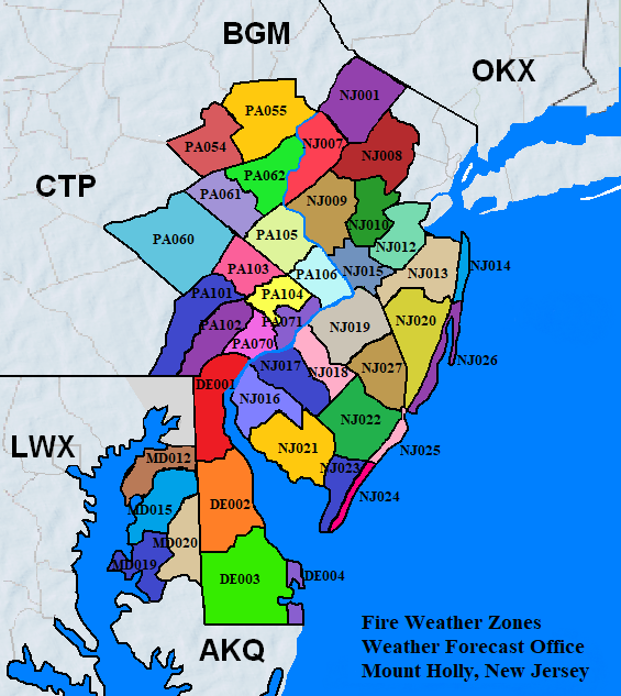


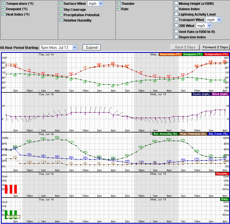
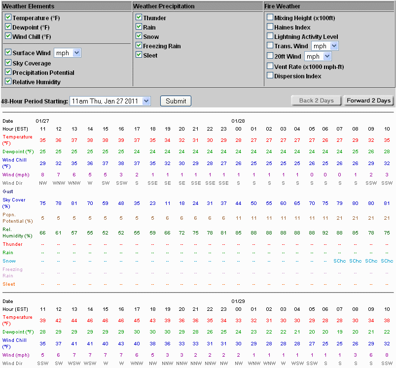


 Coastal Flood
 Marine Forecasts
 Text Products
 Climate Information
 Skywarn
 Submit Storm Report
 Weather Event Archives
 Forecast Discussion
 Emergency Managers
 Briefing Page