
A heat wave over the Southwest will intensify late week, peaking and expanding into the Intermountain West and northern High Plains this weekend. Severe thunderstorms and heavy rain are expected over portions of the Plains and Mississippi Valley tonight, which will shift to parts of the Upper Midwest and mid-Mississippi Valley Friday. Monsoonal showers and flooding persist in the Desert Southwest. Read More >
 |
NWS Mt Holly Weather Briefing Page |
 |
| Space Weather for: |
Aviation Community |
Radio Communications |
Power Companies |
Emergency Management |
Space Weather Enthusiasts |
|
 |
|
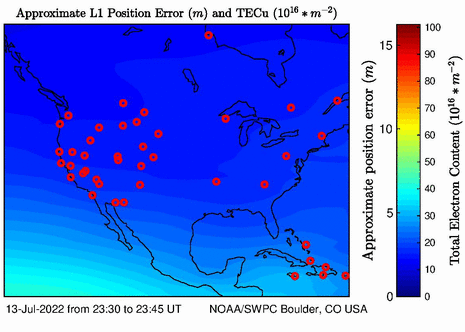
Space Weather Impact Charts (Click chart below corresponding to NOAA Scale above)
|
|
Click to enlarge
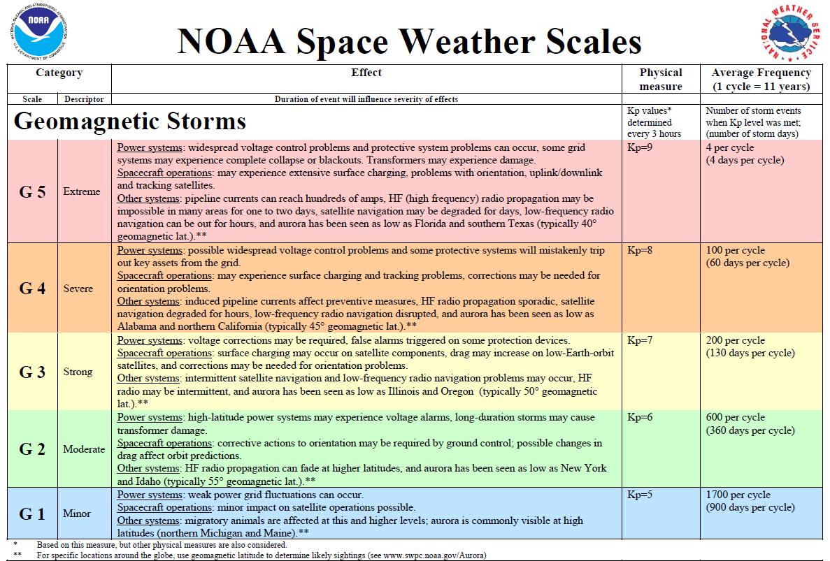 Geomagnetic Storm Impacts Geomagnetic Storm Impacts |
Click to enlarge
 Solar Radiation Storm Impacts Solar Radiation Storm Impacts |
Click to enlarge
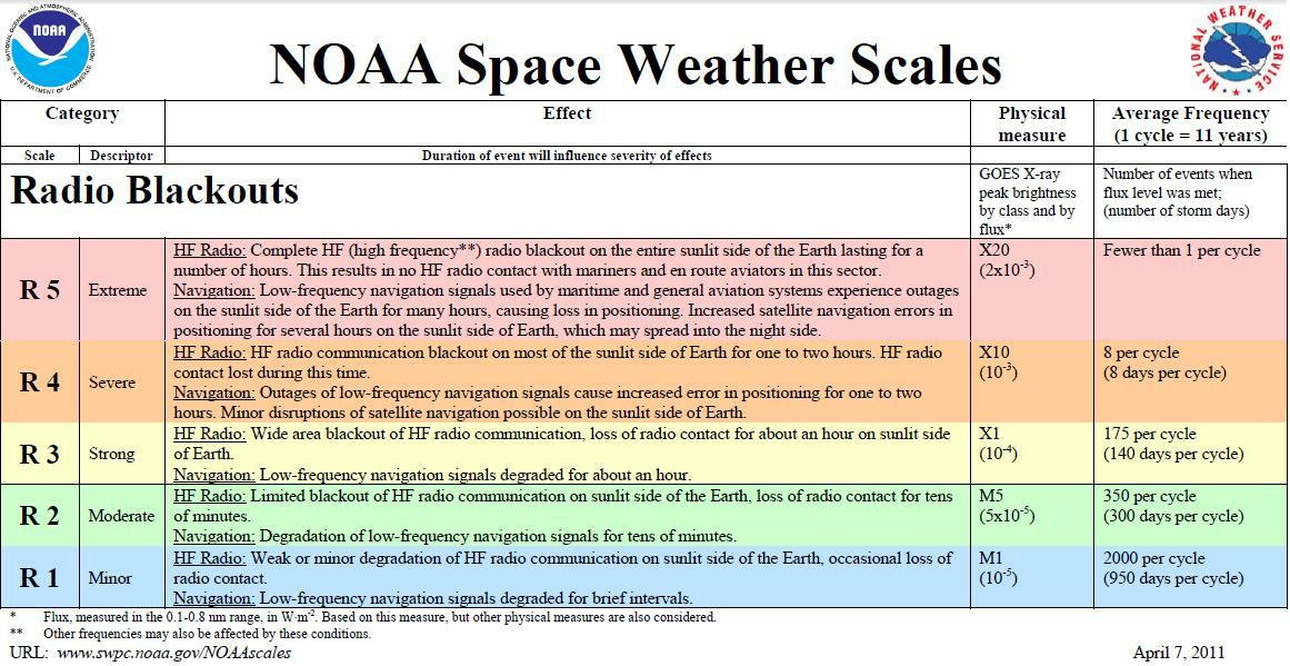 Radio Blackouts Impact Scale Radio Blackouts Impact Scale |
Updated 10 December 2020


 Coastal Flood
 Marine Forecasts
 Text Products
 Climate Information
 Skywarn
 Submit Storm Report
 Weather Event Archives
 Forecast Discussion
 Emergency Managers
 Briefing Page