
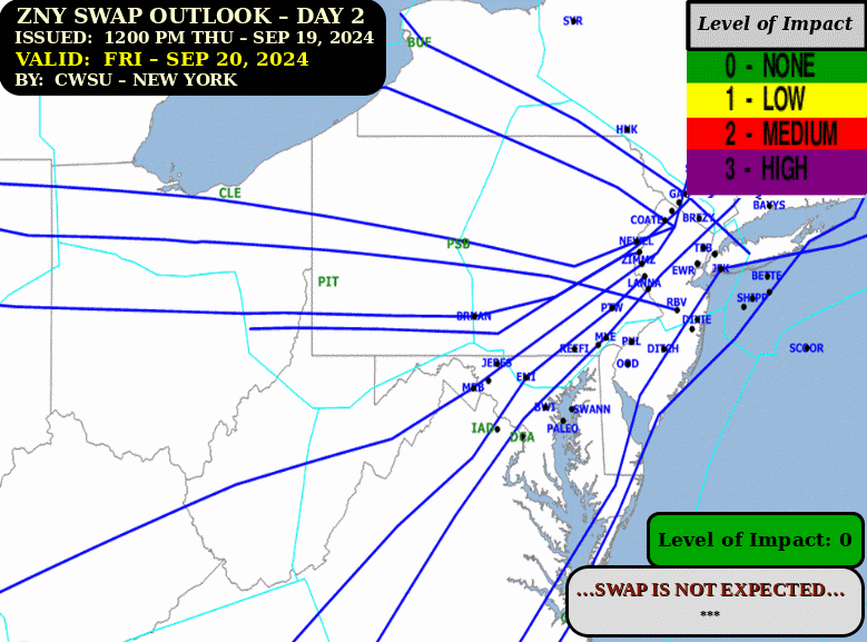
Gusty winds are expected from portions of the Mid-Atlantic into the Northeast through the night following the system that brought rain to the area. An atmospheric river will move into the Northwest late today into Saturday bringing moderate to heavy rainfall, mountain snow, windy conditions, and high surf to the area over the weekend. Read More >
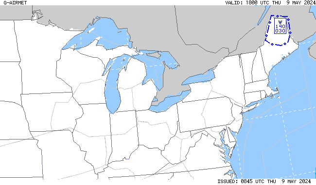
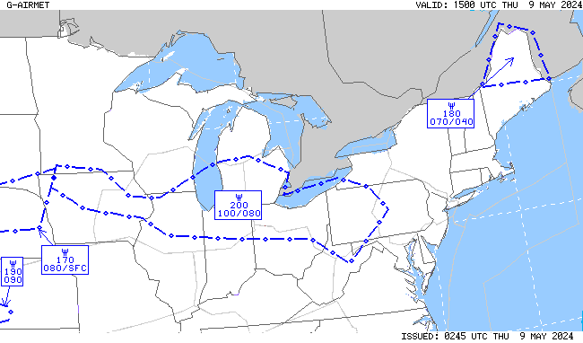
.AVIATION /12Z SATURDAY THROUGH WEDNESDAY/...
The following discussion is for KPHL, KPNE, KTTN, KABE, KRDG,
KILG, KMIV, KACY and surrounding areas.

Today...VFR. West to west-northwest winds 10-15 knots with
gusts to 20-25 knots. The winds should then diminish toward mid
to late afternoon. Moderate confidence.

Tonight...VFR. Light winds around 5 knots or less, most likely
favoring a northwesterly direction. High confidence on VFR
conditions.

Sunday...VFR. Light winds around 5 knots or less, most likely
favoring a southwesterly direction. High confidence on VFR
conditions.

Outlook...

Sunday night through Monday night...Primarily VFR. Periods of
sub-VFR conditions can't be ruled out with a chance for rain
(20-40%).

Tuesday through Wednesday...VFR. Gusty west to northwest wind
on Tuesday.

&&
FTUS80 KPHL 011121 RRX
KPHL 011120Z 0112/0218 24012KT P6SM FEW060
     FM011400 28014G24KT P6SM SCT050
     FM012100 29011KT P6SM FEW050 SCT250
     FM020000 30005KT P6SM SCT150
FTUS51 KPNE 292321 RRB
KPNE 292320Z 3000/3024 VRB04KT P6SM SKC
     FM301000 34003KT P6SM SCT030
     FM301800 17004KT P6SM FEW040 BKN200

FTUS80 KTTN 292321 RRX
KTTN 292320Z 3000/3024 VRB04KT P6SM SKC
     FM300900 VRB03KT P6SM SCT030
     FM301800 17004KT P6SM SCT200

FTUS80 KILG 292321 RRN
KILG 292320Z 3000/3024 VRB05KT P6SM SKC
     FM300900 VRB03KT P6SM SCT030
     FM301500 VRB03KT P6SM SCT035 BKN200

FTUS51 KRDG 292321 RRB
KRDG 292320Z 3000/3024 VRB02KT P6SM SKC
     FM301600 16004KT P6SM SCT200

FTUS80 KABE 292321
KABE 292320Z 3000/3024 VRB03KT P6SM SKC
     FM301800 17003KT P6SM SCT200

FTNA35 KACY 292327 RRC
KACY 292320Z 3000/3024 VRB03KT P6SM SCT025
     TEMPO 3001/3005 BKN025
     FM300500 VRB03KT P6SM BKN025
     FM301500 03005KT P6SM BKN035

FTUS80 KMIV 292321 RRR
KMIV 292320Z 3000/3024 VRB02KT P6SM FEW025
      TEMPO 3003/3006 BKN025
     FM300600 VRB02KT P6SM BKN025
     FM301500 03005KT P6SM BKN035

FTUS80 KEWR 292321 RRI
KEWR 292320Z 3000/3106 VRB03KT P6SM SKC
     FM302000 16005KT P6SM FEW250
     FM310100 VRB03KT P6SM BKN250

FTUS41 KOKX 300102 AAA
TAFLGA
TAF AMD
KLGA 300102Z 3001/3106 VRB03KT P6SM SKC
     FM301300 05005KT P6SM SKC
     FM301900 15004KT P6SM FEW250
     FM310100 VRB03KT P6SM BKN250=

FTUS80 KJFK 300103 AAA
KJFK 300102Z 3001/3106 VRB02KT P6SM SKC
     FM301600 17006KT P6SM FEW250
     FM310000 VRB03KT P6SM FEW030 BKN250

FTUS80 KMDT 292324 RRB
KMDT 292321Z 3000/3024 00000KT P6SM SKC
     FM301200 VRB03KT P6SM BKN250

FTUS80 KBWI 292321 RRD
KBWI 292320Z 3000/3106 00000KT P6SM FEW060
     FM301500 15004KT P6SM SCT250
     FM310000 00000KT P6SM BKN080

FTUS80 KIAD 292321 RRM
KIAD 292320Z 3000/3106 VRB04KT P6SM FEW250
     FM300100 00000KT P6SM SKC
     FM301500 14004KT P6SM SCT250
     FM310300 00000KT P6SM BKN080

FTUS80 KDCA 292321 RRG
KDCA 292320Z 3000/3106 12004KT P6SM SKC
     FM300300 VRB03KT P6SM SKC
     FM301500 14005KT P6SM SCT250
     FM310400 15003KT P6SM BKN070
| --TAFs-- | Time | T | Td | RH | HI | WC | Dir | Wind | G | PK | Vis | Wx | Pcp | Clouds |
|---|---|---|---|---|---|---|---|---|---|---|---|---|---|---|
| KRDG | 1154Z | 49 | 34 | 56 | 46 | 280 | 6 | 10 | FEW055 | |||||
| KABE | 1151Z | 46 | 37 | 71 | 42 | 240 | 7 | 10 | CLR | |||||
| KTTN | 1153Z | 44 | 36 | 73 | 220 | 3 | 10 | CLR | ||||||
| KPNE | 1154Z | 47 | 36 | 66 | 43 | 240 | 9 | 10 | OVC050 | |||||
| KPHL | 1154Z | 49 | 38 | 66 | 44 | 240 | 12 | 10 | FEW050 FEW120 SCT260 | |||||
| KILG | 1151Z | 49 | 38 | 66 | 45 | 250 | 10 | 10 | CLR | |||||
| KMIV | 1154Z | 48 | 39 | 71 | 44 | 240 | 8 | 10 | CLR | |||||
| KACY | 1154Z | 49 | 38 | 66 | 46 | 240 | 7 | 10 | CLR | --PA-- | Time | T | Td | RH | HI | WC | Dir | Wind | G | PK | Vis | Wx | Pcp | Clouds |
| KMPO | 1153Z | 39 | 30 | 70 | 31 | 290 | 15 | 25 | 31 | 10 | CLR | |||
| K22N | 1155Z | 45 | 34 | 66 | 260 | 3 | 10 | CLR | ||||||
| KXLL | 1155Z | 48 | 37 | 66 | 46 | 260 | 5 | 10 | CLR | |||||
| KUKT | 1155Z | 46 | 37 | 71 | calm | 10 | CLR | |||||||
| KCKZ | 1155Z | 45 | 37 | 76 | 280 | 3 | 10 | CLR | ||||||
| KDYL | 1154Z | 47 | 36 | 66 | 260 | 3 | 10 | CLR | ||||||
| KPTW | 1154Z | 45 | 35 | 68 | calm | 10 | BKN050 | |||||||
| KLOM | 1135Z | 44 | 35 | 70 | 41 | 210 | 5 | 10 | SCT050 | |||||
| KOQN | 1135Z | 43 | 34 | 71 | 40 | 250 | 5 | 10 | CLR | |||||
| KMQS | 1155Z | 46 | 36 | 66 | 42 | 270 | 7 | 10 | CLR | --NJ-- | Time | T | Td | RH | HI | WC | Dir | Wind | G | PK | Vis | Wx | Pcp | Clouds |
| KFWN | 1153Z | 47 | 28 | 48 | VRB | 3 | 10 | CLR | ||||||
| K12N | 1154Z | 40 | 30 | 68 | calm | |||||||||
| KMMU | 1145Z | 46 | 34 | 62 | 44 | 260 | 5 | 10 | FEW030 | |||||
| KSMQ | 1153Z | 44 | 35 | 71 | calm | 10 | CLR | |||||||
| KBLM | 1156Z | 44 | 40 | 85 | 39 | 230 | 9 | 10 | CLR | |||||
| KMJX | 1156Z | 42 | 36 | 79 | 38 | 230 | 6 | 10 | FEW048 | |||||
| KWRI | 1055Z | 46 | 37 | 71 | 42 | 250 | 8 | 10 | BKN049 | |||||
| KVAY | 1154Z | 48 | 36 | 63 | 44 | 240 | 8 | 10 | OVC050 | |||||
| KWWD | 1156Z | 52 | 42 | 69 | 260 | 14 | 18 | 10 | CLR | --DE-- | Time | T | Td | RH | HI | WC | Dir | Wind | G | PK | Vis | Wx | Pcp | Clouds |
| K33N | 1135Z | 46 | 39 | 76 | 42 | 250 | 7 | 10 | CLR | |||||
| KDOV | 1155Z | 47 | 38 | 70 | 43 | 220 | 8 | 10 | CLR | |||||
| KGED | 1154Z | --MD-- | Time | T | Td | RH | HI | WC | Dir | Wind | G | PK | Vis | Wx | Pcp | Clouds |
| KESN | 1145Z | 48 | 37 | 66 | 46 | 260 | 5 | 10 | CLR | --OKXTAF-- | Time | T | Td | RH | HI | WC | Dir | Wind | G | PK | Vis | Wx | Pcp | Clouds |
| KTEB | 1151Z | 48 | 29 | 48 | 45 | 270 | 7 | 10 | CLR | |||||
| KEWR | 1151Z | 48 | 33 | 56 | 44 | 210 | 9 | 10 | CLR | |||||
| KLGA | 1151Z | 50 | 26 | 39 | 45 | 270 | 13 | 10 | FEW060 FEW250 | |||||
| KJFK | 1151Z | 49 | 32 | 52 | 44 | 260 | 14 | 10 | FEW060 | |||||
| KISP | 1156Z | 50 | 30 | 46 | 45 | 280 | 15 | 10 | FEW060 FEW250 | |||||
| KHPN | 1156Z | 47 | 30 | 52 | 41 | 280 | 14 | 25 | 33 | 10 | FEW050 | |||
| KSWF | 1145Z | 43 | 32 | 66 | 36 | 300 | 14 | 21 | 10 | SKC | ||||
| KBDR | 1152Z | 48 | 30 | 50 | 42 | 270 | 14 | 23 | 10 | CLR | ||||
| KGON | 1156Z | 45 | 33 | 63 | 40 | 270 | 10 | 10 | CLR | --LWXTAF-- | Time | T | Td | RH | HI | WC | Dir | Wind | G | PK | Vis | Wx | Pcp | Clouds |
| KMTN | 1154Z | 48 | 37 | 66 | 46 | 240 | 5 | 10 | CLR | |||||
| KBWI | 1154Z | 45 | 35 | 68 | 42 | 210 | 5 | 10 | SCT250 | |||||
| KDCA | 1152Z | 47 | 33 | 59 | 42 | 250 | 10 | 10 | SCT250 | |||||
| KIAD | 1152Z | 40 | 33 | 77 | 36 | 180 | 5 | 10 | FEW080 FEW250 | |||||
| KMRB | 1153Z | 44 | 34 | 68 | 41 | 180 | 5 | 10 | CLR | |||||
| KCHO | 1153Z | 38 | 32 | 79 | 33 | 200 | 6 | 10 | CLR | -Misc- | Time | T | Td | RH | HI | WC | Dir | Wind | G | PK | Vis | Wx | Pcp | Clouds |
| KCDW | 1153Z | 48 | 30 | 50 | 45 | 290 | 7 | 10 | CLR | |||||
| KLNS | 1153Z | 42 | 35 | 76 | 270 | 3 | 10 | CLR | ||||||
| KHZL | 1155Z | 43 | 36 | 76 | 40 | 290 | 5 | 10 | SCT050 | |||||
| KAVP | 1154Z | 43 | 33 | 68 | VRB | 3 | 10 | SCT045 | ||||||
| KCXY | 1156Z | 46 | 34 | 63 | 42 | 250 | 8 | 10 | CLR | |||||
| KMDT | 1156Z | 49 | 36 | 61 | 45 | 230 | 9 | 10 | FEW055 BKN200 | |||||
| KUNV | 1153Z | 46 | 34 | 62 | 40 | 270 | 13 | 22 | 10 | BKN050 | ||||
| KTHV | 1153Z | 48 | 35 | 61 | 46 | 260 | 5 | 10 | CLR | |||||
| KSEG | 1153Z | 47 | 35 | 63 | 45 | 220 | 5 | 10 | CLR | |||||
| KMUI | 1155Z | 50 | 35 | 56 | 48 | 240 | 5 | 10 | CLR | |||||
| KAPG | 1055Z | 44 | 39 | 81 | 41 | 230 | 5 | 9 | CLR | |||||
| KNHK | 1152Z | 45 | 40 | 83 | 41 | 230 | 8 | 10 | FEW250 | |||||
| KOXB | 1153Z | 46 | 40 | 79 | 43 | 260 | 6 | 10 | CLR | |||||
| KSBY | 1154Z | 45 | 39 | 80 | 42 | 230 | 5 | 10 | CLR | |||||
| KWAL | 1154Z | 49 | 41 | 74 | 47 | 260 | 5 | 10 | CLR | |||||
| KBGM | 1153Z | 37 | 30 | 76 | 31 | 300 | 8 | 10 | BKN046 | |||||
| KNYC | 1151Z | 48 | 30 | 50 | 10 | CLR | ||||||||
| KMSV | 1156Z | 38 | 31 | 76 | 32 | 290 | 9 | 10 | CLR | |||||
| KMGJ | 1154Z | 45 | 30 | 56 | 41 | 290 | 7 | 10 | CLR | |||||
| KPOU | 1153Z | 45 | 30 | 56 | 42 | 220 | 6 | 10 | CLR |


| Current | 3-hr Forecast | 6-hr Forecast |
|
|
|
|
| 9-hr Forecast | 12-hr Forecast | |
|
|
|
| Current | 3-hr Forecast | 6-hr Forecast |
|
|
|
|
| 9-hr Forecast | 12-hr Forecast | |
|
|
|
| Current | 3-hr Forecast | 6-hr Forecast |
|
|
|
|
| 9-hr Forecast | 12-hr Forecast | |
|
|
|
| Current | 3-hr Forecast | 6-hr Forecast |
|
|
|
|
| 9-hr Forecast | 12-hr Forecast | |
|
|
|


 Visible Loop
 Infrared Loop


 Coastal Flood
 Marine Forecasts
 Text Products
 Climate Information
 Skywarn
 Submit Storm Report
 Weather Event Archives
 Forecast Discussion
 Emergency Managers
 Briefing Page