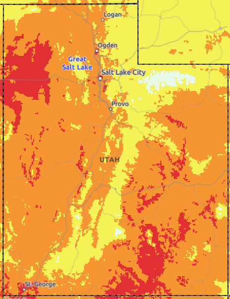
There is an increased risk for flash flooding through this evening as showers and thunderstorms will be capable of producing locally heavy rainfall, especially across central and southern Utah. Those with outdoor plans across these areas should monitor the weather and have multiple ways to receive warnings.


 HeatRisk
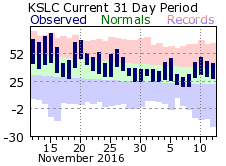 Monthly Climate Data