
Moderate to Severe geomagnetic storm conditions will remain possible into early Monday. Heavy rain potential will pose a flooding threat across areas of central to southern Florida over the next few days. On Monday, scattered severe thunderstorms may produce severe gusts, large hail, and heavy rain across portions of the central and southern High Plains into the northern Great Plains. Read More >
Last Map Update: Mon, Jun 2, 2025 at 4:54:20 am PDT


|
Text Product Selector (Selected product opens in current window)
|
|


 Social Media Feeds
 Sacramento Radar
 Beale Radar
 Satellite
 Graphical Forecasts - Local
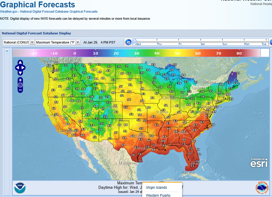 Graphical Forecasts - U.S.
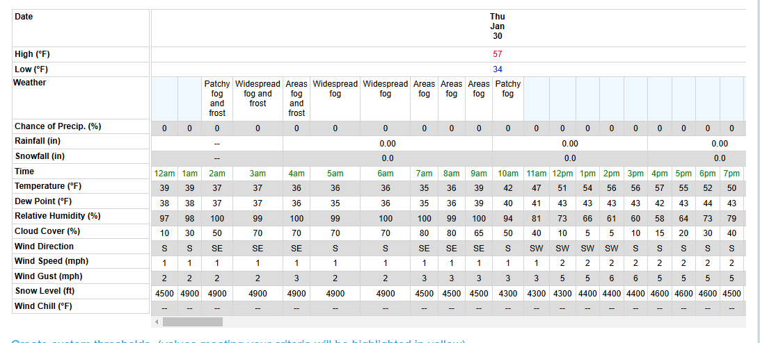 Forecast Weather Tables
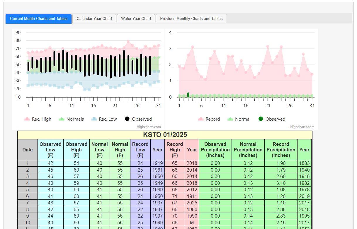 Recent STO Temperatures
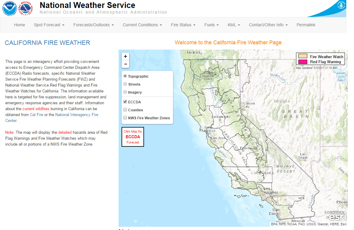 California Fire Weather Page
 Caltrans QuickMap
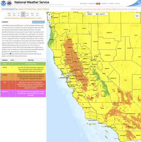 Heat Risk Link
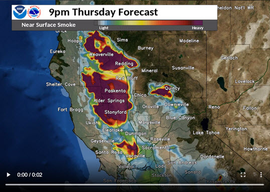 Experimental Smoke Forecast