
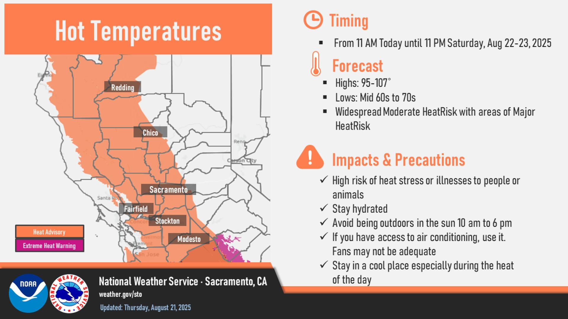
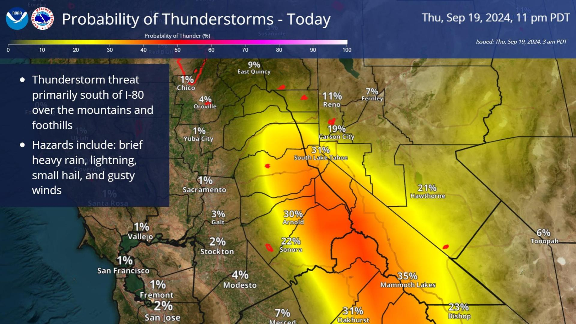
Strong thunderstorms may bring excessive rainfall and flooding over parts of the northern Gulf Coast today and over parts of the southern Rockies into the High Plains today through the weekend. A refreshingly cool and dry air mass will continue to produce below average temperatures across the central and eastern U.S. through the weekend. Read More >
Last Map Update: Fri, Aug 29, 2025 at 2:30:14 pm PDT
|
Text Product Selector (Selected product opens in current window)
|
|


 Social Media Feeds
 Sacramento Radar
 Beale Radar
 Satellite
 Graphical Forecasts - Local
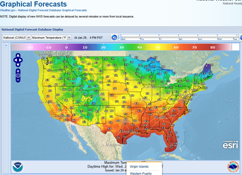 Graphical Forecasts - U.S.
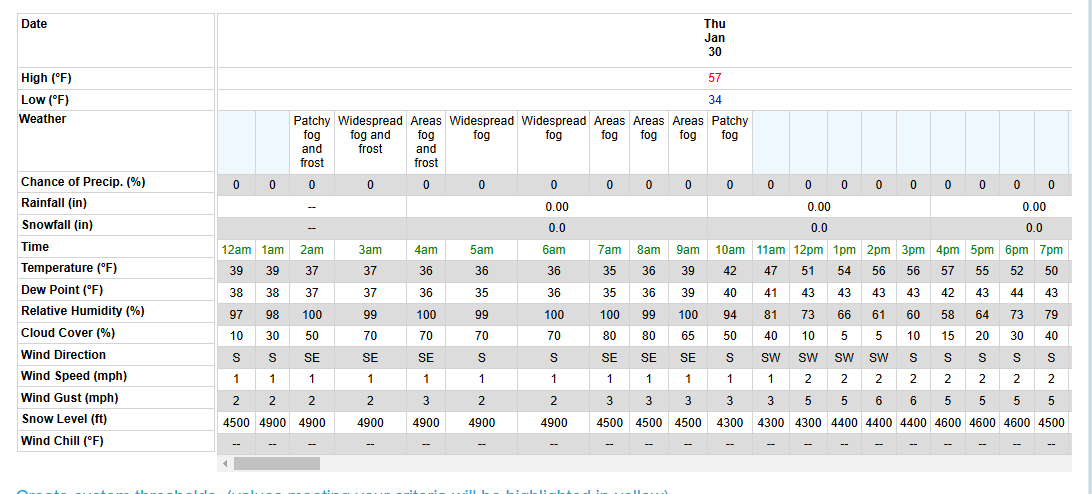 Forecast Weather Tables
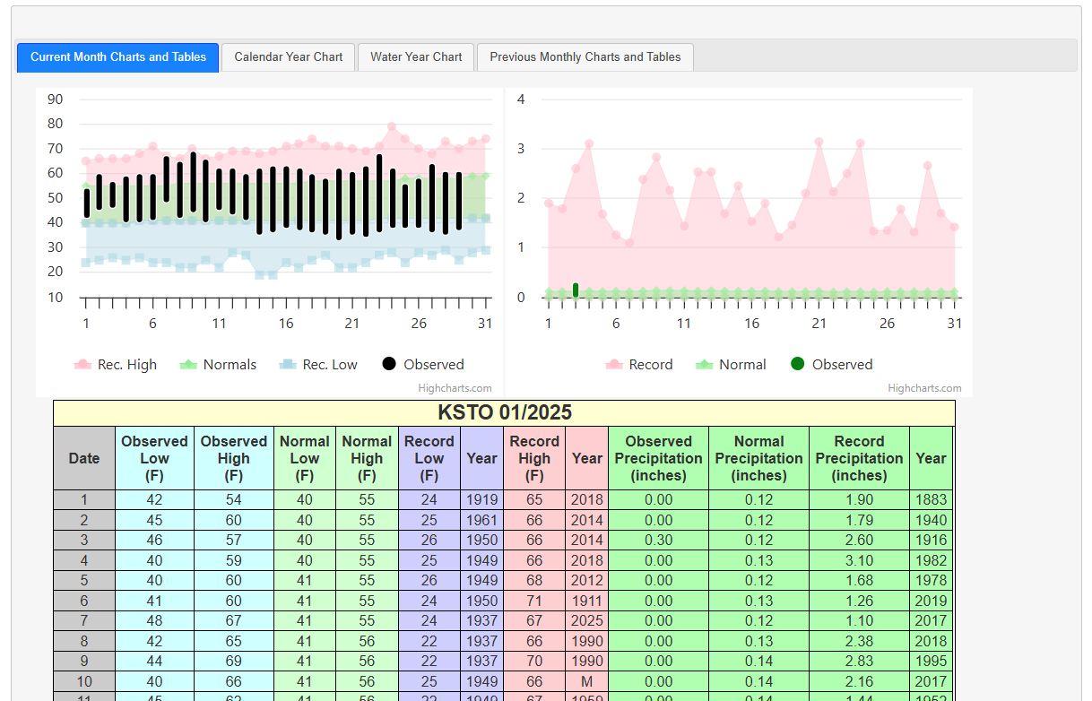 Recent STO Temperatures
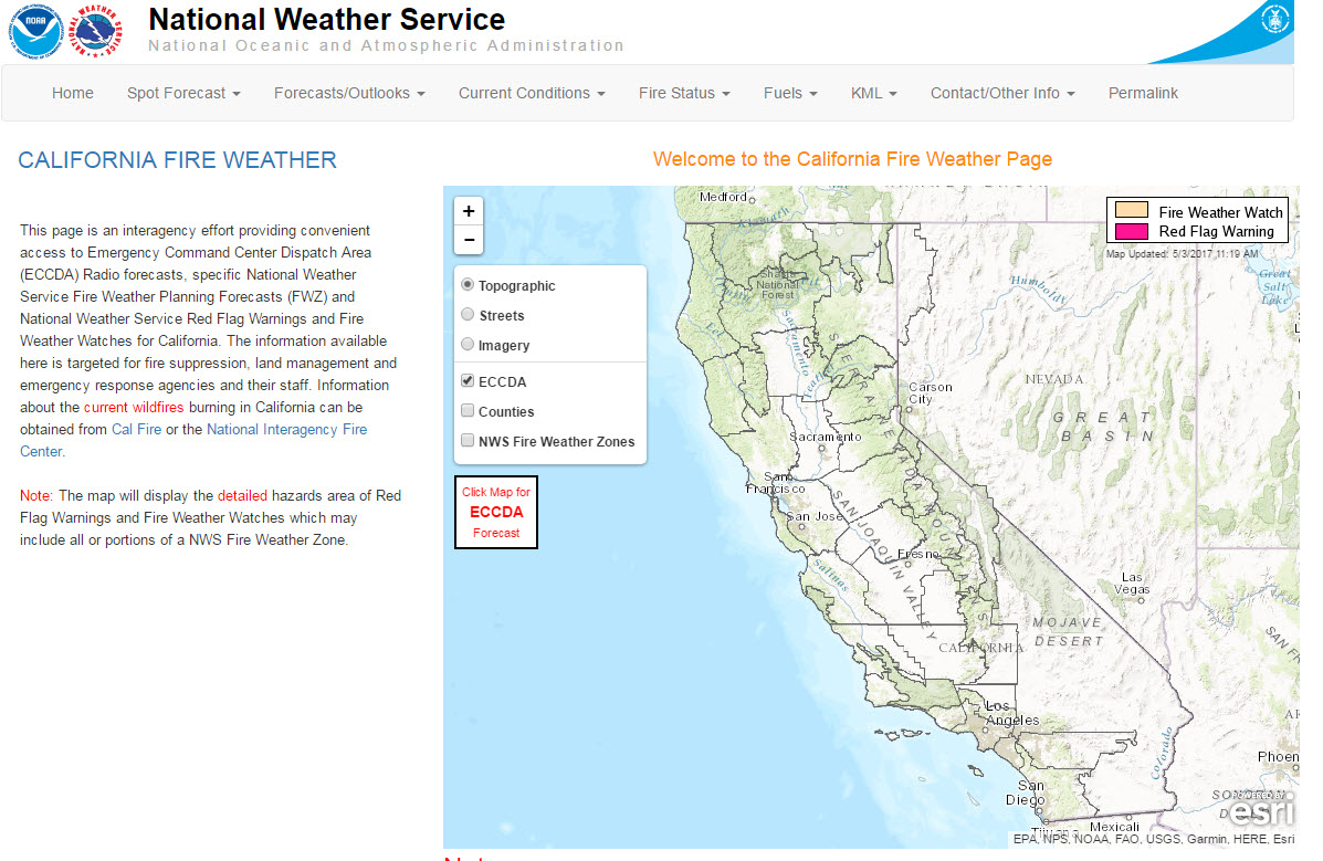 California Fire Weather Page
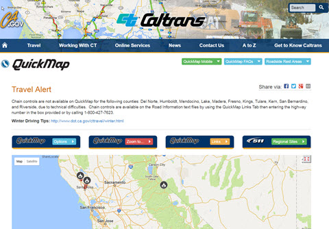 Caltrans QuickMap
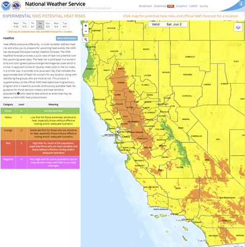 Heat Risk Link
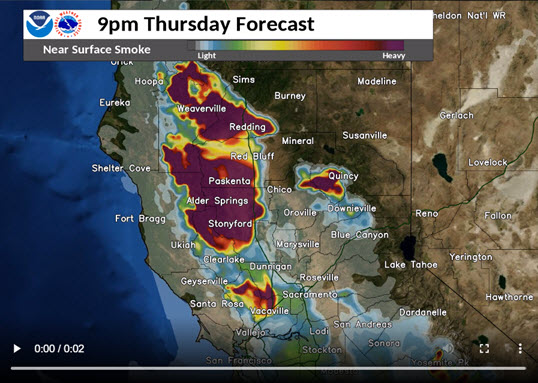 Experimental Smoke Forecast