NWS All NOAA
Sacramento, CA
Weather Forecast Office
Last Map Update: Sat, May 10, 2025 at 5:40:32 am PDT


 Social Media Feeds
 Sacramento Radar
 Beale Radar
 Satellite
 Graphical Forecasts - Local
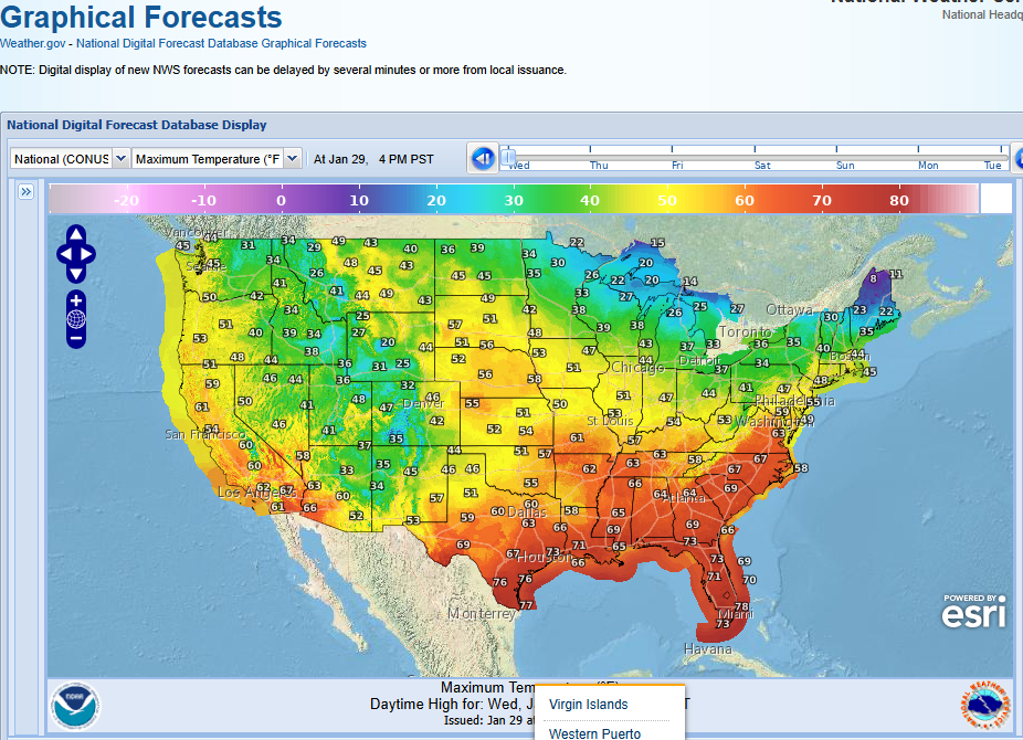 Graphical Forecasts - U.S.
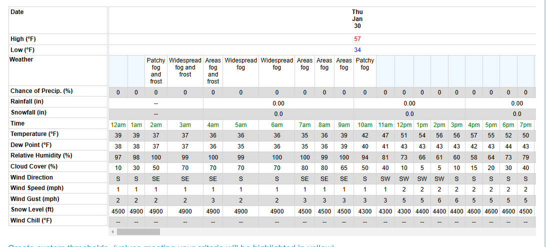 Forecast Weather Tables
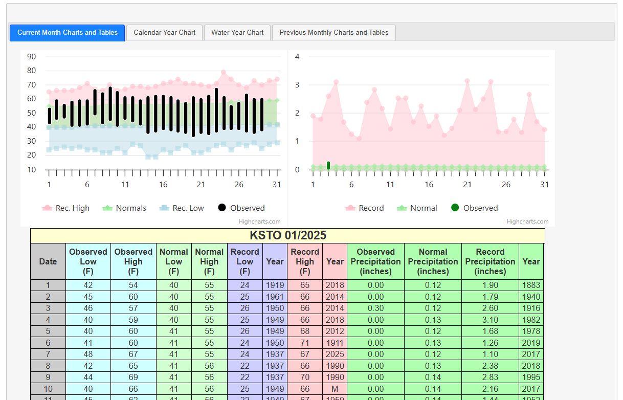 Recent STO Temperatures
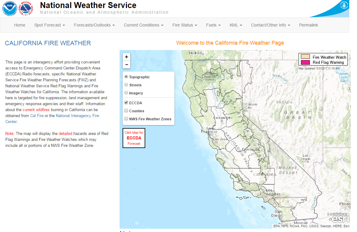 California Fire Weather Page
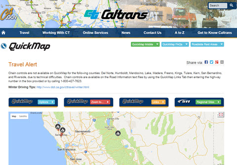 Caltrans QuickMap
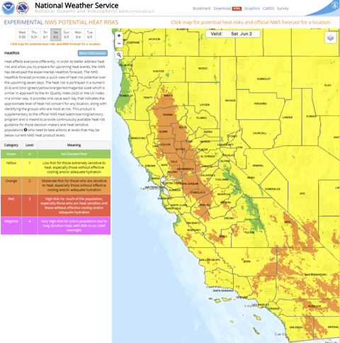 Heat Risk Link
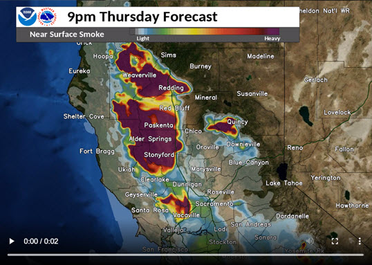 Experimental Smoke Forecast