
Heat expands across the Desert Southwest, Plains, Mississippi Valley and Midwest into Monday. Fire weather concerns continue for portions of the Intermountain West. Active monsoonal moisture fuels thunderstorms over the Southwest with possible flash flooding. Tropical cyclone Fausto in the Pacific, should weaken as it approaches Hawaii; Dangerous surf, swells and rip currents are expected. Read More >
Overview
|
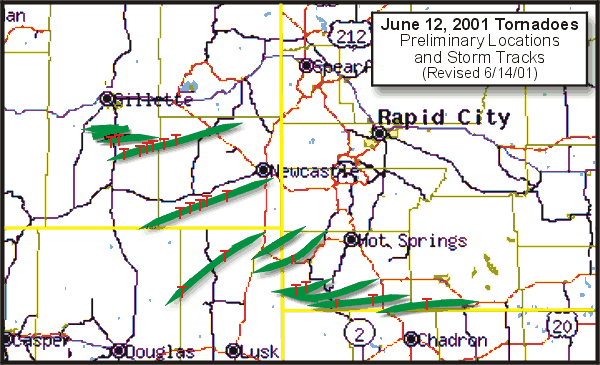
During the afternoon of June 12th, 2001 a series of supercell thunderstorms produced eight reported tornadoes across northeastern Wyoming and southwestern South Dakota. Fortunately, only isolated areas of damage were reported from these storms. The map at right shows the preliminary tornado reports (red "Ts"), which eventually were reduced to eight confirmed tornadoes because the same tornado was reported multiple times on several occasions. The green swaths represent the supercell thunderstorm tracks. |
 |
Tornadoes:
|
Tornadoes - Northeastern WY and Southwestern SD
Track Map 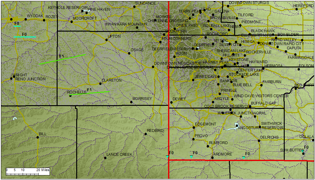  |
||||||||||||||||
Tornado ratings are assigned based on the amount of damage they cause. The tornadoes in northeastern Wyoming and southwestern South Dakota were rated using the original Fujita tornado damage scale (http://www.spc.noaa.gov/faq/tornado/f-scale.html). In 2007, the National Weather Service began using the Enhanced Fujita (EF) scale (http://www.spc.noaa.gov/faq/tornado/ef-scale.html), which is an updated F-scale developed by a team of meteorologists and wind engineers.
The Enhanced Fujita (EF) Scale classifies tornadoes into the following categories:
| EF0 Weak 65-85 mph |
EF1 Moderate 86-110 mph |
EF2 Significant 111-135 mph |
EF3 Severe 136-165 mph |
EF4 Extreme 166-200 mph |
EF5 Catastrophic 200+ mph |
 |
|||||
Photos
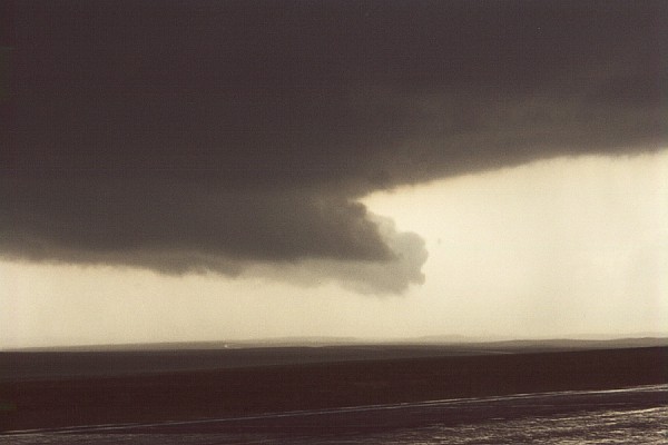
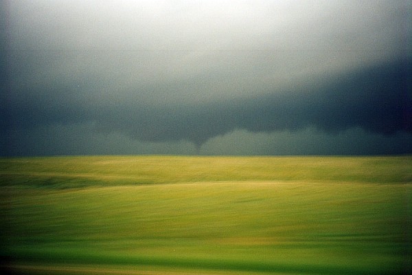
Visibility was very good across northeastern Wyoming and the tornadoes were widely observed as they moved toward western South Dakota.
 |
 |
 |
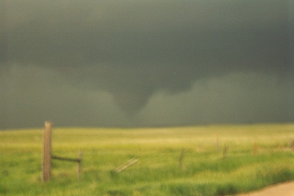
| Wall Cloud 10 miles west of Edgemont, SD, between 4:30 and 4:40 pm MDT (photo by Matt Bunkers) | Funnel cloud 10 miles west of Edgemont, SD, between 4:30 and 4:40 pm MDT (photo by Matt Bunkers) | Closer view of funnel cloud 10 miles west of Edgemont, SD, between 4:30 and 4:40 pm MDT (photo by Matt Bunkers) |
 |
 |
| Tornado at 6:05 pm MDT near the South Dakota/Nebraska border on US 385 (photo by Matt Bunkers) | Closer view of the tornado at 6:05 pm MDT near the South Dakota/Nebraska border on US 385 (photo by Matt Bunkers) |
Radar
The storms began between noon and 1 pm south of Gillette, WY, and quickly became severe. While individual storms moved to the east or northeast, there was continual redevelopment of the storms to the south. Most of the storms across Wyoming decreased in intensity as they approached South Dakota and were no longer severe by the time they crossed the state line. However, those storms furthest to the south (near the extreme southwestern corner of South Dakota) were able to tap into a more unstable atmosphere and continued to produce tornadoes across Fall River and Oglala Lakota Counties of southwestern South Dakota.
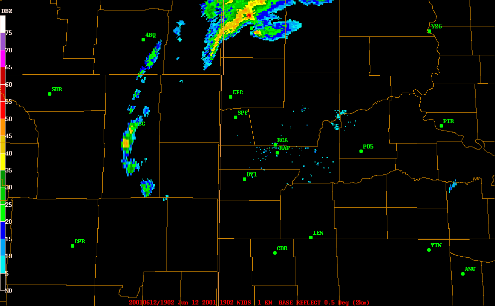 |
| Radar animation from 1:12 to 7:02 pm MDT on 12 June 2001 |
Environment
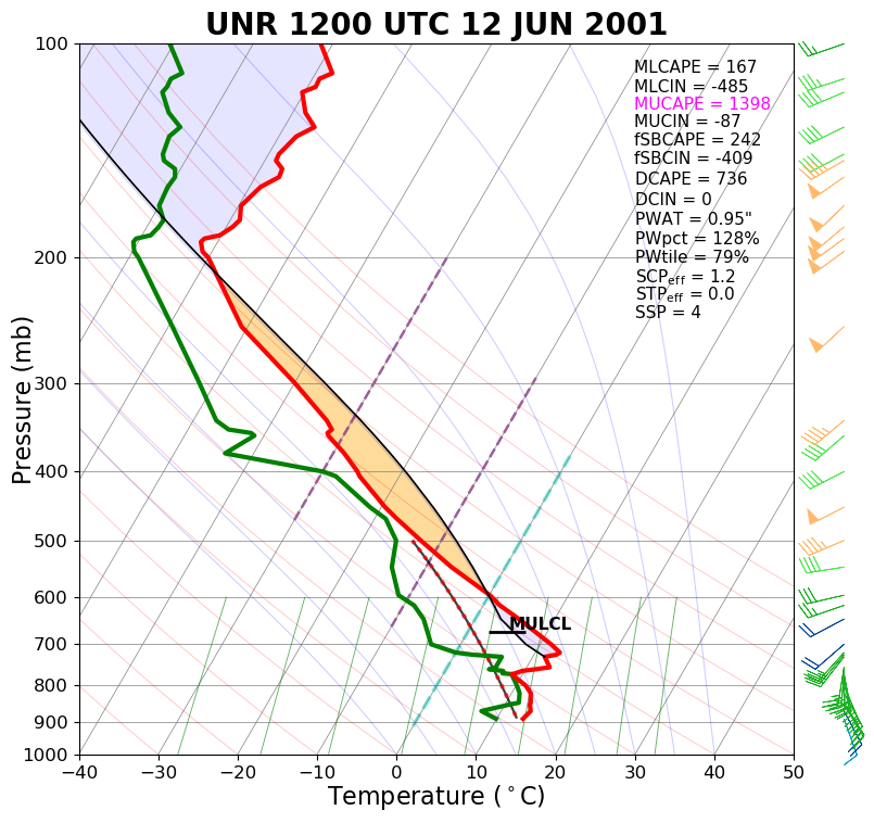
The weather conditions which produced this outbreak of tornadoes were very similar to other tornado events across this area. Surface low pressure was located over southeastern Wyoming, with a very unstable, and highly sheared atmosphere across the area. A surface front was draped from northeastern Wyoming across southwestern South Dakota, which may have helped to promote the formation of tornadoes this day.
 |
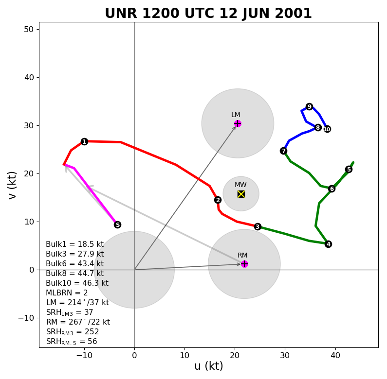 |
| Sounding for Rapid City at 6 am MDT 12 June 2001 | Hodograph for Rapid City at 6 am MDT 12 June 2001 |
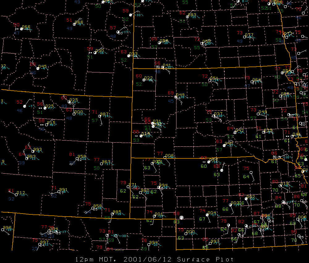
Surface dewpoint temperatures were fairly high across northeastern Wyoming around midday (below left), and by 3 pm MDT the dewpoints had reached the mid 60s in far southwestern South Dakota.
 |
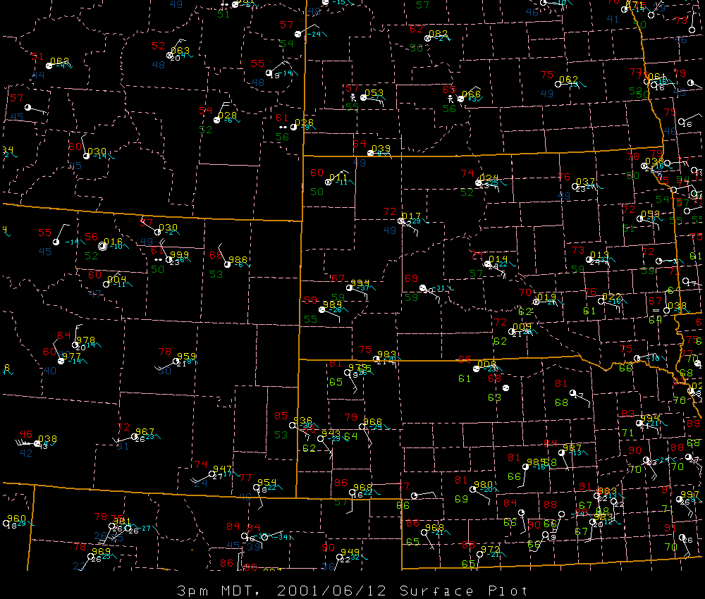 |
| Surface map valid 12 pm MDT 12 June 2001 | Surface map valid 3 pm MDT 12 June 2001 |
 |
Media use of NWS Web News Stories is encouraged! Please acknowledge the NWS as the source of any news information accessed from this site. |
|

