
Dangerous heat will expand from the Gulf Coast into the Southern Plains and Desert Southwest through week's end. Additional extreme heat impacting the Pacific Northwest will shift to the northern Plains by the weekend. Tropical Storm Bertha is expected to continue to impact portions of the northern Gulf Coast from the western Florida Panhandle to southeastern Louisiana through tonight. Read More >
Overview
|
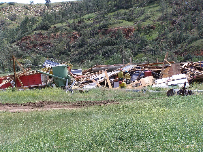
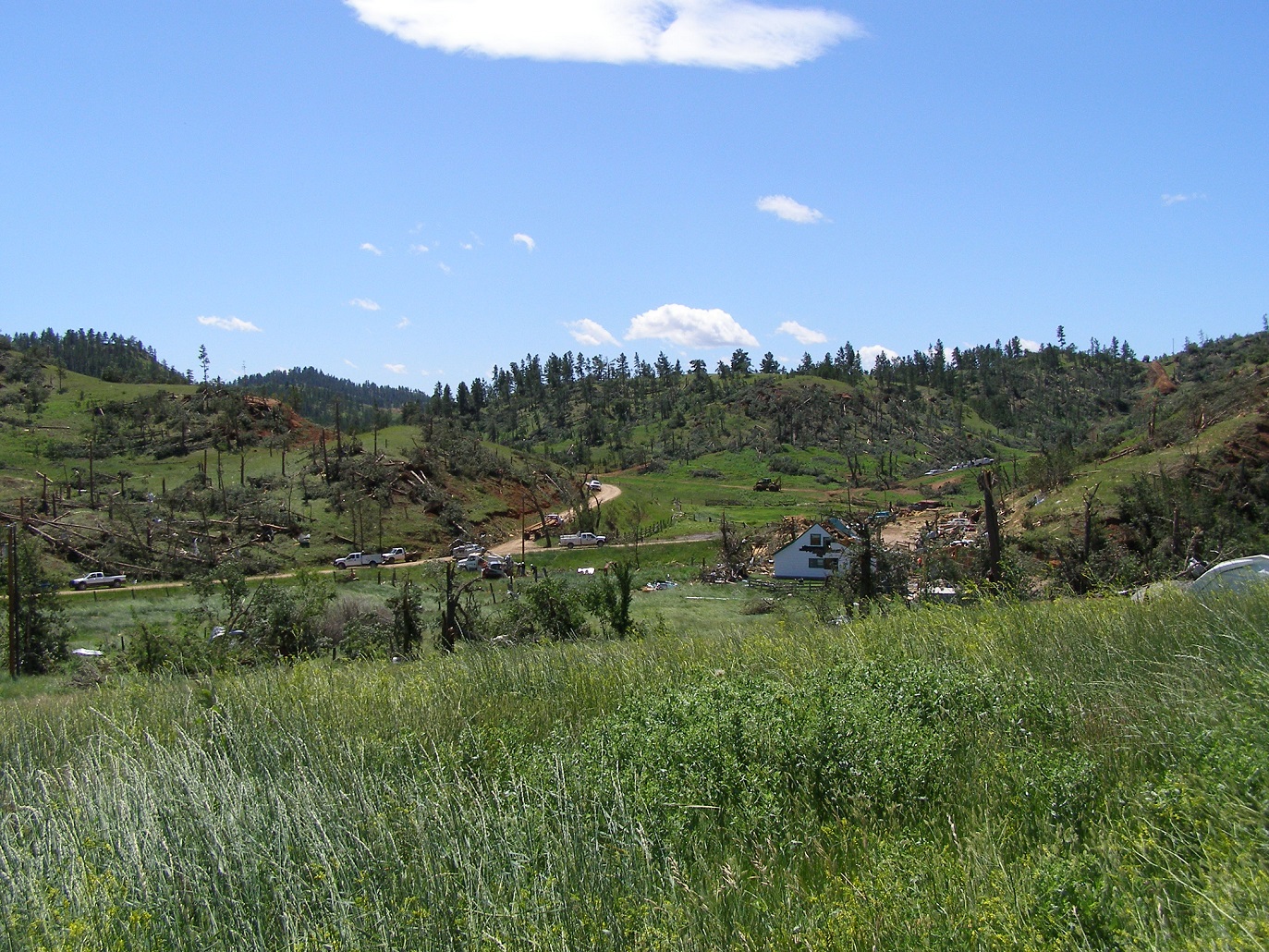
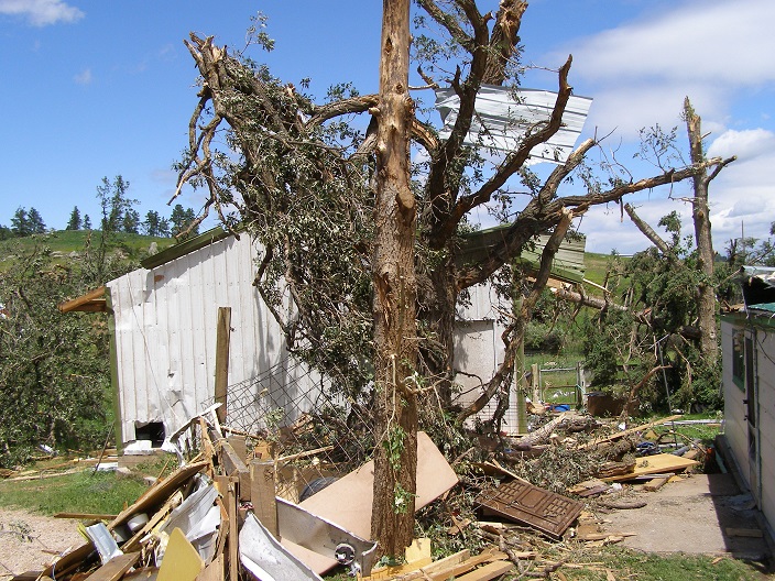
A large tornado ripped across the Bear Lodge Mountains of northeastern Wyoming the evening of July 13, toppling trees and destroying buildings on a ranch. Much of the roof was torn off the house on the ranch. A large wooden barn and two metal garages were totally demolished. Roofing and siding were torn from a mobile home. A survey by the National Weather Service estimated the winds reached 120 to 130 mph based on the extent of damage. The tornado was given a rating of EF2 on the Enhanced Fujita Scale ranking of zero through five. An aerial survey conducted by the State of Wyoming indicated the tornado touched down west of Cook Lake and traveled in an east-southeast direction for 9.5 miles before dissipating just west of Wyoming Highway 111 and north of Interstate 90. The tornado itself was about a half mile wide, but strong winds feeding into the funnel downed trees in a mile wide swath across much of the forested areas, which blocked many Forest Service roads. The storm also produced giant hail around Hulett, with some stones measuring four to five inches in diameter. |
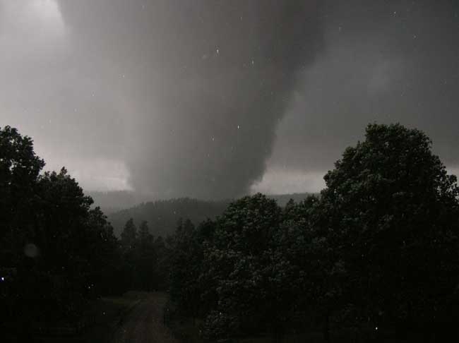 Tornado over Bear Lodge Mountains Photo by Phil Mason |
Tornadoes:
|
Tornado - 6 Miles Southwest of Aladdin, WY
Track Map 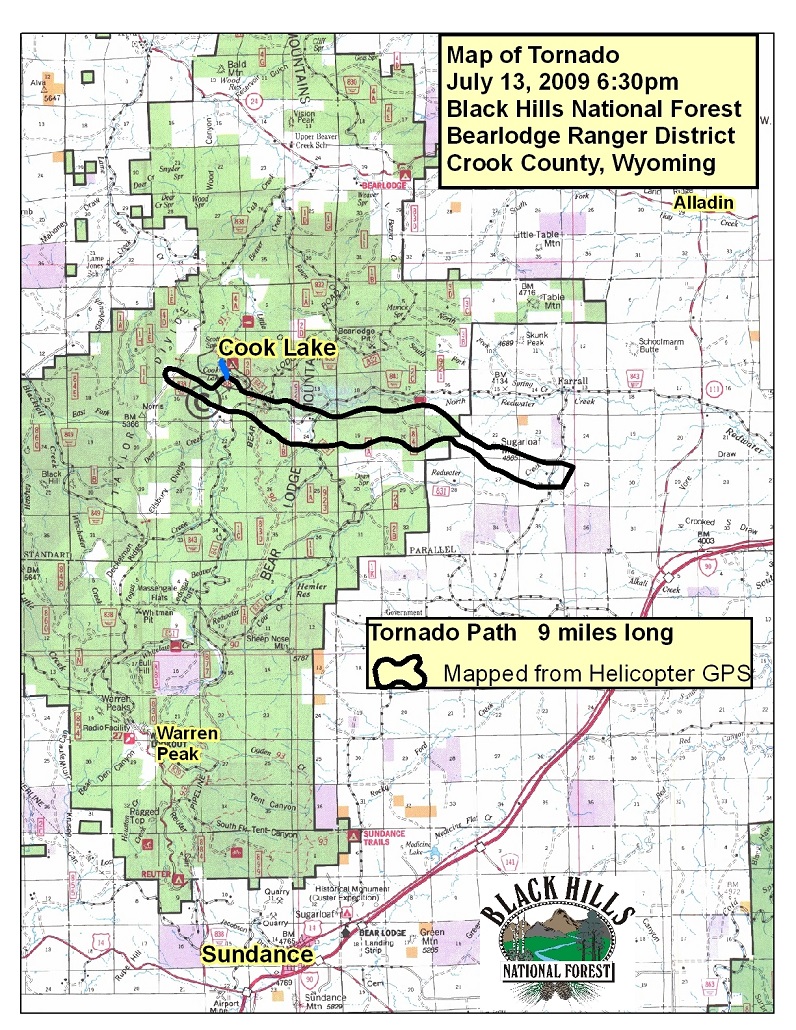 |
||||||||||||||||
The Enhanced Fujita (EF) Scale classifies tornadoes into the following categories:
| EF0 Weak 65-85 mph |
EF1 Moderate 86-110 mph |
EF2 Significant 111-135 mph |
EF3 Severe 136-165 mph |
EF4 Extreme 166-200 mph |
EF5 Catastrophic 200+ mph |
 |
|||||
Photos
 |
 |
 |
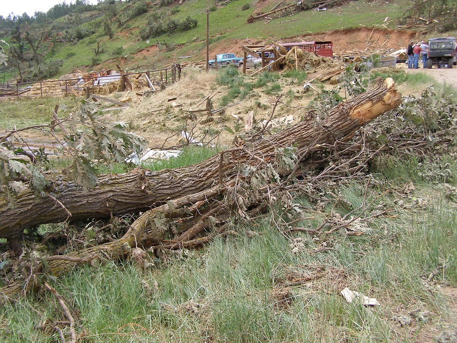 |
| Remnants of a metal shop building | Building and tree damage | Tree and building damage | Large oak tree felled by tornado |
 |
| Large hail in Hulett, WY |
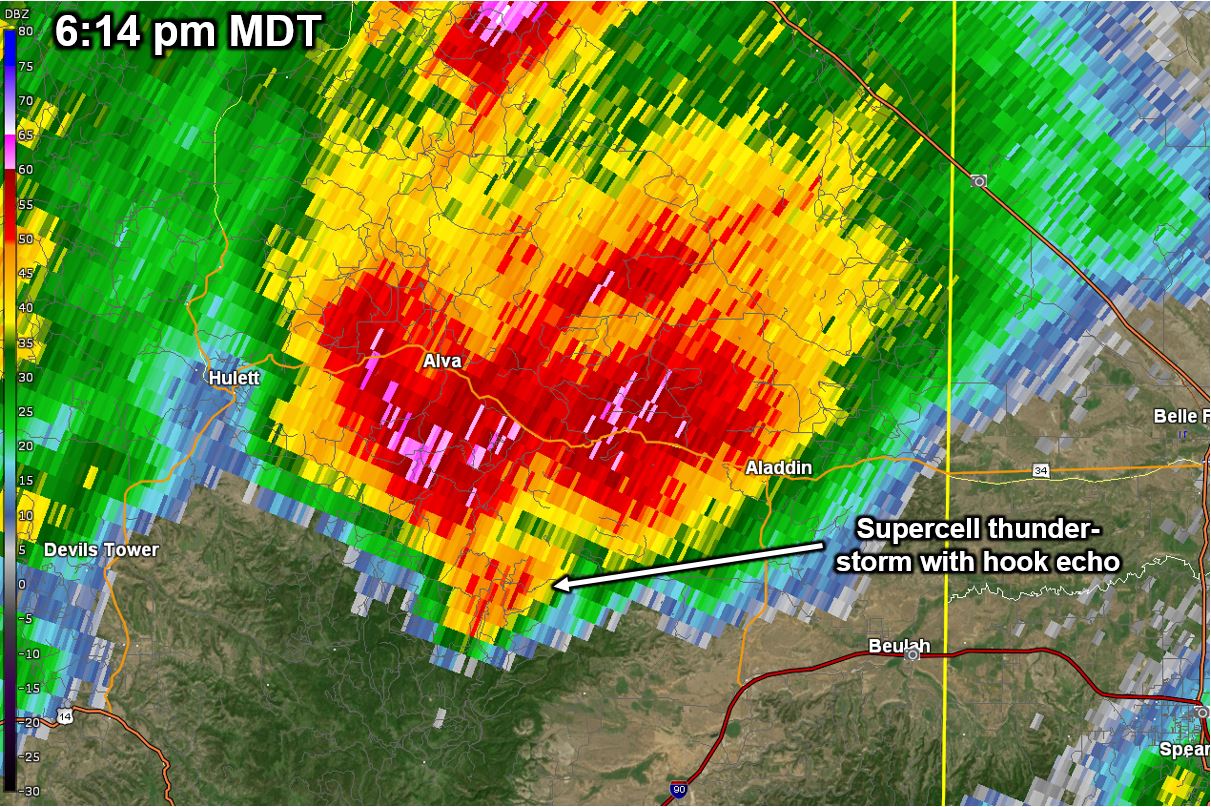
Radar
 |
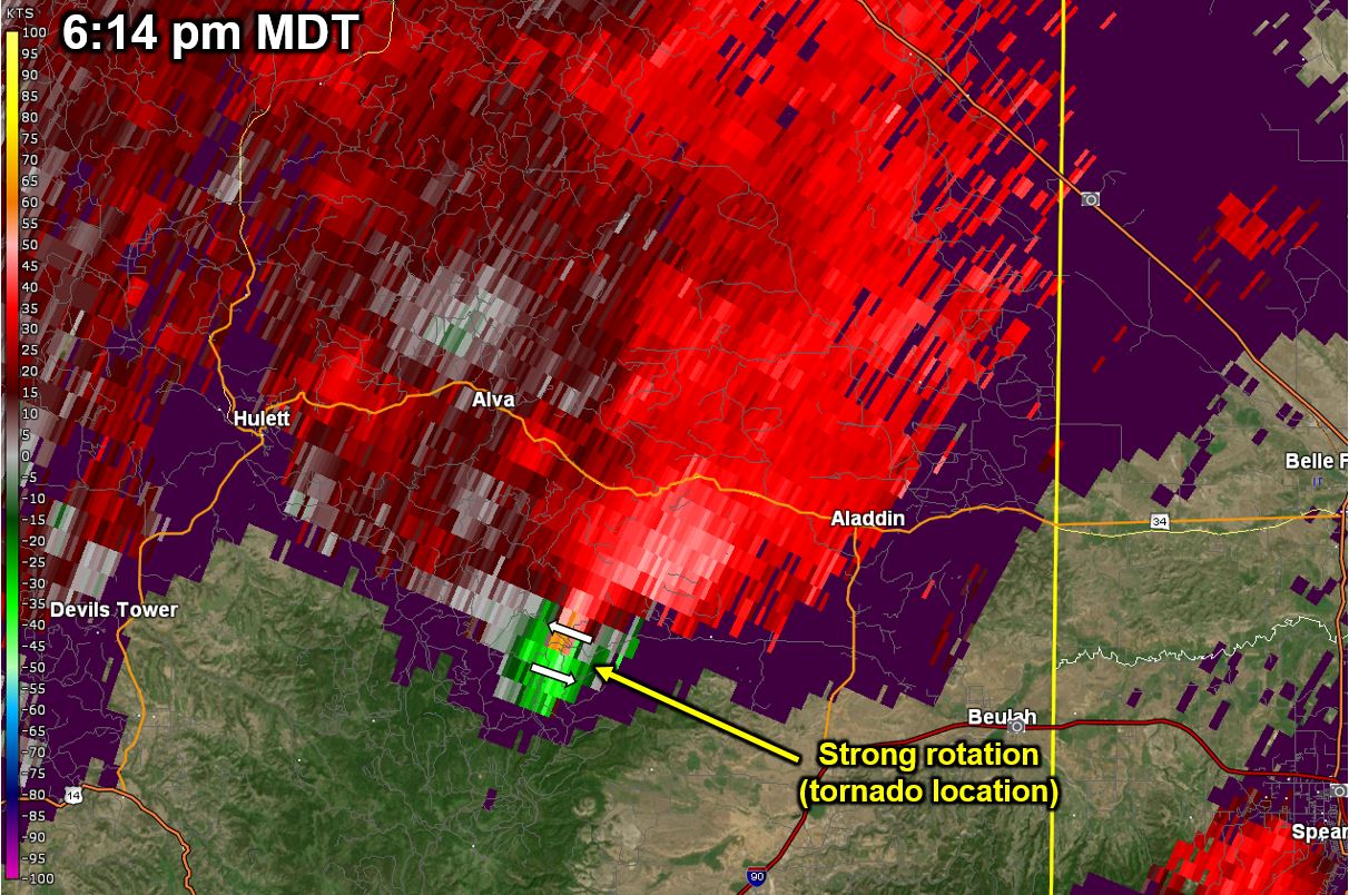 |
| July 13, 2009 614 PM MDT Base Reflectivity Image | July 13, 2009 614 PM MDT Storm Relative Velocity Image |
 |
Media use of NWS Web News Stories is encouraged! Please acknowledge the NWS as the source of any news information accessed from this site. |
|

