Dangerous heat will expand from the Gulf Coast into the Southern Plains and Desert Southwest through week's end. Additional extreme heat impacting the Pacific Northwest will shift to the northern Plains by the weekend. Tropical Storm Bertha is expected to continue to impact portions of the northwestern Gulf Coast from south central Louisiana to the upper Texas coast today. Read More >
Overview
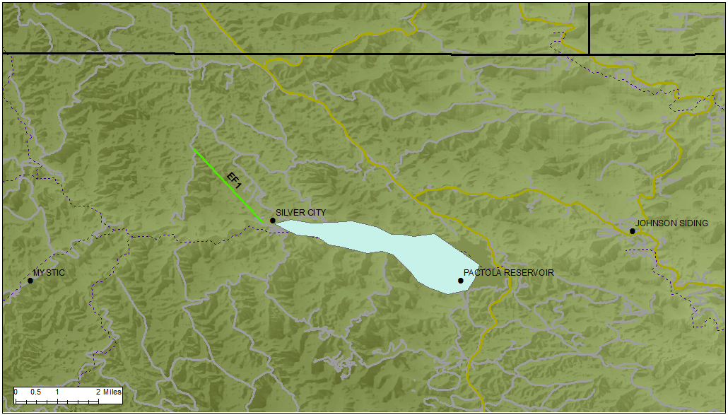
A tornado touched down in the central Black Hills near Silver City and Pactola Reservoir on Tuesday, May 27, 2014. It uprooted and snapped many large ponderosa pine trees and caused minor roof damage to a house.
Tornado:
|
Tornado - Silver City, SD
Track Map
|
||||||||||||||||
@newscenter1 viewer Tim M. also saw the Silver City tornado from Box Elder. #SDwx pic.twitter.com/vSS7pzTMVV
— Thomas Patrick (@ThomasPatrickWx) May 27, 2014
The Enhanced Fujita (EF) Scale classifies tornadoes into the following categories:
| EF0 Weak 65-85 mph |
EF1 Moderate 86-110 mph |
EF2 Significant 111-135 mph |
EF3 Severe 136-165 mph |
EF4 Extreme 166-200 mph |
EF5 Catastrophic 200+ mph |
 |
|||||
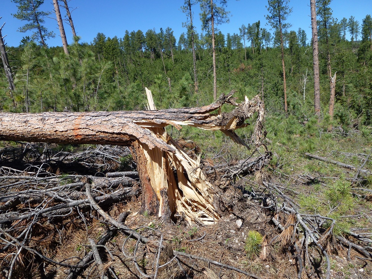
Damage Photos
 |
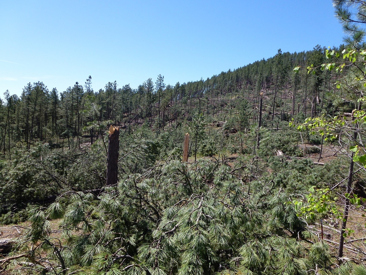 |
| Trees down a few miles north of Silver City (photo by NWS Rapid City) |
Trees down a few miles north of Silver City (photo by NWS Rapid City) |
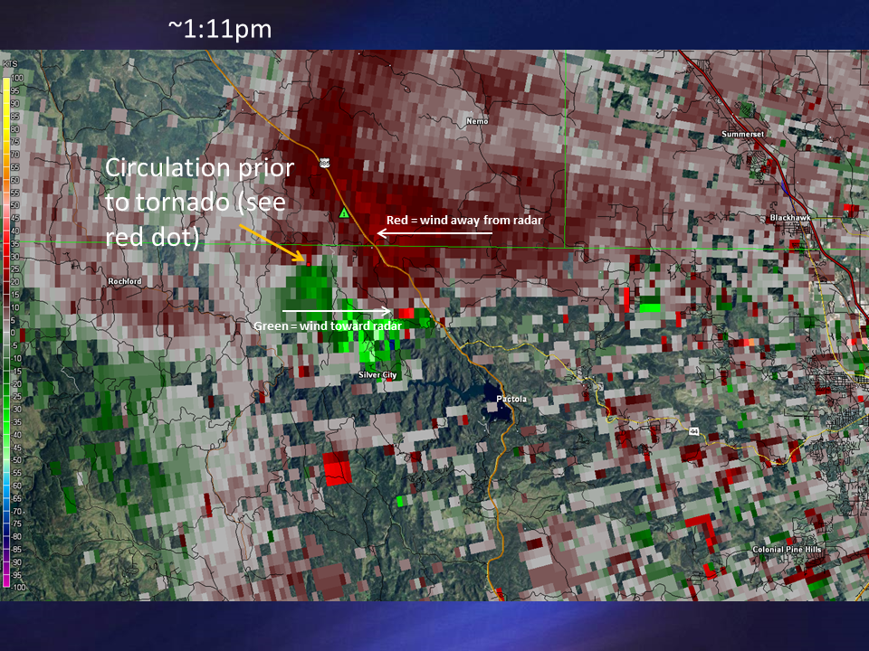
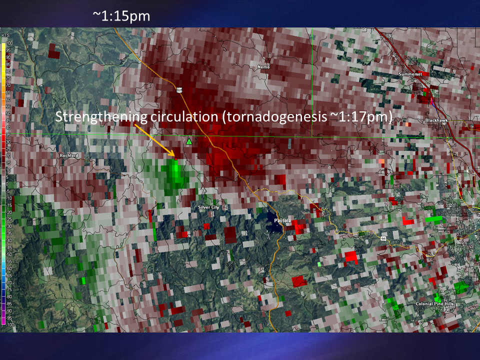
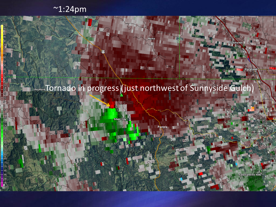
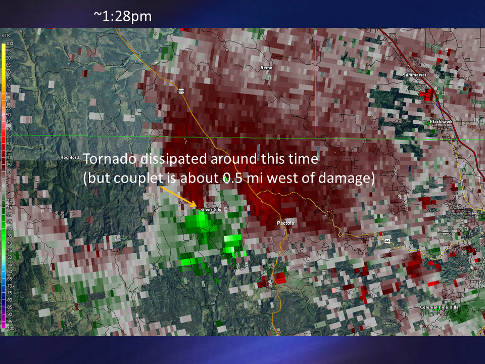
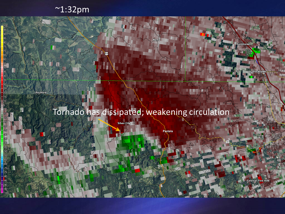
Radar
Radar animation from about 1 to 2 pm MDT
 |
 |
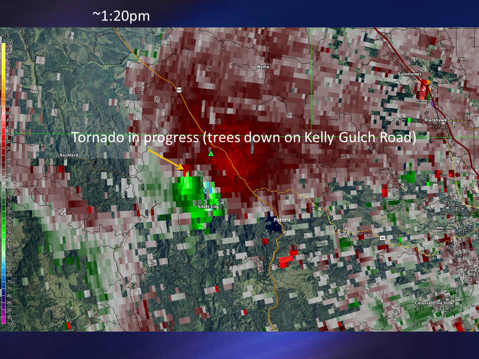 |
| Radar velocity image at 1:11 pm MDT | Radar velocity image at 1:15 pm MDT | Radar velocity image at 1:20 pm MDT |
 |
 |
 |
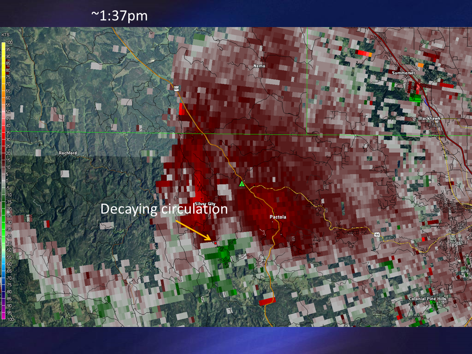 |
| Radar velocity image at 1:24 pm MDT | Radar velocity image at 1:28 pm MDT | Radar velocity image at 1:32 pm MDT | Radar velocity image at 1:37 pm MDT |
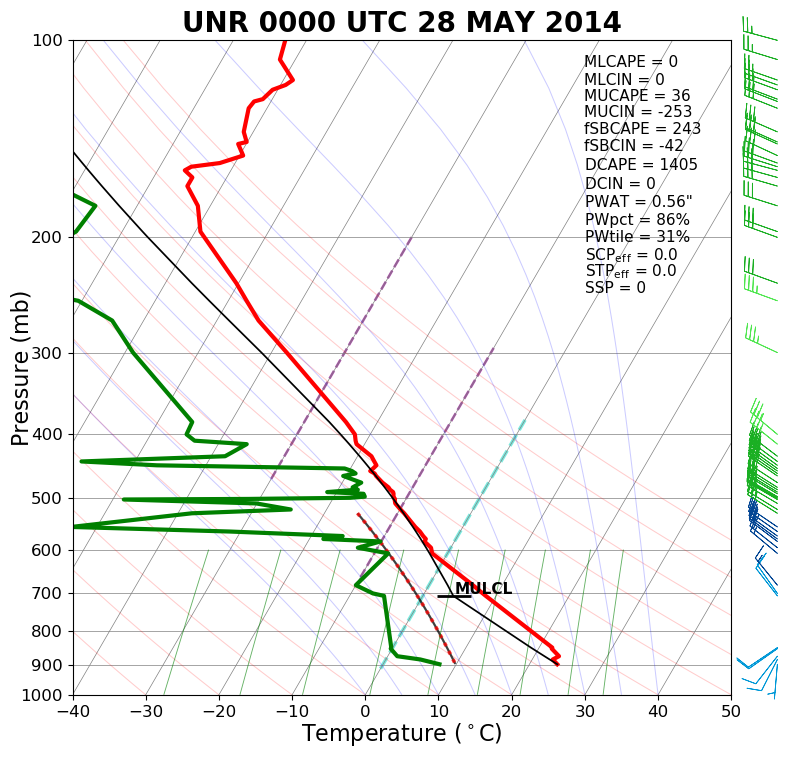
Environment
NWS Rapid City balloon information showed a weakly unstable air mass with weak vertical wind shear. However, the wind shear next to the ground was moderate. Also note that the tornado occurred about 3 1/2 hours before the time of the balloon launch.
 |
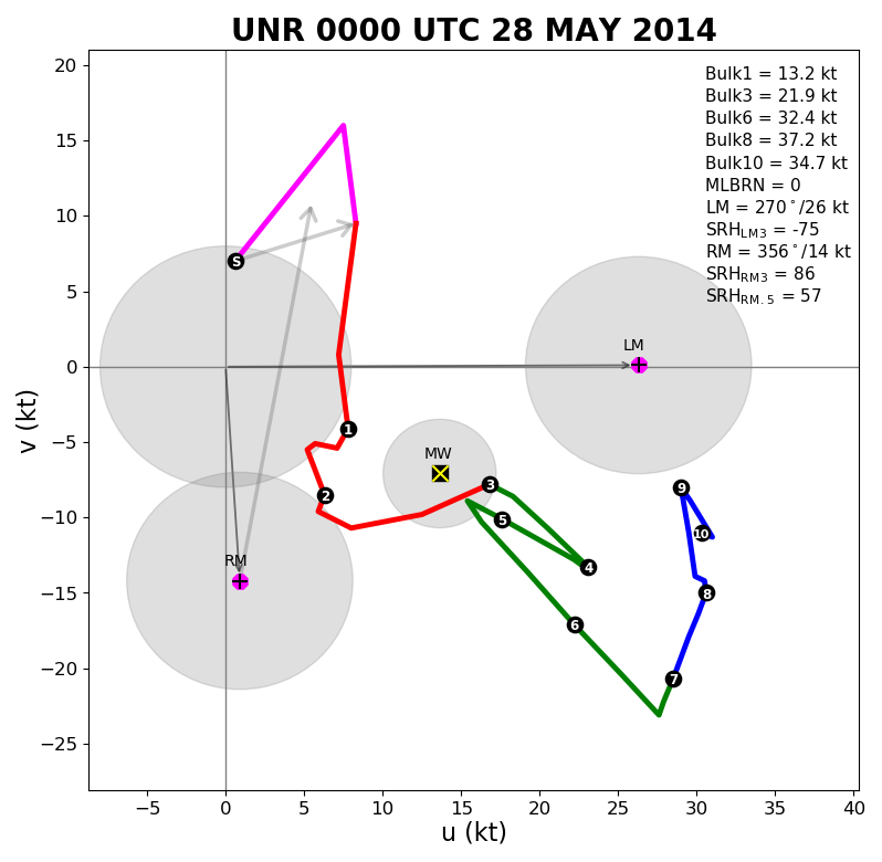 |
| Sounding for Rapid City at 6 pm MDT 27 May 2014 | Hodograph for Rapid City at 6 pm MDT 27 May 2014 |
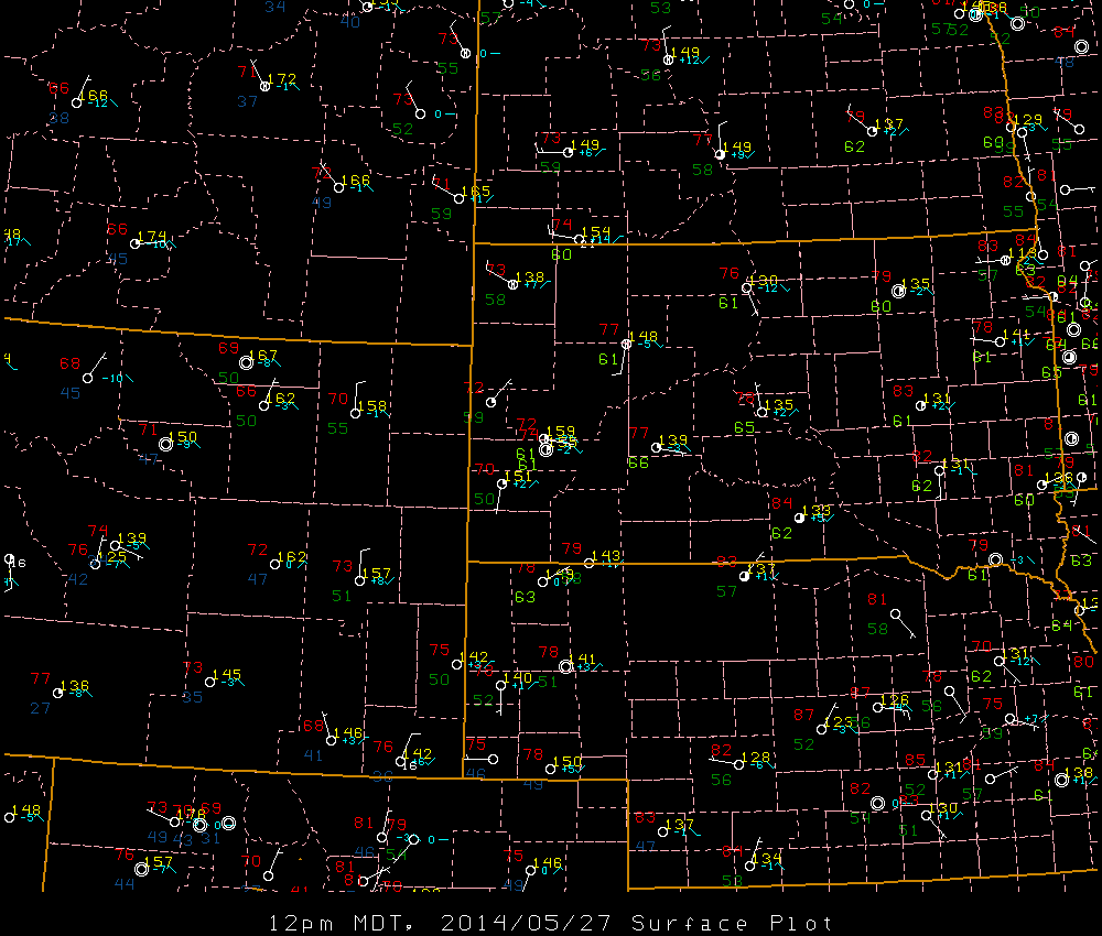
The surface maps valid at noon (below left) and 1 pm (below right) show that moisture was enhanced along the eastern side of the Black Hills.
 |
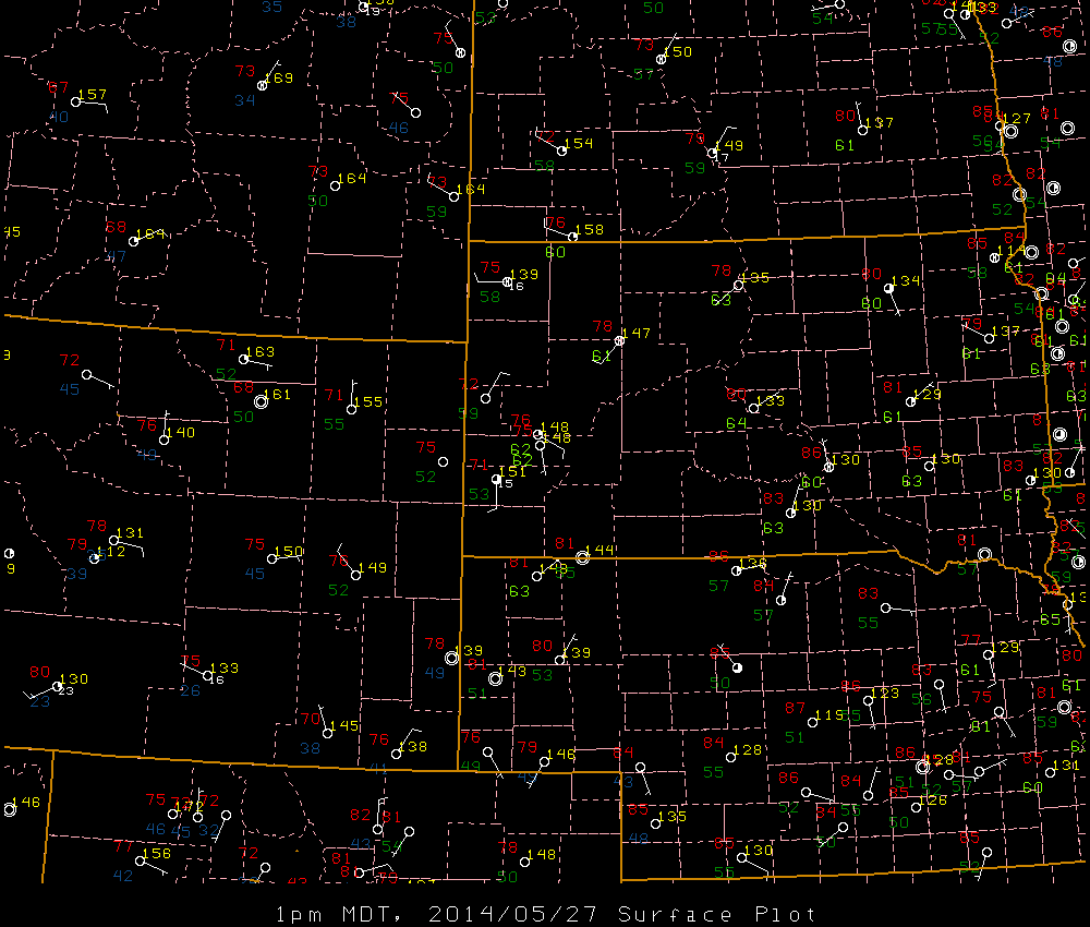 |
| Surface map valid 12 pm MDT 27 May 2014 | Surface map valid 1 pm MDT 27 May 2014 |
 |
Media use of NWS Web News Stories is encouraged! Please acknowledge the NWS as the source of any news information accessed from this site. |
|