
Dangerous heat will expand from the Gulf Coast into the Southern Plains and Desert Southwest through week's end. Additional extreme heat impacting the Pacific Northwest will shift to the northern Plains by the weekend. Tropical Storm Bertha is expected to continue to impact portions of the northwestern Gulf Coast from south central Louisiana to the upper Texas coast today. Read More >
Overview
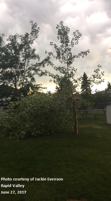
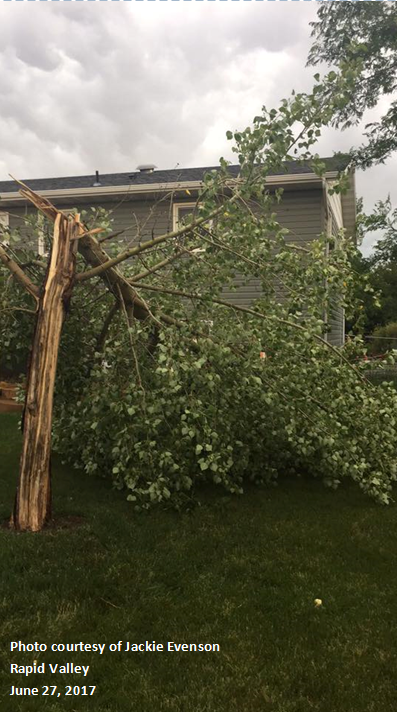
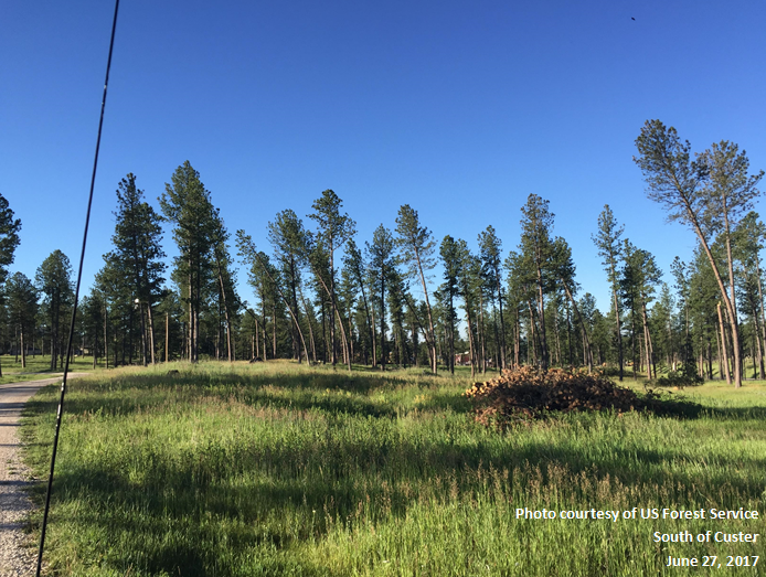
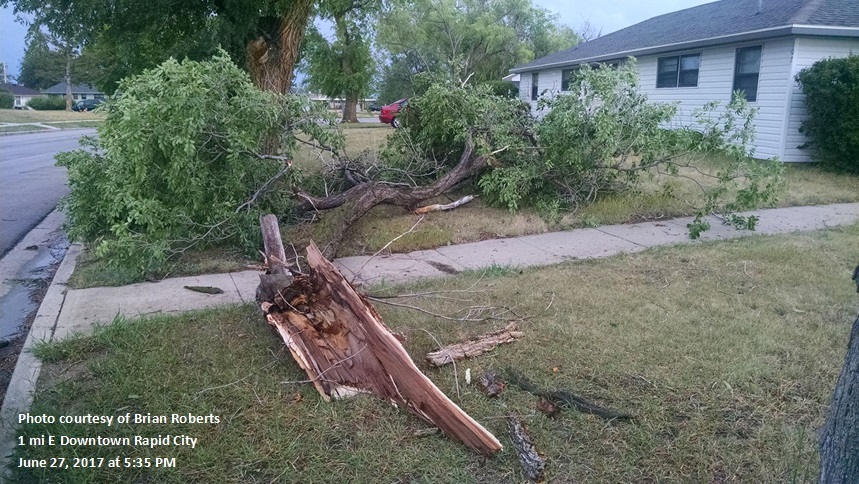
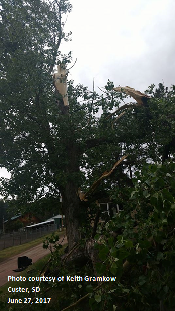
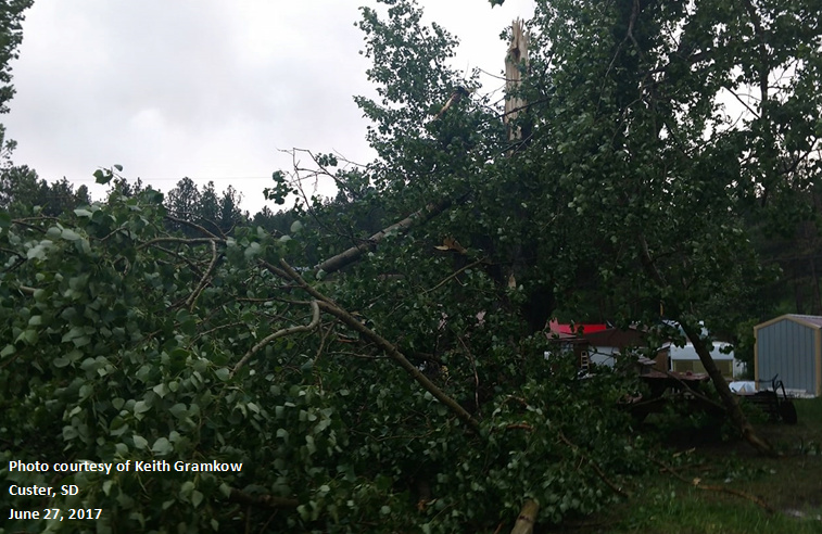
June 27, 2017 - Thunderstorms developed across northeastern Wyoming in the afternoon and strengthened as they moved into South Dakota. The storms produced very strong winds, which caused damage across the area. The Rapid City Airport measured a gust of 75 mph while the Custer County airport recorded a gust of 69 mph, one of the strongest ever at that location. Some hail accompanied these storms, with quarter-sized the largest reported. Below are photos of tree damage, the radar loop, and the list of storm reports.
 |
 |
 |
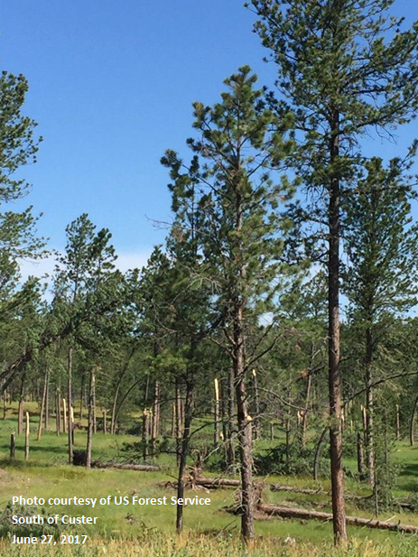 |
| Rapid Valley | Rapid Valley | South of Custer | South of Custer |
 |
 |
 |
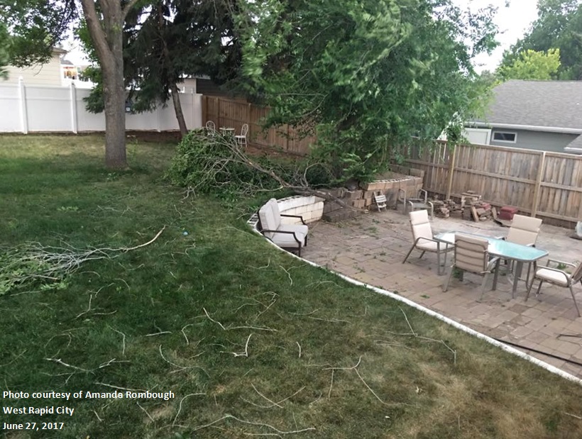 |
| 1 E Downtown Rapid City | Custer | Custer | West Rapid |
Radar:
Six-hour Loop of the Event
Storm Reports
THE STORM REPORTS LISTED BELOW ARE IN DESCENDING ORDER AND MAY NOT NECESSARILY
BE THE FINAL STORM REPORTS.

HAIL REPORTS LISTED BY SIZE (INCHES)

 SIZE    LOCATION                 ST  COUNTY           TIME
 ------  -----------------------  --  --------------   -------
  1.00   PORCUPINE                SD  OGLALA LAKOTA    0527 PM


TSTM WIND REPORTS LISTED BY SPEED (MPH)

 SPEED   LOCATION                 ST  COUNTY           TIME
 ------  -----------------------  --  --------------   -------
 75.00   RAPID CITY AIRPORT       SD  PENNINGTON       0541 PM
 70.00   6 NE OTTUMWA             SD  HAAKON           0708 PM
 70.00   7 SW RAPID CITY AIRPORT  SD  PENNINGTON       0542 PM
 69.00   2 SSW DOWNTOWN CUSTER    SD  CUSTER           0457 PM
 67.00   2 E COTTONWOOD           SD  JACKSON          0630 PM
 66.00   9 NNE EDGEMONT           SD  FALL RIVER       0457 PM
 65.00   8 WSW HILL CITY          SD  PENNINGTON       0505 PM
 65.00   10 SW DOWNTOWN GILLETTE  WY  CAMPBELL         0501 PM
 64.00   4 S DOWNTOWN RAPID CITY  SD  PENNINGTON       0525 PM
 63.00   9 NE KIRLEY              SD  HAAKON           0728 PM
 62.00   5 NE PORCUPINE           SD  OGLALA LAKOTA    0600 PM
 62.00   ELLSWORTH AFB            SD  MEADE            0544 PM
 62.00   8 WNW FAIRBURN           SD  CUSTER           0517 PM
 62.00   9 WSW HILL CITY          SD  PENNINGTON       0449 PM
 61.00   4 NNE ANGOSTURA RESERVOIRSD  FALL RIVER       0452 PM
 61.00   8 W JEWEL CAVE           SD  CUSTER           0444 PM
 60.00   2 SSE CACTUS FLAT        SD  JACKSON          0615 PM
 60.00   4 N ROZET                WY  CAMPBELL         0541 PM
 60.00   4 N DOWNTOWN RAPID CITY  SD  PENNINGTON       0537 PM
 60.00   3 WSW FAIRBURN           SD  CUSTER           0508 PM
 59.00   3 E PHILIP               SD  HAAKON           0652 PM
 56.00   25 ESE WRIGHT            WY  CAMPBELL         0330 PM
 55.00   3 S HILL CITY            SD  PENNINGTON       0510 PM
 55.00   2 SSW ORAL               SD  FALL RIVER       0505 PM
 52.00   3 ESE PINE RIDGE         SD  OGLALA LAKOTA    0456 PM
 50.00   2 W HAYWARD              SD  PENNINGTON       0520 PM
 49.00   1 SE DOWNTOWN NEWCASTLE  WY  WESTON           0427 PM
 |
Media use of NWS Web News Stories is encouraged! Please acknowledge the NWS as the source of any news information accessed from this site. |
|

