
Scattered thunderstorms with severe gusts, hail and a tornado risk are possible near a cold front from the Ohio Valley to the Mid-Atlantic tonight. Tropical Storm Bertha is expected to bring tropical storm conditions to portions of the Gulf Coast from the panhandle of Florida into Louisiana through Wednesday. Read More >
Overview
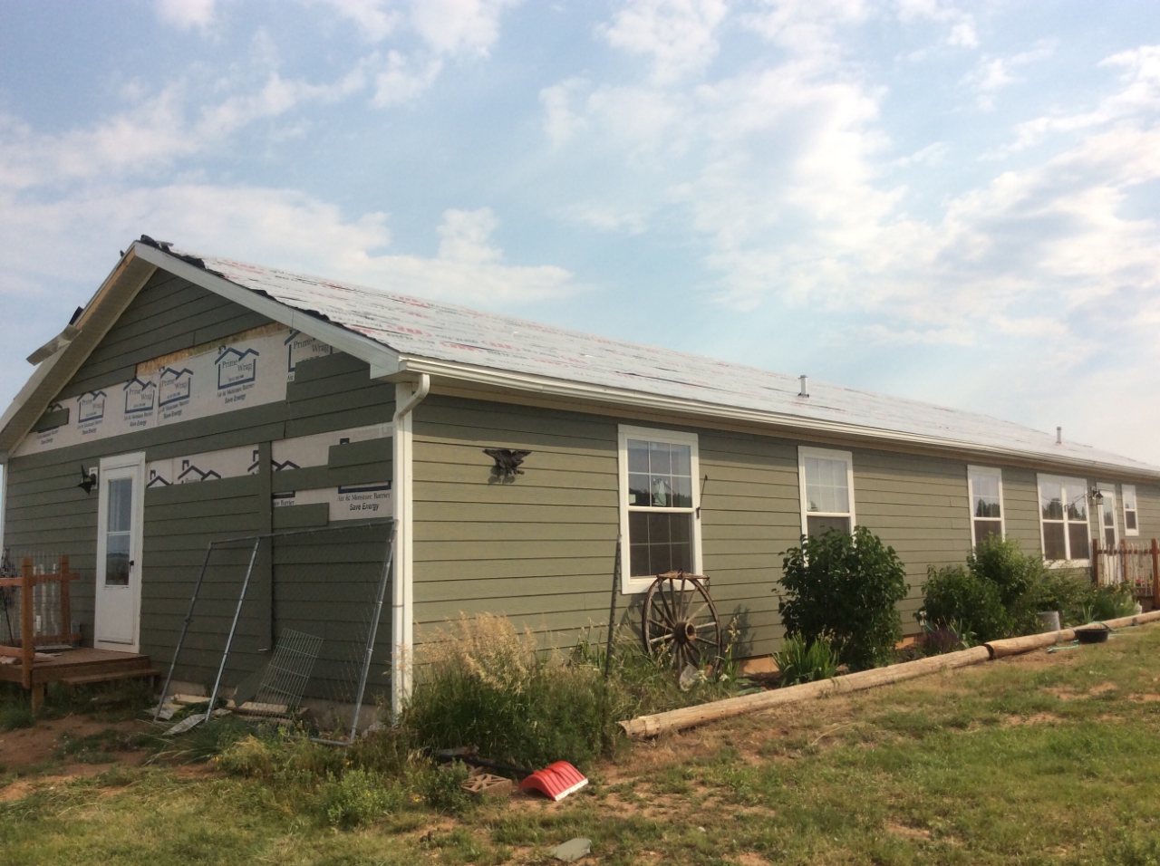
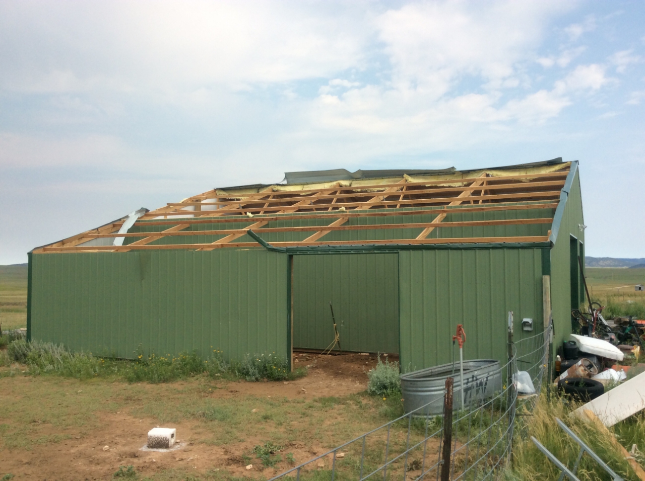
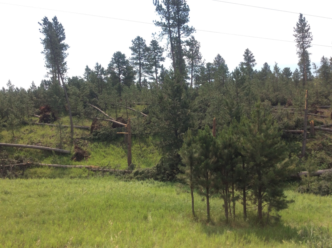
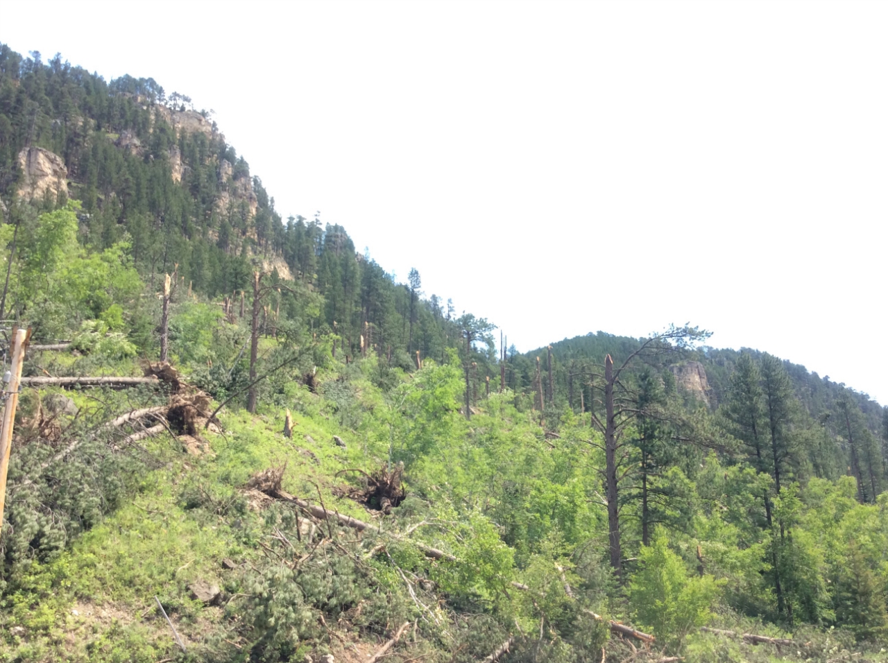
During the afternoon of June 29, 2018, two supercells moved across northeastern Wyoming and western South Dakota. In addition to producing very large hail, the southern supercell spawned a tornado with a continuous path from southeast of Sundance eastward to Spearfish Canyon. The majority of damage occurred in wooded areas, with widespread snapped trees observed throughout the tornado path. Some structural damage was also observed southeast of Sundance, just east of Highway 585, near the beginning of the tornado's path. Based on the damage, maximum winds were estimated to be 105 mph, giving the tornado an EF-1 rating.
Tornado - Northern Black Hills
Crook Co., WY and Lawrence Co., SD
Track Map 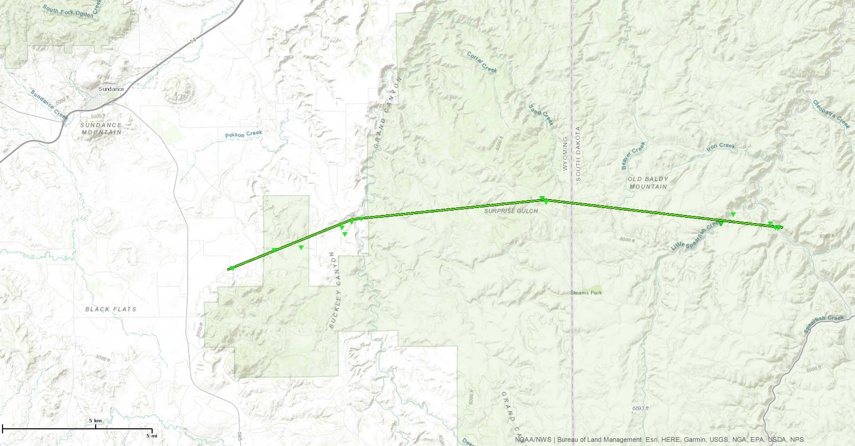 
|
||||||||||||||||
The Enhanced Fujita (EF) Scale classifies tornadoes into the following categories:
| EF0 Weak 65-85 mph |
EF1 Moderate 86-110 mph |
EF2 Significant 111-135 mph |
EF3 Severe 136-165 mph |
EF4 Extreme 166-200 mph |
EF5 Catastrophic 200+ mph |
 |
|||||
Photos & Video:
 |
 |
 |
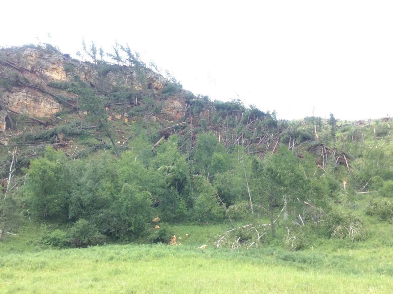 |
| Spring Canyon Road (NWS Survey) |
Spring Canyon Road (NWS Survey) |
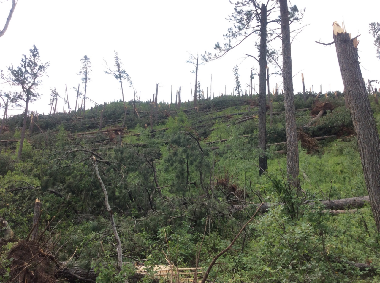
Moskee Road (NWS Survey) |
Moskee Road (NWS Survey) |
 |
 |
 |
 |
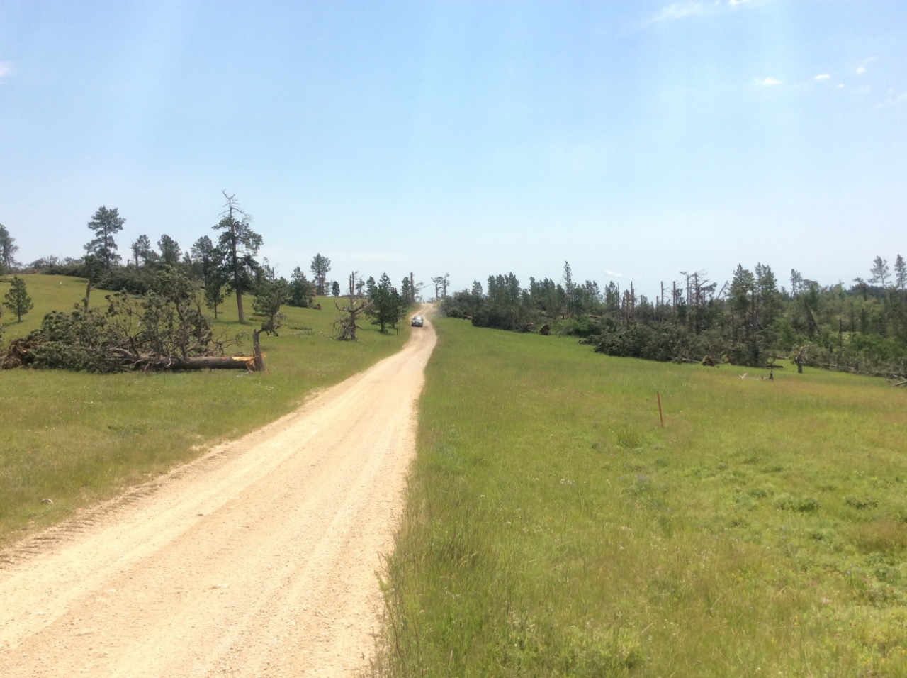
| Sand Creek Road (NWS Survey) |
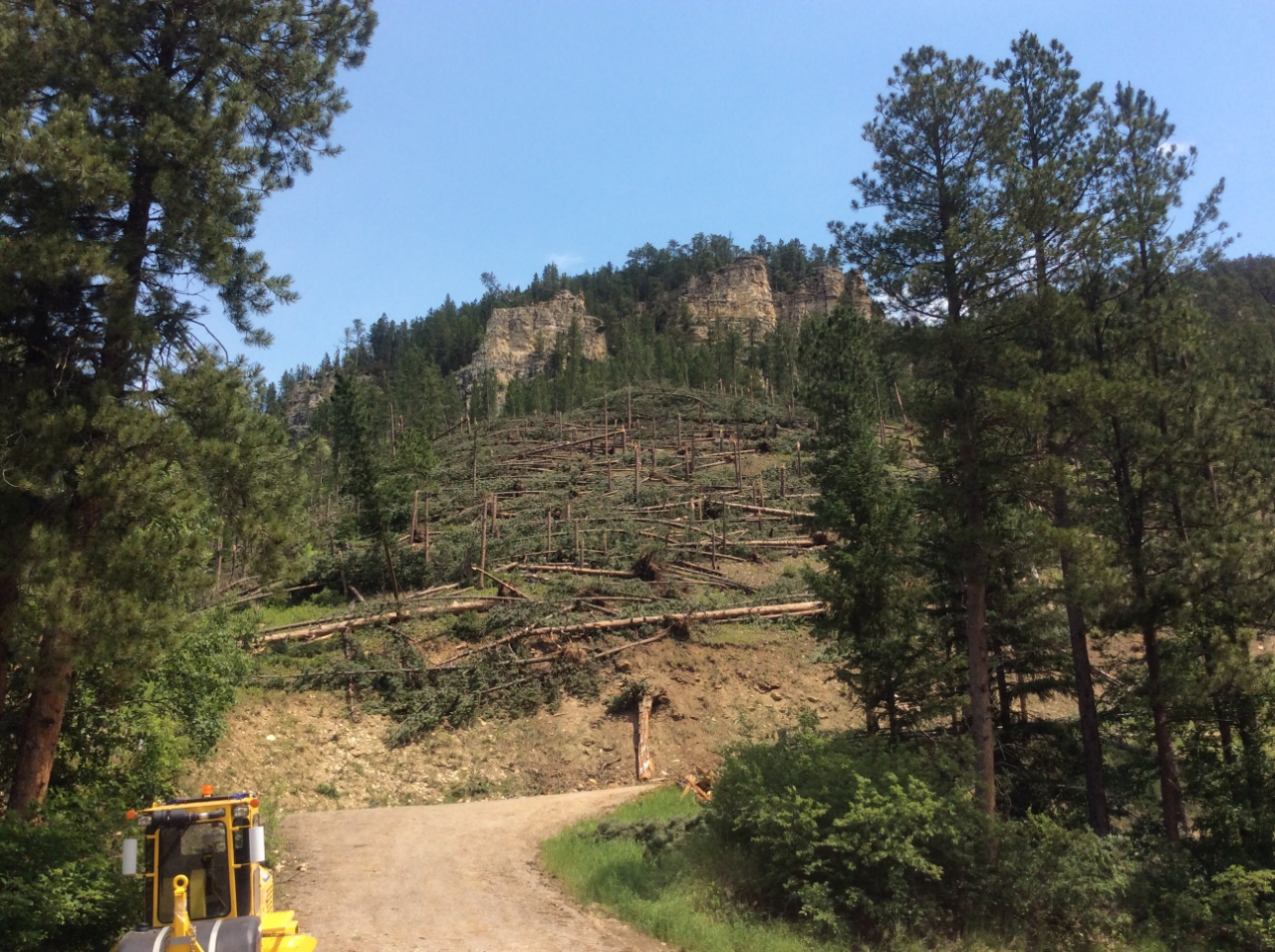
Cement Ridge Road (NWS Survey) |
Spearfish Canyon (NWS Survey) |
Spearfish Canyon (NWS Survey) |
Radar:
 |
 |
||
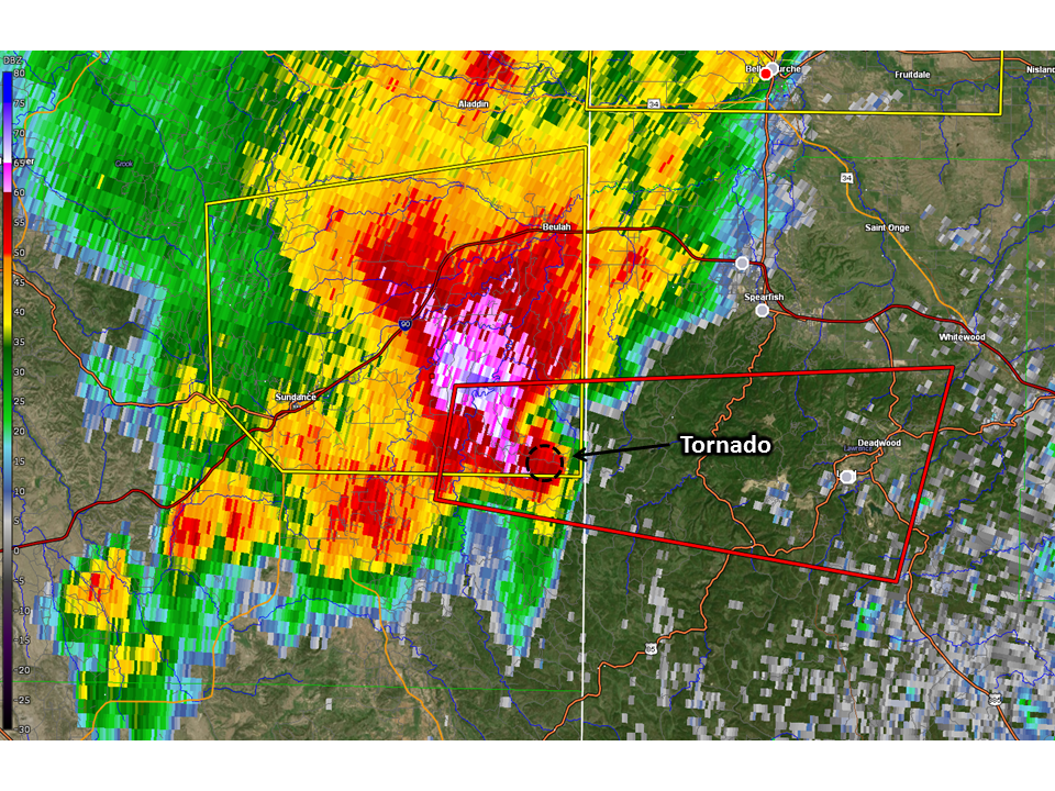
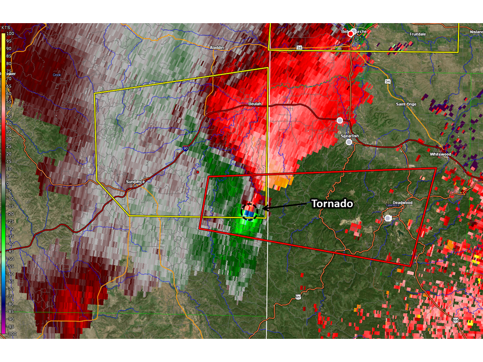
| Reflectivity at 4:17 PM MDT | Storm-Relative Motion at 4:17 PM MDT |
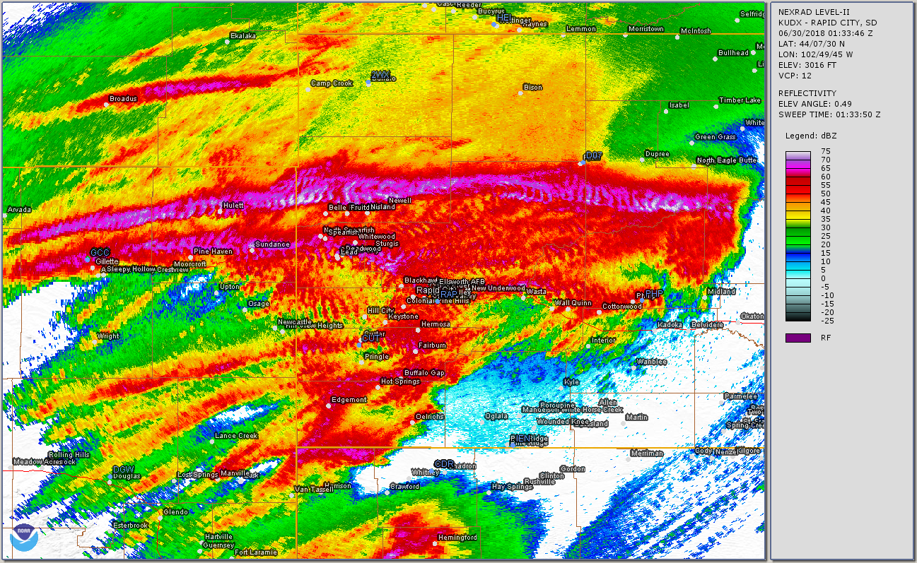 |
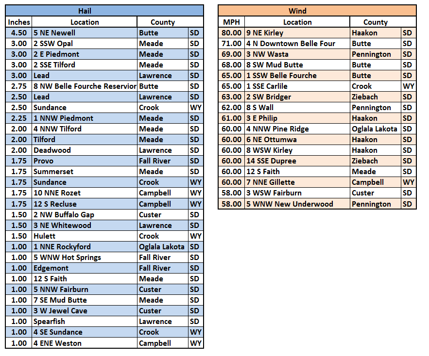
| Accumulation of the maximum radar reflectivity values from about 1:15 pm to 7:30 pm MDT on June 29, 2018. Note the two long swaths of intense (red, purple, and white) colors from west of Gillette across the northern Black Hills and into central South Dakota. The southern swath is associated with the storm that produced the northern Black Hills tornado, while the northern swath is associated with a storm that produced considerable hail and wind damage (and also two brief tornadoes). |
Storm Reports
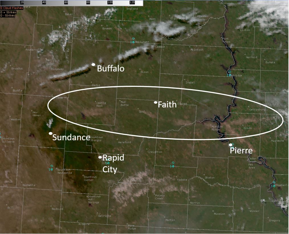 |
| The satellite image above shows a "damage scar" caused by the combination of high winds and large hail (white oval). This extends from west of Belle Fourche to south of Faith and to the north of Pierre. |
Environment
 |
||
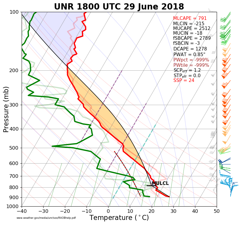
| Temperature, dew point, and wind data from the sounding launched from the Rapid City, SD forecast office at 12 PM on June 29, 2018. |
 |
Media use of NWS Web News Stories is encouraged! Please acknowledge the NWS as the source of any news information accessed from this site. |
|

