
Scattered thunderstorms with severe gusts, hail and a tornado risk are possible near a cold front from the Ohio Valley to the Mid-Atlantic tonight. Tropical Storm Bertha is expected to bring tropical storm conditions to portions of the Gulf Coast from the panhandle of Florida into Louisiana through Wednesday. Read More >
Overview
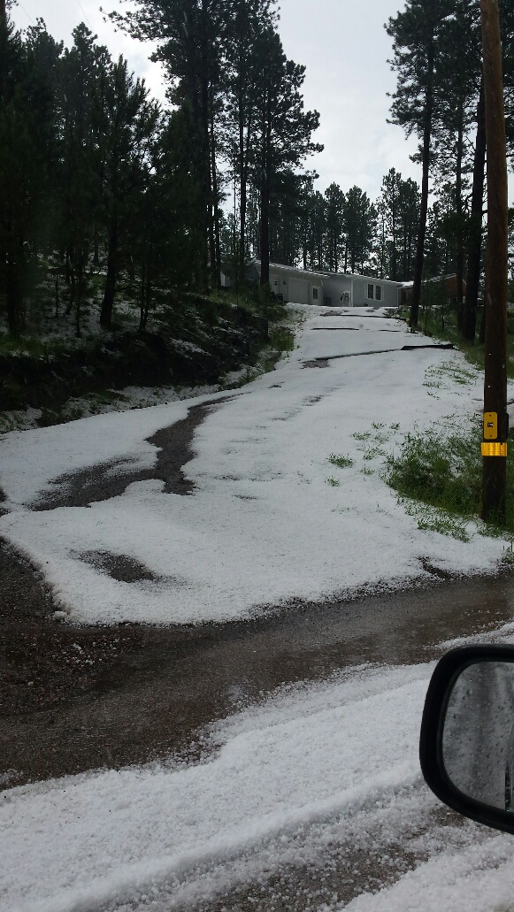
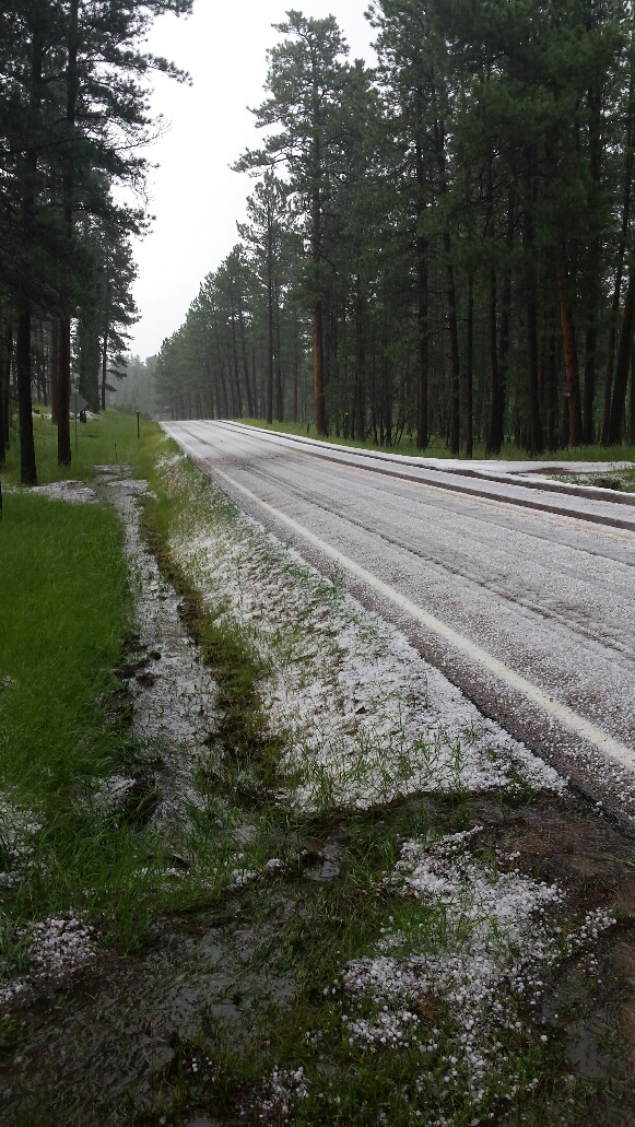
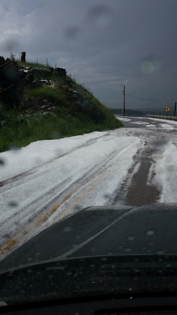
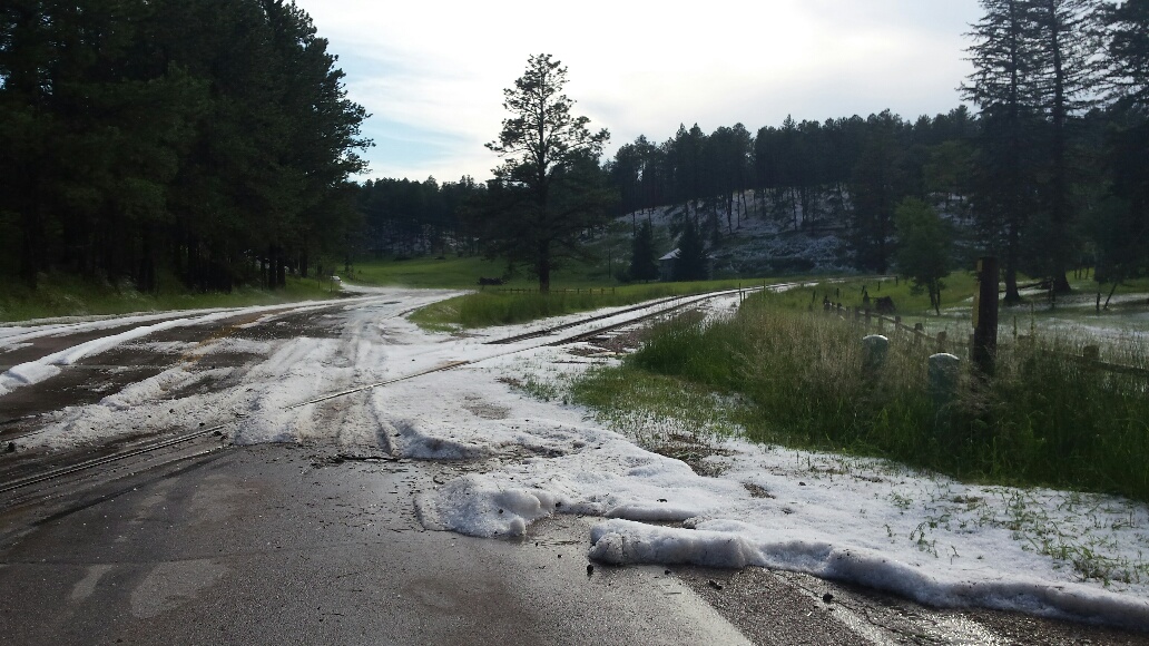
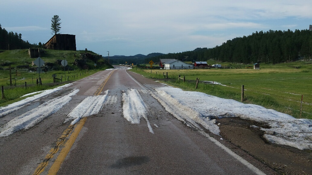
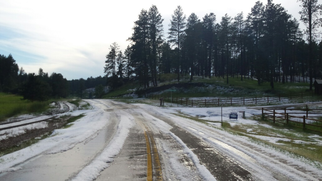
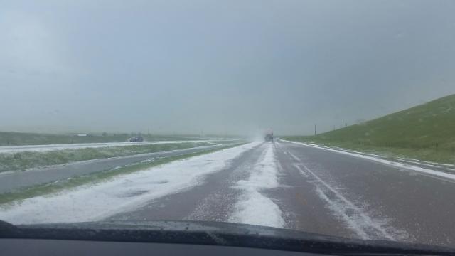
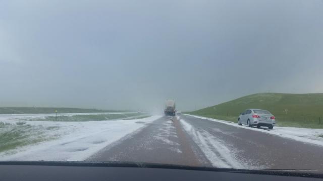
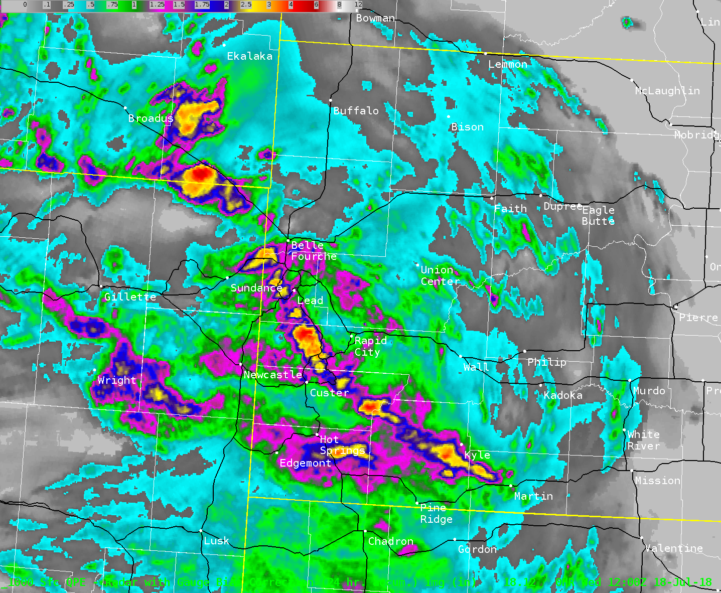
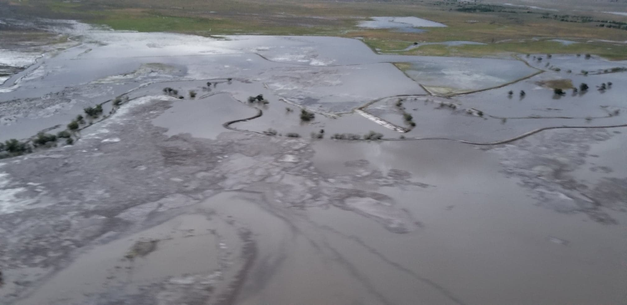
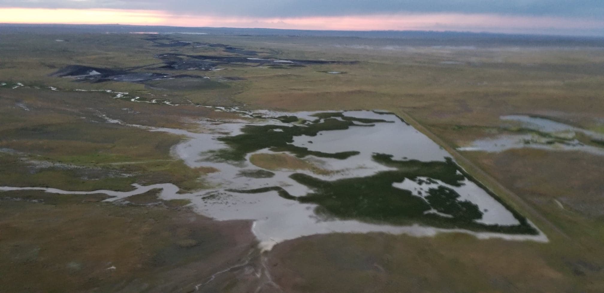
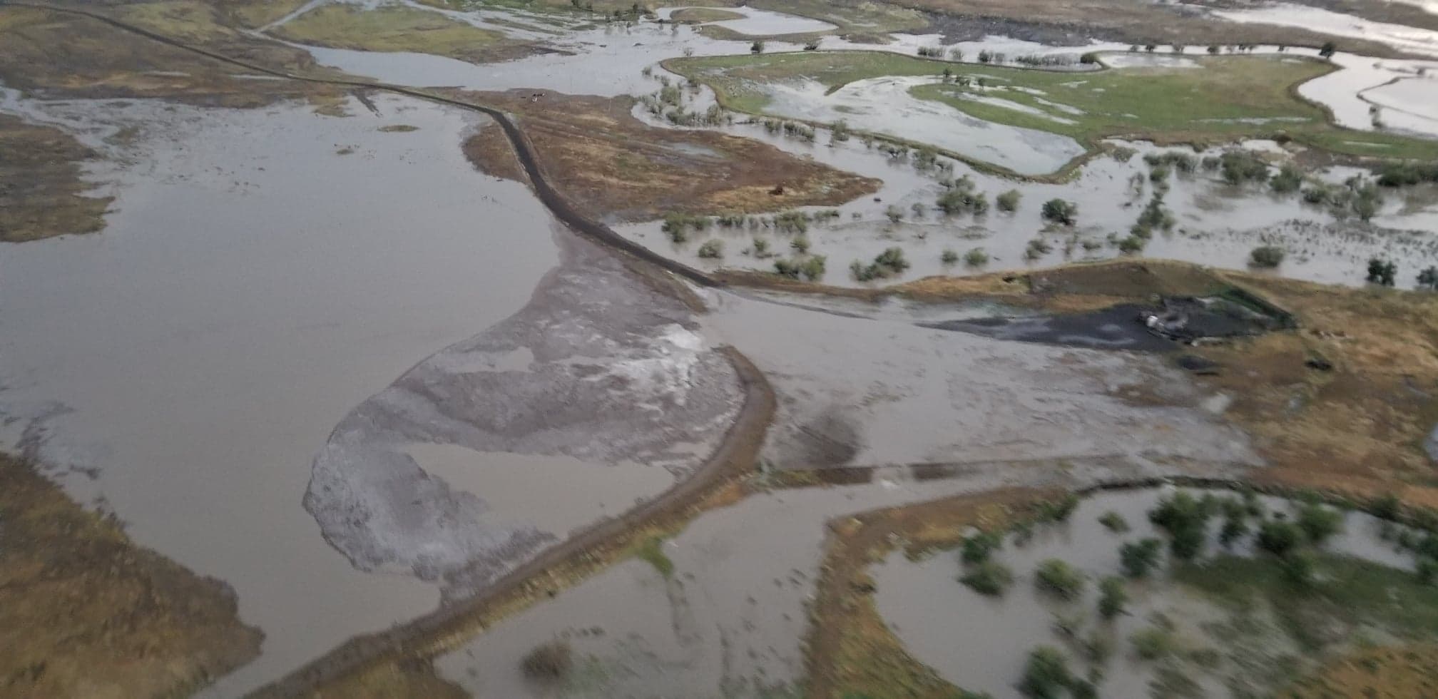
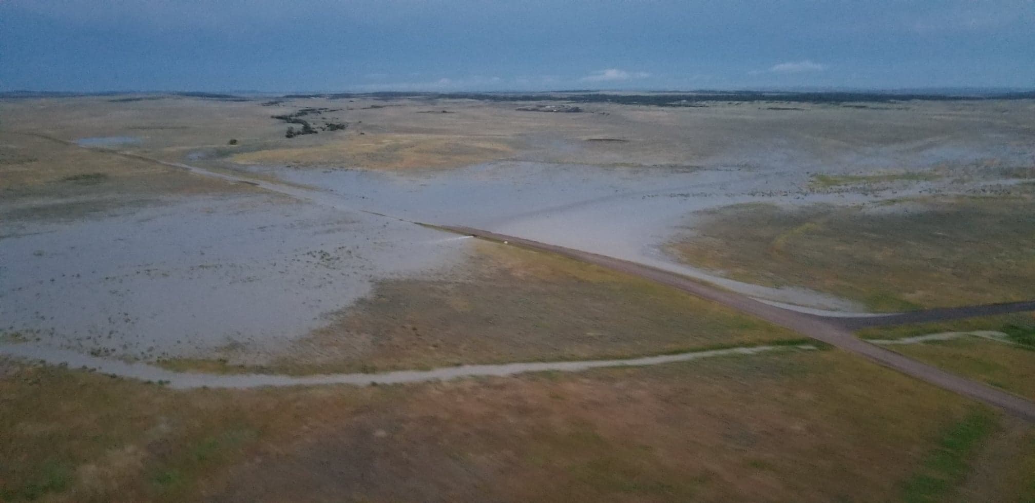
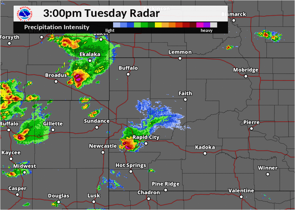
On the afternoon of July 17th, 2018, thunderstorms developed over the Black Hills. Some of these storms became severe, producing large hail and damaging winds. However, the main issue with these storms was a significant amount of small hail, covering the roads and making travel difficult. Snow plows were needed to clear inches of hail from the roads. Additionally, heavy rain caused flash flooding, which was exacerbated by hail-covered roads. The storms over the Black Hills eventually moved southeast onto the plains. More thunderstorms moved into northeastern Wyoming, becoming severe and producing large hail and strong winds. Heavy rain with these storms also produced flash flooding. These storms merged to form one storm system (what meteorologists call a mesoscale convective system, or MCS), and spread into South Dakota.
Hail:
 |
 |
 |
 |
| Between Twin Springs and Pink Cabin Road (Dave Maudlin) |
Twin Springs Road (Dave Maudlin) |
Old Hill City Road (Dave Maudlin) |
Old Hill City Road (Dave Maudlin) |
 |
 |
 |
 |
| Old Hill City Road (Dave Maudlin) |
Old Hill City Road (Dave Maudlin) |
Near Fairbun (Sara Chamberlain) |
Near Fairburn (Sara Chamberlain) |
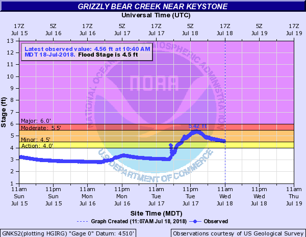
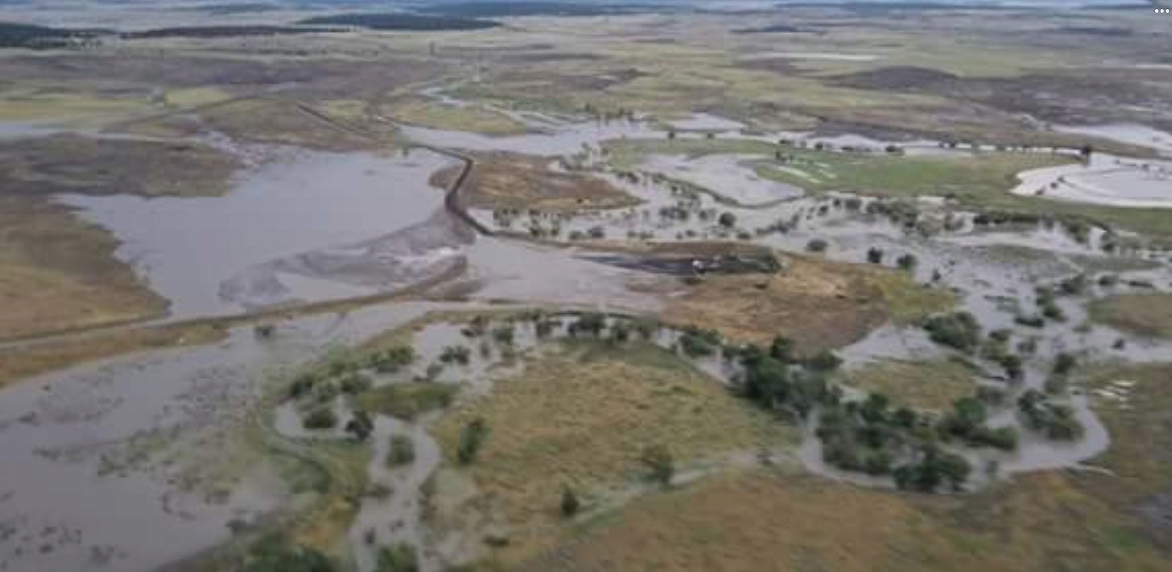
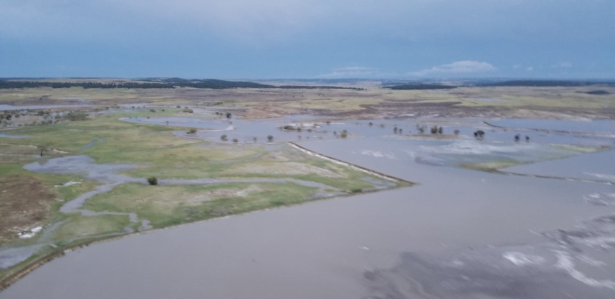
Flooding
 |
 |
 |
 |
| Storm Total Precipitation | Grizzly Bear Creek near Keystone | Thompson Creek, near the WY/MT border (John Pierce) |
Thompson Creek, ​near the WY/MT border (John Pierce) |
 |
 |
 |
 |
| Thompson Creek, ​near the WY/MT border (John Pierce) |
Thompson Creek, ​near the WY/MT border (John Pierce) |
Thompson Creek, ​near the WY/MT border (John Pierce) |
Thompson Creek, ​near the WY/MT border (John Pierce) |
Radar:
Storm Reports
The storm reports listed below are in descending order and may not
necessarily be the final storm reports.

Hail reports listed by size (inches)

 SIZE    LOCATION                 ST  COUNTY           TIME
 ------  -----------------------  --  --------------   -------
  1.75   2 W HAYWARD              SD  PENNINGTON       0355 PM
                 GROUND COVERED IN HAIL.
  1.50   2 WNW FAIRBURN           SD  CUSTER           0450 PM
  1.25   SHARPS CORNER            SD  OGLALA LAKOTA    0600 PM
                 3-4 INCHES OF WATER ON BIA 27.
  1.25   3 ENE HILL CITY          SD  PENNINGTON       0322 PM
  1.00   BEULAH                   WY  CROOK            0635 PM
  1.00   17 NE RENO JUNCTION      WY  CAMPBELL         0602 PM
  1.00   8 WSW BEULAH             WY  CROOK            0535 PM
  1.00   11 NNE SAVAGETON         WY  CAMPBELL         0505 PM
  1.00   SHARPS CORNER            SD  OGLALA LAKOTA    0500 PM
  1.00   13 NNE SAVAGETON         WY  CAMPBELL         0446 PM
  1.00   10 E DOWNTOWN CUSTER     SD  CUSTER           0429 PM
  1.00   22 WSW DOWNTOWN GILLETT  WY  CAMPBELL         0420 PM
  1.00   2 W HAYWARD              SD  PENNINGTON       0347 PM
  1.00   1 E HILL CITY            SD  PENNINGTON       0325 PM
                 GROUND IS WHITE. 0.75 INCHES OF RAIN.
  1.00   3 WSW SHERIDAN LAKE      SD  PENNINGTON       0310 PM
  1.00   1 WSW MYSTIC             SD  PENNINGTON       0220 PM
  0.88   3 ESE HILL CITY          SD  PENNINGTON       0330 PM
                 NICKEL SIZED HAIL FOR THE LAST 15 MINUTES
  0.88   2 ENE HILL CITY          SD  PENNINGTON       0316 PM
                 LOTS OF NICKLE AND DIME SIZED HAIL THAT
                 COVERED THE ROAD. VEHICLES HAD TO PULLOVER.


Tstm wind reports listed by speed (mph)

 SPEED   LOCATION                 ST  COUNTY           TIME
 ------  -----------------------  --  --------------   -------
 70.00   10 W EDGEMONT            SD  FALL RIVER       0853 PM
 70.00   2 WNW FAIRBURN           SD  CUSTER           0505 PM
 70.00   2 NNW FAIRBURN           SD  CUSTER           0505 PM
 65.00   2 SE COLONY              WY  CROOK            0630 PM
                 SPOTTER WAS DRIVING FROM BELLE FOURCHE TO
                 COLONY 12 MILES NW OF BELLE FOURCHE HE
                 ENCOUNTERED 65 MPH WIND GUSTS AND HEAVY RAIN
 65.00   10 WNW DOWNTOWN SPEARFI  SD  LAWRENCE         0615 PM
 65.00   15 N RENO JUNCTION       WY  CAMPBELL         0529 PM
 60.00   3 ENE ROCHELLE           WY  WESTON           0714 PM
 60.00   15 NNW ALVA              WY  CROOK            0550 PM
 60.00   11 NNE SAVAGETON         WY  CAMPBELL         0505 PM
 60.00   15 NNE RECLUSE           WY  CAMPBELL         0450 PM
 60.00   14 NNW SAVAGETON         WY  CAMPBELL         0425 PM
 60.00   22 WSW DOWNTOWN BELLE F  WY  CROOK            0420 PM
                 CHAIN LINK FENCE BLOWN DOWN, PATIO FURNITURE
                 BLOWN ACROSS DECK, DOG HOUSE BLOWN ACROSS
                 YARD
 57.00   3 NW WASTA               SD  PENNINGTON       0913 PM
 57.00   5 SW BEULAH              WY  CROOK            0626 PM
 56.00   3 ESE PINE RIDGE         SD  OGLALA LAKOTA    1034 PM
 56.00   5 NE PORCUPINE           SD  OGLALA LAKOTA    0620 PM
                 TIME ESTIMATED FROM RADAR
 55.00   8 NW ROCKYPOINT          WY  CAMPBELL         0540 PM
 53.00   RAPID CITY AIRPORT       SD  PENNINGTON       0844 PM


Rain amounts (inches)

 AMOUNT  LOCATION                 ST  COUNTY           TIME
 ------  -----------------------  --  --------------   -------
  2.70   7 NE SMITHWICK           SD  FALL RIVER       0700 AM
                 24-HR RAINFALL.
  2.25   6 SW BEULAH              WY  CROOK            0700 AM
                 24-HR RAINFALL.
  2.05   HILL CITY                SD  PENNINGTON       0700 AM
                 24-HR RAINFALL.
  1.78   2 ENE EDGEMONT           SD  FALL RIVER       0700 AM
                 24-HR RAINFALL.
  1.67   14 NW EDGEMONT           SD  FALL RIVER       0700 AM
                 24-HR RAINFALL.
  1.32   2 SW DOWNTOWN NEWCASTLE  WY  WESTON           0700 AM
                 24-HR RAINFALL.
  1.25   7 ENE OSAGE              WY  WESTON           0700 AM
                 24-HR RAINFALL.
  1.25   1 S DOWNTOWN BELLE FOUR  SD  BUTTE            0700 AM
                 24-HR RAINFALL.
  1.20   2 NW CENTRAL CITY        SD  LAWRENCE         0700 AM
                 24-HR RAINFALL.
  1.20   HERMOSA                  SD  CUSTER           0700 AM
                 24-HR RAINFALL.
  1.16   6 SSW MYSTIC             SD  PENNINGTON       0700 AM
                 24-HR RAINFALL.
  1.11   3 SE SAINT ONGE          SD  LAWRENCE         0700 AM
                 24-HR RAINFALL.
  1.08   3 ESE CHEYENNE CROSSING  SD  LAWRENCE         0700 AM
                 24-HR RAINFALL.
  1.05   1 WSW DOWNTOWN NEWCASTL  WY  WESTON           0700 AM
                 24-HR RAINFALL.
  0.99   4 NNE SUMMERSET          SD  MEADE            0700 AM
                 24-HR RAINFALL.
  0.96   11 NE MORRISEY           WY  WESTON           0700 AM
                 24-HR RAINFALL.
  0.95   1 N HISEGA               SD  PENNINGTON       0700 AM
                 24-HR RAINFALL.
  0.90   4 S DOWNTOWN RAPID CITY  SD  PENNINGTON       0700 AM
                 24-HR RAINFALL.
  0.87   4 NNW DOWNTOWN STURGIS   SD  MEADE            0700 AM
                 24-HR RAINFALL.
  0.86   6 NNW DOWNTOWN SPEARFIS  SD  LAWRENCE         0700 AM
                 24-HR RAINFALL.
  0.85   DOWNTOWN HOT SPRINGS     SD  FALL RIVER       0700 AM
                 24-HR RAINFALL.
  0.84   1 NW DOWNTOWN CUSTER     SD  CUSTER           0700 AM
                 24-HR RAINFALL.
  0.81   7 SSE SUNDANCE           WY  CROOK            0700 AM
                 24-HR RAINFALL.
  0.81   TILFORD                  SD  MEADE            0700 AM
                 24-HR RAINFALL.
  0.81   1 SSW DOWNTOWN HOT SPRI  SD  FALL RIVER       0700 AM
                 24-HR RAINFALL.
  0.77   5 NE ROCKERVILLE         SD  PENNINGTON       0700 AM
                 24-HR RAINFALL.
  0.75   2 NE BOX ELDER           SD  PENNINGTON       0700 AM
                 24-HR RAINFALL.
  0.75   1 NE DOWNTOWN RAPID CIT  SD  PENNINGTON       0700 AM
                 24-HR RAINFALL.
 |
Media use of NWS Web News Stories is encouraged! Please acknowledge the NWS as the source of any news information accessed from this site. |
|

