
Scattered thunderstorms with severe gusts, hail and a tornado risk are possible near a cold front from the Ohio Valley to the Mid-Atlantic tonight. Tropical Storm Bertha is expected to bring tropical storm conditions to portions of the Gulf Coast from the panhandle of Florida into Louisiana through Wednesday. Read More >
Overview

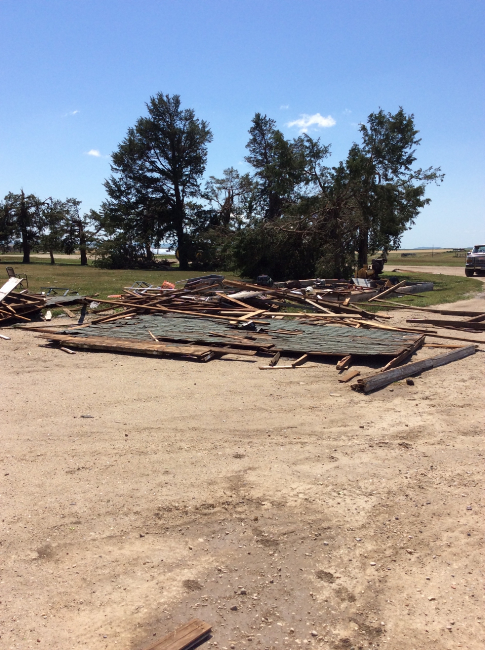
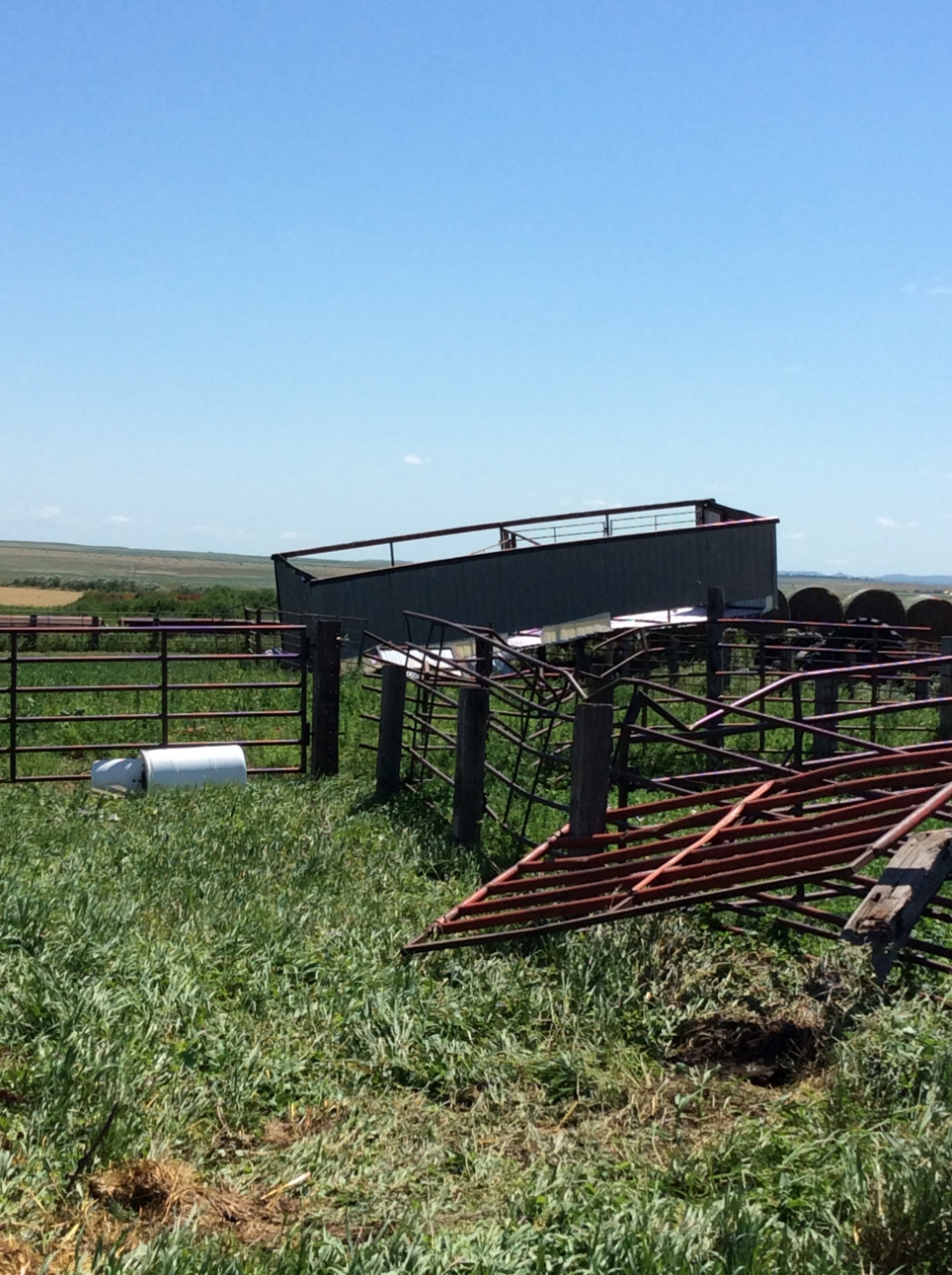
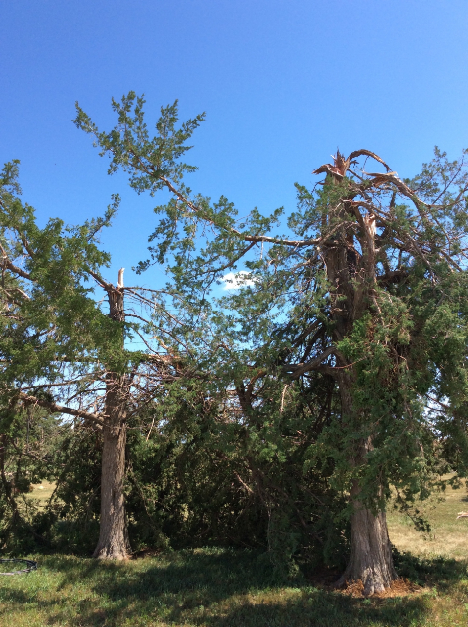
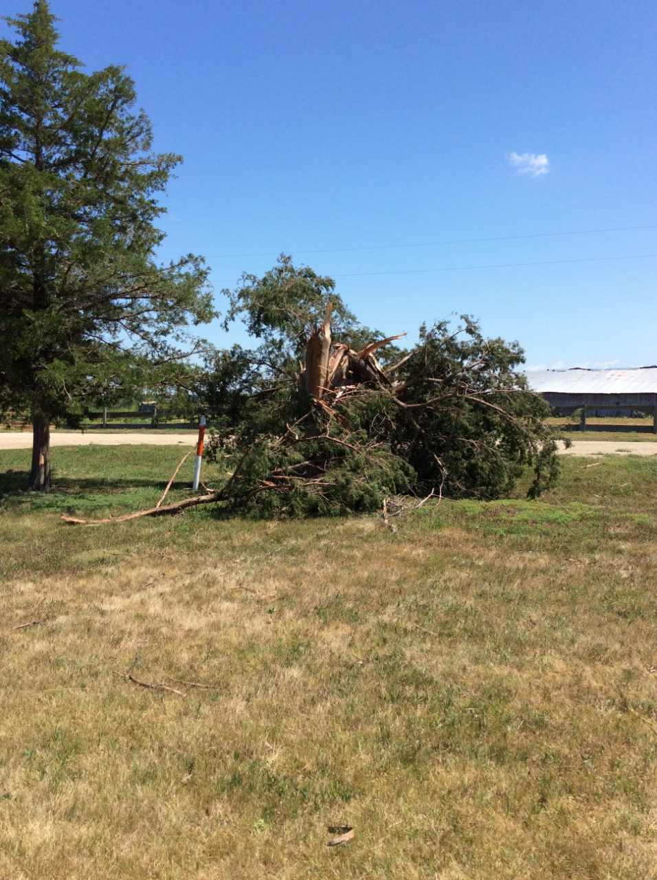
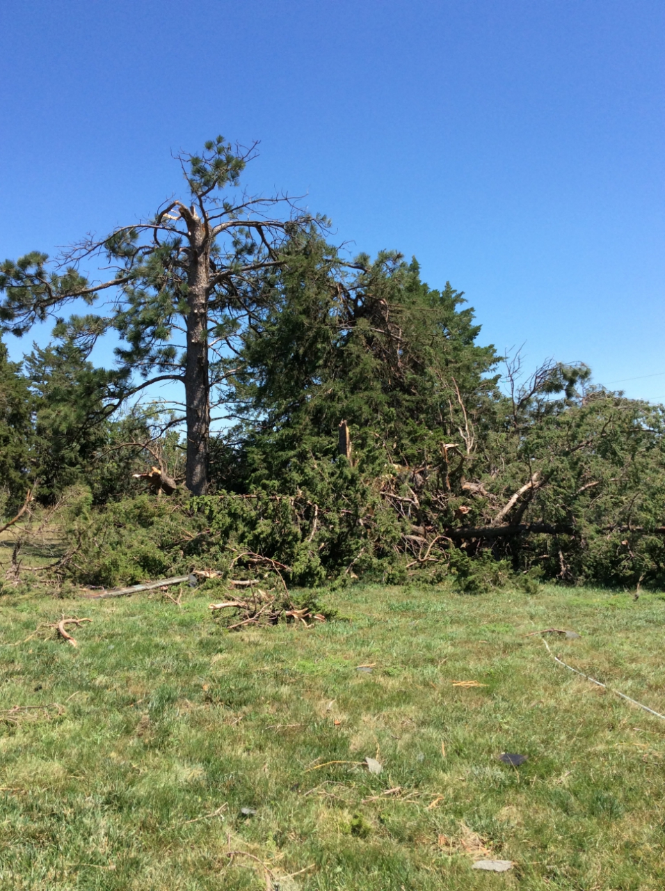
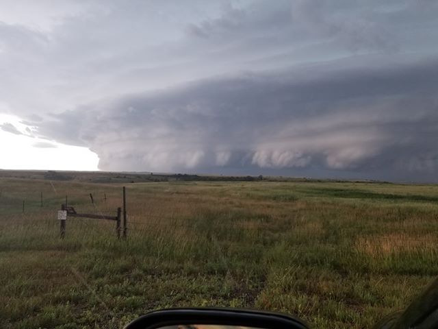
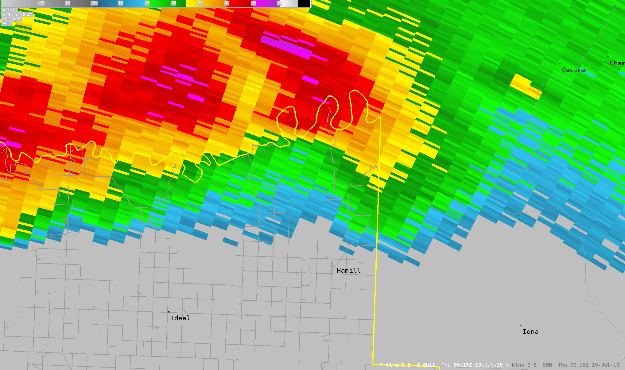
During the afternoon and evening of July 18, 2018, scattered strong to severe thunderstorms developed across western South Dakota. The most intense storm produced a brief tornado and significant straight-line wind damage over northeastern Tripp County, north of Hamill. Based on a storm damage survey, the highest winds of the tornado were estimated to be 90 to 100 mph, which gives it a rating of EF-1. In addition, straight-line winds snapped trees and power poles, with estimated wind speeds up to 115 mph. This storm is pictured to the left. Photo courtesy of Laura Welker from Hamill.
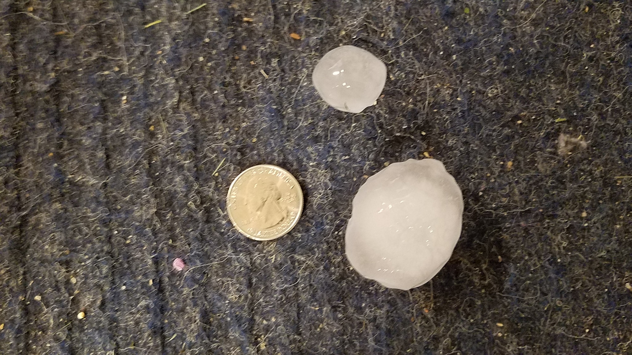
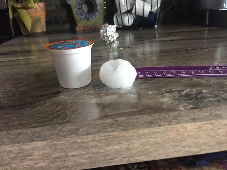
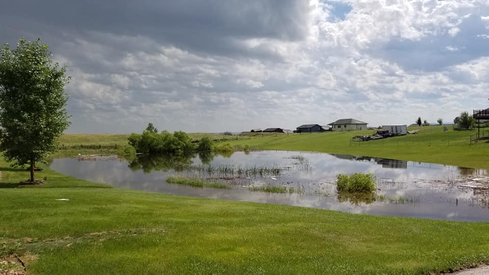
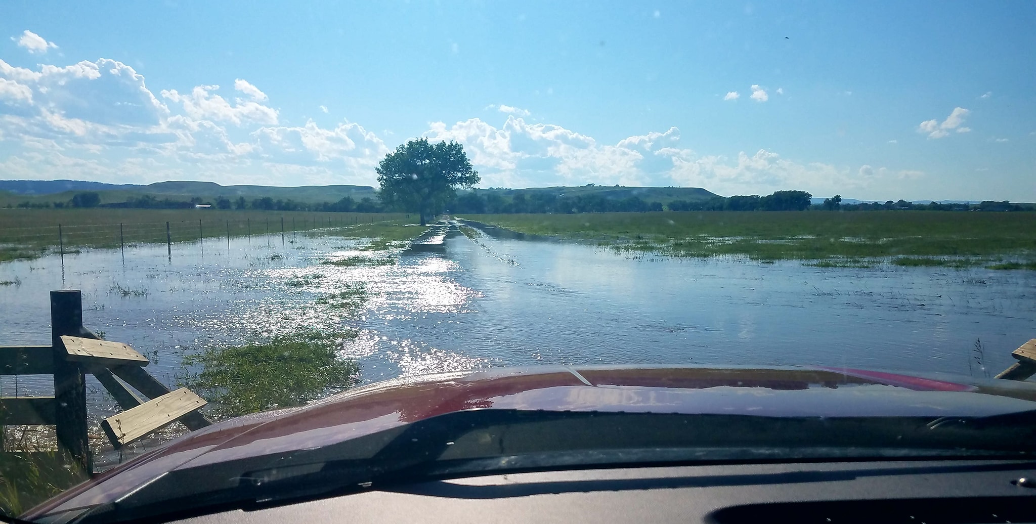
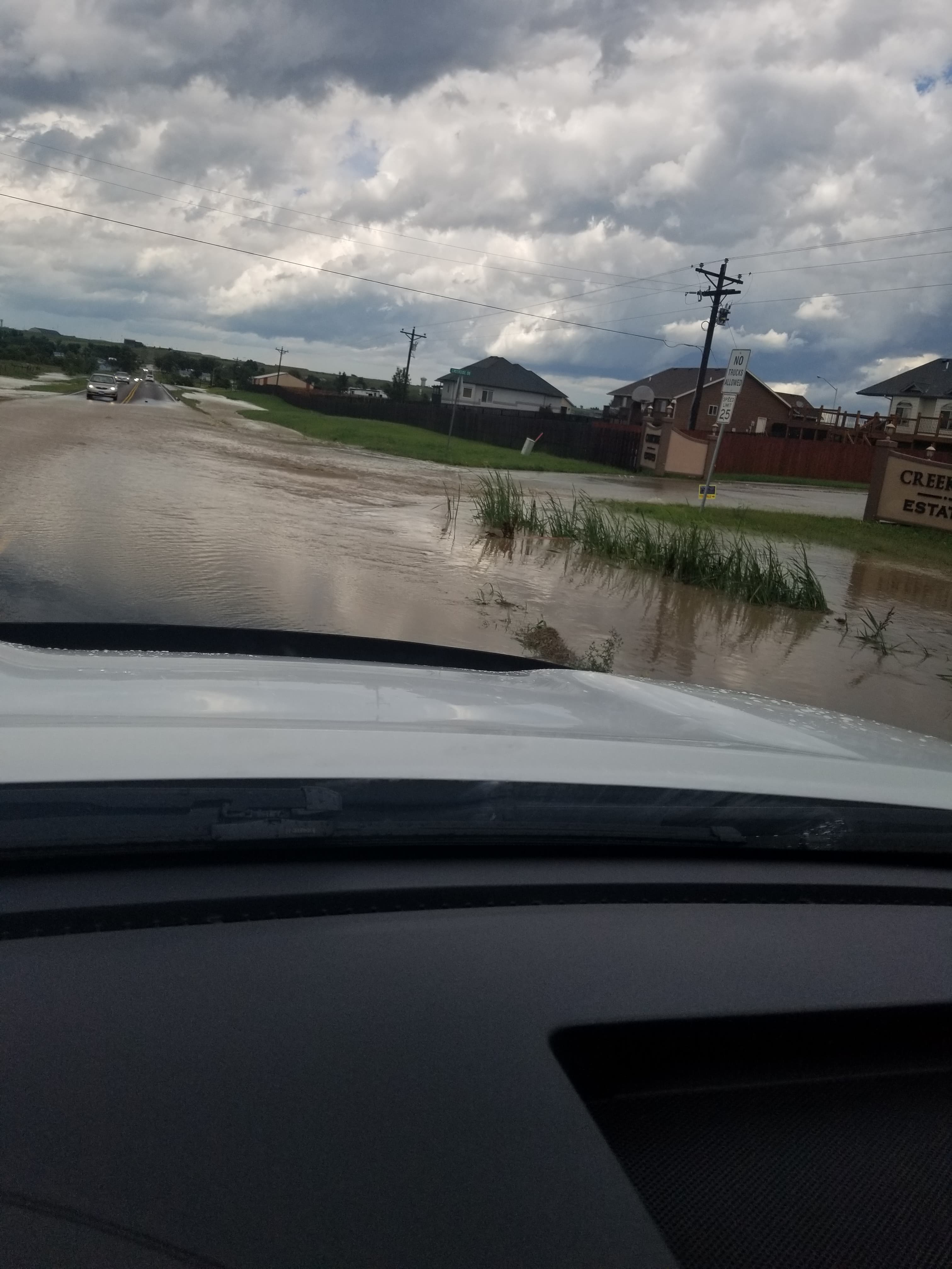
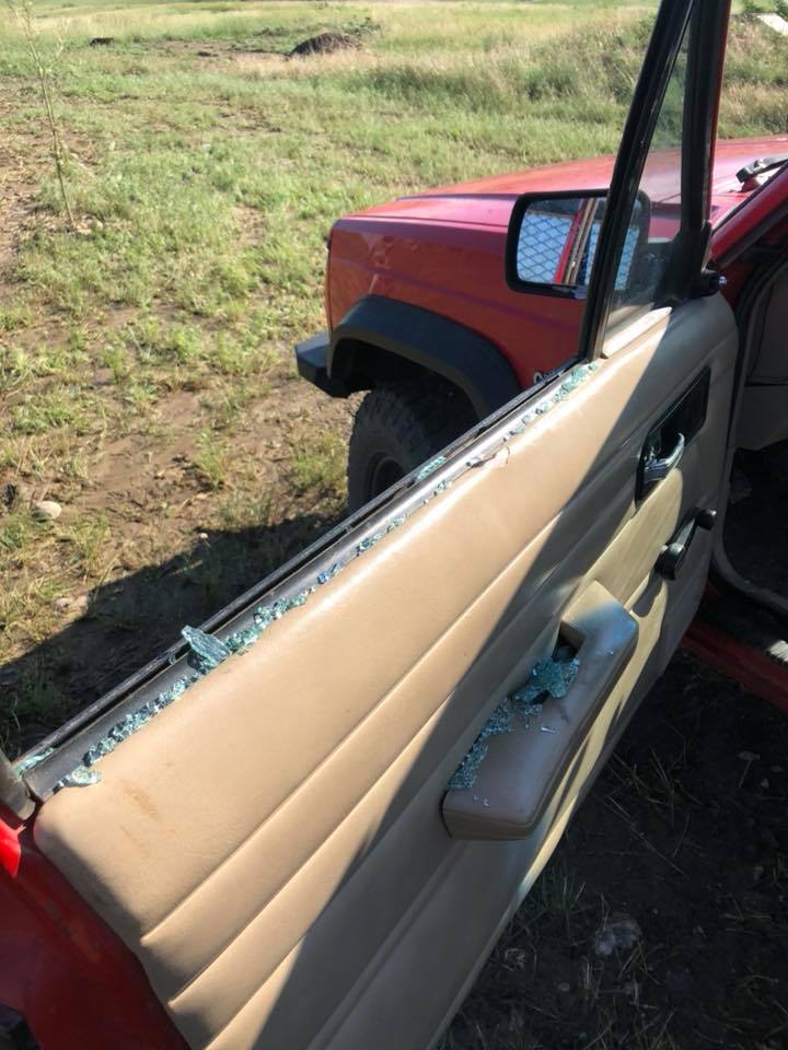
Farther west, a severe thunderstorm produced hail up to two inches in diameter and wind gusts to 70 mph across portions of Pennington, Custer, and Oglala Lakota Counties. The storm also produced locally heavy rainfall, which led to water over roadways across portions of Pennington County.
Tornadoes:
|
Tornado - North of Hamill, SD
Track Map 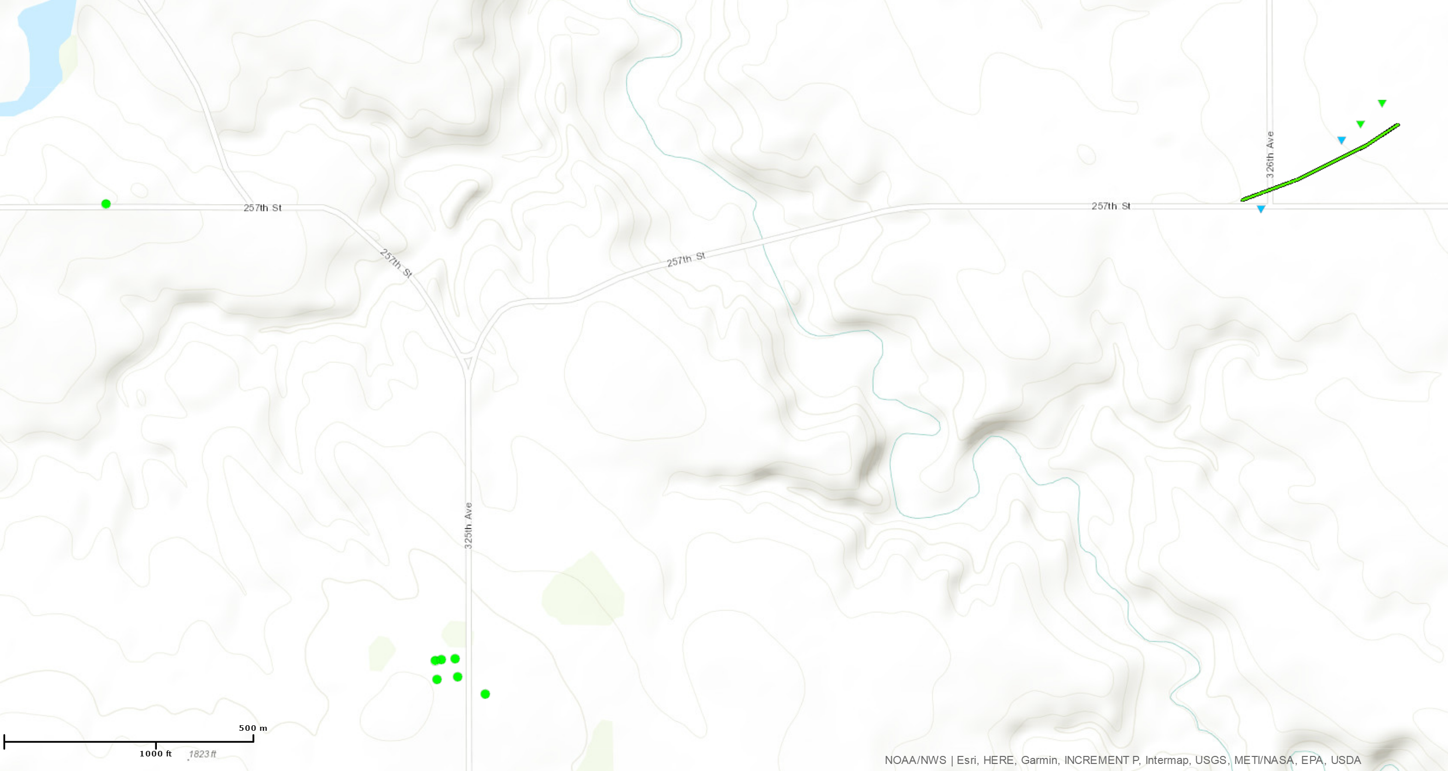 
Downloadable KMZ File |
||||||||||||||||
The Enhanced Fujita (EF) Scale classifies tornadoes into the following categories:
| EF0 Weak 65-85 mph |
EF1 Moderate 86-110 mph |
EF2 Significant 111-135 mph |
EF3 Severe 136-165 mph |
EF4 Extreme 166-200 mph |
EF5 Catastrophic 200+ mph |
 |
|||||
Photos & Video:
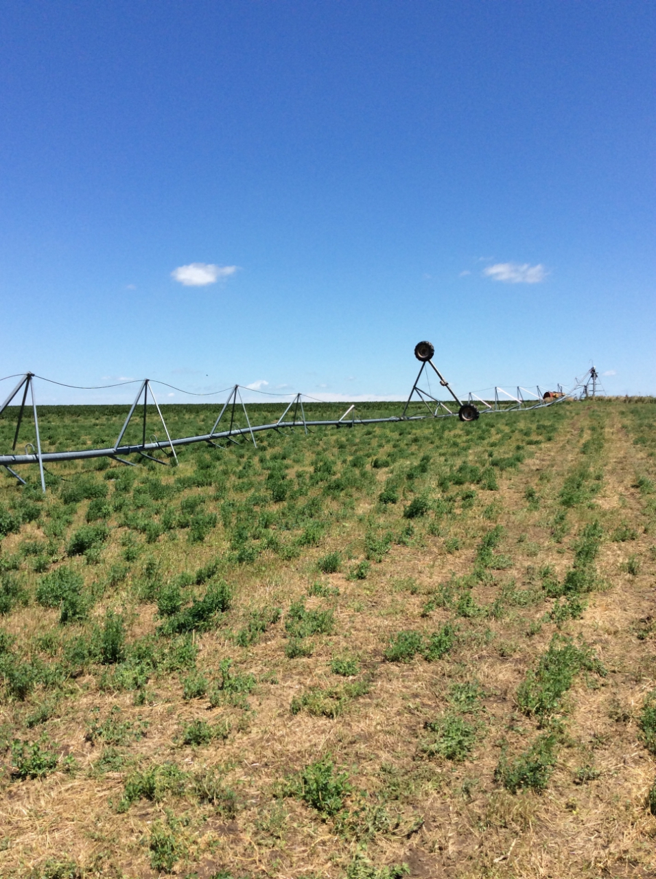
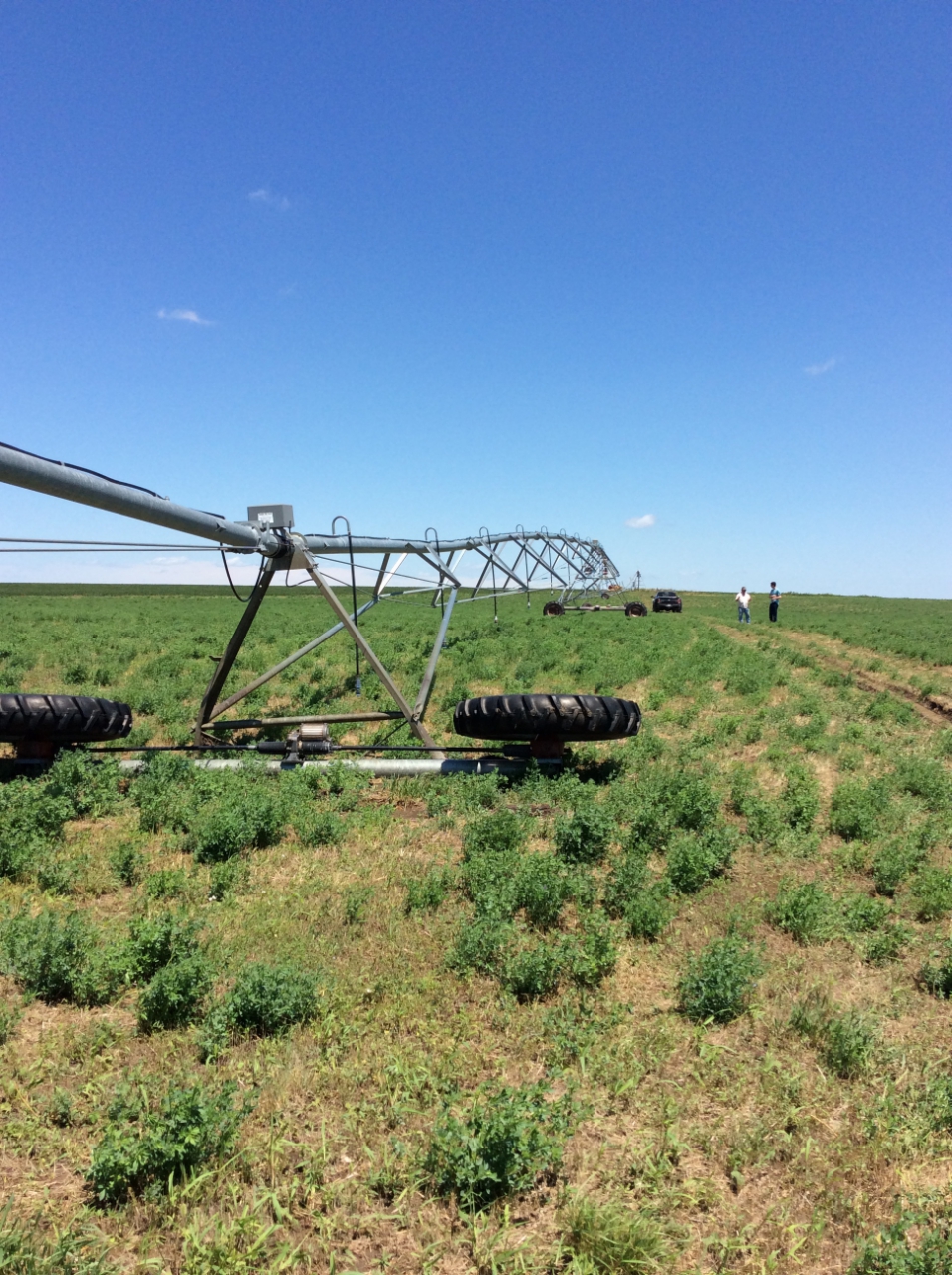
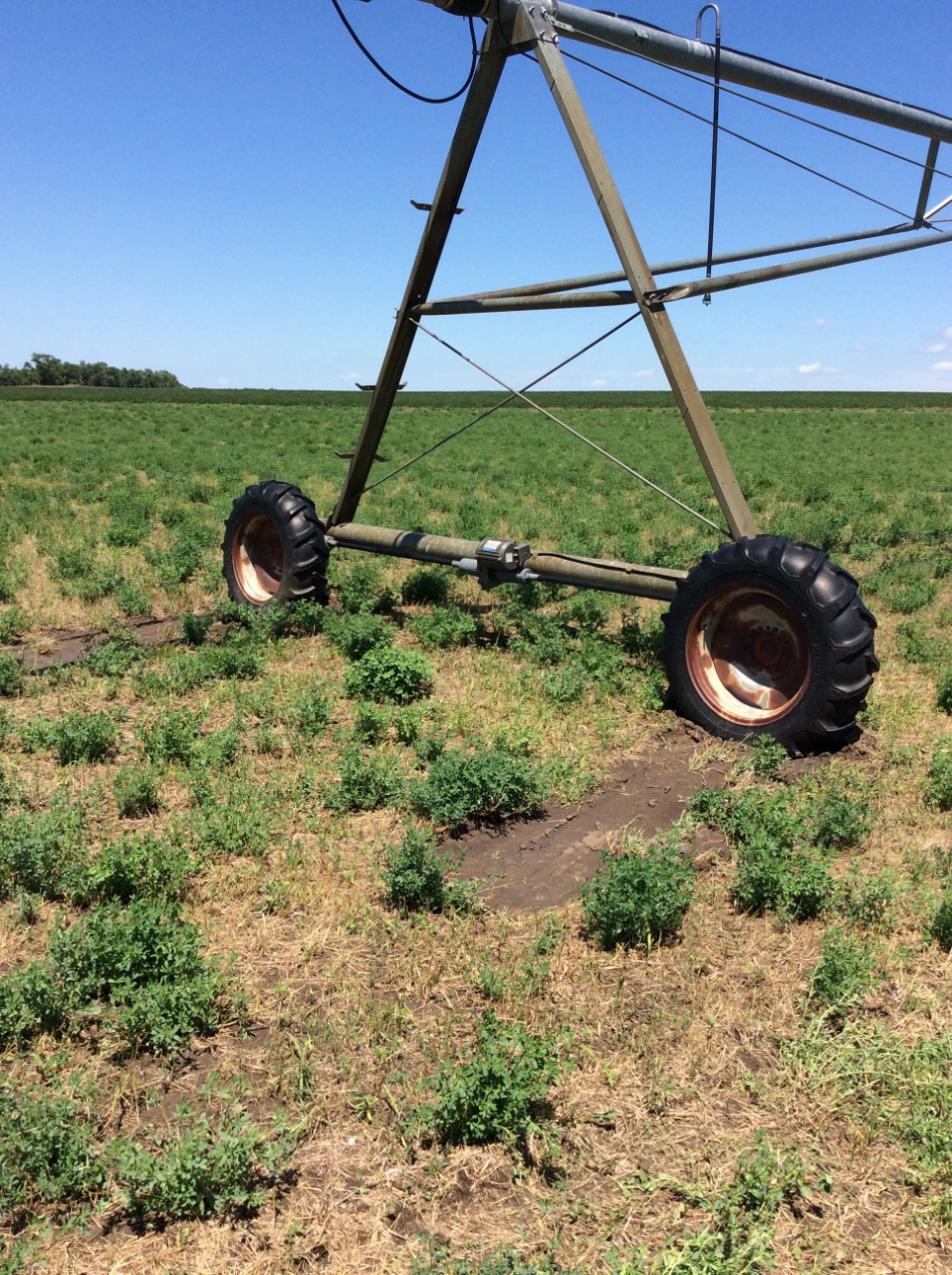
Tripp County Tornado and Straight-Line Wind Damage
 |
 |
 |
|
Irrigation Pivot Blown Over |
Irrigation Pivot Blown Over |
Irrigation Pivot Moved |
 |
 |
 |
|
Power Pole Damage |
Shed Destroyed |
Outbuilding Damaged and Moved |
 |
 |
 |
|
Tree Damage |
||
 |
 |
|
Storm Approaching |
|
Storm Video recorded from Rapid City Weather Forecast Office
Hail and Heavy Rain Photos
 |
 |
 |
 |
|
Box Elder |
Box Elder |
Box Elder |
Box Elder |
 |
 |
 |
|
Box Elder |
South of Box Elder |
South of Box Elder |
 |
 |
|
Box Elder |
South of Box Elder |
 |
 |
|
South of Box Elder |
North of I-90 |
 |
 |
|
Water on Radar Hill Road |
Hail Damage to Vehicle, south of Box Elder |
Radar:
Overview
 |
| Radar from 3 PM through 9 PM MDT on 7/18/2018 |
Tripp County Tornado
 |
 |
| Radar Reflectivity (storm intensity) | Radar Storm-Relative Velocity (wind) |
Storm Reports
 |
| Map of preliminary storm reports from July 18, 2018. Red T's, blue W's, and green H's show tornado, wind, and hail reports, respectively. |
..TIME...   ...EVENT...      ...CITY LOCATION...     ...LAT.LON...
..DATE...   ....MAG....      ..COUNTY LOCATION..ST.. ...SOURCE....
            ..REMARKS..

0238 PM     TSTM WND GST     ELLSWORTH AFB           44.15N 103.10W
07/18/2018  M51 MPH          MEADE              SD   OTHER FEDERAL

0248 PM     TSTM WND GST     1 E DOWNTOWN RAPID CITY 44.07N 103.21W
07/18/2018  M60 MPH          PENNINGTON         SD   OFFICIAL NWS OBS

0248 PM     HAIL             BOX ELDER               44.12N 103.07W
07/18/2018  M2.00 INCH       PENNINGTON         SD   SOCIAL MEDIA

0251 PM     HAIL             BOX ELDER               44.12N 103.07W
07/18/2018  M1.75 INCH       PENNINGTON         SD   SOCIAL MEDIA

0252 PM     HAIL             5 E DOWNTOWN RAPID CITY 44.08N 103.13W
07/18/2018  E1.00 INCH       PENNINGTON         SD   NWS EMPLOYEE

0252 PM     TSTM WND GST     5 E DOWNTOWN RAPID CITY 44.08N 103.13W
07/18/2018  E60 MPH          PENNINGTON         SD   NWS EMPLOYEE

0253 PM     TSTM WND GST     RAPID CITY AIRPORT      44.05N 103.06W
07/18/2018  M70 MPH          PENNINGTON         SD   ASOS

0313 PM     HAIL             2 SE FARMINGDALE        43.95N 102.86W
07/18/2018  M1.25 INCH       PENNINGTON         SD   TRAINED SPOTTER

0325 PM     HAIL             4 SE FOLSOM             43.80N 102.81W
07/18/2018  M1.00 INCH       CUSTER             SD   TRAINED SPOTTER

0325 PM     TSTM WND DMG     4 SE FOLSOM             43.80N 102.81W
07/18/2018                   CUSTER             SD   TRAINED SPOTTER

            LARGE TREE BRANCHES BROKEN.

0358 PM     TSTM WND GST     1 NNE ROCKYFORD         43.51N 102.50W
07/18/2018  E60 MPH          OGLALA LAKOTA      SD   TRAINED SPOTTER

0410 PM     HAIL             19 S OKREEK             43.10N 100.34W
07/18/2018  M1.00 INCH       TODD               SD   PUBLIC

0630 PM     TSTM WND DMG     5 N HAMILL              43.66N  99.67W
07/18/2018                   TRIPP              SD   TRAINED SPOTTER

            A SHED WAS LEVELED, MANY WINDOWS BROKEN, CEDAR TREES
            UPROOTED, 2 VERY LARGE PINE TREES BROKEN OFF ONE 6 FEET
            OFF THE GROUND THE OTHER ABOUT 12 FEET OFF THE GROUND.

0655 PM     TSTM WND GST     2 W HAMILL              43.59N  99.71W
07/18/2018  M52 MPH          TRIPP              SD   MESONET


HAIL REPORTS LISTED BY SIZE (INCHES)

 SIZE    LOCATION                 ST  COUNTY           TIME
 ------  -----------------------  --  --------------   -------
  2.00   BOX ELDER                SD  PENNINGTON       0248 PM
  1.75   BOX ELDER                SD  PENNINGTON       0251 PM
  1.25   2 SE FARMINGDALE         SD  PENNINGTON       0313 PM
  1.00   19 S OKREEK              SD  TODD             0410 PM
  1.00   4 SE FOLSOM              SD  CUSTER           0325 PM
  1.00   5 E DOWNTOWN RAPID CITY  SD  PENNINGTON       0252 PM


TSTM WIND REPORTS LISTED BY SPEED (MPH)

 SPEED   LOCATION                 ST  COUNTY           TIME
 ------  -----------------------  --  --------------   -------
 70.00   RAPID CITY AIRPORT       SD  PENNINGTON       0253 PM
 60.00   1 NNE ROCKYFORD          SD  OGLALA LAKOTA    0358 PM
 60.00   5 E DOWNTOWN RAPID CITY  SD  PENNINGTON       0252 PM
 60.00   1 E DOWNTOWN RAPID CITY  SD  PENNINGTON       0248 PM
 56.00   3 ESE PINE RIDGE         SD  OGLALA LAKOTA    1034 PM
 52.00   2 W HAMILL               SD  TRIPP            0655 PM
 51.00   ELLSWORTH AFB            SD  MEADE            0238 PM
 |
Media use of NWS Web News Stories is encouraged! Please acknowledge the NWS as the source of any news information accessed from this site. |
|

