
A heat wave over the Southwest will intensify this week, peaking and expanding into the Intermountain West and northern High Plains this weekend. Critical to extremely critical fire weather conditions are forecast from the Northwest and the northern Great Basin this weekend. Particularly Dangerous Situation Red Flag Warnings have been issued. Read More >
Overview
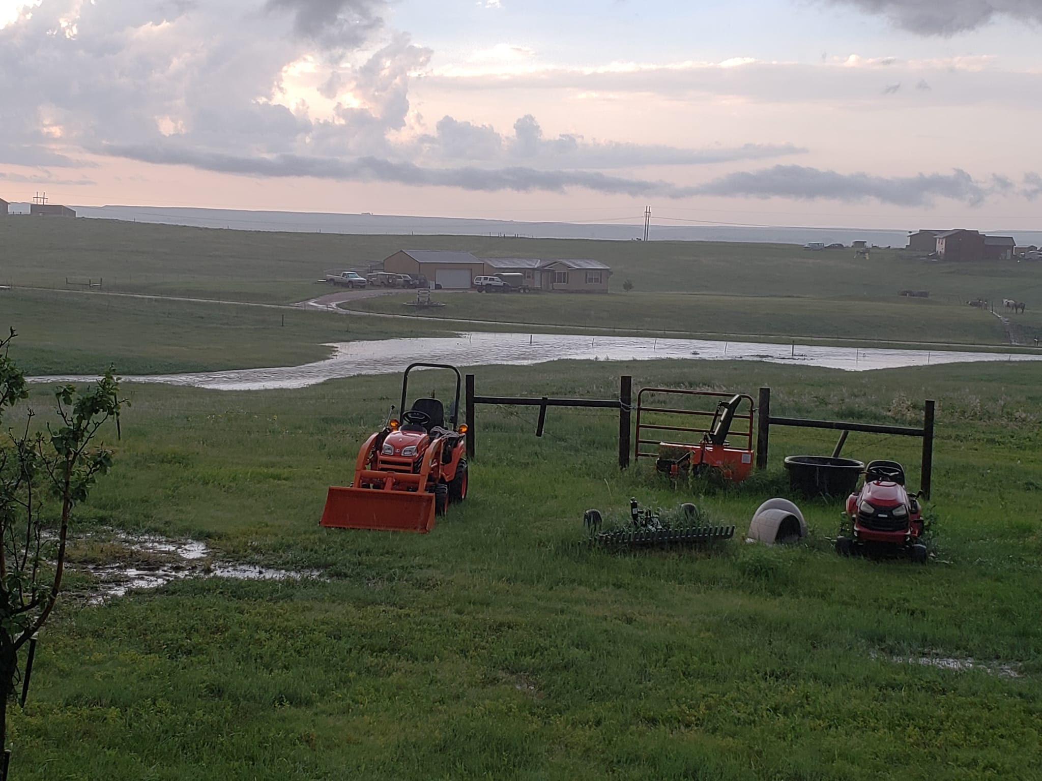
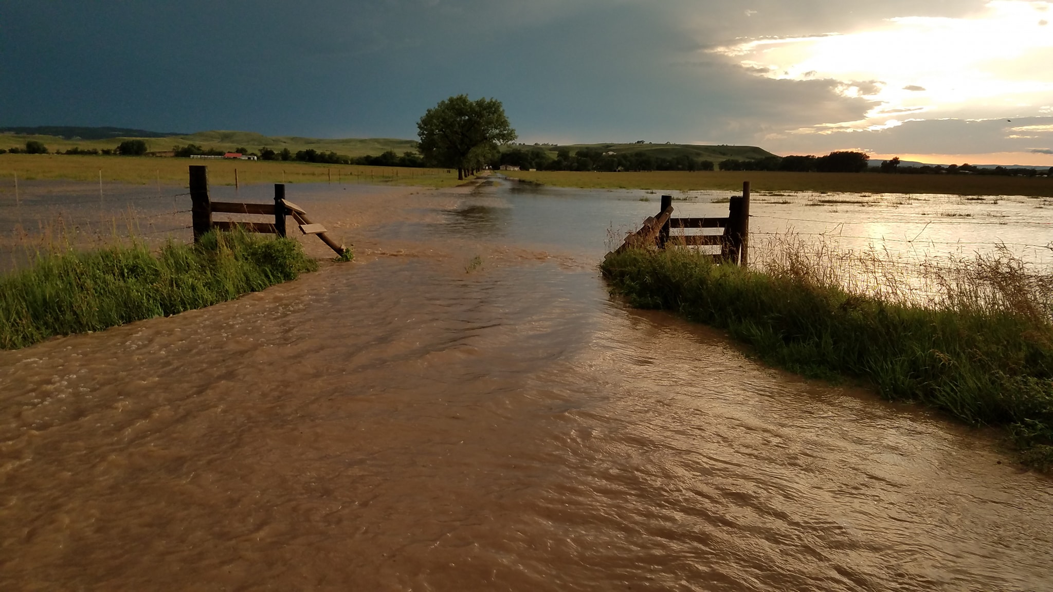
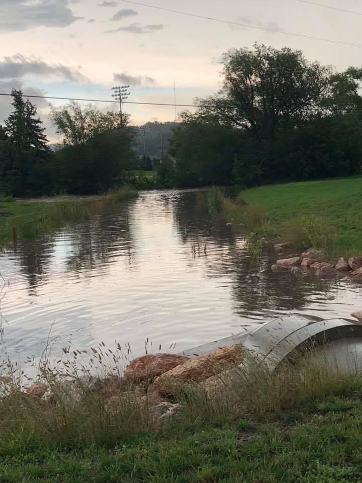
During the afternoon and evening of July 21, 2018, scattered thunderstorms produced large hail and damaging winds across portions of the Black Hills, northeastern Wyoming, and southwestern South Dakota. Additionally, near-record high atmospheric moisture content for the area, coupled with saturated soils from an anomalously wet spring and early summer, led to flash flooding across portions of the Black Hills and in Rapid City.
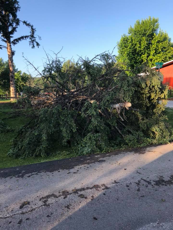
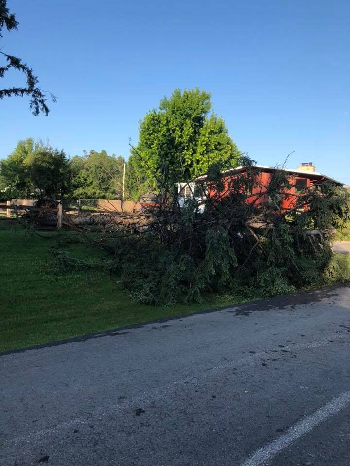
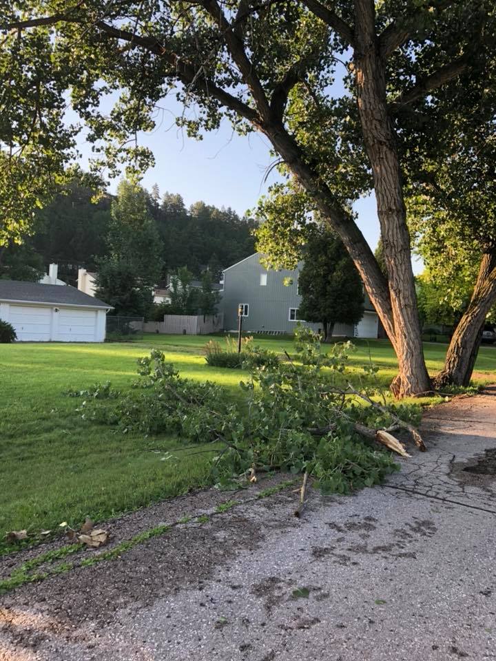
Wind Damage
 |
 |
 |
| Downed trees, east Rapid City (courtesy Rapid City Municipal Government) |
||
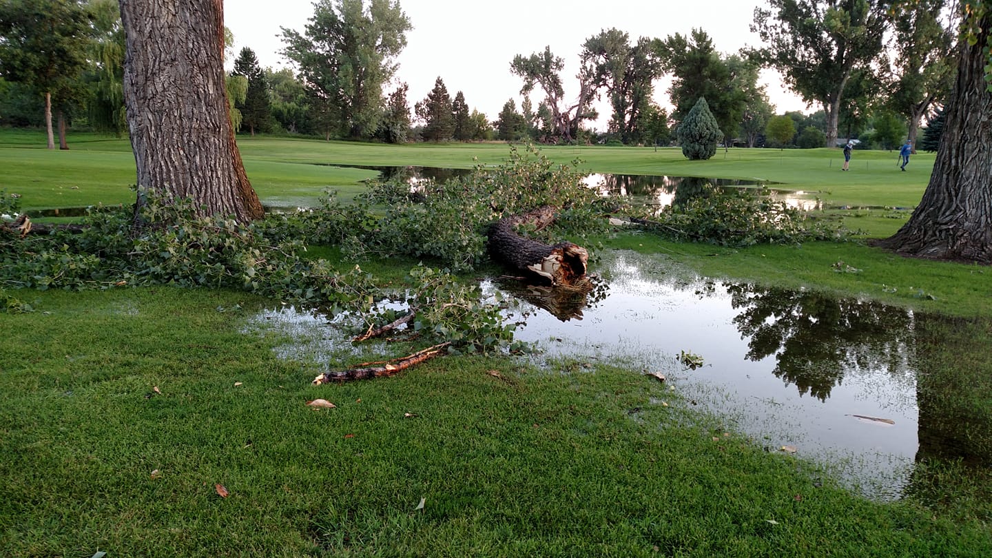 |
| Downed tree branch, Elks Golf Course (courtesy Teresa Komandt) |
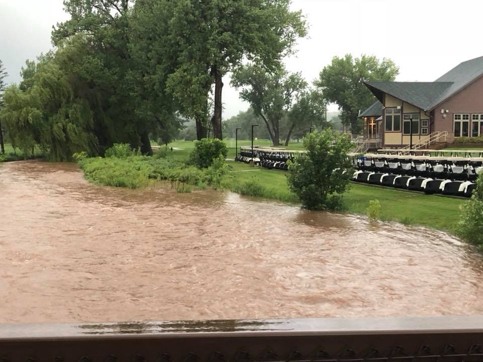
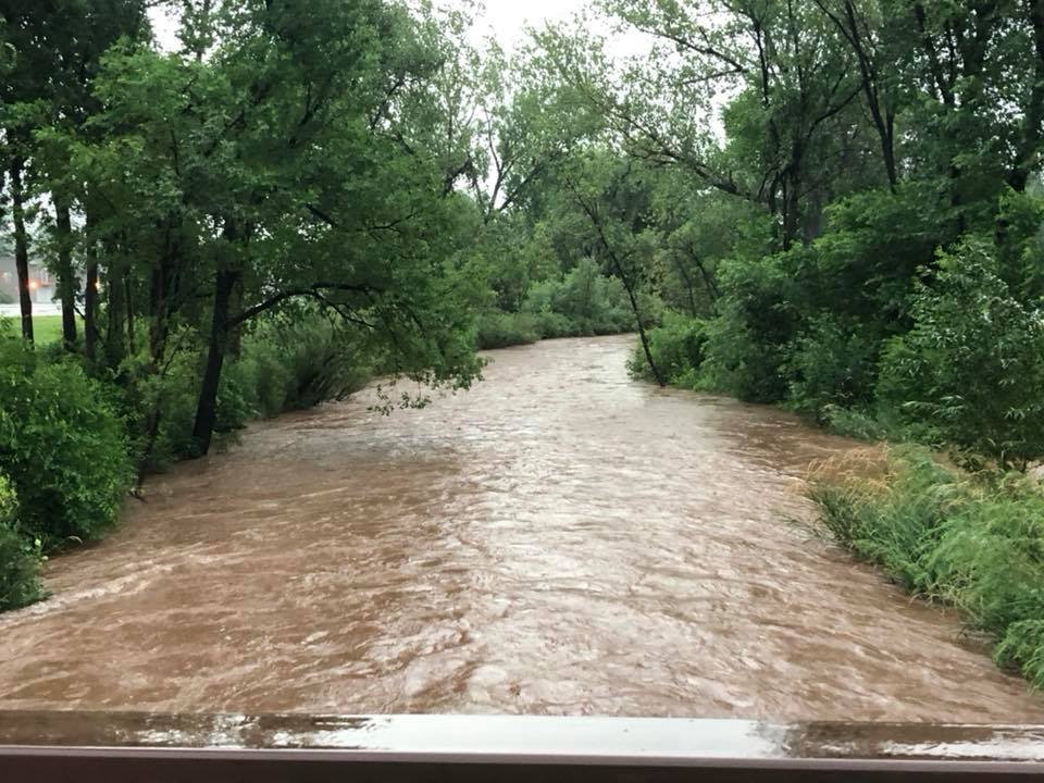
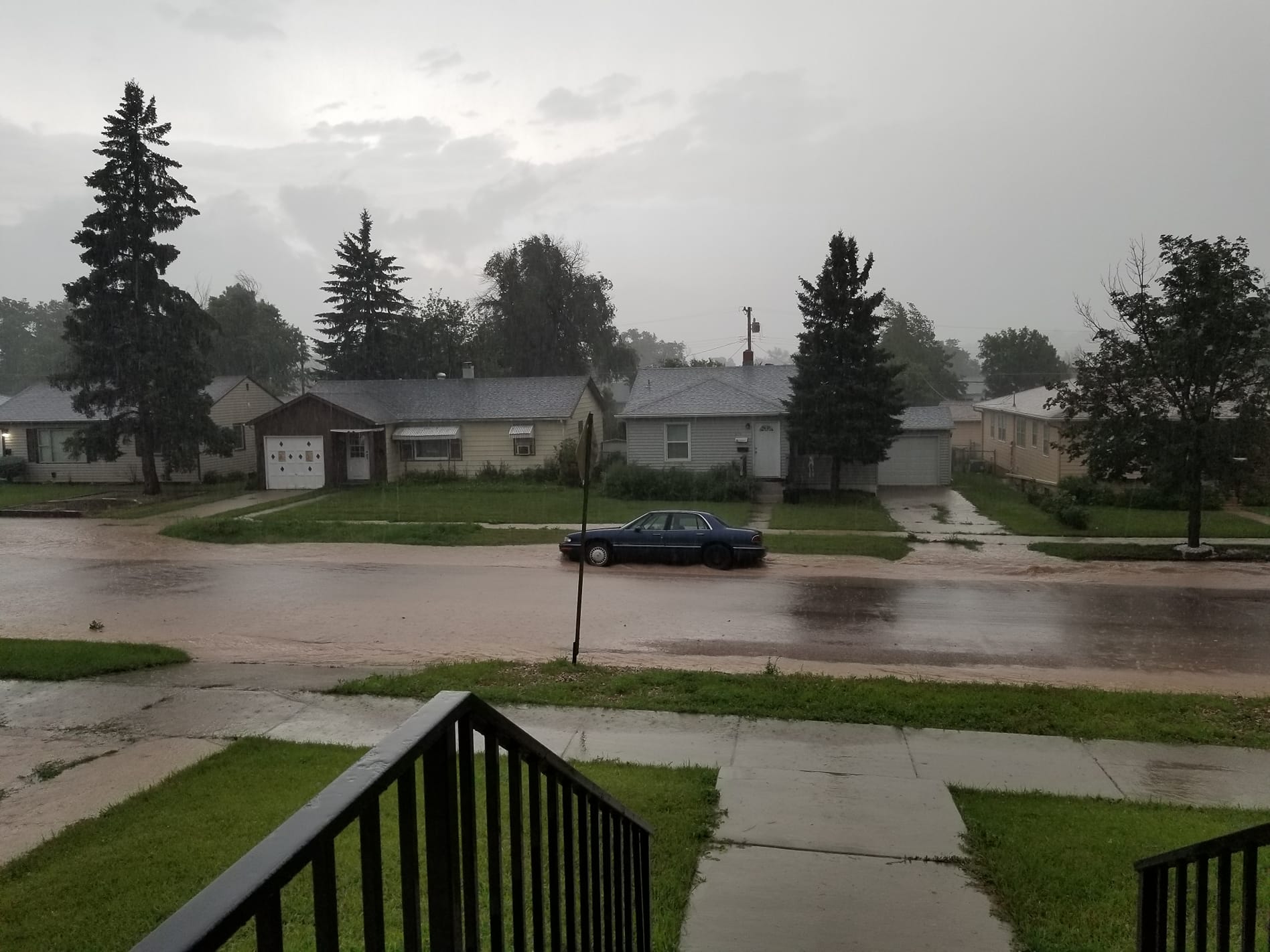
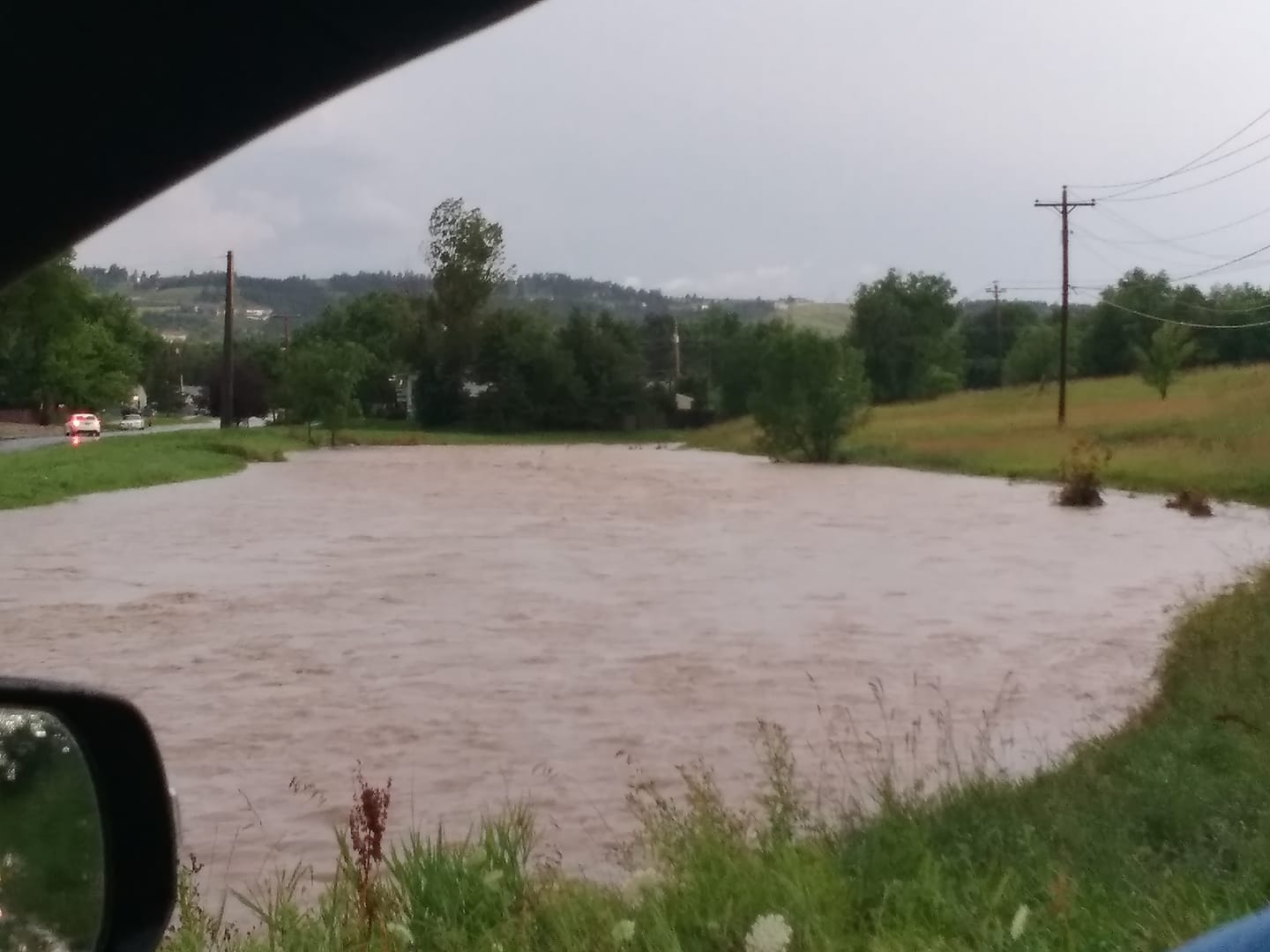
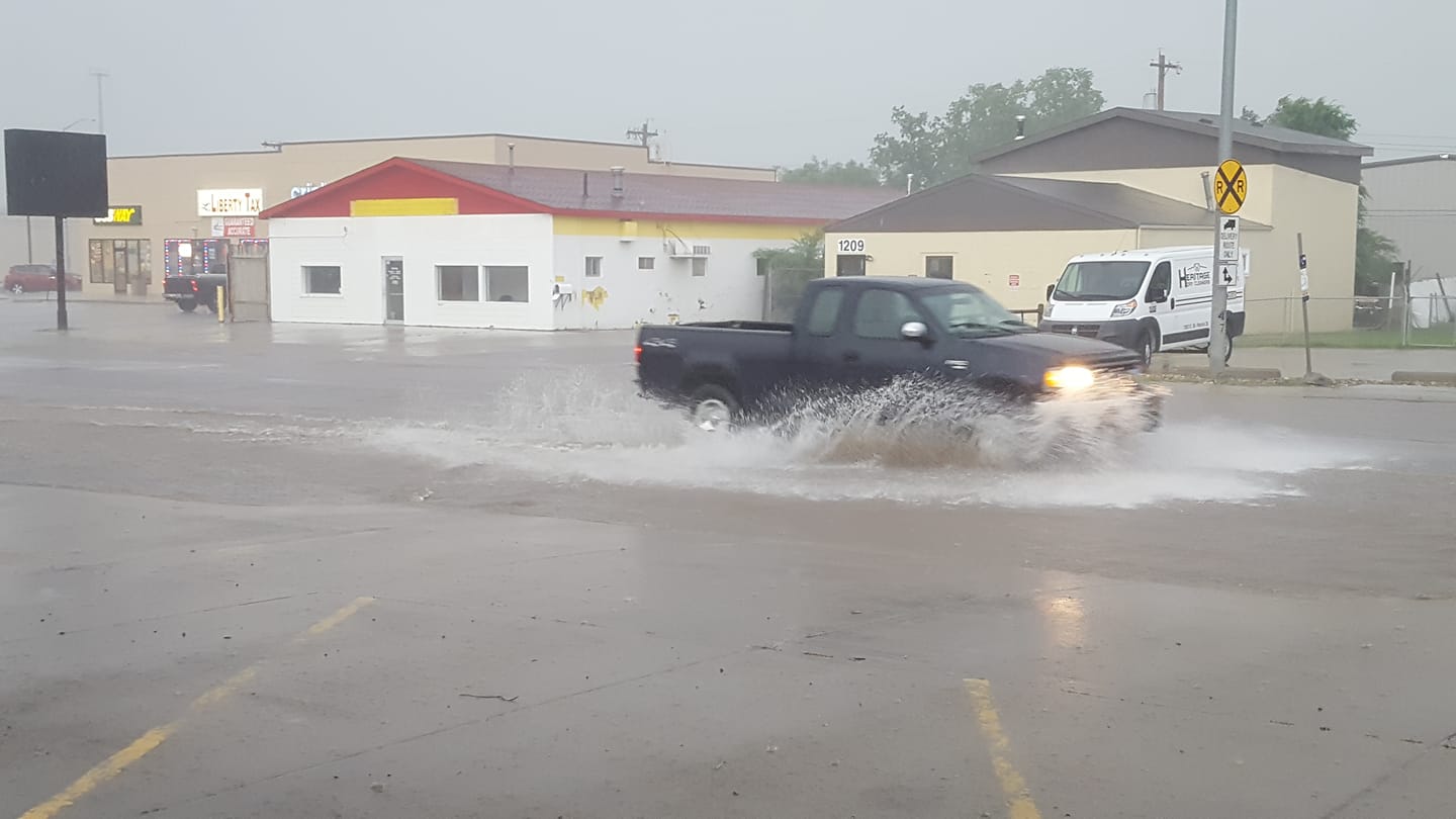
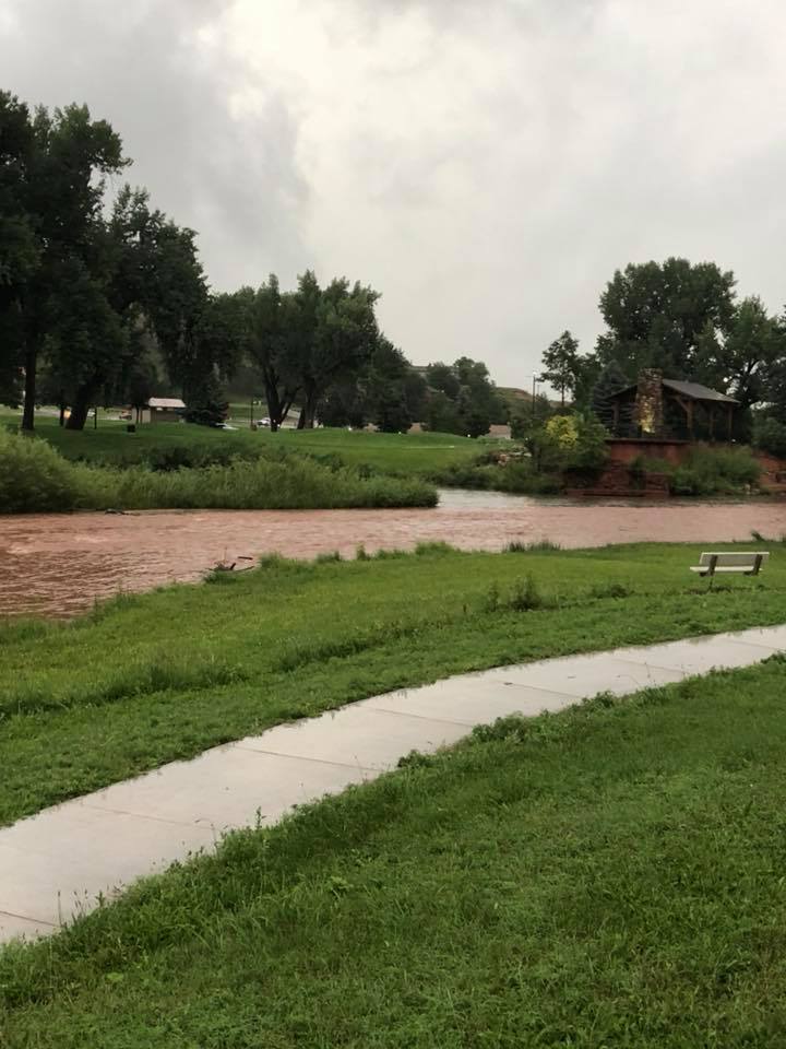
Flooding
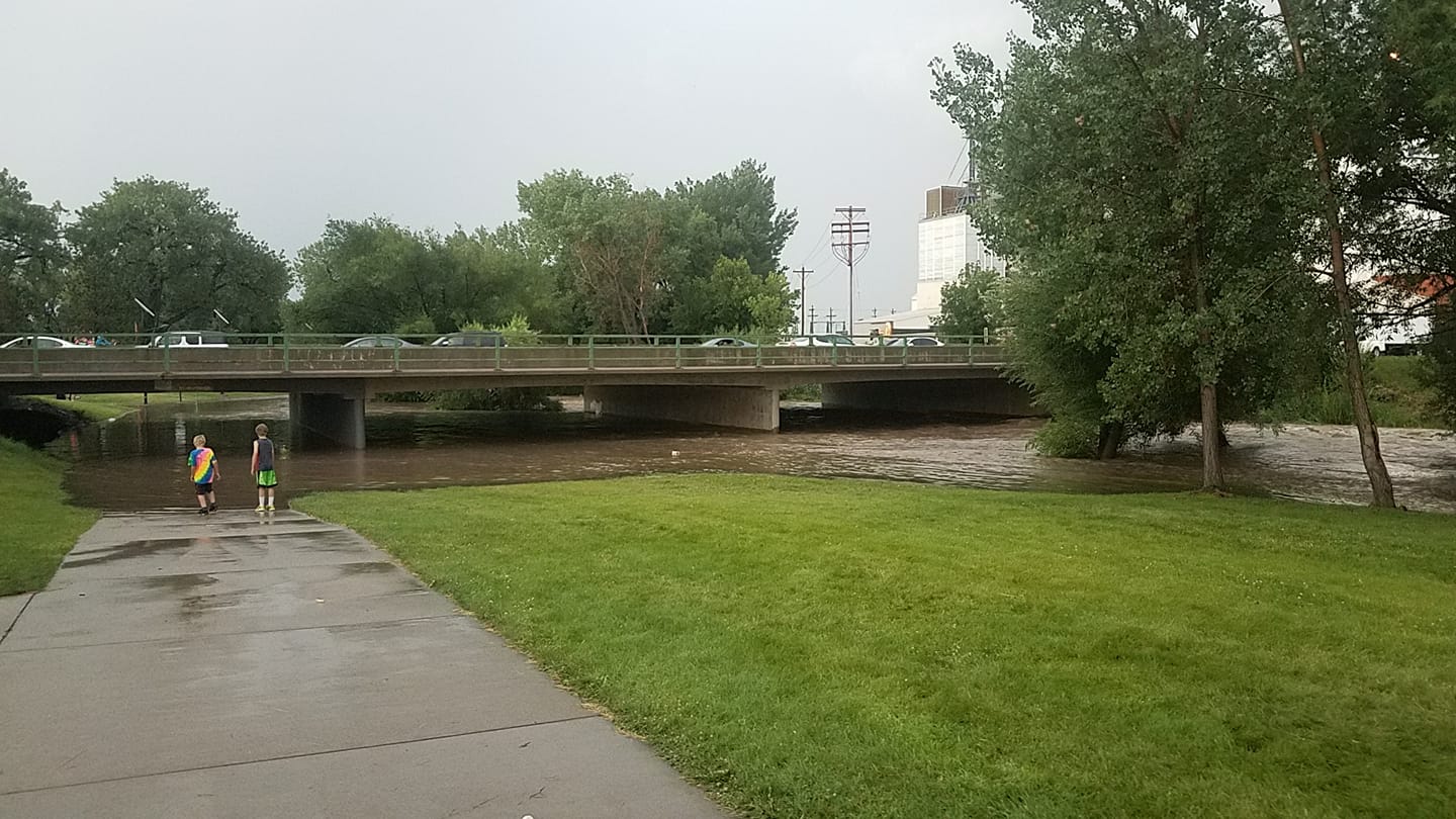
Flash flooding at 3rd and St. Francis in Rapid City. Video courtesy Stacey Morris Roberts.
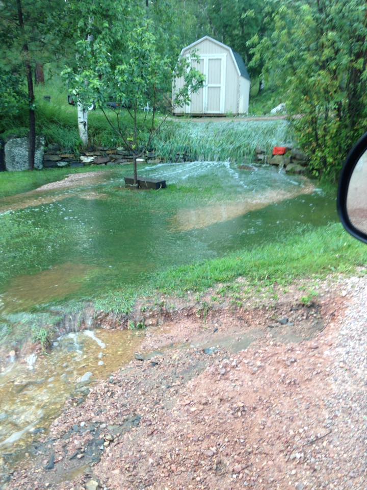
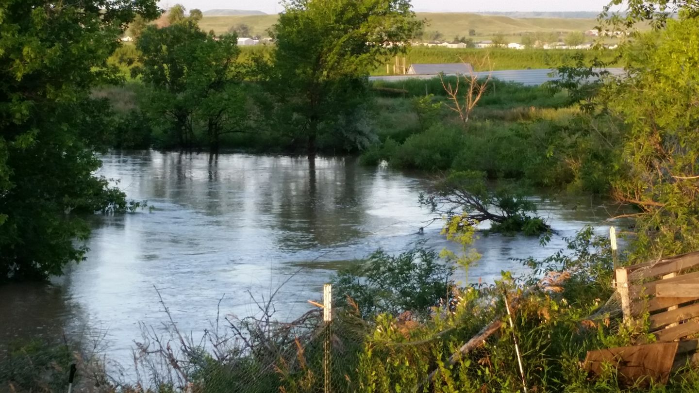
Flooding and High Water Photos
 |
 |
 |
 |
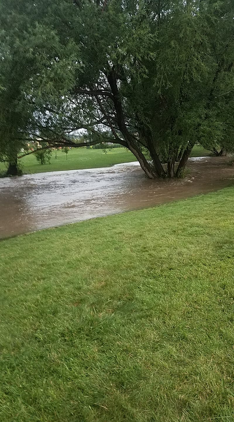
| Rapid Creek, near downtown Rapid City (courtesy Rapid City Municipal Government) |
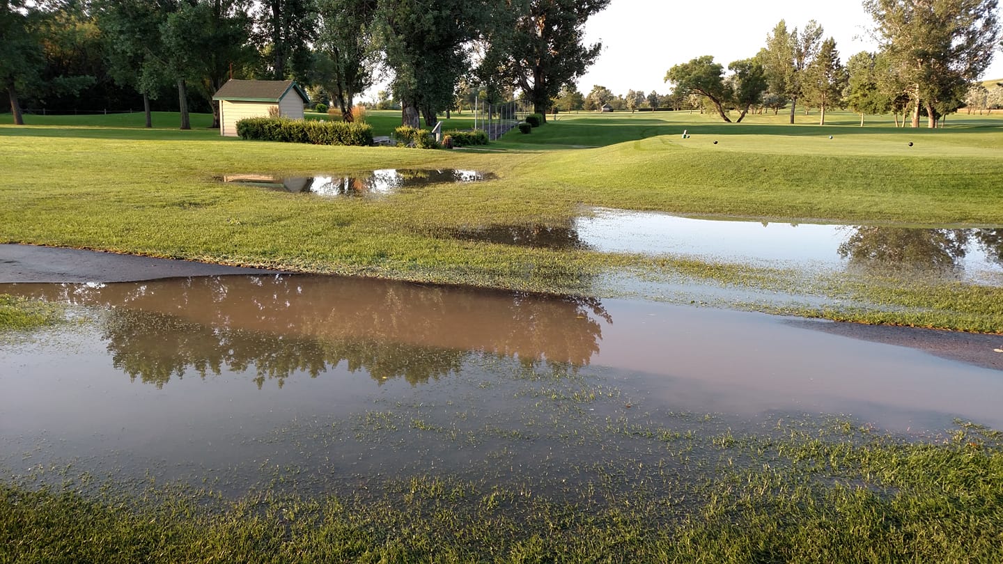
Rapid City, near Indiana and 5th (courtesy Kim Stackenwalt) |
Rapid City, near Meade St. (courtesy Heather Turnbaugh) |
|
 |
 |
 |
| Rapid City, on St. Patrick (courtesy Jiggs Cressy) |
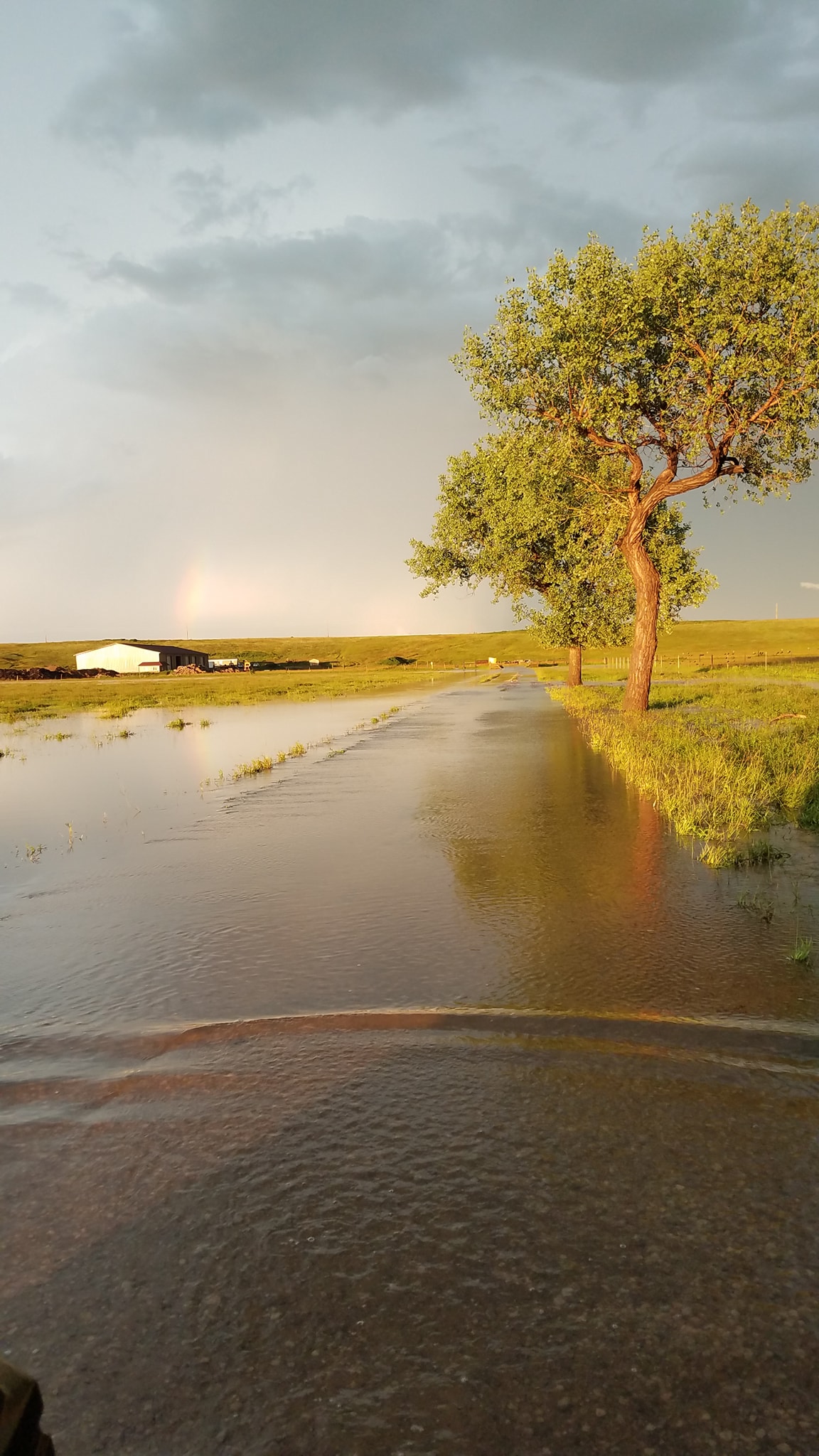
North of Ellsworth AFB (courtesy Krista Fox) |
North of I-90 on Dyess Ave (courtesy Lois Peterson) |
 |
 |
 |
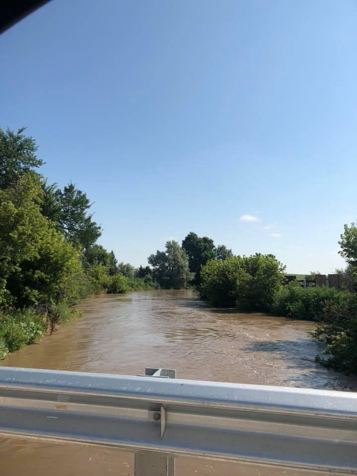 |
| Rapid Creek, near downtown Rapid City (courtesy Rapid City Municipal Government) |
Hill City (courtesy Sarah Johnson) |
Rapid Creek, near the airport (courtesy Kristen Kruse) |
|
 |
 |
 |
| Green Valley (courtesy Leanne Olson) |
The Elks Golf Course (courtesy Teresa Komandt) |
North of I-90 on Dyess Ave (courtesy Lois Peterson) |
 |
 |
| Rapid Creek, near 5th and Omaha in Rapid City (courtesy Bob Julius) |
|
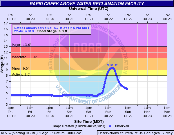
Hydrographs
 |
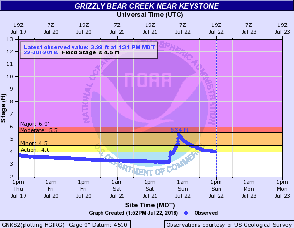 |
| Rapid Creek above the water reclamation facility east of Rapid City | Grizzly Bear Creek near Keystone |
Radar
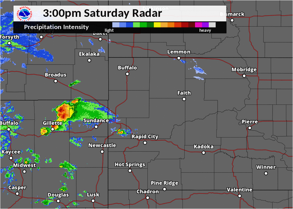 |
| Radar reflectivity (precipitation intensity) for 3 PM through 9 PM MDT on July 21, 2018. |
Storm Reports
Hail reports listed by size (inches)
SIZE LOCATION ST COUNTY TIME
------ ----------------------- -- -------------- -------
1.50 3 SW BROWNSVILLE SD LAWRENCE 0515 PM
1.25 6 SSE DOWNTOWN GILLETTE WY CAMPBELL 0458 PM
1.00 7 SW RAPID CITY AIRPORT SD PENNINGTON 0722 PM
1.00 3 N SHERIDAN LAKE SD PENNINGTON 0640 PM
1.00 6 SSE BROWNSVILLE SD LAWRENCE 0533 PM
1.00 8 SE DOWNTOWN GILLETTE WY CAMPBELL 0514 PM
1.00 6 SE DOWNTOWN GILLETTE WY CAMPBELL 0502 PM
1.00 7 NNW WESTON WY CAMPBELL 0235 PM
0.75 2 SW DOWNTOWN RAPID CIT SD PENNINGTON 0709 PM
0.50 HISEGA SD PENNINGTON 0642 PM
0.50 17 ESE RENO JUNCTION WY CAMPBELL 0625 PM
0.25 LEAD SD LAWRENCE 0418 PM
Thunderstorm wind reports listed by speed (mph)
SPEED LOCATION ST COUNTY TIME
------ ----------------------- -- -------------- -------
70.00 7 SW RAPID CITY AIRPORT SD PENNINGTON 0722 PM
67.00 RAPID CITY AIRPORT SD PENNINGTON 0725 PM
66.00 6 WNW DOWNTOWN NEWCASTL WY WESTON 0755 PM
63.00 4 S DOWNTOWN RAPID CITY SD PENNINGTON 0657 PM
60.00 3 NNE DOWNTOWN NEWCASTL WY WESTON 0755 PM
55.00 1 E DOWNTOWN RAPID CITY SD PENNINGTON 0721 PM
Rain Reports
 |
| Radar estimated rainfall during the afternoon and evening of July 21, 2018. |
Rainfall amounts (inches)
AMOUNT LOCATION ST COUNTY TIME
------ ----------------------- -- -------------- -------
2.53 5 NE ROCKERVILLE SD PENNINGTON 0700 AM
2.37 HILL CITY SD PENNINGTON 0821 AM
2.35 10 SSW DOWNTOWN RAPID C SD PENNINGTON 0739 PM
2.29 4 NE ROCKERVILLE SD PENNINGTON 0742 AM
2.28 5 W ELLSWORTH AFB SD MEADE 0700 AM
2.13 4 SSW DOWNTOWN RAPID CI SD PENNINGTON 0735 PM
2.07 1 ESE PACTOLA RESERVOIR SD PENNINGTON 0700 AM
2.00 2 SSE DOWNTOWN RAPID CI SD PENNINGTON 0733 PM
1.90 2 SW DOWNTOWN RAPID CIT SD PENNINGTON 0818 PM
1.85 5 NW SWETT SD BENNETT 0700 AM
1.81 3 NE HISEGA SD PENNINGTON 0700 AM
1.80 11 S FOLSOM SD CUSTER 0804 AM
1.65 5 ENE DOWNTOWN CUSTER SD CUSTER 0900 PM
1.64 1 W HISEGA SD PENNINGTON 0807 AM
1.60 4 W DOWNTOWN RAPID CITY SD PENNINGTON 0700 AM
1.57 5 NW DOWNTOWN RAPID CIT SD PENNINGTON 0806 AM
1.57 7 WSW FOLSOM SD CUSTER 0700 AM
1.45 3 E HISEGA SD PENNINGTON 0808 AM
1.43 2 SW DOWNTOWN RAPID CIT SD PENNINGTON 0737 PM
1.37 1 NNW DOWNTOWN RAPID CI SD PENNINGTON 0810 AM
1.26 1 E DOWNTOWN RAPID CITY SD PENNINGTON 0747 AM
1.25 1 SSW HERMOSA SD CUSTER 0805 AM
1.24 3 W RAPID VALLEY SD PENNINGTON 0808 AM
1.24 2 NNW MOUNT RUSHMORE SD PENNINGTON 0805 AM
1.17 1 NE DOWNTOWN RAPID CIT SD PENNINGTON 0700 AM
1.16 6 W HERMOSA SD CUSTER 0700 AM
1.12 4 WSW DOWNTOWN RAPID CI SD PENNINGTON 0811 AM
Environment
A sounding, or weather balloon with attached instrumentation, launched from the Rapid City National Weather Service Forecast Office (below) showed that precipitable water values (a measure of atmospheric moisture content) on the evening of July 21st were nearly 170% of normal for this time of year. Additionally, the sounding revealed extreme instability and strong vertical wind shear, key ingredients for severe weather.
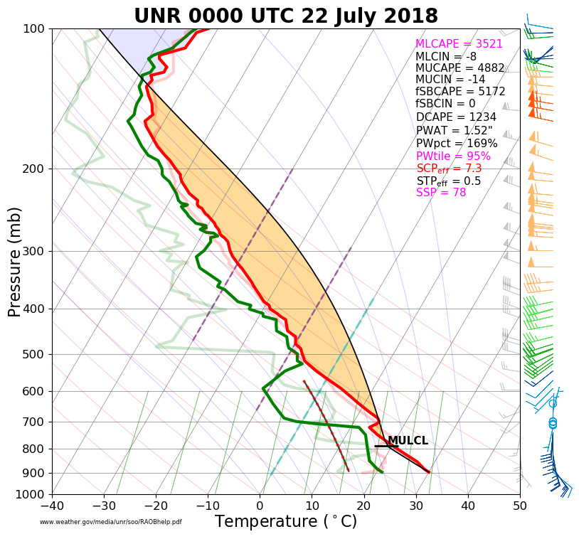 |
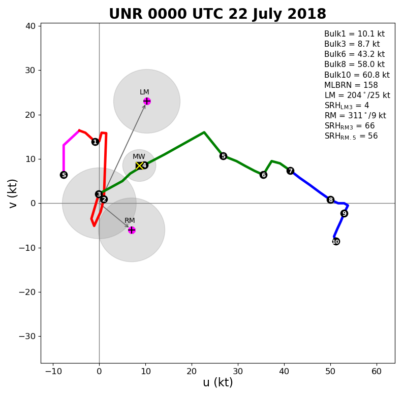 |
| Figure 1: Sounding launched from Rapid City at 5 PM on July 21, 2018. | Figure 2: Wind hodograph from the Rapid City sounding shown at left. |
Accumulated precipitation this year shows that Rapid City has experienced a wetter than average spring and summer. This anomalously high precipitation led to saturated soils across the Black Hills and Rapid City, providing antecedent conditions favorable for flash flooding.
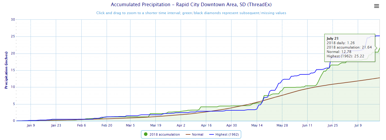 |
| Figure 3: 2018 Precipitation to Date for Rapid City. |
 |
Media use of NWS Web News Stories is encouraged! Please acknowledge the NWS as the source of any news information accessed from this site. |
|

