
Scattered thunderstorms with severe gusts, hail and a tornado risk are possible near a cold front from the Ohio Valley to the Mid-Atlantic tonight. Tropical Storm Bertha is expected to bring tropical storm conditions to portions of the Gulf Coast from the panhandle of Florida into Louisiana through Wednesday. Read More >
Overview
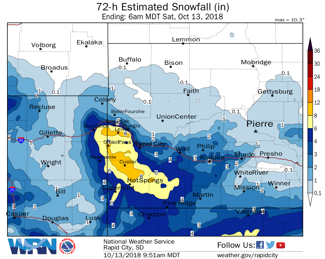
On Saturday, October 13th a winter storm system moved quickly through the northern plains. This storm initially started out as rain, before changing over to heavy, wet snow during the afternoon. The snow continued through the evening, before ending overnight. The heaviest snow fell over the central and southern Black Hills, where over 10 inches of snow was reported. Elsewhere, two to five inches of snow was common across northeastern Wyoming, southwestern South Dakota, and the foothills of the Black Hills. Brisk northwest winds created some areas of blowing snow, but generally winds were not very strong with this storm system.
 |
 |
 |
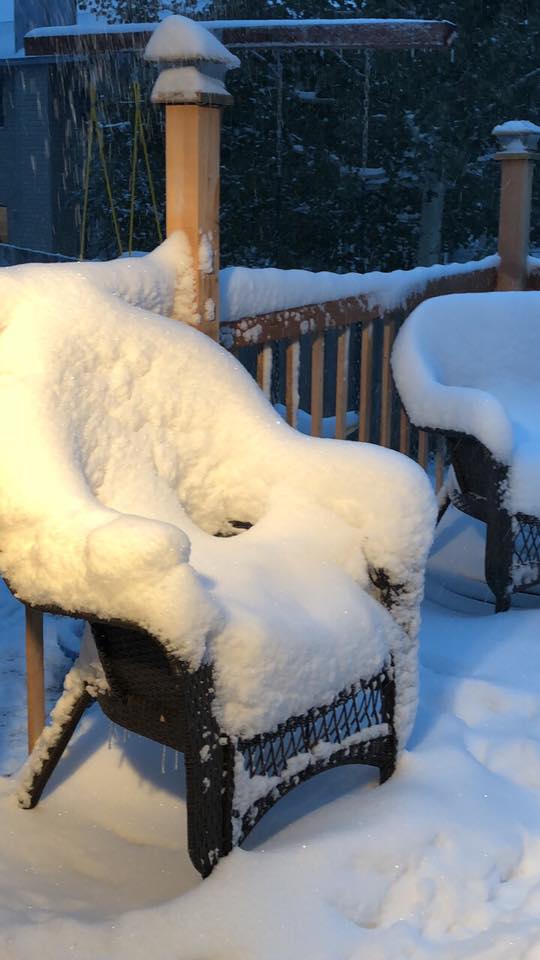
| Snow in Gillette Photo by Hanna Nichols |
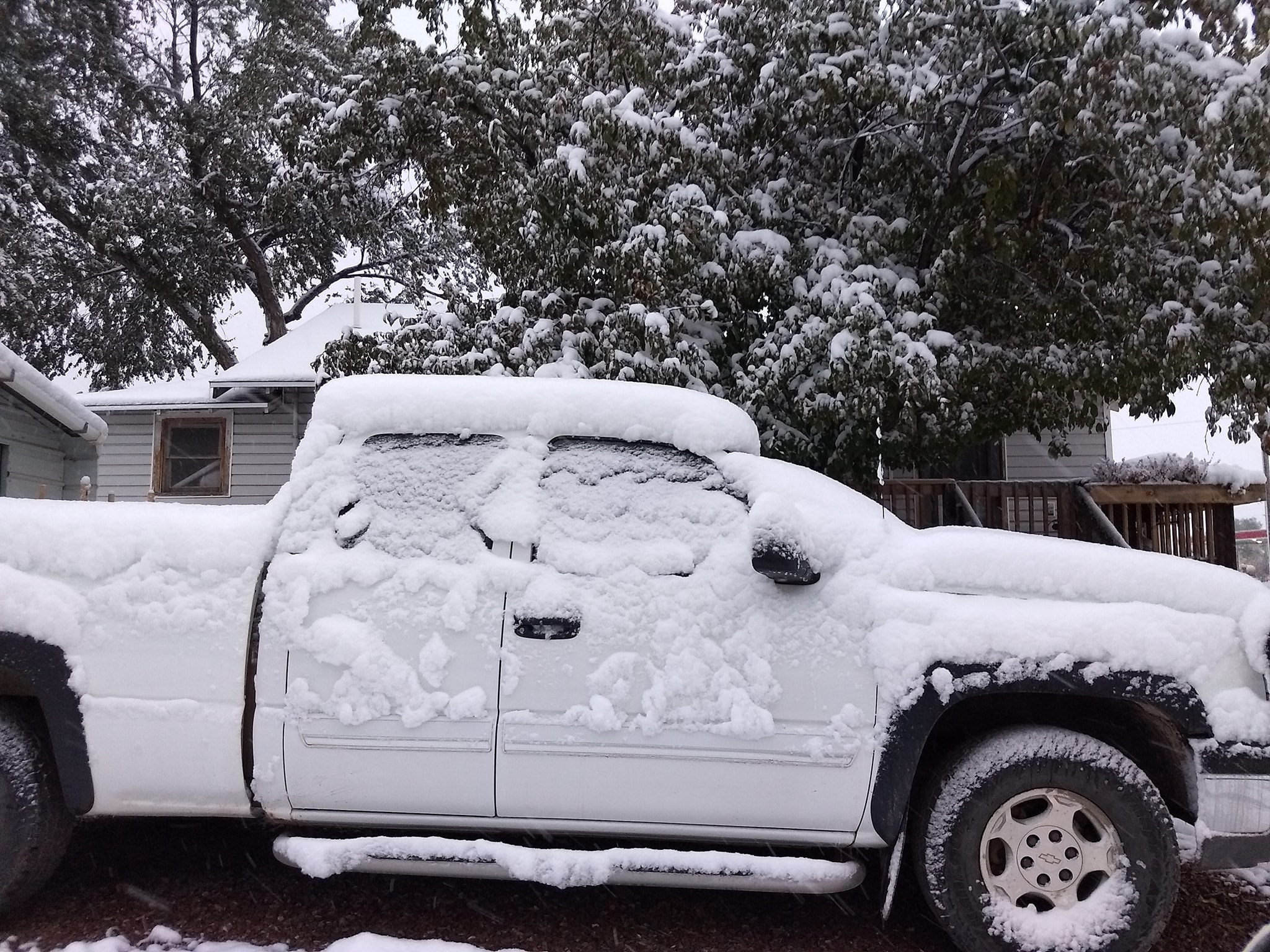
Snow in Newcastle Photo by Thomas Leighton |
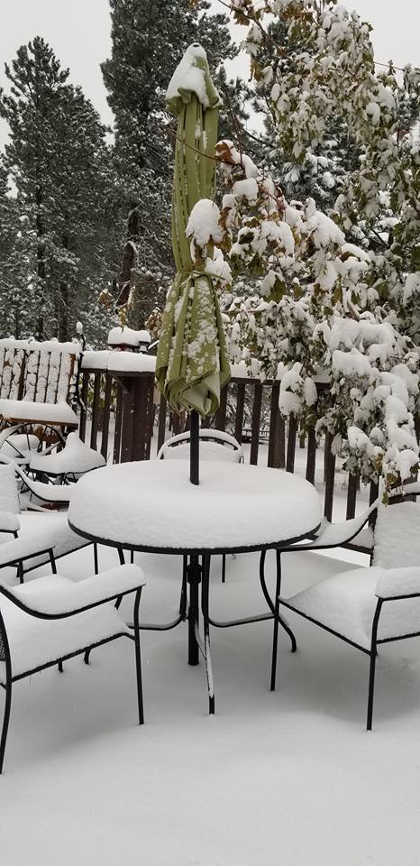
Snow in Lead Photo by LeAnn Marie |
Snowfall Map
Storm Reports
Snow reports listed by amount

 INCHES  LOCATION                 ST  COUNTY           TIME
 ------  -----------------------  --  --------------   -------
 10.00   4 W DOWNTOWN CUSTER      SD  CUSTER           1054 PM
                 CLOSE TO A FOOT.
  6.00   LEAD                     SD  LAWRENCE         0700 AM
  6.00   DEER MOUNTAIN            SD  LAWRENCE         1000 AM
  5.50   5 SW DOWNTOWN HOT SPRIN  SD  FALL RIVER       0700 AM
                 24 HOUR SNOWFALL
  5.00   DOWNTOWN HOT SPRINGS     SD  FALL RIVER       0800 AM
                 SNOWFALL THE PAST 24 HOURS
  5.00   1 W DOWNTOWN NEWCASTLE   WY  WESTON           0730 AM
                 0.34" OF MOISTURE AT KASL RADIO STATION IN
                 NEWCASTLE.
  5.00   1 WSW DOWNTOWN NEWCASTL  WY  WESTON           0700 AM
  4.50   1 ESE MOORCROFT          WY  CROOK            0700 AM
  4.20   14 NNW DOWNTOWN GILLETT  WY  CAMPBELL         0700 AM
  4.00   SUNDANCE                 WY  CROOK            0700 AM
  4.00   14 SE FAIRBURN           SD  CUSTER           0800 AM
  3.00   TUTHILL                  SD  BENNETT          0800 AM
  3.00   1 SSE DOWNTOWN SPEARFIS  SD  LAWRENCE         0700 AM
                 0.54" OF MOISTURE OVER THE PAST 24 HOURS
  2.80   11 NNE WESTON            WY  CAMPBELL         0700 AM
  2.60   PACTOLA DAM              SD  PENNINGTON       0700 AM
  2.60   3 NE HISEGA              SD  PENNINGTON       0700 AM
                 0.26" OF MOISTURE OVER THE PAST 24 HOURS
  2.50   4 S DOWNTOWN RAPID CITY  SD  PENNINGTON       0800 AM
  2.40   9 E CARLILE              WY  CROOK            0700 AM
  2.30   3 NNE JOHNSON SIDING     SD  PENNINGTON       0700 AM
  2.30   DOWNTOWN RAPID CITY      SD  PENNINGTON       0700 AM
  2.20   19 SW UPTON              WY  WESTON           0700 AM
  2.00   5 NE ROCKERVILLE         SD  PENNINGTON       0810 AM
  2.00   1 NNW PIEDMONT           SD  MEADE            0700 AM
  2.00   2 SW NORRIS              SD  MELLETTE         0700 AM
                 0.25" OF MOISTURE OVER THE PAST 24 HOURS
  2.00   5 ESE NORRIS             SD  MELLETTE         0700 AM
  1.90   6 NNW DOWNTOWN SPEARFISH SD  LAWRENCE         0700 AM
  1.50   HULETT                   WY  CROOK            0700 AM
  1.50   3 SE SAINT ONGE          SD  LAWRENCE         0700 AM
  1.00   SMITHWICK                SD  FALL RIVER       0730 AM
 |
Media use of NWS Web News Stories is encouraged! Please acknowledge the NWS as the source of any news information accessed from this site. |
|

