
Dangerous heat will expand from the Gulf Coast into the Southern Plains and Desert Southwest through week's end. Additional extreme heat impacting the Pacific Northwest will shift to the northern Plains by the weekend. Tropical Storm Bertha is expected to continue to impact portions of the northwestern Gulf Coast from south central Louisiana to the upper Texas coast today. Read More >
Overview
|
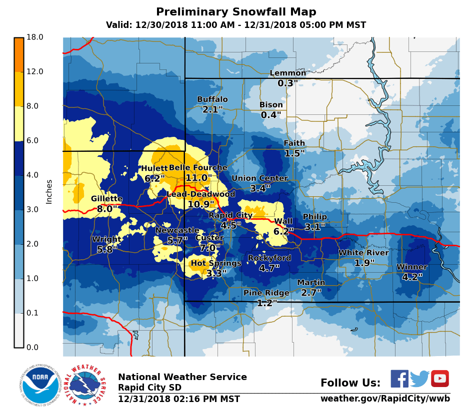
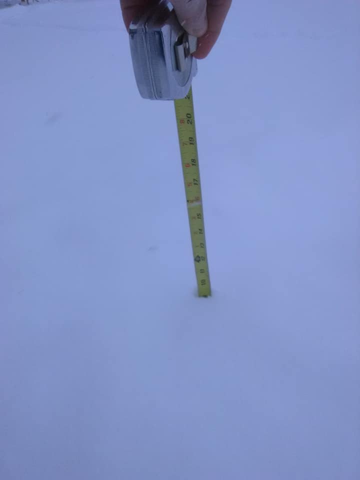
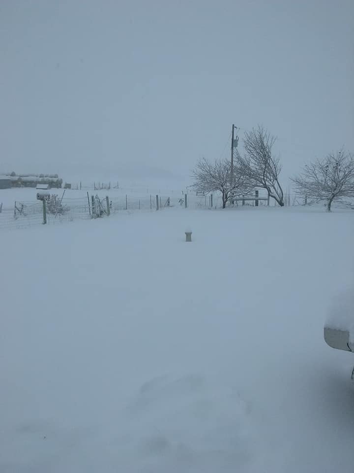
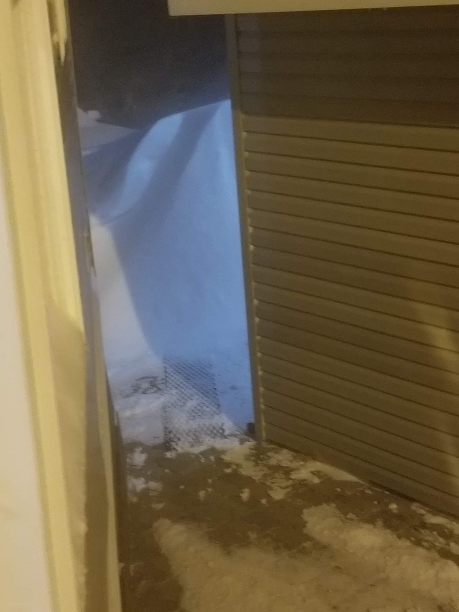
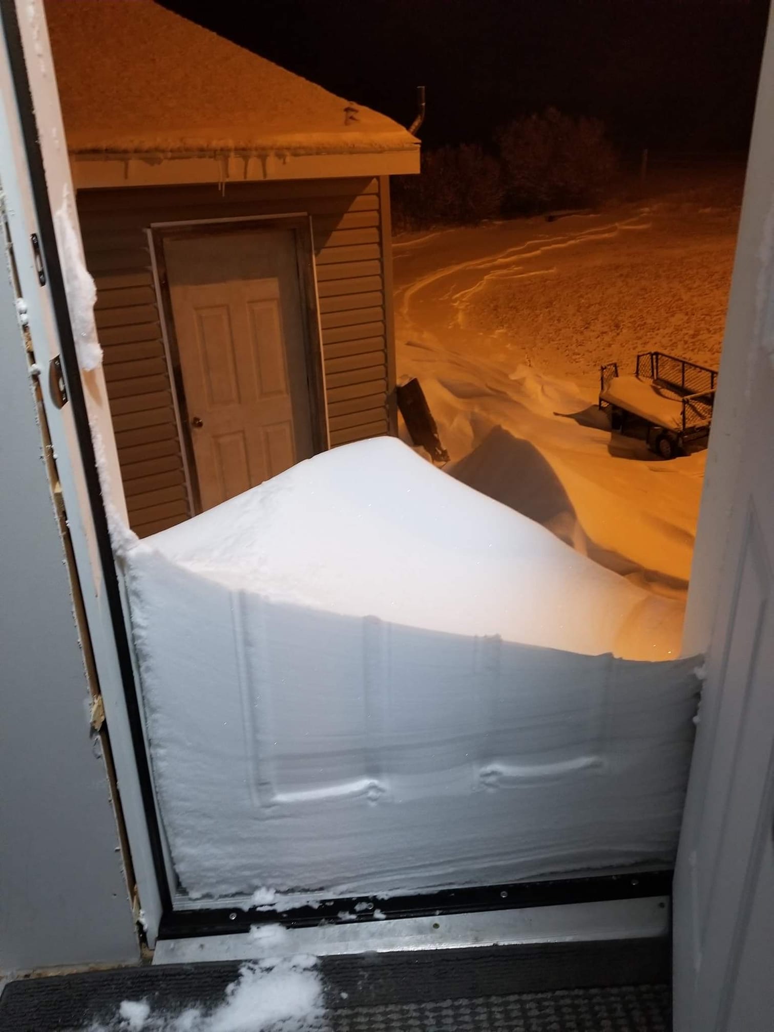
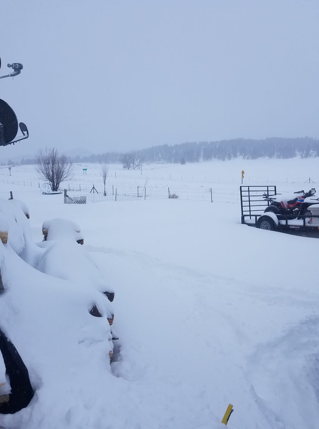
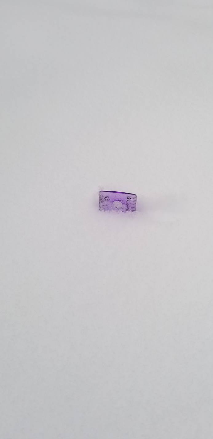
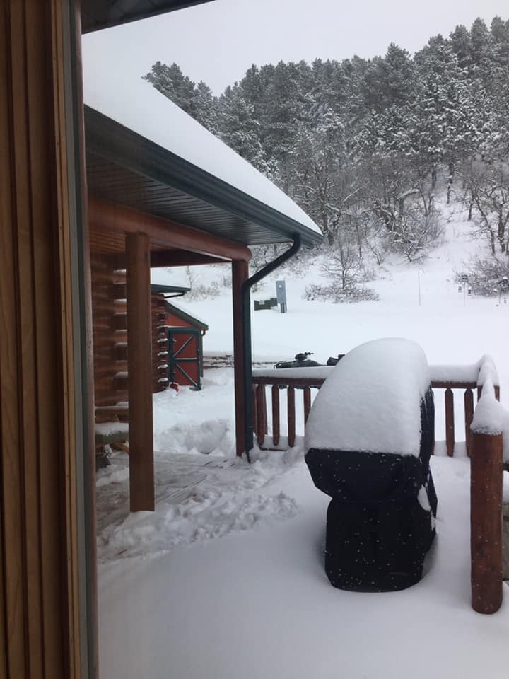
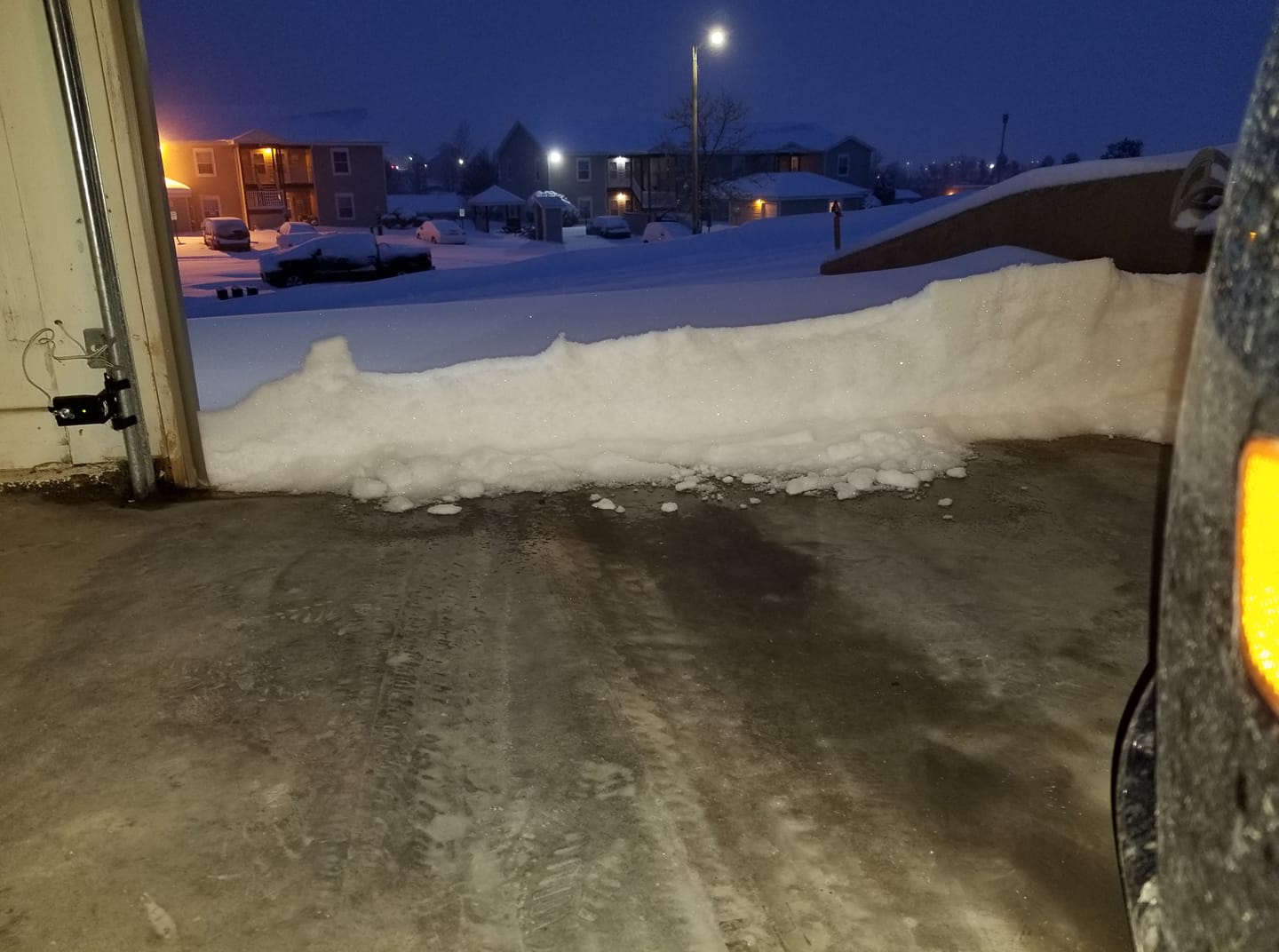
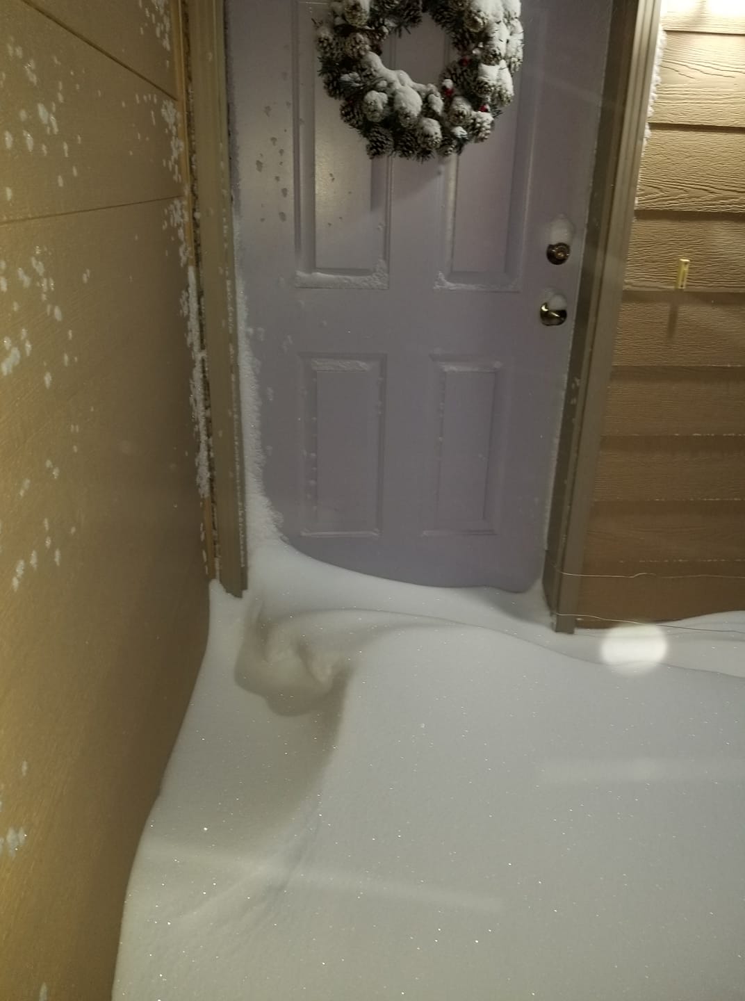
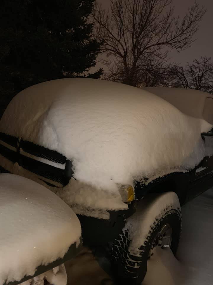
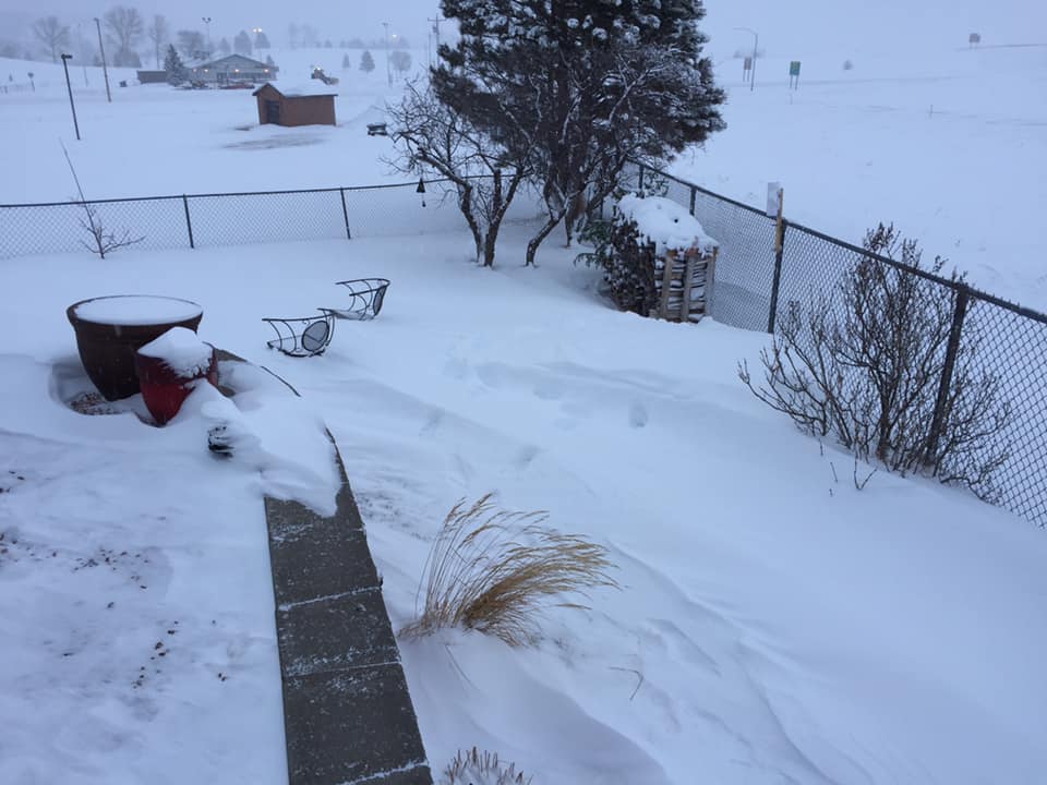
The year of 2018 closed with a blast of snow, wind, and cold across northeastern WY and western SD. A strong winter storm brought heavy snowfall and blizzard-like conditions to much of the area on December 30th and 31st. Snow began across northeastern WY on the afternoon of the 30th before gradually spreading across the entire area. Rain preceded the snow across portions of western SD, providing a glaze of ice beneath accumulating snow as temperatures plummeted through the night of the 30th into the morning of the 31st. Hazardous travel conditions caused by a combination of slick roads, heavy snow, and wind gusts of 40 to 60 mph led to the closure of I-90 across portions of WY, and later, closure of both the Gillette-Campbell County Airport and Rapid City Regional Airport. Heaviest snowfall amounts occurred across northeastern WY and portions of the northern and southern Black Hills, where 8 to nearly 14 inches of snow were reported. Blizzard conditions were observed in Rapid City and the surrounding plains and foothills for several hours on the morning of the 31st. Additionally, downtown Rapid City set a new record daily snowfall for New Year's Eve, with 2.5" of snow breaking the previous record of 2.4" in 1924. |
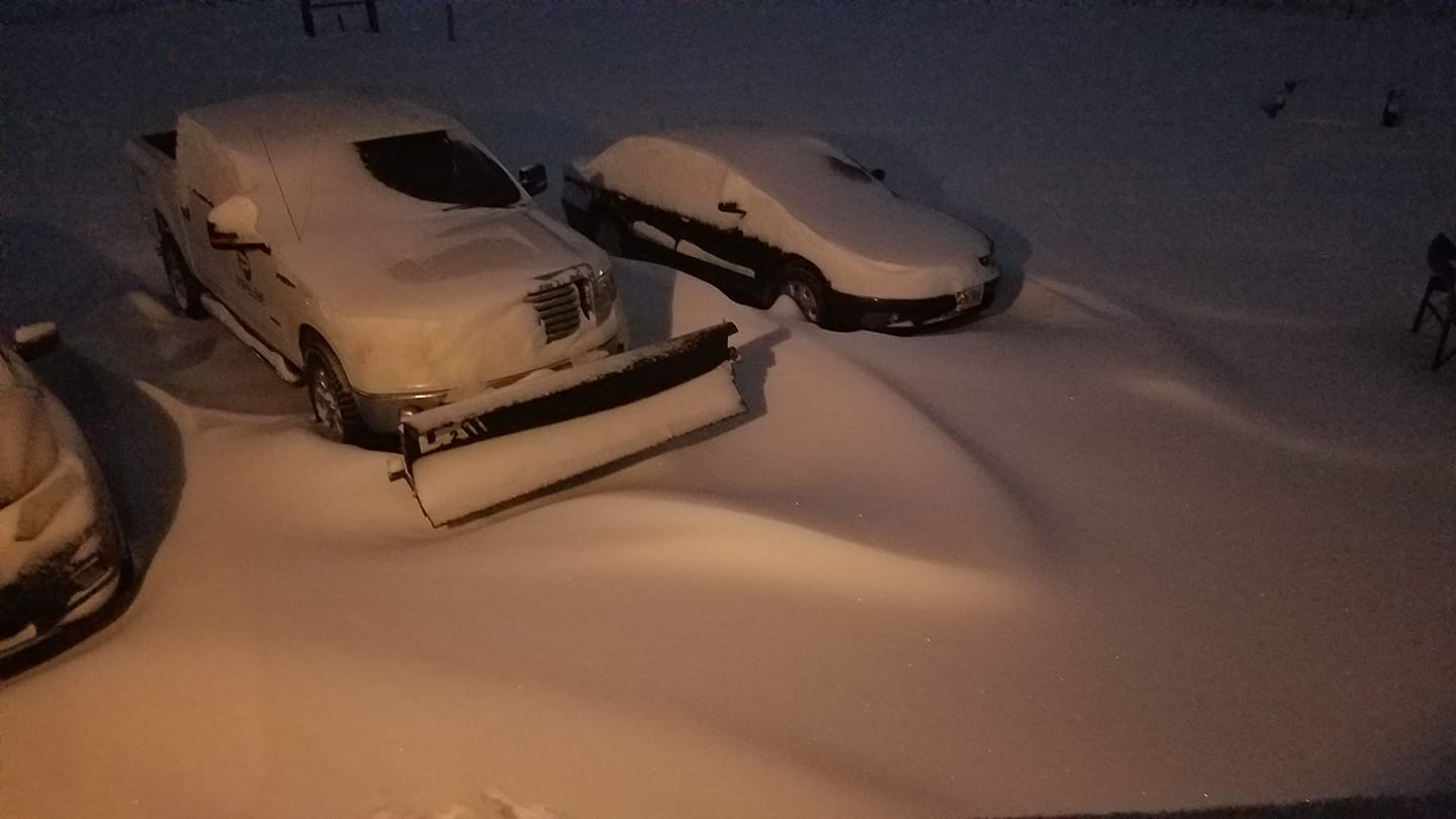
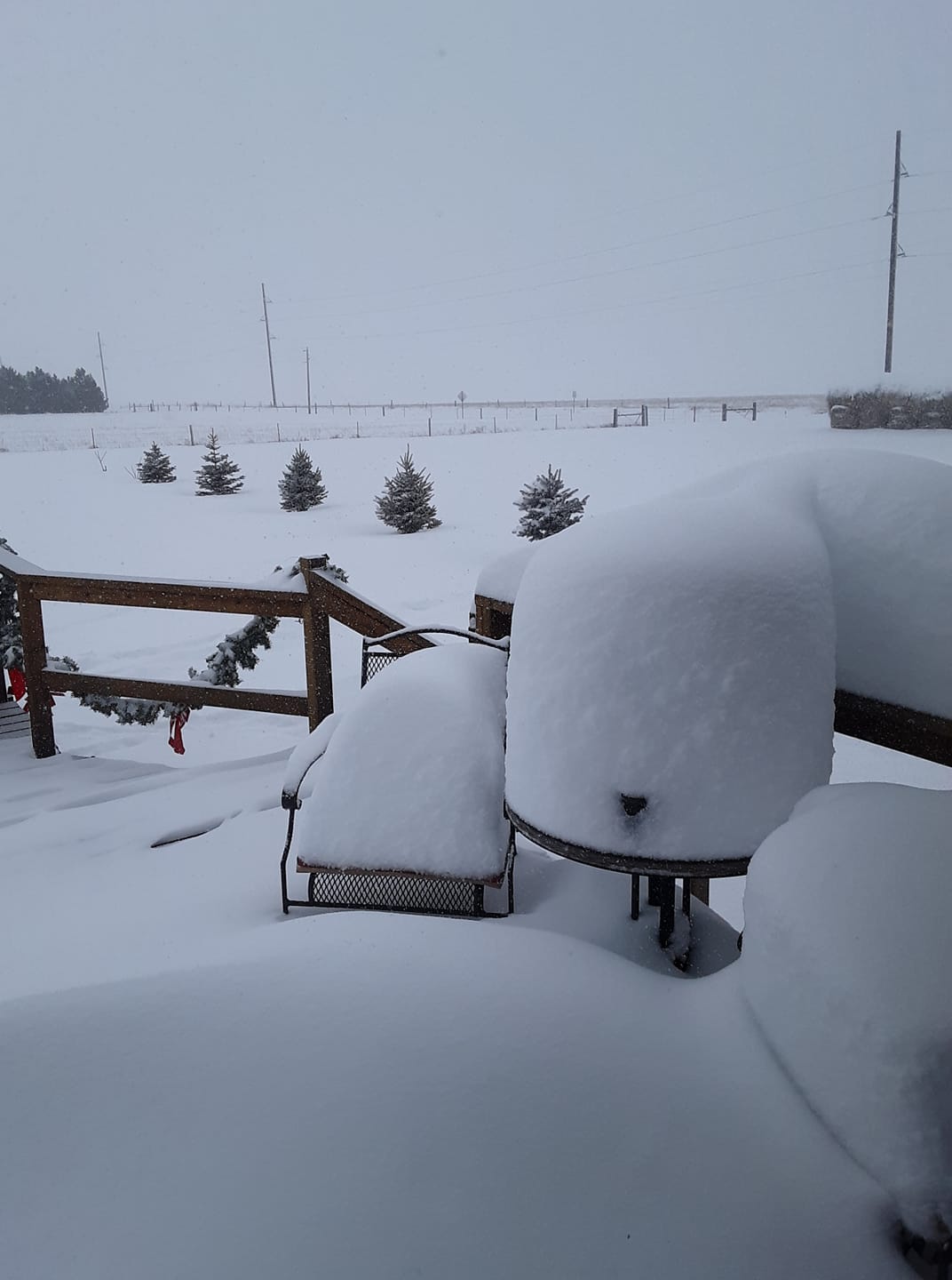 Belle Fourche, SD Courtesy Brian J. |
Snow
Photos
 |
 |
 |
 |
| 9N Alva, WY Courtesy Paula B. |
9N Alva, WY Courtesy Paula B. |
Belle Fourche, SD Courtesy Victoria P. |
Edgemont, SD Courtesy Katherine A. |
 |
 |
 |
 |
| Galena, SD Courtesy Elizabeth K. |
Gillette, WY Courtesy Patrick K. |
Gillette, WY Courtesy Patrick K. |
Gillette, WY Courtesy Patrick K. |
 |
 |
 |
 |
| Near Carlile, WY Courtesy Jeana W. |
Spearfish, SD Courtesy Carrie GW. |
Spearfish, SD Courtesy Debbie L. |
Spearfish, SD Courtesy Jessica S. |
 |
 |
 |
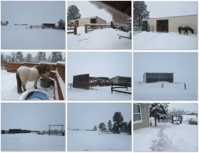 |
| Spearfish, SD Courtesy Jessica S. |
Sturgis, SD Courtesy Ky M. |
Sundance, WY Courtesy MD P. |
4S Devil's Tower, WY Courtesy Heike B. |
 |
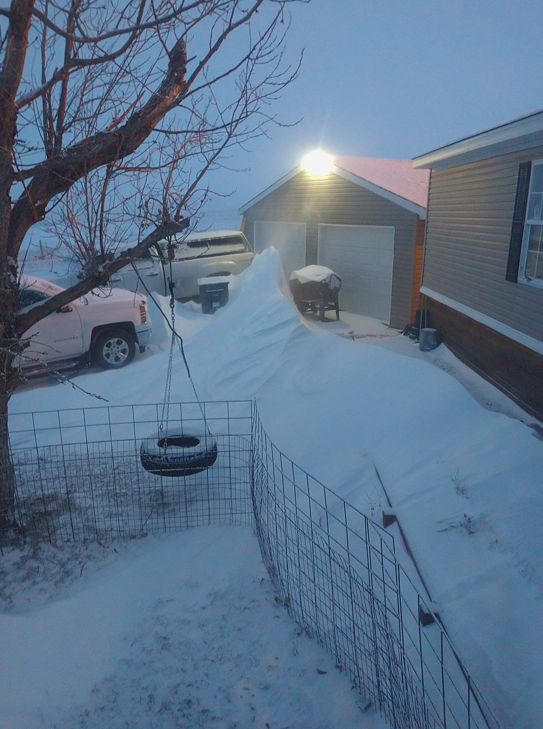
| Belle Fourche, SD Courtesy Gary B. |
Storm Reports
SNOW REPORTS LISTED BY AMOUNT
INCHES LOCATION ST COUNTY TIME
------ ----------------------- -- -------------- -------
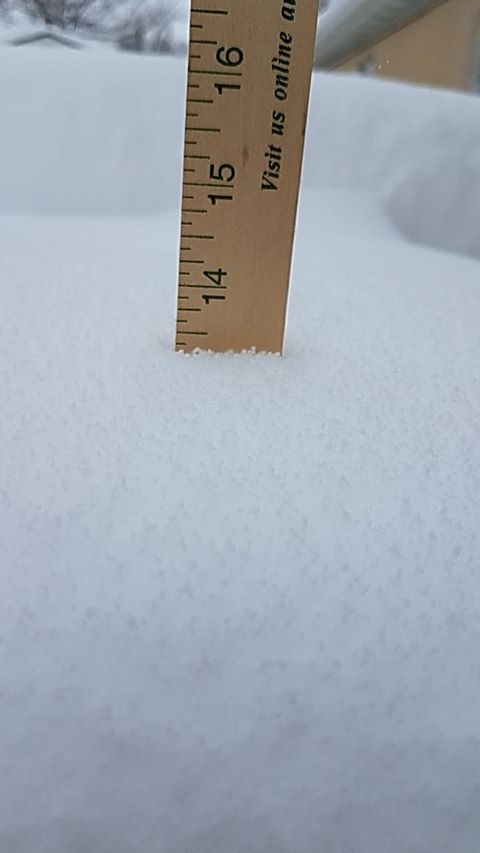
13.50 1 N DOWNTOWN BELLE FOUR SD BUTTE 1230 PM
12.50 LEAD SD LAWRENCE 0200 PM
12.00 DEADWOOD SD LAWRENCE 1210 PM
12.00 2 NNW SAINT ONGE SD LAWRENCE 1125 AM
2-4 FOOT DRIFTS
12.00 2 NW BEULAH WY CROOK 1004 AM
12.00 1 W DOWNTOWN BELLE FOUR SD BUTTE 0901 AM
11.80 1 NNW DOWNTOWN SPEARFIS SD LAWRENCE 0801 AM
10.50 1 SSE DOWNTOWN SPEARFIS SD LAWRENCE 0800 AM
10.00 2 SE COLONY WY CROOK 0105 PM
10.00 9 N ALVA WY CROOK 0945 AM
10.00 6 SW BEULAH WY CROOK 0800 AM
10.00 DOWNTOWN SPEARFISH SD LAWRENCE 0641 AM
9.00 11 W DOWNTOWN HOT SPRIN SD FALL RIVER 1057 AM
9.00 1 SE DOWNTOWN SPEARFISH SD LAWRENCE 0713 AM
8 TO 10 INCHES
9.00 6 NNW DOWNTOWN SPEARFIS SD LAWRENCE 0700 AM
8.00 6 ENE CARLILE WY CROOK 0837 AM
8.00 DOWNTOWN STURGIS SD MEADE 0658 AM
8.00 DOWNTOWN GILLETTE WY CAMPBELL 0330 AM
WIDESPREAD DRIFTS OF 3 TO 4 FEET
8.00 S DOWNTOWN CUSTER SD CUSTER 1017 PM
SOUTHSIDE OF TOWN
7.80 WRIGHT WY CAMPBELL 0100 PM
DRIFTS OVER 3 FEET
7.60 9 E CARLILE WY CROOK 0700 AM
7.50 ARGYLE SD CUSTER 0857 AM
7.50 1 SSW DOWNTOWN CUSTER SD CUSTER 0841 AM
7.50 3 ESE CHEYENNE CROSSING SD LAWRENCE 0800 AM
7.20 1 S DOWNTOWN BELLE FOUR SD BUTTE 0700 AM
7.00 1 NE DOWNTOWN CUSTER SD CUSTER 0841 AM
7.00 4 SE DOWNTOWN SPEARFISH SD LAWRENCE 0750 AM
AT LEAST 7 INCHES
7.00 DOWNTOWN NEWCASTLE WY WESTON 0612 PM
6 TO 7 INCHES
6.50 14 NNW DOWNTOWN GILLETT WY CAMPBELL 0700 AM
6.00 6 ESE CLARETON WY WESTON 0909 AM
6.00 5 ESE ELM SPRINGS SD MEADE 0900 AM
6.00 SUNDANCE WY CROOK 0819 AM
DRIFTS OVER TWO FEET
6.00 EDGEMONT SD FALL RIVER 0759 AM
6.00 19 SW UPTON WY WESTON 0700 AM
6.00 11 NE MORRISEY WY WESTON 0700 AM
6.00 5 SW DOWNTOWN HOT SPRIN SD FALL RIVER 0700 AM
6.00 6 NNW SUNDANCE WY CROOK 0640 AM
STORM TOTAL SO FAR
6.00 3 ESE DEVILS TOWER WY CROOK 0600 AM
6.00 3 E DOWNTOWN NEWCASTLE WY WESTON 0600 AM
6.00 4 S HILL CITY SD PENNINGTON 0550 AM
5.60 HULETT WY CROOK 0702 AM
5.50 11 NNE WESTON WY CAMPBELL 0700 AM
5.50 3 SE SAINT ONGE SD LAWRENCE 0545 AM
5.50 OSAGE WY WESTON 0909 PM
5.50 WRIGHT WY CAMPBELL 0509 PM
5.00 14 SSW PROVO SD FALL RIVER 1248 PM
5.00 4 S DEVILS TOWER WY CROOK 1158 AM
DRIFTS OVER 3 FEET, DIFFICULT TO GET ACCURATE
MEASUREMENT
5.00 15 E DOWNTOWN NEWCASTLE SD PENNINGTON 0858 AM
5.00 15 NE DOWNTOWN STURGIS SD MEADE 0818 AM
5.00 EDGEMONT SD FALL RIVER 0700 AM
5.00 QUINN SD PENNINGTON 0630 AM
ABOUT 4 TO 6 INCHES OF SNOW FROM WALL TO 5 MI
EAST OF QUINN. VISIBILITY FROM HALF MILE TO
NEAR ZERO.
5.00 1 ENE PRINGLE SD CUSTER 0728 PM
5.00 2 SSW DOWNTOWN CUSTER SD CUSTER 0518 PM
4.70 DOWNTOWN RAPID CITY SD PENNINGTON 0700 AM
4.50 1 E DOWNTOWN RAPID CITY SD PENNINGTON 1100 AM
1-2 FOOT DRIFTS
4.50 2 W OPAL SD MEADE 0700 AM
4.50 4 NNE SUMMERSET SD MEADE 0700 AM
4.20 2 W IDEAL SD TRIPP 0159 PM
4 TO 4.5 INCHES
4.00 1 NW VETAL SD BENNETT 0205 PM
4.00 8 NW HILL CITY SD PENNINGTON 0728 AM
AT LEAST 4 INCHES
4.00 4 W DOWNTOWN RAPID CITY SD PENNINGTON 0700 AM
4.00 DOWNTOWN HOT SPRINGS SD FALL RIVER 0700 AM
4.00 7 NW CEDAR BUTTE SD MELLETTE 0700 AM
4.00 1 NNE EDGEMONT SD FALL RIVER 0600 AM
4.00 9 NW DEERFIELD SD PENNINGTON 0500 AM
STORM TOTAL SO FAR
4.00 7 SSE CHEYENNE CROSSING SD LAWRENCE 0500 AM
STORM TOTAL SO FAR
4.00 9 W JEWEL CAVE SD CUSTER 0525 PM
3 TO 4 INCHES
4.00 DOWNTOWN NEWCASTLE WY WESTON 0413 PM
3.70 2 S DOWNTOWN RAPID CITY SD PENNINGTON 0700 AM
3.50 5 W ELLSWORTH AFB SD MEADE 0700 AM
3.50 DOWNTOWN HOT SPRINGS SD FALL RIVER 0700 AM
3.20 1 E DOWNTOWN RAPID CITY SD PENNINGTON 0500 AM
1-2 FOOT DRIFTS
3.00 1 W OGLALA SD OGLALA LAKOTA 0137 PM
3.00 6 ENE NEWELL SD BUTTE 0800 AM
2.80 3 NE HISEGA SD PENNINGTON 0800 AM
2.50 HOWES SD MEADE 0113 PM
2 TO 3 INCHES, 2 FOOT DRIFTS
2.50 8 E SMITHWICK SD FALL RIVER 1245 PM
ESTIMATED 2 TO 3 INCHES
2.50 15 S BUFFALO SD HARDING 0738 AM
ABOUT 2 TO 3 INCHES
2.50 3 NNE JOHNSON SIDING SD PENNINGTON 0700 AM
2.40 1 ESE PACTOLA RESERVOIR SD PENNINGTON 0710 AM
2.00 7 NE SMITHWICK SD FALL RIVER 1240 PM
2.00 5 ESE NORRIS SD MELLETTE 0822 AM
2.00 14 SSE DUPREE SD ZIEBACH 0800 AM
2.00 3 SSE HARDING SD HARDING 0800 AM
2.00 2 SW NORRIS SD MELLETTE 0800 AM
1.50 7 N WOOD SD MELLETTE 0647 AM
1.50 HERMOSA SD CUSTER 0600 AM
1.30 5 NE ROCKERVILLE SD PENNINGTON 0700 AM
1.00 2 SSE PINE RIDGE SD OGLALA LAKOTA 0141 PM
1.00 8 WSW LODGEPOLE SD PERKINS 0820 AM
1.00 6 SSW FAIRPOINT SD MEADE 0700 AM
1.00 ORAL SD FALL RIVER 0700 AM
1.00 8 WNW USTA SD PERKINS 0700 AM
SUSTAINED WIND REPORTS LISTED BY SPEED (MPH)
SPEED LOCATION ST COUNTY TIME
------ ----------------------- -- -------------- -------
44.00 RAPID CITY AIRPORT SD PENNINGTON 0203 AM
ALSO GUSTING TO 59 MPH
WIND GUST REPORTS LISTED BY SPEED (MPH)
SPEED LOCATION ST COUNTY TIME
------ ----------------------- -- -------------- -------
61.00 RAPID CITY AIRPORT SD PENNINGTON 0118 AM
57.00 1 NE ECHETA WY CAMPBELL 1251 AM
PEAK WIND IN THE LAST HOUR
55.00 1 E DOWNTOWN RAPID CITY SD PENNINGTON 1228 AM
 |
Media use of NWS Web News Stories is encouraged! Please acknowledge the NWS as the source of any news information accessed from this site. |
|

