
Wildfire smoke continues to impact air quality from the Great Lakes region into New England and the Mid-Atlantic today with widespread Air Quality Alerts in effect. Severe thunderstorms are expected across portions of the Ohio Valley and Lower Great Lakes into the Mid-Atlantic and Northeast, this afternoon into the evening. Monsoonal thunderstorms may bring areas of flooding to the Southwest. Read More >
Overview
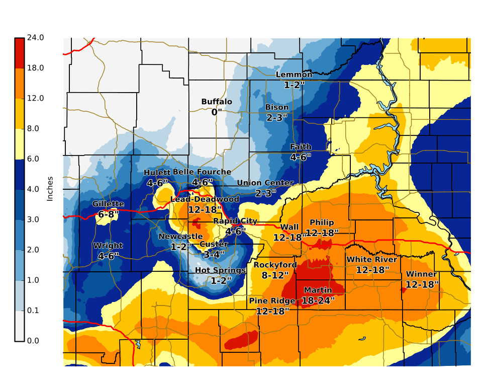
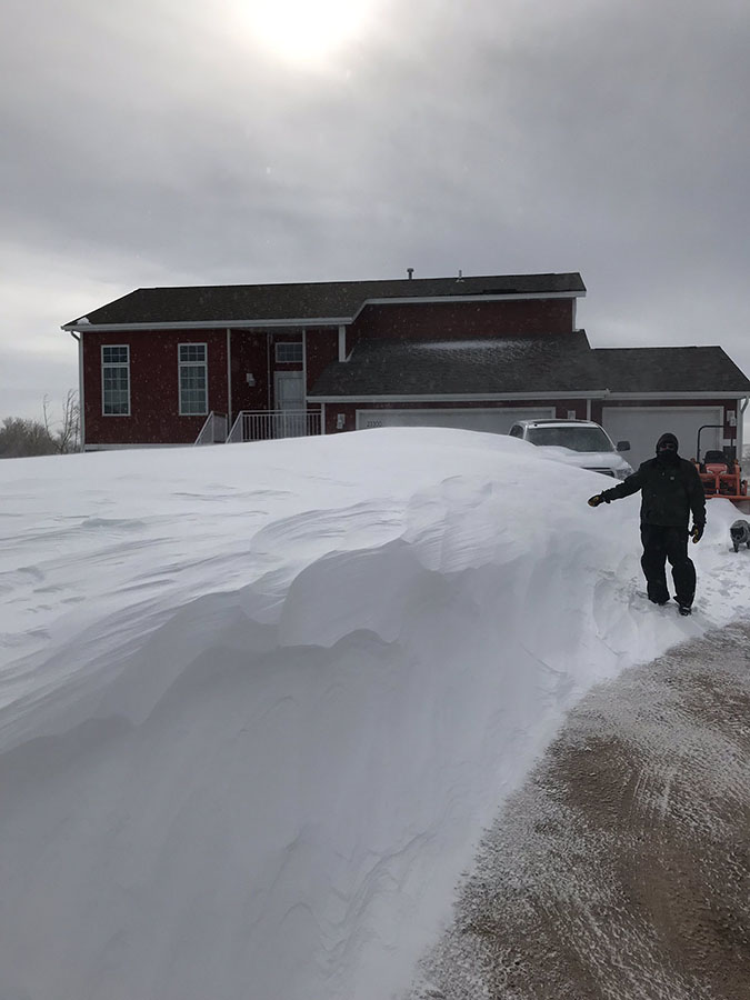
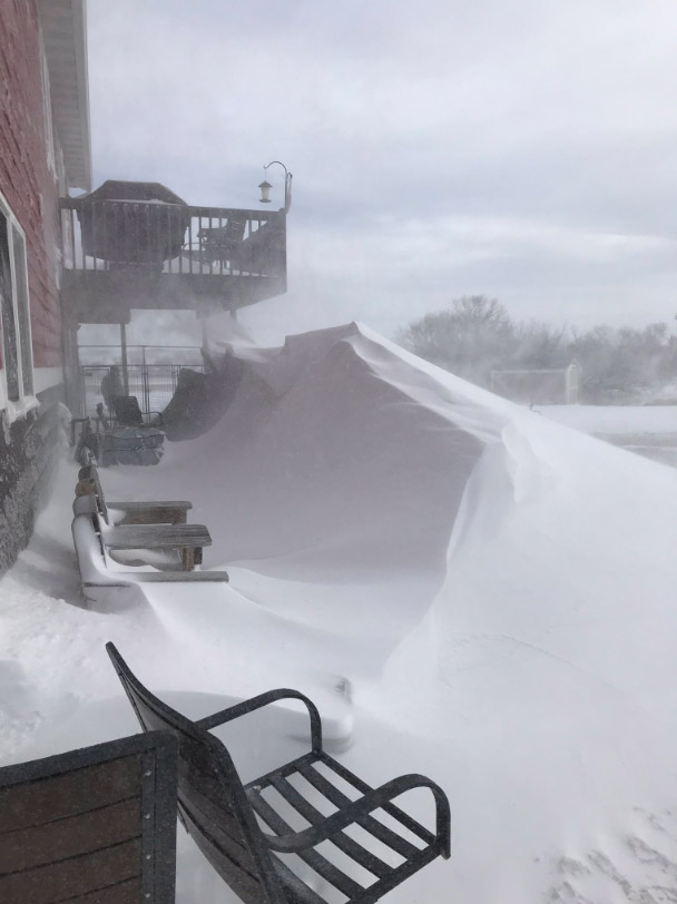
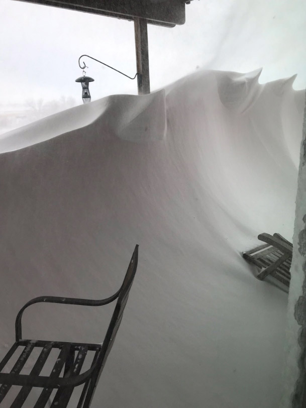
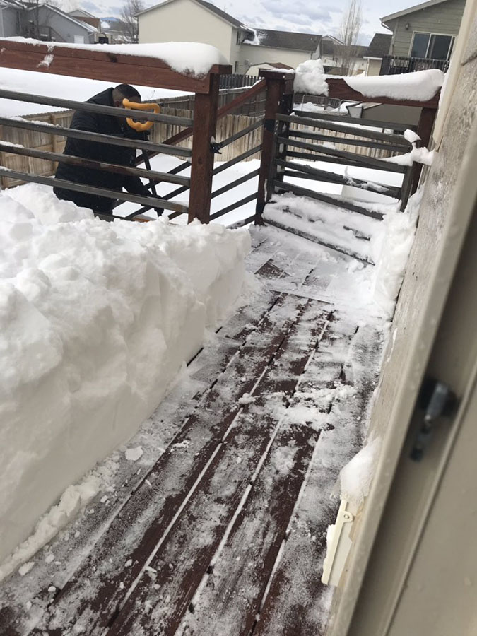
March 13-14, 2019, a powerful winter storm brought heavy snow and strong winds to northeastern Wyoming and western South Dakota. Snow amounts across the area varied widely, ranging from around an inch across northwestern SD and the downsloped Newcastle area, to 16 inches in the central Black Hills, and 18 inches near Kadoka. Wind gusts reached 60 to 70 mph, which created a blizzard. Less than one quarter-mile visibility was reported across the area and drifts several feet deep resulted, even in areas that received only a few inches of snow. Below is the radar imagery of the storm. As you can see, there was a hole in the snow around Rapid City for a while, depicting the pocket of dry air Wednesday morning that kept snow at bay for several hours. This resulted in lowered snow amounts for Rapid City and the surrounding areas. Nonetheless, travel was hazardous to impossible due to the icing and drifting on roads and zero visibility.
Snowfall
Given the very strong winds that occurred with this blizzard, these snowfall totals are very preliminary.
The storm reports listed below are in descending order and may not
necessarily be the final storm reports.

Snow reports listed by amount

 INCHES  LOCATION                 ST  COUNTY           TIME
 ------  -----------------------  --  --------------   -------
 18.30   KADOKA                   SD  JACKSON          0700 AM
 18.00   8 SE INTERIOR            SD  JACKSON          0600 AM
 16.00   2 ESE OKREEK             SD  TODD             1100 AM
 16.00   7 NW CEDAR BUTTE         SD  MELLETTE         0600 AM
 16.00   4 SE DEERFIELD           SD  PENNINGTON       0529 AM
 15.00   2 SW NORRIS              SD  MELLETTE         0800 AM
 14.70   JOHNSON SIDING           SD  PENNINGTON       1117 AM
 14.70   5 ESE NORRIS             SD  MELLETTE         1109 PM
 13.50   3 ESE CHEYENNE CROSSING  SD  LAWRENCE         0800 AM
 13.00   FOUR CORNERS             WY  WESTON           0809 PM
 11.00   1 NNW DOWNTOWN SPEARFIS  SD  LAWRENCE         0900 AM
  9.00   DOWNTOWN GILLETTE        WY  CAMPBELL         0706 AM
  9.00   WASTA                    SD  PENNINGTON       0500 AM
  8.50   3 NNE JOHNSON SIDING     SD  PENNINGTON       0700 AM
  8.10   1 NNE SUNDANCE           WY  CROOK            1200 AM
  8.00   7 NNE ELLSWORTH AFB      SD  MEADE            0700 AM
  8.00   5 ESE ELM SPRINGS        SD  MEADE            0626 AM
  8.00   SUNDANCE                 WY  CROOK            0600 AM
  8.00   2 SW DOWNTOWN RAPID CIT  SD  PENNINGTON       0246 AM
  7.80   3 SE SAINT ONGE          SD  LAWRENCE         0515 AM
  7.50   1 SSE DOWNTOWN SPEARFIS  SD  LAWRENCE         0800 AM
  7.50   5 NE ROCKERVILLE         SD  PENNINGTON       0700 AM
  7.00   3 NE WHITEWOOD           SD  LAWRENCE         1009 AM
  7.00   FOUR CORNERS             WY  WESTON           0518 PM
  6.30   14 SSE DUPREE            SD  ZIEBACH          0800 AM
  6.00   8 E SMITHWICK            SD  FALL RIVER       1228 PM
  5.50   1 NNW PIEDMONT           SD  MEADE            1041 AM
  5.00   8 WSW GLAD VALLEY        SD  ZIEBACH          0700 AM
  5.00   3 ESE DEVILS TOWER       WY  CROOK            0600 AM
  5.00   1 E DOWNTOWN RAPID CITY  SD  PENNINGTON       0600 AM
  5.00   9 N CEDAR BUTTE          SD  MELLETTE         0600 AM
  4.50   1 S DOWNTOWN BELLE FOUR  SD  BUTTE            0700 AM
  4.50   2 S DOWNTOWN RAPID CITY  SD  PENNINGTON       0700 AM
  4.20   1 ESE PACTOLA RESERVOIR  SD  PENNINGTON       0930 AM
  4.10   TILFORD                  SD  MEADE            0700 AM
  4.00   9 WSW RED ELM            SD  ZIEBACH          0830 AM
  4.00   9 W DOWNTOWN SPEARFISH   SD  LAWRENCE         0819 AM
  4.00   4 SE USTA                SD  PERKINS          0700 AM
  4.00   HILL CITY                SD  PENNINGTON       0700 AM
  4.00   11 NE MORRISEY           WY  WESTON           0700 AM
  4.00   DOWNTOWN STURGIS         SD  MEADE            0500 AM
  4.00   UPTON                    WY  WESTON           0811 PM
  4.00   4 S DOWNTOWN RAPID CITY  SD  PENNINGTON       0700 PM
  4.00   DOWNTOWN GILLETTE        WY  CAMPBELL         0330 PM
  3.40   6 NNW DOWNTOWN SPEARFIS  SD  LAWRENCE         0700 AM
  3.40   3 NE HISEGA              SD  PENNINGTON       0700 AM
  3.00   HERMOSA                  SD  CUSTER           0829 AM
  3.00   4 NNE SUMMERSET          SD  MEADE            0730 AM
  3.00   8 WNW USTA               SD  PERKINS          0700 AM
  2.50   14 NNW DOWNTOWN GILLETT  WY  CAMPBELL         0700 AM
  2.00   8 WSW LODGEPOLE          SD  PERKINS          0755 AM
  2.00   ORAL                     SD  FALL RIVER       0700 AM
  2.00   1 NNE EDGEMONT           SD  FALL RIVER       0700 AM
  1.40   6 WNW SHADEHILL          SD  PERKINS          0700 AM
  1.20   8 SE MUD BUTTE           SD  MEADE            0900 AM
  1.00   6 ENE NEWELL             SD  BUTTE            0700 AM
  1.00   1 WSW DOWNTOWN NEWCASTL  WY  WESTON           0700 AM
  1.00   6 SSW FAIRPOINT          SD  MEADE            0700 AM
  1.00   3 E DOWNTOWN NEWCASTLE   WY  WESTON           0600 AM
  1.00   2 E DOWNTOWN STURGIS     SD  MEADE            0600 PM
  1.00   ARGYLE                   SD  CUSTER           0443 PM
  1.00   DOWNTOWN HOT SPRINGS     SD  FALL RIVER       0400 PM
Strong Winds
Here is a preliminary look at the highest wind reports received and recorded.
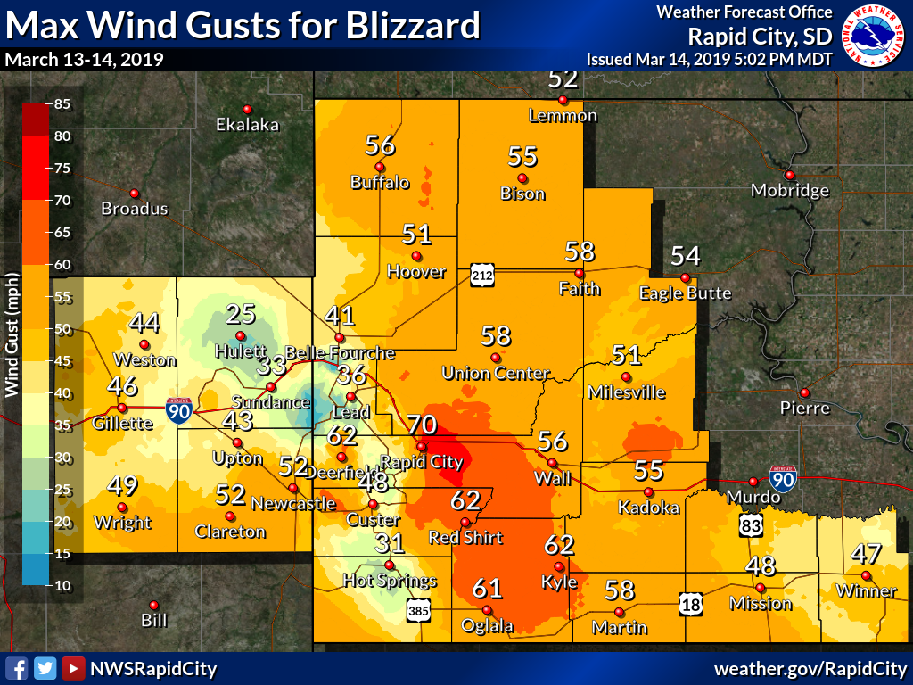
Wind gust reports listed by speed (mph)

 SPEED   LOCATION                 ST  COUNTY           TIME
 ------  -----------------------  --  --------------   -------
 70.00   1 E DOWNTOWN RAPID CITY  SD  PENNINGTON       0500 AM
 68.00   RAPID CITY AIRPORT       SD  PENNINGTON       0121 AM
 66.00   3 ESE PINE RIDGE         SD  OGLALA LAKOTA    0449 AM
 65.00   6 W ROCHFORD             SD  PENNINGTON       0408 AM
 64.00   3 E PHILIP               SD  HAAKON           0100 AM
 64.00   JEWEL CAVE               SD  CUSTER           0855 AM
 61.00   4 NNW FAIRBURN           SD  CUSTER           0500 PM
 60.00   5 NE PORCUPINE           SD  OGLALA LAKOTA    0441 AM
 60.00   1 NE WINNER              SD  TRIPP            0210 AM
 59.00   8 S WALL                 SD  PENNINGTON       1220 AM
 58.00   1 NNE FAITH              SD  MEADE            0721 PM
 56.00   1 ESE MARTIN             SD  BENNETT          0215 AM
 54.00   6 W PARMELEE             SD  TODD             0428 AM
 53.00   8 S WALL                 SD  PENNINGTON       0420 PM
 53.00   5 SSE BEAR BUTTE STATE   SD  MEADE            0255 PM
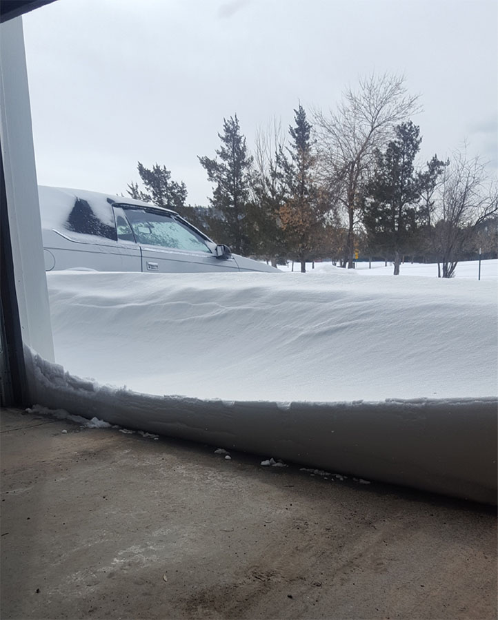
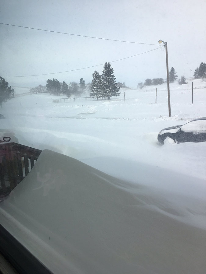
Photos & Video
Videos of our Weather Balloon Releases
March 13, 2019 around 500 PM Evening Launch
March 14, 2019 around 500 AM Morning Launch
Photos from Around the Area
 |
 |
 |
 |
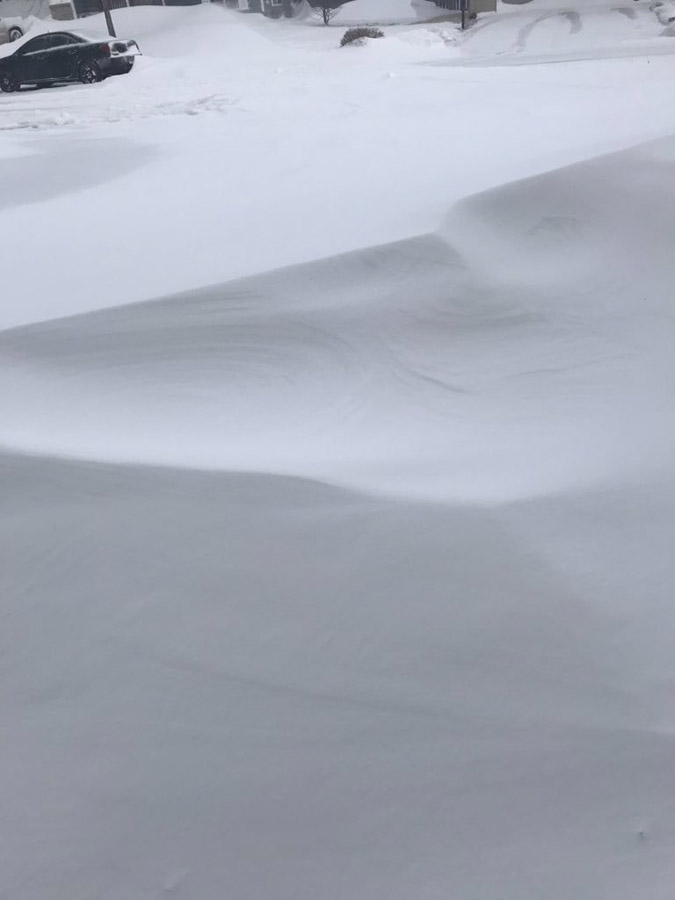
| 1 N Hisega (Susan Rudge) |
Allen (Caitlin Young) |
Rapid Valley (Kayleigh Schmidt) |
Rapid Valley (Kayleigh Schmidt) |
 |
 |
 |
 |
| Rapid Valley (Kayleigh Schmidt) |
Rapid Valley (Shannon) |
Rapid Valley (Shannon) |
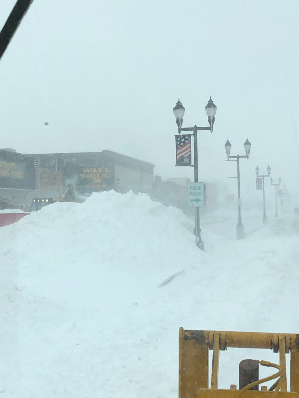
Wall (Jim Kitterman) |
 |
 |
 |
 |
| Wall (Jim Kitterman) |
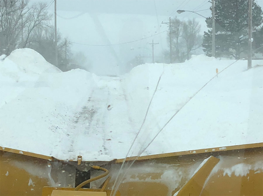
MM71 on I-90 (Mike Carlson) |
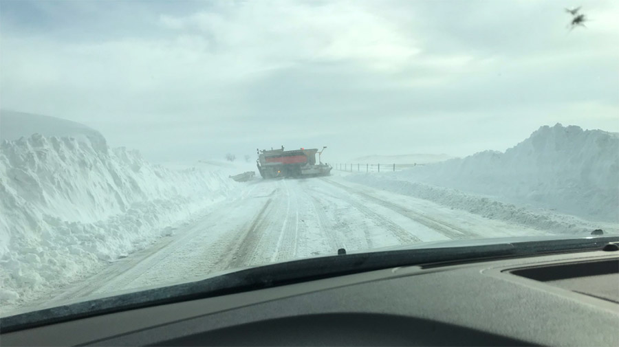
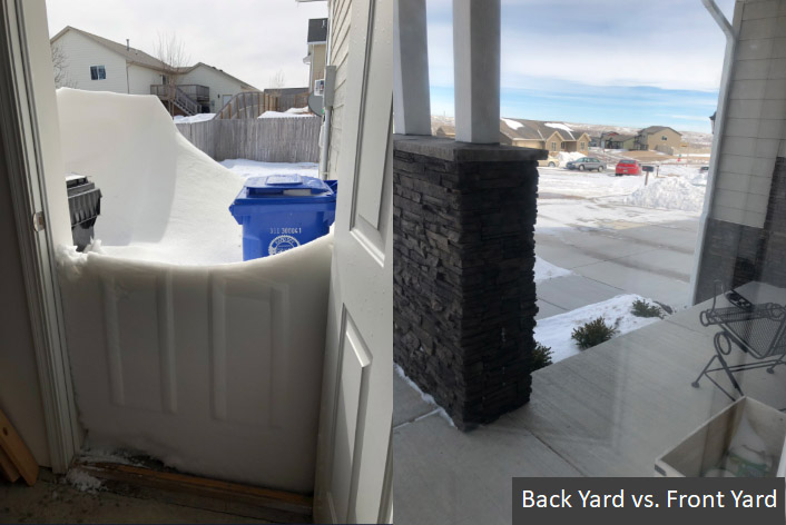
Rapid City (DG) |
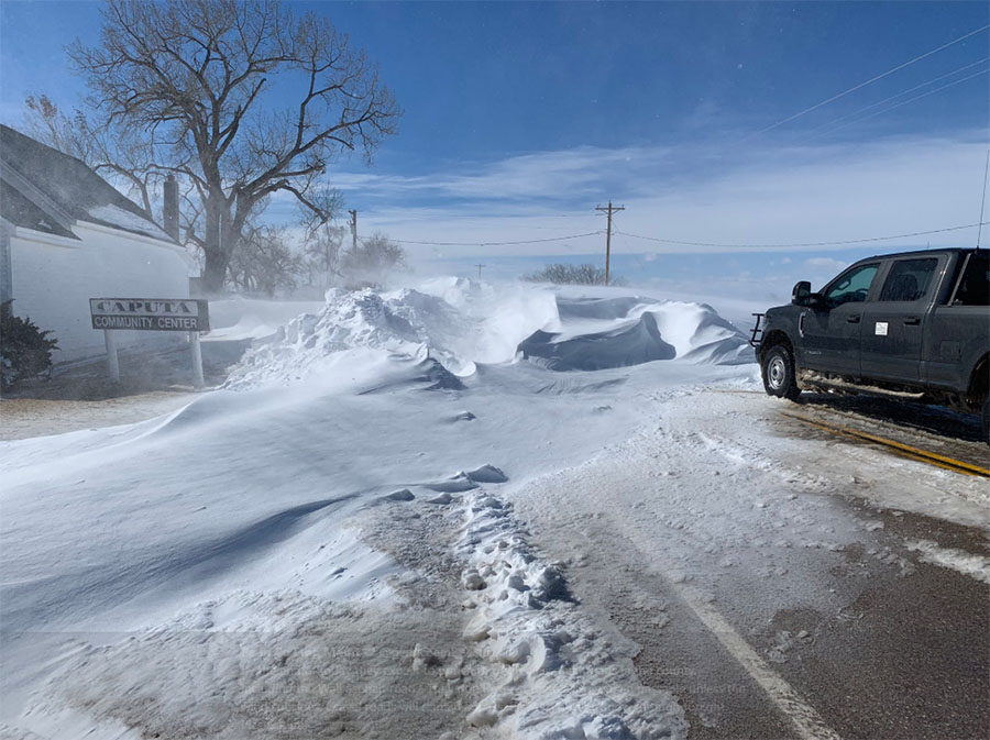
Caputa, SD (Pennington County EM) |
 |
Media use of NWS Web News Stories is encouraged! Please acknowledge the NWS as the source of any news information accessed from this site. |
|

