Overview
|
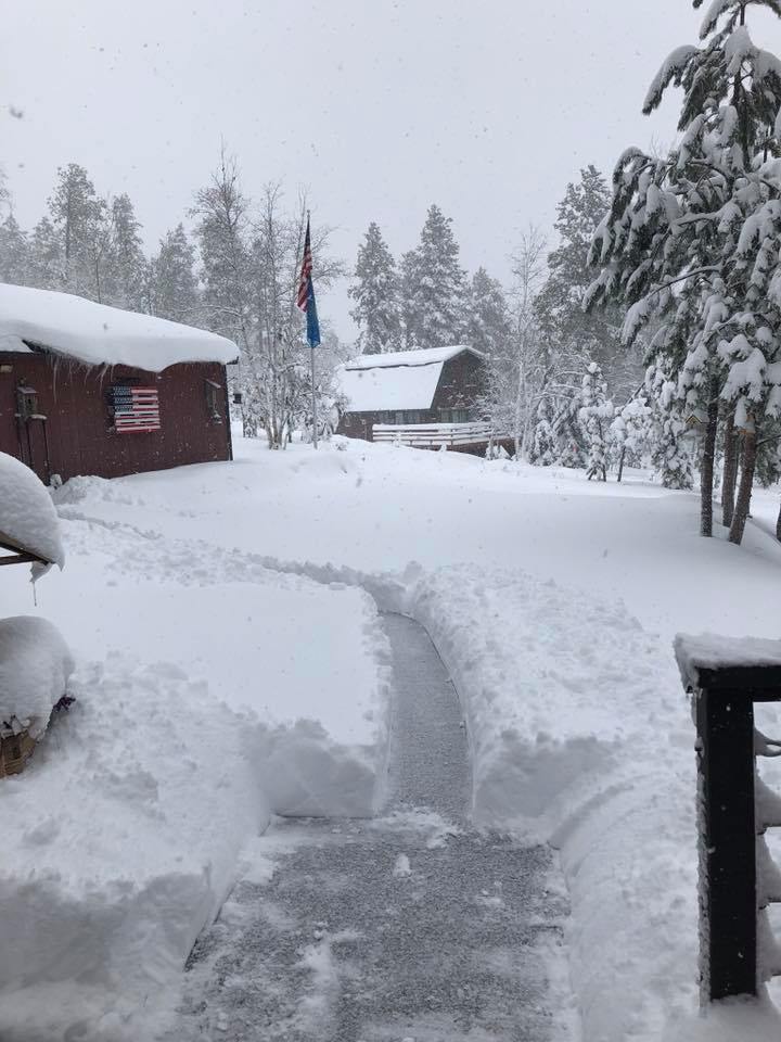
A large storm brought heavy rain and historic late season snowfall to the Black Hills region May 20-22, 2019. A powerful low pressure system slowly moved from the Four Corners region northward through the Plains during this time, leading to a prolonged period of precipitation to western South Dakota and northeastern Wyoming. |
 Enjoying the snow with a cup of coffee south of Deadwood! Photo by Michele S |
Snow
A list of snowfall reports are included below the maps
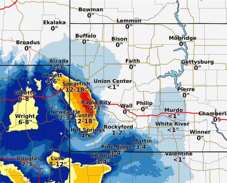
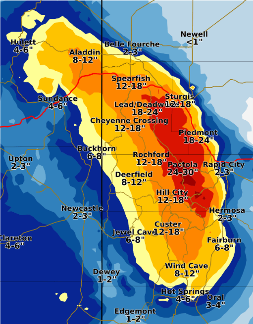
Snowfall across the region Detailed snowfall map of the Black Hills
 INCHES  LOCATION                  ST  COUNTY           TIME
 ------  -----------------------   --  --------------   -------
 25.00   2 S PACTOLA RESERVOIR     SD  PENNINGTON       0823 AM
 22.00   1 SW ROCKERVILLE          SD  PENNINGTON       0812 AM
 20.00   3 E DEADWOOD              SD  LAWRENCE         1039 AM
 19.00   HAYWARD                   SD  PENNINGTON       0820 AM
 19.00   HISEGA                    SD  PENNINGTON       0820 AM
 19.00   LEAD                      SD  LAWRENCE         0100 PM
 18.80   JOHNSON SIDING            SD  PENNINGTON       0119 PM
 18.00   4 ENE JOHNSON SIDING      SD  PENNINGTON       1005 AM
 18.00   2 NNE BROWNSVILLE         SD  LAWRENCE         0846 AM
 17.60   3 NE HISEGA               SD  PENNINGTON       0700 AM
 17.00   4 SE ROCKERVILLE          SD  PENNINGTON       1026 AM
 16.20   HILL CITY                 SD  PENNINGTON       0800 AM
 16.00   2 E GALENA                SD  LAWRENCE         1024 AM
 16.00   1 N HISEGA                SD  PENNINGTON       0819 AM
 15.00   DOWNTOWN CUSTER           SD  CUSTER           1035 AM
 15.00   2 W HAYWARD               SD  PENNINGTON       1000 AM
 15.00   4 NE ROCKERVILLE          SD  PENNINGTON       0638 AM
 15.00   5 ENE DOWNTOWN CUSTER     SD  CUSTER           0620 AM
 14.00   4 ESE ROCKERVILLE         SD  PENNINGTON       0830 AM
 13.00   4 NE ROCKERVILLE          SD  PENNINGTON       0844 AM
 13.00   1 SSE DOWNTOWN SPEARFISH  SD  LAWRENCE         0700 AM
 12.90   3 SSW HILL CITY           SD  PENNINGTON       0850 AM
 12.50   2 E HISEGA                SD  PENNINGTON       0815 AM
 12.50   5 SW DOWNTOWN RAPID CITY  SD  PENNINGTON       0700 AM
 12.50   MOUNT RUSHMORE            SD  PENNINGTON       1200 AM
 12.00   6 SW BEULAH               WY  CROOK            0900 AM
 12.00   BLACK HAWK                SD  MEADE            0825 AM
 12.00   4 S MYSTIC                SD  PENNINGTON       0808 AM
 12.00   7 NW DEADWOOD             SD  LAWRENCE         0808 AM
 12.00   SUMMERSET                 SD  MEADE            0643 AM
 11.80   5 NE ROCKERVILLE          SD  PENNINGTON       0700 AM
 11.00   DOWNTOWN CUSTER           SD  CUSTER           0851 AM
 11.00   WHITEWOOD                 SD  LAWRENCE         0845 AM
 11.00   1 NW HILL CITY            SD  PENNINGTON       0820 AM
 11.00   2 WNW DOWNTOWN SPEARFISH  SD  LAWRENCE         0650 AM
 10.00   1 WNW WIND CAVE           SD  CUSTER           0100 PM
 10.00   5 NE ROCKERVILLE          SD  PENNINGTON       0837 AM
  9.90   6 W HERMOSA               SD  CUSTER           0700 AM
  9.50   DOWNTOWN SPEARFISH        SD  LAWRENCE         0818 AM
  9.00   SUMMERSET                 SD  MEADE            0755 AM
  9.00   1 NNW PIEDMONT            SD  MEADE            0730 AM
  8.50   3 SE SAINT ONGE           SD  LAWRENCE         0700 AM
  8.50   3 SE SAINT ONGE           SD  LAWRENCE         0530 AM
  8.00   5 W BEULAH                WY  CROOK            0700 AM
  8.00   WRIGHT                    WY  CAMPBELL         1046 AM
  8.00   DOWNTOWN GILLETTE         WY  CAMPBELL         0929 AM
  8.00   2 NNW SAINT ONGE          SD  LAWRENCE         0900 AM
  8.00   SAINT ONGE                SD  LAWRENCE         0849 AM
  8.00   1 SE PIEDMONT             SD  MEADE            0839 AM
  8.00   DOWNTOWN SPEARFISH        SD  LAWRENCE         0501 AM
  7.50   DOWNTOWN GILLETTE         WY  CAMPBELL         0700 AM
  7.00   2 SW DOWNTOWN RAPID CITY  SD  PENNINGTON       0125 PM
  6.20   14 NNW DOWNTOWN GILLETTE  WY  CAMPBELL         0700 AM
  6.20   14 NNW DOWNTOWN GILLETTE  WY  CAMPBELL         0640 AM
  6.00   9 E DEVILS TOWER          WY  CROOK            0842 AM
  6.00   4 S DOWNTOWN RAPID CITY   SD  PENNINGTON       0741 AM
  5.50   19 SW UPTON               WY  WESTON           0700 AM
  4.20   8 W DOWNTOWN GILLETTE     WY  CAMPBELL         0818 AM
  4.00   5 E PORCUPINE             SD  OGLALA LAKOTA    0740 AM
  3.50   2 S DOWNTOWN RAPID CITY   SD  PENNINGTON       0300 AM
  3.00   BOX ELDER                 SD  PENNINGTON       0812 AM
  3.00   4 W DOWNTOWN HOT SPRINGS  SD  FALL RIVER       0700 AM
  3.00   4 NNE SUMMERSET           SD  MEADE            0700 AM
  3.00   4 W DOWNTOWN HOT SPRINGS  SD  FALL RIVER       0645 AM
  3.00   4 NNE SUMMERSET           SD  MEADE            0630 AM
  2.00   PINE HAVEN                WY  CROOK            0919 AM
  2.00   1 NNE SUNDANCE            WY  CROOK            1200 AM
  1.00   7 WSW FOLSOM              SD  CUSTER           0630 AM
Records
The snow set many records for daily snowfall and snow so late in the year:
Rapid City NWS:
Daily snowfall records set:
May 20: 1.2"; previous record 1.0" in 1959
May 21: 1.5"; no snow ever recorded on May 21
May 22: 0.5"; no snow ever recorded on May 22
Storm total snowfall (May 20-22): 3.2"
Highest May storm total snowfalls:
14.6" May 3-4, 1905
13.6" May 9-10, 2015
13.3" May 2-3, 2008
11.8" May 6-7, 1950
10.5" May 7-8, 1892
May 2019 snowfall: 6.4"; tied for 10th highest May snowfall
Highest May snowfall: 19.2" in 1892
Latest measurable snowfall in May: 0.2" on May 26, 1893
Latest measurable snowfall for the season: 3.0" on June 13, 1969
Lead:
Daily snowfall record set for May 22: 18.0"; previous record 3.0" in 1957
Storm total snowfall (May 20-22): 19.0"
Highest May storm total snowfalls:
54.5" May 1-2, 2008
41.0" May 12-16, 1916
34.0" May 8-9, 1965 & May 11-14, 1922
May 2019 monthly snowfall: 29.1"; 7th highest May snowfall
Highest May snowfall: 61.6" in 2008
Latest measurable snowfall for the season: 2.0" on June 19, 1972
Spearfish:
Daily snowfall record set for May 22: 9.5"; no snow ever recorded on May 22
Storm total snowfall (May 20-22): 9.5"
Highest May storm total snowfalls:
24.0" May 2-3, 2008 & May 4, 1905
18.0" May 16-17, 1942
16.0" May 8-9, 1927
May 2019 snowfall: 13.3"; 5th highest May snowfall
Highest May snowfall: 31.0" in 1942
Latest measurable snowfall for the season: 0.5" on May 30, 1954
Gillette:
Daily snowfall records set for May 22: 7.0; previous record 0.4" in 1986
Storm total snowfall (May 20-22): 7.5"
Highest May storm total snowfalls:
17.0" May 8-9, 1965
11.0" May 7-8, 1978 & May 3-5, 1912
10.6" May 20-21, 1975
8.0" May 7, 1950
May 2019 snowfall: 12.5"; 2nd highest May snowfall
Highest May snowfall: 17.5" in 1965
Latest measurable snowfall in May: 1.0" on May 31, 1969
Latest measurable snowfall for the season: 3.5" on June 13, 1969
Photos
Click on a picture for a larger image
Snow Pictures
 |
 |
 |
 |
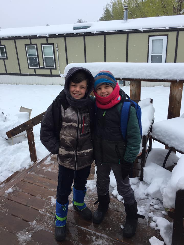
| Last day of school in Sturgis Photo by Amanda C |
I can't believe it's snowing in Hisega! Photo by Jenn L |
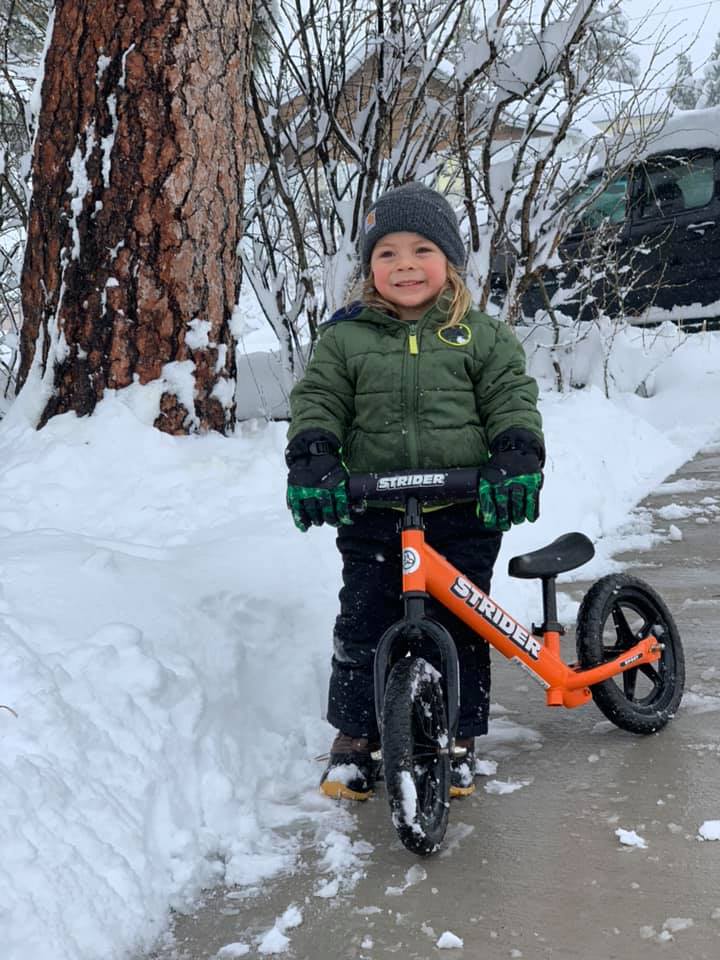
Riding a bike in Lead Photo by Robin L |
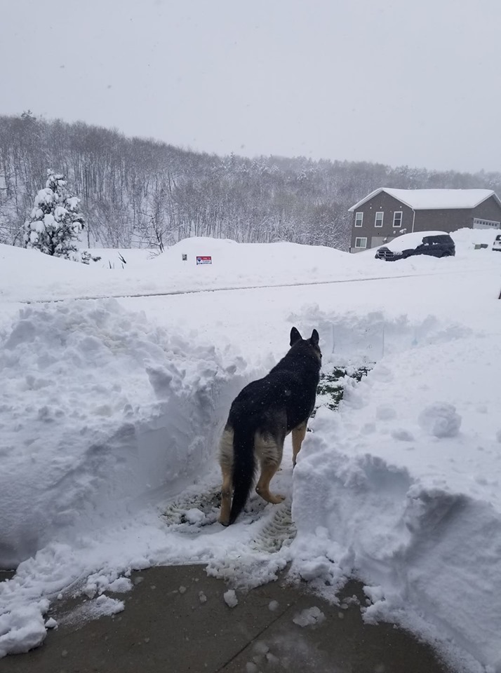
Dog looking for a path in the snow near Deadwood Photo by Alison S |
 |
 |
 |
 |
| Near Devils Tower Photo by Heike B |
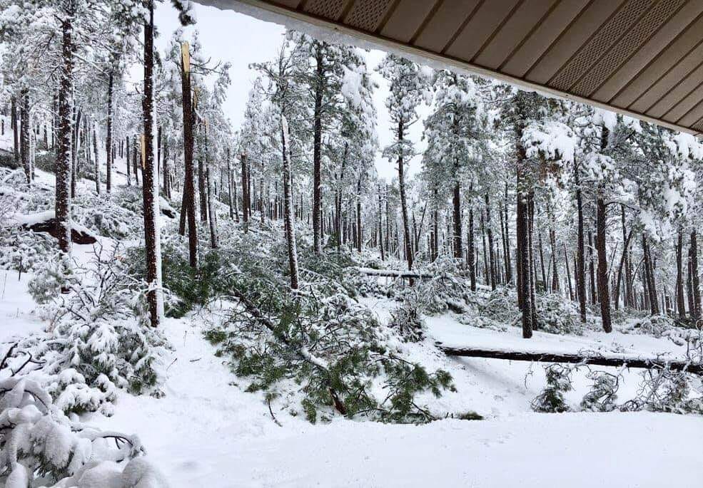
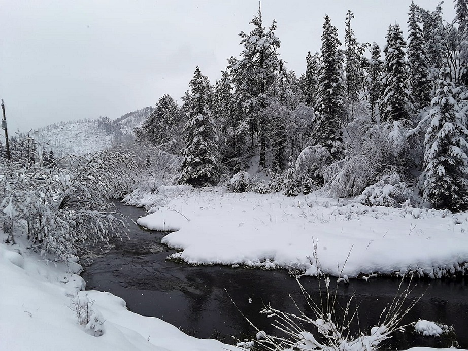
Downed trees near Johnson Siding Photo by Alison S |
Snow near Spearfish Photo by Jennifer M |
Spring Creek above Hill City Photo by Heidi C |
 |
 |
 |
 |
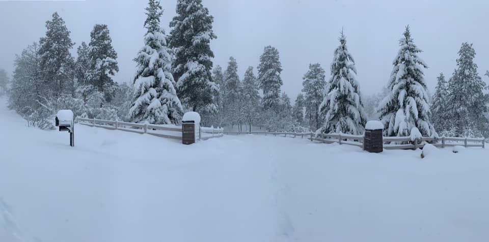
| Over a foot of snow near Ardmore, SD Photo by Dana B |
Over two feet of snow near Pactola! Photo by Michelle V |
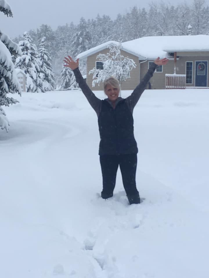
Dear Mountain snow Photo by Cathy E |
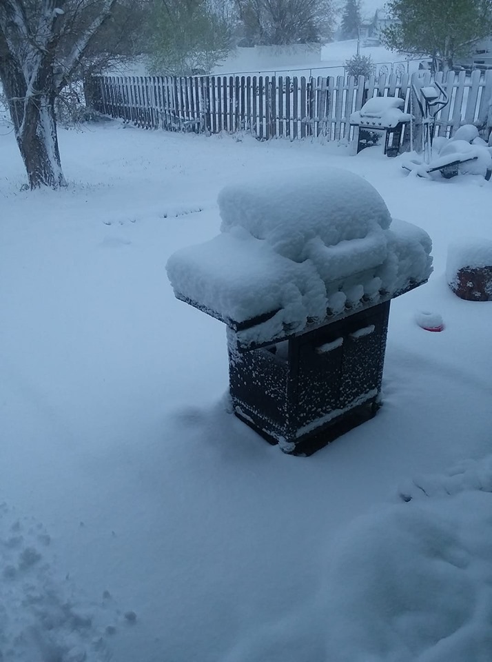
Snow-laden trees in Summerset, SD Photo by Leilani S |
 |
 |
 |
 |
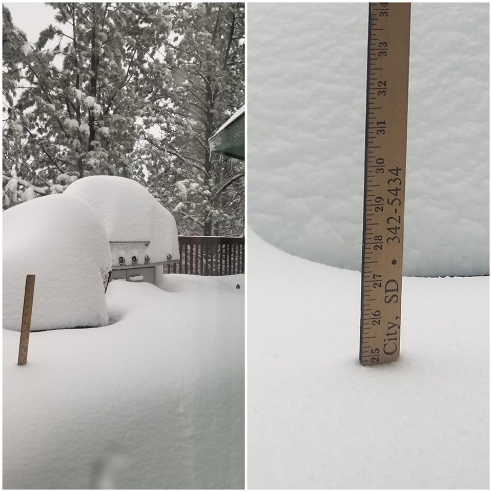
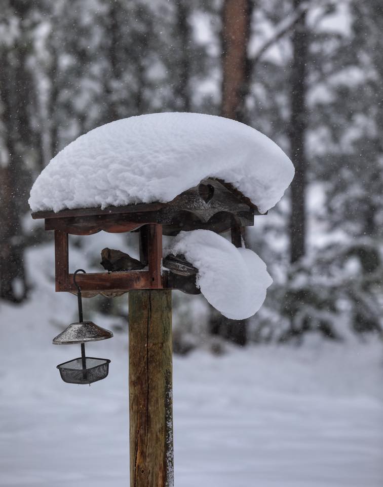
| Custer birdhouse Photo by Ann M |
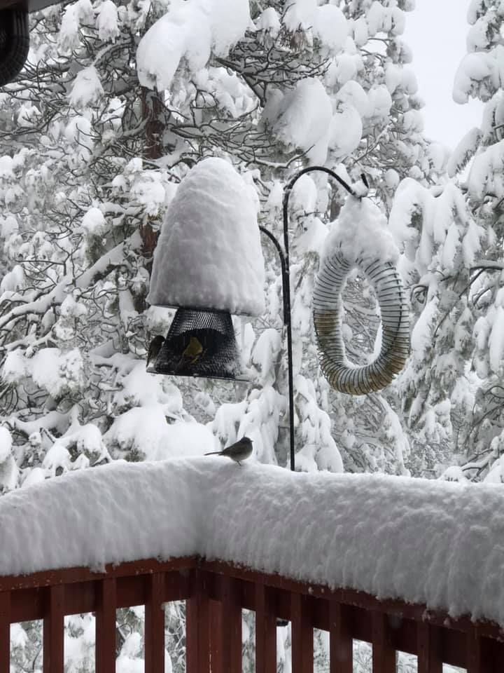
Spearfish birdhouse Photo by Courtney W |
Between Hermosa & Keystone Photo by Tom C |
Snow in Rapid Valley Photo by Steve Z |
 |
 |
 |
 |
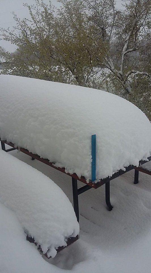
| Snow near Piedmont Photo by Alan A |
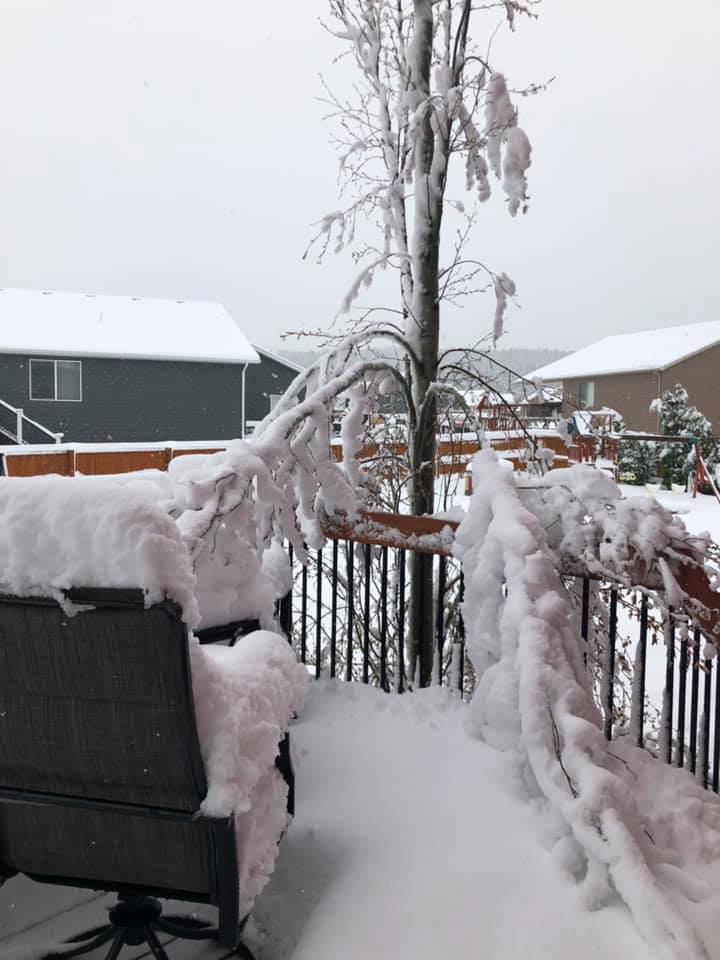
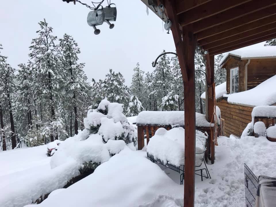
Snow on Deadwood Deck Photo by Bill S |
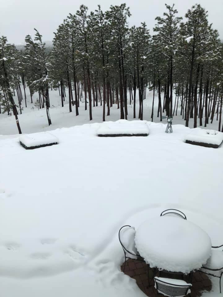
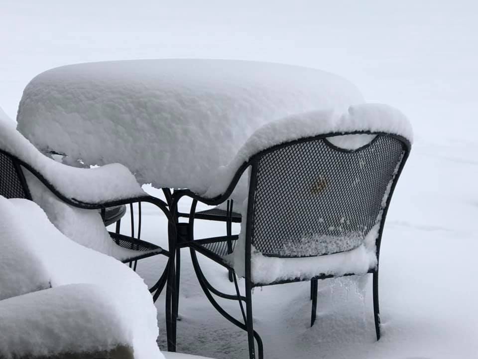
Snow on Hill City patio table Photo by Beverly B |
Snow in Wright, WY Photo by Vickie M |
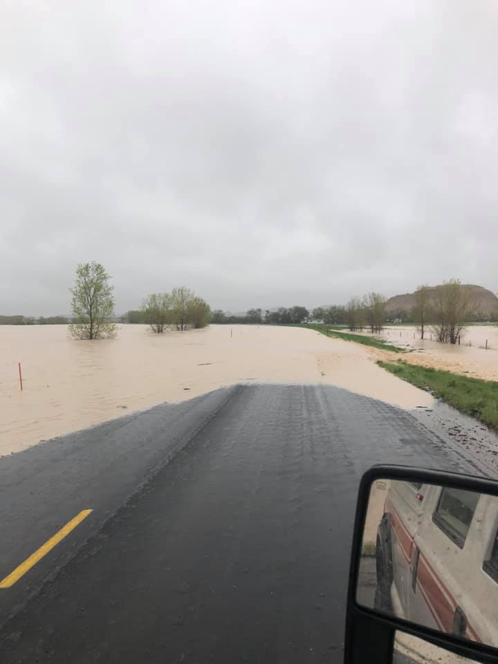
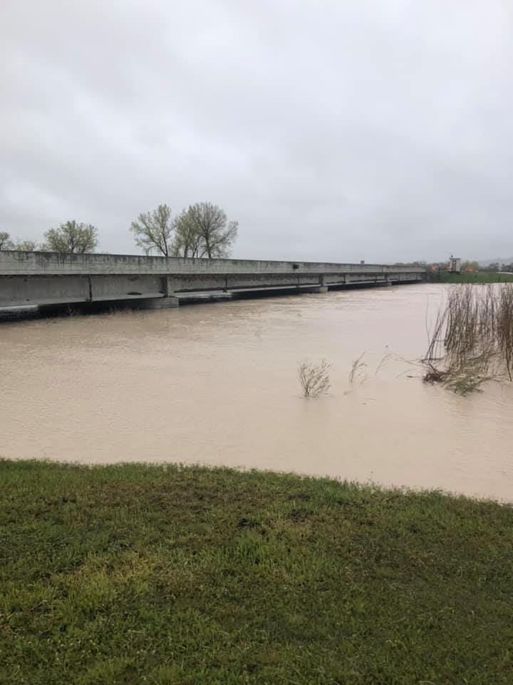
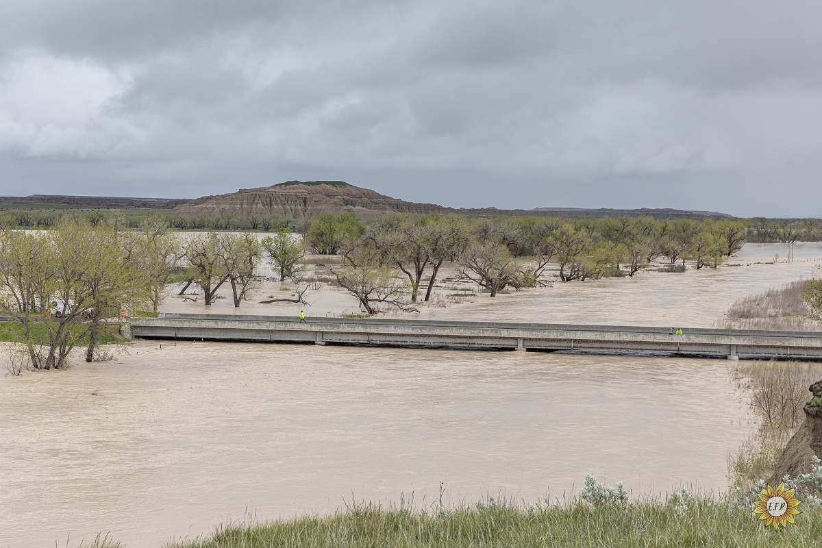
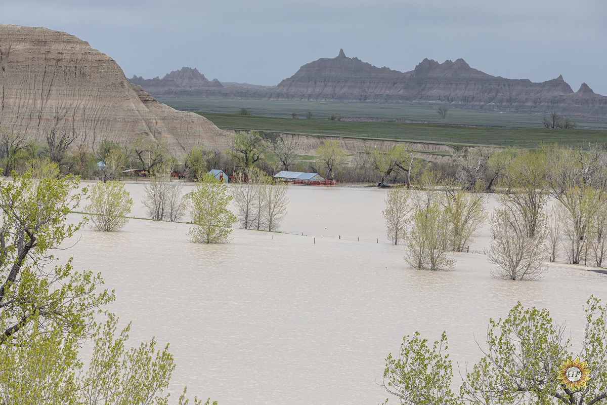
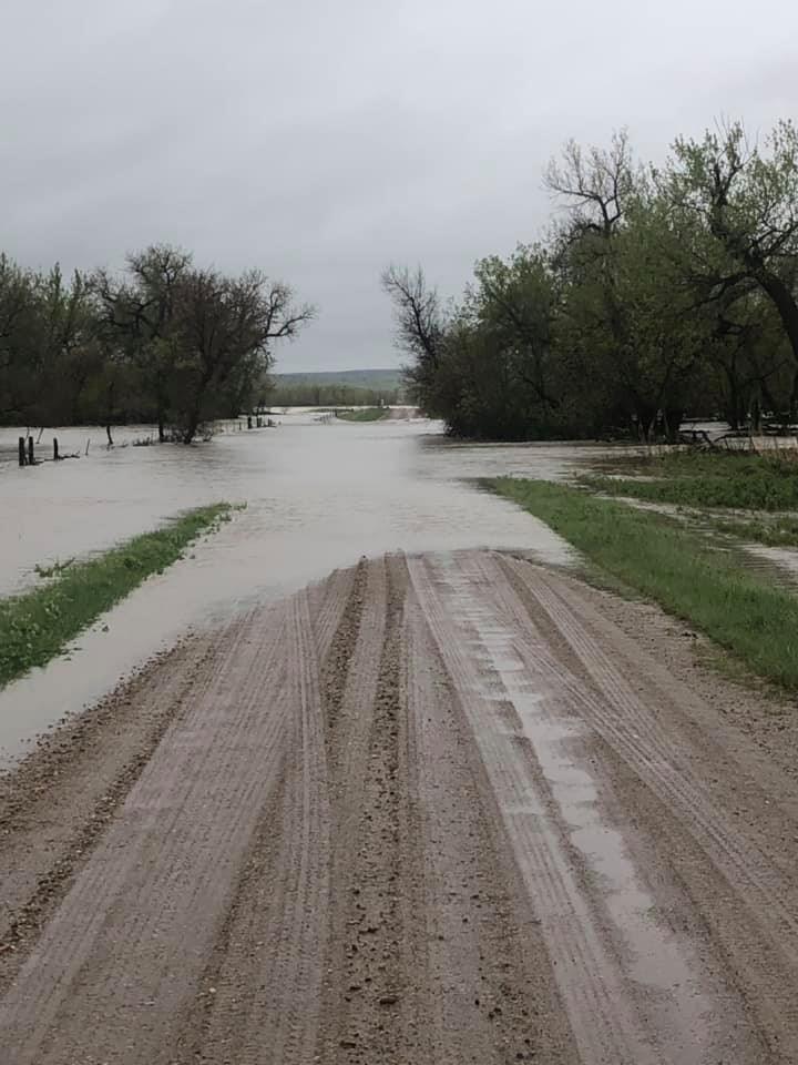
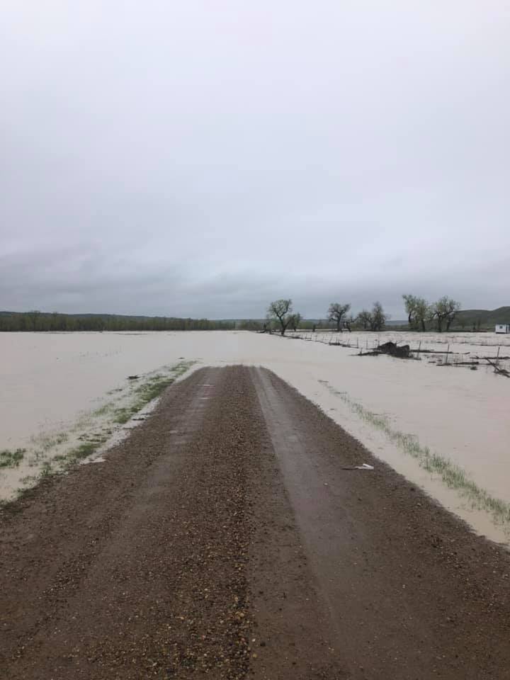
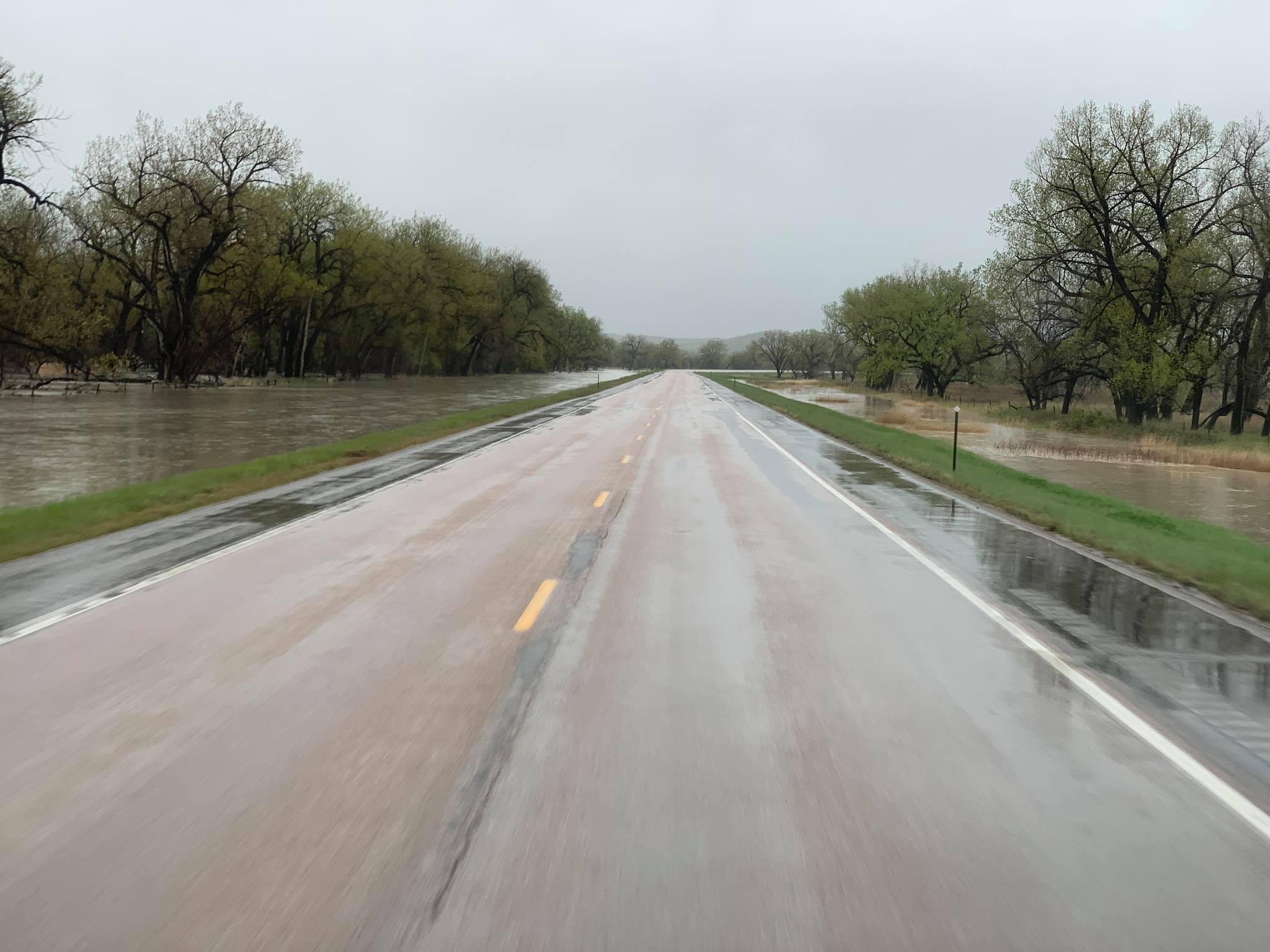
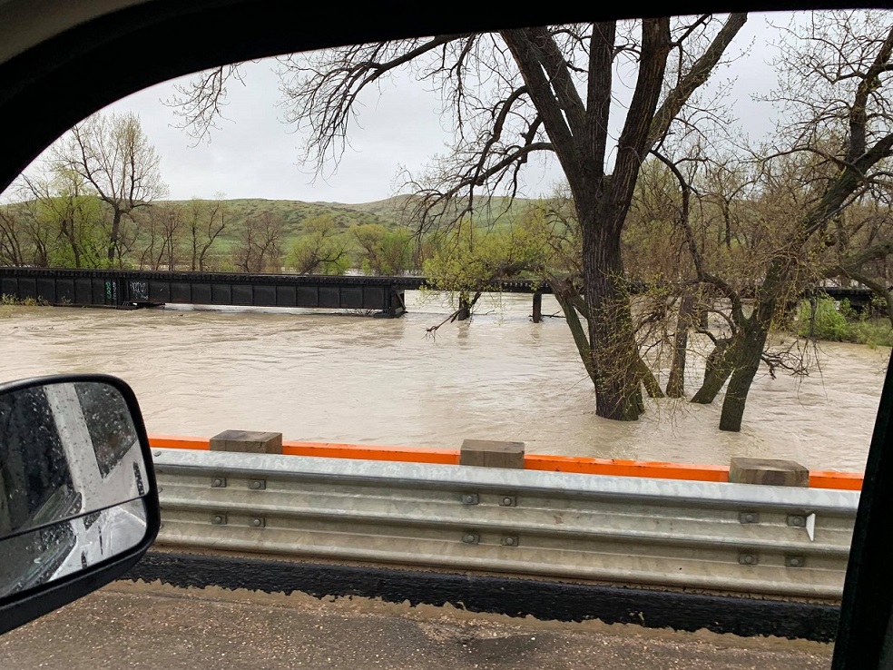
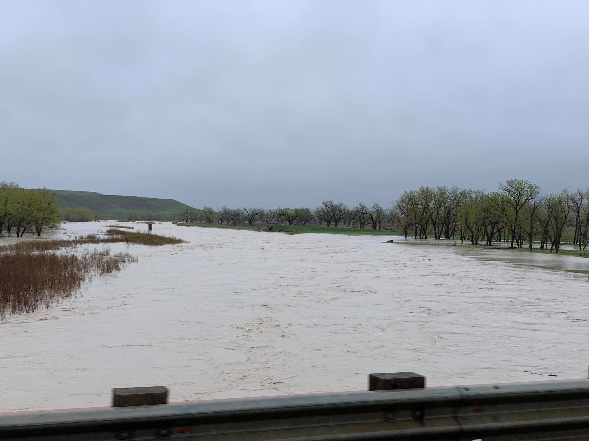
Flooding Pictures
 |
 |
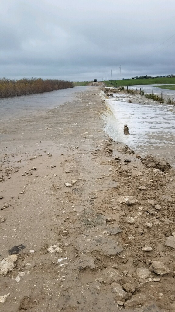 |
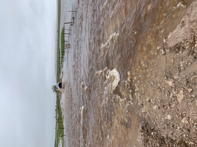 |
| Bad River near Phiilp | Flooding in Bennett County Photo by Jeff Siscoe |
Flooding in Bennett County southwest of Martin Photo by Jeff Siscoe |
Flooding in Bennett County southwest of Martin Photo by Jeff Siscoe |
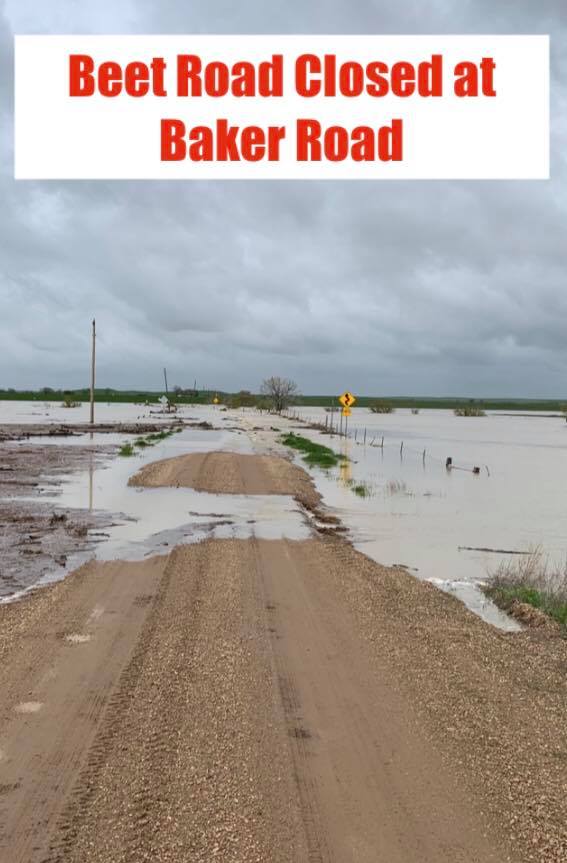 |
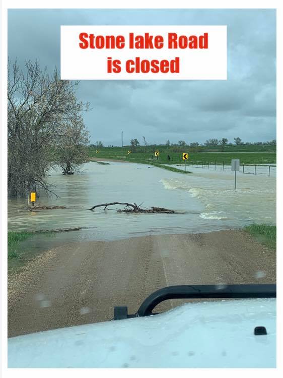 |
 |
 |
 |
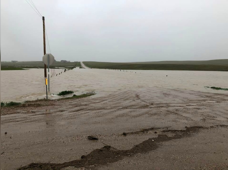
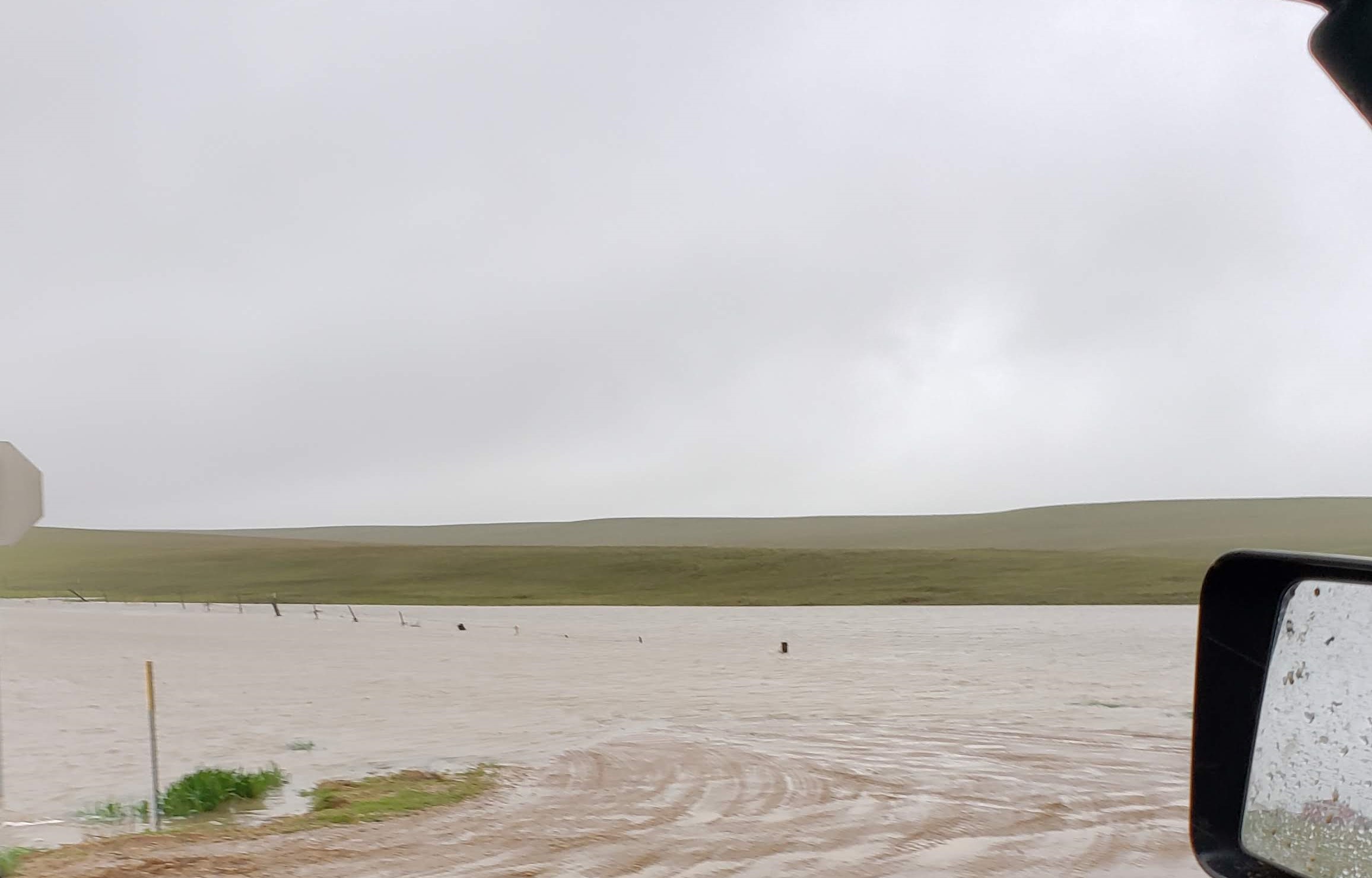
| Beet Road in Butte County Photo by Butte County Sheriff |
Stone Lake Rd in Butte County Photo by Butte County Sheriff |
King Horn Rd in Butte County Photo by Butte County Sheriff |
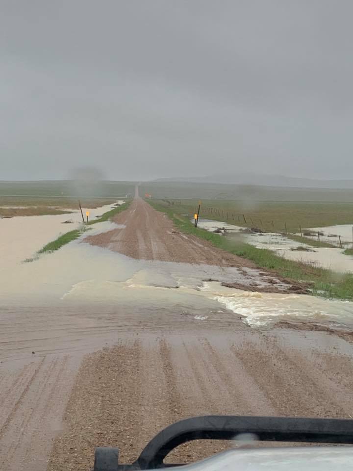
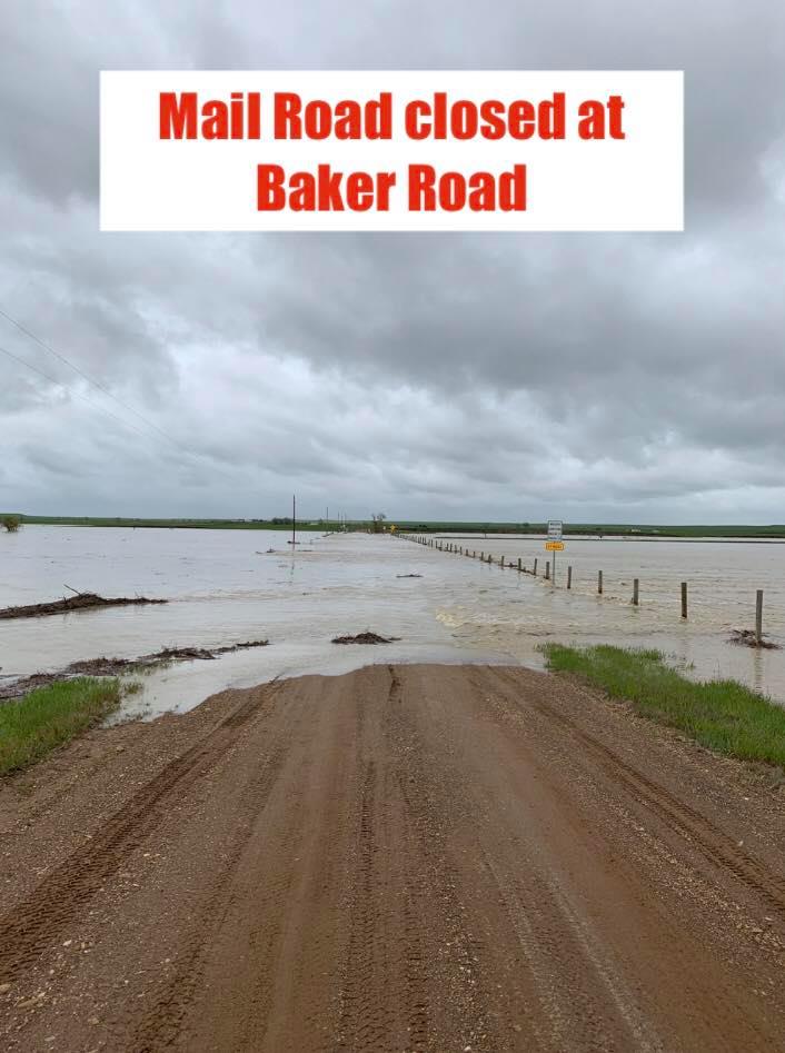
Mail Road in Butte County Photo by Butte County Sheriff |
Valley Road in Butte County Photo by Butte County Sheriff |
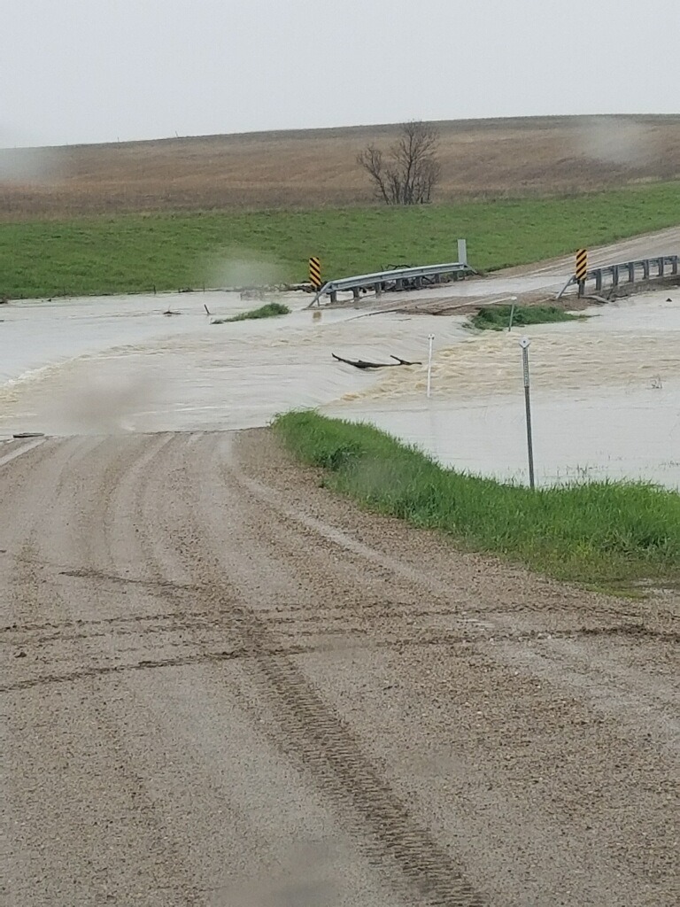
 |
 |
 |
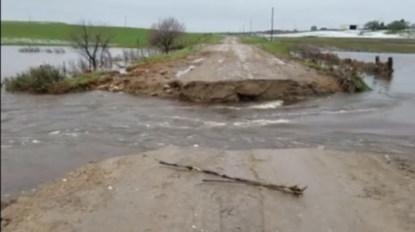
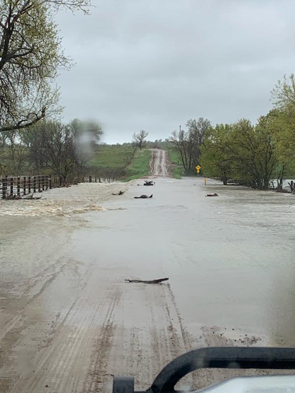
| Near Folsom, SD Photo by Custer County Sheriff |
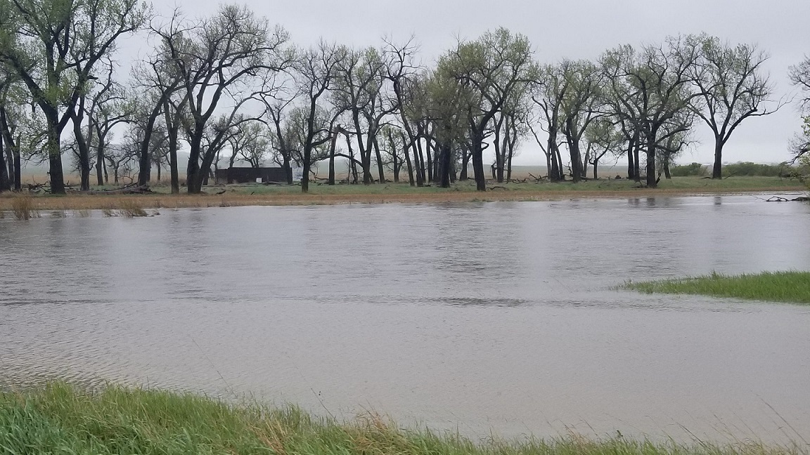
White River near Interior Photo by Interior Fire Dept |
White River near Interior Photo by Interior Fire Dept |
 |
 |
 |
| White River near Interior Photo by Elsie Fortune Photography |
White River near Interior Photo by Elsie Fortune Photography |
White River near Interior Photo by Elsie Fortune Photography |
 |
 |
 |
| Flooding north of Ellsworth AFB Photo by Suzie N. |
Flooding north of Ellsworth AFB Photo by Colten S. |
Flooding north of Ellsworth AFB Photo by Carissa E |
 |
 |
 |
 |
| Flooding south of Wasta Photo by Kandi D |
Flooding south of Wasta Photo by Kandi D |
Flooding near Quinn, SD Photo by Pennington Co Highway Dept |
Flooding near Quinn, SD Photo by Pennington Co Highway Dept |
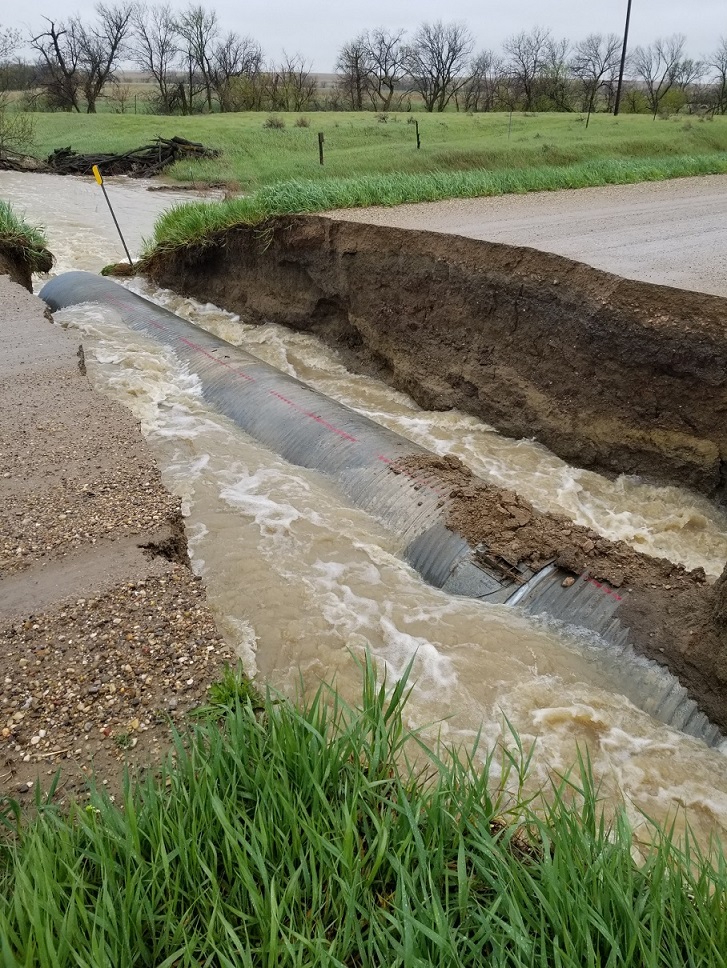
 |
 |
 |
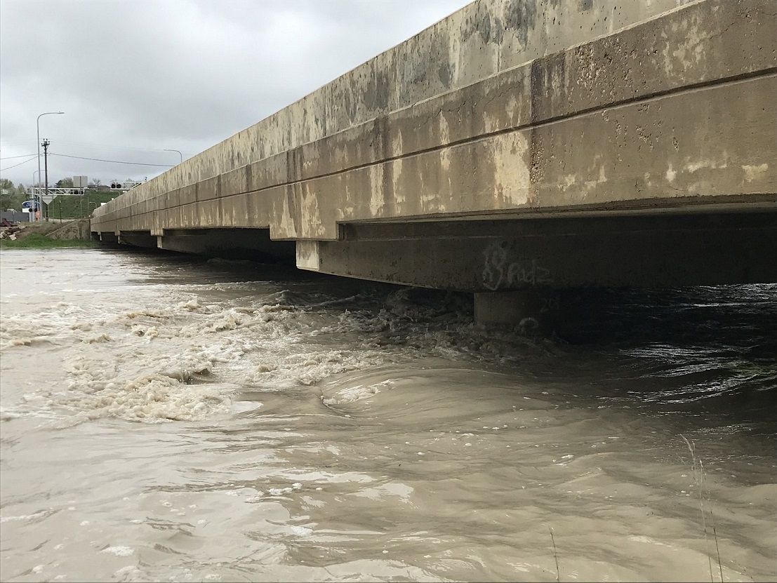
| Highway 44 at Creston, SD (NW of Scenic) Photo by Pennington Co Highway Dept |
Rapid Creek at Creston, SD (NW of Scenic) Photo by Pennington Co Highway Dept |
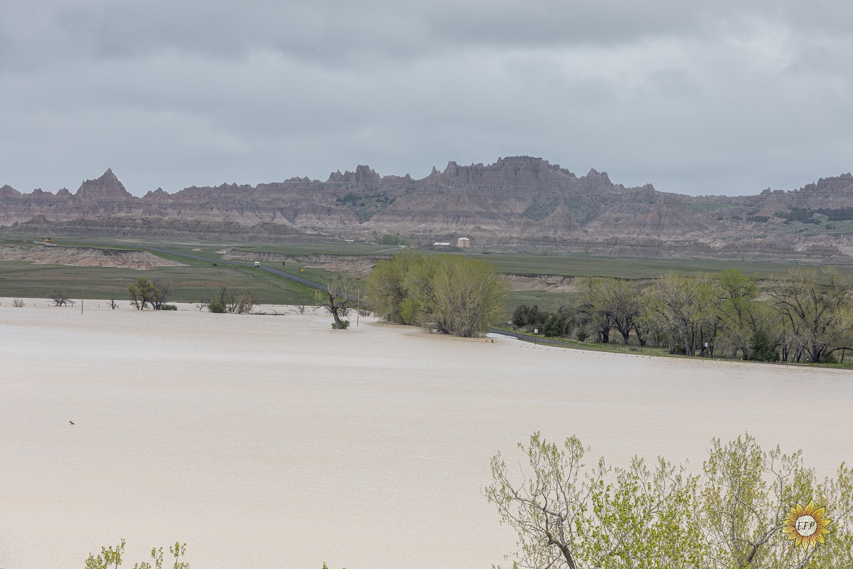
Cheyenne River at northwest of Scenic Photo by Pennington Co Highway Dept |
Radar
Radar animation from Noon MDT Monday, May 20 through 11 AM MDT Wednesday, May 22
Rain Reports
A list of rainfall reports are included below the map
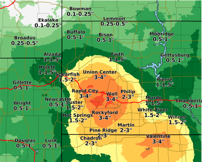
Rainfall over the region May 20-22
 AMOUNT  LOCATION                  ST  COUNTY           TIME
 ------  -----------------------   --  --------------   -------
  5.80   6 E MARTIN                SD  BENNETT          0953 AM
  4.25   2 NNW SAINT ONGE          SD  LAWRENCE         1029 AM
  3.60   9 NNW CREIGHTON           SD  PENNINGTON       0629 AM
  3.50   RED SHIRT                 SD  OGLALA LAKOTA    0618 AM
  3.45   3 SE SAINT ONGE           SD  LAWRENCE         0700 AM
  3.45   1 SSE DOWNTOWN SPEARFISH  SD  LAWRENCE         0700 AM
  3.39   3 ENE KYLE                SD  OGLALA LAKOTA    0700 AM
  3.35   TILFORD                   SD  MEADE            0700 AM
  3.18   2 SW DOWNTOWN RAPID CITY  SD  PENNINGTON       0126 PM
  3.10   5 E PORCUPINE             SD  OGLALA LAKOTA    0740 AM
  2.94   OELRICHS                  SD  FALL RIVER       0700 AM
  2.91   2 WNW DOWNTOWN SPEARFISH  SD  LAWRENCE         0700 AM
  2.90   3 NE HISEGA               SD  PENNINGTON       0700 AM
  2.65   7 E LAKEVIEW              SD  TODD             0700 AM
  2.54   1 ESE PACTOLA RESERVOIR   SD  PENNINGTON       0700 AM
  2.46   ORAL                      SD  FALL RIVER       0700 AM
  2.40   1 ESE WINNER              SD  TRIPP            0700 AM
  2.35   RED OWL                   SD  MEADE            0700 AM
  2.23   4 S DOWNTOWN RAPID CITY   SD  PENNINGTON       0104 PM
  2.16   6 ENE NEWELL              SD  BUTTE            0700 AM
  2.12   1 WNW WIND CAVE           SD  CUSTER           0100 PM
  2.04   HILL CITY                 SD  PENNINGTON       0800 AM
  2.04   6 SW BEULAH               WY  CROOK            0700 AM
  1.98   3 SSE HARDING             SD  HARDING          0700 AM
  1.88   9 SSE SORUM               SD  PERKINS          0700 AM
  1.80   2 W OPAL                  SD  MEADE            0700 AM
  1.79   MOUNT RUSHMORE            SD  PENNINGTON       1200 AM
 |
Media use of NWS Web News Stories is encouraged! Please acknowledge the NWS as the source of any news information accessed from this site. |
|

