
Dangerous heat will expand from the Gulf Coast into the Southern Plains and Desert Southwest through week's end. Additional extreme heat impacting the Pacific Northwest will shift to the northern Plains by the weekend. Tropical Storm Bertha is expected to continue to impact portions of the northern Gulf Coast from the western Florida Panhandle to southeastern Louisiana through tonight. Read More >
Overview
|
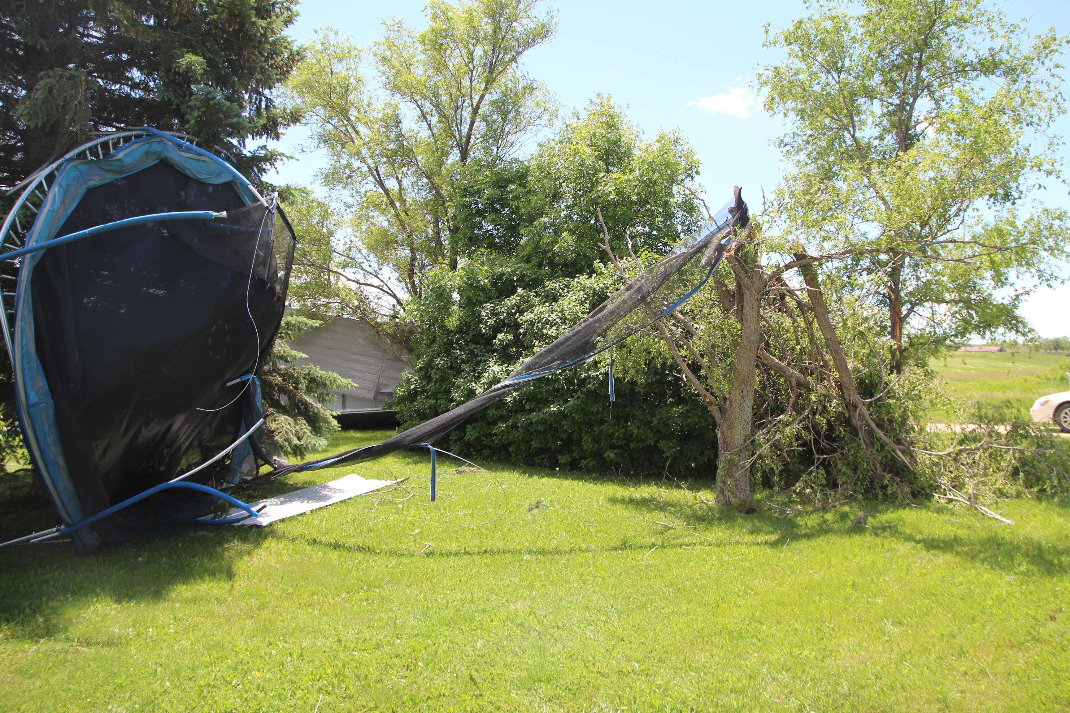
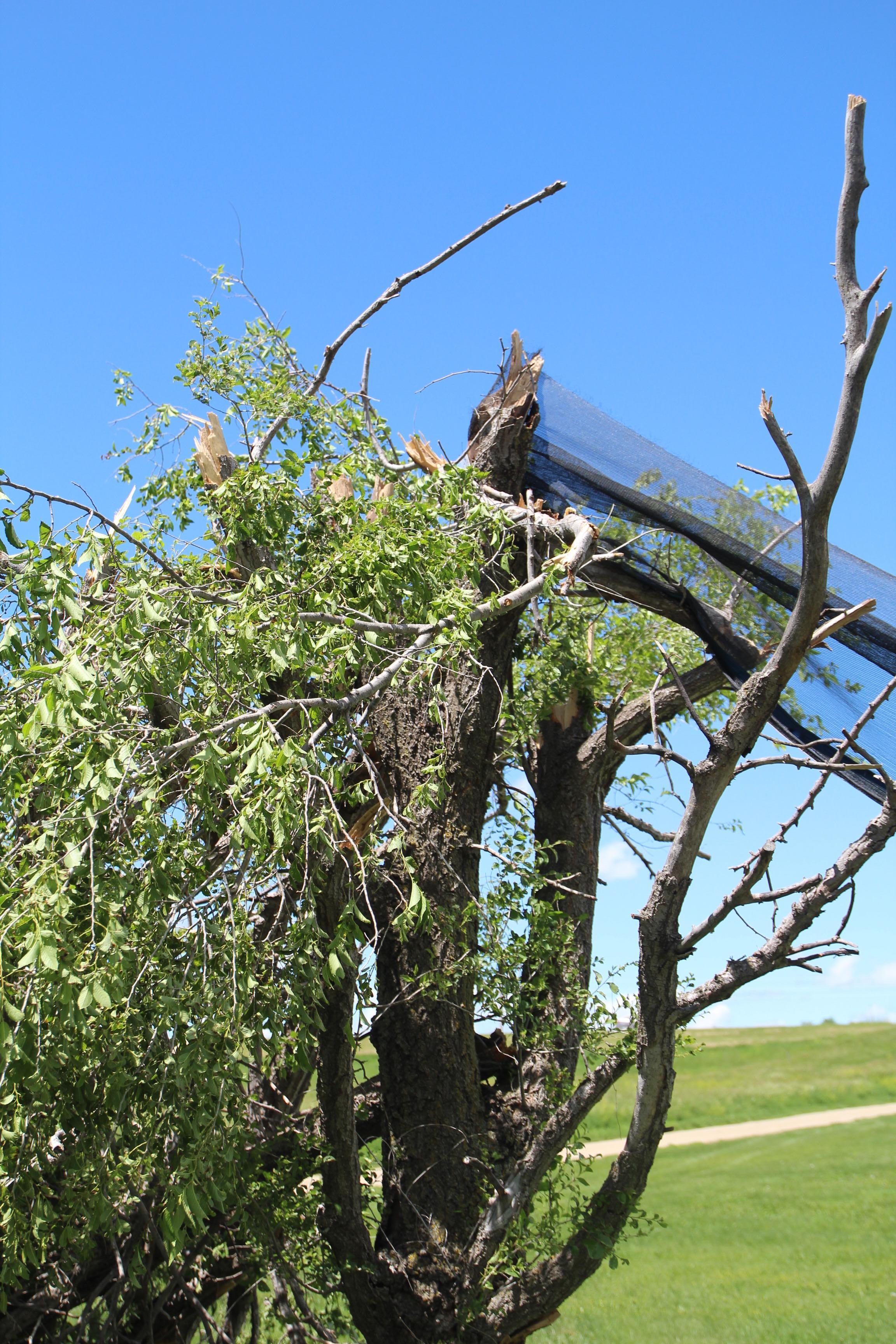
Around 1:00 PM CDT, emergency management reported a brief landspout tornado near Mission, SD. This landspout caused damage to one residence, located just west of Mission, SD. Damage to the residence included shingles missing from the roof, branches and small trees damaged, a swing set and carport tossed around, and a trampoline being lifted into some trees. Landspout tornadoes are typically weak and short-lived, posing a relatively minor threat of property damage. Landspouts can form with developing thunderstorms before rain, hail, and even thunder is observed. Landspout tornadoes are not usually associated with a wall cloud and are often difficult to detect with weather radar. For more information on landspouts and the differences between "typical" tornadoes (those formed from supercells), see National Severe Storms Laboratory's page. |
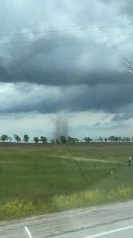 Photo from Robert Oliver |
Landspout Tornado:
|
Tornado - West of Mission, SD
Track Map 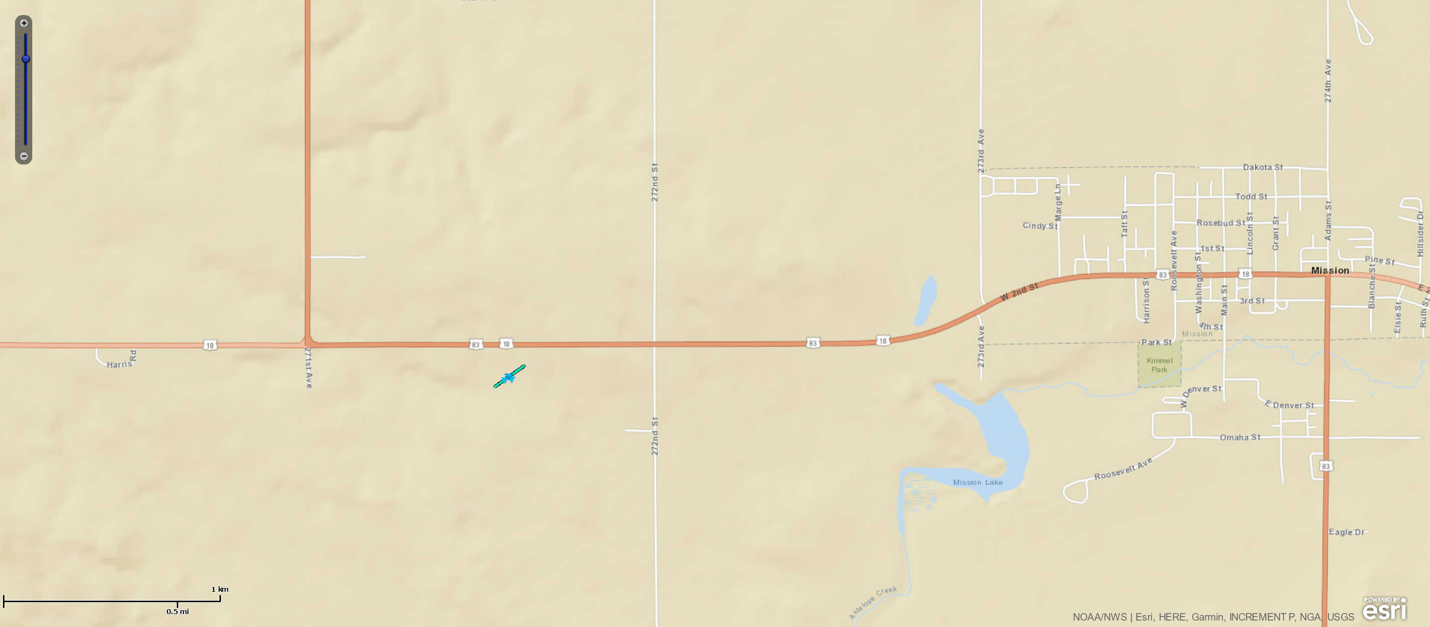 
|
||||||||||||||||
The Enhanced Fujita (EF) Scale classifies tornadoes into the following categories:
| EF0 Weak 65-85 mph |
EF1 Moderate 86-110 mph |
EF2 Significant 111-135 mph |
EF3 Severe 136-165 mph |
EF4 Extreme 166-200 mph |
EF5 Catastrophic 200+ mph |
 |
|||||
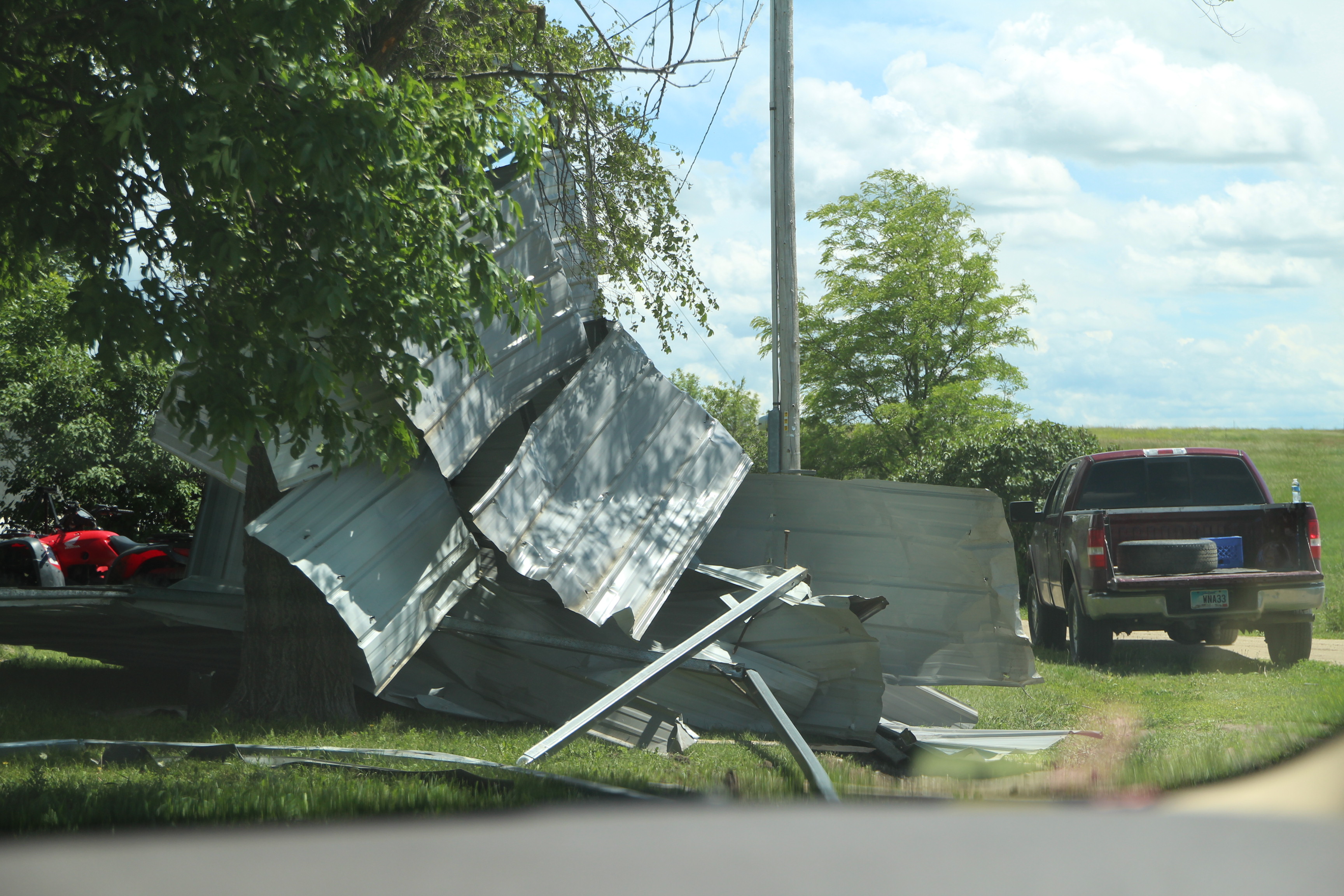
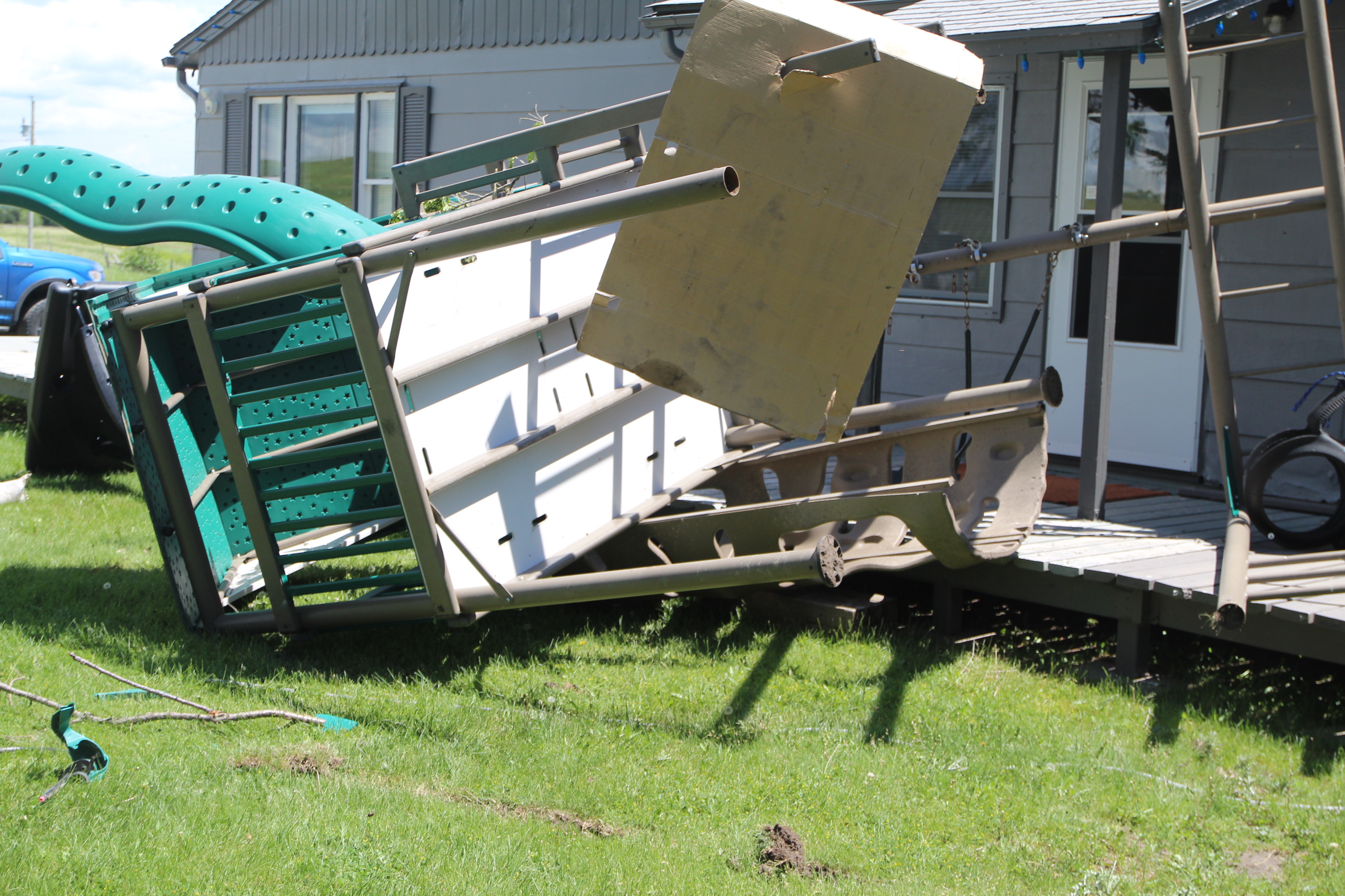
Damage Photos
 |
 |
 |
| Damaged Carport (Rich Winter) |
Swingset Damage (Rich Winter) |
Trampoline and Tree Damage (Rich Winter) |
 |
||
| Tree Damage (Rich Winter) |
||
 |
Media use of NWS Web News Stories is encouraged! Please acknowledge the NWS as the source of any news information accessed from this site. |
|

