
Dangerous heat will expand from the Gulf Coast into the Southern Plains and Desert Southwest through week's end. Additional extreme heat impacting the Pacific Northwest will shift to the northern Plains by the weekend. Tropical Storm Bertha is expected to continue to impact portions of the northwestern Gulf Coast from south central Louisiana to the upper Texas coast today. Read More >
Overview
|
Two tornadoes developed northwest of Hulett, Wyoming, around 8:00 pm MDT on June 25, 2019. Numerous trees were downed by the tornadoes. The tornadoes were not visible because they traveled over hilly terrain and were embedded in rain. |
|
Tornadoes:
|
Tornado #1
Track Map 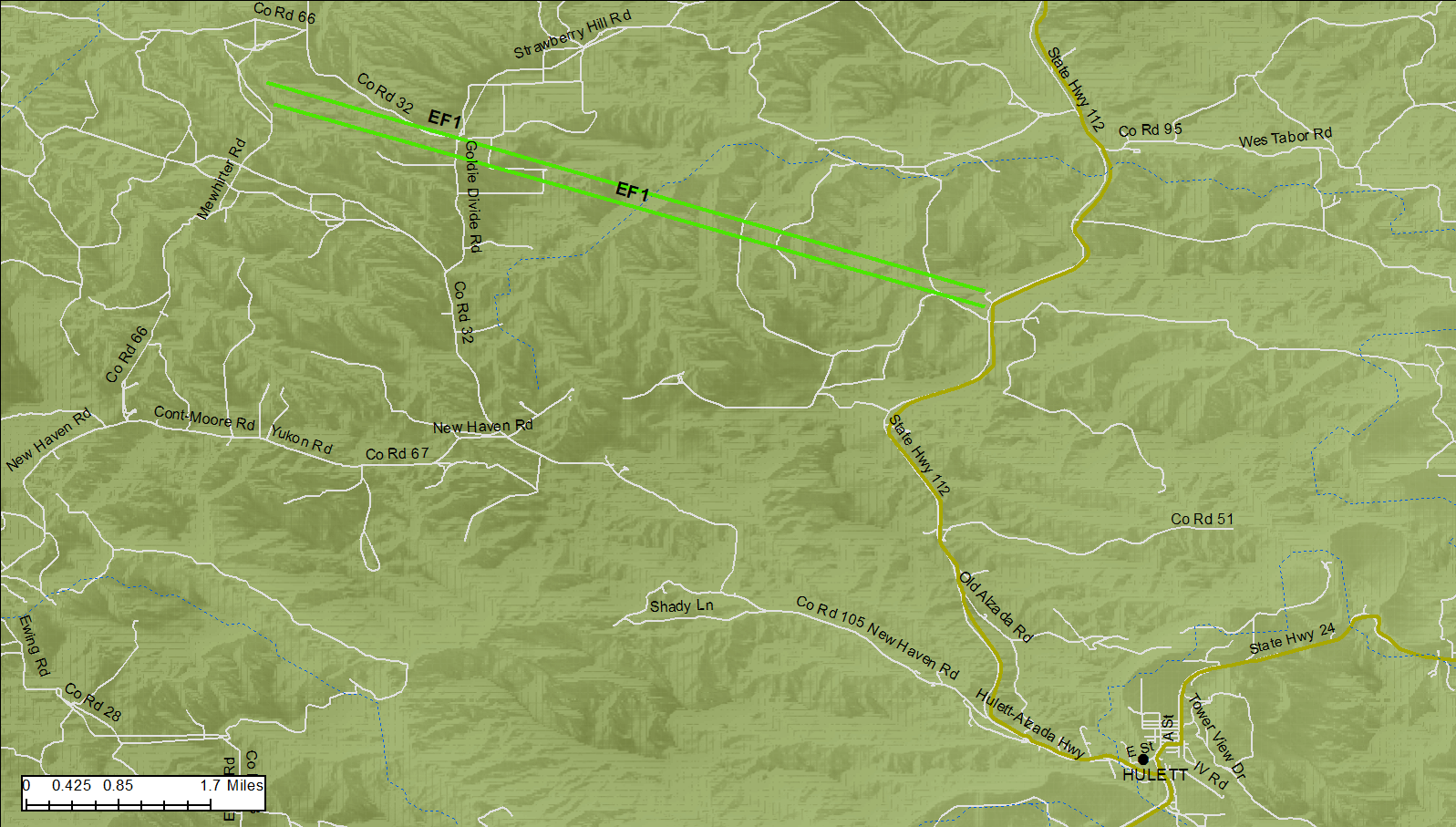  |
||||||||||||||||
Tornadoes:
|
Tornado #2
Track Map |
||||||||||||||||
The Enhanced Fujita (EF) Scale classifies tornadoes into the following categories:
| EF0 Weak 65-85 mph |
EF1 Moderate 86-110 mph |
EF2 Significant 111-135 mph |
EF3 Severe 136-165 mph |
EF4 Extreme 166-200 mph |
EF5 Catastrophic 200+ mph |
 |
|||||
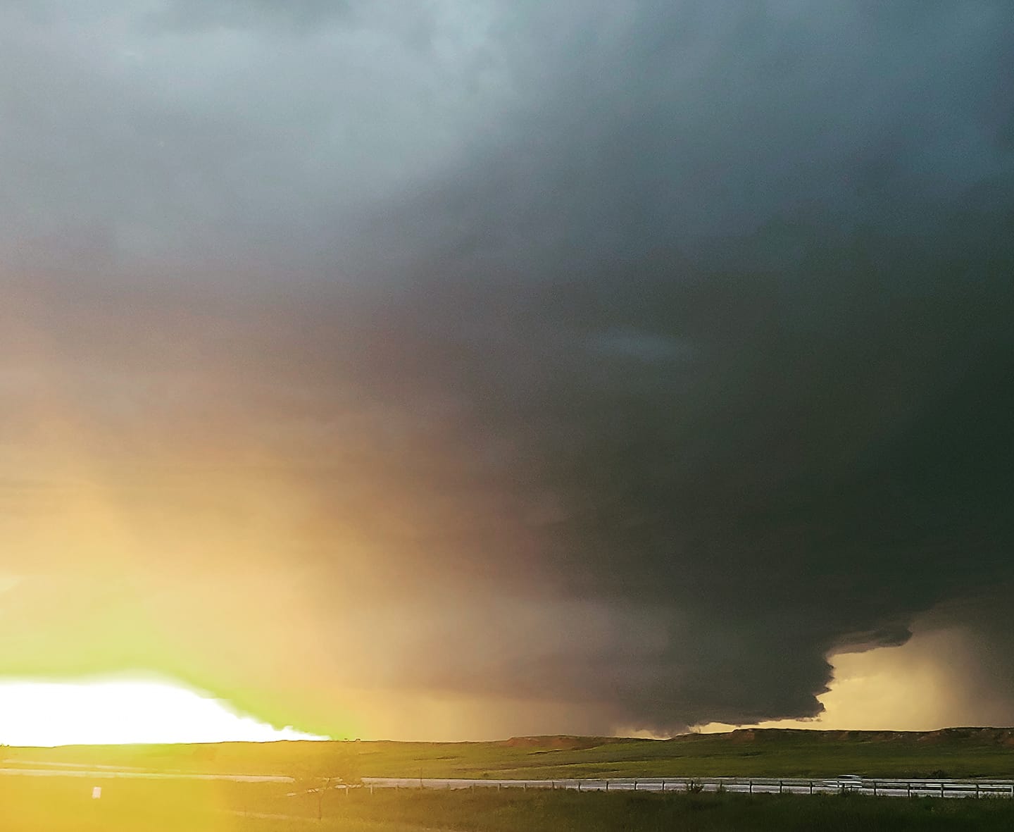
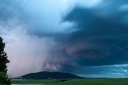
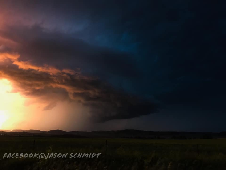
Photos & Video
Timelapse videos of the storm as it approached Belle Fourche, SD courtesy of Anthony Carabajal of Black Hills Aerial Imagery: https://vimeo.com/344475362 and https://vimeo.com/344478710.
 |
 |
 |
 |
| Looking west from Beulah, WY (Nadia Simons) |
Looking from Sundance, WY (Meghan and Dave Porter) |
Looking west from Beulah, WY (Jason Schmidt) |
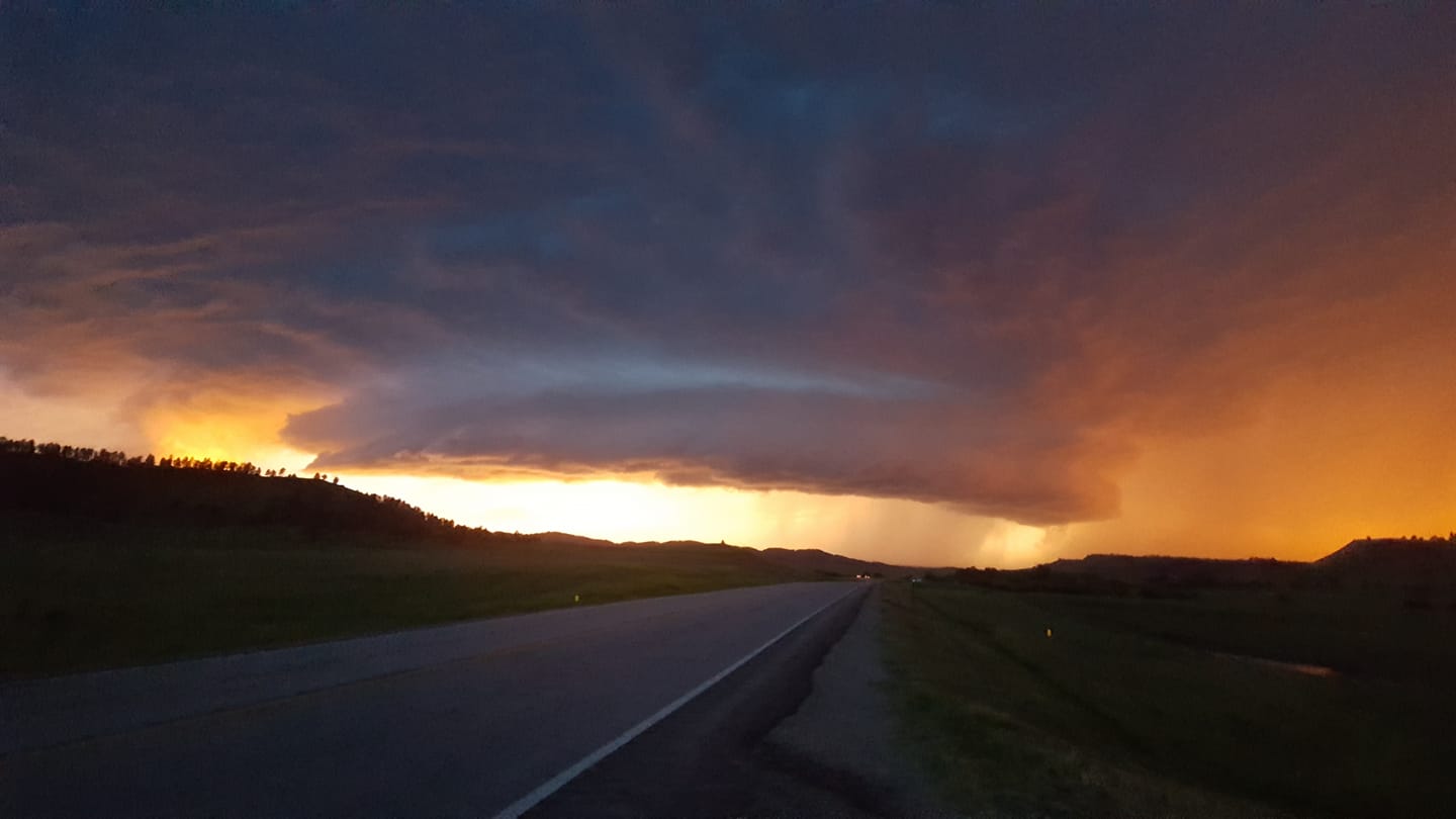
Photo as storm headed to Belle Fourche, SD (Lars Dunavant) |
 |
 |
 |
|
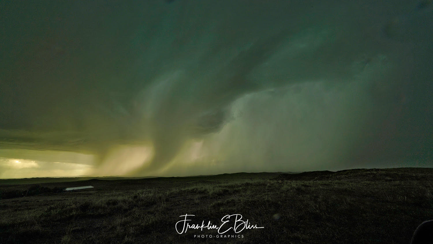
| Photo of the rain shaft from northeastern Campbell County (Frank Bliss) |
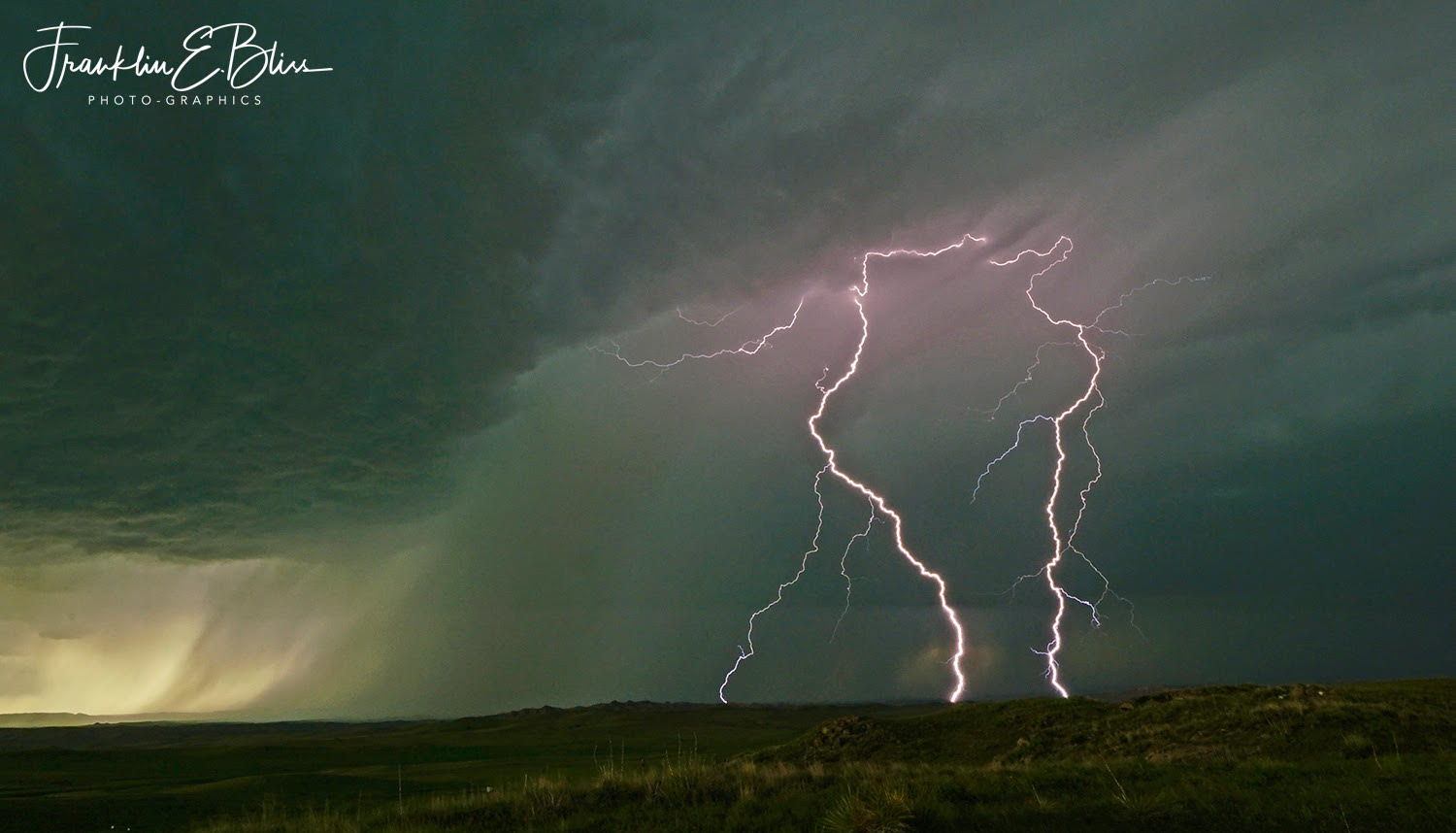
Lightning photo from northeastern Campbell County (Frank Bliss) |
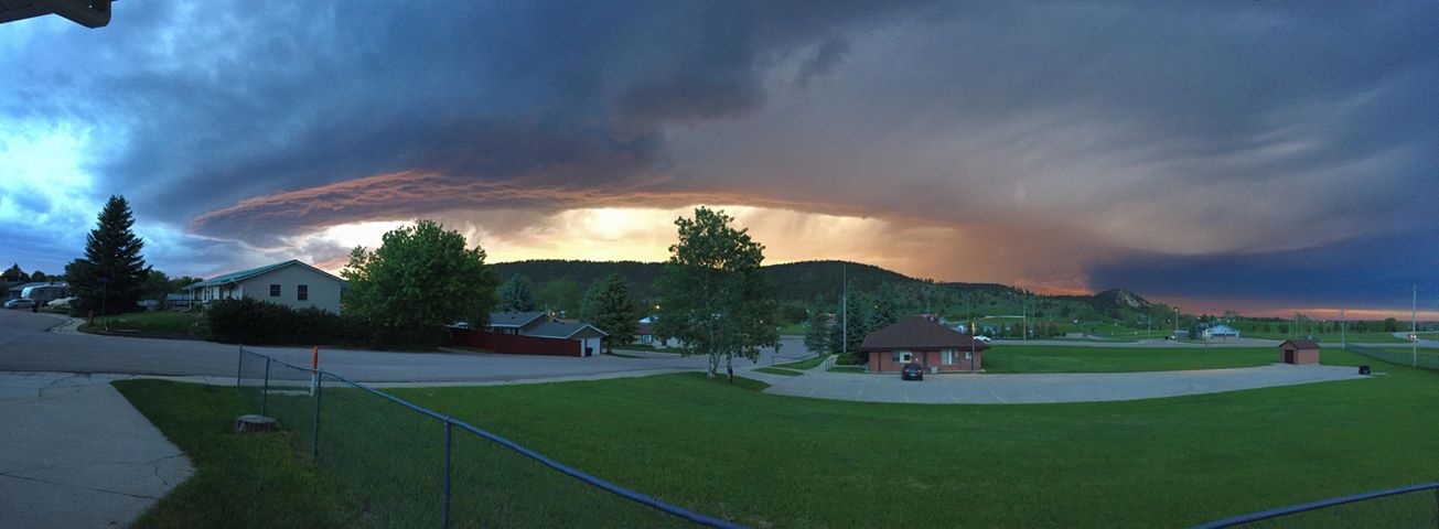
Photo of the storm from Sundance, WY (Meghan and Dave Porter) |
|
|
|
|
Radar & Lightning
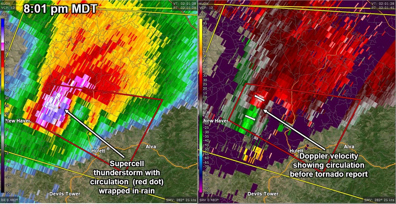 |
| Radar reflectivity (left) and storm-relative velocity (right) at 8:01 pm MDT showing the supercell thunderstorm and developing tornadic circulation just before the first report of a tornado |
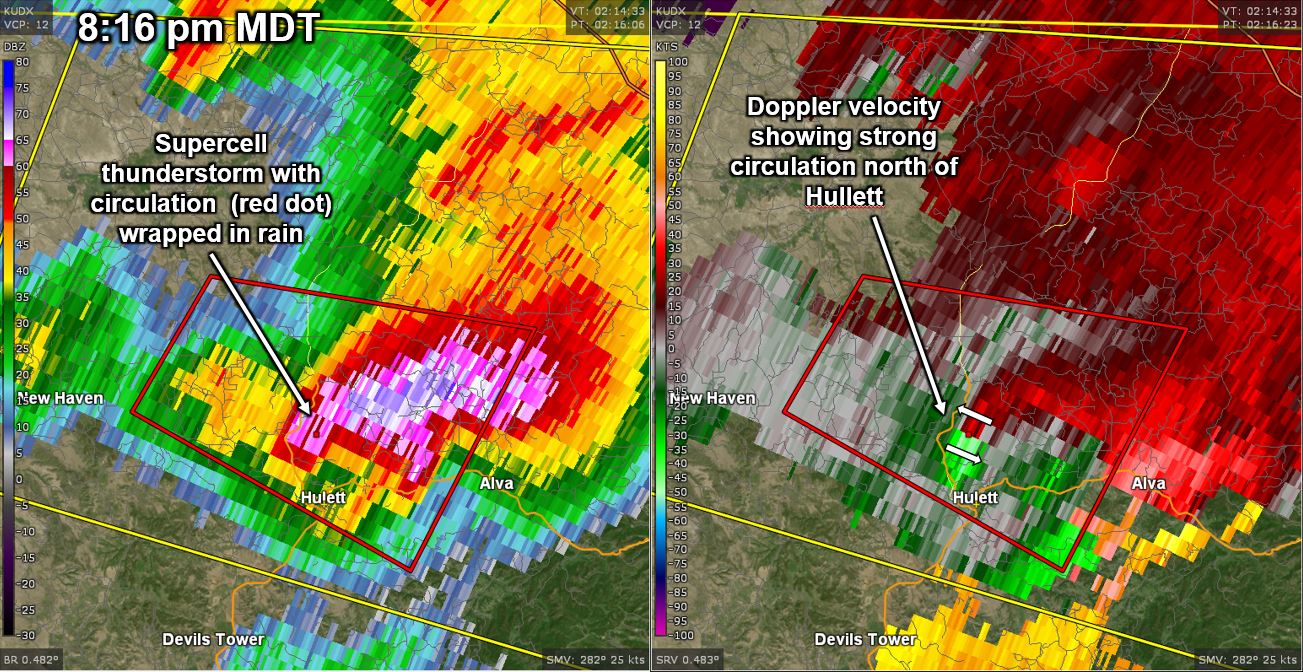 |
| Radar reflectivity (left) and storm-relative velocity (right) at 8:16 pm MDT showing the supercell thunderstorm and tornadic circulation near the time when radar-indicated rotation was the strongest |
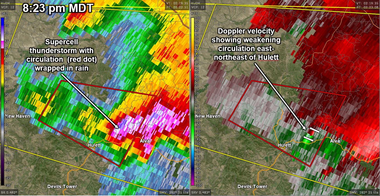 |
| Radar reflectivity (left) and storm-relative velocity (right) at 8:23 pm MDT showing the supercell thunderstorm and weakening tornadic circulation |
 |
| Radar-accumluated rotation from 7:50 to 8:50 pm MDT showing the supercell's strongest low-level circulation from northwest to east of Hulett, Wyoming |
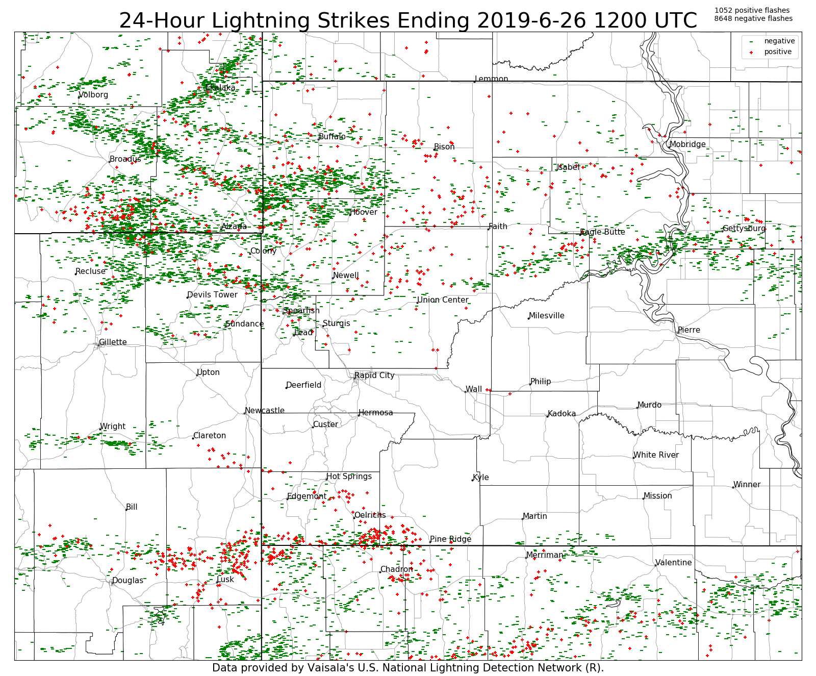 |
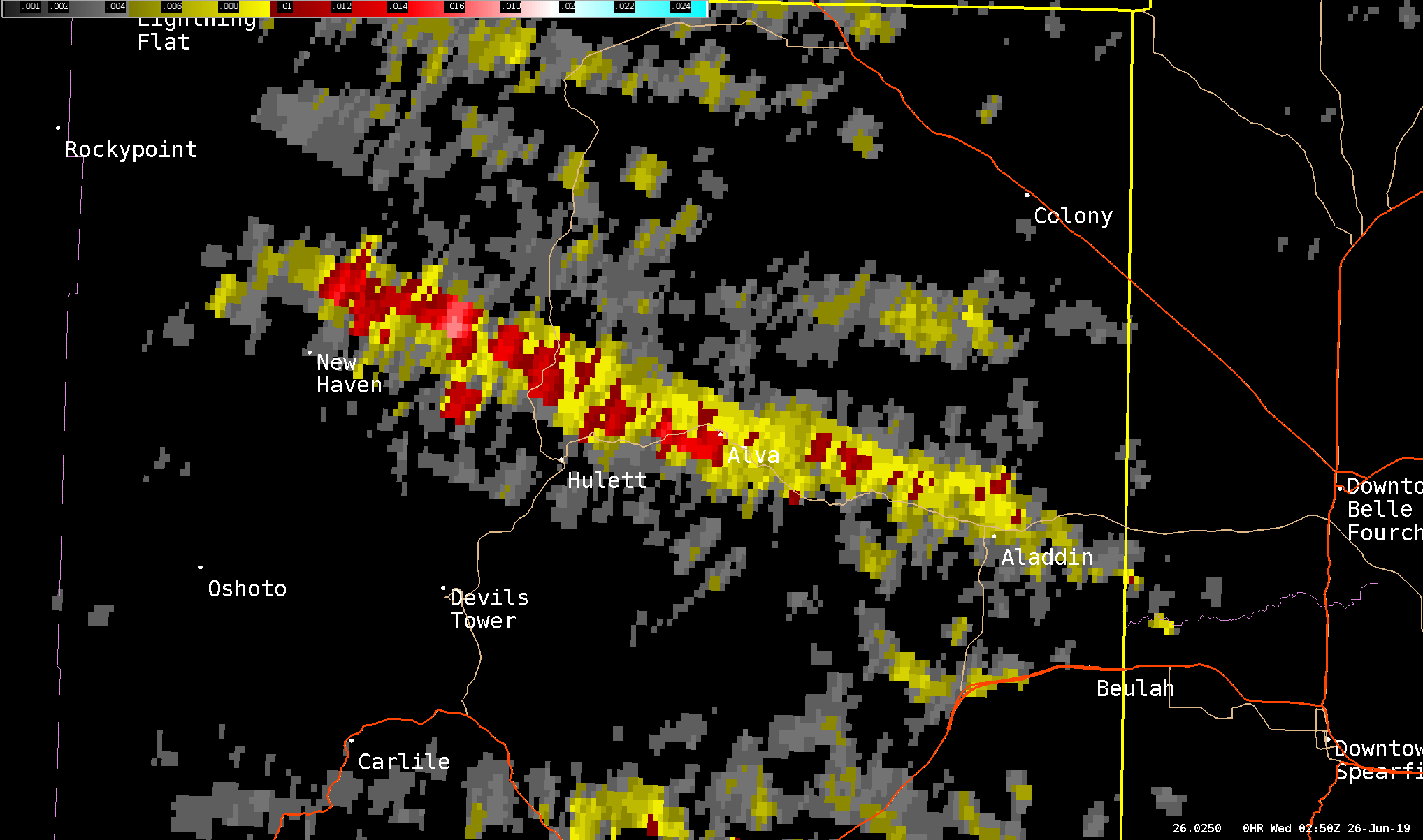
| Cloud-to-ground lightning from 6 am June 25 to 6 am June 26, 2019. |
Storm Reports
Preliminary storm reports for June 25, 2019.
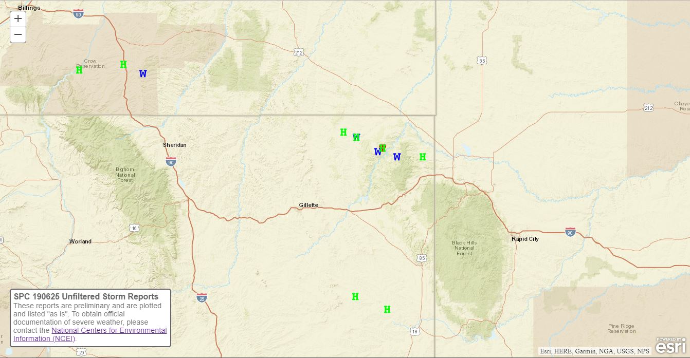 |
| Preliminary storm reports for June 25, 2019 (green H's represent hail; blue W's represent wind gusts; the red T in northeastern Wyoming represents the tornado report) |
The storm reports listed below are in descending order and may not necessarily be the final storm reports. Hail reports listed by size (inches) SIZE LOCATION ST COUNTY TIME ------ ----------------------- -- -------------- ------- 1.75 3 N ALADDIN WY CROOK 0850 PM 1.50 6 NNW NEW HAVEN WY CROOK 0750 PM 1.25 5 N HULETT WY CROOK 0809 PM 1.00 8 S LIGHTNING FLAT WY CROOK 0740 PM 1.00 8 W MORRISEY WY WESTON 0455 PM 1.00 3 ENE ROCHELLE WY WESTON 0416 PM Thunderstorm wind reports listed by speed (mph) SPEED LOCATION ST COUNTY TIME ------ ----------------------- -- -------------- ------- 60.00 7 E HULETT WY CROOK 0825 PM 60.00 6 NNW NEW HAVEN WY CROOK 0750 PM 56.00 1 NNE FAITH SD MEADE 1100 PM 50.00 8 S LIGHTNING FLAT WY CROOK 0740 PM |
Environment
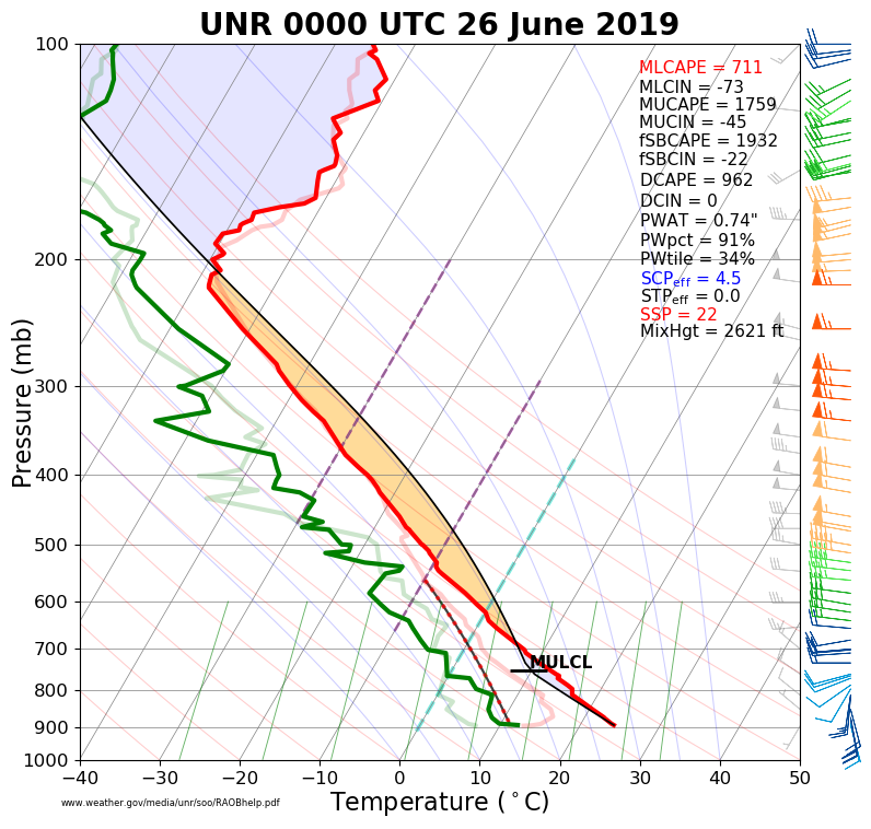
The environment was moderately unstable (left image) but exhibited strong vertical wind shear (right image) according to the 6 pm MDT June 25, 2019 (0000 UTC 25 June 2019) balloon release at the NWS in East Rapid City, SD.
 |
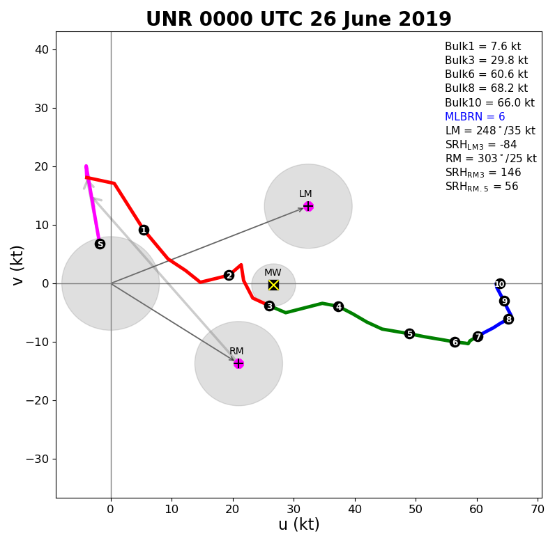 |
| Sounding based off the 6 pm balloon release at NWS Rapid City | Hodograph based off the 6 pm balloon release at NWS Rapid City |
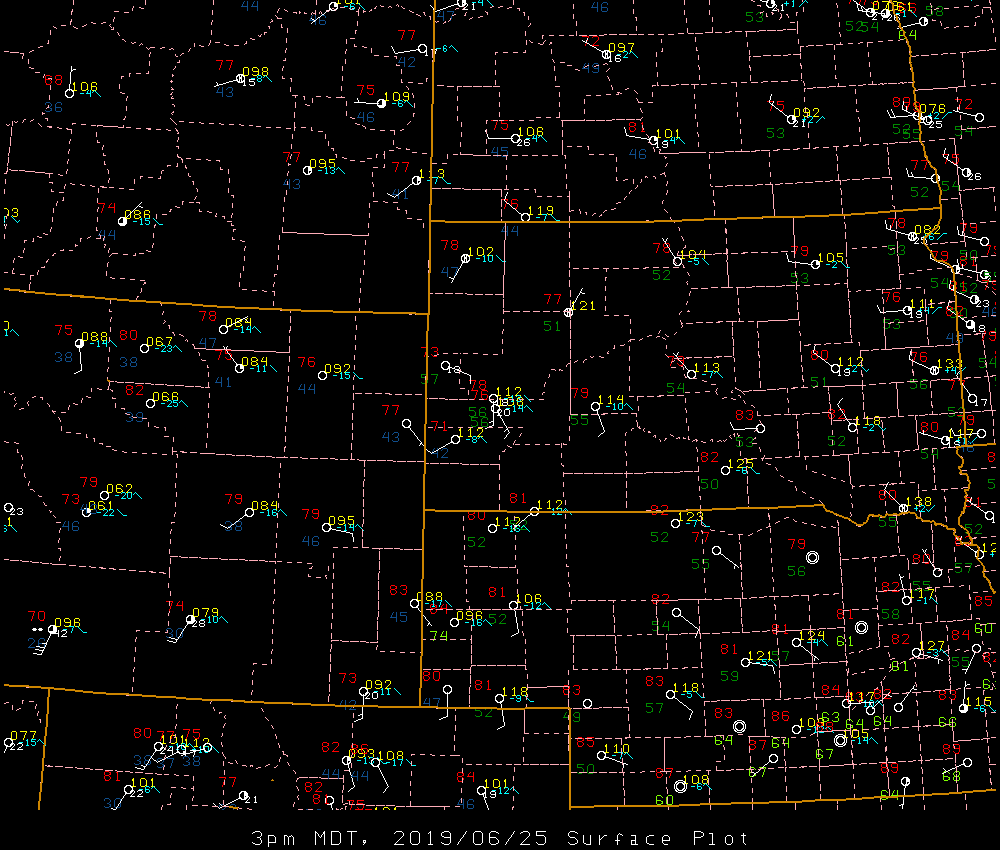
The surface maps at 3 and 6 pm MDT indicated that moist air was flowing from the east-southeast into northeastern Wyoming.
 |
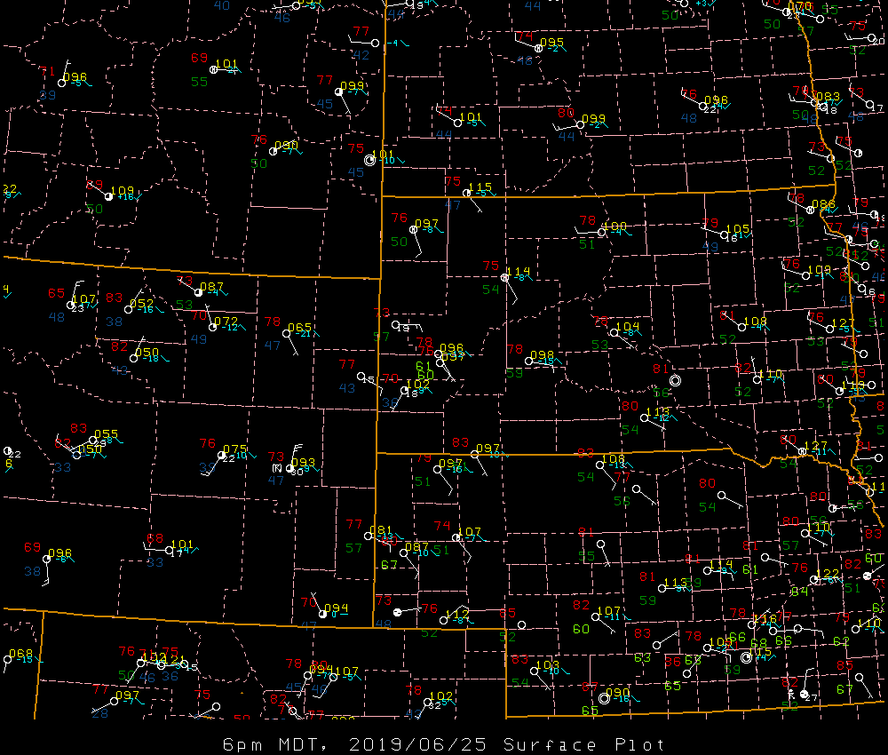 |
| Surface map valid 3 pm MDT 25 June 2019 | Surface map valid 6 pm MDT 25 June 2019 |
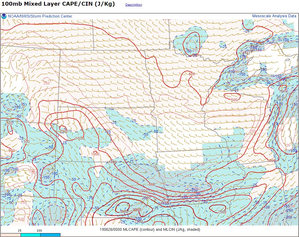
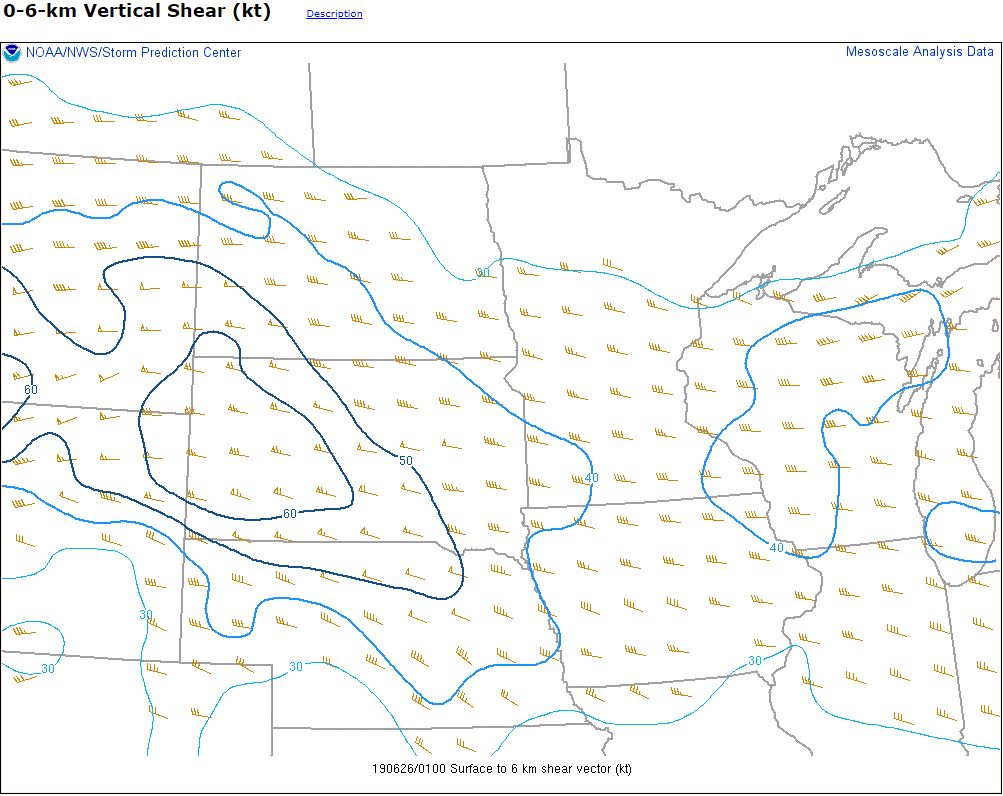
The mesoscale analysis from the Storm Prediction Center (SPC) showed modest buoyancy (left image) over northeastern Wyoming (strongest over western South Dakota). The vertical wind shear from the surface to about 18,000 feet above ground (middle image) was very strong across all of the area. The significant tornado parameter (STP, right image), which combines several tornado-relevant variables, showed that the potential for EF-2 or greater tornadoes was small over northeastern Wyoming.
 |
 |
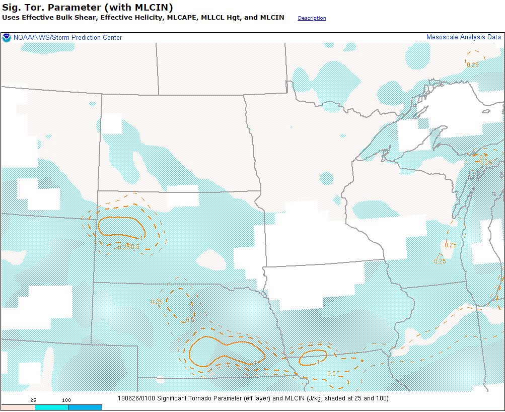 |
| Mixed-layer CAPE (a measure of buoyancy in the atmosphere) valid at 7 pm MDT (about 1 hour prior to the tornado) | 0-6 km wind difference (a measure of storm rotation potential) valid at 7 pm MDT (about 1 hour prior to the tornado) | Signficant tornado parameter (a measure of the potential for EF-2 or stronger tornadoes) valid at 7 pm MDT (about 1 hour prior to the tornado) |
 |
Media use of NWS Web News Stories is encouraged! Please acknowledge the NWS as the source of any news information accessed from this site. |
|

