
Scattered thunderstorms with severe gusts, hail and a tornado risk are possible near a cold front from the Ohio Valley to the Mid-Atlantic tonight. Tropical Storm Bertha is expected to bring tropical storm conditions to portions of the Gulf Coast from the panhandle of Florida into Louisiana through Wednesday. Read More >
Overview
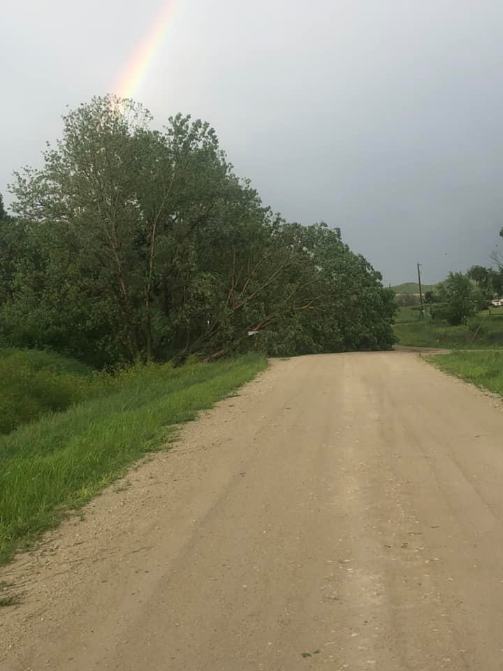
An active period of weather continued on July 9th, with another round of strong to severe thunderstorms across northeastern Wyoming and western South Dakota. The hardest hit areas included Campbell County, WY south of Gillette, far southern Fall River County, and portions of Tripp County near Winner. At least 70 mph winds were reported in each area, while widespread downed trees and power poles were observed in Tripp County.Photos & Video
 |
 |
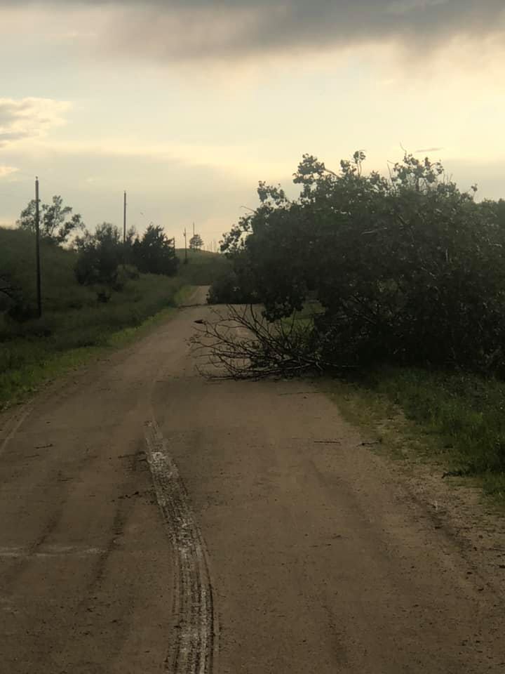 |
| Wind and hail damage southeast of Winner (Rita Pravecek) |
||
Storm Reports
..TIME... ...EVENT... ...CITY LOCATION... ...LAT.LON...
..DATE... ....MAG.... ..COUNTY LOCATION..ST.. ...SOURCE....
..REMARKS..
0124 PM TSTM WND GST WRIGHT 43.75N 105.50W
07/09/2019 E60 MPH CAMPBELL WY PUBLIC
0124 PM HAIL WRIGHT 43.75N 105.50W
07/09/2019 E1.00 INCH CAMPBELL WY PUBLIC
MOSTLY NICKEL SIZE WITH QUARTERS MIXED IN.
0136 PM HAIL 13 SW DWTN GILLETTE 44.16N 105.69W
07/09/2019 E0.88 INCH CAMPBELL WY PUBLIC
TREE LIMBS DOWN.
0136 PM TSTM WND GST 13 SW DWTN GILLETTE 44.16N 105.69W
07/09/2019 E60 MPH CAMPBELL WY PUBLIC
TREE LIMBS DOWN.
0137 PM TSTM WND GST 12 SW DWTN GILLETTE 44.15N 105.65W
07/09/2019 M76 MPH CAMPBELL WY PUBLIC
0252 PM TSTM WND GST ARDMORE 43.02N 103.66W
07/09/2019 E90 MPH FALL RIVER SD PUBLIC
SEVERAL TREES DOWN IN ARDMORE. 70-90 MPH WINDS. DELAYED
REPORT.
0252 PM TSTM WND DMG ARDMORE 43.02N 103.66W
07/09/2019 FALL RIVER SD PUBLIC
SEVERAL TREES DOWN IN ARDMORE. 70-90 MPH WINDS. DELAYED
REPORT.
0340 PM HAIL 3 ENE KYLE 43.44N 102.14W
07/09/2019 E2.00 INCH OGLALA LAKOTA SD TRAINED SPOTTER
0350 PM HAIL 8 S POTATO CREEK 43.42N 101.95W
07/09/2019 E1.00 INCH JACKSON SD TRAINED SPOTTER
0408 PM TSTM WND GST 8 ENE FARMINGDALE 44.00N 102.75W
07/09/2019 E50 MPH PENNINGTON SD PUBLIC
0425 PM TSTM WND GST 3 NW WASTA 44.10N 102.50W
07/09/2019 M73 MPH PENNINGTON SD MESONET
0430 PM TSTM WND GST 3 W UNION CENTER 44.56N 102.72W
07/09/2019 M55 MPH MEADE SD MESONET
0435 PM HAIL 5 N TUTHILL 43.23N 101.51W
07/09/2019 E0.25 INCH BENNETT SD PUBLIC
A LOT OF PEA SIZED HAIL
0438 PM HAIL 4 NNW TUTHILL 43.22N 101.51W
07/09/2019 M1.50 INCH BENNETT SD NWS EMPLOYEE
IMAGES SHOW HAIL OF VARIOUS SIZES UP TO ABOUT PING PONG
BALL SIZED
0452 PM TSTM WND GST 3 NNE CREIGHTON 44.29N 102.18W
07/09/2019 E60 MPH PENNINGTON SD TRAINED SPOTTER
WINDS BETWEEN 50 AND 70 MPH
0520 PM HAIL 7 S SAINT FRANCIS 43.05N 100.89W
07/09/2019 E1.00 INCH TODD SD PUBLIC
DIME TO QUARTER SIZED HAIL
0558 PM TSTM WND GST 9 NE KIRLEY 44.62N 101.18W
07/09/2019 M51 MPH HAAKON SD PUBLIC
0655 PM TSTM WND DMG 5 SSE WITTEN 43.36N 100.05W
07/09/2019 TRIPP SD LAW ENFORCEMENT
SEVERAL POWER POLES DOWNED ALONG HWY 53 FROM 278TH
STREET TO 279TH STREET. TIME ESTIMATED FROM RADAR AND
NEARBY OBSERVATIONS.
0656 PM TSTM WND GST 4 SSE WITTEN 43.39N 100.07W
07/09/2019 M71 MPH TRIPP SD MESONET
0705 PM TSTM WND GST 5 SSE WINNER 43.30N 99.81W
07/09/2019 E65 MPH TRIPP SD TRAINED SPOTTER
0719 PM HAIL 1 N MILLBORO 43.09N 99.97W
07/09/2019 E1.00 INCH TRIPP SD PUBLIC
0719 PM TSTM WND GST 1 N MILLBORO 43.09N 99.97W
07/09/2019 E60 MPH TRIPP SD PUBLIC
THE STORM REPORTS LISTED BELOW ARE IN DESCENDING ORDER AND MAY NOT
NECESSARILY BE THE FINAL STORM REPORTS.
HAIL REPORTS LISTED BY SIZE (INCHES)
SIZE LOCATION ST COUNTY TIME
------ ----------------------- -- -------------- -------
2.00 3 ENE KYLE SD OGLALA LAKOTA 0340 PM
1.50 4 NNW TUTHILL SD BENNETT 0438 PM
1.00 1 N MILLBORO SD TRIPP 0719 PM
1.00 7 S SAINT FRANCIS SD TODD 0520 PM
1.00 8 S POTATO CREEK SD JACKSON 0350 PM
1.00 WRIGHT WY CAMPBELL 0124 PM
0.88 13 SW DWTN GILLETTE WY CAMPBELL 0136 PM
0.25 5 N TUTHILL SD BENNETT 0435 PM
TSTM WIND REPORTS LISTED BY SPEED (MPH)
SPEED LOCATION ST COUNTY TIME
------ ----------------------- -- -------------- -------
90.00 ARDMORE SD FALL RIVER 0252 PM
76.00 12 SW DWTN GILLETTE WY CAMPBELL 0137 PM
73.00 3 NW WASTA SD PENNINGTON 0425 PM
71.00 4 SSE WITTEN SD TRIPP 0656 PM
65.00 5 SSE WINNER SD TRIPP 0705 PM
60.00 1 N MILLBORO SD TRIPP 0719 PM
60.00 3 NNE CREIGHTON SD PENNINGTON 0452 PM
60.00 13 SW DWTN GILLETTE WY CAMPBELL 0136 PM
60.00 WRIGHT WY CAMPBELL 0124 PM
55.00 3 W UNION CENTER SD MEADE 0430 PM
51.00 9 NE KIRLEY SD HAAKON 0558 PM
50.00 8 ENE FARMINGDALE SD PENNINGTON 0408 PM
Radar
| Radar loop during the afternoon of July 9, 2019 |
 |
Media use of NWS Web News Stories is encouraged! Please acknowledge the NWS as the source of any news information accessed from this site. |
|

