
Heat expands across the Desert Southwest, Plains, Mississippi Valley and Midwest into Monday. Fire weather concerns continue for portions of the Intermountain West. Active monsoonal moisture fuels thunderstorms over the Southwest with possible flash flooding. Tropical cyclone Fausto in the Pacific, should weaken as it approaches Hawaii; Dangerous surf, swells and rip currents are expected. Read More >
Overview
|
Severe thunderstorms moved across northeastern Wyoming and western through central South Dakota late Tuesday afternoon (July 16th), continuing past midnight into early Wednesday morning (July 17th). A tornado occurred between Rozet and Moorcroft, Wyoming (south of Interstate-90); flooding was reported in Butte County, South Dakota, washing out some roads; lightning struck near the NWS Doppler radar north of New Underwood, South Dakota, causing a temporary outage; and a brief tornado occurred north-northwest of Vetal in Bennett County, South Dakota. The cloud-to-ground lightning plot to the right shows that most of the area experienced thunderstorms during this event.
Here are a couple links to videos of the Wyoming tornado (video #1 and video #2). |
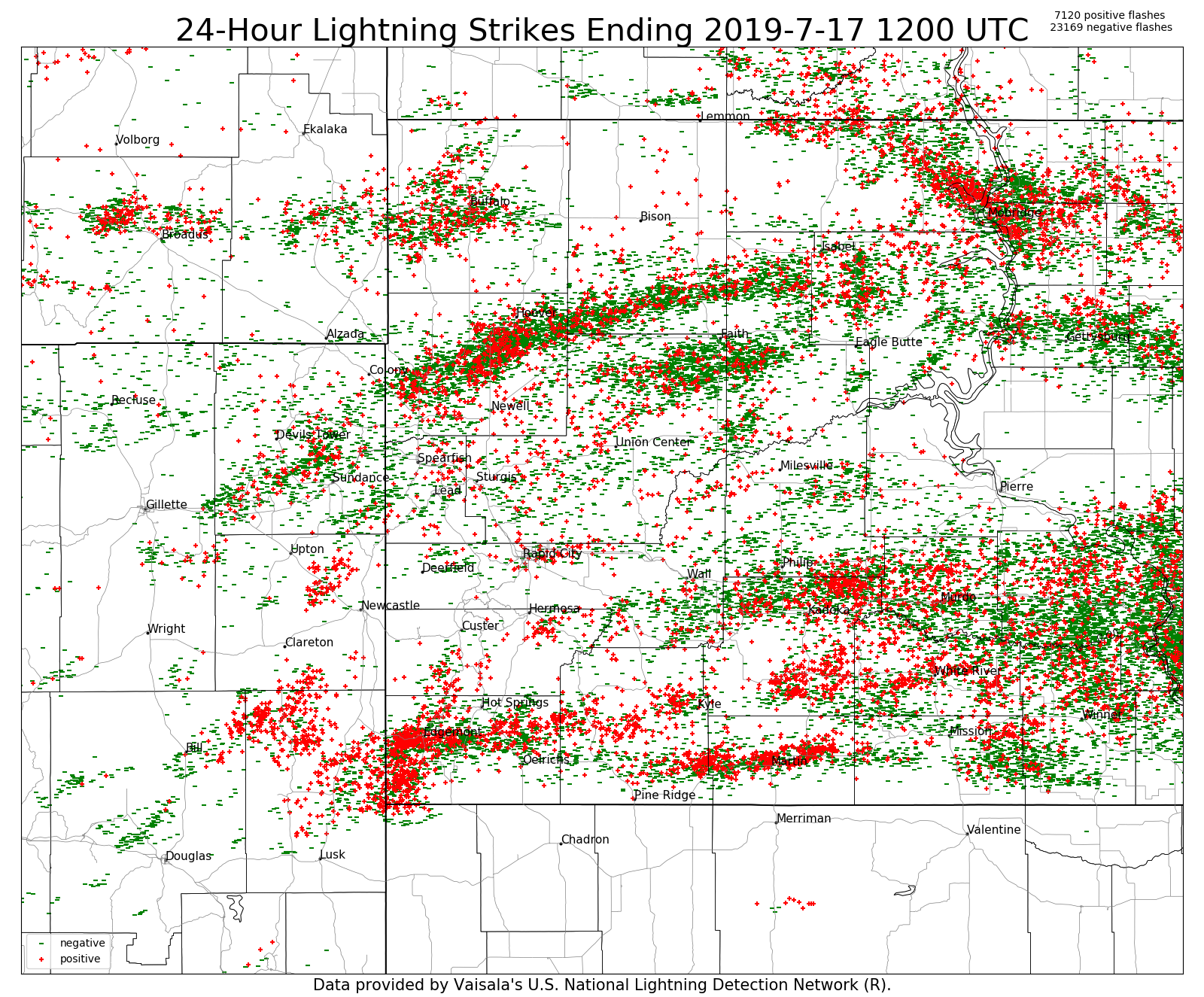 24-hour cloud-to-ground lightning from 6 am July 16 to 6 am July 17, 2019 |
Tornadoes:
|
Tornado - 3 miles East of Rozet to 6 miles East Rozet
Photo of tornado from Dwayne Sisson 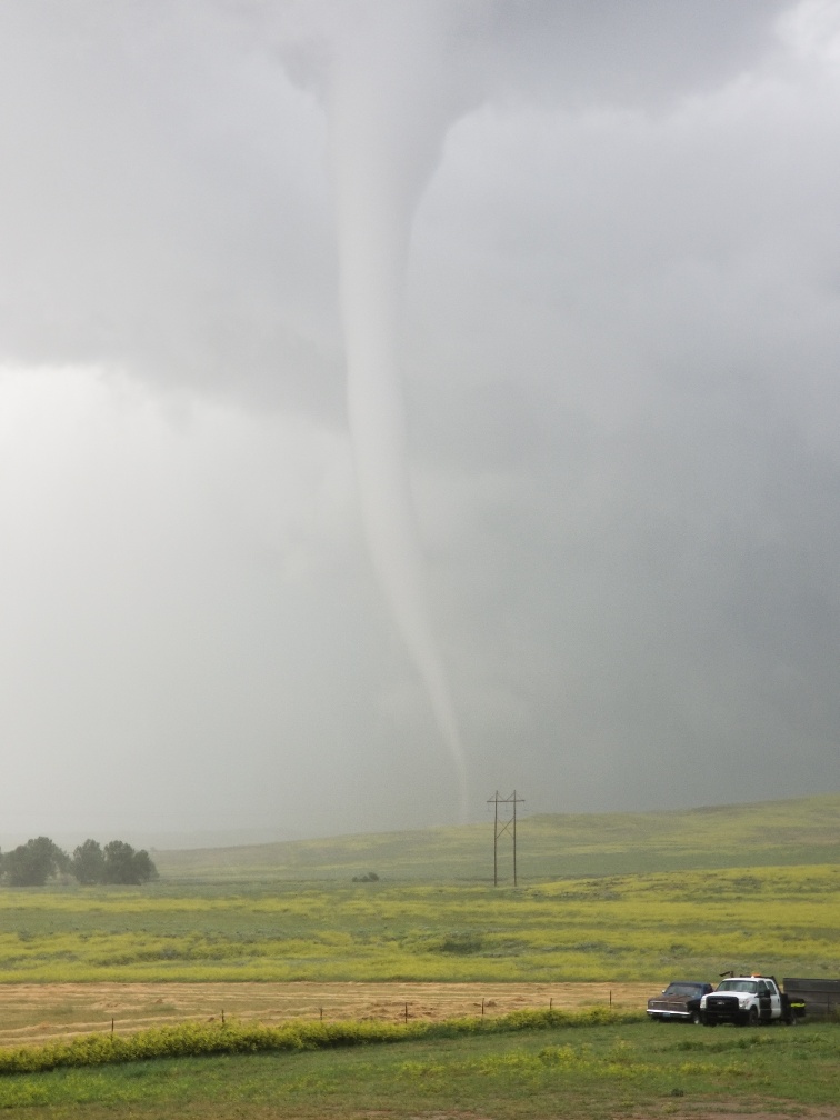 |
||||||||||||||||
|
Tornado - 9 miles NNW of Vetal
|
||||||||||||||||
The Enhanced Fujita (EF) Scale classifies tornadoes into the following categories:
| EF0 Weak 65-85 mph |
EF1 Moderate 86-110 mph |
EF2 Significant 111-135 mph |
EF3 Severe 136-165 mph |
EF4 Extreme 166-200 mph |
EF5 Catastrophic 200+ mph |
 |
|||||
Flooding & Rainfall
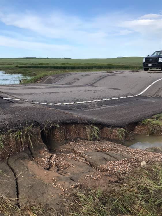
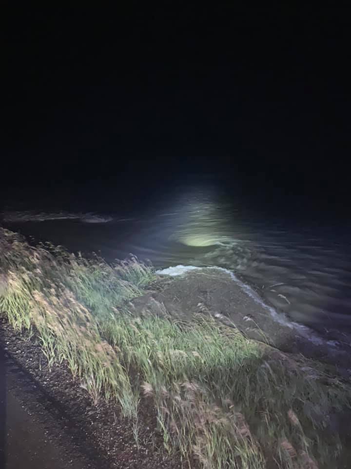
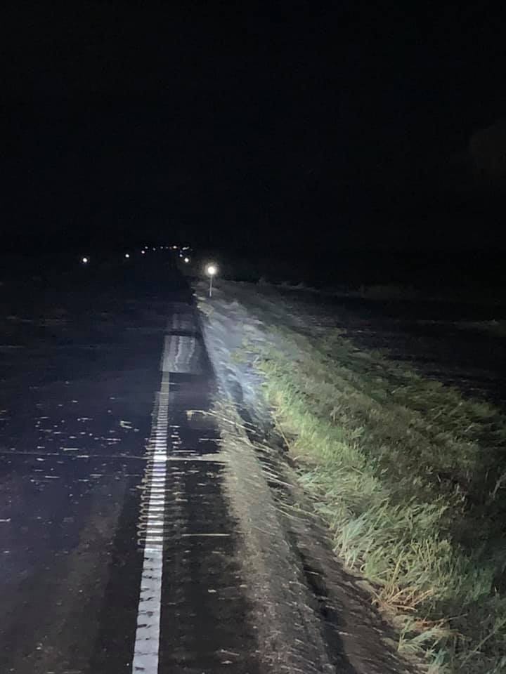
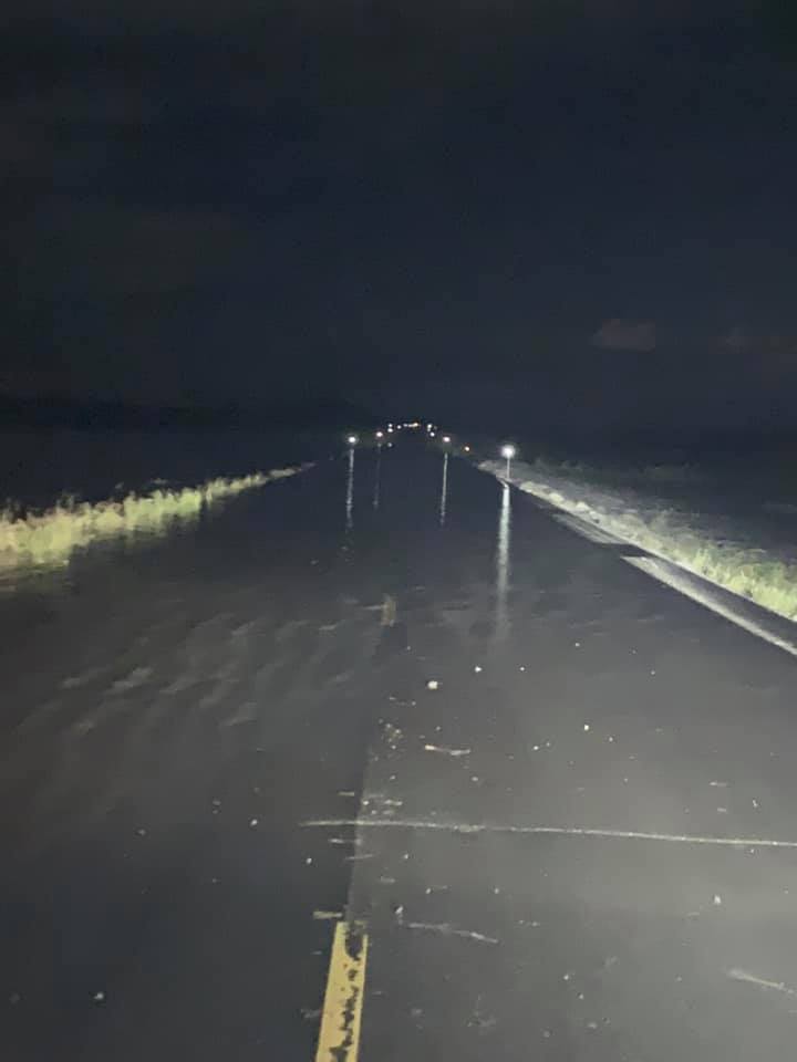
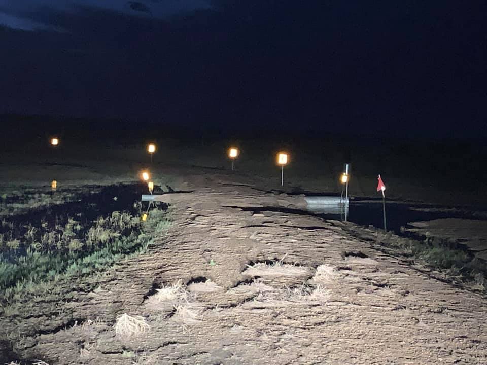
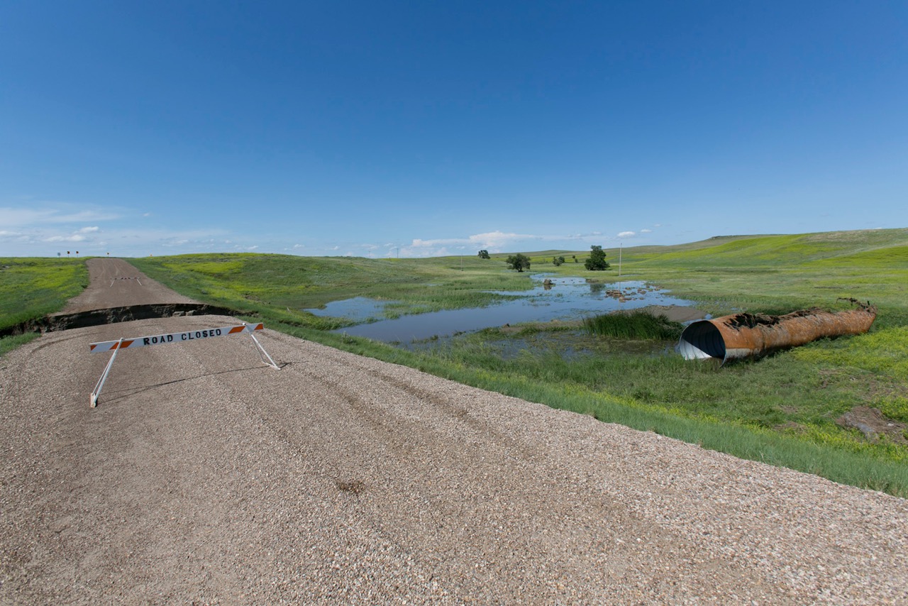
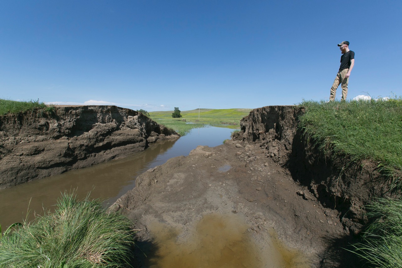
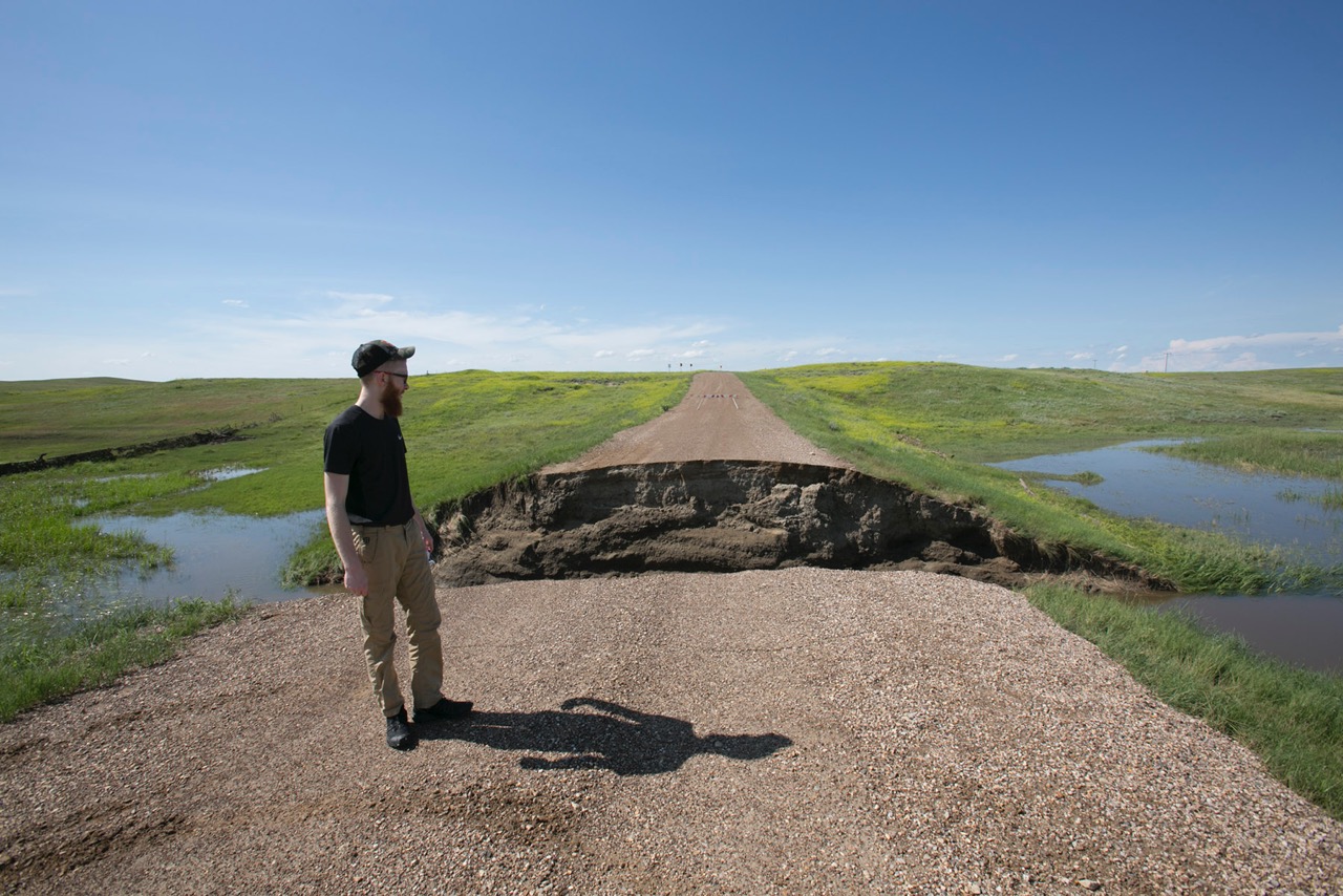
Thunderstorms produced very heavy rainfall and flooding across parts of Butte County, especially in the area south of Hoover through Castle Rock, where some roads were washed out.
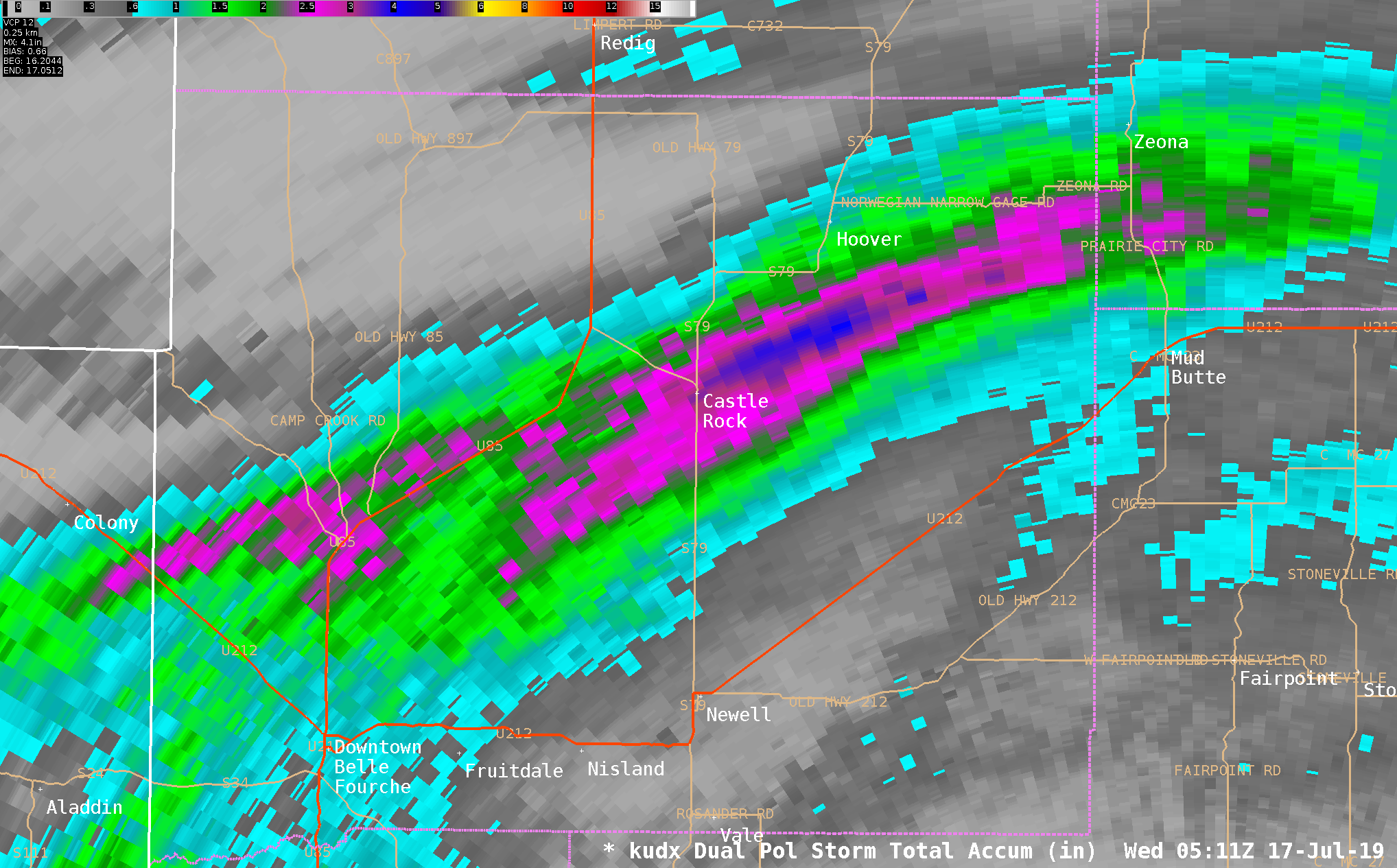 |
| Radar estimated rainfall from 2:44 to 11:12 pm MDT on July 16th, 2019. Areas in blue are estimates of around 4 inches. |
Photos from Harding County Sheriff's Office
 |
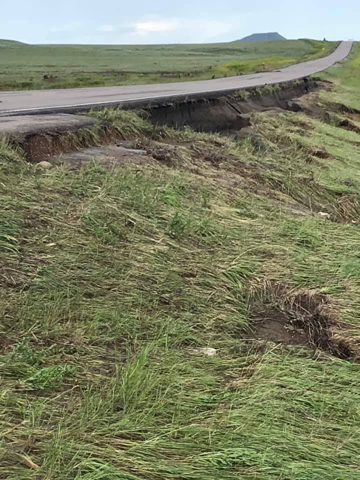 |
| South of Hoover on Frog Creek, where road is out | South of Hoover on Frog Creek, where road is out |
Photos from Butte County Sheriff's Office
 |
 |
 |
 |
| SD HWY 79 at Mile Marker 163.5 | SD HWY 79 at Mile Marker 163.5 | SD HWY 79 at Mile Marker 163.5 | Erk Road in the area of Goeringer Road |
Photos from Markus Erk
 |
 |
 |
| Erk Road | Erk Road | Erk Road |
Radar
Here is a radar reflectivity loop of the entire severe event for July 16-17, 2019, along with some radar images during the time of the tornadoes in both Wyoming and South Dakota.
| Radar reflectivity animation at 30-min intervals from approximately 3 to 11 pm MDT 16 July 2019 (shortly before the Rapid City radar was disabled by lightning). |
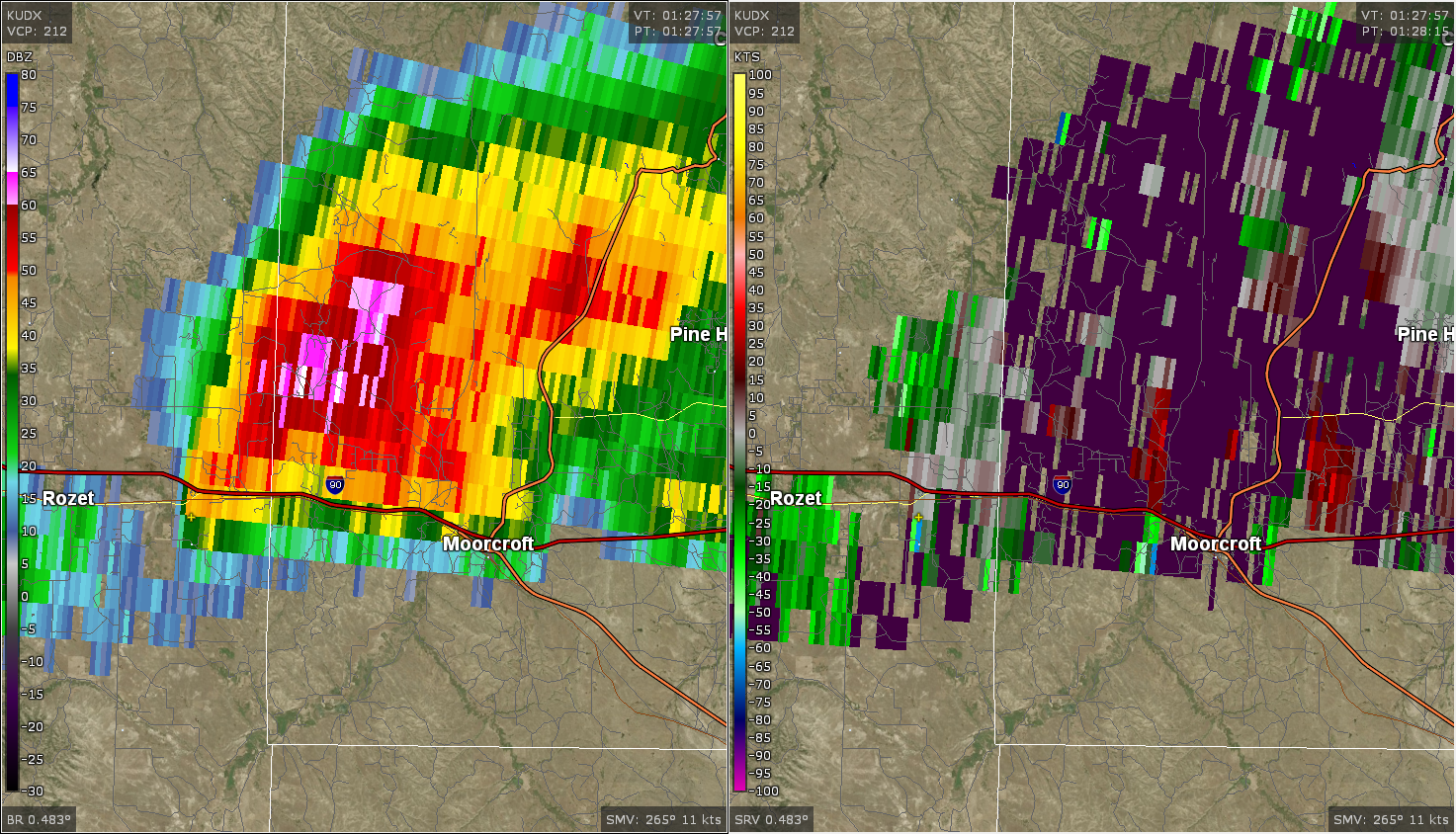 |
| Radar image at 7:28 pm MDT 16 July 2019, showing reflectivity (left) and velocity (right). The small yellow cross denotes the approximate location of the tornado at the time it begin between Rozet and Moorcroft (south of Interstate-90). |
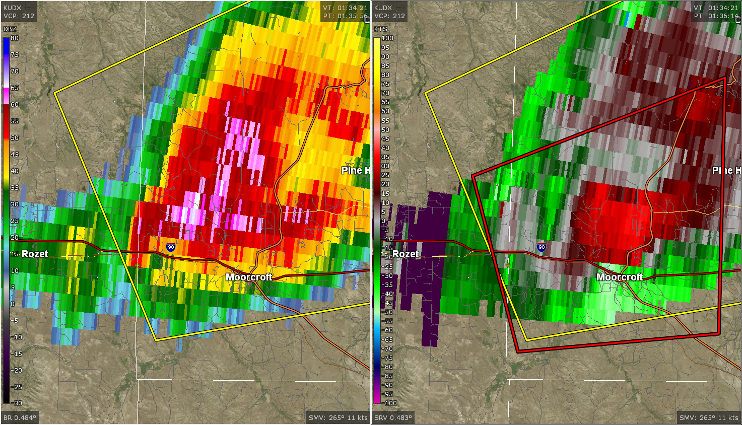 |
| Radar image at 7:36 pm MDT 16 July 2019, showing reflectivity (left) and velocity (right). The small yellow cross denotes the approximate location of the tornado at the time it ended between Rozet and Moorcroft (south of Interstate-90). The yellow (red) polygon delineates the severe thunderstorm (tornado) warning. |
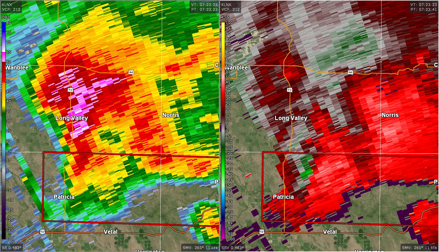 |
| Radar image at 1:23 am MDT 17 July 2019, showing reflectivity (left) and velocity (right). The small yellow cross denotes the approximate location of the tornado 9 miles north-northwest of Vetal, SD. The red polygon delineates the tornado warning. |
Storm Reports
Here are the preliminary severe thunderstorm storm reports for July 16, 2019 (link to reports).
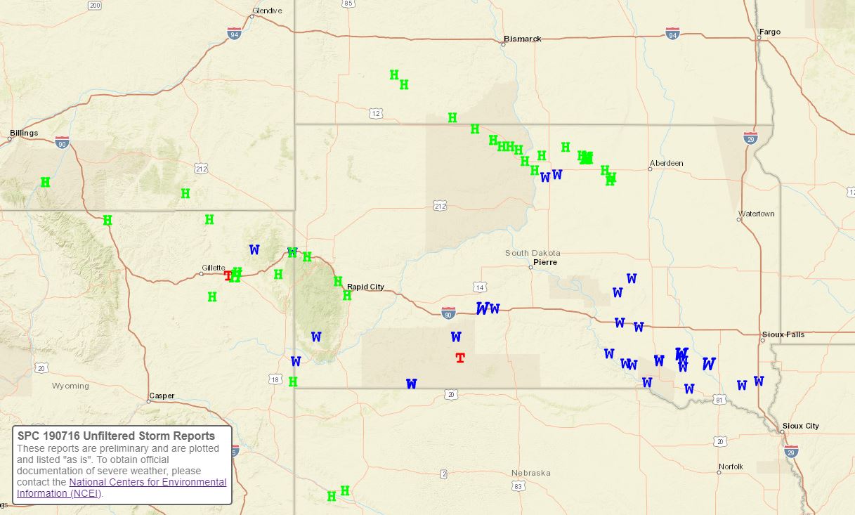 |
| Preliminary storm reports for July 16-17, 2019 (green H's represent hail; blue W's represent wind gusts; and red T's represent tornado reports). |
The storm reports listed below are in descending order and may not
necessarily be the final storm reports.

Hail reports listed by size (inches)

 SIZE    LOCATION                 ST  COUNTY           TIME
 ------  -----------------------  --  --------------   -------
  3.00   MOORCROFT                WY  CROOK            0752 PM
  1.75   19 SSW ROZET             WY  CAMPBELL         0805 PM
  1.75   1 S DWTN SPEARFISH       SD  LAWRENCE         0800 PM
  1.50   3 NNE MOORCROFT          WY  CROOK            0800 PM
  1.00   2 S DWTN RAPID CITY      SD  PENNINGTON       1045 PM
  1.00   BEULAH                   WY  CROOK            0805 PM
  1.00   9 SSE SUNDANCE           WY  CROOK            0740 PM
  1.00   13 W ROCKYPOINT          WY  CAMPBELL         0732 PM
  1.00   2 NNW SUMMERSET          SD  MEADE            0336 PM
  0.88   15 NNW RECLUSE           WY  CAMPBELL         0705 PM
  0.50   WALL                     SD  PENNINGTON       0120 AM


Tstm wind reports listed by speed (mph)

 SPEED   LOCATION                 ST  COUNTY           TIME
 ------  -----------------------  --  --------------   -------
 81.00   9 ENE BELVIDERE          SD  JACKSON          0929 PM
 70.00   10 W EDGEMONT            SD  FALL RIVER       0616 PM
 65.00   9 SW BATESLAND           SD  OGLALA LAKOTA    0835 PM
 60.00   7 E WANBLEE              SD  JACKSON          0905 PM
 60.00   3 SE DEVILS TOWER        WY  CROOK            0805 PM
 60.00   BEULAH                   WY  CROOK            0805 PM
 60.00   4 NW ARGYLE              SD  CUSTER           0700 PM
                 RAIN FELL IN 20 MINUTES
 58.00   7 E WANBLEE              SD  JACKSON          0859 PM
 52.00   4 SSE WITTEN             SD  TRIPP            0219 AM
 50.00   10 W HARDING             SD  HARDING          0845 PM
 50.00   10 W HARDING             SD  HARDING          0845 PM
Environment
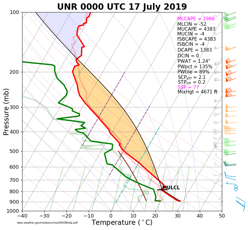
The atmosphere was very unstable over northeastern Wyoming and western South Dakota on Tuesday, July 16th, 2019, per the information obtained from the weather balloon released in East Rapid City at 6 pm MDT (left image). The vertical wind shear (right image) was rather strong, which favored severe storms with both large hail and damaging winds.
 |
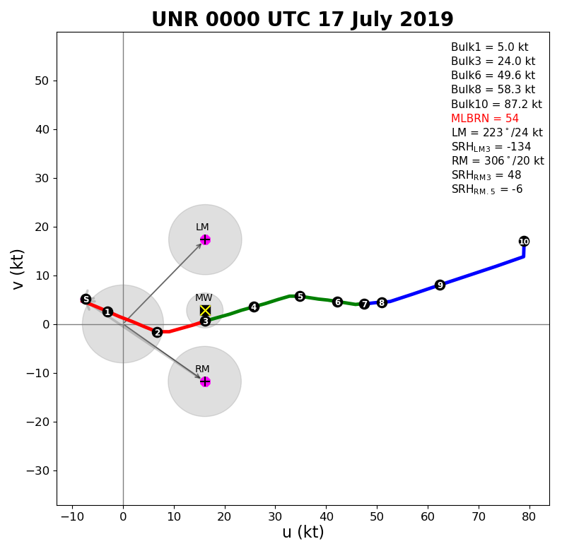 |
| July 16, 2019, 6 pm upper-air sounding for Rapid City (00z on the 17th) | July 16, 2019, 6 pm upper-air hodograph for Rapid City (00z on the 17th) |
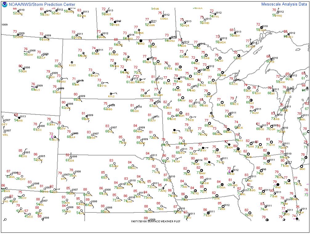
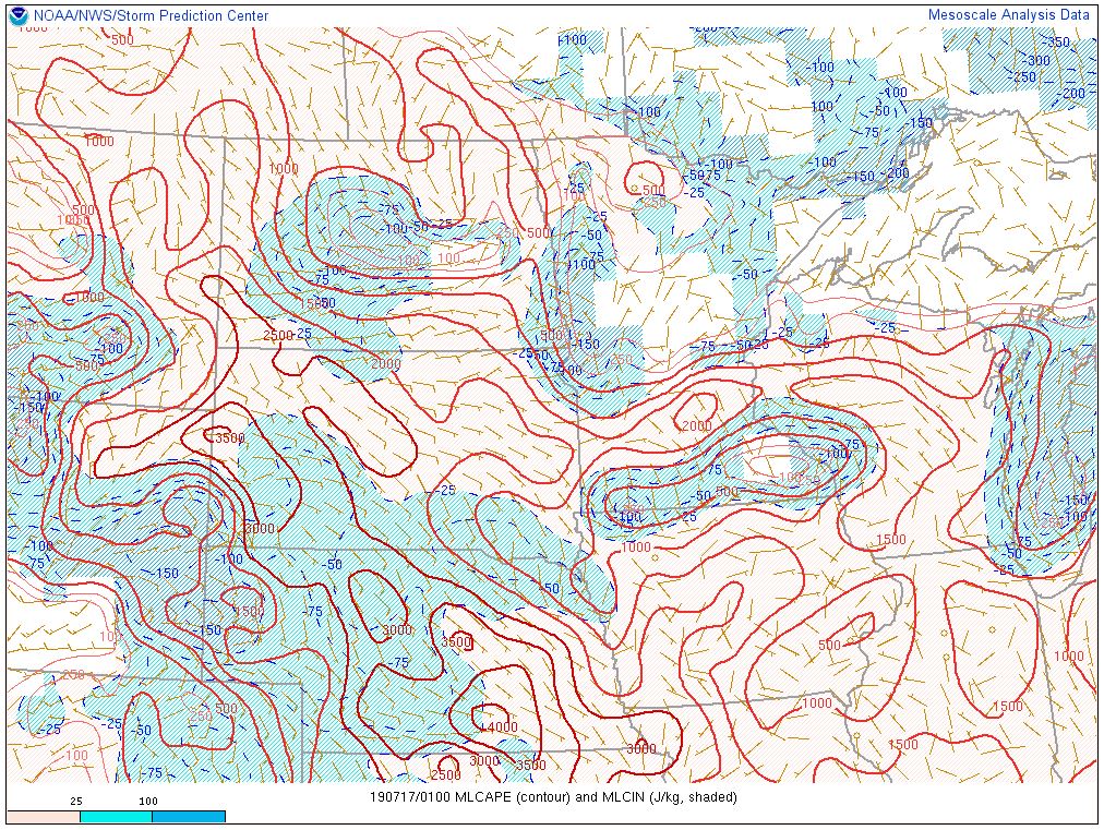
A moist and unstable air mass was in place with east-to-southeast winds bringing humid air into the region, per the images below. Strong winds well above the ground created more than sufficient vertical wind shear that is needed to sustain severe thunderstorms.
 |
 |
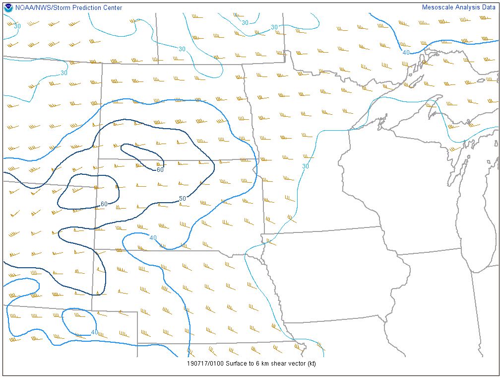 |
| SPC surface map valid 7 pm MDT 16 July 2019 | SPC mixed-layer CAPE (a measure of buoyancy) valid 7 pm MDT 16 July 2019 | SPC vertical wind shear from the surface to 6 km above ground (about 18,000 ft) valid 7 pm MDT 16 July 2019 |
 |
Media use of NWS Web News Stories is encouraged! Please acknowledge the NWS as the source of any news information accessed from this site. |
|

