
Tropical Depression Two is expected to gradually strengthen and could bring tropical storm conditions to the Florida Panhandle beginning late Monday. Areas of flash flooding will be possible through Thursday along the eastern and central Gulf Coast. Severe thunderstorms will develop and move along a cold front crossing the Upper Midwest Monday, and through the Ohio Valley/Mid-Atlantic on Tuesday. Read More >
Overview
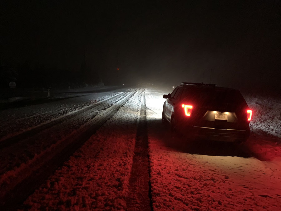
 An early season winter storm moved into the region late Wednesday, October 9, and brought widespread snow and gusty northerly winds. The highest snow totals fell in the northern Black Hills, with slightly lesser amounts on the plains. Northerly winds gusting near 50 mph created areas of blowing and drifting snow, especially on the South Dakota plains. Snowfall ended from west to east late Thursday and early Friday.
Storm Total Snowfall
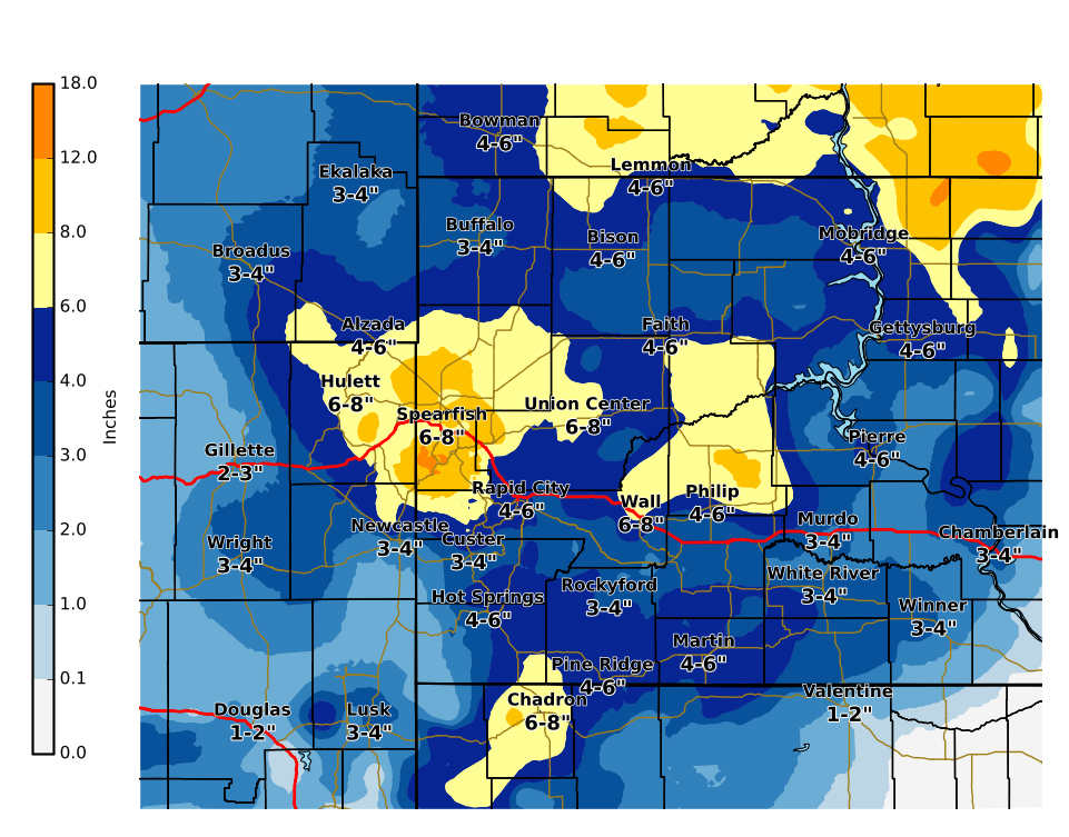
Snow reports listed by amount

 INCHES  LOCATION                 ST  COUNTY           TIME
 ------  -----------------------  --  --------------   -------
 12.90   14 SSE DUPREE            SD  ZIEBACH          0900 AM
 11.70   LEAD                     SD  LAWRENCE         0900 AM
 10.00   2 NNW SAINT ONGE         SD  LAWRENCE         0933 AM
  9.00   3 NE WHITEWOOD           SD  LAWRENCE         1030 AM
  8.00   JOHNSON SIDING           SD  PENNINGTON       0605 PM
  8.00   2 WNW DWTN RAPID CITY    SD  PENNINGTON       0700 AM
  8.00   3 ESE CHEYENNE CROSSING  SD  LAWRENCE         0700 AM
  8.00   3 NE HISEGA              SD  PENNINGTON       0700 AM
  7.50   5 ESE NORRIS             SD  MELLETTE         0717 AM
  7.00   MIDLAND                  SD  HAAKON           0920 AM
  7.00   4 S HILL CITY            SD  PENNINGTON       0600 AM
  7.00   4 SSW HILL CITY          SD  PENNINGTON       0600 AM
  6.60   HILL CITY                SD  PENNINGTON       0900 AM
  6.50   6 SSW LEAD               SD  LAWRENCE         0700 AM
  6.50   2 WNW DWTN SPEARFISH     SD  LAWRENCE         0808 AM
  6.50   1 SSE DWTN SPEARFISH     SD  LAWRENCE         0700 AM
  6.00   2 W OPAL                 SD  MEADE            0900 AM
  6.00   9 WSW RED ELM            SD  ZIEBACH          0613 PM
  6.00   1 WNW WIND CAVE VISITOR  SD  CUSTER           0100 PM
  6.00   1 SSW BELLE FOURCHE      SD  BUTTE            1130 AM
  6.00   2 SW DWTN RAPID CITY     SD  PENNINGTON       0930 AM
  6.00   ORAL                     SD  FALL RIVER       0900 AM
  6.00   BLACK HAWK               SD  MEADE            0811 AM
  6.00   OELRICHS                 SD  FALL RIVER       0730 AM
  6.00   8 NNW NEWCASTLE          WY  WESTON           0700 AM
  6.00   1 N HISEGA               SD  PENNINGTON       0700 AM
  5.80   3 SE SAINT ONGE          SD  LAWRENCE         0600 AM
  5.80   4 NNW WHITEWOOD          SD  LAWRENCE         0600 AM
  5.50   2 E COTTONWOOD           SD  JACKSON          0700 AM
  5.30   5 NE ROCKERVILLE         SD  PENNINGTON       0700 AM
  5.00   PHILIP                   SD  HAAKON           0926 AM
  5.00   3 SSE HARDING            SD  HARDING          0900 AM
  5.00   1 NNW DWTN SPEARFISH     SD  LAWRENCE         0900 AM
  5.00   RED OWL                  SD  MEADE            0900 AM
  5.00   1 ESE PACTOLA RES        SD  PENNINGTON       0900 AM
  5.00   DUPREE                   SD  ZIEBACH          0430 PM
  5.00   8 SE MUD BUTTE           SD  MEADE            0830 AM
  5.00   1 NNW PIEDMONT           SD  MEADE            0747 AM
  4.90   6 NNW DWTN SPEARFISH     SD  LAWRENCE         0700 AM
  4.80   8 WSW LODGEPOLE          SD  PERKINS          0900 AM
  4.80   3 WNW SUNDANCE           WY  CROOK            0930 AM
  4.70   2 S DWTN RAPID CITY      SD  PENNINGTON       0700 AM
  4.60   1 E DWTN RAPID CITY      SD  PENNINGTON       0900 AM
  4.50   HOT SPRINGS              SD  FALL RIVER       0400 PM
  4.00   1 NNE EDGEMONT           SD  FALL RIVER       0900 AM
  4.00   2 SSW NORRIS             SD  MELLETTE         0700 AM
  4.00   LEMMON                   SD  PERKINS          0500 PM
  4.00   3 ENE KYLE               SD  OGLALA LAKOTA    0700 AM
  4.00   HERMOSA                  SD  CUSTER           0600 AM
  3.60   7 ENE ROCHELLE           WY  WESTON           0900 AM
  3.50   5 SW HOT SPRINGS         SD  FALL RIVER       0715 AM
  3.50   1 S BELLE FOURCHE        SD  BUTTE            0700 AM
  3.50   4 NNE SUMMERSET          SD  MEADE            0700 AM
  3.50   MOUNT RUSHMORE           SD  PENNINGTON       1200 AM
  3.10   13 ENE WHITE RIVER       SD  MELLETTE         0700 AM
  3.00   WINNER                   SD  TRIPP            0929 AM
  3.00   8 E MARTIN               SD  BENNETT          0900 AM
  3.00   4 NW DWTN RAPID CITY     SD  PENNINGTON       0900 AM
  3.00   4 S DWTN RAPID CITY      SD  PENNINGTON       0845 AM
  3.00   12 S QUINN               SD  PENNINGTON       0700 AM
  3.00   2 SW NORRIS              SD  MELLETTE         0700 AM
  3.00   19 SW UPTON              WY  WESTON           0700 AM
  2.50   3 E NEWCASTLE            WY  WESTON           0600 AM
  2.50   4 E NEWCASTLE            WY  WESTON           0600 AM
  2.00   7 E LAKEVIEW             SD  TODD             0900 AM
  2.00   DWTN SPEARFISH           SD  LAWRENCE         0700 AM
  2.00   17 NW WHITE RIVER        SD  MELLETTE         0700 AM
  2.00   3 WNW KADOKA             SD  JACKSON          0530 AM
  1.10   4 NE DWTN RAPID CITY     SD  PENNINGTON       0700 AM
  1.00   20 SSE BISON             SD  PERKINS          0700 AM
  1.00   14 NNW DWTN GILLETTE     WY  CAMPBELL         0600 AM
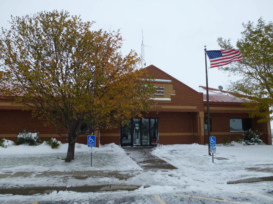
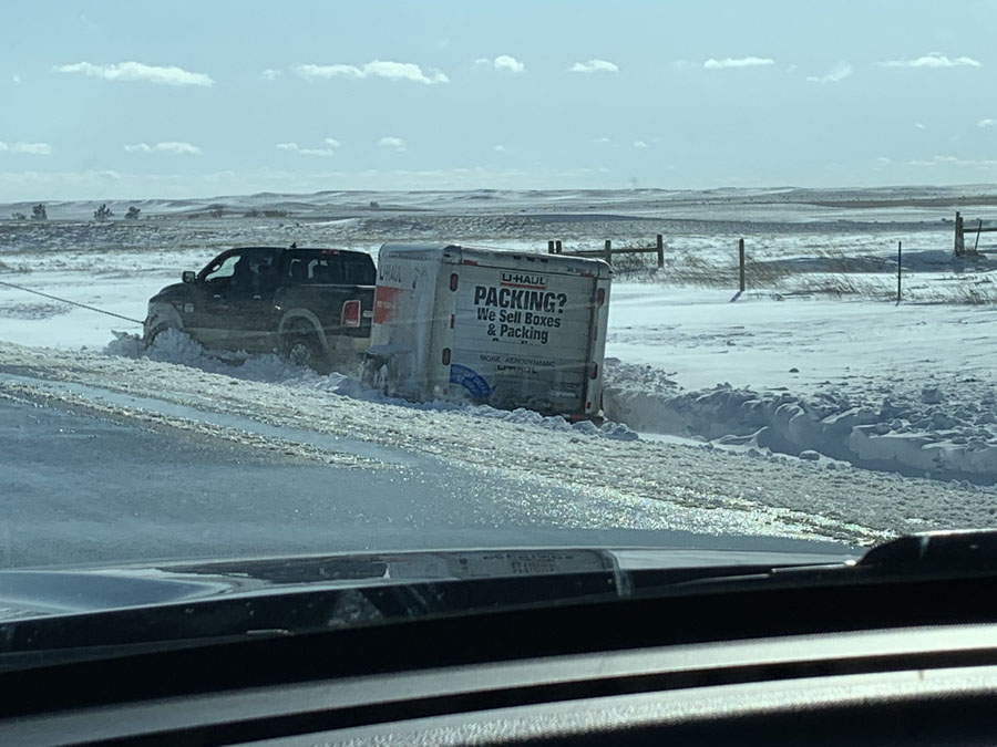
Photos
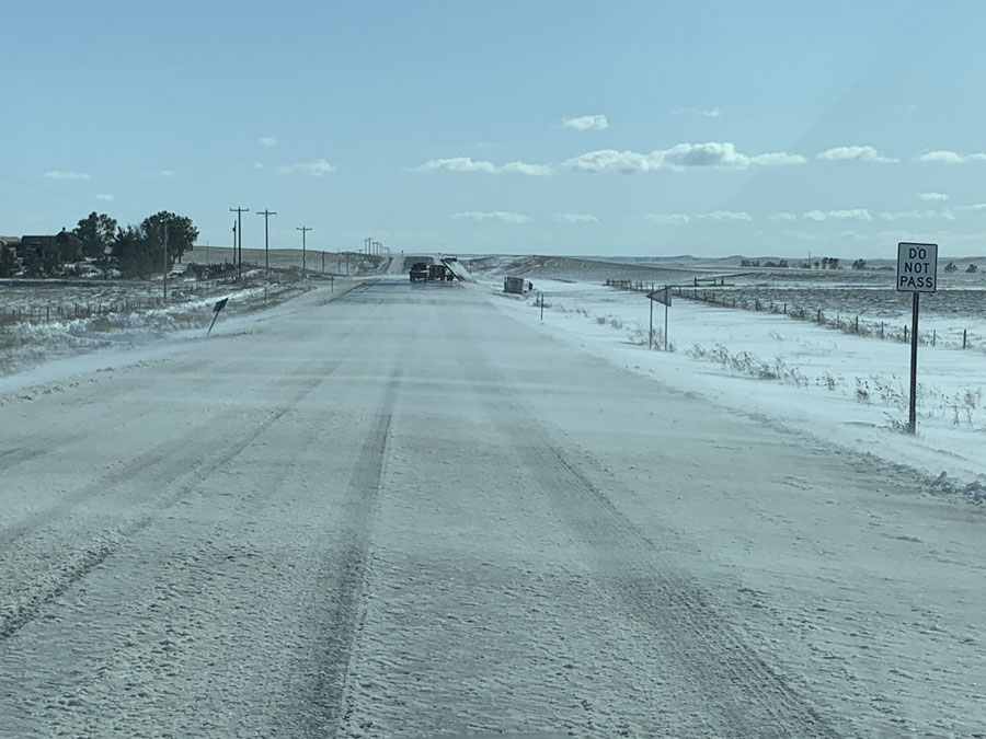 |
 |
 |
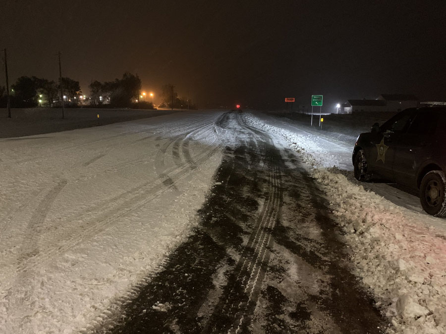 |
| Courtesy Perkins County Sheriff | Courtesy Perkins County Sheriff | Courtesy Perkins County Sheriff | Courtesy Perkins County Sheriff |
 |
Media use of NWS Web News Stories is encouraged! Please acknowledge the NWS as the source of any news information accessed from this site. |
|

