Hazardous heat will continue across the Southern Plains, Gulf Coast and Desert Southwest through the weekend. Additional heat will build into the Great Basin and Northern Plains this weekend. A stalled front is expected to bring periods of heavy to excessive rainfall and flooding from the Tennessee Valley to the Southeast U.S on Friday. Read More >
Overview
|
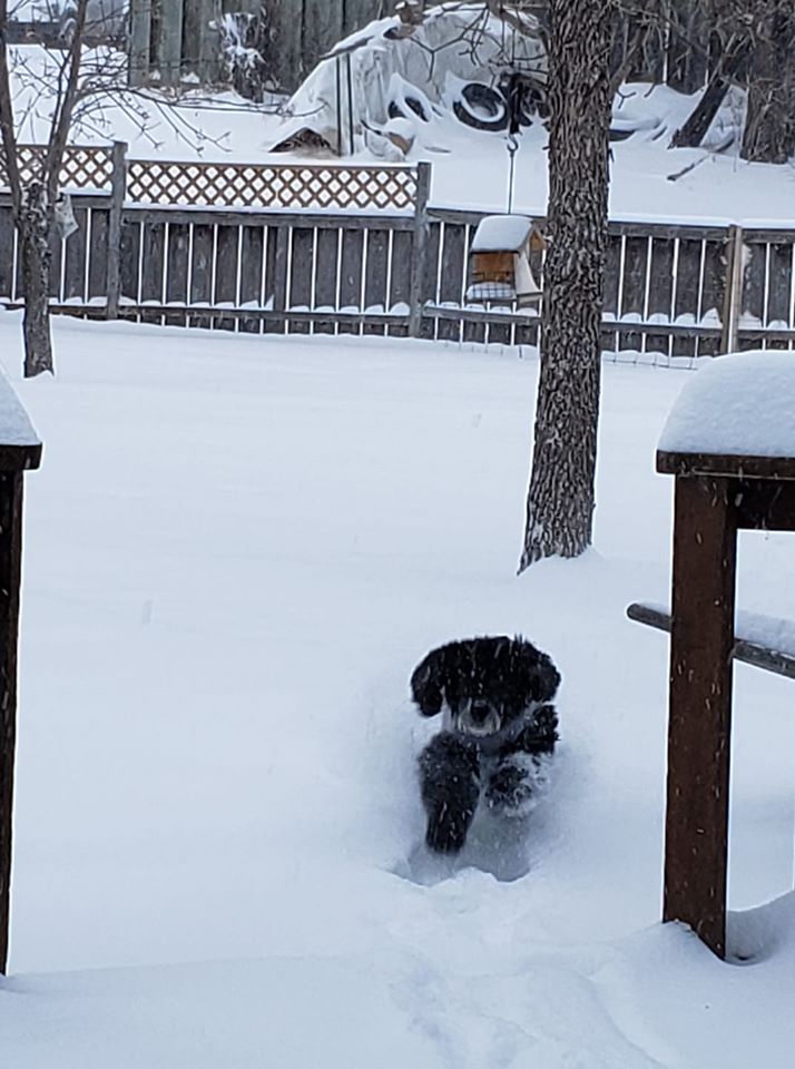
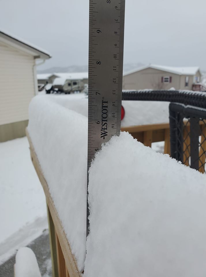
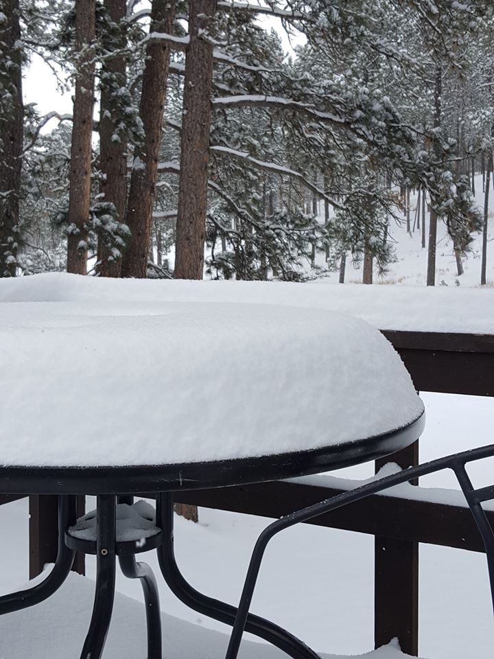
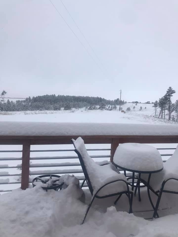
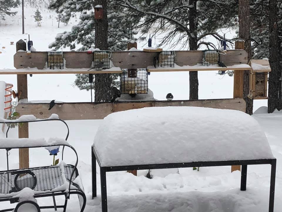
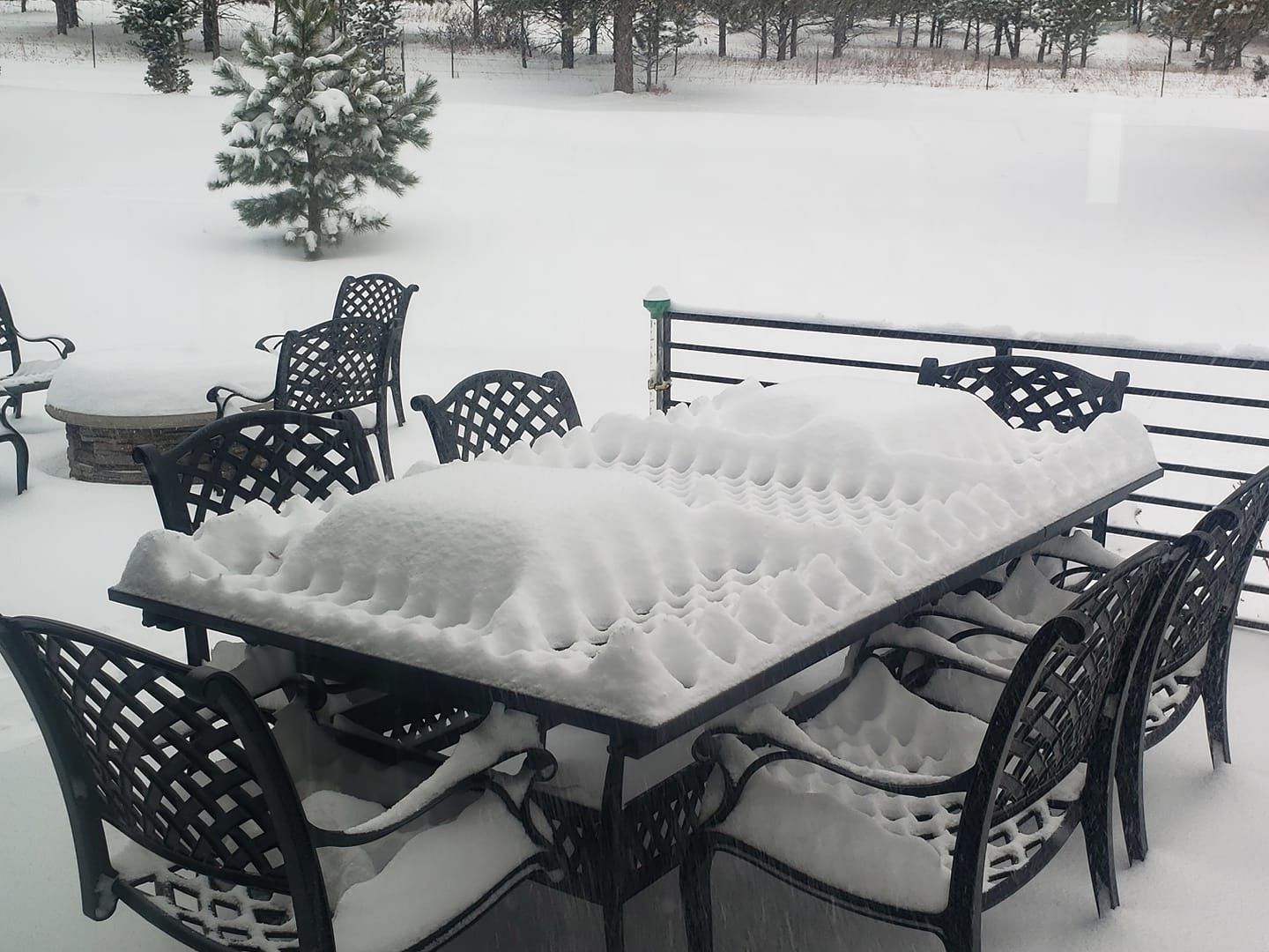
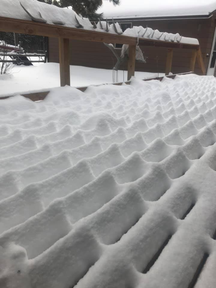
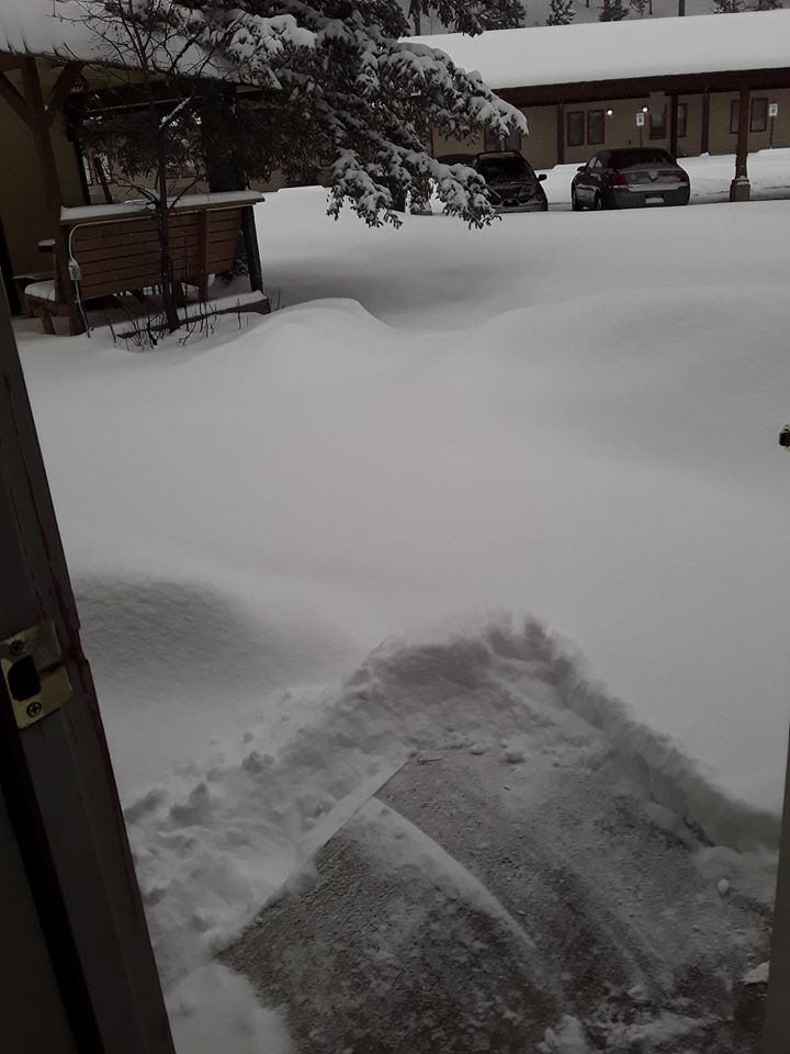
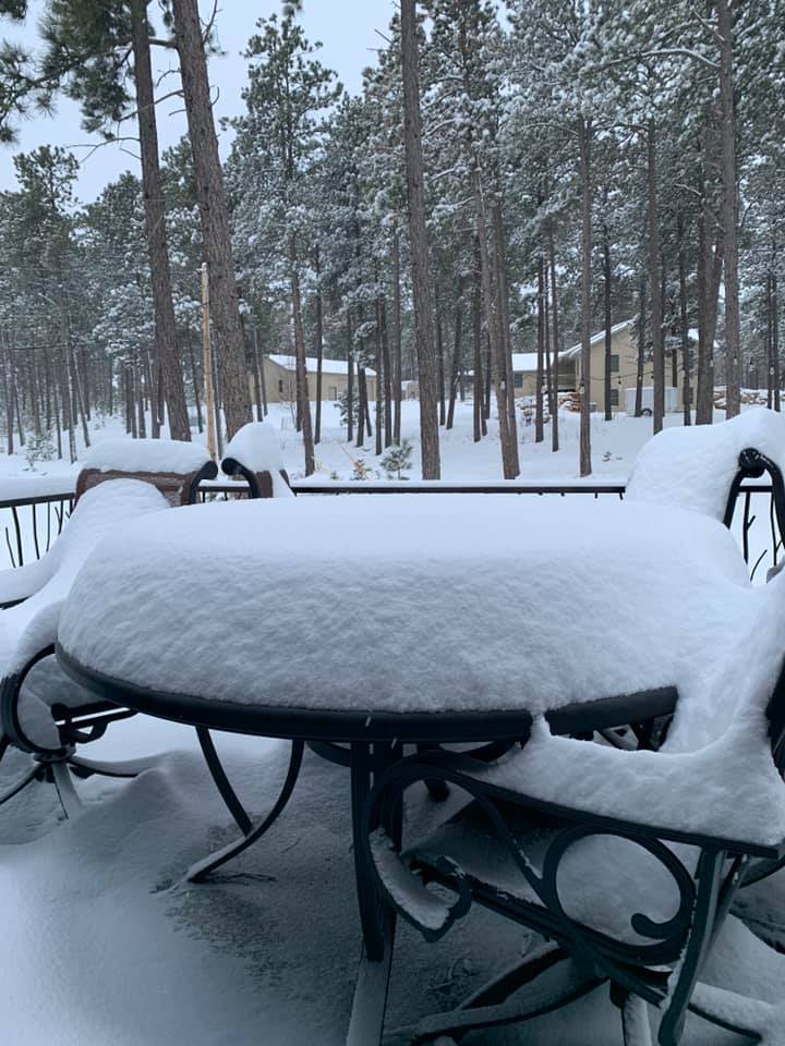
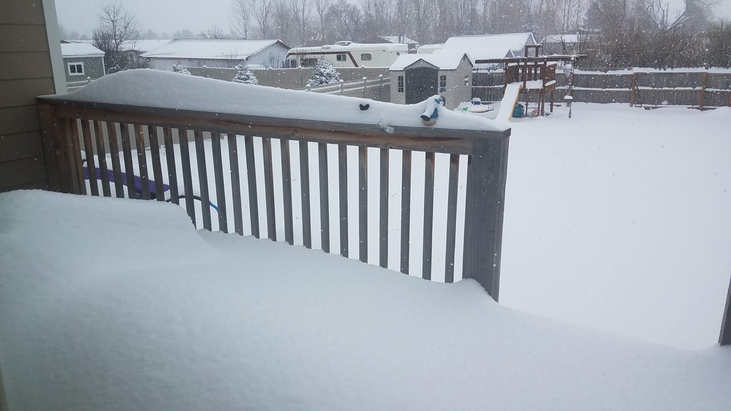
A spring storm system brought heavy snow and gusty winds to portions of the Black Hills, northeastern Wyoming, and western South Dakota from the evening of April 1st through April 2nd, 2020. Before the snow began, thunderstorms occurred over southwestern and south central South Dakota. These storms had small hail and gusty winds. As temperatures cooled Wednesday night, rain changed to freezing rain and snow across the area. Icing resulted in slippery roads and hazardous travel. By Thursday morning, several inches of snow had fallen across the area. A couple locations received a foot of snow. Gusts over 50 mph were reported, which created blowing and drifting snow. Snow and blowing snow continued into the afternoon of April 2nd, finally diminishing by evening. |
|
Photos
 |
 |
 |
 |
| Belle Fourche (Penny) |
Custer (Ellen) |
1 S Custer (Lori) |
Custer Highlands (Kamryn) |
 |
 |
 |
 |
| 2 SW Rapid City (Galen) |
Heart Ranch (Jeff and Marlene) |
Nemo Road (Jay) |
Nemo Road (Gabe) |
 |
 |
 |
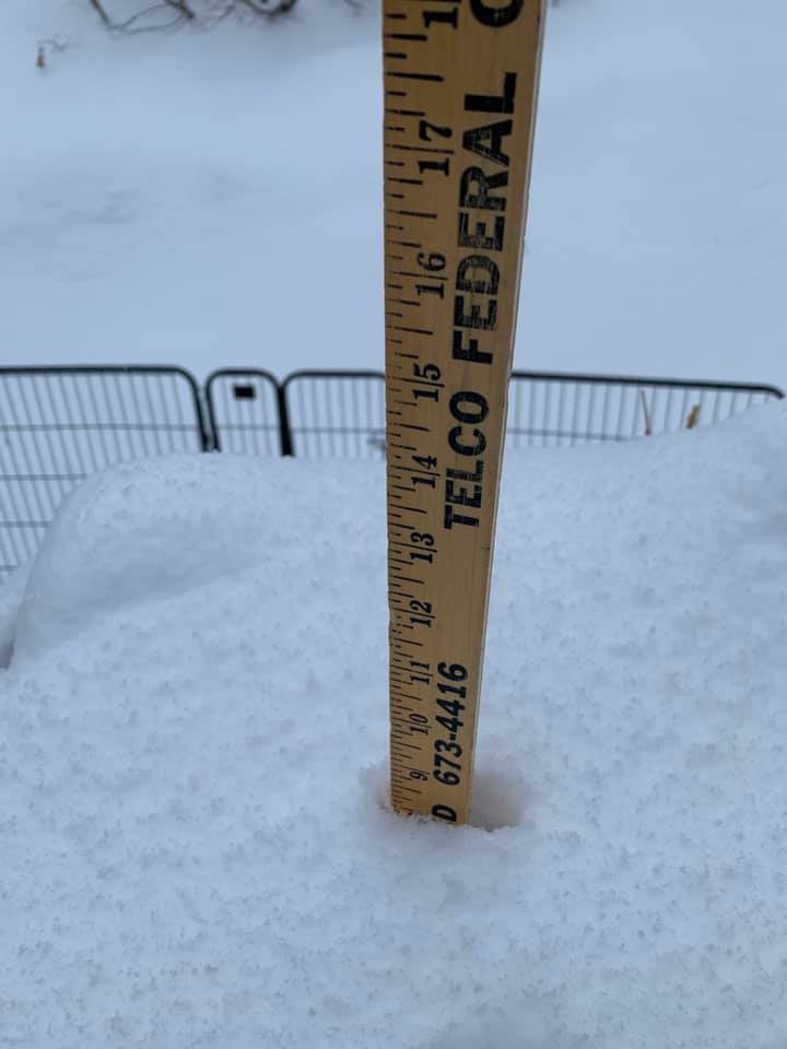 |
| Lead (Kay) |
Sheridan Lake Road (Ben) |
Spearfish (Alicia) |
Rockerville (Stacy) |
Radar
Storm Reports
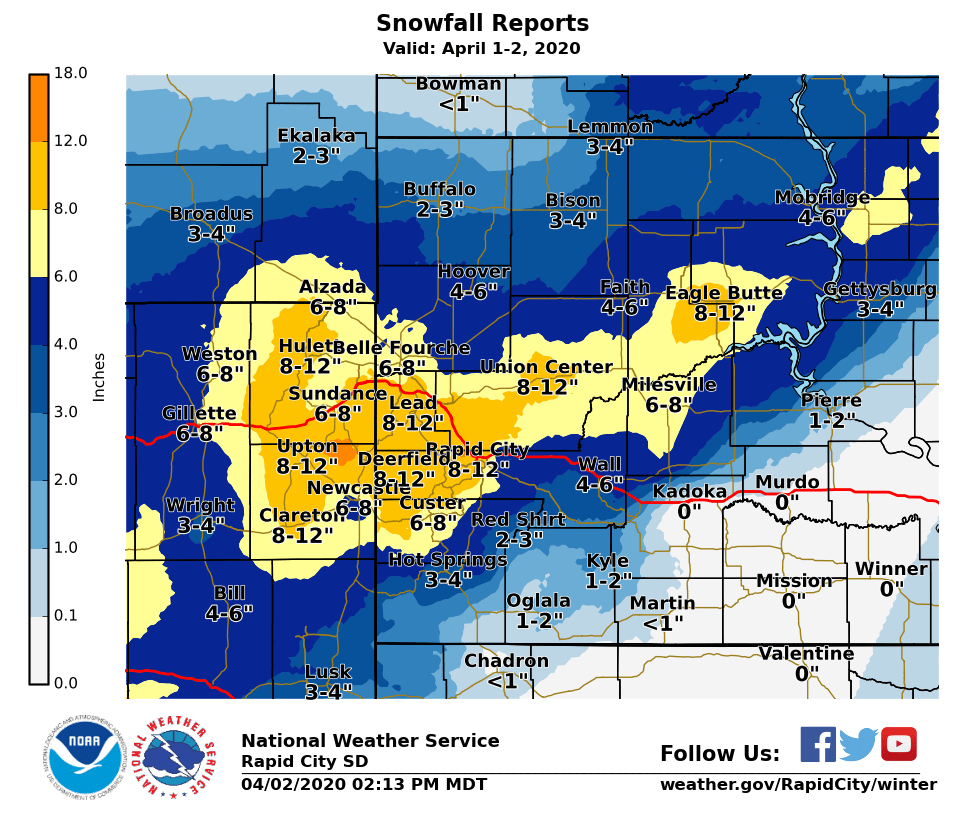
The storm reports listed below are in descending order and may not
necessarily be the final storm reports.

Snow reports listed by amount

 INCHES  LOCATION                 ST  COUNTY           TIME
 ------  -----------------------  --  --------------   -------
 12.20   7 W DWTN RAPID CITY      SD  PENNINGTON       0800 AM
 12.00   10 N OSAGE               WY  WESTON           0800 AM
 11.00   4 SE DEERFIELD           SD  PENNINGTON       0249 AM
 10.00   15 SSE DUPREE            SD  ZIEBACH          0800 AM
 10.00   3 WNW DWTN RAPID CITY    SD  PENNINGTON       0800 AM
 10.00   4 SSW HILL CITY          SD  PENNINGTON       0646 AM
  9.60   1 NNW PIEDMONT           SD  MEADE            1041 AM
  9.50   HILL CITY                SD  PENNINGTON       0856 AM
  9.50   PACTOLA RES              SD  PENNINGTON       0750 AM
  9.10   1 E DWTN RAPID CITY      SD  PENNINGTON       0148 PM
  9.00   SUNDANCE                 WY  CROOK            0846 AM
  9.00   7 W JEWEL CAVE           SD  CUSTER           0804 AM
  9.00   5 W ELLSWORTH AFB        SD  MEADE            0800 AM
  8.80   3 NNE JOHNSON SIDING     SD  PENNINGTON       0800 AM
  8.50   6 SSW LEAD               SD  LAWRENCE         0800 AM
  8.50   8 NW CUSTER              SD  CUSTER           0626 AM
  8.00   2 NNW SAINT ONGE         SD  LAWRENCE         0150 PM
  8.00   15 NNW ALVA              WY  CROOK            0111 PM
  8.00   BLACK HAWK               SD  MEADE            1100 AM
  8.00   9 NNW CREIGHTON          SD  PENNINGTON       1051 AM
  8.00   2 SW DWTN RAPID CITY     SD  PENNINGTON       1043 AM
  8.00   12 WSW HEREFORD          SD  MEADE            1017 AM
  8.00   6 SW BEULAH              WY  CROOK            0900 AM
  8.00   PINE HAVEN               WY  CROOK            0900 AM
  8.00   3 WNW DWTN SPEARFISH     SD  LAWRENCE         0800 AM
  8.00   LEAD                     SD  LAWRENCE         0755 AM
  8.00   4 NE ROCKERVILLE         SD  PENNINGTON       0743 AM
  8.00   2 SW ROCKERVILLE         SD  PENNINGTON       0741 AM
  8.00   2 W DWTN SPEARFISH       SD  LAWRENCE         0729 AM
  7.50   7 NNE ELLSWORTH AFB      SD  MEADE            1156 AM
  7.50   DWTN SPEARFISH           SD  LAWRENCE         0900 AM
  7.50   4 NE DWTN RAPID CITY     SD  PENNINGTON       0700 AM
  7.50   2 SW DWTN RAPID CITY     SD  PENNINGTON       0542 AM
  7.00   5 NE MILESVILLE          SD  HAAKON           0102 PM
  7.00   LEAD                     SD  LAWRENCE         0900 AM
  7.00   DWTN SPEARFISH           SD  LAWRENCE         0900 AM
  7.00   2 NW DWTN RAPID CITY     SD  PENNINGTON       0800 AM
  7.00   2 W CUSTER               SD  CUSTER           0730 AM
  7.00   7 SW RAPID CITY ARPT     SD  PENNINGTON       0628 AM
  7.00   4 S DWTN RAPID CITY      SD  PENNINGTON       0600 AM
  6.90   5 SW DWTN RAPID CITY     SD  PENNINGTON       0800 AM
  6.50   13 SSW NEWCASTLE         WY  WESTON           0800 AM
  6.30   ARGYLE                   SD  CUSTER           1248 PM
  6.00   6 NNW KIRLEY             SD  HAAKON           0127 PM
  6.00   8 W KIRLEY               SD  HAAKON           0103 PM
  6.00   1 S PHILIP               SD  HAAKON           0102 PM
  6.00   7 E CREIGHTON            SD  PENNINGTON       1257 PM
  6.00   7 SE MUD BUTTE           SD  MEADE            1250 PM
  6.00   14 SSE ROZET             WY  CAMPBELL         1101 AM
  6.00   3 S DWTN RAPID CITY      SD  PENNINGTON       0833 AM
  6.00   10 ENE DWTN GILLETTE     WY  CAMPBELL         0800 AM
  6.00   5 SSW DWTN GILLETTE      WY  CAMPBELL         0800 AM
  6.00   DWTN GILLETTE            WY  CAMPBELL         0642 AM
  5.70   1 SSE BELLE FOURCHE      SD  BUTTE            0800 AM
  5.60   11 NE WESTON             WY  CAMPBELL         0800 AM
  5.50   3 NE WHITEWOOD           SD  LAWRENCE         1241 PM
  5.50   1 NE DWTN GILLETTE       WY  CAMPBELL         0800 AM
  5.50   5 E PIEDMONT             SD  MEADE            0800 AM
  5.50   CUSTER                   SD  CUSTER           0744 AM
  5.30   8 SE MUD BUTTE           SD  MEADE            0900 AM
  5.00   8 S SAVAGETON            WY  CAMPBELL         1050 AM
  5.00   1 W NEWCASTLE            WY  WESTON           0900 AM
  5.00   1 ESE NEWCASTLE          WY  WESTON           0900 AM
  5.00   2 NE BOX ELDER           SD  PENNINGTON       0900 AM
  5.00   1 SW HERMOSA             SD  CUSTER           0853 AM
  5.00   9 SE NEWELL              SD  BUTTE            0805 AM
  5.00   7 NNW DWTN SPEARFISH     SD  LAWRENCE         0800 AM
  5.00   4 E NEWCASTLE            WY  WESTON           0700 AM
  4.50   WALL                     SD  PENNINGTON       1255 PM
  4.50   19 SE WRIGHT             WY  CAMPBELL         1057 AM
  4.50   9 WSW RED ELM            SD  ZIEBACH          0830 AM
  4.50   4 NNW WHITEWOOD          SD  LAWRENCE         0630 AM
  4.00   1 WNW HOOVER             SD  BUTTE            0107 PM
  4.00   9 SSE DWTN GILLETTE      WY  CAMPBELL         1059 AM
  4.00   WRIGHT                   WY  CAMPBELL         1041 AM
  4.00   4 SSE WASTA              SD  PENNINGTON       0900 AM
  4.00   ORAL                     SD  FALL RIVER       0700 AM
  4.00   OPAL                     SD  MEADE            0700 AM
  4.00   SUNDANCE                 WY  CROOK            0700 AM
  3.50   14 SSW RED SHIRT         SD  OGLALA LAKOTA    0115 PM
  3.50   CAMP CROOK               SD  HARDING          0109 PM
  3.50   HERMOSA                  SD  CUSTER           0700 AM
  3.00   1 E WRIGHT               WY  CAMPBELL         1044 AM
  3.00   9 SSE SORUM              SD  PERKINS          0800 AM
  3.00   4 W HOT SPRINGS          SD  FALL RIVER       0800 AM
  3.00   EDGEMONT                 SD  FALL RIVER       0700 AM
  2.50   1 W NEWCASTLE            WY  WESTON           0800 AM
  2.50   HOT SPRINGS              SD  FALL RIVER       0800 AM
  2.00   EDGEMONT                 SD  FALL RIVER       0800 AM
  2.00   8 NNW USTA               SD  PERKINS          0800 AM
  2.00   3 E KYLE                 SD  OGLALA LAKOTA    0700 AM
  1.50   1 W ALLEN                SD  BENNETT          0136 PM
  1.50   14 SSW RED SHIRT         SD  OGLALA LAKOTA    0134 PM
  1.40   5 SW LODGEPOLE           SD  PERKINS          0750 AM
  1.00   OELRICHS                 SD  FALL RIVER       0140 PM
  1.00   3 WNW KADOKA             SD  JACKSON          0630 AM


Sustained wind reports listed by speed (mph)

 SPEED   LOCATION                 ST  COUNTY           TIME
 ------  -----------------------  --  --------------   -------
 41.00   15 SSE MISSION           SD  TODD             1256 AM
 40.00   1 WSW RED ELM            SD  ZIEBACH          1004 AM


Wind gust reports listed by speed (mph)

 SPEED   LOCATION                 ST  COUNTY           TIME
 ------  -----------------------  --  --------------   -------
 53.00   RAPID CITY ARPT          SD  PENNINGTON       0422 AM
 51.00   15 SSE MISSION           SD  TODD             0101 AM
 50.00   2 SW BRIDGER             SD  ZIEBACH          1045 PM
 |
Media use of NWS Web News Stories is encouraged! Please acknowledge the NWS as the source of any news information accessed from this site. |
|