
Severe thunderstorms capable of large to very hail and damaging winds are possible from parts of the northern High Plains into lower elevations of the northern and central Plains Thursday afternoon into night. Thunderstorms with heavy to excessive rainfall may produce flooding over a part of the Midwest Thursday. Read More >
Overview
|
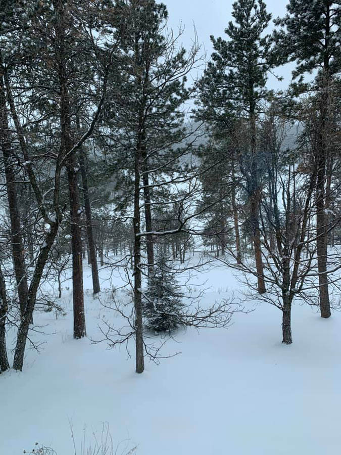
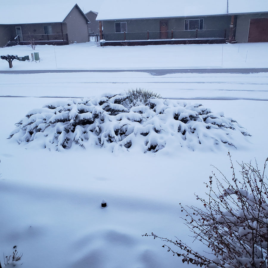
Early on April 11, 2020 a spring storm moved from southwestern Canada into the northern plains. Rain initially developed ahead of the system early Saturday morning. A cold front moved from northeast to southwest across the area Saturday, changing the rain to snow. Moderate to heavy snow fell Saturday night across the region, with 1-inch per hour snowfall rates at times. The snow tapered off quickly Easter Sunday morning, April 12, 2020. |
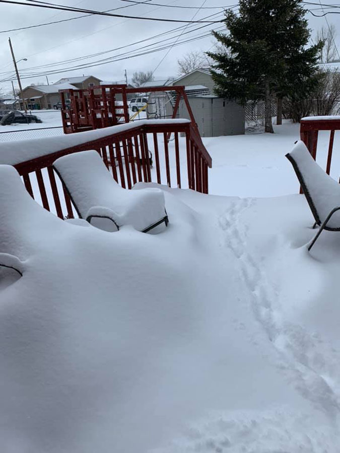
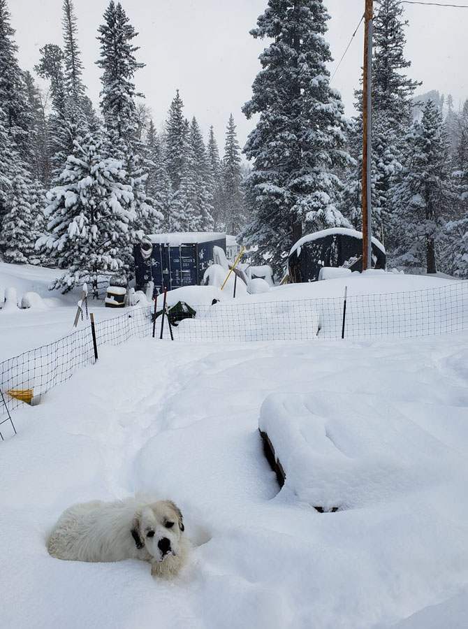 2S Lead, SD Courtesy Bill H. |
Photos & Video
 |
 |
 |
 |
| 1.5SE Rockerville, SD Courtesy Stacy S. |
1S Deadwood, SD Courtesy Bil S. |
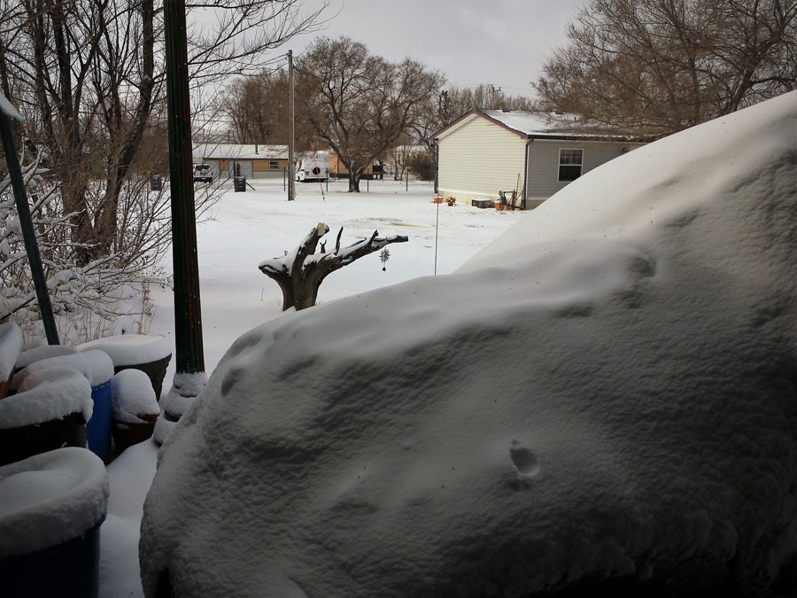
Between Tilford and Piedmont, SD Courtesy Jean A. |
Black Hawk, SD Courtesy Wendy S. |
 |
 |
 |
 |
| Box Elder, SD Courtesy Meri C. |
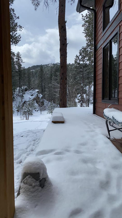
Keystone, SD Courtesy Christine S. |
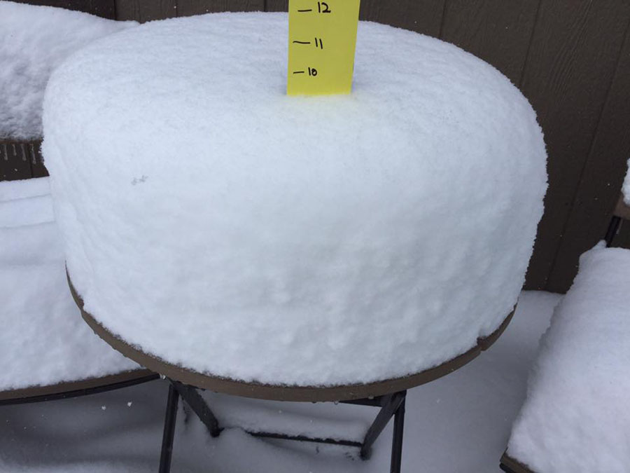
Piedmont, SD Courtesy Gale H. |
Spearfish, SD Courtesy Vicki B. |
Radar
Storm Reports
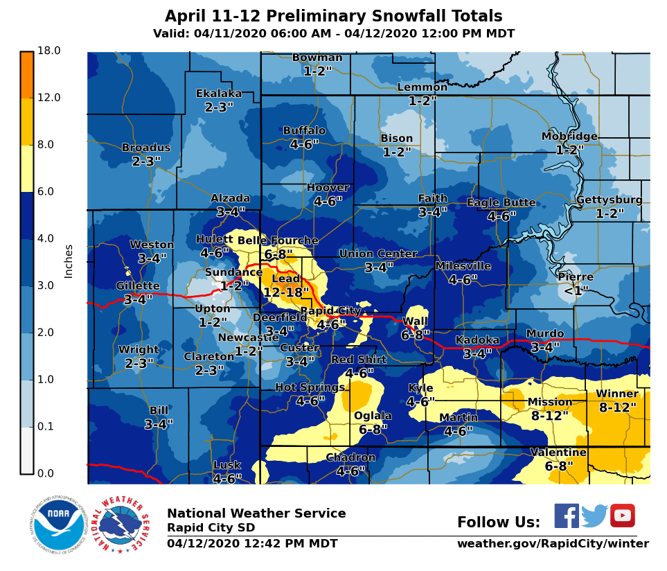
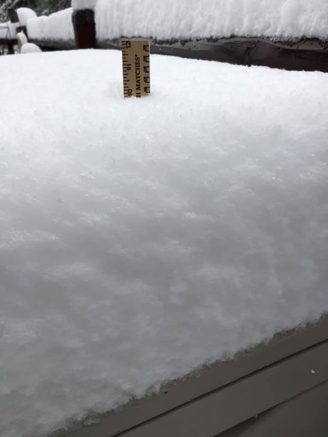
The storm reports listed below are in descending order and may not
necessarily be the final storm reports.

Snow reports listed by amount

 INCHES  LOCATION                 ST  COUNTY           TIME
 ------  -----------------------  --  --------------   -------
 15.00   1 S DEADWOOD             SD  LAWRENCE         0843 AM
 13.00   LEAD                     SD  LAWRENCE         0900 AM
 12.00   2 S LEAD                 SD  LAWRENCE         1111 AM
 10.90   1 NW PIEDMONT            SD  MEADE            0920 AM
 10.00   2 NNW SAINT ONGE         SD  LAWRENCE         1054 AM
 10.00   14 SSW RED SHIRT         SD  OGLALA LAKOTA    0955 AM
 10.00   BLACK HAWK               SD  MEADE            0906 AM
 10.00   6 SSW LEAD               SD  LAWRENCE         0800 AM
  9.50   1 SSW BELLE FOURCHE      SD  BUTTE            0826 AM
  9.40   5 ESE NORRIS             SD  MELLETTE         0814 AM
  9.00   COLOME                   SD  TRIPP            0940 AM
  9.00   DWTN SPEARFISH           SD  LAWRENCE         0909 AM
  9.00   2 W DWTN SPEARFISH       SD  LAWRENCE         0907 AM
  9.00   9 ENE WEWELA             SD  TRIPP            0700 AM
  8.00   6 SW BEULAH              WY  CROOK            0900 AM
  8.00   7 W DWTN RAPID CITY      SD  PENNINGTON       0800 AM
  8.00   2 SSW NORRIS             SD  MELLETTE         0800 AM
  7.90   DWTN SPEARFISH           SD  LAWRENCE         0900 AM
  7.80   JOHNSON SIDING           SD  PENNINGTON       1004 AM
  7.50   STURGIS                  SD  MEADE            0828 AM
  7.50   3 WNW DWTN RAPID CITY    SD  PENNINGTON       0800 AM
  7.50   3 WNW DWTN SPEARFISH     SD  LAWRENCE         0800 AM
  7.50   1 SSE BELLE FOURCHE      SD  BUTTE            0800 AM
  7.50   2 W DWTN SPEARFISH       SD  LAWRENCE         0721 AM
  7.50   1 SSW RAPID VALLEY       SD  PENNINGTON       0600 AM
  7.30   3 NNE JOHNSON SIDING     SD  PENNINGTON       0800 AM
  7.00   WHITEWOOD                SD  LAWRENCE         0908 AM
  6.50   8 SE INTERIOR            SD  JACKSON          0845 AM
  6.50   4 NNW WHITEWOOD          SD  LAWRENCE         0700 AM
  6.20   14 NNW DWTN GILLETTE     WY  CAMPBELL         0800 AM
  6.20   7 NNW DWTN SPEARFISH     SD  LAWRENCE         0800 AM
  6.20   7 NNW DWTN SPEARFISH     SD  LAWRENCE         0800 AM
  6.00   FARMINGDALE              SD  PENNINGTON       1101 AM
  6.00   WALL                     SD  PENNINGTON       1042 AM
  6.00   7 ENE WASTA              SD  PENNINGTON       1037 AM
  6.00   OGLALA                   SD  OGLALA LAKOTA    0956 AM
  6.00   2 SE ROCKERVILLE         SD  PENNINGTON       0842 AM
  6.00   1 N BELLE FOURCHE        SD  BUTTE            0829 AM
  6.00   PACTOLA RES              SD  PENNINGTON       0800 AM
  6.00   4 S DWTN RAPID CITY      SD  PENNINGTON       0745 AM
  6.00   3 E KYLE                 SD  OGLALA LAKOTA    0700 AM
  6.00   7 N WOOD                 SD  MELLETTE         0700 AM
  5.90   1 E DWTN RAPID CITY      SD  PENNINGTON       0855 AM
  5.50   5 WNW HERMOSA            SD  CUSTER           0952 AM
  5.50   2 NE BOX ELDER           SD  PENNINGTON       0900 AM
  5.10   5 SW DWTN RAPID CITY     SD  PENNINGTON       0800 AM
  5.00   KEYSTONE                 SD  PENNINGTON       1206 PM
  5.00   1 E NEWELL               SD  BUTTE            1137 AM
  5.00   3 SSE SILVER CITY        SD  PENNINGTON       1136 AM
  5.00   5 ESE ELM SPRINGS        SD  MEADE            1126 AM
  5.00   BOX ELDER                SD  PENNINGTON       0908 AM
  5.00   EDGEMONT                 SD  FALL RIVER       0800 AM
  5.00   5 E PIEDMONT             SD  MEADE            0730 AM
  5.00   9 N CEDAR BUTTE          SD  MELLETTE         0700 AM
  4.80   HILL CITY                SD  PENNINGTON       0700 AM
  4.50   7 NNE ELLSWORTH AFB      SD  MEADE            1135 AM
  4.50   14 SSE DUPREE            SD  ZIEBACH          1018 AM
  4.50   4 W HOT SPRINGS          SD  FALL RIVER       0800 AM
  4.20   HOT SPRINGS              SD  FALL RIVER       0800 AM
  4.00   7 NNE CAMP CROOK         SD  HARDING          1126 AM
  4.00   BUFFALO                  SD  HARDING          1124 AM
  4.00   1 WNW HOOVER             SD  BUTTE            1121 AM
  4.00   6 SSW ELM SPRINGS        SD  MEADE            1104 AM
  4.00   SHARPS CORNER            SD  OGLALA LAKOTA    1103 AM
  4.00   4 SE FOLSOM              SD  CUSTER           1059 AM
  4.00   2 NE KADOKA              SD  JACKSON          1053 AM
  4.00   19 S QUINN               SD  PENNINGTON       1050 AM
  4.00   5 E ELM SPRINGS          SD  MEADE            1048 AM
  4.00   1 SSW PINE RIDGE         SD  OGLALA LAKOTA    0958 AM
  4.00   ARGYLE                   SD  CUSTER           0725 AM
  4.00   ORAL                     SD  FALL RIVER       0700 AM
  4.00   EDGEMONT                 SD  FALL RIVER       0700 AM
  3.50   2 W CUSTER               SD  CUSTER           1137 AM
  3.50   8 NW CUSTER              SD  CUSTER           0730 AM
  3.50   3 WNW KADOKA             SD  JACKSON          0630 AM
  3.10   2 SW KEYSTONE            SD  PENNINGTON       1158 PM
  3.00   3 SSE HARDING            SD  HARDING          1159 AM
  3.00   WASTA                    SD  PENNINGTON       1133 AM
  3.00   10 NW CLARETON           WY  WESTON           1119 AM
  3.00   11 ESE RENO JUNCTION     WY  CAMPBELL         1117 AM
  3.00   10 WNW PINE TREE JUNCTI  WY  CAMPBELL         1114 AM
  3.00   9 NNW CREIGHTON          SD  PENNINGTON       1044 AM
  3.00   15 NW EDGEMONT           SD  FALL RIVER       1030 AM
  3.00   6 N NORRIS               SD  MELLETTE         1007 AM
  3.00   7 SW RAPID CITY ARPT     SD  PENNINGTON       0959 AM
  3.00   DWTN GILLETTE            WY  CAMPBELL         0939 AM
  3.00   13 SSW NEWCASTLE         WY  WESTON           0800 AM
  3.00   OPAL                     SD  MEADE            0700 AM
  3.00   8 E MARTIN               SD  BENNETT          0600 AM
  2.50   2 S DEVILS TOWER         WY  CROOK            1138 AM
  2.50   7 ENE ROCHELLE           WY  WESTON           1119 AM
  2.50   1 WNW CLARETON           WY  WESTON           0800 AM
  2.30   11 NE WESTON             WY  CAMPBELL         0800 AM
  2.00   1 E WRIGHT               WY  CAMPBELL         1116 AM
  2.00   8 NNW USTA               SD  PERKINS          0800 AM
  1.80   SUNDANCE                 WY  CROOK            0700 AM
  1.50   3 S REDIG                SD  HARDING          1123 AM
  1.20   5 SW LODGEPOLE           SD  PERKINS          0600 AM
  1.00   1 W NEWCASTLE            WY  WESTON           0800 AM
  1.00   4 E NEWCASTLE            WY  WESTON           0700 AM
 |
Media use of NWS Web News Stories is encouraged! Please acknowledge the NWS as the source of any news information accessed from this site. |
|

