
Dangerous heat will expand from the Gulf Coast into the Southern Plains and Desert Southwest through week's end. Additional extreme heat impacting the Pacific Northwest will shift to the northern Plains by the weekend. Tropical Storm Bertha is expected to continue to impact portions of the northern Gulf Coast from the western Florida Panhandle to southeastern Louisiana through tonight. Read More >
Overview
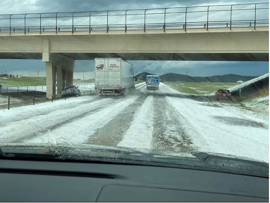
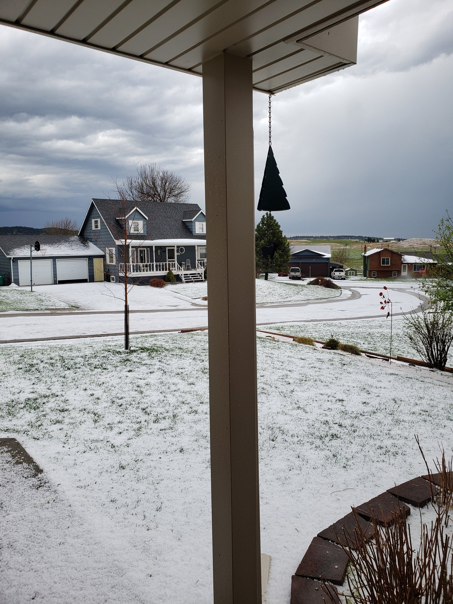
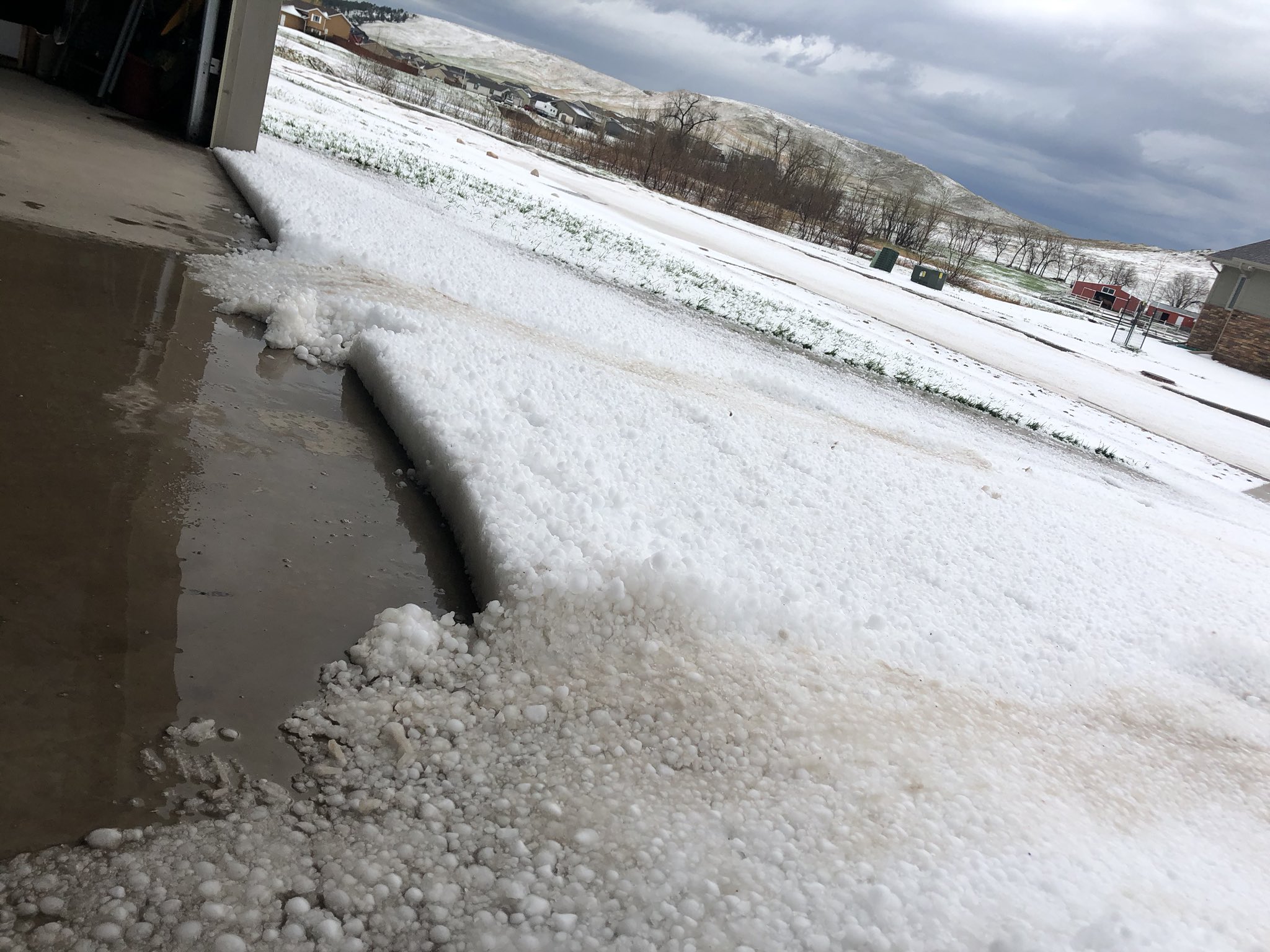
On May 3, 2020, scattered severe thunderstorms brought large hail to portions of the Black Hills, western South Dakota plains, and northeastern Wyoming. The largest hail reported occurred in Jackson County between Potato Creek and Wanblee, where tennis ball to baseball sized hail was reported. Accumulating hail was also observed in the Black Hills foothills and western plains as several inches of hail covered the ground and roads from Black Hawk southward to northern portions of Rapid City and points southeast.
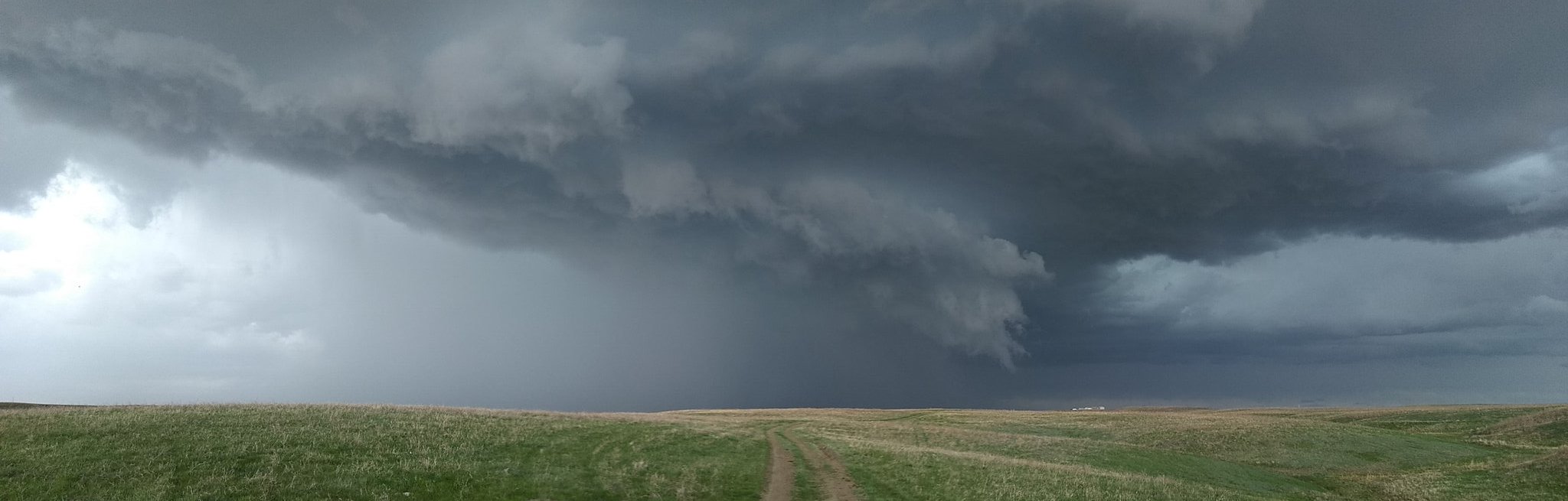 |
| Panoramic view of a severe thunderstorm near Caputa. Image courtesy of Craig Birnie. |
Hail Photos
 |
 |
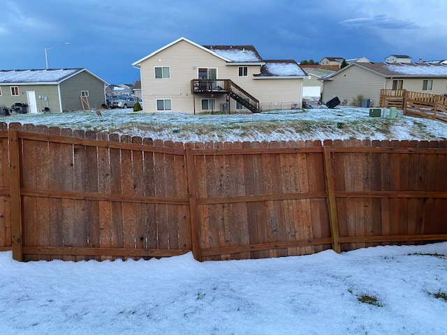 |
| Accumulated hail near Black Hawk (courtesy Jen Kuyper) |
Accumulated hail (courtesy Pat Gerdes) |
Accumulated hail and drifts in Box Elder (courtesy Matt Thompson) |
 |
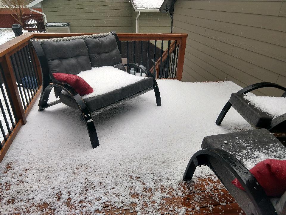 |
| Accumulated hail (courtesy Jordan Johnson) |
Accumulated hail in north Rapid City (courtesy Katie Pojorlie) |
Radar
| Radar loop of the severe storms over and near the Black Hills during the afternoon of May 3, 2020. |
Storm Reports
HAIL REPORTS LISTED BY SIZE (INCHES)

 SIZE    LOCATION                 ST  COUNTY           TIME
 ------  -----------------------  --  --------------   -------
  2.75   5 NNE POTATO CREEK       SD  JACKSON          0705 PM
  1.75   4 NE FARMINGDALE         SD  PENNINGTON       0502 PM
  1.75   STURGIS                  SD  MEADE            0336 PM
  1.50   4 WNW RAPID CITY ARPT    SD  PENNINGTON       0425 PM
  1.50   3 N DWTN RAPID CITY      SD  PENNINGTON       0407 PM
  1.50   3 N DWTN RAPID CITY      SD  PENNINGTON       0406 PM
  1.50   3 E BLACK HAWK           SD  MEADE            0402 PM
  1.25   6 WSW LONG VALLEY        SD  JACKSON          0753 PM
  1.25   8 WSW WANBLEE            SD  JACKSON          0734 PM
  1.25   4 E BLACK HAWK           SD  MEADE            0400 PM
  1.25   3 ENE DEADWOOD           SD  LAWRENCE         0250 PM
  1.00   13 NNW VETAL             SD  BENNETT          0813 PM
  1.00   19 S QUINN               SD  PENNINGTON       0640 PM
  1.00   4 S HILL CITY            SD  PENNINGTON       0632 PM
  1.00   8 NE SCENIC              SD  PENNINGTON       0600 PM
  1.00   3 SSE DWTN RAPID CITY    SD  PENNINGTON       0500 PM
  1.00   1 NNE UPTON              WY  WESTON           0404 PM
  1.00   4 N DWTN RAPID CITY      SD  PENNINGTON       0400 PM
  1.00   4 E BLACK HAWK           SD  MEADE            0354 PM
  1.00   BLACK HAWK               SD  MEADE            0338 PM
  1.00   STURGIS                  SD  MEADE            0331 PM
  1.00   STURGIS                  SD  MEADE            0320 PM
  1.00   SUMMERSET                SD  MEADE            0318 PM
  1.00   SUMMERSET                SD  MEADE            0310 PM
  0.88   1 NNE UPTON              WY  WESTON           0400 PM
  0.88   12 W UPTON               WY  WESTON           0330 PM
  0.88   DEADWOOD                 SD  LAWRENCE         0248 PM
  0.70   5 ENE CUSTER             SD  CUSTER           0640 PM
  0.70   NEW UNDERWOOD            SD  PENNINGTON       0509 PM
  0.70   DWTN RAPID CITY          SD  PENNINGTON       0452 PM
  0.70   3 N JOHNSON SIDING       SD  PENNINGTON       0325 PM
  0.50   5 S HARDING              SD  HARDING          0715 PM
  0.25   6 SW HERMOSA             SD  CUSTER           0710 PM
 |
Media use of NWS Web News Stories is encouraged! Please acknowledge the NWS as the source of any news information accessed from this site. |
|

