
Numerous severe thunderstorms are expected across a broad region from the Ohio Valley to the Mid-Atlantic and Northeast States today into tonight. Swaths of damaging wind gusts are expected and some tornadoes are possible. Bertha is expected to bring tropical storm conditions to portions of the Gulf Coast from the Florida Panhandle westward to southeastern Louisiana later today and Wednesday. Read More >
Overview
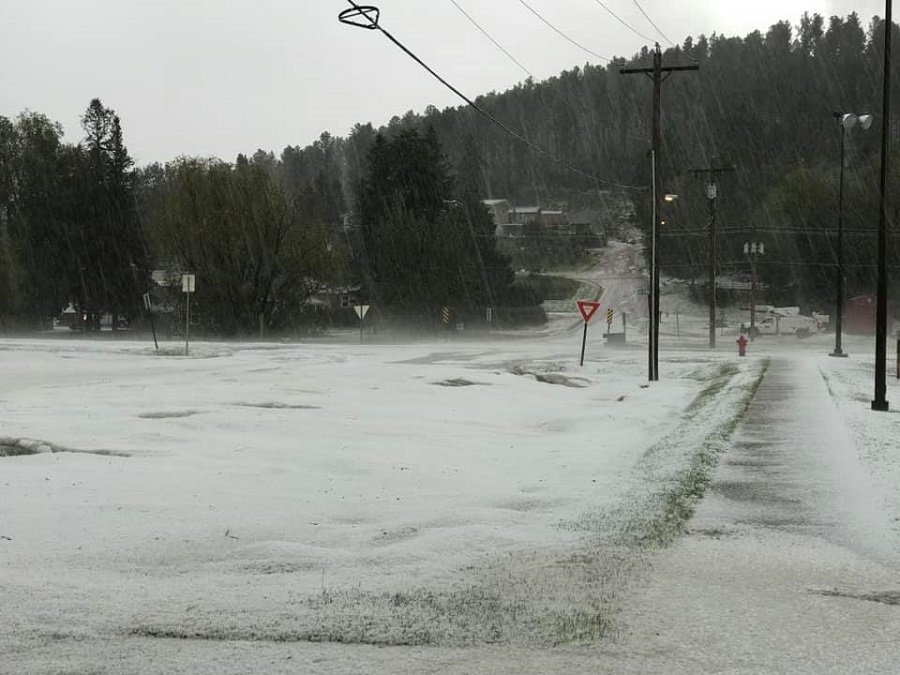
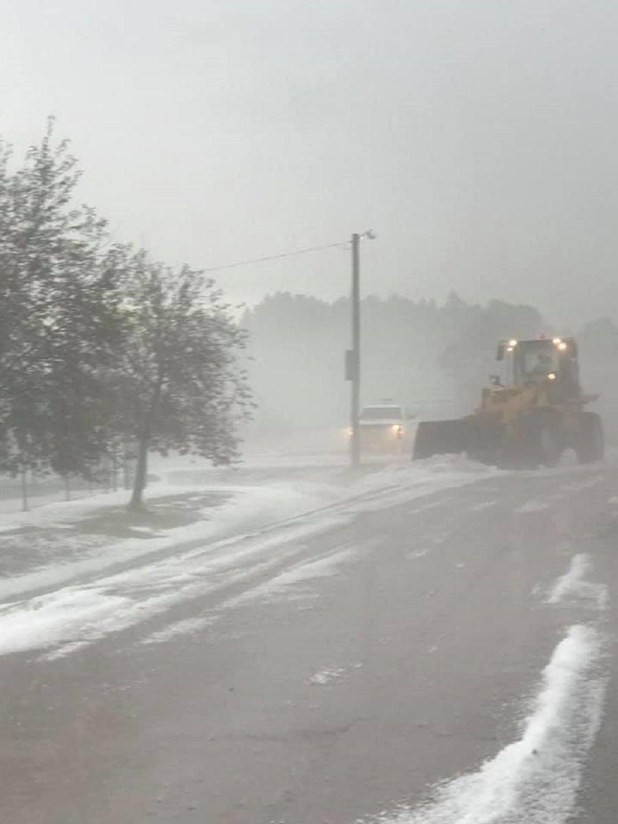
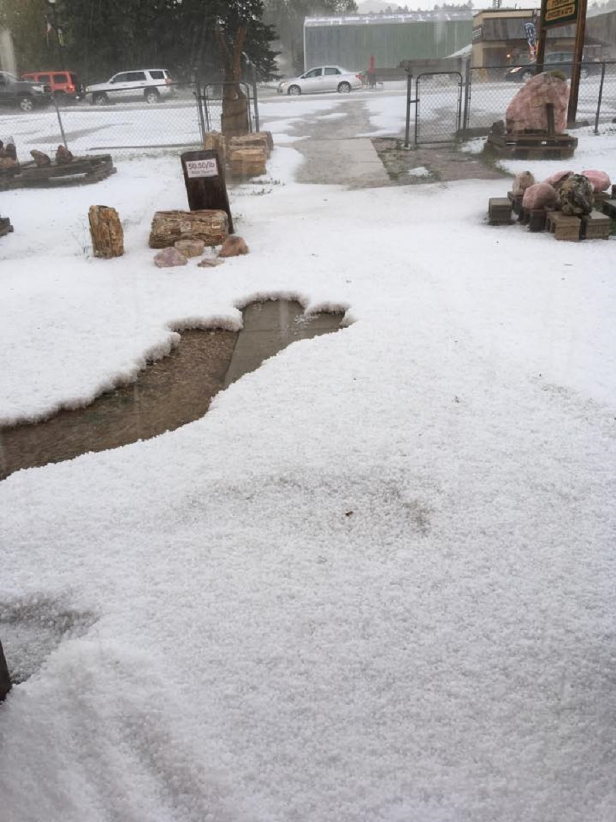
In the early afternoon of June 25, 2020, a severe thunderstorm developed over Custer. Hail reports ranged in size from peas to golf balls, and the massive amounts of hail that accumulated forced plows to clear roads. In addition, the combination of heavy rain and accumulating hail caused some flooding around Custer.
Photos & Video
Hail
 |
 |
 |
| courtesy Custer County Sheriff | courtesy Custer County Sheriff | courtesy Custer County Sheriff |
 |
 |
||
| courtesy Custer County Sheriff | courtesy Susan Parker |
Storm Photo
 |
|||
| courtesy Jim Strain |
Videos
Hail no. ðŸ¤¦â™€ï¸ #wx #sdwx #weather #kotaweather @NWSRapidCity @KOTAWeather @NewsCenter1 @WeatherNation pic.twitter.com/LzTlvqOwFY
— Nature Tech Family (@naturetechfam) June 25, 2020
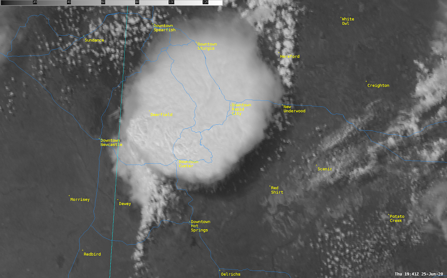
Radar and Satellite
Radar
Satellite
 |
 |
Media use of NWS Web News Stories is encouraged! Please acknowledge the NWS as the source of any news information accessed from this site. |
|

