
Dangerous heat will expand from the Gulf Coast into the Southern Plains and Desert Southwest through week's end. Additional extreme heat impacting the Pacific Northwest will shift to the northern Plains by the weekend. Tropical Storm Bertha is expected to continue to impact portions of the northwestern Gulf Coast from south central Louisiana to the upper Texas coast today. Read More >
Overview
|
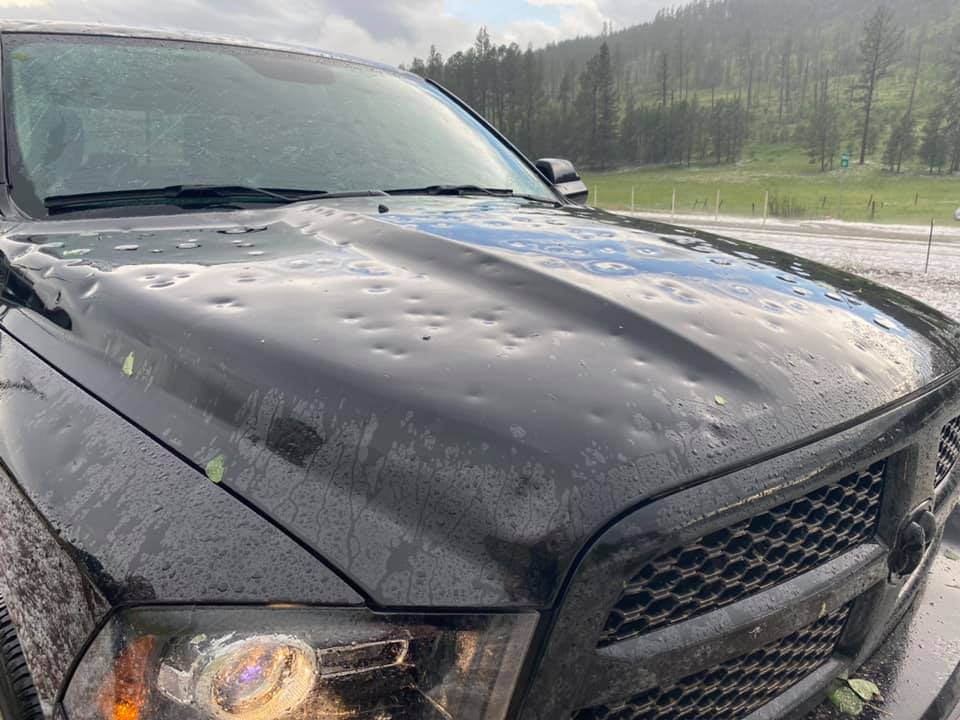
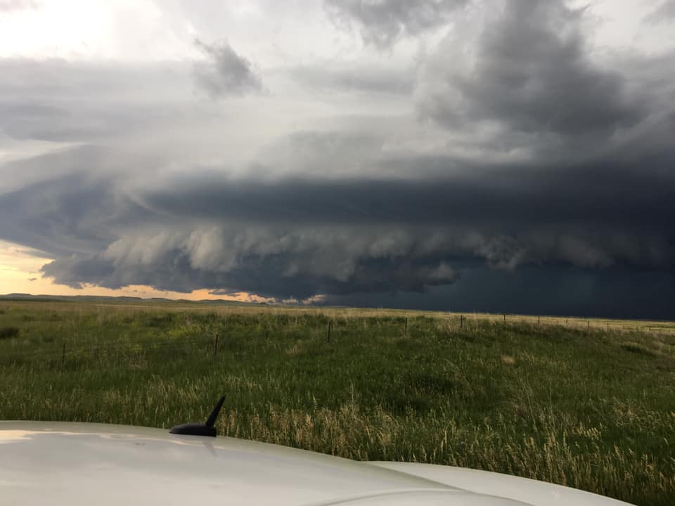
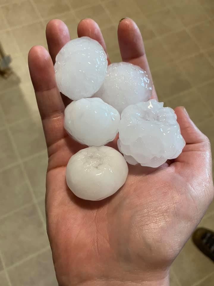
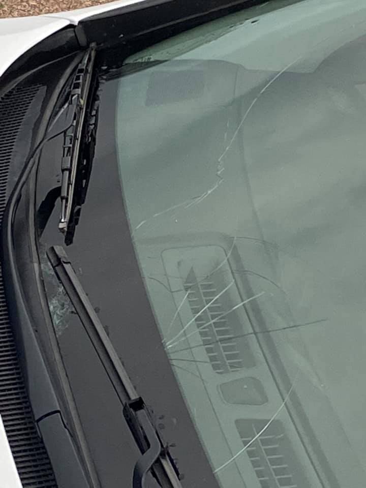
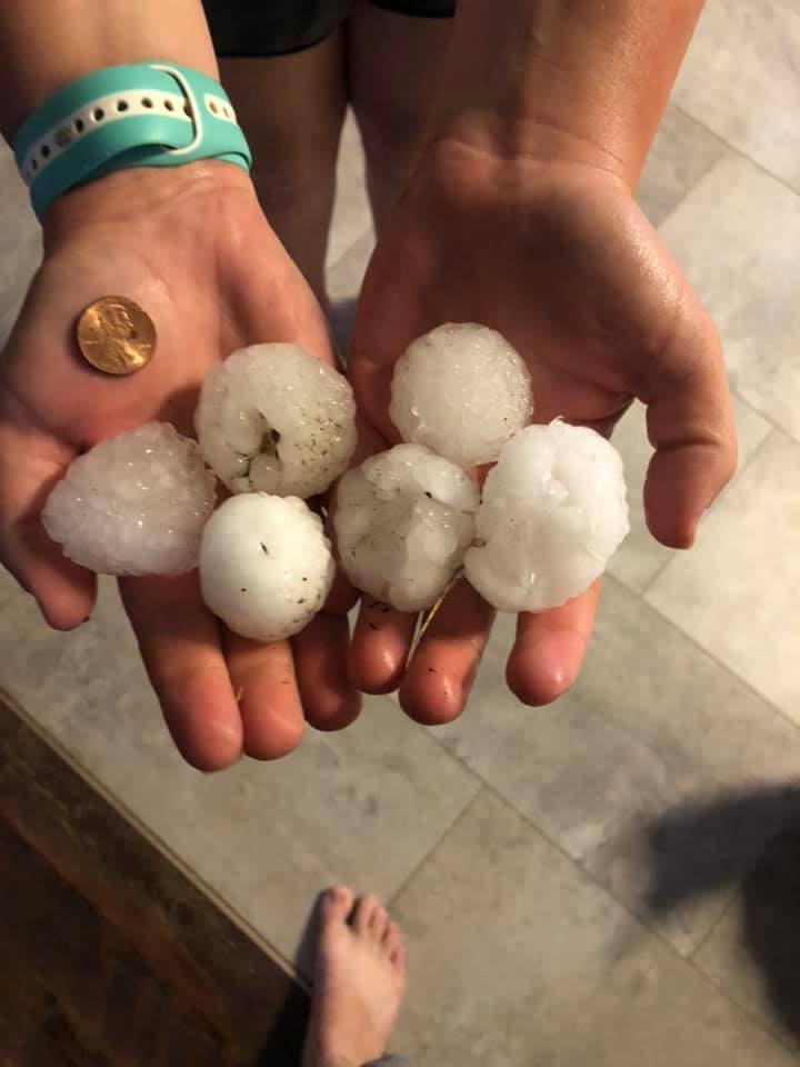
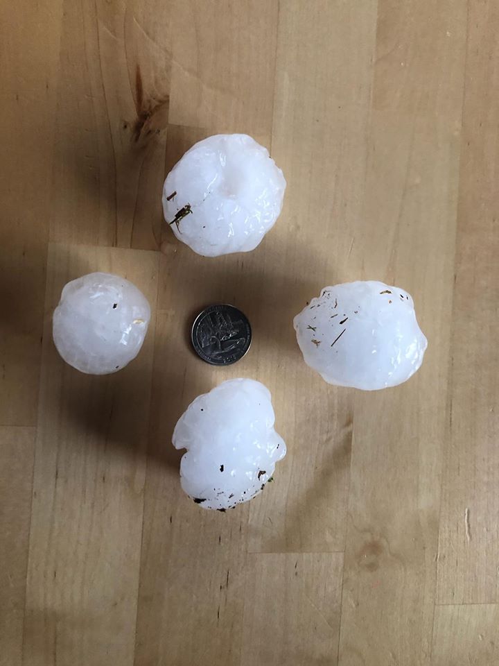
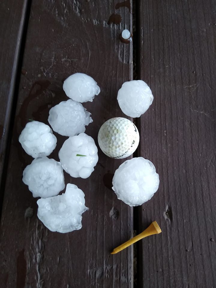
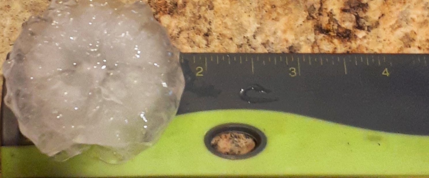
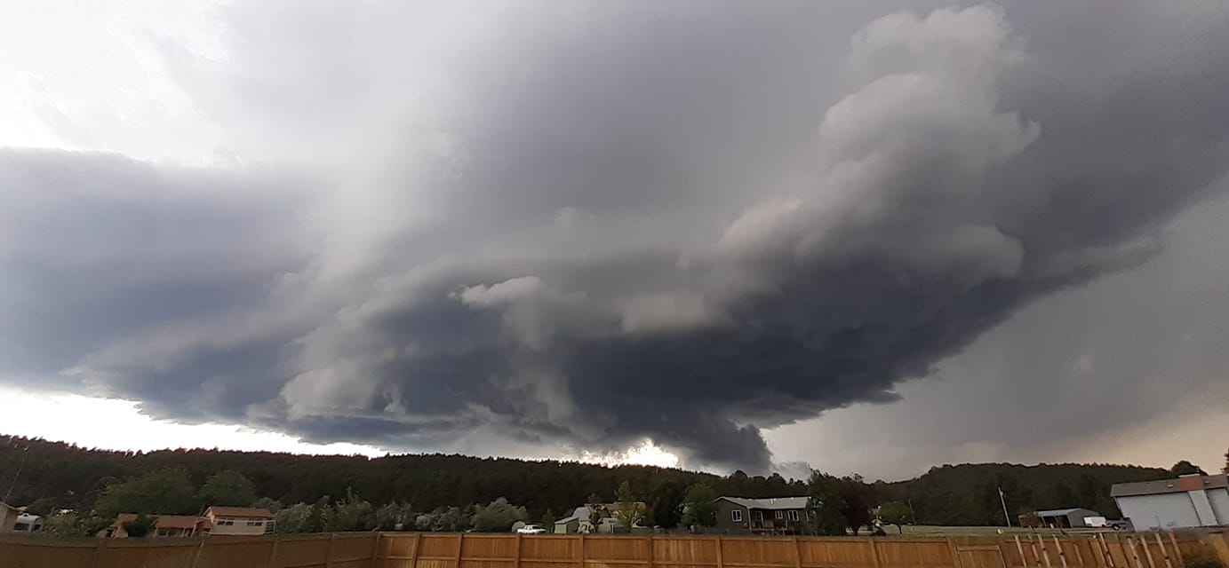
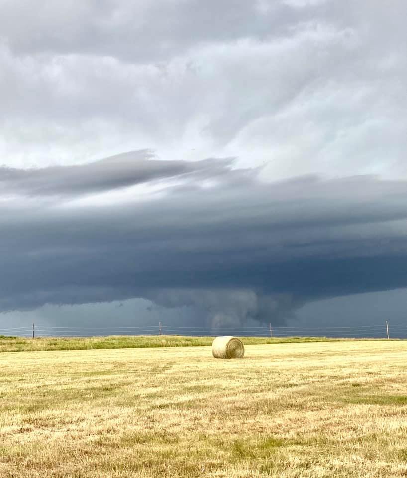
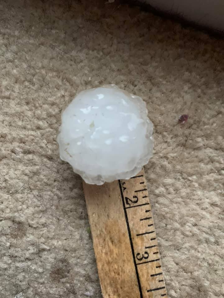
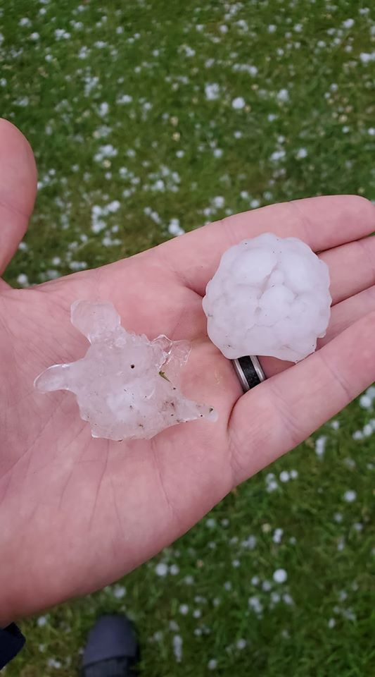
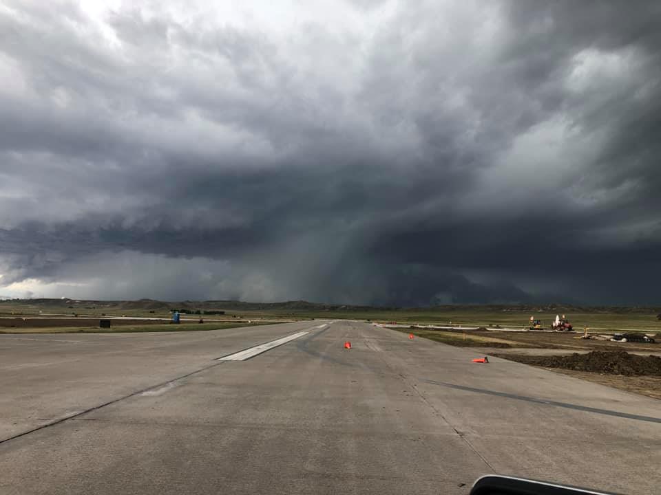
In the afternoon and evening of Sunday, June 28th, 2020, thunderstorms developed across northeastern WY, and moved across western SD. Several locations received damaging hail and winds. The largest hail reported was 2.25 inches, and the strongest wind reported was 83 mph. Several roofs were blown off, and hail damage was sustained to buildings and cars. Storms gradually dissipated as they shifted east Sunday evening. |
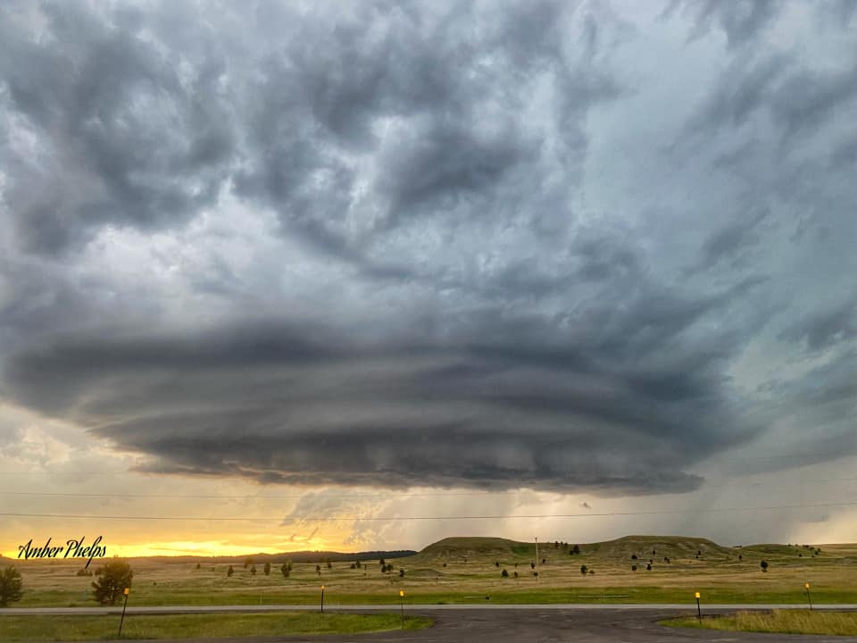 Rapid City (A. Phelps) |
Photos
 |
 |
 |
 |
| Merritt (S. Schell) |
Merritt (S. Schell) |
Newell (J. Bernstein) |
Black Hawk (S. Fleming Solano) |
 |
 |
 |
 |
| Nemo (P. Wiley) |
Nisland (A. Kaye) |
Black Hawk (K. Dowling) |
Black Hawk (K. Larsen Anderson) |
 |
 |
 |
 |
| Piedmont (A. Schwab) |
Piedmont (A. Reed) |
Piedmont (E. Bohnenkamp) |
Piedmont (J. LaPlante) |
 |
 |
 |
 |
| Piedmont (L. Hart Brewer) |
Summerset (D. Hoiten) |
Summerset (K. Peterson) |
Summeset (K. Peterson) |
 |
 |
 |
 |
| Belle Fourche (J. and H. Williams) |
Custer (M. Czarnek) |
Custer (T. Parsons) |
Gillette Airport (L.B. Bourne) |
Radar
Storm Reports
The storm reports listed below are in descending order and may not
necessarily be the final storm reports.

Hail reports listed by size (inches)

 SIZE    LOCATION                 ST  COUNTY           TIME
 ------  -----------------------  --  --------------   -------
  2.25   PIEDMONT                 SD  MEADE            0615 PM
  2.00   SUMMERSET                SD  MEADE            0615 PM
  2.00   4 N SILVER CITY          SD  LAWRENCE         0550 PM
  1.75   CUSTER                   SD  CUSTER           0733 PM
  1.75   PIEDMONT                 SD  MEADE            0613 PM
  1.75   1 NNW PIEDMONT           SD  MEADE            0610 PM
                 LOTS OF HALF DOLLAR SIZE HAIL
  1.75   11 E DEVILS TOWER        WY  CROOK            0405 PM
  1.50   4 NW HILL CITY           SD  PENNINGTON       0740 PM
  1.50   1 NNW PIEDMONT           SD  MEADE            0609 PM
  1.50   2 N NISLAND              SD  BUTTE            0520 PM
  1.25   4 S DWTN RAPID CITY      SD  PENNINGTON       0817 PM
  1.25   2 W HAYWARD              SD  PENNINGTON       0800 PM
  1.25   3 ENE CUSTER             SD  CUSTER           0730 PM
  1.25   1 W CUSTER               SD  CUSTER           0720 PM
  1.25   9 SW MUD BUTTE           SD  BUTTE            0618 PM
  1.00   5 WSW MARTIN             SD  BENNETT          0820 PM
  1.00   1 SE ROCKERVILLE         SD  PENNINGTON       0802 PM
  1.00   NEMO                     SD  LAWRENCE         0603 PM
  1.00   3 N MYSTIC               SD  PENNINGTON       0535 PM
  1.00   9 WSW BELLE FOURCHE      SD  BUTTE            0447 PM
  1.00   ALADDIN                  WY  CROOK            0432 PM
  1.00   9 SE DEVILS TOWER        WY  CROOK            0400 PM
  1.00   4 N ROZET                WY  CAMPBELL         0310 PM
                 CAMPER LAID ON IT`S SIDE
  1.00   ROZET                    WY  CAMPBELL         0305 PM
  1.00   5 ENE DWTN GILLETTE      WY  CAMPBELL         0250 PM
  1.00   DWTN GILLETTE            WY  CAMPBELL         0242 PM
  1.00   4 S DWTN GILLETTE        WY  CAMPBELL         0235 PM
  0.88   4 SE DEERFIELD           SD  PENNINGTON       0725 PM
  0.88   BELLE FOURCHE            SD  BUTTE            0520 PM


Tstm wind reports listed by speed (mph)

 SPEED   LOCATION                 ST  COUNTY           TIME
 ------  -----------------------  --  --------------   -------
 83.00   7 NNE RALPH              SD  HARDING          0629 PM
 82.00   1 NNE FAITH              SD  MEADE            0729 PM
 72.00   1 WSW RED ELM            SD  ZIEBACH          0744 PM
 70.00   9 SW MUD BUTTE           SD  BUTTE            0618 PM
 70.00   2 SE BELLE FOURCHE RESV  SD  BUTTE            0515 PM
 70.00   9 WSW DWTN GILLETTE      WY  CAMPBELL         0225 PM
 70.00   19 NNW SAVAGETON         WY  CAMPBELL         0210 PM
                 ROOF BLOWN AWAY
 69.00   1 N BUFFALO              SD  HARDING          0542 PM
 66.00   1 NNE FAITH              SD  MEADE            0722 PM
 63.00   1 WSW RED ELM            SD  ZIEBACH          0734 PM
 61.00   16 WSW DWTN GILLETTE     WY  CAMPBELL         0222 PM
 60.00   5 WSW MARTIN             SD  BENNETT          0820 PM
 60.00   9 WSW RED ELM            SD  ZIEBACH          0732 PM
 60.00   9 E MAURINE              SD  MEADE            0700 PM
 60.00   6 NW UNION CENTER        SD  MEADE            0635 PM
 60.00   1 N CAMP CROOK           SD  HARDING          0510 PM
 60.00   BELLE FOURCHE            SD  BUTTE            0505 PM
 60.00   3 E SUNDANCE             WY  CROOK            0447 PM
 60.00   5 ENE DWTN GILLETTE      WY  CAMPBELL         0250 PM
 60.00   1 S DWTN GILLETTE        WY  CAMPBELL         0240 PM
 59.00   3 E PHILIP               SD  HAAKON           0941 PM
 59.00   1 ENE MUD BUTTE          SD  MEADE            0639 PM
 58.00   1 NNW NISLAND            SD  BUTTE            0520 PM
 57.00   3 W UNION CENTER         SD  MEADE            0619 PM
 57.00   3 W UNION CENTER         SD  MEADE            0614 PM
 56.00   3 W UNION CENTER         SD  MEADE            0629 PM
 56.00   3 W UNION CENTER         SD  MEADE            0624 PM
 55.00   1 ENE MUD BUTTE          SD  MEADE            0634 PM
 55.00   12 WSW DWTN GILLETTE     WY  CAMPBELL         0228 PM
 53.00   3 W UNION CENTER         SD  MEADE            0635 PM
 52.00   FOUR CORNERS             WY  WESTON           0452 PM
 52.00   FOUR CORNERS             WY  WESTON           0446 PM
 51.00   1 NE MIDLAND             SD  HAAKON           1012 PM
 50.00   9 ENE BELVIDERE          SD  JACKSON          1002 PM
 50.00   1 NNW NISLAND            SD  BUTTE            0525 PM
 |
Media use of NWS Web News Stories is encouraged! Please acknowledge the NWS as the source of any news information accessed from this site. |
|

