
Dangerous and extreme heat will remain across portions of the southern U.S. through the weekend. A heat wave over the Southwest U.S. will intensify this week, peaking and expanding into the Intermountain West and northern High Plains this weekend. Multiple rounds of thunderstorms will produce heavy to excessive rainfall with significant flash flooding across portions of southern New England. Read More >
Overview
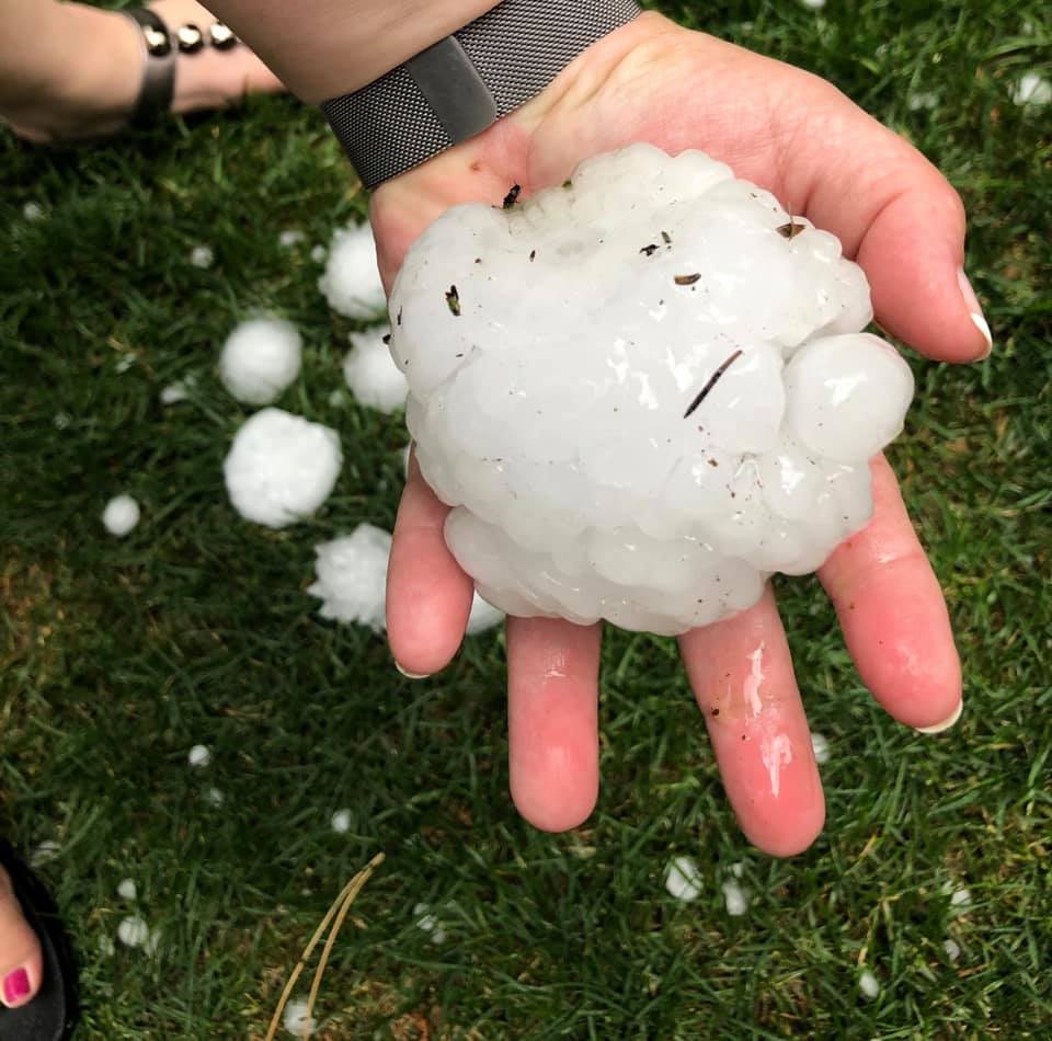
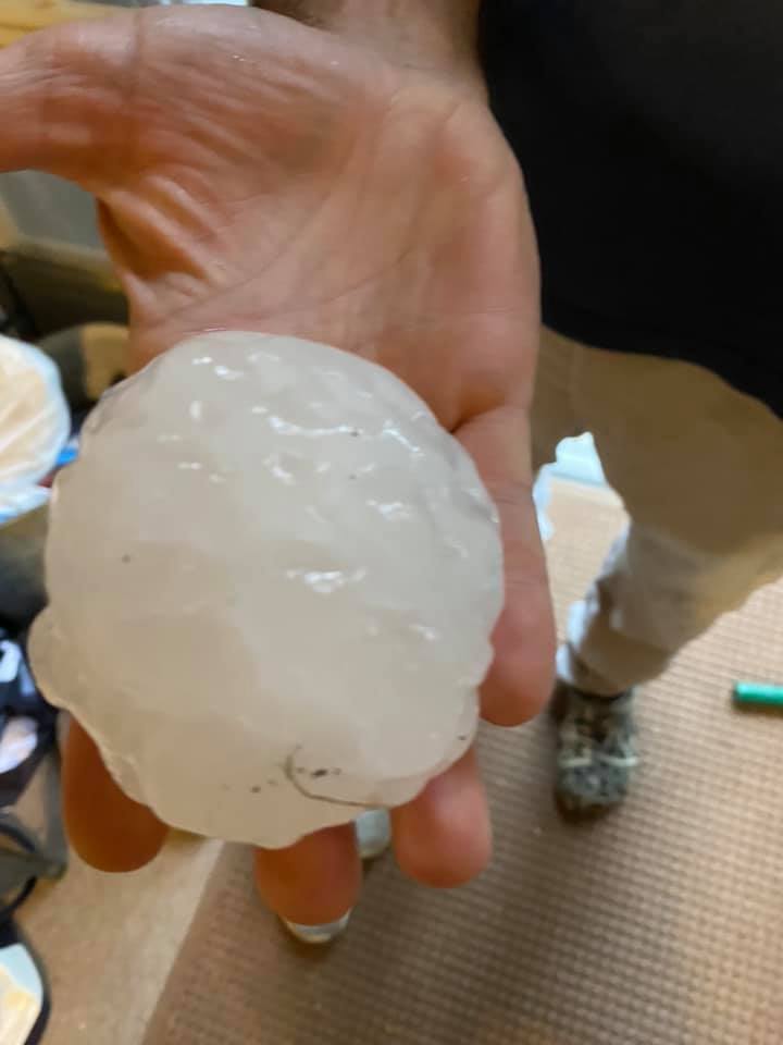
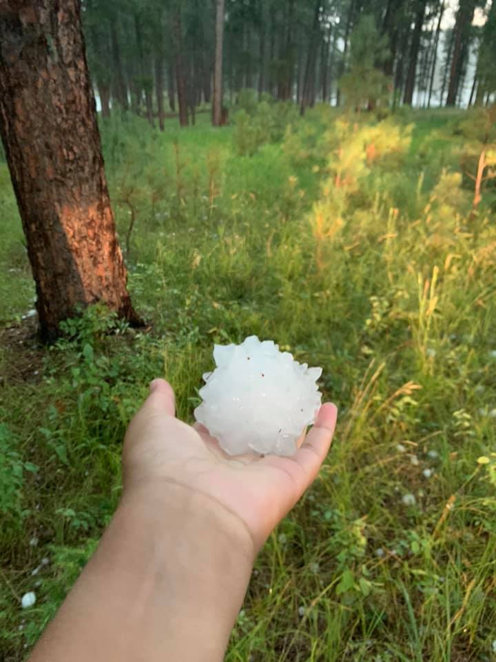
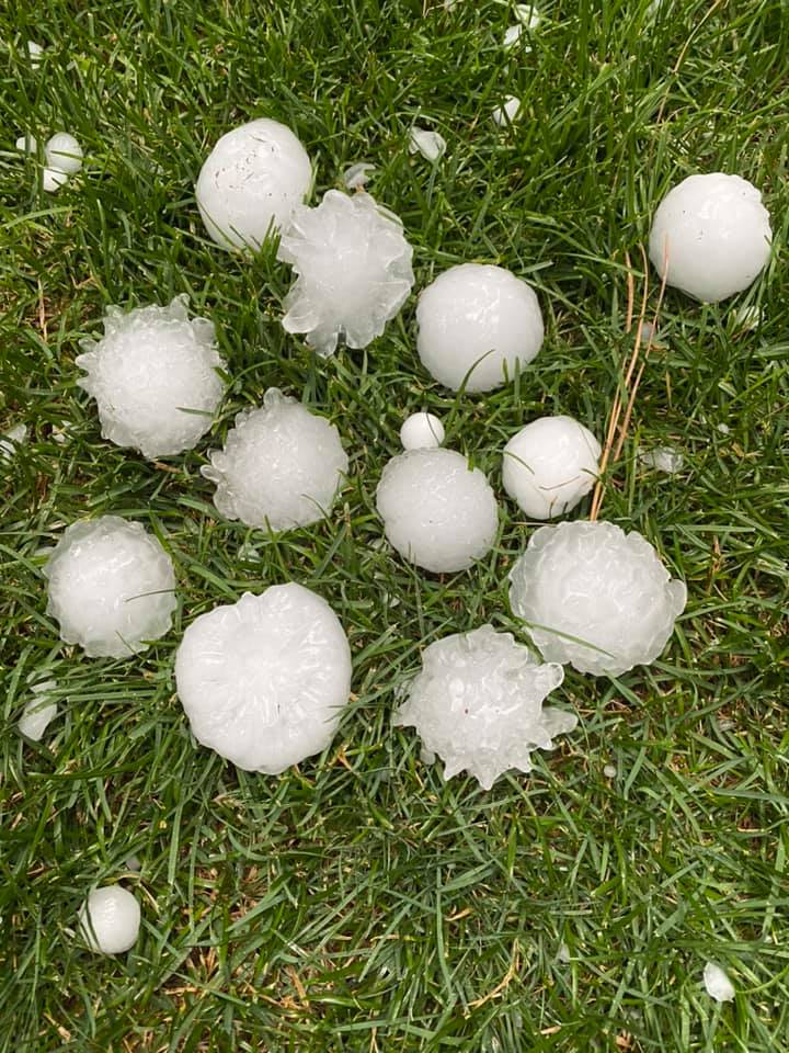
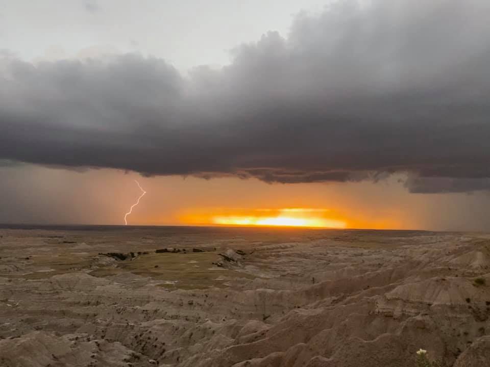
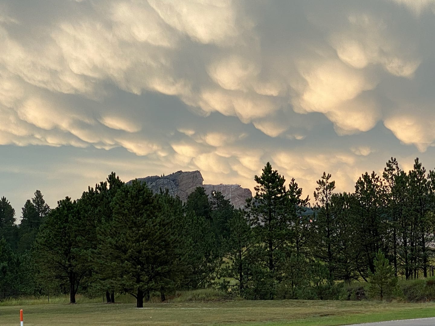
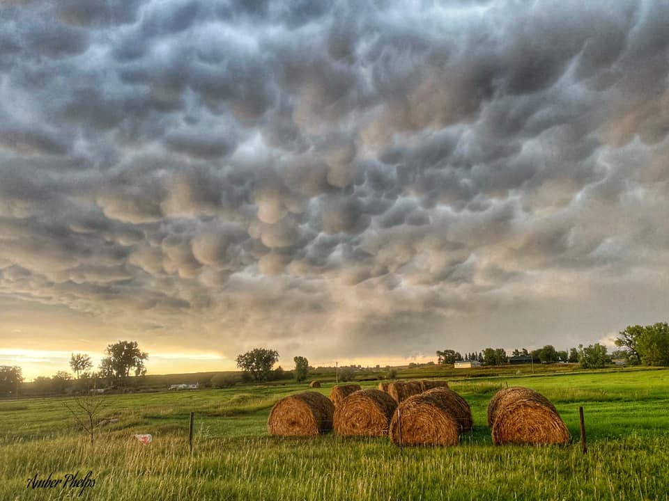
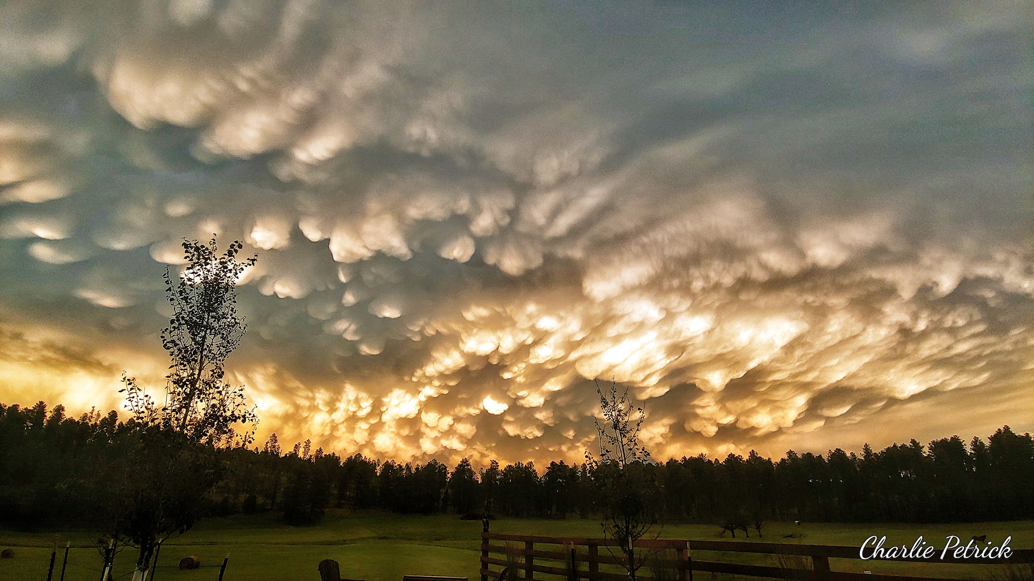
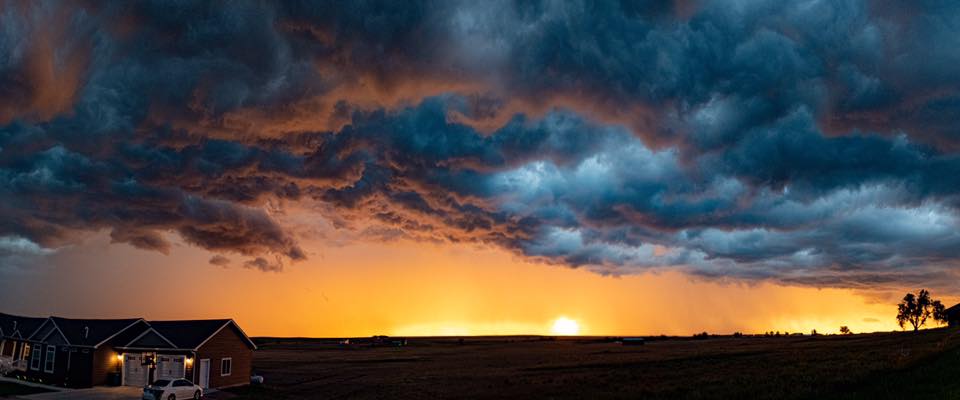
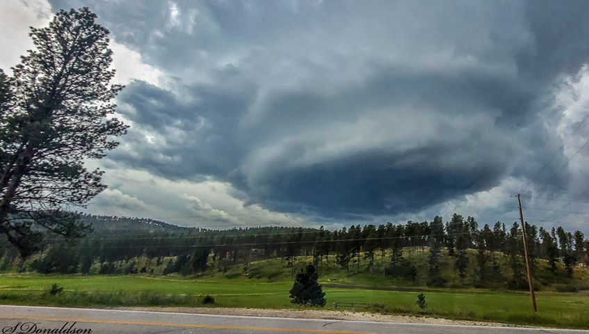
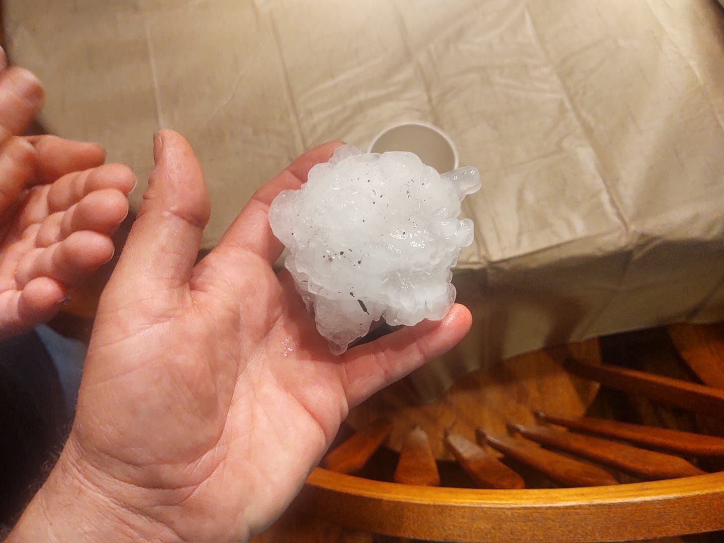
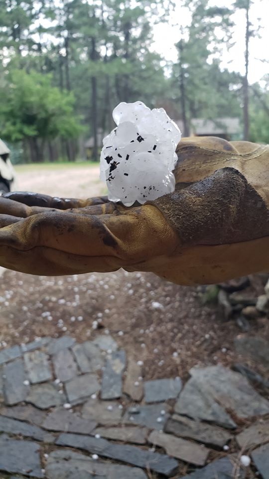
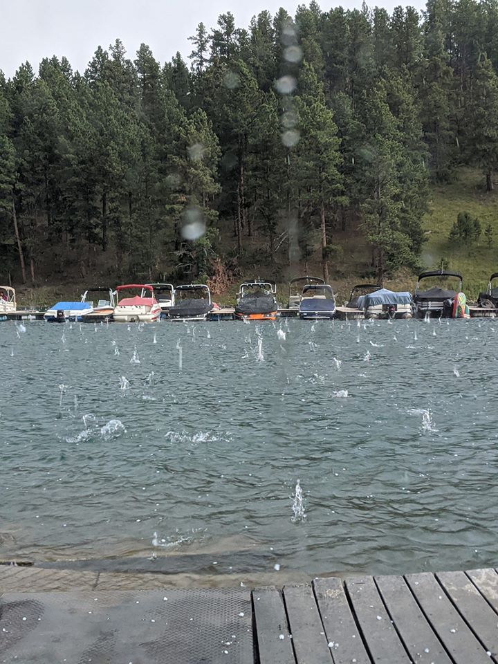
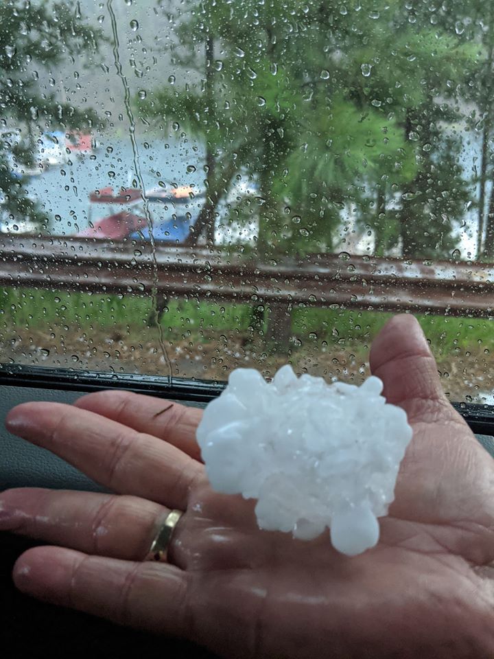
| In the afternoon of August 8th, 2020, thunderstorms developed across eastern Wyoming and western South Dakota. These brought large hail and damaging winds to the area through the evening. One storm that developed over the Black Hills produced grapefruit-sized (4.5 inch) hail! As the storms shifted eastward, they formed a line, developing into a mesoscale convective system as more storms converged together. The main threat changed from hail to strong winds, with nearly 80 mph gusts reported across south central South Dakota. As the storms passed, magnificent mammatus was seen by many. | 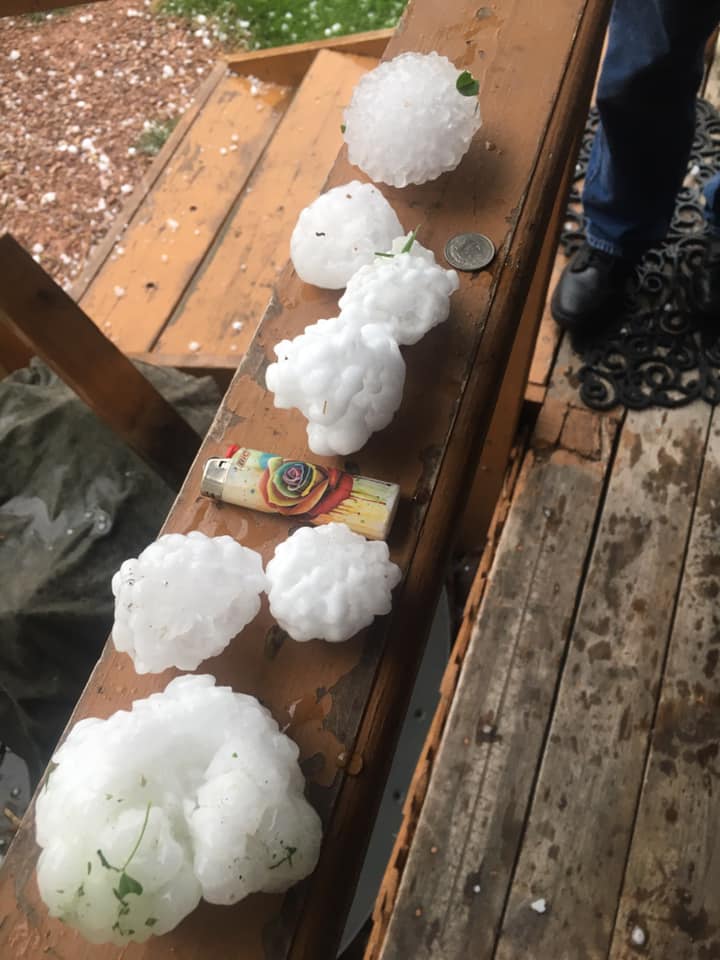 Pactola (R. Strom) |
Photos
 |
 |
 |
 |
| Silver City (T. Kammerer) |
Silver City (T. Kammerer) |
Pactola (B. Huey) |
Silver City (T. Kammerer) |
 |
 |
 |
 |
| Badlands (R. Royer) |
Crazy Horse (C. Schmidt) |
Rapid City (A. W. Phelps) |
South of Lead (C. Petrick) |
 |
 |
 |
 |
| South of Pactola (J. Fowler) |
Wall (B. Law) |
1 West Rapid City (S. Donaldson) |
Pactola (J. Woods) |
 |
 |
 |
 |
| Johnson Siding (K. Kooima) |
Pactola (M.K. Lemmel) |
Pactola (M.K. Lemmel) |
Highway 44 (K. Jones) |
Saturday evening saw severe storms move through Pactola Reservoir and the Black Hills. Baseball sized hail is absolutely nothing to mess with. Hoping for a quick recovery for this resident. Always take warnings seriously. @NWSRapidCity pic.twitter.com/GMWUeWvG9q
— Brant Beckman ? (@BrantBeckmanwx) August 9, 2020
Golf ball sized hail south of Rockerville @NWSRapidCity pic.twitter.com/1Pg9Yvirsn
— Jordan Hall (@TheOJordanHall) August 9, 2020
Radar
Storm Reports
The storm reports listed below are in descending order and may not
necessarily be the final storm reports.

Hail reports listed by size (inches)

 SIZE    LOCATION                 ST  COUNTY           TIME
 ------  -----------------------  --  --------------   -------
  4.50   1 N PACTOLA RESV         SD  PENNINGTON       0510 PM
  4.00   1 N PACTOLA RESV         SD  PENNINGTON       0505 PM
  2.75   2 NNW PACTOLA RESV       SD  PENNINGTON       0500 PM
  2.50   2 NE SILVER CITY         SD  PENNINGTON       0459 PM
                 GROUND IS WHITE
  1.75   2 ESE ROCKERVILLE        SD  PENNINGTON       0600 PM
  1.75   PACTOLA RESV             SD  PENNINGTON       0530 PM
  1.00   5 N SCENIC               SD  PENNINGTON       0740 PM
                 FEW PIECES OF HAIL
  1.00   1 E DWTN RAPID CITY      SD  PENNINGTON       0605 PM
  1.00   4 NNW BLACK HAWK         SD  MEADE            0540 PM
  1.00   7 NW EDGEMONT            SD  FALL RIVER       0520 PM
                 MAINLY HALF-INCH HAIL WITH A FEW ONE INCH
                 PIECES. HAIL COMPLETELY COVERED THE GROUND.
  1.00   2 NW EDGEMONT            SD  FALL RIVER       0515 PM
                 MAINLY PEA TO MARBLE HAIL WITH BIGGEST PIECES
                 AROUND 1 INCH.
  1.00   7 E LAKEVIEW             SD  TODD             0915 PM
                 18 BROKEN WINDOWS, GARDEN GONE
  0.88   1 SW HERMOSA             SD  CUSTER           0640 PM
                 0.47 INCHES OF RAINFALL ENDING AT 704 PM
  0.75   4 SW DWTN RAPID CITY     SD  PENNINGTON       0545 PM
                 BIGGEST PIECE THREE QUARTER INCH BUT MOST WAS
                 SMALLER. LASTED 15 MINUTES.

Tstm wind reports listed by speed (mph)

 SPEED   LOCATION                 ST  COUNTY           TIME
 ------  -----------------------  --  --------------   -------
 79.00   15 SSE MISSION           SD  TODD             0914 PM
 77.00   4 SSE WITTEN             SD  TRIPP            1004 PM
 65.00   FARMINGDALE              SD  PENNINGTON       0703 PM
 64.00   3 ESE PINE RIDGE         SD  OGLALA LAKOTA    0655 PM
 62.00   3 WSW FAIRBURN           SD  CUSTER           0633 PM
 61.00   1 NE WINNER              SD  TRIPP            1019 PM
 60.00   19 ESE SAINT FRANCIS     SD  TODD             0915 PM
 60.00   5 NNW FAIRBURN           SD  CUSTER           0637 PM
 60.00   12 ENE BUFFALO GAP       SD  CUSTER           0655 PM
                 SMALL BRANCHES BROKEN OFF TREES.
 60.00   6 SW HERMOSA             SD  CUSTER           0636 PM
 59.00   11 SW PARMELEE           SD  TODD             0904 PM
 57.00   2 W HAMILL               SD  TRIPP            1040 PM
 57.00   7 E WANBLEE              SD  JACKSON          0839 PM
 56.00   6 W PARMELEE             SD  TODD             0910 PM
 56.00   11 SW PARMELEE           SD  TODD             0858 PM
 56.00   4 E CACTUS FLAT          SD  JACKSON          0824 PM
 56.00   3 NNW SCENIC             SD  PENNINGTON       0730 PM
 55.00   4 E CACTUS FLAT          SD  JACKSON          0839 PM
 55.00   2 NNE PINE RIDGE         SD  OGLALA LAKOTA    0655 PM
 54.00   7 E WANBLEE              SD  JACKSON          0834 PM
 54.00   RAPID CITY ARPT          SD  PENNINGTON       0606 PM
 52.00   WEWELA                   SD  TRIPP            0954 PM
 52.00   3 NNW SCENIC             SD  PENNINGTON       0720 PM
 51.00   9 SW BATESLAND           SD  OGLALA LAKOTA    0804 PM
 50.00   5 N SCENIC               SD  PENNINGTON       0740 PM
                 FEW PIECES OF HAIL
 |
Media use of NWS Web News Stories is encouraged! Please acknowledge the NWS as the source of any news information accessed from this site. |
|

