
Heat expands across the Desert Southwest, Plains, Mississippi Valley and Midwest into Monday. Fire weather concerns continue for portions of the Intermountain West. Active monsoonal moisture fuels thunderstorms over the Southwest with possible flash flooding. Tropical cyclone Fausto in the Pacific, should weaken as it approaches Hawaii; Dangerous surf, swells and rip currents are expected. Read More >
Overview
|
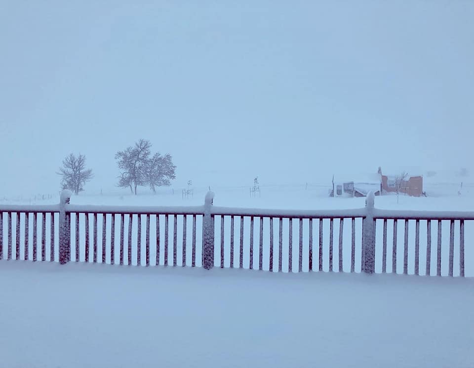
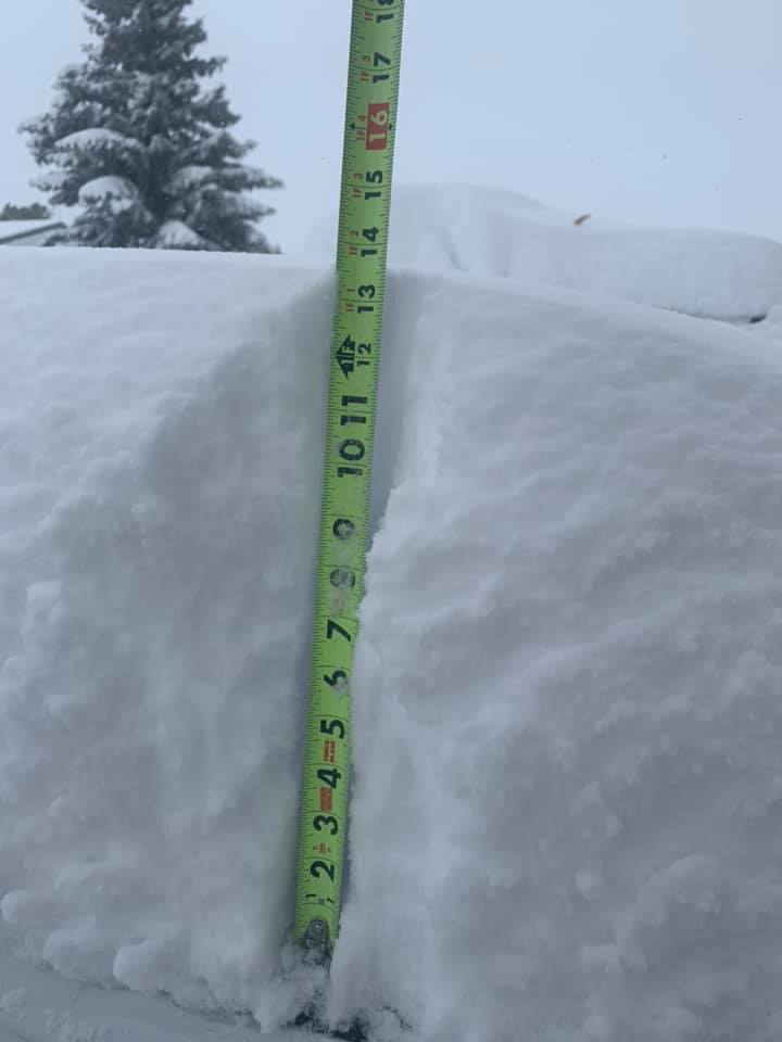
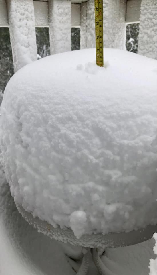
A powerful early winter storm moved from the Rockies across the northern Plains. Snow began over northeastern Wyoming during the night of Monday, October 11, leaving almost a foot of snow by morning. The snow spread over the Black Hills on Tuesday, October 12, accumulating one to two feet over the northern Black Hills and northern foothills. Heavy rain fell over the plains of western South Dakota, with many locations receiving one to four inches. Strong winds also occurred on the plains, where gusts reached 60 to 80 mph. |
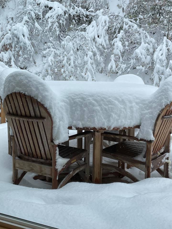
 Heavy snow on trees in Spearfish Photo courtesy of Amber K |
Snow
PRELIMINARY SNOW TOTALS LISTED BY MAGNITUDE

LOCATION                 SNOWFALL (inches)    TIME OF REPORT

3 ENE Deadwood SD              27.0        225 PM 10/13/2021
Deadwood SD                    22.5        930 AM 10/13/2021
3 SW Whitewood SD              22.0        930 AM 10/13/2021
1 N Whitewood SD               21.4       1000 AM 10/13/2021
5 SSE Whitewood SD             21.4       1245 PM 10/13/2021
1 N Deadwood SD                20.6       1130 AM 10/13/2021
4 WNW Terry Peak SD            20.0       1045 AM 10/13/2021
Wright WY                      20.0        733 PM 10/13/2021
Rozet WY                       18.2       1200 PM 10/13/2021
5 W Downtown Gillette WY       18.0        800 AM 10/13/2021
2 NNW Saint Onge SD            18.0        130 PM 10/13/2021
Whitewood SD                   17.0       1000 AM 10/13/2021
6 N Downtown Gillette WY       16.6        900 AM 10/13/2021
3 NE Whitewood SD              16.0        953 AM 10/13/2021
2 NE Downtown Gillette WY      16.0       1000 AM 10/13/2021
6 S Deadwood SD                16.0       1200 PM 10/13/2021
9 W Downtown Spearfish SD      15.0        859 AM 10/13/2021
11 S Deadwood SD               14.0        900 AM 10/13/2021
4 SE Deerfield SD              14.0        802 AM 10/13/2021
2 N Downtown Spearfish SD      14.0        900 AM 10/13/2021
Spearfish SD                   14.0        800 AM 10/13/2021
4 SSW Hill City SD             14.0        544 AM 10/13/2021
Downtown Gillette WY           13.8       1000 AM 10/13/2021
3 WNW Spearfish SD             13.5        700 AM 10/13/2021
5 SW Nemo SD                   13.0       1200 PM 10/13/2021
2 WNW Downtown Spearfish SD    13.0        748 AM 10/13/2021
4 NNW Whitewood SD             12.8        600 AM 10/13/2021
1 NNE Sundance SD              12.3       1258 AM 10/14/2021
Hill City SD                   12.0       1200 PM 10/13/2021
Colony WY                      12.0        110 PM 10/13/2021
11 NE Weston WY                12.0        700 AM 10/13/2021
4 NW Hill City SD              12.0        600 AM 10/13/2021
6 SE Belle Fourche SD          12.0        930 AM 10/13/2021
Alva WY                        12.0        600 AM 10/13/2021
4 SE Downtown Gillette WY      12.0        430 PM 10/13/2021
1 SSE Carlile WY               12.0        100 PM 10/13/2021
11 SW Cheyenne Crossing SD     12.0       1000 AM 10/13/2021
6 SW Beulah WY                 12.0        800 AM 10/13/2021
2 E Sturgis SD                 11.5        600 PM 10/13/2021
1 S Downtown Spearfish SD      11.0        730 AM 10/13/2021
17 NW Belle Fourche Reservoir  10.0        100 PM 10/13/2021
Camp Crook SD                   9.0        100 PM 10/13/2021
Moorcroft WY                    9.0       1225 PM 10/13/2021
Rockerville SD                  9.0       1000 AM 10/13/2021
1 ESE Pactola Reservoir SD      9.0        800 AM 10/14/2021
7 NNW Spearfish SD              8.8        700 AM 10/13/2021
1 NNW Piedmont SD               8.0        331 PM 10/13/2021
10 WNW Rapid City SD            7.2        700 AM 10/13/2021
1 ESE Newcastle WY              7.2        800 AM 10/14/2021
Pine Haven WY                   7.0       1227 PM 10/13/2021
Summerset SD                    7.0       1045 AM 10/13/2021
8 W Rapid City SD               6.7        700 AM 10/13/2021
7 W Rapid City SD               6.1        700 AM 10/13/2021
Mount Rushmore SD               6.0       1158 PM 10/13/2021
8 N Downtown Rapid City SD      6.0        900 AM 10/13/2021
2 W Custer SD                   6.0        900 PM 10/13/2021
1 ESE Wright WY                 5.0        700 AM 10/13/2021
Sundance WY                     4.5        600 AM 10/13/2021
5 E Piedmont SD                 4.5        600 AM 10/13/2021
8 N Newcastle WY                4.0        700 AM 10/13/2021
4 S Rapid City SD               4.0        803 AM 10/13/2021
6 NNE Rapid City SD             3.5        700 AM 10/13/2021
3 WNW Rapid City SD             3.5        700 AM 10/13/2021
1 E Downtown Rapid City SD      3.4        724 PM 10/13/2021
4 NW Downtown Rapid City SD     3.0        600 AM 10/14/2021
2 NW Rapid City SD              3.0        700 AM 10/13/2021
4 NE Rapid City SD              3.0        600 AM 10/13/2021
26 WSW Newcastle WY             2.0        700 AM 10/13/2021
Rain & Wind
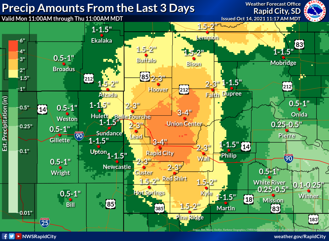
Liquid precipitation from 11 am MDT Monday, October 11 through 11 am MDT Thursday, October 14
PRELIMINARY RAINFALL TOTALS LISTED BY MAGNITUDE

LOCATION                   RAIN (inches)      TIME OF REPORT

9 NNE Union Center SD          4.85       1230 PM 10/13/2021
4 NNW Whitewood SD             4.19        600 AM 10/14/2021
Spearfish SD                   3.61        800 AM 10/13/2021
Buffalo SD                     3.50       1005 AM 10/13/2021
Box Elder SD                   3.50        900 AM 10/13/2021
New Underwood SD               3.25       1000 AM 10/13/2021
Vale SD                        3.23        730 AM 10/14/2021
4 SE Folsom SD                 3.21       1025 AM 10/13/2021
2 E Elm Springs SD             3.13        123 PM 10/13/2021
22 SSW Wasta SD                3.11        700 AM 10/13/2021
12 WSW Hereford SD             3.10        717 PM 10/13/2021
Ardmore SD                     3.00       1000 AM 10/13/2021
5 ESE Elm Springs SD           3.00        826 AM 10/13/2021
1 NNW Piedmont SD              2.94        715 PM 10/13/2021
4 S New Underwood SD           2.90        900 AM 10/13/2021
3 NE Scenic SD                 2.90       1000 AM 10/13/2021
4 NE Rapid City SD             2.90        600 AM 10/13/2021
6 ESE Box Elder SD             2.85        700 AM 10/13/2021
4 NNW Elm Springs SD           2.83        600 AM 10/13/2021
10 ESE Hermosa SD              2.81        700 AM 10/13/2021
2 W Hermosa SD                 2.80       1000 AM 10/13/2021
26 N Wall SD                   2.80        200 PM 10/13/2021
2 N Hermosa SD                 2.75        800 AM 10/13/2021
3 W Stoneville SD              2.75        800 AM 10/13/2021
Wall SD                        2.70        900 AM 10/13/2021
9 NW Wall SD                   2.62        700 AM 10/13/2021
Shadehill SD                   2.60       1200 PM 10/13/2021
2 NE Box Elder SD              2.57        800 AM 10/13/2021
9 E Hermosa SD                 2.55       1000 AM 10/13/2021
3 ENE Newell SD                2.52        700 AM 10/13/2021
6 NNE Rapid City SD            2.51        700 AM 10/13/2021
Hermosa SD                     2.51        600 AM 10/13/2021
24 SW Bison SD                 2.49        700 AM 10/13/2021
4 SSW Hill City SD             2.46        544 AM 10/13/2021
6 W Hermosa SD                 2.42        700 AM 10/13/2021
7 W Rapid City SD              2.42        700 AM 10/13/2021
3 WNW Rapid City SD            2.38        700 AM 10/13/2021
5 WNW Hermosa SD               2.37        910 AM 10/13/2021
9 W Bison SD                   2.35        700 AM 10/13/2021
2 ENE Wall SD                  2.34        800 AM 10/13/2021
10 WNW Rapid City SD           2.33        700 AM 10/13/2021
Tilford SD                     2.32        700 AM 10/13/2021
3 SE Buffalo Gap SD            2.30       1045 AM 10/13/2021
6 NNE Stoneville SD            2.26        640 AM 10/13/2021
Argyle SD                      2.25        957 AM 10/13/2021
11 NE Weston WY                2.25        700 AM 10/14/2021
2 NW Rapid City SD             2.25        700 AM 10/13/2021
14 S Reva SD                   2.20        828 AM 10/13/2021
5 E Piedmont SD                2.20        600 AM 10/13/2021
4 S Rapid City SD              2.20        803 AM 10/13/2021
4 N Downtown Rapid City SD     2.13        725 AM 10/13/2021
11 NW Union Center SD          2.09        700 AM 10/13/2021
8 W Rapid City SD              2.09        700 AM 10/13/2021
12 SW Dupree SD                2.07        201 PM 10/13/2021
8 NNE Box Elder SD             2.04        557 AM 10/13/2021
10 WSW Red Elm SD              2.00        751 AM 10/14/2021
1 SW Hermosa SD                1.98        853 AM 10/13/2021
20 NE Creighton SD             1.97       1217 PM 10/13/2021
36 W Faith SD                  1.95        745 AM 10/13/2021
3 SE Pringle SD                1.90       1000 AM 10/13/2021
8 WNW Usta SD                  1.90       1042 AM 10/13/2021
Rapid City SD                  1.88        800 AM 10/13/2021
2 SW Howes SD                  1.85        700 AM 10/13/2021
7 NNW Spearfish SD             1.84        700 AM 10/13/2021
2 NNW Newell SD                1.80        700 AM 10/13/2021
10 E Pine Ridge SD             1.80       1200 PM 10/13/2021
4 NW Downtown Rapid City SD    1.78        700 AM 10/13/2021
4 W Hot Springs SD             1.72        700 AM 10/13/2021
3 WNW Spearfish SD             1.71        700 AM 10/13/2021
1 E Downtown Rapid City SD     1.61        724 PM 10/13/2021
Hot Springs SD                 1.53        700 AM 10/13/2021
Long Valley SD                 1.50        900 AM 10/13/2021
13 SSE Wall SD                 1.49        800 AM 10/13/2021
1 NNE Edgemont SD              1.49        700 AM 10/13/2021
2 ENE Edgemont SD              1.48        700 AM 10/13/2021
21 NW Philip SD                1.48        800 AM 10/13/2021
3 ENE Kyle SD                  1.35       1000 AM 10/13/2021
21 NW Faith SD                 1.30        600 AM 10/13/2021
7 NNE Batesland SD             1.25        800 AM 10/13/2021
6 SW Beulah WY                 1.20        800 AM 10/13/2021
4 WSW Wanblee SD               1.18        700 AM 10/13/2021
Edgemont SD                    1.16        700 AM 10/13/2021
15 NW Buffalo SD               1.11        700 AM 10/13/2021
14 ENE Martin SD               1.09        600 AM 10/13/2021
8 E Martin SD                  1.00        700 AM 10/13/2021
18 N Philip SD                 1.00        900 AM 10/13/2021

MAXIMUM OBSERVED WIND GUSTS LISTED BY MAGNITUDE

LOCATION                    MAX WIND (MPH)    TIME OF REPORT
3 NW Wasta SD                    79       1225 PM 10/13/2021
5 WNW New Underwood SD           74        930 AM 10/13/2021
4 E Cactus Flat SD               71        245 PM 10/13/2021
3 E Philip SD                    69        300 PM 10/13/2021
4 SSE Witten SD                  68        121 PM 10/13/2021
1 NE Midland SD                  68        410 PM 10/13/2021
10 W Edgemont SD                 67        735 AM 10/13/2021
Wasta SD                         67        916 AM 10/13/2021
1 NE Winner SD                   66        350 PM 10/13/2021
3 NNW Scenic SD                  65        935 AM 10/13/2021
8 S Wall SD                      64        420 PM 10/13/2021
Rapid City Regional Airport SD   64        751 AM 10/13/2021
12 E Oelrichs SD                 64       1250 PM 10/13/2021
9 ENE Belvidere SD               63        340 PM 10/13/2021
Ellsworth AFB SD                 62        743 AM 10/13/2021
3 ESE Pine Ridge SD              61        234 PM 10/13/2021
7 E Sturgis SD                   61       1135 AM 10/13/2021
15 SSE Mission SD                61        126 PM 10/13/2021
3 W Union Center SD              60        425 PM 10/13/2021
6 W Parmelee SD                  59        328 PM 10/13/2021
1 W Box Elder SD                 59       1041 AM 10/13/2021
3 WSW Angostura Reservoir SD     59       1215 PM 10/13/2021
2 SW Bridger SD                  58        205 PM 10/13/2021
1 E Downtown Rapid City SD       58        922 AM 10/13/2021
8 SSW Folsom SD                  57        839 AM 10/13/2021
7 E Wanblee SD                   56        435 PM 10/13/2021
1 N Buffalo SD                   56        539 PM 10/13/2021
Wewela SD                        56        335 PM 10/13/2021
12 WSW Castle Rock SD            55        809 AM 10/13/2021
13 SSW Reva SD                   55        420 PM 10/13/2021
1 ENE Mud Butte SD               55        546 PM 10/13/2021
8 N Redig SD                     53        106 PM 10/13/2021
11 SW Parmelee SD                53       1130 AM 10/13/2021
2 E Cottonwood SD                52        135 PM 10/13/2021
7 ESE Rosebud SD                 52        130 PM 10/13/2021
9 SW Batesland SD                51        215 PM 10/13/2021
2 W Hamill SD                    51        345 PM 10/13/2021
1 NNE Faith SD                   51        600 PM 10/13/2021
4 S Downtown Rapid City SD       51       1150 AM 10/13/2021
7 NNE Ralph SD                   50        450 PM 10/13/2021
Photos & Video
Header
 |
 |
 |
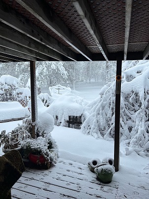 |
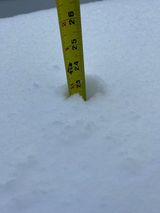
| Eleven inches of snow in Spearfish Photo courtesy of Amber K |
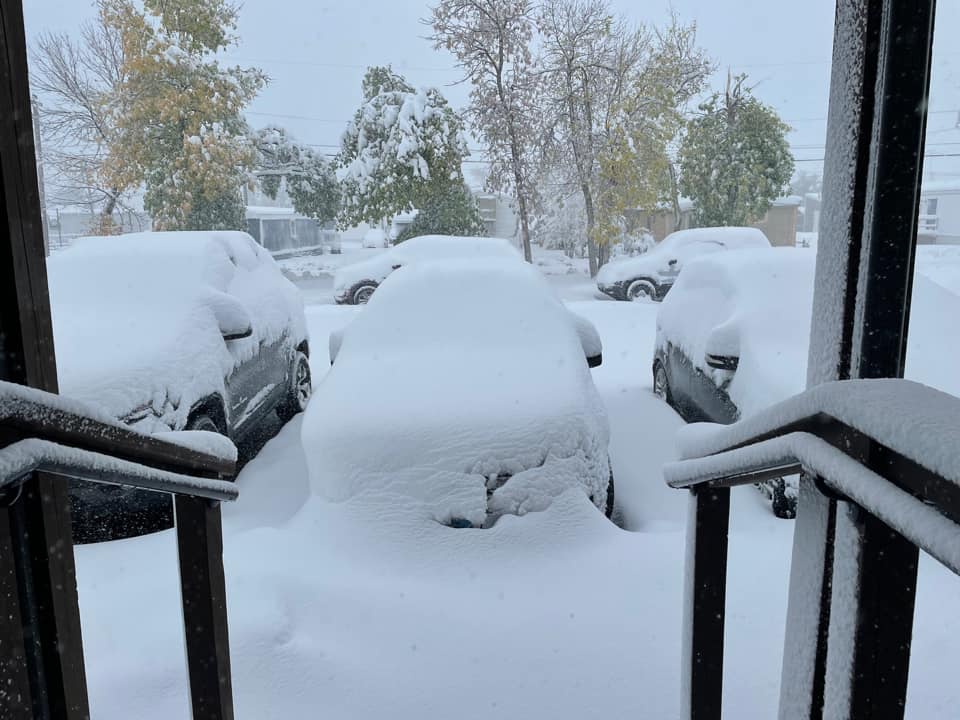
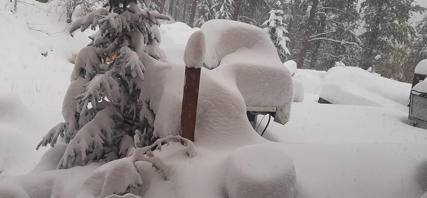
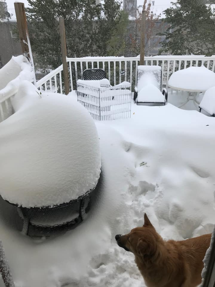
Heavy snow buried cars in Spearfish Photo courtesy of Breanne H |
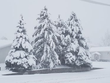
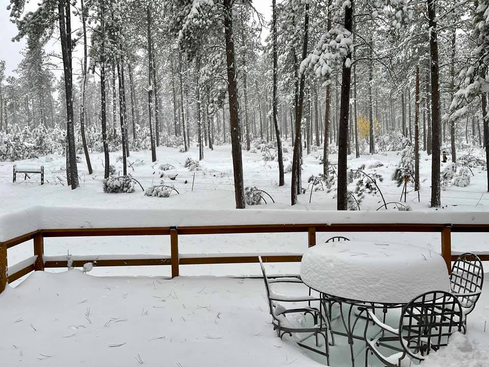
Heavy snow southwest of Whitewood Photo courtesy of Sharon K |
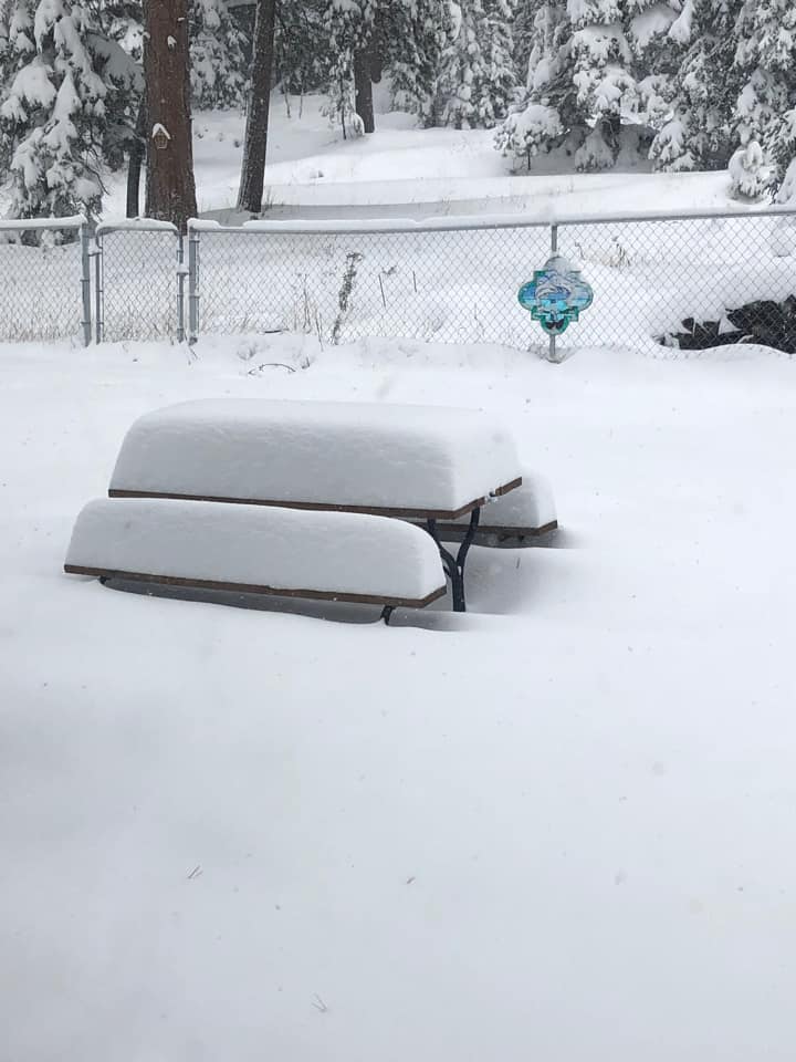
Heavy snow near Belle Fourche Photo courtesy of Robbi B |
 |
 |
 |
 |
| Heavy snow east of Rochford Photo courtesy of Rob R |
Heavy snow in Spearfish Canyon Photo courtesy of Shari B |
Heavy snow south of Deadwood Photo courtesy of Michele S |
Heavy snow in Beulah, WY Photo courtesy of Doris P |
 |
 |
 |
 |
| Over 22 inches of snow in Deadwood Photo courtesy of Sianna G |
Heavy snow in Lead Photo courtesy of Lacy B |
Heavy snow in Boulder Canyon west of Sturgis Photo courtesy of Callie T |
Heavy snow between Whitewood and Sturgis Photo courtesy of Kaleigh C |
 |
 |
 |
 |
| Fourteen inches of snow in Gillette Photo courtesy of Chad T |
Heavy snow in Gillette Photo courtesy of Debbie S |
Heavy snow in Gillette Photo courtesy of Lillian S |
Heavy rain fills the Belle Fourche River near Hereford, SD Photo courtesy of Paula P |
Radar
 |
Media use of NWS Web News Stories is encouraged! Please acknowledge the NWS as the source of any news information accessed from this site. |
|

