
Dangerous heat will expand from the Gulf Coast into the Southern Plains and Desert Southwest through week's end. Additional extreme heat impacting the Pacific Northwest will shift to the northern Plains by the weekend. Tropical Storm Bertha is expected to continue to impact portions of the northern Gulf Coast from the western Florida Panhandle to southeastern Louisiana through tonight. Read More >
Overview
|
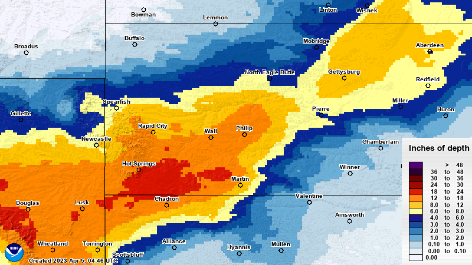
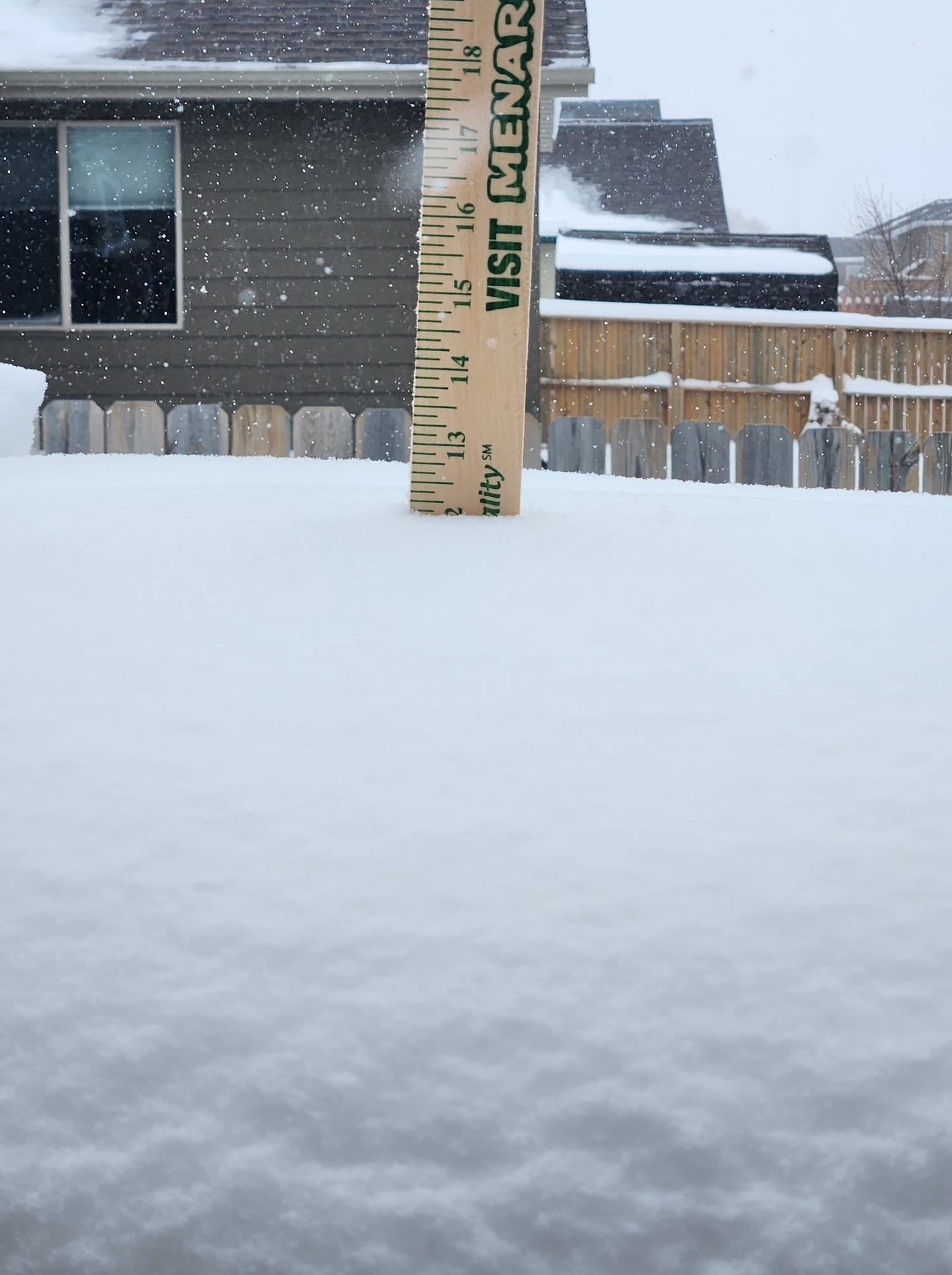
On April 3, 2023 a potent winter storm developed over the Four Corners region. The low strengthened as it moved northeast into Wyoming and then through western South Dakota on April 4. The strength of the storm was sufficient to efficiently wring out significant moisture in the form of snow. Heavy snow fell for most of the day on the 3rd over far southwest South Dakota. The storm plodded northward the next day, dropping heavy snow across most of western South Dakota and the Black Hills. The storm exited the region on the 5th. The heaviest snow fell over far southwest South Dakota where a location 2 miles west of Hot Springs recorded 30" of fresh snow. Snow totals of 18-24" were common from Custer to Hermosa to Hot Springs. 12" reports were common across much of west-central South Dakota. Northwest winds of 20 to 30 mph with gusts up to 40 mph caused blowing and drifting snow on the 4th. Blizzard conditions occurred on the open plains of South Dakota where these winds were the strongest. During the height of the storm, I-90 was shut down over western South Dakota due to the blizzard conditions. |
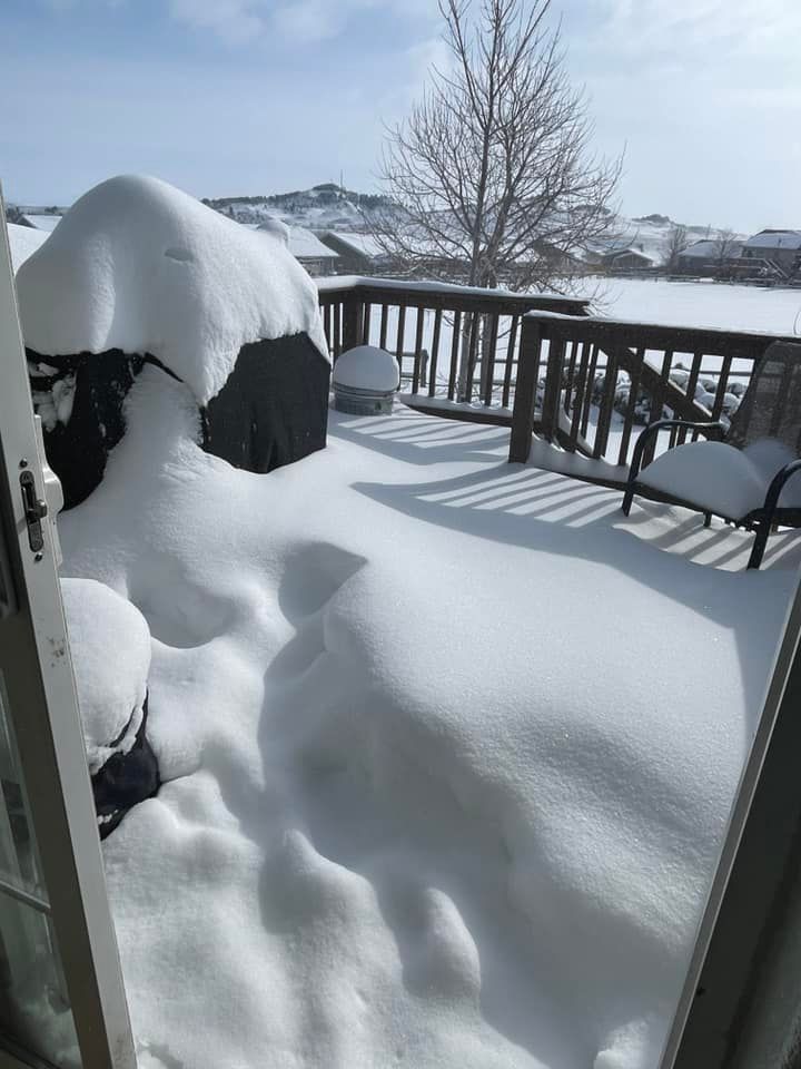
 1E Custer State Park Airport, SD Courtesy Mary Frances |
Snow
This map shows the estimated snowfall for April 3-5, 2023. Notice the sharp cutoff on the northern edge of the storm, as well as the southeast edge.
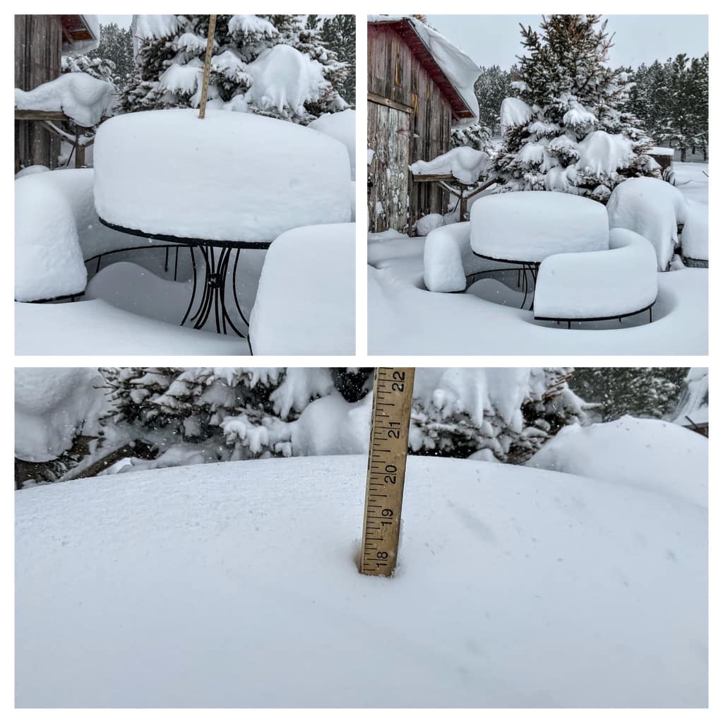
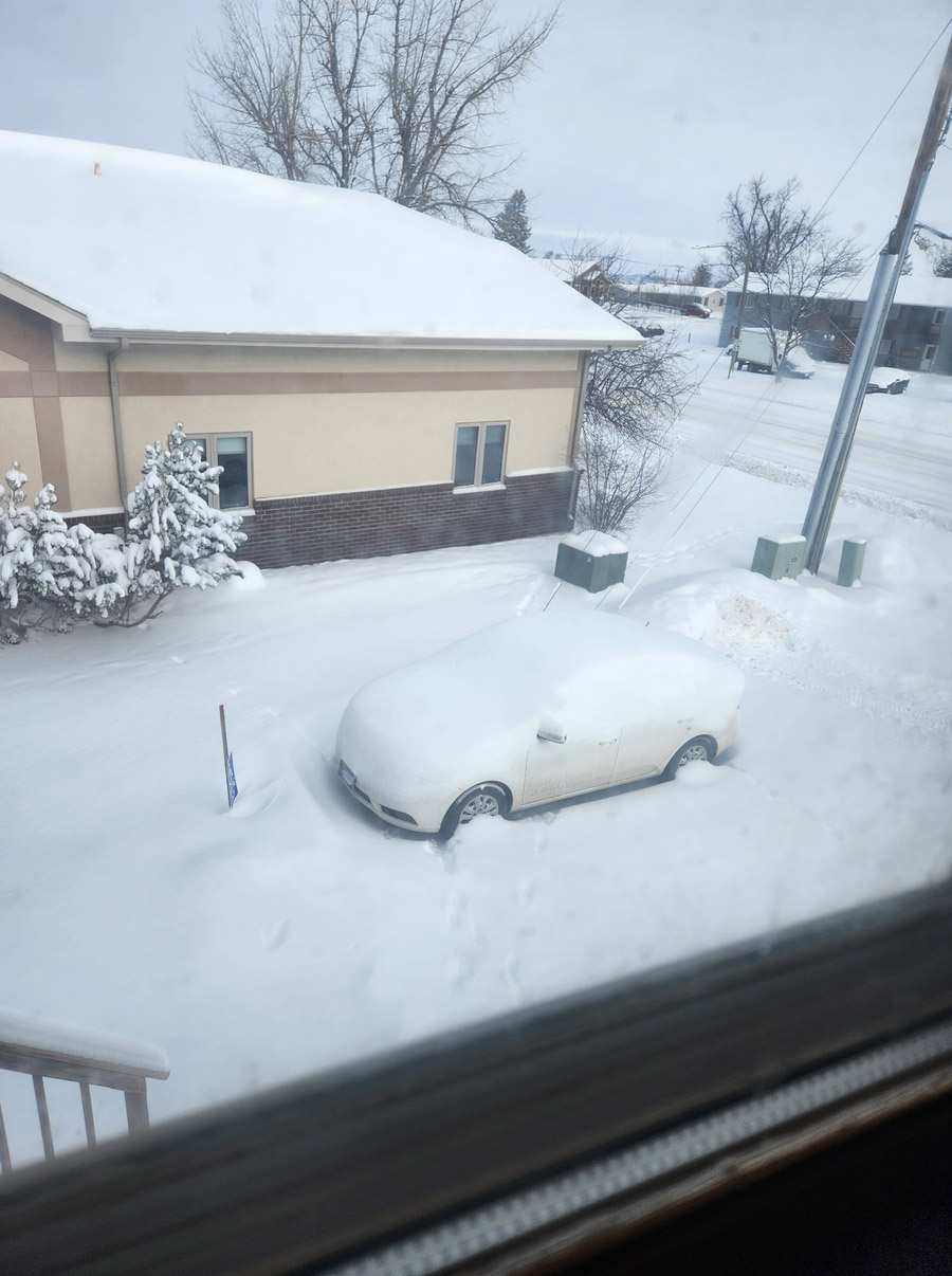
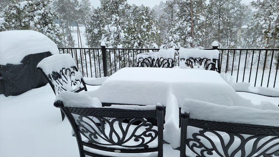
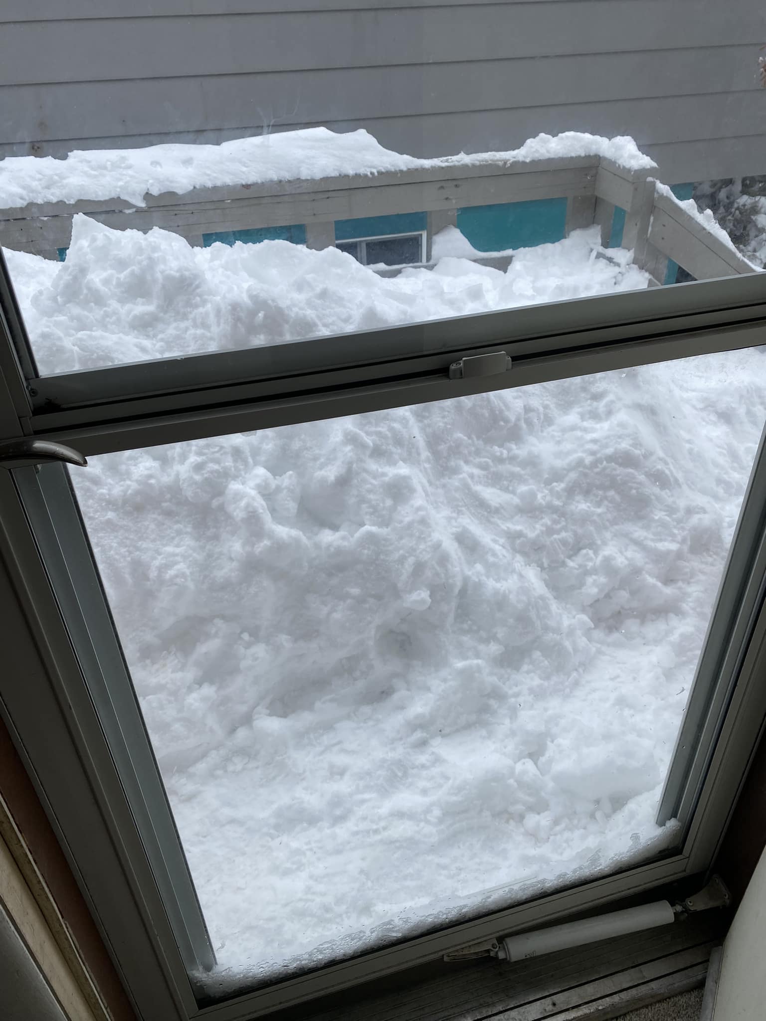
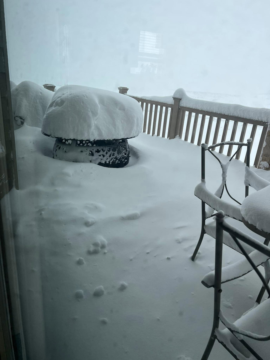
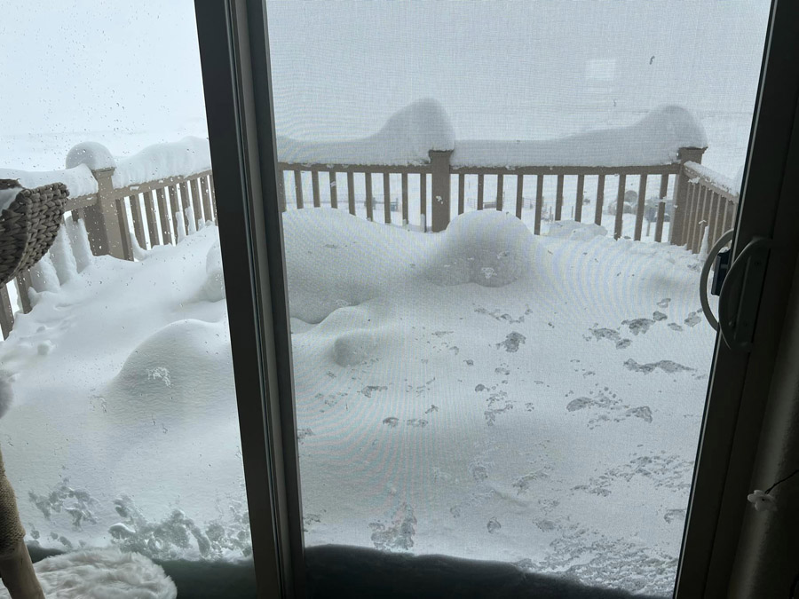
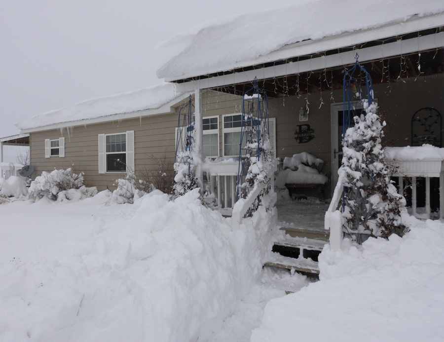
Photos
 |
 |
 |
 |
| Spearfish, SD Courtesy Amber Schweigert |
4NE Rockerville, SD Courtesy Eric Helgeson |
Box Elder, SD Courtesy Kay Luther |
Hot Springs, SD Courtesy Carol Foster |
 |
 |
 |
 |
| Hot Springs, SD Courtesy Jasmine Otteson |
Hot Springs, SD Courtesy Pam Bogart |
Oelrichs, SD Courtesy Megan J. Harkless |
Hot Springs, SD Courtesy Jasmine Otteson |
 |
 |
 |
 |
| Whitewood, SD Courtesy Katie Solvie |
0.5W Highway 79 on LH Road Courtesy Wendy Parker Lockyear |
0.5W Highway 79 on LH Road Courtesy Wendy Parker Lockyear |
3W Hot Springs, SD Courtesy Wendy Brehe |
4/4/2023 6pm: 12.6" snow officially at our office in east Rapid City. 0.87" liquid-equivalent precipitation. #SDwx #RapidCity #BlackHills #snow pic.twitter.com/2hkiuklnsM
— NWS Rapid City (@NWSRapidCity) April 5, 2023
An aerial view of Rapid City from Skyline Drive following the snow storm. @NWSRapidCity #sdoakwx pic.twitter.com/MUkZCEBt9H
— Matt Gade (@mattgadephotog) April 5, 2023
WED-7:01 AM: Gate being lifted on I-90 eastbound in Box Elder. No word on whether it’s open, but that’s a good sign. @NWSRapidCity #sdwx pic.twitter.com/C45tbKJb7H
— Brant Beckman (@BrantBeckmanwx) April 5, 2023
NO TRAVEL ADVISED in Pennington County! Sage Creek Road is totally blocked. This truck got stuck using a side road to get around closure of Interstate 90. Even if roads and weather look improved, they are not. Stay safe. Stay inside. pic.twitter.com/o26b9b9BCq
— Pennington County SO (@PennCoSheriff) April 4, 2023
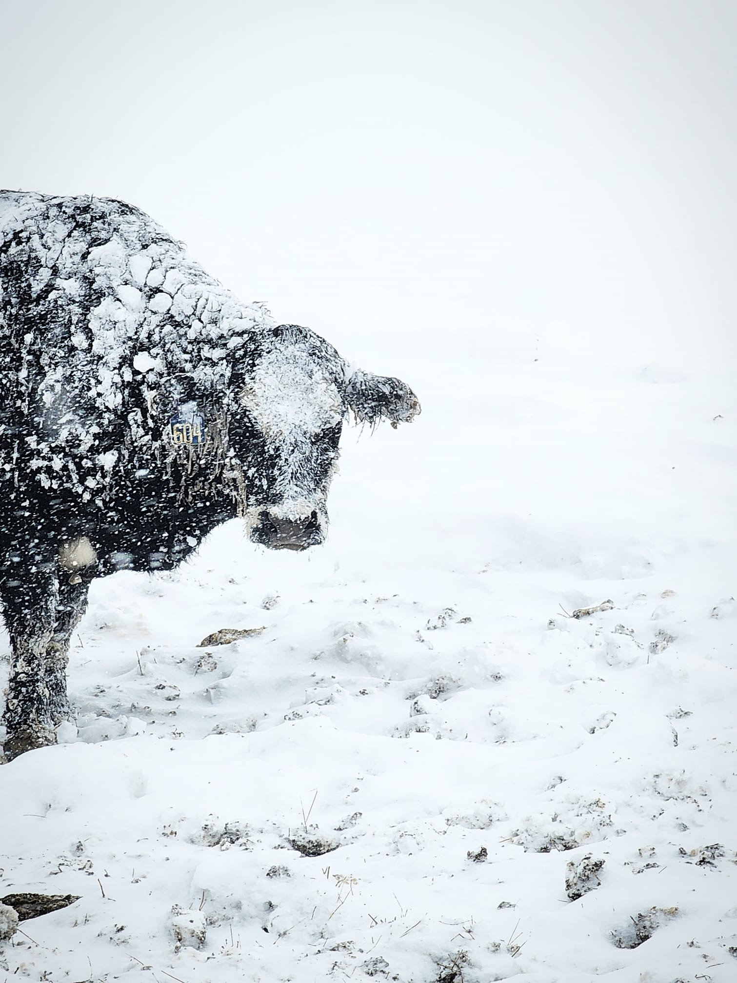
Sure enough, there was a newborn calf they rescued from the elements. They took it home and will be staying with the family through the night to stay warm.
— Brant Beckman (@BrantBeckmanwx) April 5, 2023
Great testimony of why these forecasts are so important to ranchers this time of year. @NWSRapidCity #sdwx pic.twitter.com/hGIWxS0bei
I-90 is scheduled to close from the Wyoming state line to Wall (Exit 110) beginning at 8 p.m. (MT) on Monday, April 3.
— SDDOT (@SouthDakotaDOT) April 3, 2023
As the storm continues to move across the state, Interstate closures are expected to be extended, with multi-day closures anticipated.https://t.co/jAj5PbAmq4 pic.twitter.com/NIQwossaot
Radar & Satellite
| April 3-5, 2023 radar loop of the winter storm and blizzard. |
| April 3-5, 2023 satellite loop of the winter storm and blizzard. |
Snowfall Reports
...PRELIMINARY SNOW TOTALS SORTED BY MAGNITUDE...

LOCATION                      SNOWFALL    COMMENTS
                               IN/S/

2 W Hot Springs SD             30.0       1243 PM 4/04/2023
14 SSW Provo SD                28.0        800 AM 4/04/2023
5 ENE Custer SD                24.0        700 AM 4/05/2023
Hermosa SD                     24.0        310 PM 4/04/2023
Hot Springs SD                 24.0        645 AM 4/04/2023
7 WSW Folsom SD                21.0        530 AM 4/05/2023
4 W Hot Springs SD             20.0        700 AM 4/04/2023
Mount Rushmore SD              20.0       1258 AM 4/05/2023
3 NE Hisega SD                 16.5        700 AM 4/05/2023
1 E Hayward SD                 16.0        619 PM 4/04/2023
5 WNW Hermosa SD               16.0        840 AM 4/04/2023
4 W Dwtn Rapid City SD         15.5        700 AM 4/05/2023
6 W Hermosa SD                 14.2        700 AM 4/04/2023
3 WNW Kadoka SD                13.7        530 AM 4/05/2023
4 NNE Johnson Siding SD        13.7        800 AM 4/05/2023
Edgemont SD                    13.5        700 AM 4/05/2023
Hill City SD                   13.3        700 AM 4/05/2023
1 SW Deadwood SD               13.0       1044 PM 4/04/2023
1 N Hisega SD                  13.0        700 AM 4/05/2023
3 NNE Johnson Siding SD        12.9        700 AM 4/05/2023
1 E Dwtn Rapid City SD         12.8        600 AM 4/05/2023
4 NE Rockerville SD            12.8        215 PM 4/04/2023
7 NNE Ellsworth AFB SD         12.5        700 AM 4/05/2023
1 N Johnson Siding SD          12.1        800 AM 4/05/2023
3 ENE Kyle SD                  12.0        700 AM 4/05/2023
2 SW Dwtn Rapid City SD        12.0        341 PM 4/04/2023
1 WNW Clareton WY              12.0        700 AM 4/04/2023
Whitewood SD                   12.0       1135 AM 4/05/2023
Box Elder SD                   12.0        535 PM 4/04/2023
1 E Dwtn Spearfish SD          12.0        600 AM 4/05/2023
2 SSE Dwtn Rapid City SD       11.6        700 AM 4/05/2023
14 NW Edgemont SD              11.5        800 AM 4/04/2023
1 ESE Pactola Resv SD          11.5        900 AM 4/05/2023
Black Hawk SD                  11.5        515 PM 4/04/2023
3 W Dwtn Rapid City SD         11.5        902 AM 4/04/2023
3 SE Saint Onge SD             11.4        530 AM 4/05/2023
Piedmont SD                    11.0        430 PM 4/04/2023
Cedar Pass SD                  11.0        500 PM 4/04/2023
11 NE Morrisey WY              10.5        700 AM 4/04/2023
1 SSE Dwtn Spearfish SD        10.4        800 AM 4/05/2023
Vale SD                        10.0        800 AM 4/04/2023
6 W New Underwood SD           10.0        700 AM 4/05/2023
7 SW Rapid City Arpt SD        10.0        521 PM 4/04/2023
1 NNW Dwtn Spearfish SD        10.0       1000 AM 4/05/2023
2 SSW Norris SD                10.0        700 AM 4/05/2023
Wright WY                       9.5        700 AM 4/05/2023
3 ESE Cheyenne Crossing SD      9.5        700 AM 4/05/2023
4 NNE Summerset SD              9.5        600 AM 4/05/2023
Pringle SD                      9.5        708 PM 4/03/2023
1 WSW Dwtn Rapid City SD        9.5        238 PM 4/04/2023
3 S Dwtn Rapid City SD          9.5        750 AM 4/04/2023
4 NW Dwtn Rapid City SD         9.0        700 AM 4/05/2023
Summerset SD                    9.0        646 AM 4/05/2023
14 NNW Edgemont SD              9.0        448 AM 4/04/2023
4 WNW Rapid City Arpt SD        9.0        950 AM 4/04/2023
1 NNE Edgemont SD               9.0        700 AM 4/05/2023
19 NNE Creighton SD             8.5        700 AM 4/05/2023
3 NE Whitewood SD               8.0        758 PM 4/04/2023
Sturgis SD                      8.0        230 PM 4/04/2023
4 S Dwtn Rapid City SD          8.0        640 AM 4/04/2023
8 SE Interior SD                8.0       1049 AM 4/04/2023
8 E Martin SD                   8.0        700 AM 4/05/2023
3 SW Dwtn Rapid City SD         8.0        958 AM 4/04/2023
1 SW Dwtn Rapid City SD         8.0        800 AM 4/05/2023
1 NE Dwtn Rapid City SD         8.0        600 AM 4/04/2023
2 WNW Dwtn Spearfish SD         7.8        700 AM 4/05/2023
5 ESE Norris SD                 7.5        848 AM 4/05/2023
Argyle SD                       7.0        454 PM 4/03/2023
2 E Sturgis SD                  7.0        700 PM 4/04/2023
2 W Custer SD                   7.0       1217 AM 4/04/2023
6 S Custer SD                   7.0        655 PM 4/03/2023
6 SW Beulah WY                  7.0        800 AM 4/05/2023
4 NNW Elm Springs SD            6.7        600 AM 4/05/2023
Tilford SD                      6.5        700 AM 4/04/2023
2 N Black Hawk SD               6.5        821 AM 4/04/2023
4 NW Parmelee SD                6.5        700 AM 4/05/2023
1 WNW Caputa SD                 6.0        449 AM 4/04/2023
5 NE Milesville SD              6.0        700 PM 4/04/2023
8 NNW Newcastle WY              6.0        700 AM 4/04/2023
Dupree SD                       6.0        700 PM 4/04/2023
6 NE Summerset SD               5.5        700 AM 4/04/2023
6 NNW Dwtn Spearfish SD         5.0        700 AM 4/05/2023
3 E Midland SD                  5.0        700 AM 4/04/2023
4 SE Gillette WY                5.0        530 PM 4/04/2023
4 NNW Tilford SD                5.0        800 AM 4/04/2023
Dwtn Gillette WY                5.0        241 PM 4/04/2023
8 WNW Usta SD                   5.0        700 AM 4/05/2023
7 W Ardmore SD                  5.0        515 AM 4/04/2023
7 N Wood SD                     4.2        600 AM 4/05/2023
Sundance WY                     4.0        600 AM 4/05/2023
2 E Cottonwood SD               4.0        450 AM 4/04/2023
Saint Onge SD                   4.0        111 PM 4/04/2023
8 ENE Alva WY                   4.0        700 AM 4/05/2023
9 WSW Red Elm SD                3.5        649 PM 4/04/2023
1 SE Newcastle WY               3.5        800 AM 4/04/2023
1 ESE Newcastle WY              3.5        900 AM 4/04/2023
5 SSE Dwtn Spearfish SD         3.0        715 AM 4/04/2023
11 W Milesville SD              3.0        452 AM 4/04/2023
4 SE Upton WY                   2.6        700 AM 4/04/2023
14 NNW Dwtn Gillette WY         2.3        700 AM 4/04/2023
8 WSW Rozet WY                  2.3        700 AM 4/05/2023
3 NNE Rozet WY                  2.3        600 AM 4/04/2023
1 SSE White River SD            2.0        451 AM 4/04/2023
7 E Sturgis SD                  2.0        451 AM 4/04/2023
16 SSE Mission SD               2.0        600 AM 4/05/2023
6 SSW Fairpoint SD              1.5        700 AM 4/05/2023
3 E Newcastle WY                1.5        600 AM 4/04/2023
Lead SD                         1.4        900 AM 4/05/2023
3 SSW Argyle SD                 1.0        700 AM 4/03/2023
Oral SD                         1.0        700 AM 4/03/2023
 |
Media use of NWS Web News Stories is encouraged! Please acknowledge the NWS as the source of any news information accessed from this site. |
|

