
Dangerous heat will expand from the Gulf Coast into the Southern Plains and Desert Southwest through week's end. Additional extreme heat impacting the Pacific Northwest will shift to the northern Plains by the weekend. Tropical Storm Bertha is expected to continue to impact portions of the northern Gulf Coast from the western Florida Panhandle to southeastern Louisiana through tonight. Read More >
Overview
|
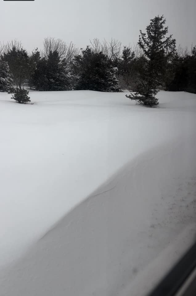
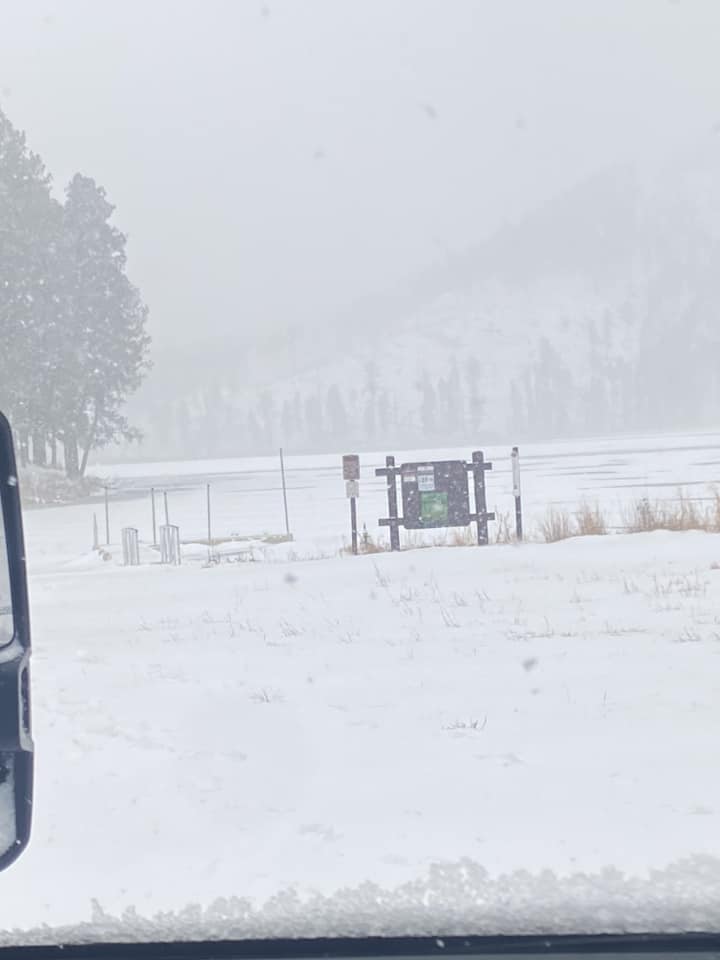
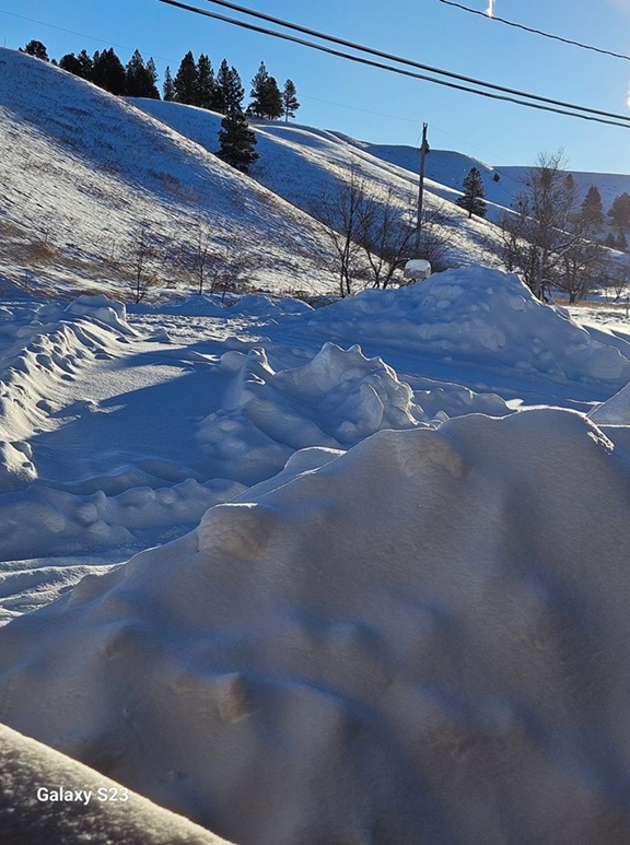
A powerful low-pressure system slowly moved across the central plains on December 25-26, 2023. Plentiful moisture wrapped around the low into western SD, bringing heavy snow to parts of our area. The highest amounts were in the northern Black Hills, where over a foot of snow fell. A tight pressure gradient resulted in very strong winds on the western SD plains, with gusts of 50-60 mph creating blizzard conditions along with much blowing and drifting snow. The highest wind gust was 72 mph at the Rapid City Airport. As warm air filtered into the region behind the low, snow changed to freezing rain, which caused some icing across parts of northwestern SD. Much of Interstate 90 was closed for about 12 hours, and even afterwards, no travel was advised, especially in the northern Black Hills. Make sure you click on the Radar and Satellite tab below. Check out the water vapor loop, which gives perspective on how much area the storm covered across the United States.
|
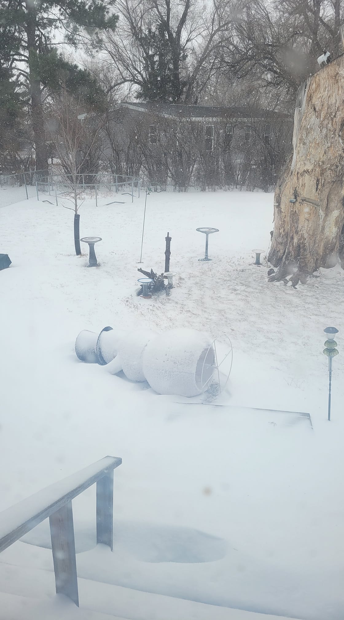
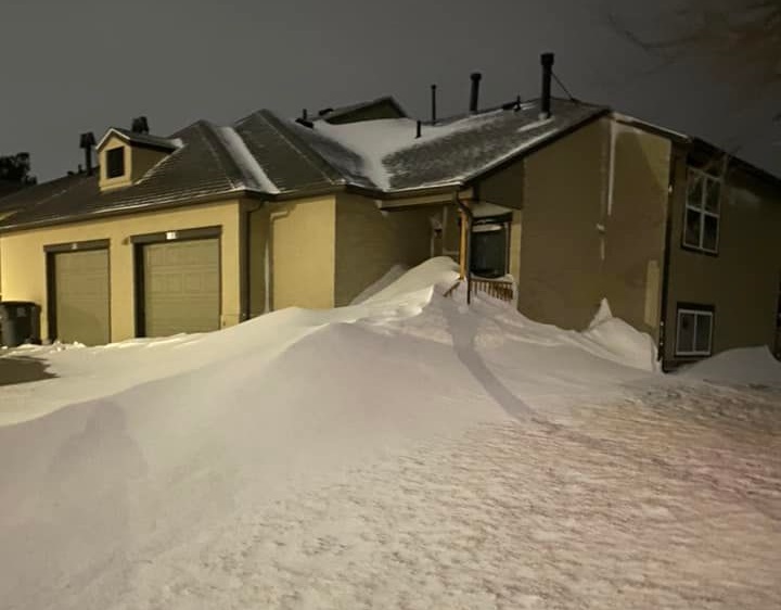
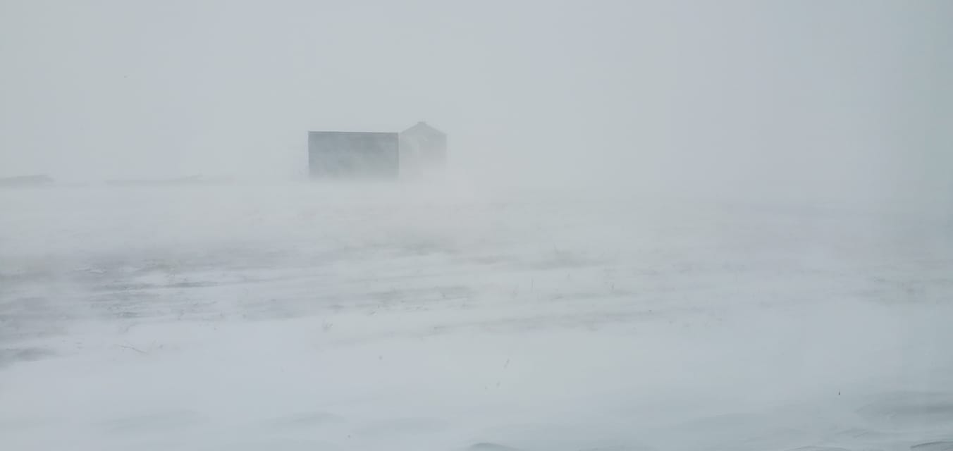 New Underwood, SD Courtesy Amy Hakola |
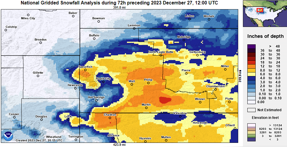
Snowfall Map
Photos
 |
 |
 |
 |
| North of Wall, SD Courtesy Aimee Baker Paulsen |
Sheridan Lake, SD Courtesy Jacob Lee |
Rapid City, SD Courtesy Nancy Babb |
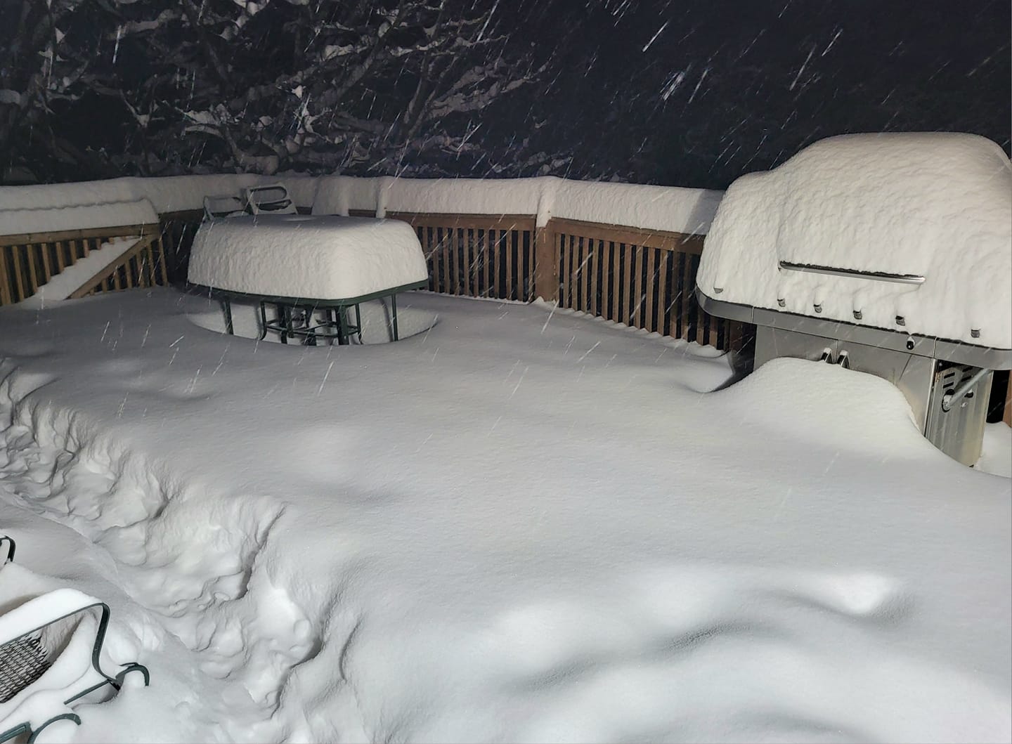
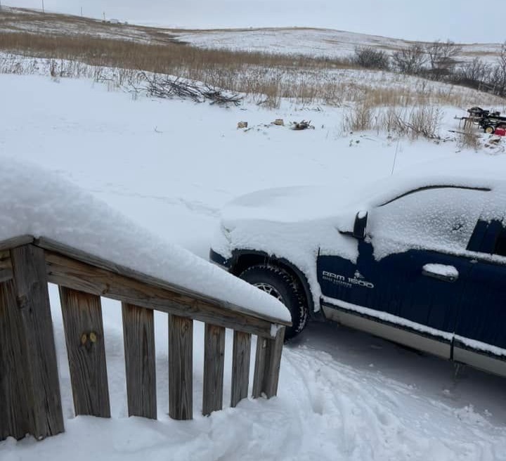
New Underwood, SD Courtesy New Underwood Fire Department |
 |
 |
 |
 |
| 3 SW Whitewood, SD Courtesy Sharon Kirkpatrick Sanchez |
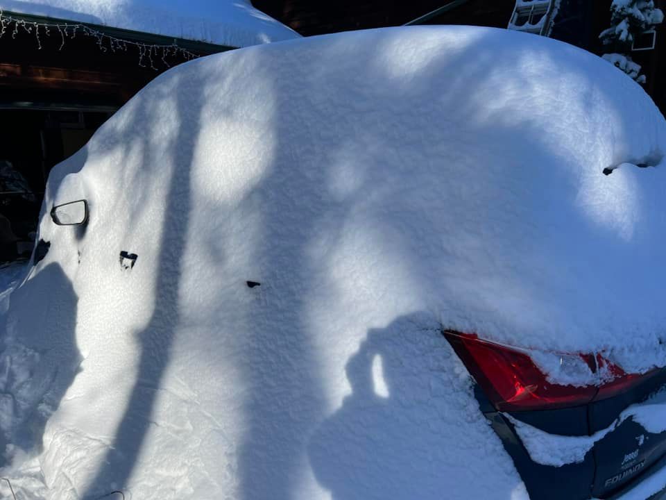
Spearfish, SD Courtesy Stacey McCarty |
Box Elder, SD Courtesy Natalie Schubert |
Kyle, SD Courtesy Marlene Iyohlate |
 |
 |
 |
.jpg) |
| South Lead Courtesy Barb Baker |
Spearfish Courtesy Dawn Shaw |
Spearfish Courtesy Carlie Stierwalt |
South Lead Courtesy Ronnie Hess |
INTERSTATE CLOSURE UPDATE: 9 p.m. CT/8 p.m. MT
— SDDOT (@SouthDakotaDOT) December 26, 2023
Interstate 90 (eastbound) from Rapid City (exit 67) to Wall (exit 110) was closed at 9 p.m. CT/8 p.m. MT. The westbound lanes of I-90 from Rapid City to Wall are expected to remain open unless weather and road conditions change. https://t.co/ZBAhlmDHq6
Eastbound and westbound lanes of Interstate 90 from Mitchell to Rapid City REOPENED at 10 a.m. CT/9 a.m. MT on Tuesday, Dec. 26, 2023. No Travel Advisories remain in place on some highways across the state.
— SDDOT (@SouthDakotaDOT) December 26, 2023
Full Press Release: https://t.co/JwWdp9mTjf#SDDOT #SD511 pic.twitter.com/jArtWiJqyV
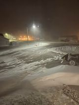
Major whiteout conditions on I-90 West near New Underwood, SD. Visibility 1/4 mile in spots. #sdwx @NWSRapidCity pic.twitter.com/l5DlN2jwKk
— Ryan Scholl (Gorilla Hail Enthusiast) (@WxScholl) December 26, 2023
Radar and Satellite
Radar loop from December 24, 2023 125pm to December 27, 2023 925am
Water vapor loop from December 24, 2023 101pm to December 26, 2023 1121pm
Storm Reports
...PRELIMINARY SNOW AND SLEET TOTALS (AT LEAST 0.5 INCH) SORTED BY MAGNITUDE...

LOCATION                      SNOWFALL    COMMENTS
                               IN/S/

2 SSW Norris SD                20.0        700 AM 12/27/2023
1 S Lead SD                    17.0        600 AM 12/27/2023
5 ESE Norris SD                15.6       1108 AM 12/27/2023
1 NW Dwtn Spearfish SD         14.6        538 PM 12/26/2023
3 SW Whitewood SD              14.0        612 PM 12/26/2023
1 SSW Deadwood SD              14.0       1120 PM 12/26/2023
7 N Wood SD                    13.8        600 AM 12/27/2023
3 ENE Kyle SD                  13.0        600 AM 12/27/2023
4 NW Parmelee SD               13.0        700 AM 12/27/2023
2 WNW Dwtn Spearfish SD        12.5        700 AM 12/27/2023
2 N Dwtn Spearfish SD          12.0        250 PM 12/26/2023
5 NE Milesville SD             12.0        600 PM 12/26/2023
6 WNW Union Center SD          12.0        700 AM 12/27/2023
3 ESE Cheyenne Crossing SD     11.8        700 AM 12/27/2023
Saint Onge SD                  10.5        735 PM 12/26/2023
Brownsville SD                 10.5        345 PM 12/26/2023
5 NNE Four Corners WY          10.0        614 PM 12/26/2023
16 WNW Milesville SD           10.0        708 PM 12/26/2023
9 W Dwtn Spearfish SD           9.0        920 AM 12/26/2023
8 SE Interior SD                9.0        945 AM 12/26/2023
3 NE Hisega SD                  8.6        700 AM 12/27/2023
Johnson Siding SD               8.6       1119 PM 12/26/2023
3 E Midland SD                  8.5        700 AM 12/27/2023
1 ESE Pactola Resv SD           8.3        800 AM 12/27/2023
1 S Dwtn Spearfish SD           8.0       1038 AM 12/26/2023
Hill City SD                    8.0        300 PM 12/26/2023
Lead SD                         8.0        800 AM 12/26/2023
2 NNW Winner SD                 8.0        600 AM 12/27/2023
6 SW Beulah WY                  8.0        800 AM 12/27/2023
Mount Rushmore SD               7.2       1158 PM 12/26/2023
6 NNW Dwtn Spearfish SD         7.2        700 AM 12/27/2023
11 S Hot Springs SD             7.0        430 PM 12/26/2023
4 W Dwtn Rapid City SD          6.5        700 AM 12/27/2023
6 W New Underwood SD            6.0        700 AM 12/27/2023
2 WSW Swett SD                  6.0        700 AM 12/27/2023
8 E Martin SD                   6.0        600 AM 12/26/2023
3 NW Mount Rushmore SD          6.0        500 AM 12/27/2023
5 ESE Elm Springs SD            6.0        600 PM 12/26/2023
Belle Fourche SD                6.0        559 PM 12/26/2023
16 SSE Mission SD               6.0        600 AM 12/27/2023
1 NNW Piedmont SD               5.7       1212 AM 12/27/2023
3 WNW Kadoka SD                 5.4        730 AM 12/26/2023
Hot Springs SD                  5.2        700 AM 12/27/2023
3 W Cottonwood SD               5.0        720 PM 12/26/2023
2 E Sturgis SD                  5.0        600 PM 12/26/2023
19 NNE Creighton SD             5.0        700 AM 12/26/2023
7 NNE Ellsworth AFB SD          5.0        700 AM 12/27/2023
3 NNE Rockerville SD            4.5       1215 PM 12/26/2023
Sundance WY                     4.5        600 AM 12/27/2023
9 ENE Wewela SD                 4.2        600 AM 12/26/2023
4 S Dwtn Rapid City SD          4.0        630 AM 12/27/2023
7 ESE Potato Creek SD           4.0        700 AM 12/26/2023
11 SE Potato Creek SD           4.0        700 AM 12/26/2023
2 W Beulah WY                   4.0       1151 AM 12/26/2023
14 S Mission SD                 3.5        600 AM 12/26/2023
1 E Dwtn Rapid City SD          3.4       1214 AM 12/27/2023
4 NNW Elm Springs SD            3.3        600 AM 12/26/2023
2 SSE Dwtn Rapid City SD        3.3        700 AM 12/27/2023
4 W Hot Springs SD              3.0        700 AM 12/27/2023
4 NW Dwtn Rapid City SD         3.0        600 AM 12/27/2023
6 SSW Fairpoint SD              3.0        700 AM 12/26/2023
5 NNE Aladdin WY                3.0        500 AM 12/27/2023
Dupree SD                       3.0        600 PM 12/25/2023
8 WNW Usta SD                   3.0        700 AM 12/26/2023
9 WSW Red Elm SD                2.5        734 AM 12/26/2023
2 WNW Dwtn Rapid City SD        2.5        700 AM 12/26/2023
8 SE Mud Butte SD               2.5        900 AM 12/26/2023
2 ESE Colony WY                 2.0        500 AM 12/27/2023
4 NNE Johnson Siding SD         2.0        800 AM 12/26/2023
6 NE Summerset SD               1.7        700 AM 12/27/2023
9 N Cedar Butte SD              1.5        600 AM 12/25/2023
9 ENE Hayward SD                1.0        800 AM 12/27/2023
Hermosa SD                      1.0        600 AM 12/26/2023
7 WSW Folsom SD                 1.0        700 AM 12/26/2023


...MAXIMUM OBSERVED WINDS (AT LEAST 50 MPH) SORTED BY MAGNITUDE...

LOCATION                      MAX WIND    COMMENTS
                               MPH

Rapid City Arpt SD               72        350 AM 12/26/2023
1 WSW Red Elm SD                 63        625 PM 12/25/2023
8 SSW Folsom SD                  63       1110 PM 12/25/2023
8 WNW Fairburn SD                63       1218 AM 12/26/2023
2 SSW Custer SD                  63       1148 PM 12/25/2023
5 WNW New Underwood SD           62        625 PM 12/25/2023
2 SW Bridger SD                  61        905 PM 12/25/2023
1 E Dwtn Rapid City SD           61        848 PM 12/25/2023
3 NW Wasta SD                    60        555 PM 12/25/2023
3 NNW Scenic SD                  59        617 PM 12/25/2023
3 WSW Fairburn SD                59        628 PM 12/25/2023
15 SSE Mission SD                59        711 PM 12/25/2023
Jewel Cave SD                    58        555 AM 12/26/2023
Howes SD                         57        619 PM 12/25/2023
4 S Dwtn Rapid City SD           57        648 PM 12/25/2023
Ellsworth AFB SD                 56        911 PM 12/25/2023
2 ENE Rockerville SD             55        628 PM 12/25/2023
1 NNE Faith SD                   55        856 PM 12/25/2023
1 W Box Elder SD                 55        858 PM 12/25/2023
5 WNW Jewel Cave SD              54        255 AM 12/26/2023
Usta SD                          54        940 PM 12/25/2023
11 SW Parmelee SD                53        719 PM 12/25/2023
5 NE Porcupine SD                52       1241 AM 12/26/2023
1 NE Winner SD                   52        549 PM 12/25/2023
Pringle SD                       52       1205 AM 12/26/2023
1 WNW Caputa SD                  52        720 PM 12/25/2023
10 W Jewel Cave SD               52        200 AM 12/26/2023
Four Corners WY                  51       1022 PM 12/25/2023
7 ESE Rosebud SD                 51        700 PM 12/25/2023
8 S Wall SD                      51        620 PM 12/25/2023
Wewela SD                        51        515 PM 12/25/2023
9 ENE Hayward SD                 50        553 PM 12/25/2023
13 NE Newell SD                  50       1051 PM 12/25/2023
2 SSE Dwtn Rapid City SD         50        105 PM 12/26/2023
 |
Media use of NWS Web News Stories is encouraged! Please acknowledge the NWS as the source of any news information accessed from this site. |
|

